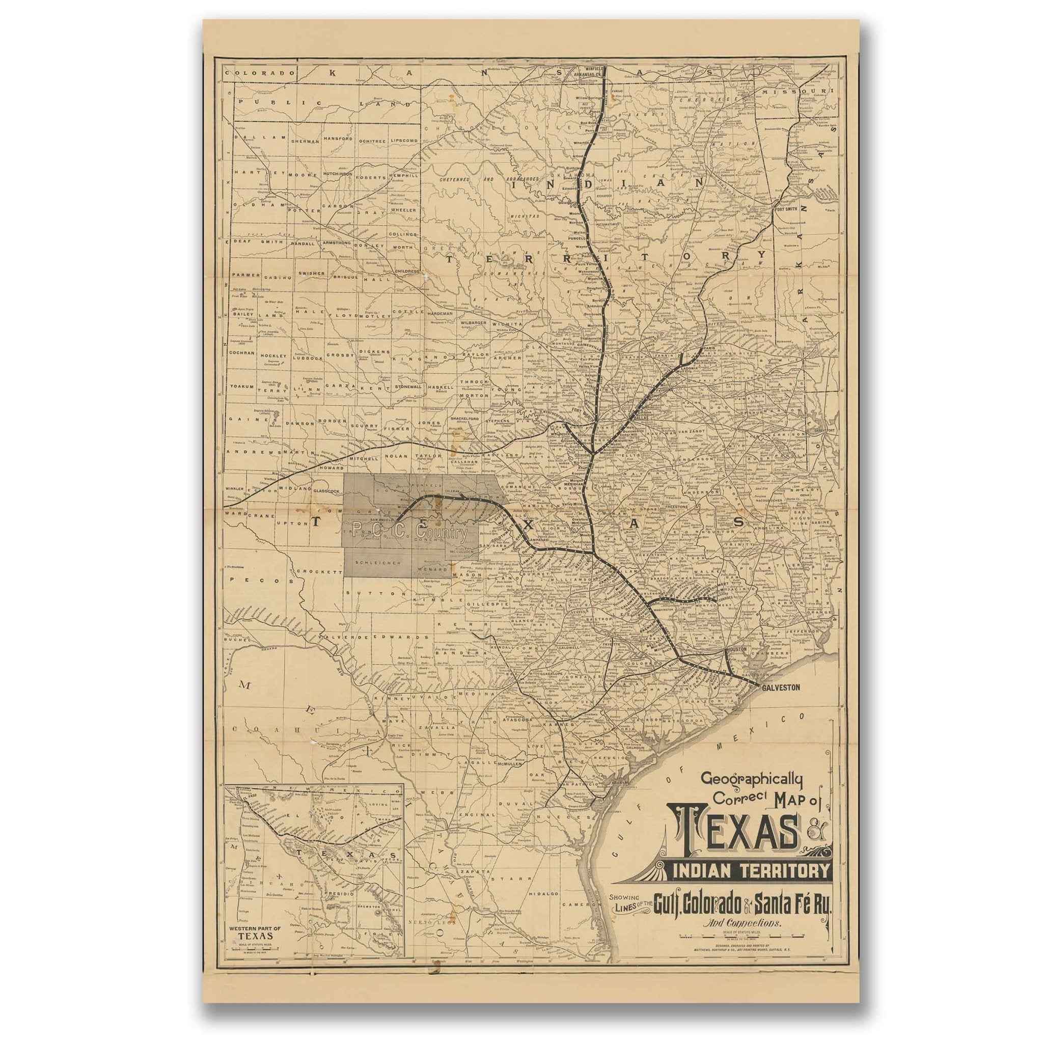
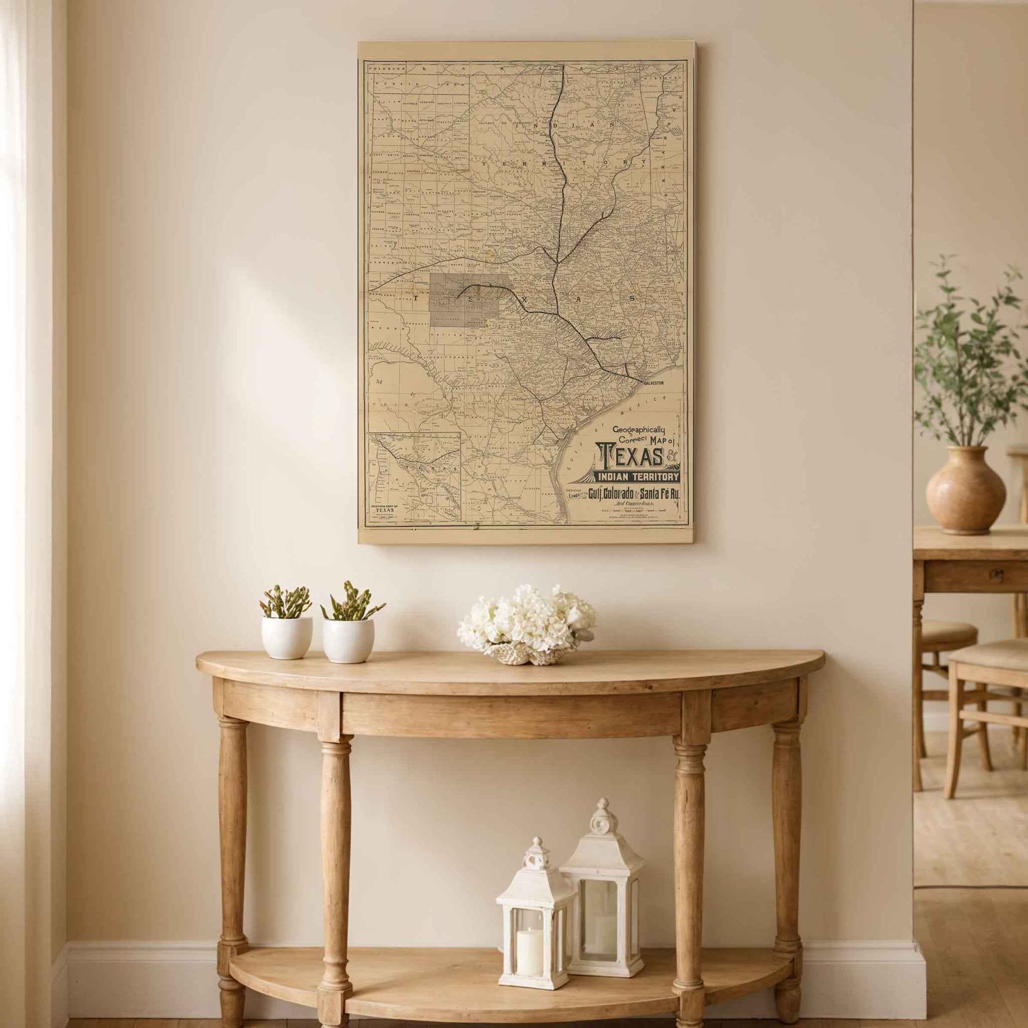
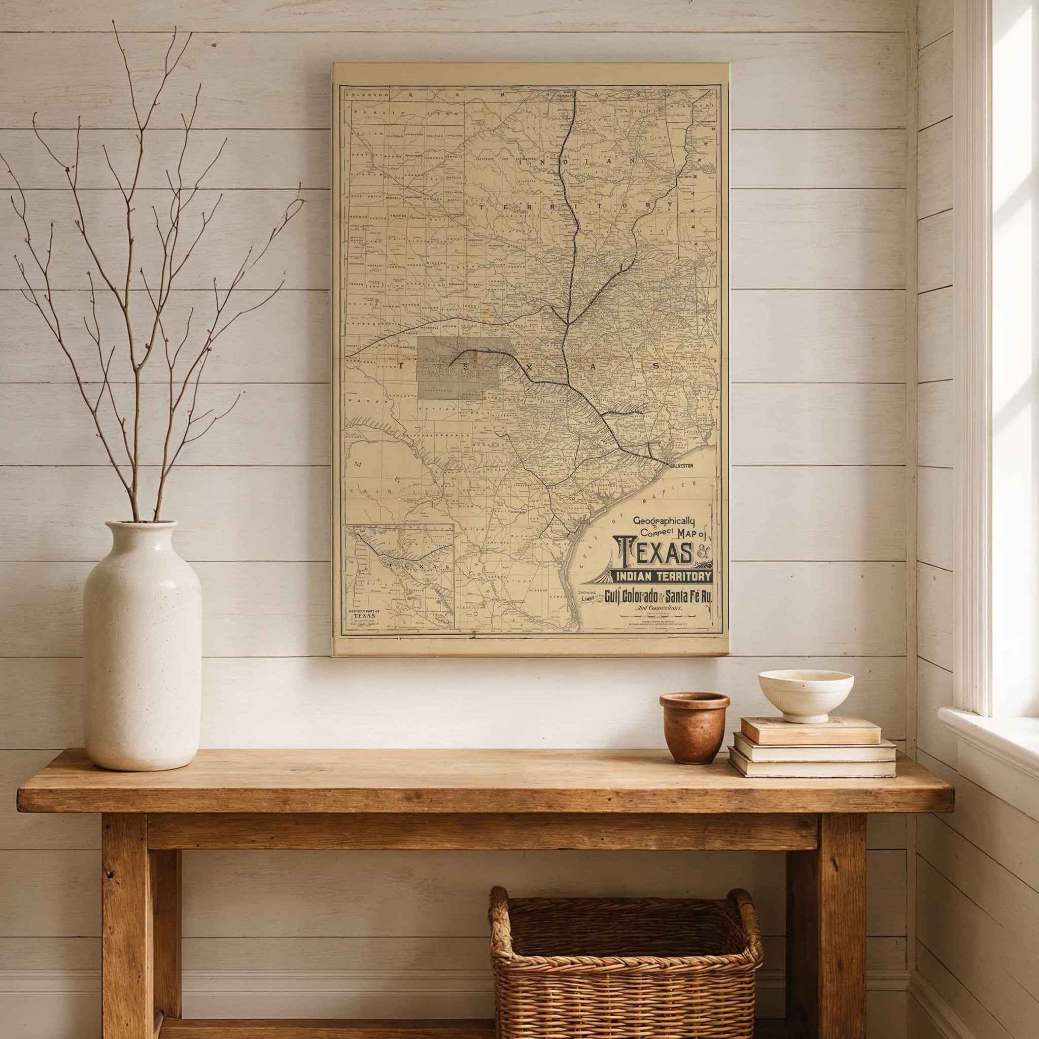
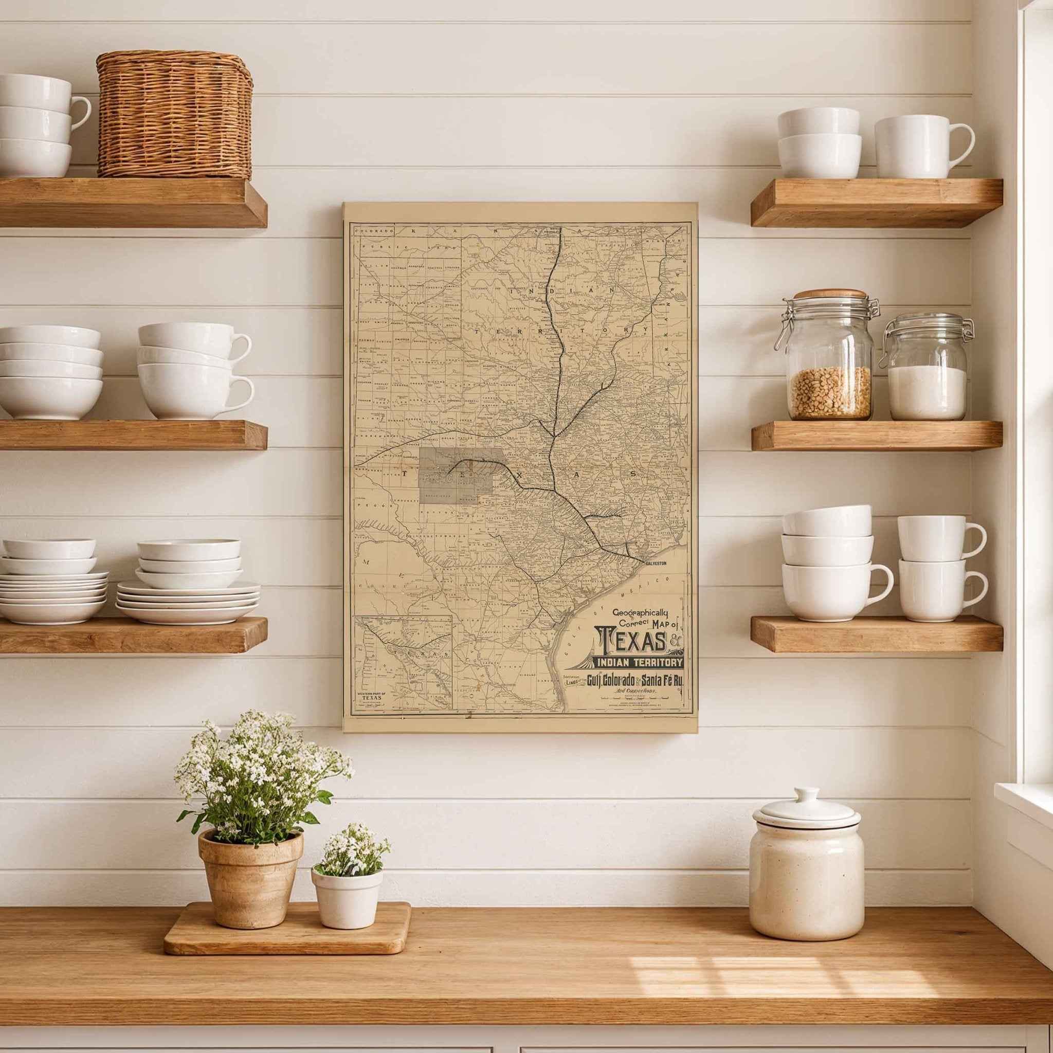
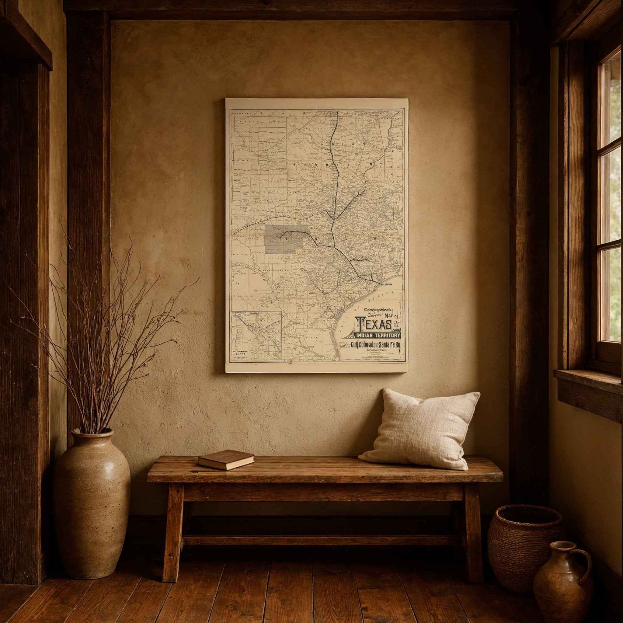
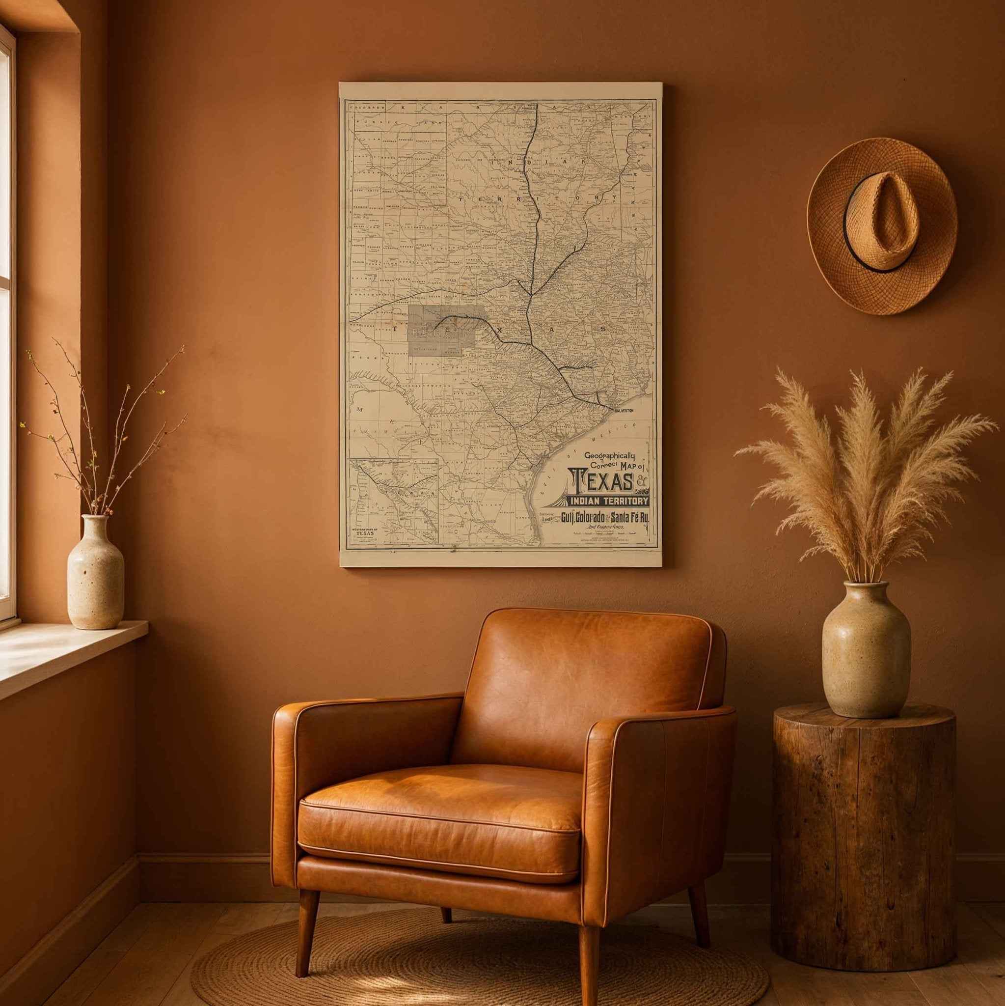
Geographically Correct Map of Texas and Indian Territory
Download Hi-Res Preview
Enter your details and we'll send you a high-resolution version of this map image.
Discover a Piece of Texas History
Step back into the late 1800s and experience Texas as it once was with this beautifully restored map of Texas and Indian Territory, originally created for the Gulf, Colorado & Santa Fe Railway. Every detail - from the expanding rail lines to the early county boundaries and thriving frontier towns - has been carefully preserved to bring the spirit of the Old West to life.
Each map includes a custom historical letter that tells the story behind the piece, making it an ideal gift for history lovers, collectors, and anyone who cherishes the rich heritage of Texas. Printed on heavyweight archival paper or handcrafted polycotton canvas, your map is designed to last for generations while capturing every intricate line in ultra-high-definition clarity thanks to our meticulous digital restoration process.
To ensure your piece arrives in perfect condition, we use secure, protective packaging - rolled in a sturdy cardboard mailing tube for paper prints or shipped in a reinforced box for canvases. From presentation to preservation, every detail is crafted with care.
Bring home more than wall art — bring home a story, a conversation starter, and a striking centerpiece that celebrates the bold spirit of expansion that shaped the Lone Star State.
Tracing the Rails of Time: A Tale of Texas, 1876
In the golden haze of late 19th-century ambition, a remarkable artifact emerged: the Geographically Correct Map of the State of Texas, meticulously compiled from actual surveys and updated with all county changes as of September 1, 1876. Published by the Texas & Pacific Railway Company in St. Louis, this map was far more than ink on paper - it was a bold vision of Texas at the crossroads of history.
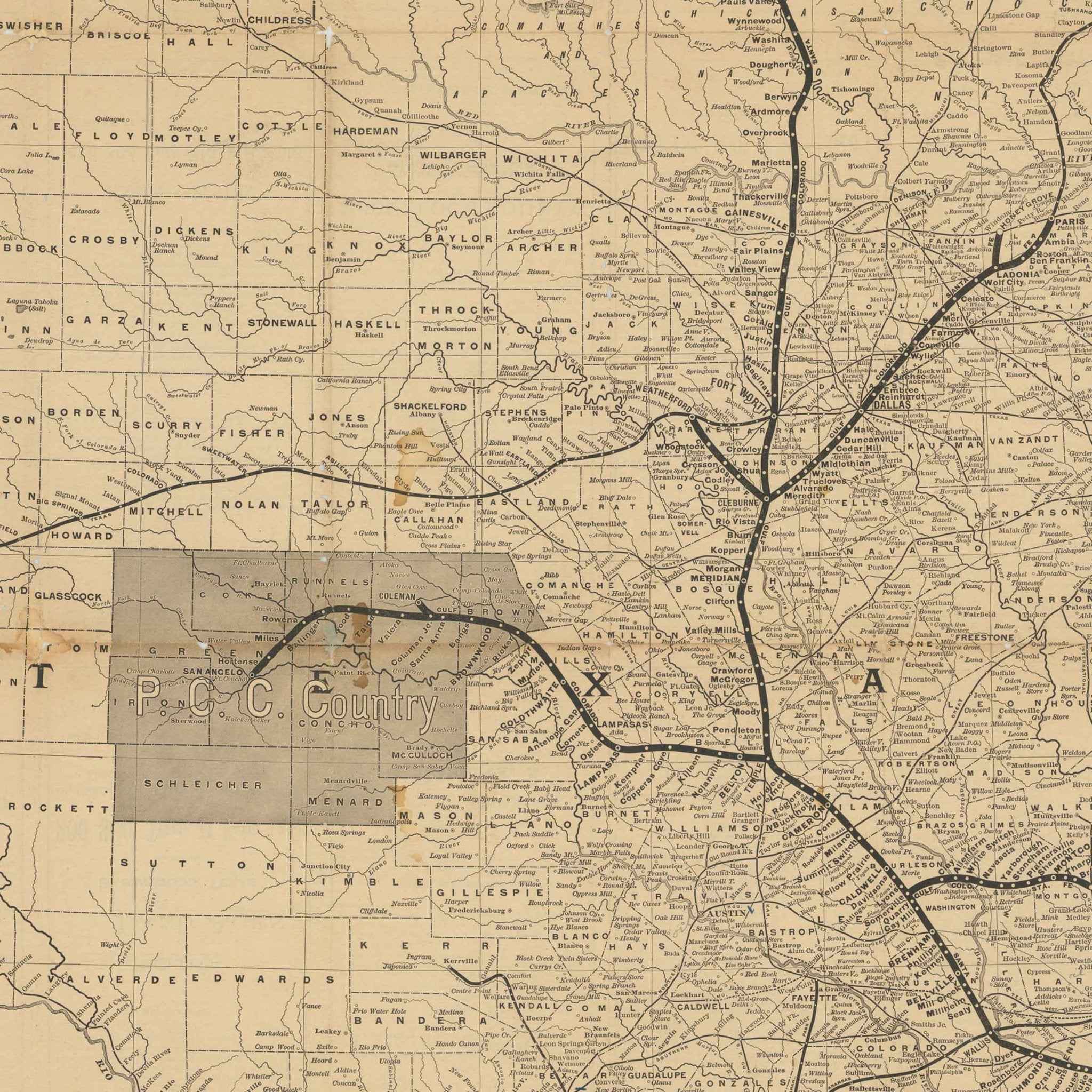
To hold this map is to step into a moment when Texas was still being shaped - not just politically, but physically. The lines of county borders carve out a growing state, while tiny black dots reveal towns just beginning to rise from the prairie. Some names are familiar today; others are long forgotten, absorbed into the evolving story of settlement and progress.
At the heart of this map lies the lifeblood of Texas’s transformation: the railroads. The bold black strokes of the Gulf, Colorado & Santa Fe Railway (GC&SF) in Galveston, Texas; and its connected lines weave across the page like veins carrying promise into every corner of the state. In 1876, these were more than transportation routes - they were economic lifelines, carving paths for commerce, migration, and dreams. For many settlers, following these tracks meant chasing opportunity, staking claims, and starting new lives on the frontier.
Delicate hachures show the rise and fall of hills and valleys, evidence of the mapmaker’s dedication to detail and accuracy. With a scale of 24 miles per inch, this map balanced both beauty and utilit - guiding travelers, informing investors, and shaping the strategies of railroad tycoons eager to connect an emerging Texas to the rest of the nation.
This map was more than a document. It was an invitation, - a promise etched in ink, that Texas’s future was vast, open, and waiting to be claimed. Every county boundary, every stretch of rail, every blank expanse spoke of a state in motion, a people forging identity from wilderness and ambition.
To explore this map is to walk beside pioneers, entrepreneurs, and dreamers who shaped Texas as we know it today. It is a reminder that history isn’t confined to dusty archives; - it lives in artifacts like this, whispering the stories of visionaries who dared to imagine a state without limits.
The Map Story
In the golden haze of late 19th-century ambition, a remarkable artifact emerged: the Geographically Correct Map of the State of Texas, meticulously compiled from actual surveys and updated with all county changes as of September 1, 1876. Published by the Texas & Pacific Railway Company in St. Louis, this map was far more than ink on paper - it was a bold vision of Texas at the crossroads of history.
To hold this map is to step into a moment when Texas was still being shaped - not just politically, but physically. The lines of county borders carve out a growing state, while tiny black dots reveal towns just beginning to rise from the prairie. Some names are familiar today; others are long forgotten, absorbed into the evolving story of settlement and progress.
At the heart of this map lies the lifeblood of Texas’s transformation: the railroads. The bold black strokes of the Gulf, Colorado & Santa Fe Railway (GC&SF) in Galveston, Texas; and its connected lines weave across the page like veins carrying promise into every corner of the state. In 1876, these were more than transportation routes - they were economic lifelines, carving paths for commerce, migration, and dreams. For many settlers, following these tracks meant chasing opportunity, staking claims, and starting new lives on the frontier.
Delicate hachures show the rise and fall of hills and valleys, evidence of the mapmaker’s dedication to detail and accuracy. With a scale of 24 miles per inch, this map balanced both beauty and utilit - guiding travelers, informing investors, and shaping the strategies of railroad tycoons eager to connect an emerging Texas to the rest of the nation.
This map was more than a document. It was an invitation, - a promise etched in ink, that Texas’s future was vast, open, and waiting to be claimed. Every county boundary, every stretch of rail, every blank expanse spoke of a state in motion, a people forging identity from wilderness and ambition.
To explore this map is to walk beside pioneers, entrepreneurs, and dreamers who shaped Texas as we know it today. It is a reminder that history isn’t confined to dusty archives; - it lives in artifacts like this, whispering the stories of visionaries who dared to imagine a state without limits.
Materials
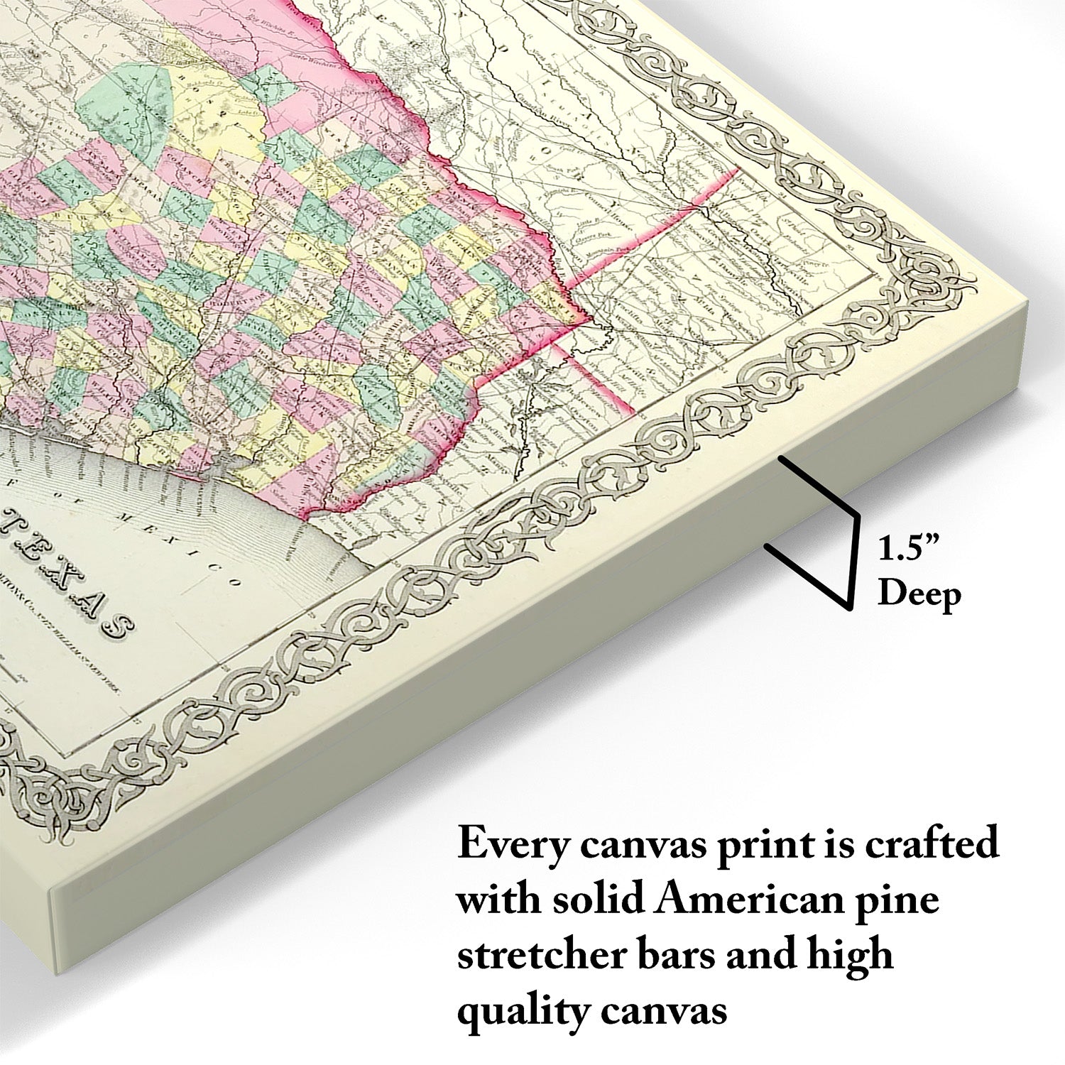
Hand‑Stretched Canvas: If you choose canvas, we use a premium cotton‑poly blend stretched over solid pine frames. Each canvas is carefully hand‑stretched for a tight, gallery‑quality finish that’s ready to hang right out of the box.
Vivid, Fade‑Resistant Inks: We use professional‑grade inks that are UV‑resistant, so your print retains its rich colors even when displayed in bright rooms.
Expert Restoration: Every map is digitally restored by skilled artisans. We preserve the character of the original while enhancing clarity, so you see the map as it was meant to be seen.
Secure Packaging: Paper prints are rolled in heavy‑duty mailing tubes, and canvases are cushioned in reinforced boxes to ensure they arrive in pristine condition.
Choosing one of our prints means investing in craftsmanship. We combine historical authenticity with modern print technology and premium materials, giving you a work of art built to stand the test of time.
Choose options
Why Choose Us?
| Feature | Us | Competitor A | Competitor B |
|---|---|---|---|
| Hand Crafted | |||
| Museum Quality | |||
| 100 Year Guarantee | |||
| Restored by Hand | |||
| Certificate of Authenticity |

Art Prints
Archival quality colors. Best option if you'd like to frame it yourself
The Best Materials
We hand-stretched our canvas on solid American-grown pine stretcher bars. We use quality canvas and fade-resistant inks to create the lasting art. Canvases come with hardware already installed and ready to hang.
Need help?
Frequently Asked Questions
Order
All of our maps are meticulously restored reproductions of historic originals. Each piece is digitally repaired and color-corrected to bring out the finest details while preserving its authentic, vintage character.
Yes. All Archive Prints products are printed to order in the USA with archival materials.
We offer two premium formats:
- High-Quality Paper Posters – Printed on thick, archival-grade matte paper for rich, vibrant detail.
- Hand-Stretched Canvas Prints – Printed on premium polycotton canvas and mounted on 1.5" solid American pine stretcher bars for a gallery-quality finish.
We carefully digitally restore each map to enhance clarity and color while preserving its original look and historic charm. You’ll enjoy sharp details and a timeless vintage aesthetic that feels true to the original piece.
Currently, we don’t offer framing or personalization. However, our posters are printed in standard sizes, making it easy to find a ready-made frame. For a polished, gallery-style look, our stretched canvas prints arrive ready to hang right out of the box.
Yes! We offer free shipping on all products within the United States. Each map is carefully packaged to ensure it arrives in perfect condition.
If you’re not completely satisfied, you can return your order in new condition for a full refund. Return shipping costs are the responsibility of the customer.
Absolutely! Our maps make thoughtful, one-of-a-kind gifts for history lovers, map collectors, or anyone looking to add vintage character to their home or office. Choose between paper prints for framing or stretched canvas for a ready-to-hang presentation.
- Paper Posters → Shipped in durable, protective tubes to prevent creasing.
- Canvas Prints → Carefully wrapped, padded, and boxed to ensure safe delivery.
Our maps look stunning in a variety of settings, including:
- Living rooms and home offices
- Libraries and studies
- Corporate offices and conference rooms
- Restaurants, cafes, and boutique spaces