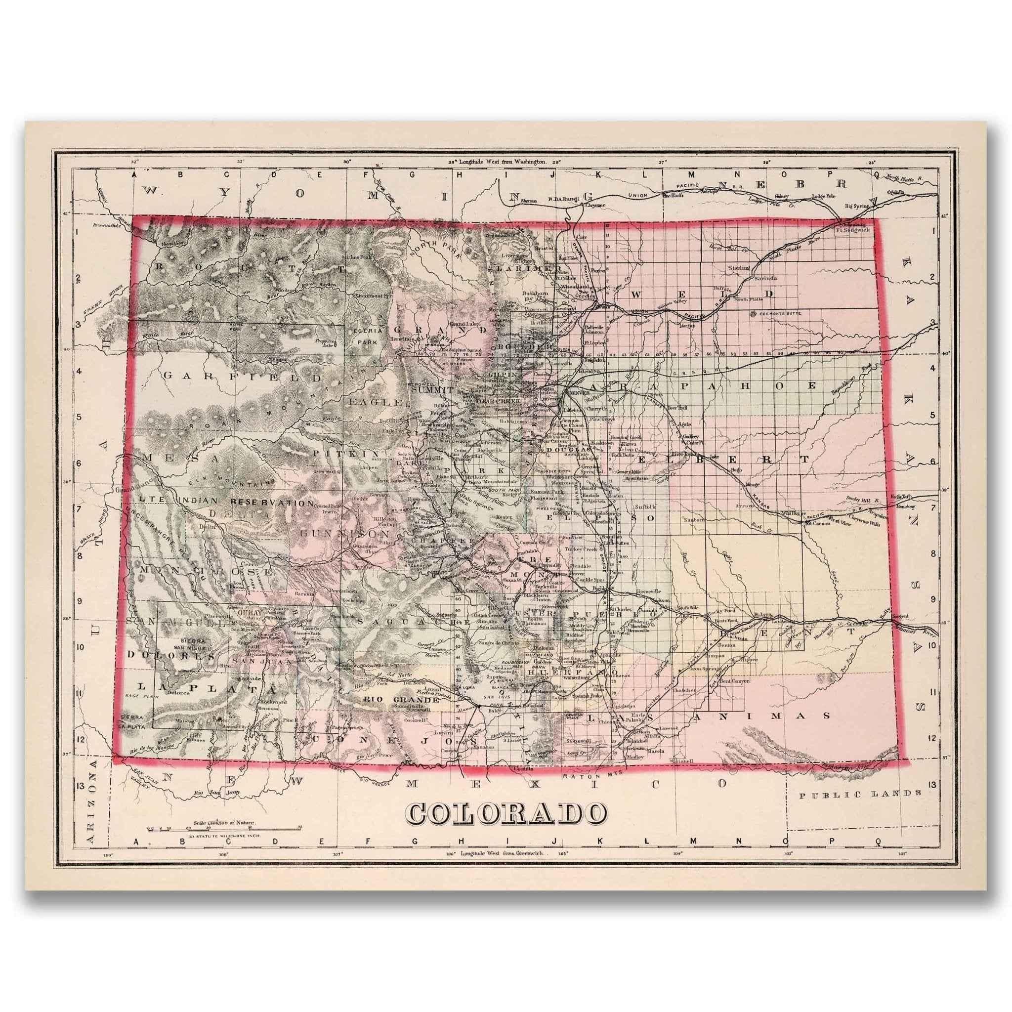
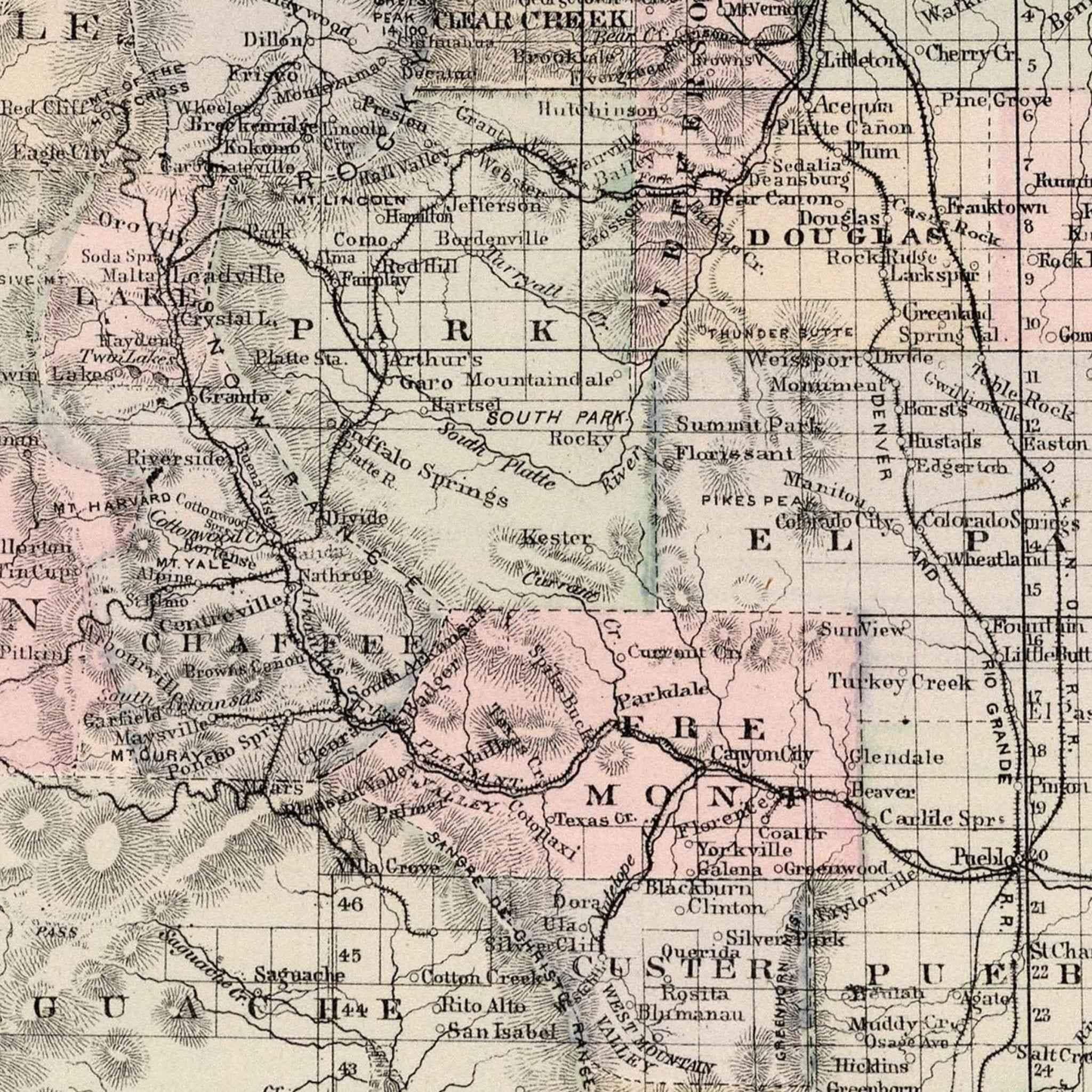
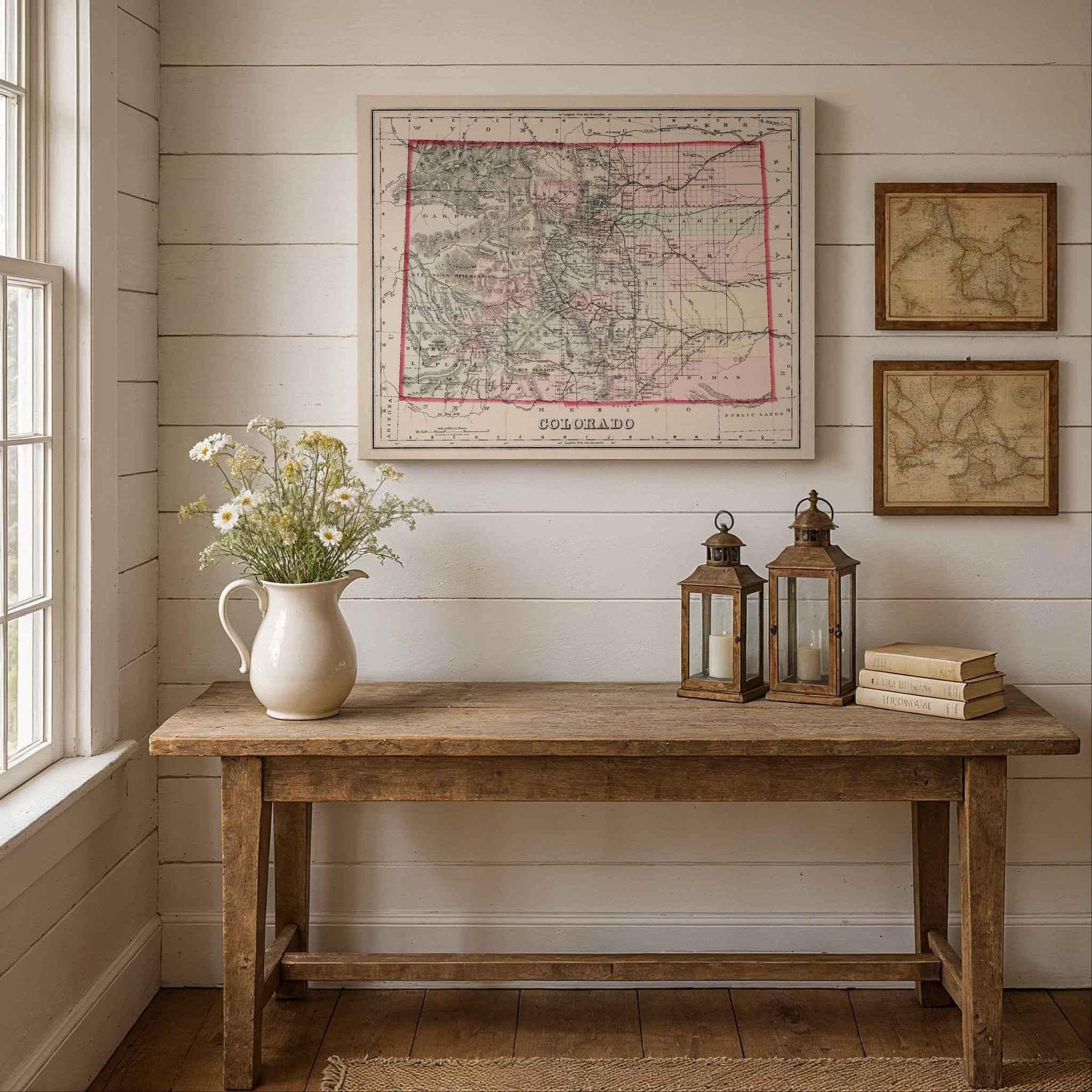
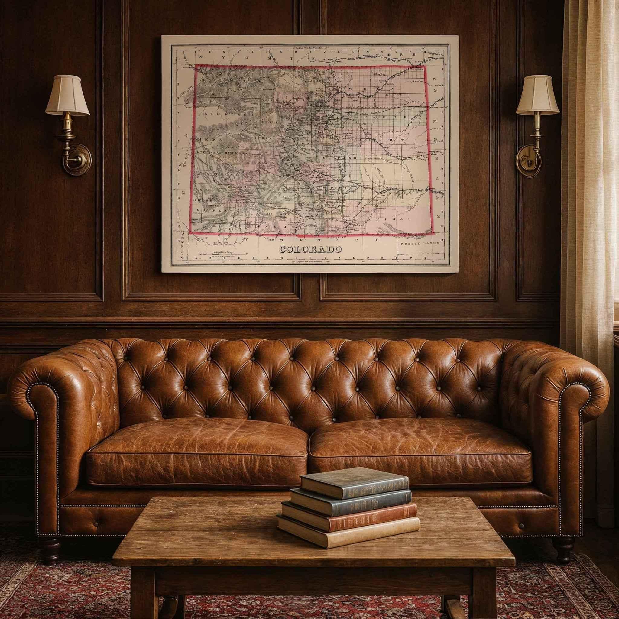
1884 Colorado Map - Restored Vintage Wall Art by O.W. Gray
Colorado Map
Step back into the late 19th century Colorado Map and experience Colorado as it once was with this beautifully restored 1884 O.W. Gray Map of Colorado. Originally published by O.W. Gray & Son as part of The National Atlas, this rare historical map captures the state during an era of rapid growth, booming industry, and expanding infrastructure.
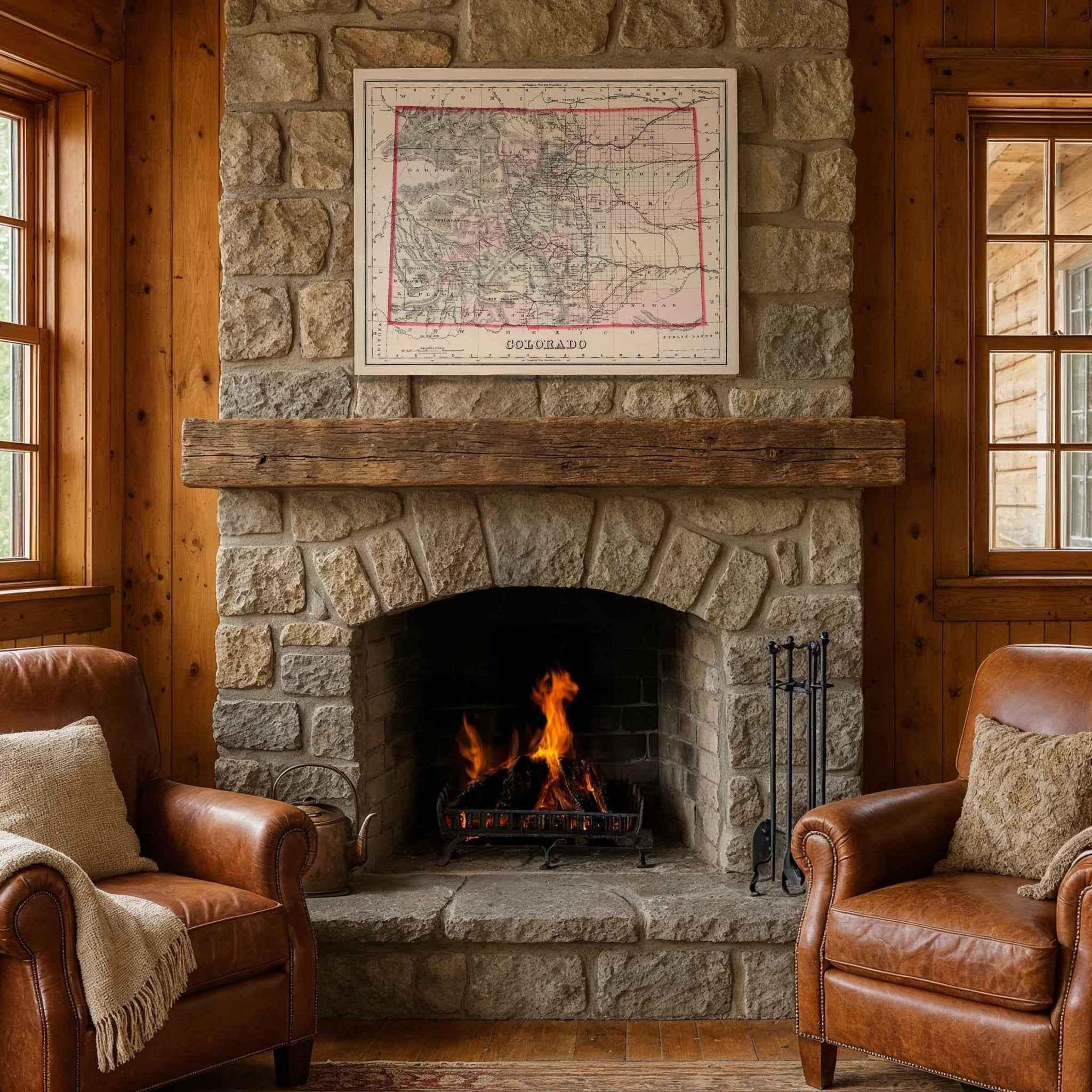
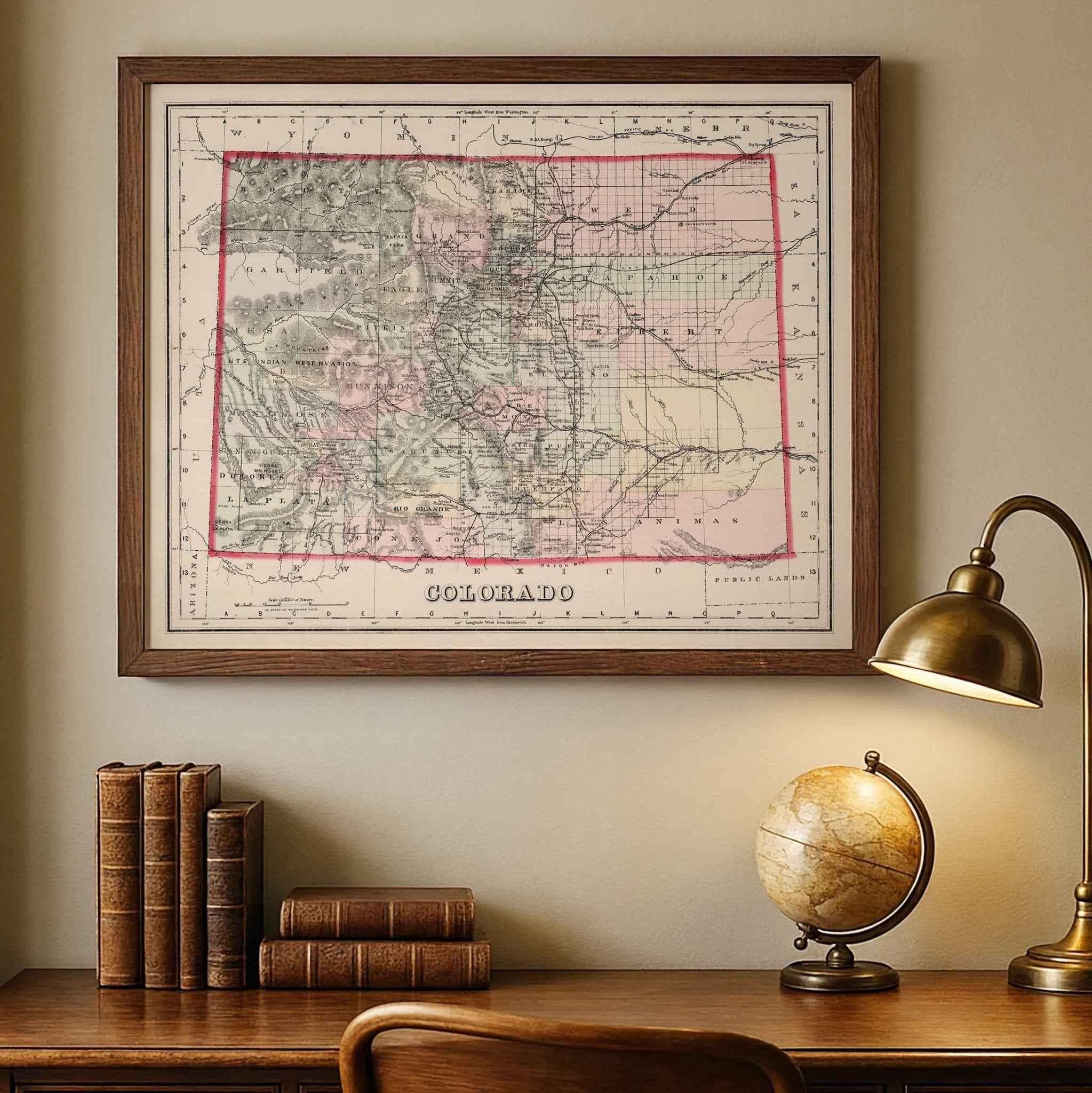
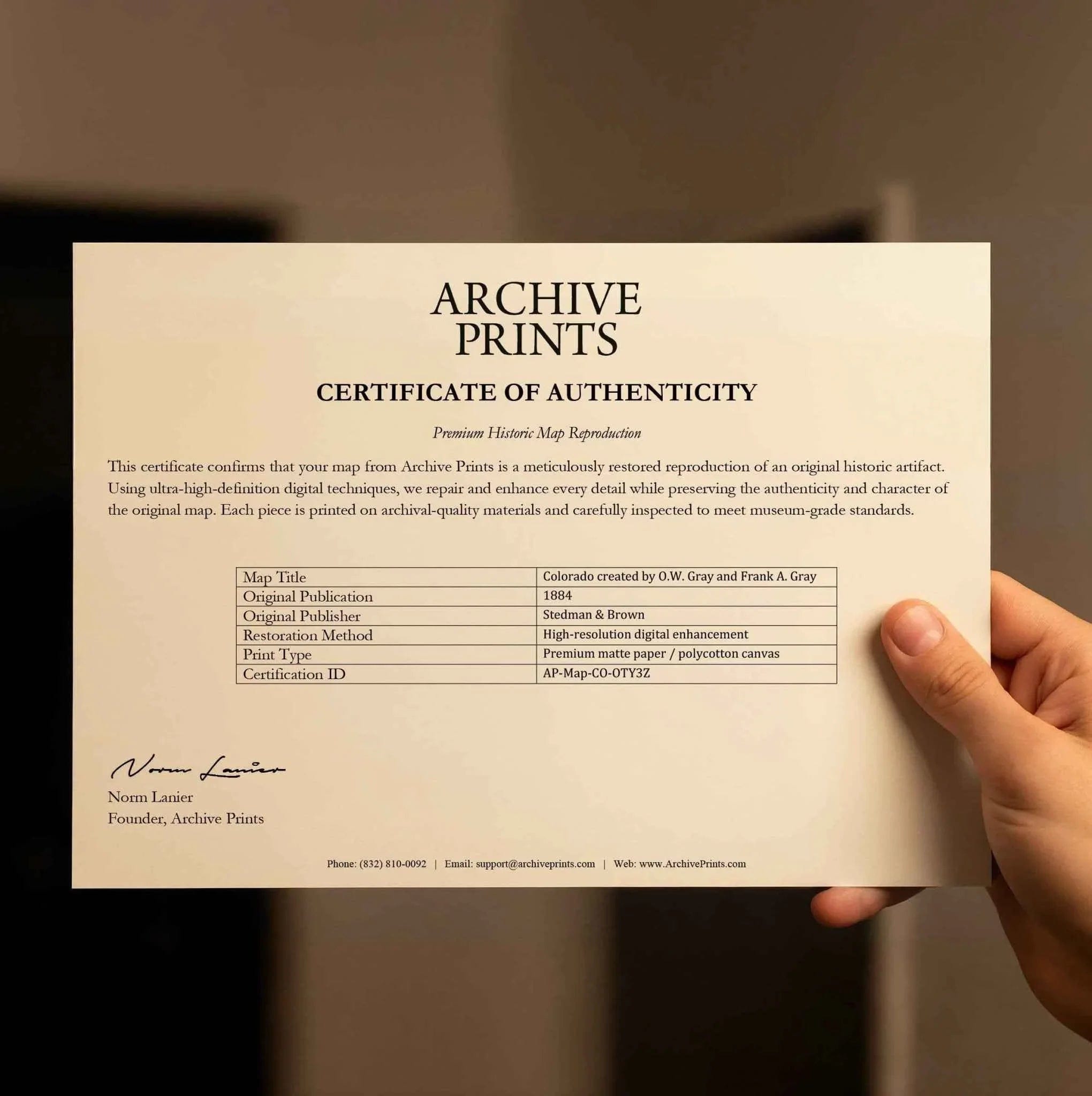
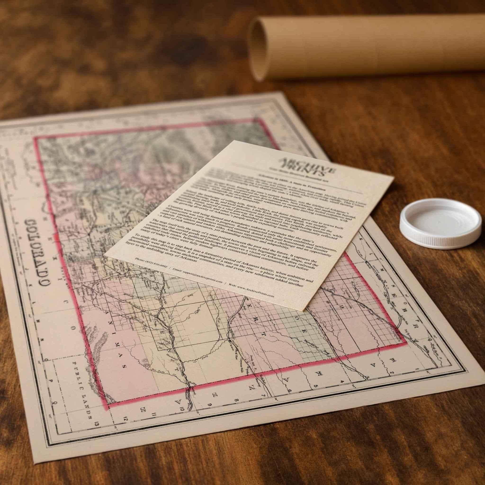
Each reproduction includes a custom historical letter telling the story behind the map, making it the perfect gift for collectors, history lovers, and anyone who appreciates Colorado’s rich heritage. Printed on heavyweight archival paper or premium polycotton canvas, every line, label, and detail is preserved in ultra-high-definition clarity thanks to our meticulous digital restoration process.
To ensure your map arrives safely, paper prints are carefully rolled in a sturdy cardboard mailing tube, while canvases ship in reinforced boxes for maximum protection. From presentation to preservation, every detail is crafted with care.
Bring home more than wall art — bring home a story, a conversation piece, and a striking centerpiece that celebrates the enduring history of Colorado.
The Map Story
In 1920, Arizona was a young state still finding its identity within the rapidly changing American Southwest. This beautifully detailed map, published by the George F. Cram Company as part of the Auto Trails and Commercial Survey of the United States, captures Arizona at a moment when progress and tradition met along the dusty roads and growing towns of the desert. It reflects a period when automobiles were transforming travel, industry was expanding, and Arizona’s open landscapes were beginning to connect through a network of modern highways.
Every line on this map tells a story. Counties are outlined in soft green for clarity, with roads and trails highlighted in red and blue, revealing the routes that linked cities, farms, and remote settlements. Electric lines are marked across the terrain, symbols of a new infrastructure reshaping life in the desert. In 1920, the automobile was revolutionizing mobility, and Cram’s atlas served as an indispensable tool for travelers eager to explore Arizona’s rugged beauty.
Major cities like Phoenix, Tucson, and Prescott stand prominently, surrounded by small towns and settlements that were just beginning to emerge. Many of these names endure today, while others have faded into history, absorbed into a landscape that was constantly evolving. Mountain ranges, valleys, rivers, and canyons are meticulously labeled, offering a window into the natural landmarks that shaped Arizona’s culture and economy.
This was also a time when tourism and exploration began to flourish. The Grand Canyon, declared a national park just the year before, drew adventurers from across the country. The development of paved roads and improved auto trails made Arizona’s breathtaking landscapes more accessible, while railroads and early highways helped connect remote regions to larger markets.
The map’s style reflects the artistry and precision of early 20th-century cartography. Designed for both practicality and beauty, it served businesses, motorists, and curious families alike. Bound within Cram’s comprehensive road atlas, this Arizona sheet combined topographic detail, census data, and travel routes into a single resource, illustrating a state on the edge of modern transformation.
Today, this map is more than a historical document. It is a snapshot of Arizona at a turning point, when expanding infrastructure met untouched wilderness, and when roads promised opportunity while preserving the character of the land. It captures a moment when the desert was vast, the future was open, and the possibilities seemed endless.
Materials
Hand‑Stretched Canvas: If you choose canvas, we use a premium cotton‑poly blend stretched over solid pine frames. Each canvas is carefully hand‑stretched for a tight, gallery‑quality finish that’s ready to hang right out of the box.
Vivid, Fade‑Resistant Inks: We use professional‑grade inks that are UV‑resistant, so your print retains its rich colors even when displayed in bright rooms.
Expert Restoration: Every map is digitally restored by skilled artisans. We preserve the character of the original while enhancing clarity, so you see the map as it was meant to be seen.
Secure Packaging: Paper prints are rolled in heavy‑duty mailing tubes, and canvases are cushioned in reinforced boxes to ensure they arrive in pristine condition.
Choosing one of our prints means investing in craftsmanship. We combine historical authenticity with modern print technology and premium materials, giving you a work of art built to stand the test of time.
Choose options

Because every place has a story
Make History Personal
A vintage map is more than art.
It is a reminder of where life began.
Where memories were made.
Where hearts still live. Give the gift of place.
Beautifully preserved and made for the moments that matter.
Why Choose Us?
| Feature | Us | Competitor A | Competitor B |
|---|---|---|---|
| Hand Crafted | |||
| Museum Quality | |||
| 100 Year Guarantee | |||
| Restored by Hand | |||
| Certificate of Authenticity |

Art Prints
Archival quality colors. Best option if you'd like to frame it yourself

The Best Materials
We hand-stretched our canvas on solid American-grown pine stretcher bars. We use quality canvas and fade-resistant inks to create the lasting art. Canvases come with hardware already installed and ready to hang.
Need help?
Frequently Asked Questions
Order
All of our maps are meticulously restored reproductions of historic originals. Each piece is digitally repaired and color-corrected to bring out the finest details while preserving its authentic, vintage character.
Yes. All Archive Prints products are printed to order in the USA with archival materials.
We offer two premium formats:
- High-Quality Paper Posters – Printed on thick, archival-grade matte paper for rich, vibrant detail.
- Hand-Stretched Canvas Prints – Printed on premium polycotton canvas and mounted on 1.5" solid American pine stretcher bars for a gallery-quality finish.
We carefully digitally restore each map to enhance clarity and color while preserving its original look and historic charm. You’ll enjoy sharp details and a timeless vintage aesthetic that feels true to the original piece.
Yes, we do! We offer premium framing options to make your map ready to hang the moment it arrives. You can choose from Oak, Maple, Black, or Walnut frames directly on the product page. We also offer Stretched Canvas prints for a modern gallery look, as well as archival-quality Posters if you prefer to frame it yourself.
Yes! We offer free shipping on all products within the United States. Each map is carefully packaged to ensure it arrives in perfect condition.
If you’re not completely satisfied, you can return your order in new condition for a full refund. Return shipping costs are the responsibility of the customer.
Absolutely! Our maps make thoughtful, one-of-a-kind gifts for history lovers, map collectors, or anyone looking to add vintage character to their home or office. Choose between paper prints for framing or stretched canvas for a ready-to-hang presentation.
- Paper Posters → Shipped in durable, protective tubes to prevent creasing.
- Canvas Prints → Carefully wrapped, padded, and boxed to ensure safe delivery.
Our maps look stunning in a variety of settings, including:
- Living rooms and home offices
- Libraries and studies
- Corporate offices and conference rooms
- Restaurants, cafes, and boutique spaces