1855 Illinois Map - Vintage Colton State Map for Collectors
Hawaii Map
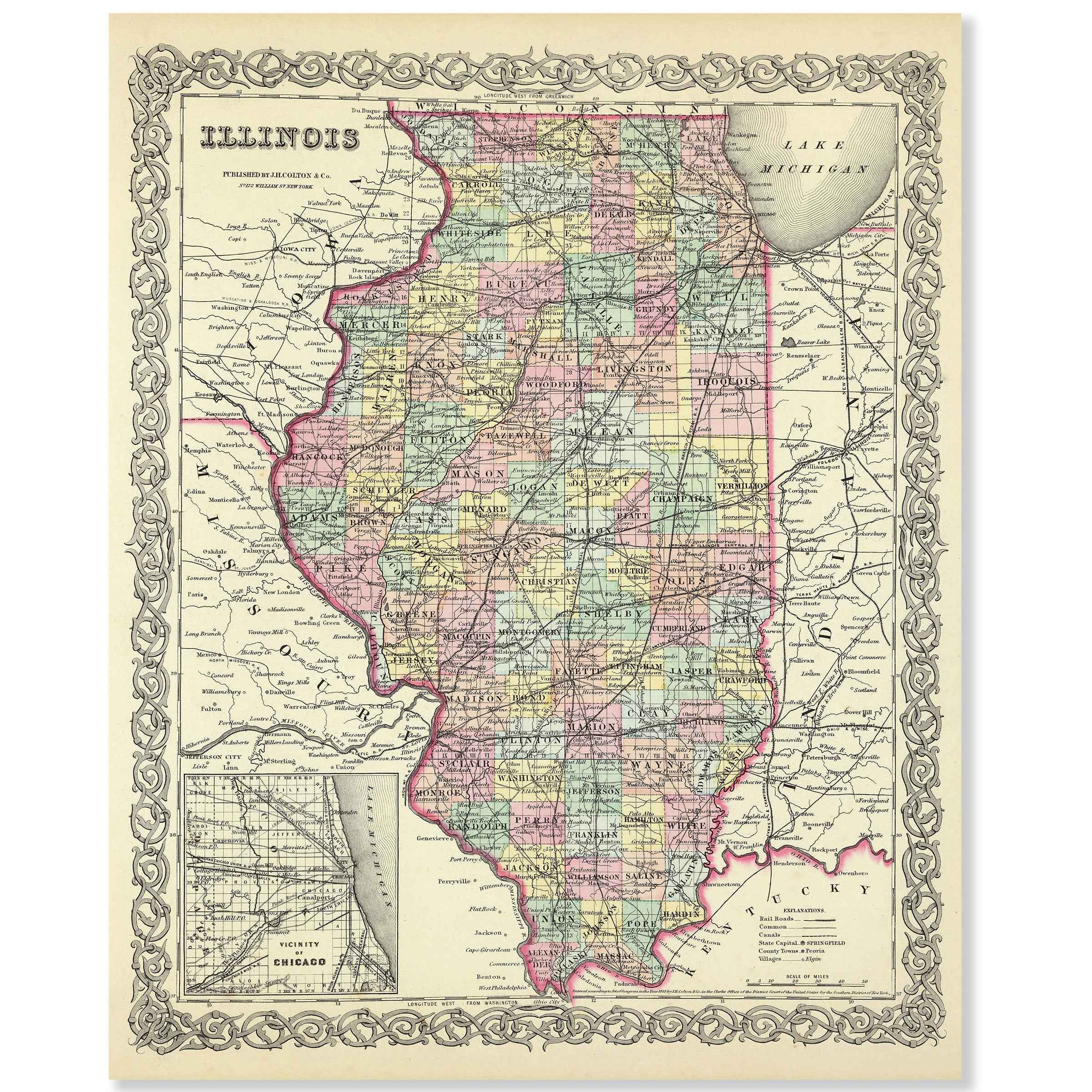
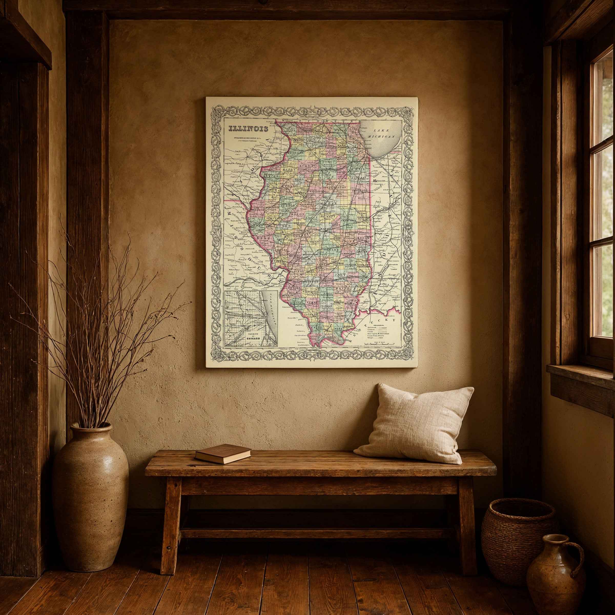
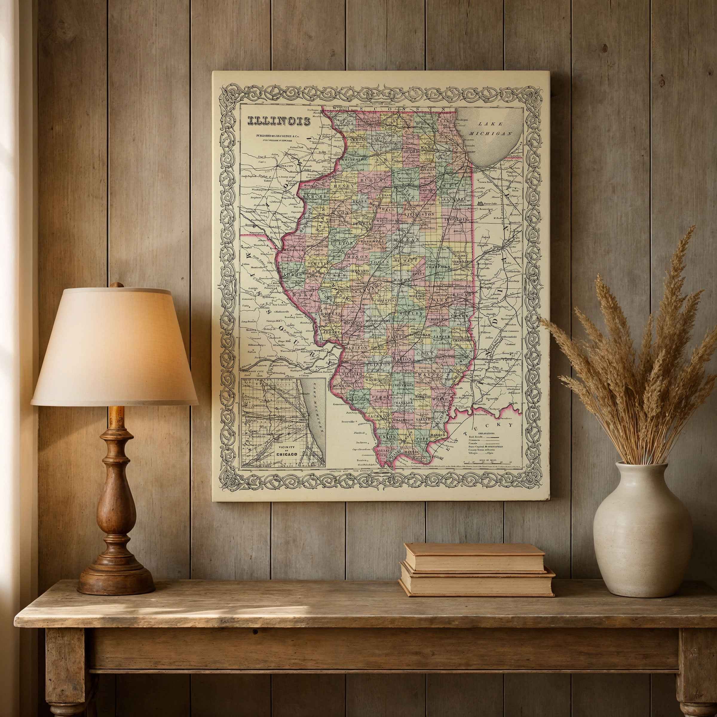
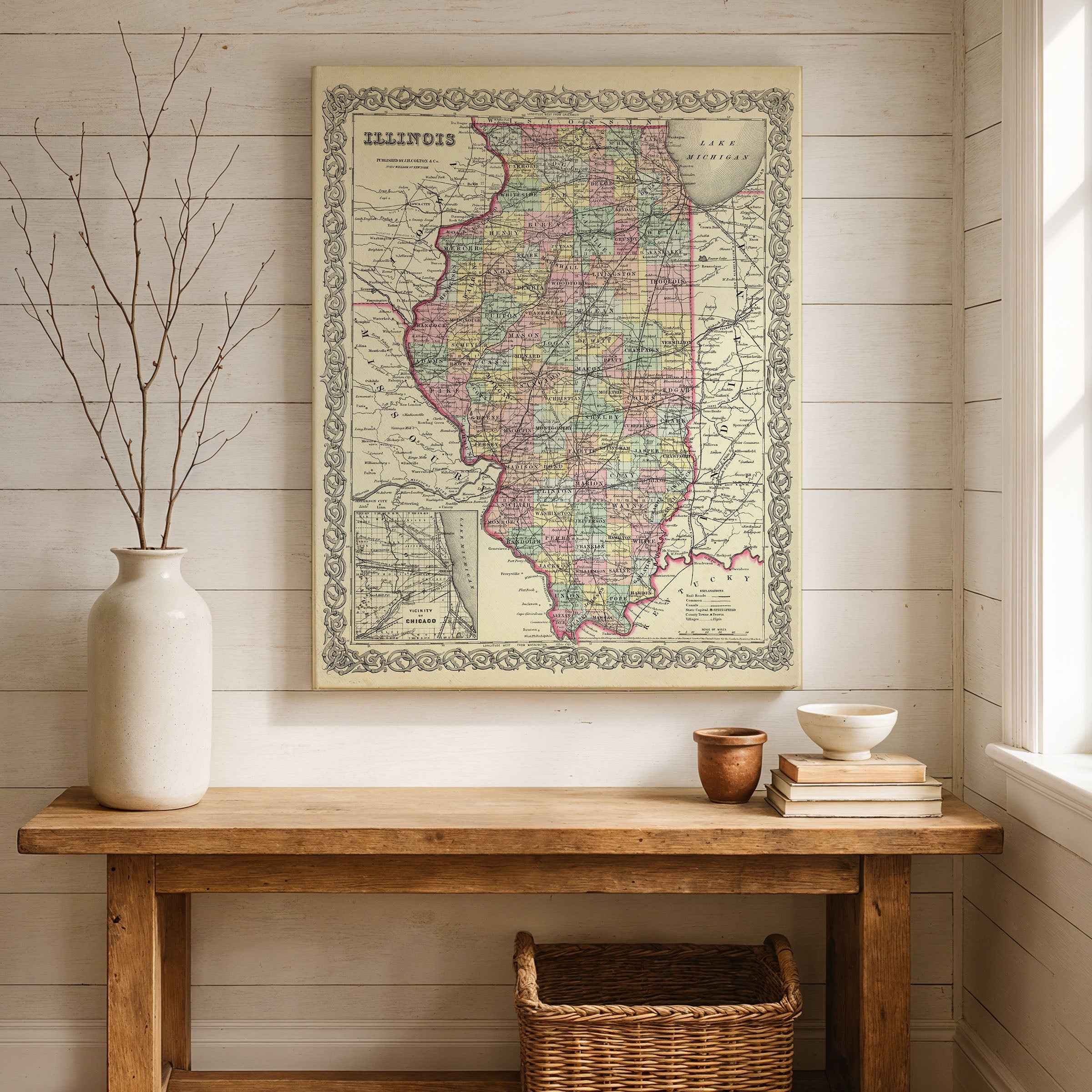
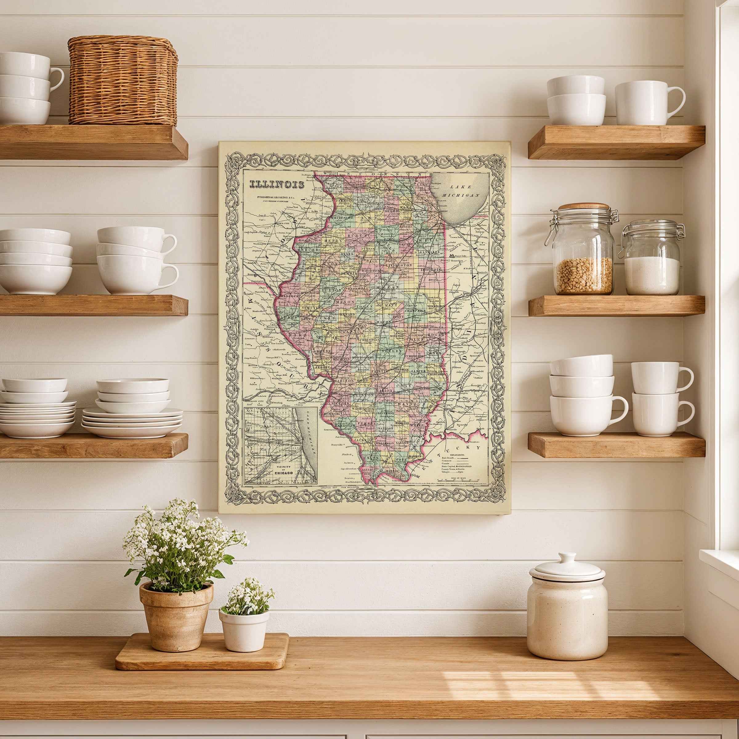
Step back into the mid-19th century Illinois Map and explore Illinois as it once was with this beautifully restored 1855 map by George W. Colton. Originally published in Colton’s celebrated atlas, this historic engraving captures Illinois during a formative era—its counties outlined, towns carefully placed, and railroads and rivers marked as vital lifelines for a growing state. The inset of Chicago highlights a young city on the rise, already beginning its transformation into a hub of trade and industry.
Each reproduction includes every line, label, and detail meticulously preserved through digital restoration, making this print a timeless gift for collectors, historians, and admirers of Illinois heritage. Whether displayed in a home, office, classroom, or library, it brings both beauty and history to the wall.
Printed in the USA on heavyweight archival paper or premium poly-cotton canvas, every print is made to last. Paper posters ship rolled in sturdy tubes for protection, while canvas options arrive in reinforced packaging for safe delivery.
Bring home more than wall art—bring home a piece of Illinois history, a conversation starter, and a striking centerpiece that celebrates the state’s enduring story.
The Map Story
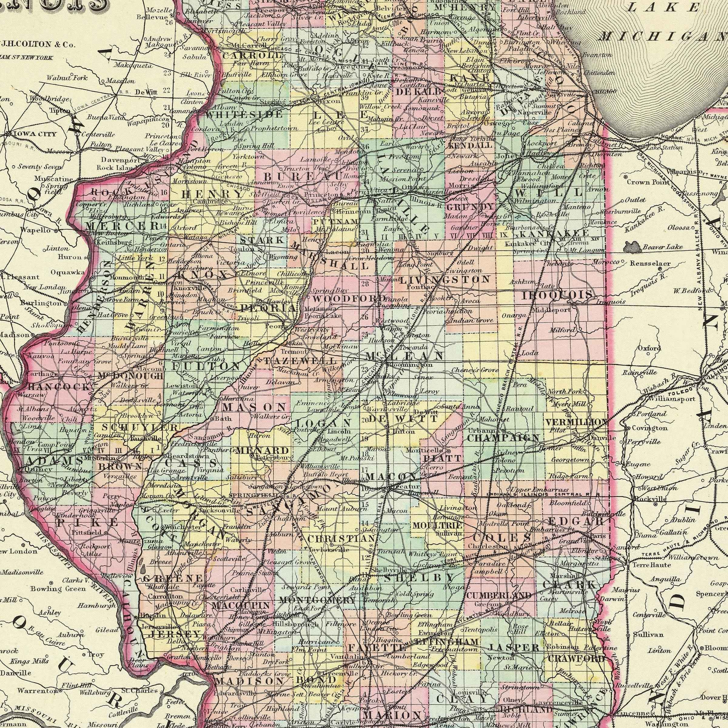
Colton’s 1855 map of Illinois shows a young state already stretching beyond its frontier image, framed by neat county lines, railroads just beginning to crisscross the prairie, and an inset of Chicago—a small but ambitious city perched on the edge of Lake Michigan. The engraved border is elegant, but the story within the lines is one of restless growth and transformation.
It is 1855 and Franklin Pierce is president. Nationally, the fallout of the Kansas–Nebraska Act has split parties and stirred violence west of the Mississippi, and Illinois feels the tremors of that debate. This is Abraham Lincoln’s Illinois, where the lawyer-turned-politician sharpens his arguments against the spread of slavery in courthouses and town halls. The prairies may look quiet on the map, but in reality they hum with politics, migration, and enterprise.
Rivers define the state’s movement of goods and people. The Illinois River curves southward, feeding into the Mississippi, while the Ohio and Wabash mark boundaries alive with steamboat whistles. To the north, the canal linking Chicago to the Illinois River turns the city into a gateway, drawing lumber from Wisconsin forests, grain from prairie farms, and immigrants from Europe who arrive eager to till black soil. The map’s inset of Chicago hints at its destiny: a port town swelling into a metropolis of warehouses, grain elevators, and stockyards.
Across the counties, settlements are marked with dots and names—Peoria, Springfield, Galena—towns that grew with lead mining, milling, or politics. Springfield, the capital, was modest in appearance but rising in importance, its streets home to lawyers, legislators, and debates that would echo into the national stage. Railroads, still thin lines compared to their future sprawl, begin to tie these communities together. Each track marked on the map represented a bet on growth, a promise that land once walked by bison and plowed by smallholders would soon roar with locomotives.
Life in 1855 Illinois was both hardship and promise. Families carved farms from prairie sod, their houses simple but their fields rich with corn and wheat. New arrivals—Germans, Irish, and Scandinavians among them—shaped communities with their languages, churches, and festivals. Town squares filled with markets and fairs; local presses rolled out papers that carried both local gossip and national disputes.
Colton’s map suggests order, but Illinois was anything but settled. The landscape carried Native trails, wagon ruts, and telegraph wires strung along the new rails. In the north, Chicago was beginning its climb toward modernity; in the south, communities along the Mississippi still tied themselves to river trade and older rhythms. Together they formed a state both divided and unified, preparing to play an outsized role in the nation’s unfolding story.
Hold the map at arm’s length and it resolves into a portrait of transition: a prairie state becoming a heartland, its railroads and rivers stitching together a future that would soon place Illinois at the center of America’s destiny.
Materials
Hand‑Stretched Canvas: If you choose canvas, we use a premium cotton‑poly blend stretched over solid pine frames. Each canvas is carefully hand‑stretched for a tight, gallery‑quality finish that’s ready to hang right out of the box.
Vivid, Fade‑Resistant Inks: We use professional‑grade inks that are UV‑resistant, so your print retains its rich colors even when displayed in bright rooms.
Expert Restoration: Every map is digitally restored by skilled artisans. We preserve the character of the original while enhancing clarity, so you see the map as it was meant to be seen.
Secure Packaging: Paper prints are rolled in heavy‑duty mailing tubes, and canvases are cushioned in reinforced boxes to ensure they arrive in pristine condition.
Choosing one of our prints means investing in craftsmanship. We combine historical authenticity with modern print technology and premium materials, giving you a work of art built to stand the test of time.
Choose options

Because every place has a story
Make History Personal
A vintage map is more than art.
It is a reminder of where life began.
Where memories were made.
Where hearts still live. Give the gift of place.
Beautifully preserved and made for the moments that matter.
Why Choose Us?
| Feature | Us | Competitor A | Competitor B |
|---|---|---|---|
| Hand Crafted | |||
| Museum Quality | |||
| 100 Year Guarantee | |||
| Restored by Hand | |||
| Certificate of Authenticity |

Art Prints
Archival quality colors. Best option if you'd like to frame it yourself

The Best Materials
We hand-stretched our canvas on solid American-grown pine stretcher bars. We use quality canvas and fade-resistant inks to create the lasting art. Canvases come with hardware already installed and ready to hang.
Need help?
Frequently Asked Questions
Order
All of our maps are meticulously restored reproductions of historic originals. Each piece is digitally repaired and color-corrected to bring out the finest details while preserving its authentic, vintage character.
Yes. All Archive Prints products are printed to order in the USA with archival materials.
We offer two premium formats:
- High-Quality Paper Posters – Printed on thick, archival-grade matte paper for rich, vibrant detail.
- Hand-Stretched Canvas Prints – Printed on premium polycotton canvas and mounted on 1.5" solid American pine stretcher bars for a gallery-quality finish.
We carefully digitally restore each map to enhance clarity and color while preserving its original look and historic charm. You’ll enjoy sharp details and a timeless vintage aesthetic that feels true to the original piece.
Yes, we do! We offer premium framing options to make your map ready to hang the moment it arrives. You can choose from Oak, Maple, Black, or Walnut frames directly on the product page. We also offer Stretched Canvas prints for a modern gallery look, as well as archival-quality Posters if you prefer to frame it yourself.
Yes! We offer free shipping on all products within the United States. Each map is carefully packaged to ensure it arrives in perfect condition.
If you’re not completely satisfied, you can return your order in new condition for a full refund. Return shipping costs are the responsibility of the customer.
Absolutely! Our maps make thoughtful, one-of-a-kind gifts for history lovers, map collectors, or anyone looking to add vintage character to their home or office. Choose between paper prints for framing or stretched canvas for a ready-to-hang presentation.
- Paper Posters → Shipped in durable, protective tubes to prevent creasing.
- Canvas Prints → Carefully wrapped, padded, and boxed to ensure safe delivery.
Our maps look stunning in a variety of settings, including:
- Living rooms and home offices
- Libraries and studies
- Corporate offices and conference rooms
- Restaurants, cafes, and boutique spaces