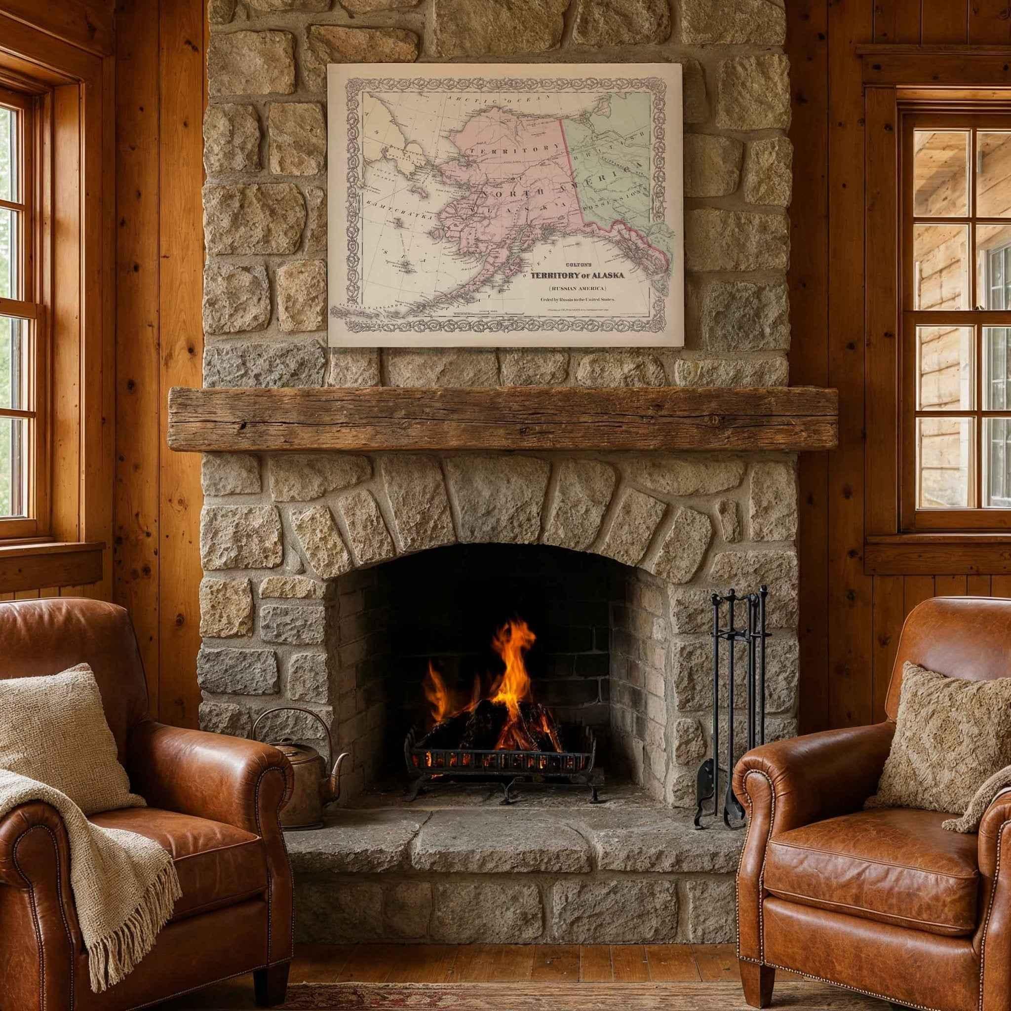
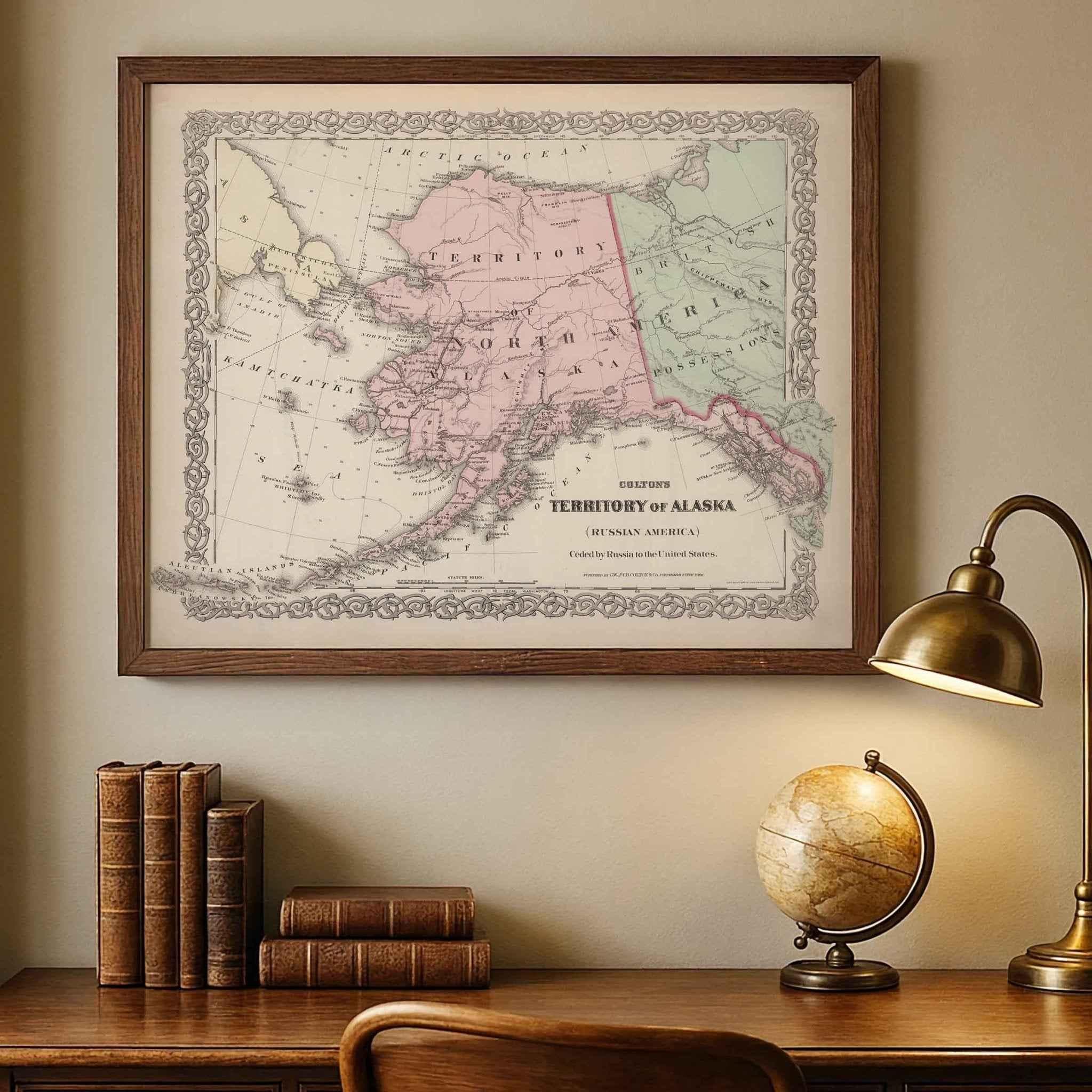
1886 Alaska Map – Restored Vintage Wall Art by Colton
Alaska Map
Step back into the late 19th century Alaska Map and experience Alaska as it once was with this beautifully restored 1886 Colton Map of the Territory of Alaska (Russian America). Originally published by G.W. & C.B. Colton & Co., this rare historical map captures Alaska during a remarkable period of transition — just decades after its purchase from Russia by the United States in 1867.
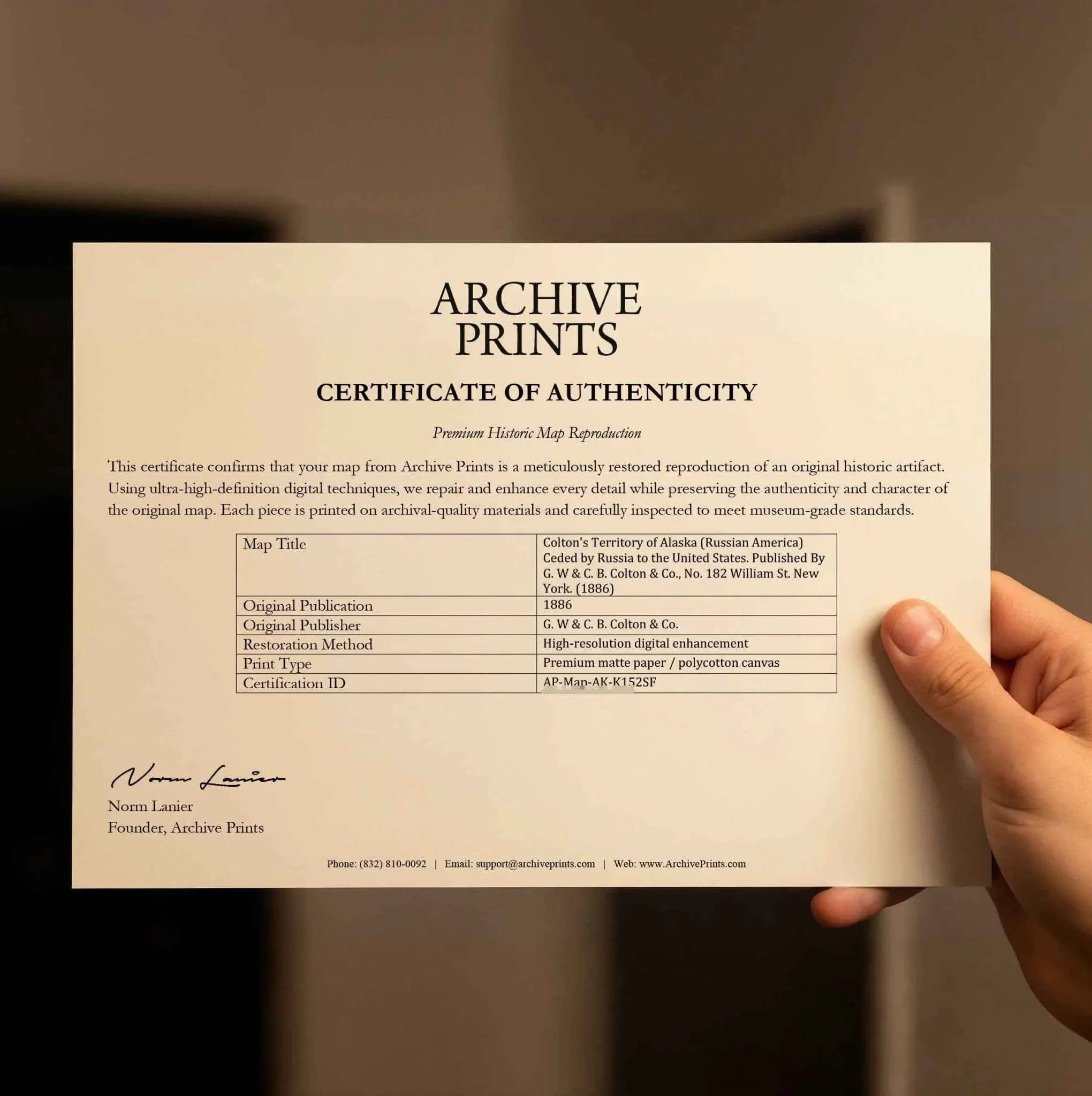
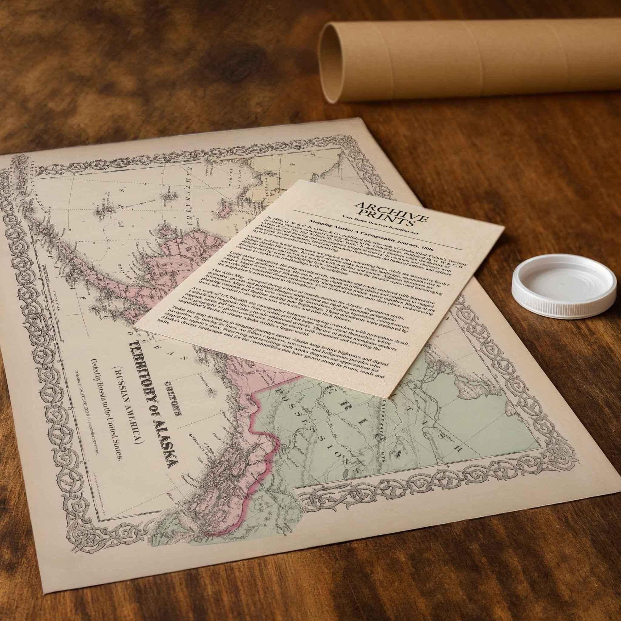
Each reproduction includes a custom historical letter telling the story behind the map, making it an ideal gift for collectors, history enthusiasts, and anyone who appreciates Alaska’s unique heritage. Printed on heavyweight archival paper or premium polycotton canvas, every line, label, and detail is preserved in ultra-high-definition clarity thanks to our meticulous digital restoration process.
To ensure your map arrives safely, paper prints are carefully rolled in a sturdy cardboard mailing tube, while canvases ship in reinforced boxes for maximum protection. From presentation to preservation, every detail is crafted with care.
Bring home more than wall art — bring home a story, a conversation piece, and a striking centerpiece that celebrates the enduring history of Alaska.
The Map Story
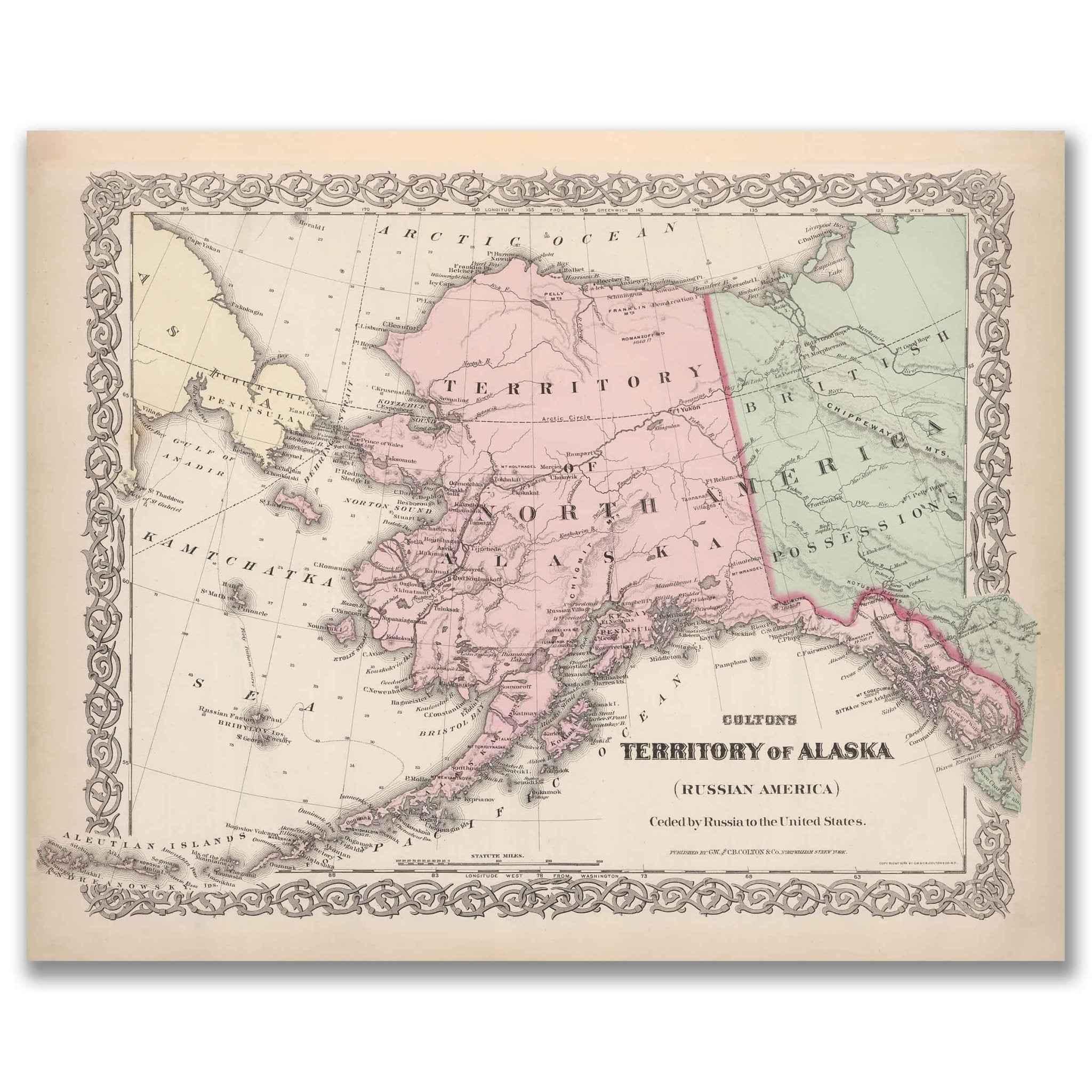
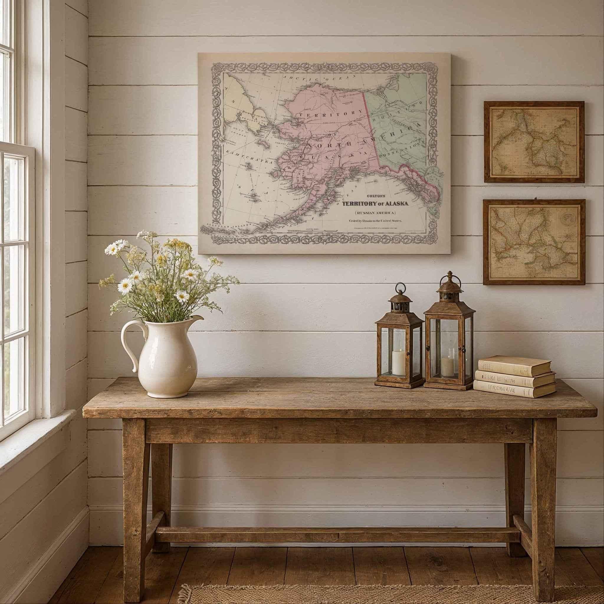
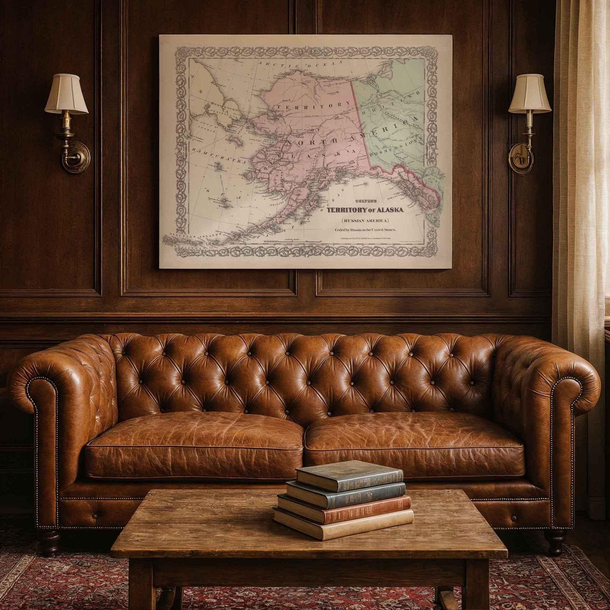
In 1886, G. W & C. B. Colton & Co. published this atlas map of Alaska titled 'Colton's Territory of Alaska (Russian America) Ceded by Russia to the United States. Published By G. W & C. B. Colton & Co., No. 182 William St. New York.'. It captures a moment when the identity of Alaska was still forming and cartographers sought to convey its contours and character with precision. Every boundary, label and ornament demonstrates the blend of artistry and science typical of nineteenth-century mapmaking.
County and territorial boundaries are shaded with contrasting hues, while the decorative border frames Alaska like a stage. Rivers and streams snake across the landscape, mountains rise in delicate hachures and towns are marked with neat dots and names. Adjacent territories are distinguished by color, highlighting how Alaska fits within the broader region and encouraging viewers to explore its relationships with its neighbors.
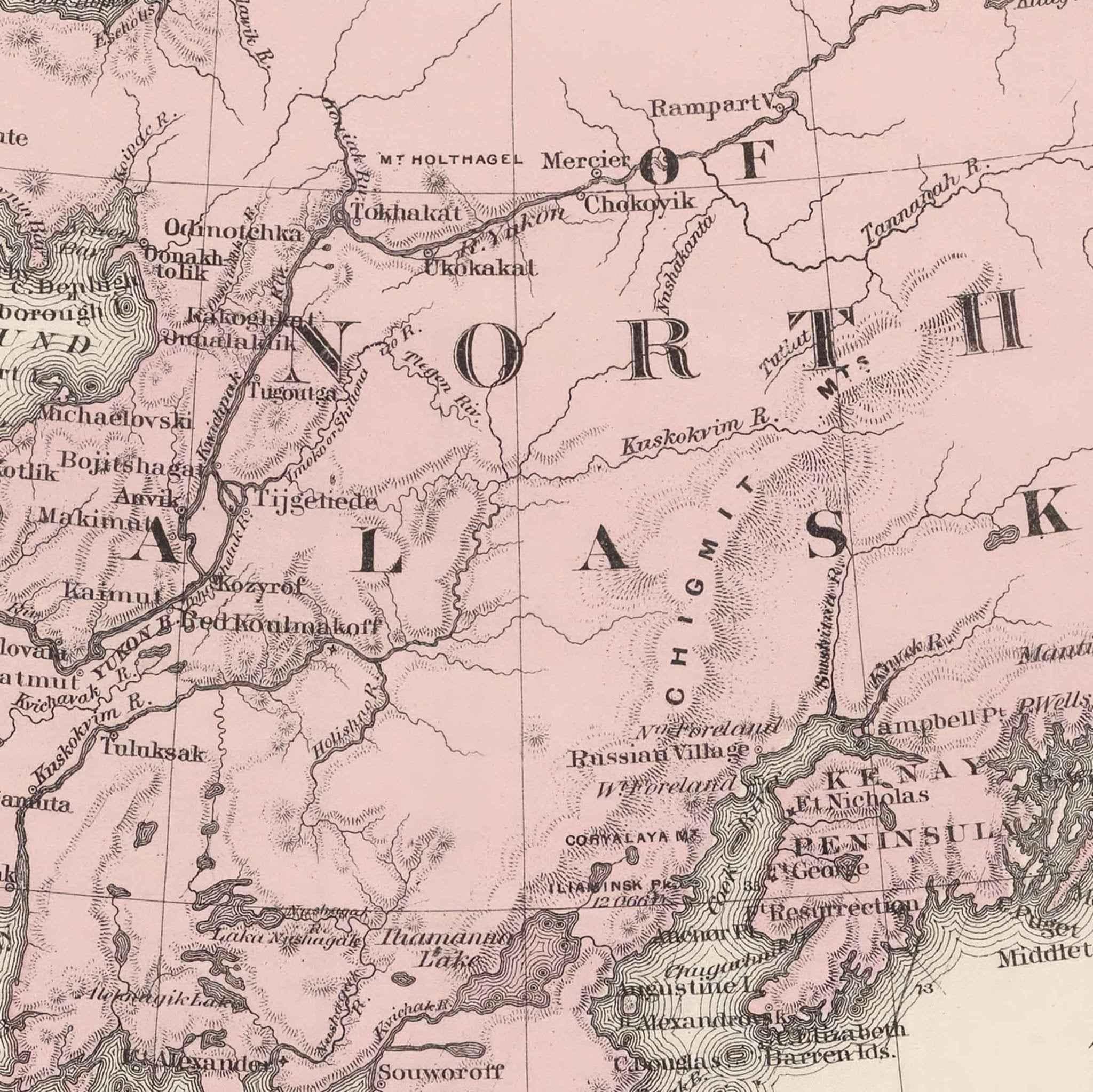
Upon closer inspection, the map reveals rivers, mountains and towns rendered with impressive detail. Subtle gradients convey elevation, giving depth to rolling plains and emphasis to rugged ranges. Major rivers, minor streams and early transportation routes weave together, hinting at the networks that connected distant settlements. Even isolated hamlets earn their place, underscoring the mapmaker’s commitment to thoroughness.
This Atlas Map
emerged during a time of transformation for Alaska. Population shifts, economic growth and political changes underscored the need for accurate geographic information. Maps like this were consulted by lawmakers drafting legislation, entrepreneurs planning ventures and families seeking new beginnings. These documents were treasured by those who needed to navigate across territories and plan their futures.
At a scale of 1:7,500,000, the cartographer balances sweeping overviews with meticulous detail. Latitude and longitude lines form a subtle grid that helps readers orient themselves, while legends, insets and bar scales provide additional context. The use of prime meridians anchors local geography to global coordinates, blending clarity with ornament and revealing the mapmaker’s desire to situate Alaska within a larger world.
Today this map invites us to imagine journeys across Alaska long before highways and digital navigation. By tracing its lines, we follow explorers, surveyors and Indigenous peoples who shaped the region’s story. Preserving and revisiting such works deepens our appreciation for Alaska's diverse landscapes and for the communities that have grown along its rivers, roads and trails.
Materials
Hand‑Stretched Canvas: If you choose canvas, we use a premium cotton‑poly blend stretched over solid pine frames. Each canvas is carefully hand‑stretched for a tight, gallery‑quality finish that’s ready to hang right out of the box.
Vivid, Fade‑Resistant Inks: We use professional‑grade inks that are UV‑resistant, so your print retains its rich colors even when displayed in bright rooms.
Expert Restoration: Every map is digitally restored by skilled artisans. We preserve the character of the original while enhancing clarity, so you see the map as it was meant to be seen.
Secure Packaging: Paper prints are rolled in heavy‑duty mailing tubes, and canvases are cushioned in reinforced boxes to ensure they arrive in pristine condition.
Choosing one of our prints means investing in craftsmanship. We combine historical authenticity with modern print technology and premium materials, giving you a work of art built to stand the test of time.
Choose options

Because every place has a story
Make History Personal
A vintage map is more than art.
It is a reminder of where life began.
Where memories were made.
Where hearts still live. Give the gift of place.
Beautifully preserved and made for the moments that matter.
Why Choose Us?
| Feature | Us | Competitor A | Competitor B |
|---|---|---|---|
| Hand Crafted | |||
| Museum Quality | |||
| 100 Year Guarantee | |||
| Restored by Hand | |||
| Certificate of Authenticity |

Art Prints
Archival quality colors. Best option if you'd like to frame it yourself

The Best Materials
We hand-stretched our canvas on solid American-grown pine stretcher bars. We use quality canvas and fade-resistant inks to create the lasting art. Canvases come with hardware already installed and ready to hang.
Need help?
Frequently Asked Questions
Order
All of our maps are meticulously restored reproductions of historic originals. Each piece is digitally repaired and color-corrected to bring out the finest details while preserving its authentic, vintage character.
Yes. All Archive Prints products are printed to order in the USA with archival materials.
We offer two premium formats:
- High-Quality Paper Posters – Printed on thick, archival-grade matte paper for rich, vibrant detail.
- Hand-Stretched Canvas Prints – Printed on premium polycotton canvas and mounted on 1.5" solid American pine stretcher bars for a gallery-quality finish.
We carefully digitally restore each map to enhance clarity and color while preserving its original look and historic charm. You’ll enjoy sharp details and a timeless vintage aesthetic that feels true to the original piece.
Yes, we do! We offer premium framing options to make your map ready to hang the moment it arrives. You can choose from Oak, Maple, Black, or Walnut frames directly on the product page. We also offer Stretched Canvas prints for a modern gallery look, as well as archival-quality Posters if you prefer to frame it yourself.
Yes! We offer free shipping on all products within the United States. Each map is carefully packaged to ensure it arrives in perfect condition.
If you’re not completely satisfied, you can return your order in new condition for a full refund. Return shipping costs are the responsibility of the customer.
Absolutely! Our maps make thoughtful, one-of-a-kind gifts for history lovers, map collectors, or anyone looking to add vintage character to their home or office. Choose between paper prints for framing or stretched canvas for a ready-to-hang presentation.
- Paper Posters → Shipped in durable, protective tubes to prevent creasing.
- Canvas Prints → Carefully wrapped, padded, and boxed to ensure safe delivery.
Our maps look stunning in a variety of settings, including:
- Living rooms and home offices
- Libraries and studies
- Corporate offices and conference rooms
- Restaurants, cafes, and boutique spaces