
1878 San Francisco Bird's-Eye Map - Restored Vintage Wall Art for Home Decor
Discover a Piece of San Francisco History
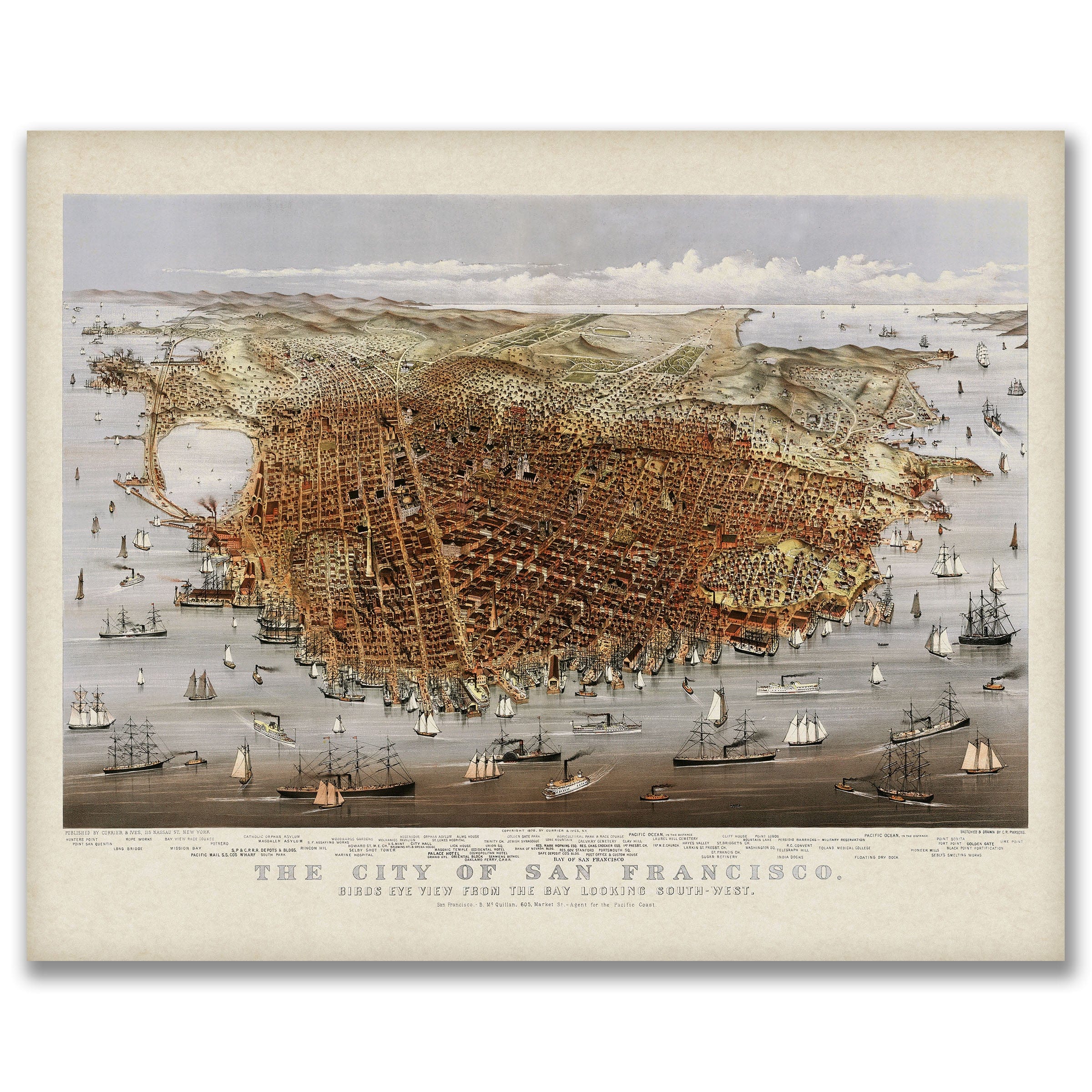
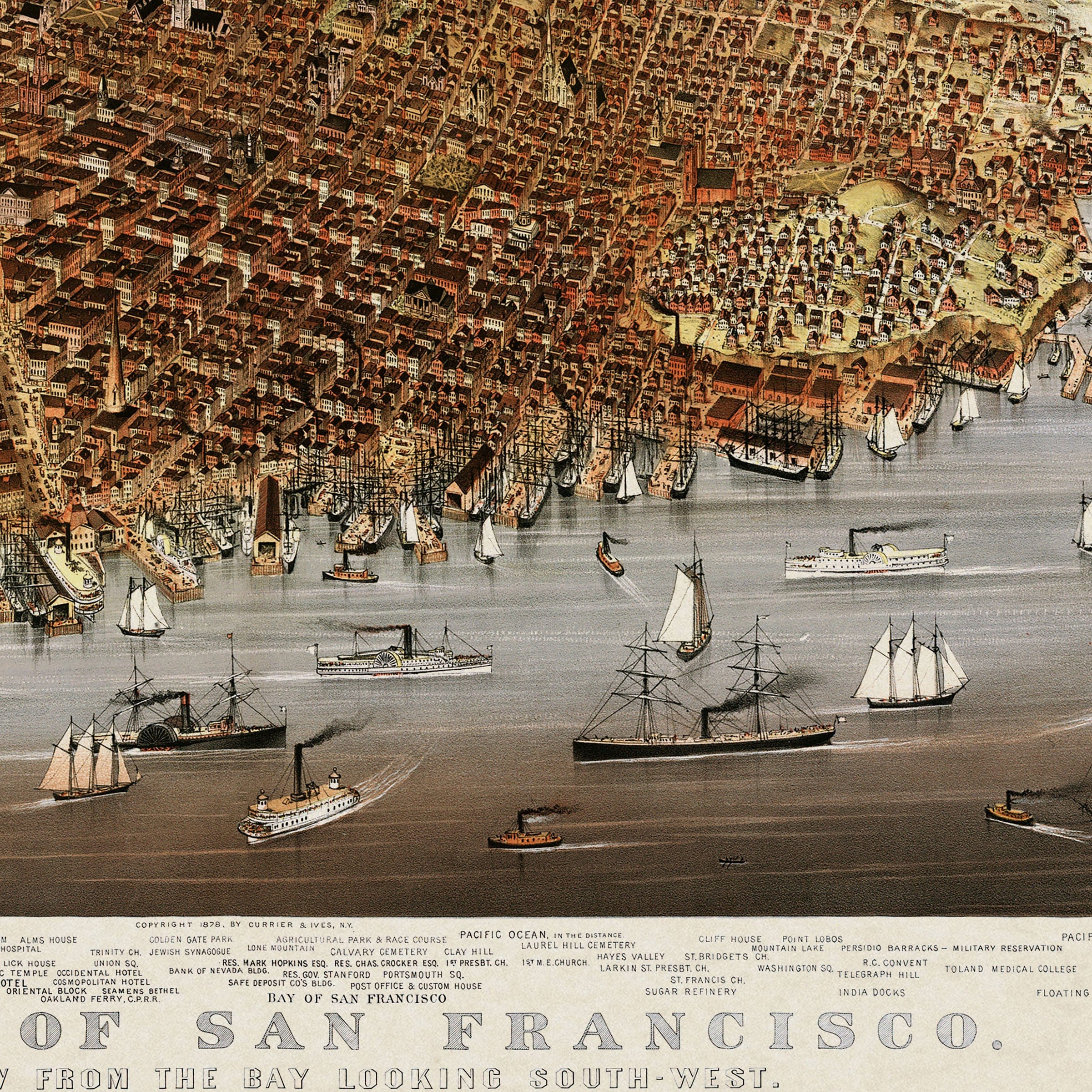
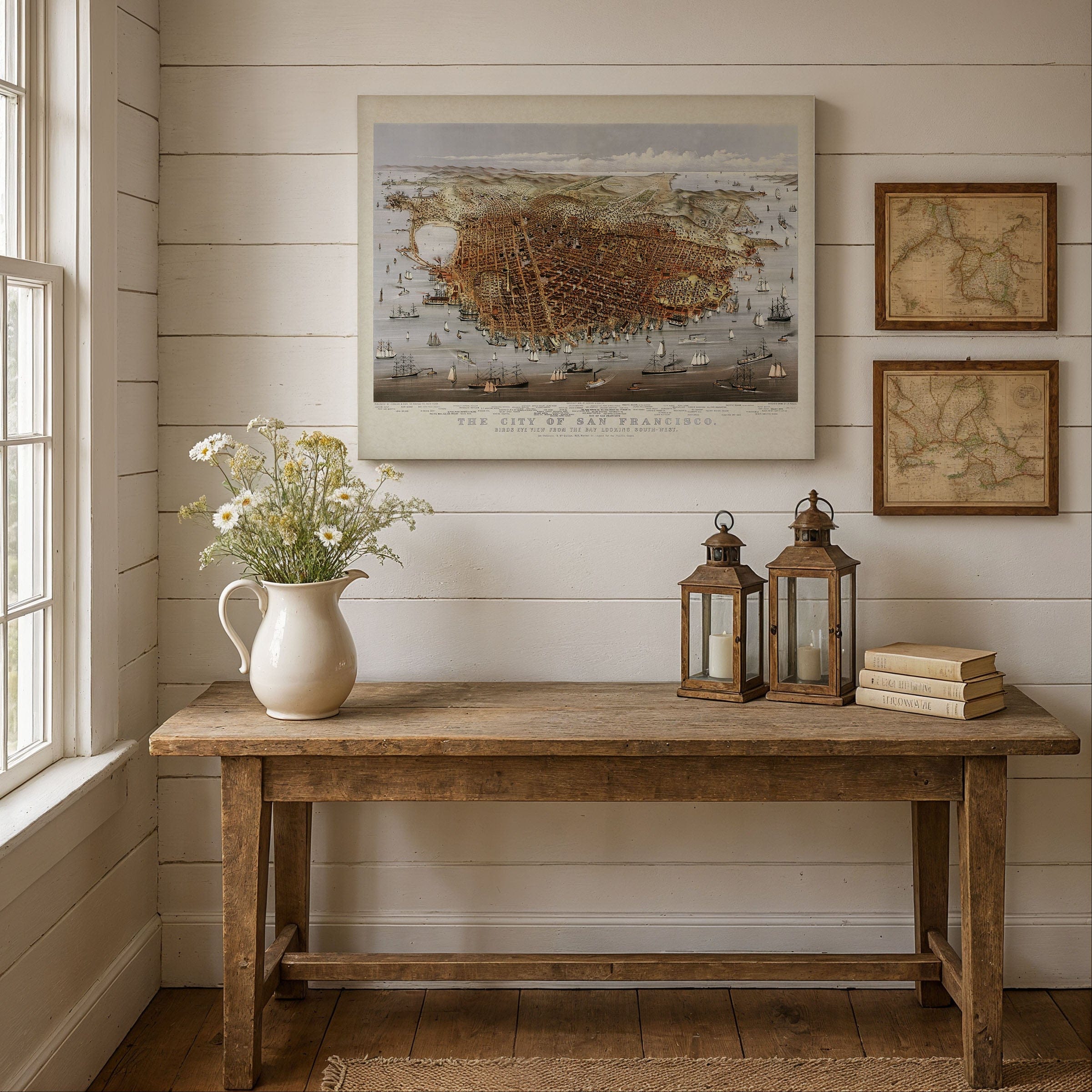
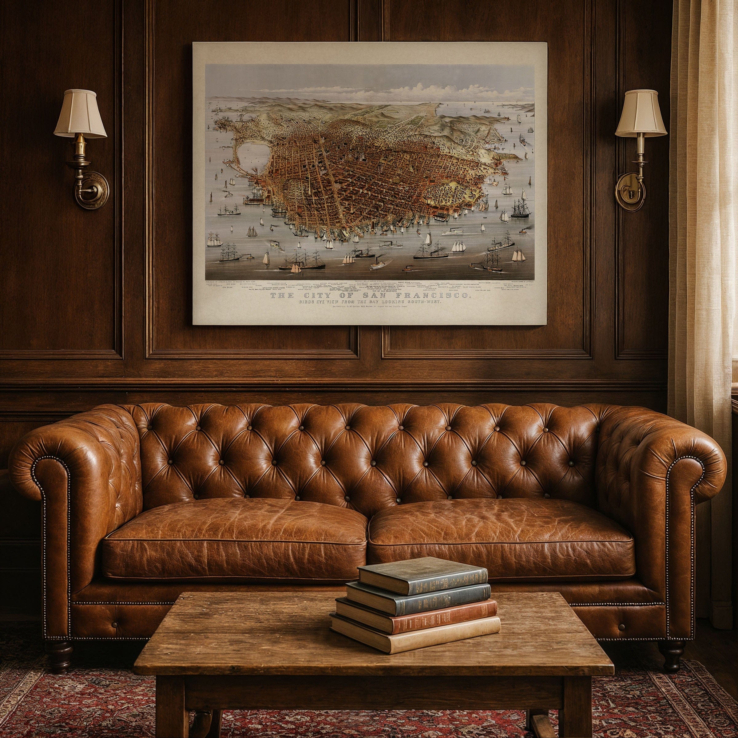
Step back into the Gilded Age and see the Bay City as it once was with this beautifully restored 1878 Bird's-Eye View of San Francisco. Drawn at the height of the harbor's bustle—sails crowding the water, warehouses lining the piers, and new neighborhoods climbing the hills—this panoramic map captures the city between gold-rush memory and modern ambition. You'll spot the waterfront alive with ships, the rectilinear street grid, and familiar slopes rising toward Telegraph and Nob Hill, all set beneath a sky rolling in from the Pacific.
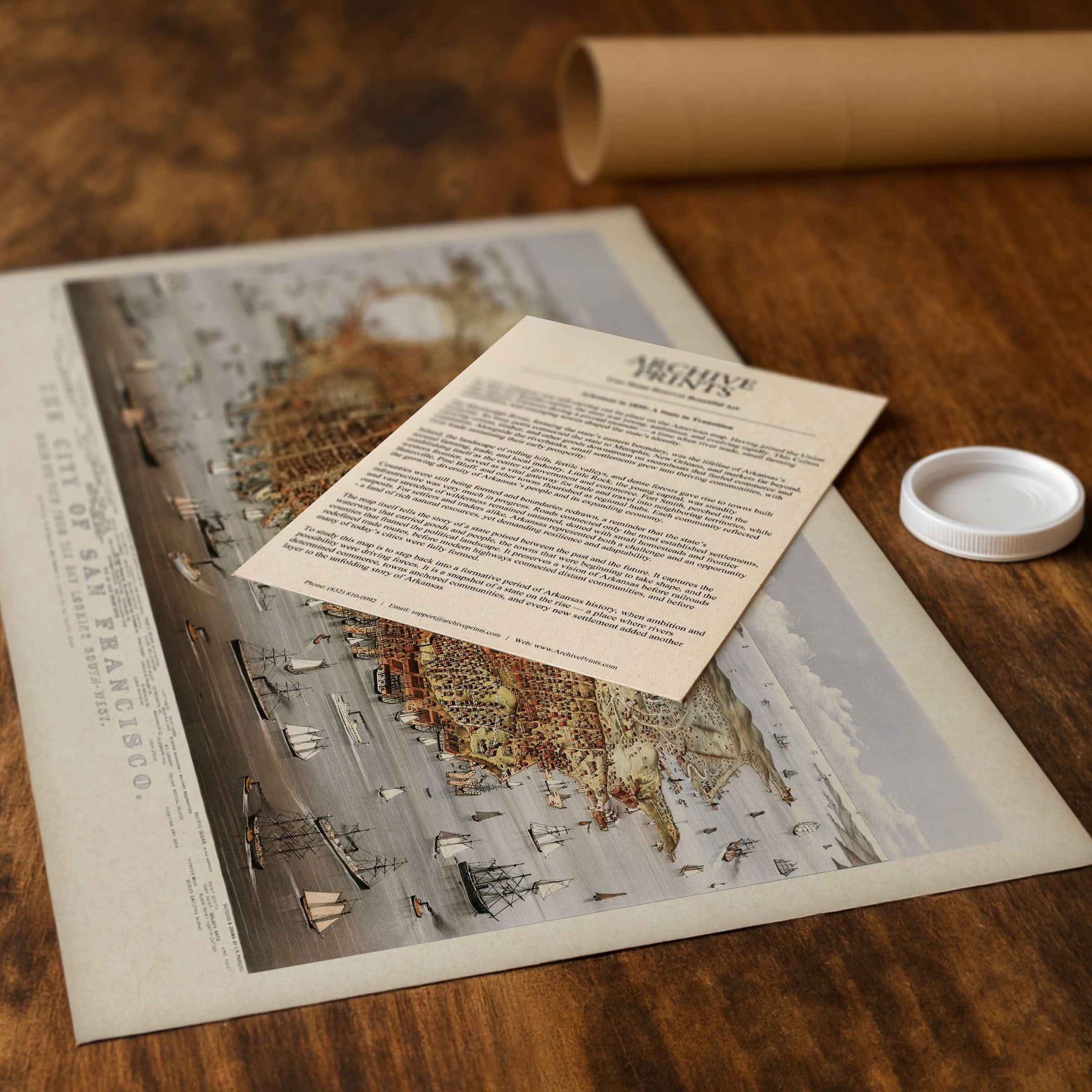
Each reproduction includes a custom historical letter that tells the story behind the view, making it an ideal gift for collectors, history lovers, and anyone who cherishes California's coastal heritage. Printed on heavyweight archival paper or premium poly-cotton canvas, every rooftop, street, and ship's rigging is preserved in ultra-high-definition clarity thanks to meticulous digital restoration—rich tones, crisp linework, and the gentle patina of the original lithograph retained.
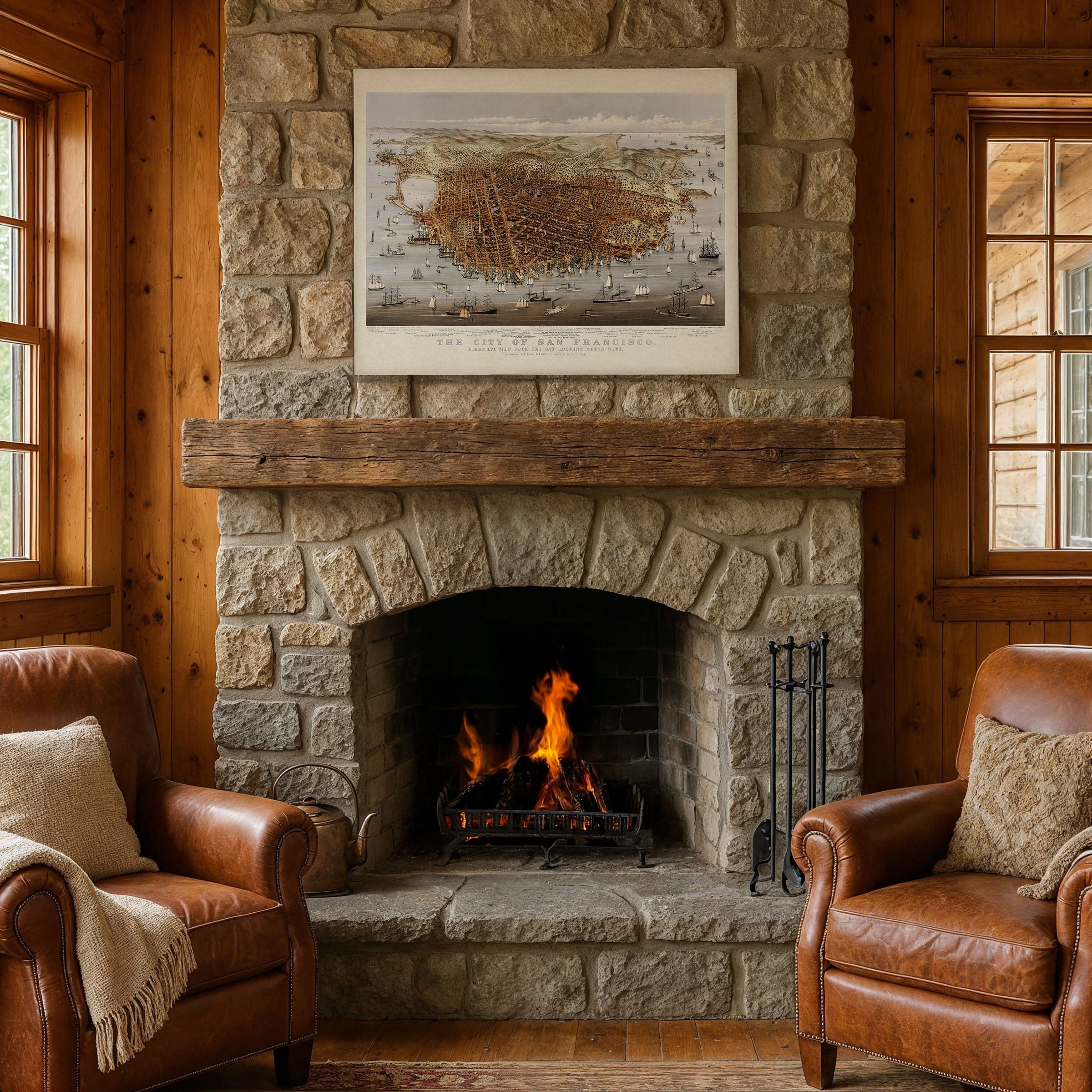
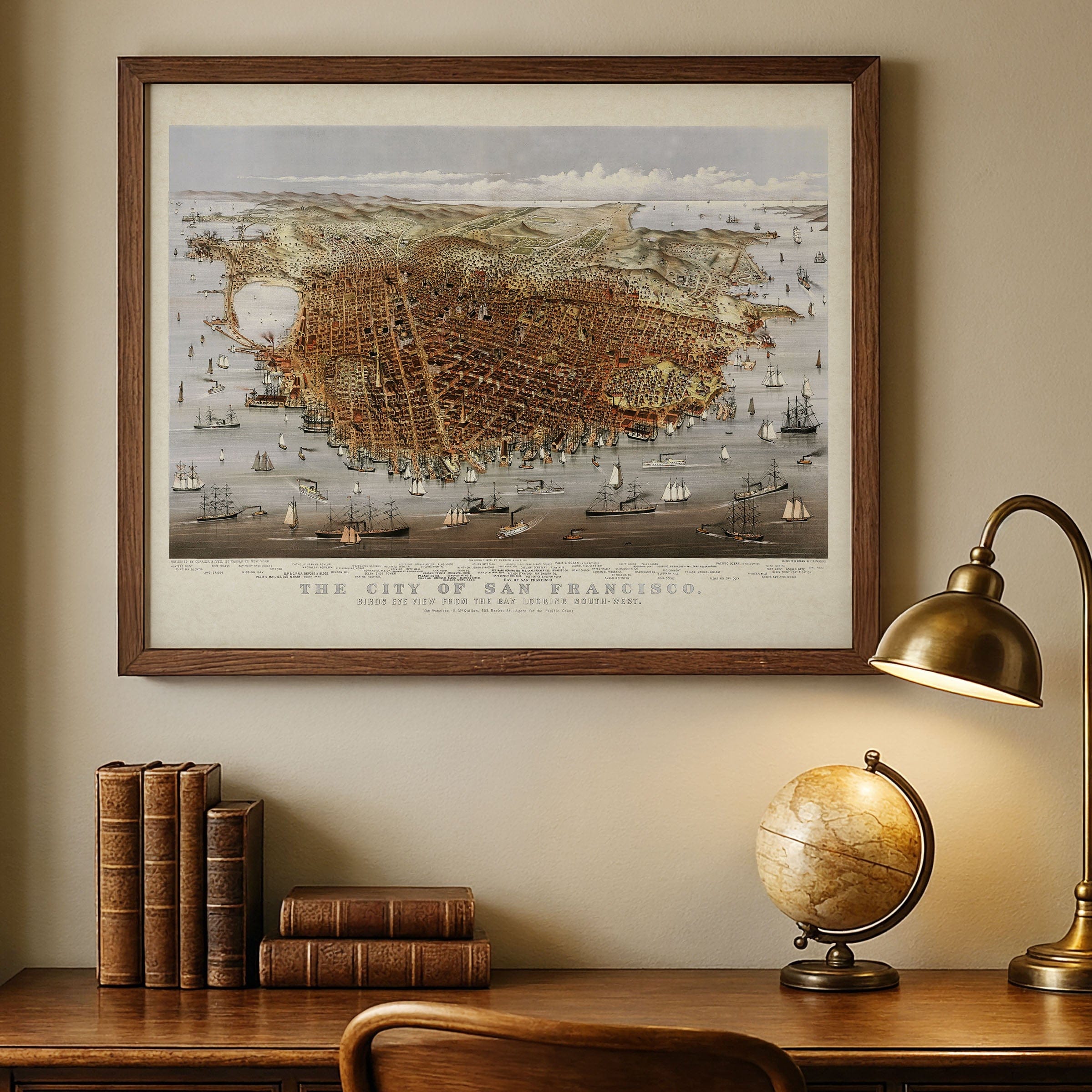
For presentation and protection, we craft every detail with care. Paper prints are carefully rolled in a sturdy cardboard mailing tube to arrive flat and flawless after framing. Canvas prints are gallery-wrapped on solid 1.5″ pine stretcher bars and ship in reinforced boxes—ready to hang right out of the box with a pre-installed sawtooth hanger.
Bring home more than wall art. Bring home a story, a conversation piece, and a striking centerpiece that celebrates San Francisco's harbor, hills, and unstoppable energy in the late 19th century. Whether it anchors a living room, office, or library, this 1878 panoramic map turns any space into a window overlooking the city by the bay as it first soared toward greatness.
The Map Story
San Francisco, 1878: City of Hills, Harbor, and Cable
The bird's-eye map spreads the city like a fan across the peninsula—streets combed straight toward the water, roofs set in neat ranks, the bay stippled with sails and smoke. Beyond the masts, ferries cut white wakes toward Oakland, and the hills rise like shoulders against a pale sky. From up here the city looks finished, almost serene. But 1878 San Francisco is still a work in motion, loud, restless, and certain of its future.
Rutherford B. Hayes is president, picking a careful path through the end of Reconstruction while the nation rides out the last years of a grinding depression. California feels both the pinch and the promise. Money is tight, but the harbor never sleeps. Wheat, lumber, and fruit stream in from the valleys; coal and manufactured goods arrive from across the Pacific. The transcontinental connection ends on the water—rails to the Oakland pier, then ferry across—and each landing spills people and cargo into a city built to trade.
On the map you can almost trace stories. The brand-new Palace Hotel glows from its block like a statement of intent. Cable cars climb the grades—Clay Street first, then California—steel grip and rope turning hills into neighborhoods. Golden Gate Park is still young, an engineered miracle sprouting from dunes, its drives curling west toward the rumble of surf. South of Market, lumberyards and foundries anchor the working waterfront; north along the Embarcadero, piers bristle with rigging as clippers share space with squat, efficient steamers.
Politics run hot. The "sand-lot" speeches draw crowds, and the Workingmen's Party rails against monopolies and immigrants, especially the Chinese communities who keep shops open late and laundry steam high. The city's booming promise collides with fear and scapegoat anger, and California begins the constitutional convention that will rewrite rules with the impatience of a place that wants growth without chaos. In Chinatown, lanterns burn anyway, temples ring, and families carry on—resilient in the face of laws and mobs alike.
Evenings smell of salt and coal smoke. Telegraph wires hum, saloons spill piano into the street, and barges drift past the shadow of Telegraph Hill. Out at the Ocean Beach, the wind scours the sand clean; at the Cliff House, visitors watch the sea lions and talk about the next real-estate scheme. The city remembers fires and earthquakes and knows more will come, but it builds upward regardless—brick by brick, cable by cable.
The map pretends to stillness: every block neat, every ship forever in mid-harbor. Yet the truth of 1878 is movement. San Francisco is a hinge between oceans and continent, a place where fortunes arrive by tide and steam, where engineers lay lines across sand and granite and call them streets. To trace these lines is to feel a city teaching itself how to climb, how to trade, and how to argue—loudly, brilliantly—on its way toward the century ahead.
The Map Story
This breathtaking panoramic view of San Francisco, created in 1878, captures the city at the height of its emergence as the West Coast’s crown jewel. Drawn from a bird’s-eye perspective looking southwest from the bay, the map reveals a city bursting with energy and ambition—its wharves crowded with ships, its streets teeming with life, and its skyline rising from the hills like a promise of modernity.
Every detail in this richly colored lithograph tells a story of transformation. Only three decades earlier, this peninsula was little more than a small port called Yerba Buena. The Gold Rush of 1849 changed everything—turning San Francisco into a global gateway where miners, merchants, and immigrants converged in search of fortune. By the time this view was published, the city had matured into a thriving metropolis of nearly 200,000 people, with a dense grid of streets stretching inland from the bustling piers of the Embarcadero.
In the foreground, the harbor brims with schooners, clipper ships, and steamers that connected San Francisco to Asia, South America, and the eastern United States. The scene captures not only the city’s commercial might but also its cultural vitality—an urban experiment unlike any other in 19th-century America. Telegraph Hill, Nob Hill, and Russian Hill rise distinctly from the landscape, dotted with homes and public buildings that reflect the city’s growing prosperity.
What makes this map truly remarkable is its sense of optimism. It is both a work of art and a declaration—a celebration of human progress and determination on the edge of a continent. The precision of the lithography, combined with the grandeur of its perspective, invites viewers to witness San Francisco not as it was, but as it aspired to be: a city of opportunity, energy, and endless horizons.
Materials
Choose options

Because every place has a story
Make History Personal
A vintage map is more than art.
It is a reminder of where life began.
Where memories were made.
Where hearts still live. Give the gift of place.
Beautifully preserved and made for the moments that matter.
Why Choose Us?
| Feature | Us | Competitor A | Competitor B |
|---|---|---|---|
| Hand Crafted | |||
| Museum Quality | |||
| 100 Year Guarantee | |||
| Restored by Hand | |||
| Certificate of Authenticity |

Art Prints
Archival quality colors. Best option if you'd like to frame it yourself

The Best Materials
We hand-stretched our canvas on solid American-grown pine stretcher bars. We use quality canvas and fade-resistant inks to create the lasting art. Canvases come with hardware already installed and ready to hang.
Need help?
Frequently Asked Questions
Order
All of our maps are meticulously restored reproductions of historic originals. Each piece is digitally repaired and color-corrected to bring out the finest details while preserving its authentic, vintage character.
Yes. All Archive Prints products are printed to order in the USA with archival materials.
We offer two premium formats:
- High-Quality Paper Posters – Printed on thick, archival-grade matte paper for rich, vibrant detail.
- Hand-Stretched Canvas Prints – Printed on premium polycotton canvas and mounted on 1.5" solid American pine stretcher bars for a gallery-quality finish.
We carefully digitally restore each map to enhance clarity and color while preserving its original look and historic charm. You’ll enjoy sharp details and a timeless vintage aesthetic that feels true to the original piece.
Yes, we do! We offer premium framing options to make your map ready to hang the moment it arrives. You can choose from Oak, Maple, Black, or Walnut frames directly on the product page. We also offer Stretched Canvas prints for a modern gallery look, as well as archival-quality Posters if you prefer to frame it yourself.
Yes! We offer free shipping on all products within the United States. Each map is carefully packaged to ensure it arrives in perfect condition.
If you’re not completely satisfied, you can return your order in new condition for a full refund. Return shipping costs are the responsibility of the customer.
Absolutely! Our maps make thoughtful, one-of-a-kind gifts for history lovers, map collectors, or anyone looking to add vintage character to their home or office. Choose between paper prints for framing or stretched canvas for a ready-to-hang presentation.
- Paper Posters → Shipped in durable, protective tubes to prevent creasing.
- Canvas Prints → Carefully wrapped, padded, and boxed to ensure safe delivery.
Our maps look stunning in a variety of settings, including:
- Living rooms and home offices
- Libraries and studies
- Corporate offices and conference rooms
- Restaurants, cafes, and boutique spaces