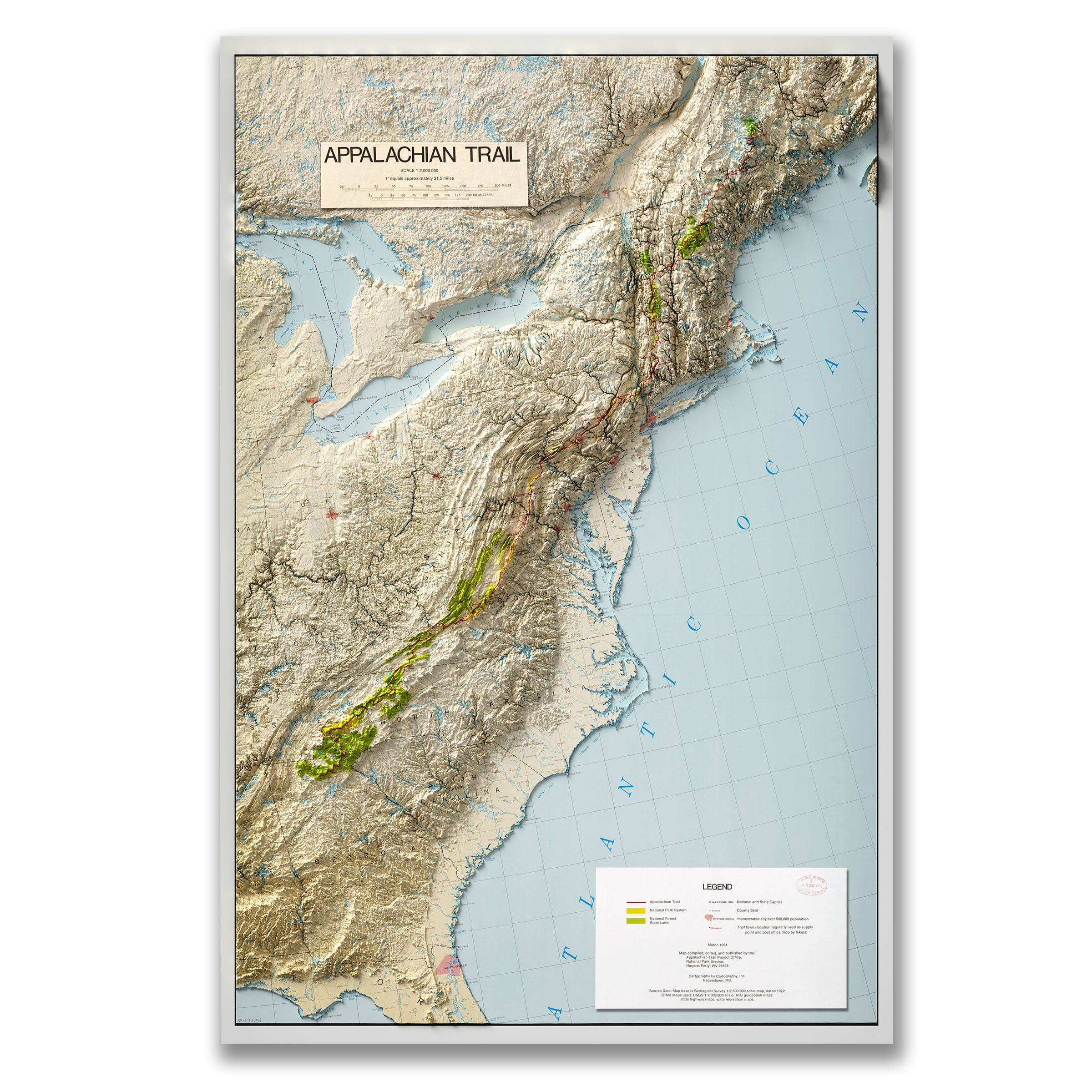
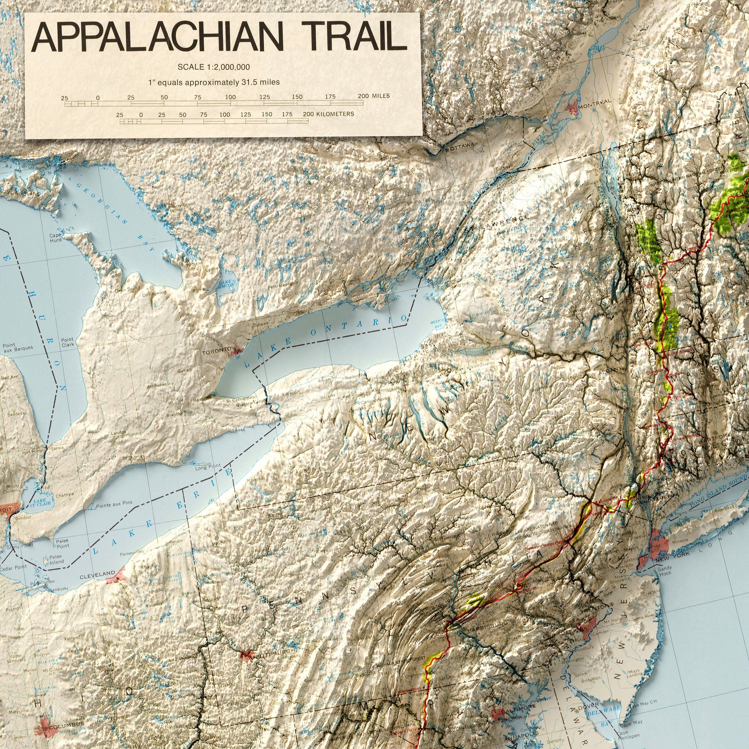
Appalachian Trail 3D Shaded Flat 2D Map - Topographic Hiking Guide (Not a Relief Map)
This is a flat 2D print that only looks three-dimensional due to the shaded-relief design.
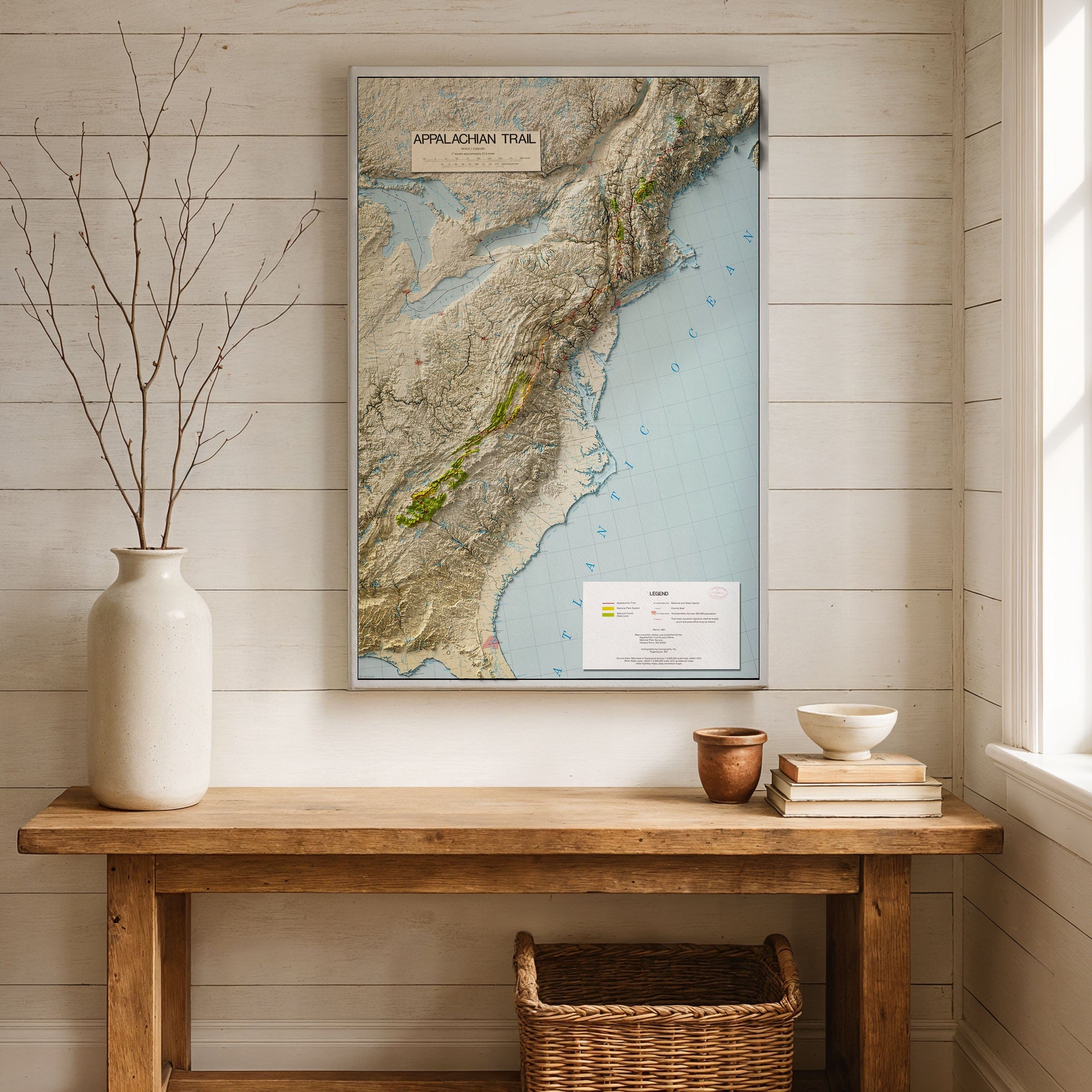
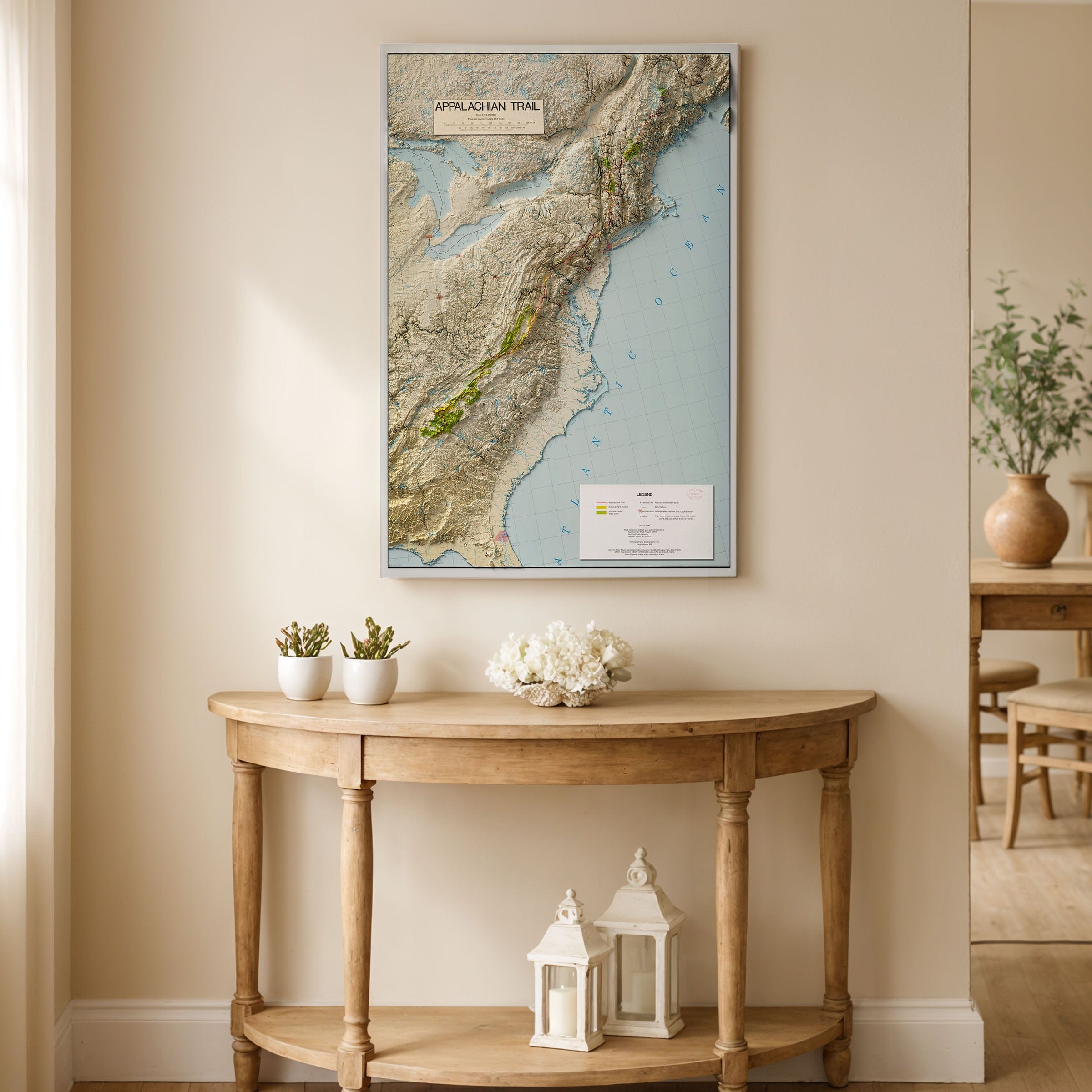
Experience the legendary Appalachian Trail 3D Shaded Map that captures more than two thousand miles of America's most iconic hiking trail stretching through the spine of the eastern United States. This vintage map style visualization reveals the trail as less a path than a pilgrimage—a living thread connecting the granite of Maine to the red clay of Georgia through relief and light that shows how geography itself shapes endurance, solitude, and the quiet promise of motion. The Appalachian Trail 3D Map brings to life the vision first conceived in the 1920s by forester Benton MacKaye, born from a dream of balance between civilization and wilderness when America was industrializing at unprecedented pace. This old map aesthetic honors the volunteers, rangers, and dreamers who by 1937 had connected the final gaps, forming a route that stitched together fourteen states, six national parks, and countless towns built along the edge of the wild. The topography revealed in this vintage map tells the story better than words can, with the trail line hugging ancient ridges and folded valleys, tracing mountains older than the Rockies and Alps combined. From Katahdin's granite crown in Maine to Springer Mountain's forested rise in Georgia, the trail follows a continent's ancient spine where every mile carries the memory of shifting stone and slow time. The map's shaded relief brings the journey to life through the rugged Presidential Range, the misty hollows of the Smokies, and the green tunnels of Virginia's Blue Ridge. Every contour whispers of hardship and joy—of blisters, rain, and the sudden mercy of sunlight breaking through cloud. For those who walk its length, the trail represents both a physical and spiritual crossing: a test of endurance and a lesson in humility. More than a route, the Appalachian Trail is a republic of wanderers where thousands attempt its full traverse each year, and tens of thousands more walk a single day upon it. Towns like Damascus, Harpers Ferry, and Hanover have become sanctuaries for those chasing the long horizon, with each footstep linking past and present as the same ridgelines that once guided Cherokee hunters and Revolutionary scouts now carry hikers toward something wordless and eternal. Each reproduction includes a custom historical letter detailing the story behind the map, making it perfect for hikers, outdoor enthusiasts, and Appalachian Trail collectors. Printed on heavyweight archival paper or hand-stretched polycotton canvas, every ridge, valley, and trail marker is restored in museum-grade clarity for generations of enjoyment. Paper prints ship rolled in heavy-duty tubes, while canvas editions arrive gallery-wrapped on solid pine stretcher bars with pre-installed hardware—ready to display the moment it arrives. Bring home the spirit of America's most beloved long-distance trail and celebrate the legacy of persistence, quiet miles, and the human need to keep moving forward through beauty and uncertainty alike.
The Map Story
Materials
Choose options

Because every place has a story
Make History Personal
A vintage map is more than art.
It is a reminder of where life began.
Where memories were made.
Where hearts still live. Give the gift of place.
Beautifully preserved and made for the moments that matter.
Why Choose Us?
| Feature | Us | Competitor A | Competitor B |
|---|---|---|---|
| Hand Crafted | |||
| Museum Quality | |||
| 100 Year Guarantee | |||
| Restored by Hand | |||
| Certificate of Authenticity |

Art Prints
Archival quality colors. Best option if you'd like to frame it yourself

The Best Materials
We hand-stretched our canvas on solid American-grown pine stretcher bars. We use quality canvas and fade-resistant inks to create the lasting art. Canvases come with hardware already installed and ready to hang.
Need help?
Frequently Asked Questions
Order
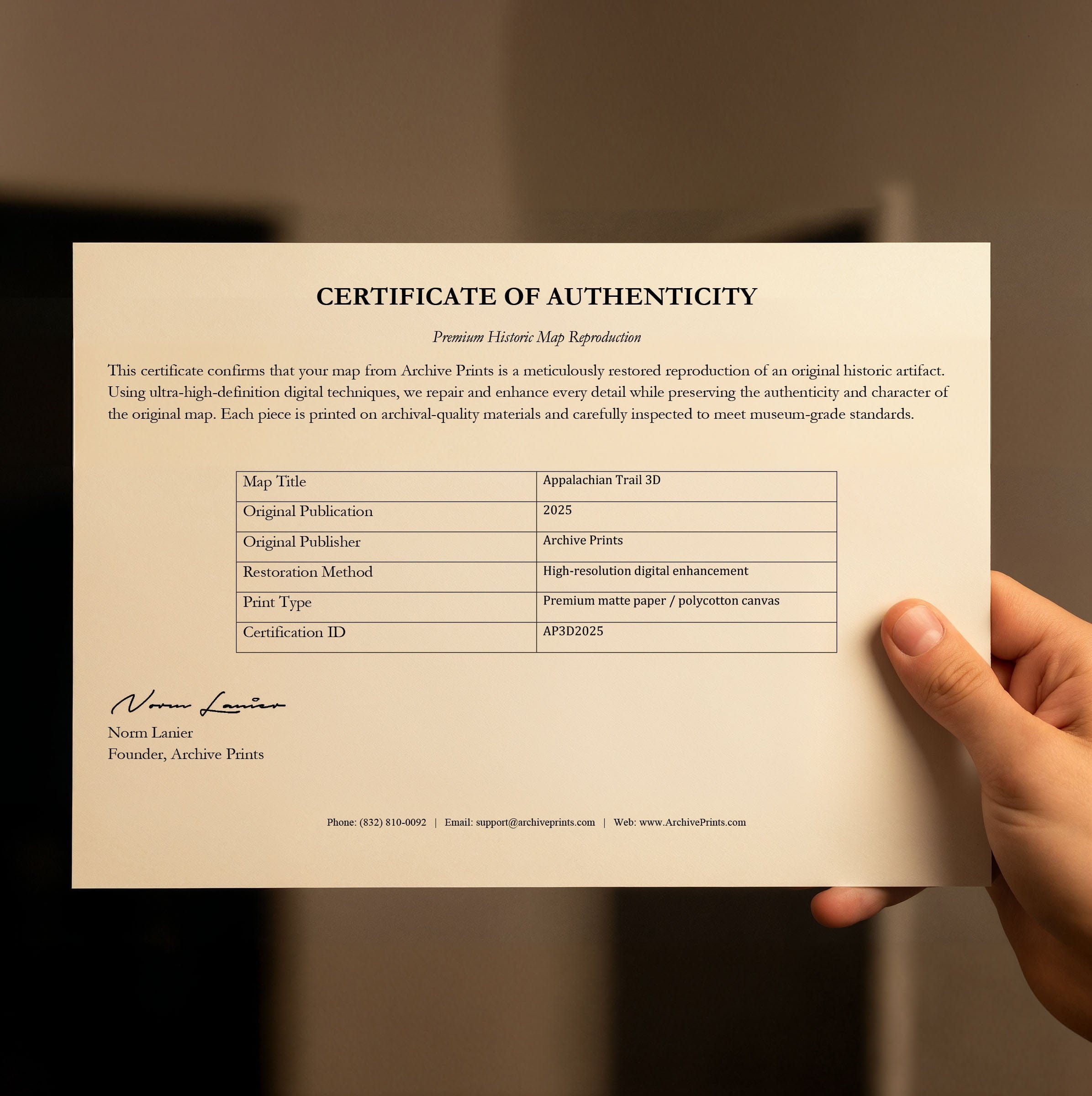
All of our maps are meticulously restored reproductions of historic originals. Each piece is digitally repaired and color-corrected to bring out the finest details while preserving its authentic, vintage character.
Yes. All Archive Prints products are printed to order in the USA with archival materials.
We offer two premium formats:
- High-Quality Paper Posters – Printed on thick, archival-grade matte paper for rich, vibrant detail.
- Hand-Stretched Canvas Prints – Printed on premium polycotton canvas and mounted on 1.5" solid American pine stretcher bars for a gallery-quality finish.
We carefully digitally restore each map to enhance clarity and color while preserving its original look and historic charm. You’ll enjoy sharp details and a timeless vintage aesthetic that feels true to the original piece.
Yes, we do! We offer premium framing options to make your map ready to hang the moment it arrives. You can choose from Oak, Maple, Black, or Walnut frames directly on the product page. We also offer Stretched Canvas prints for a modern gallery look, as well as archival-quality Posters if you prefer to frame it yourself.
Yes! We offer free shipping on all products within the United States. Each map is carefully packaged to ensure it arrives in perfect condition.
If you’re not completely satisfied, you can return your order in new condition for a full refund. Return shipping costs are the responsibility of the customer.
Absolutely! Our maps make thoughtful, one-of-a-kind gifts for history lovers, map collectors, or anyone looking to add vintage character to their home or office. Choose between paper prints for framing or stretched canvas for a ready-to-hang presentation.
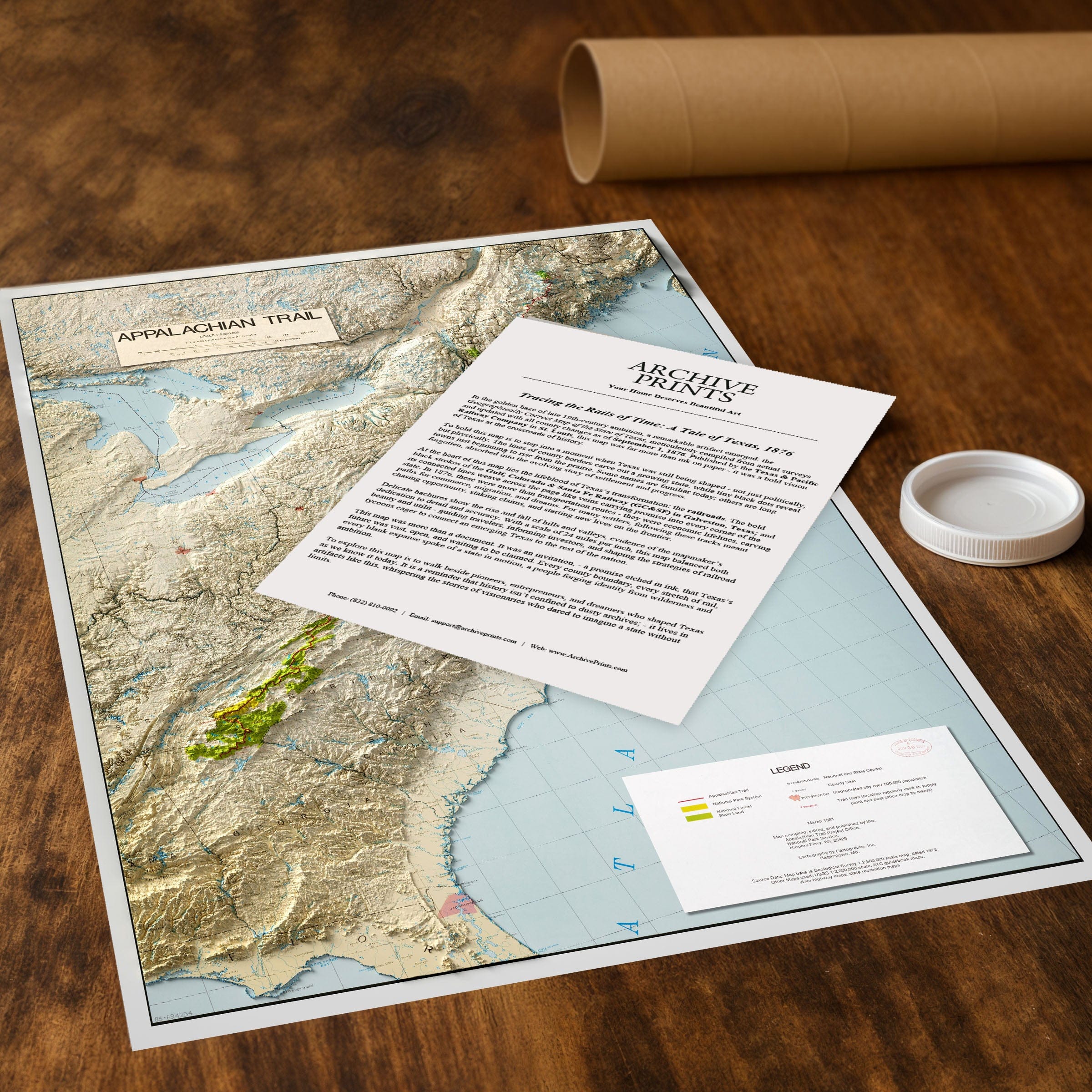
- Paper Posters → Shipped in durable, protective tubes to prevent creasing.
- Canvas Prints → Carefully wrapped, padded, and boxed to ensure safe delivery.
Our maps look stunning in a variety of settings, including:
- Living rooms and home offices
- Libraries and studies
- Corporate offices and conference rooms
- Restaurants, cafes, and boutique spaces