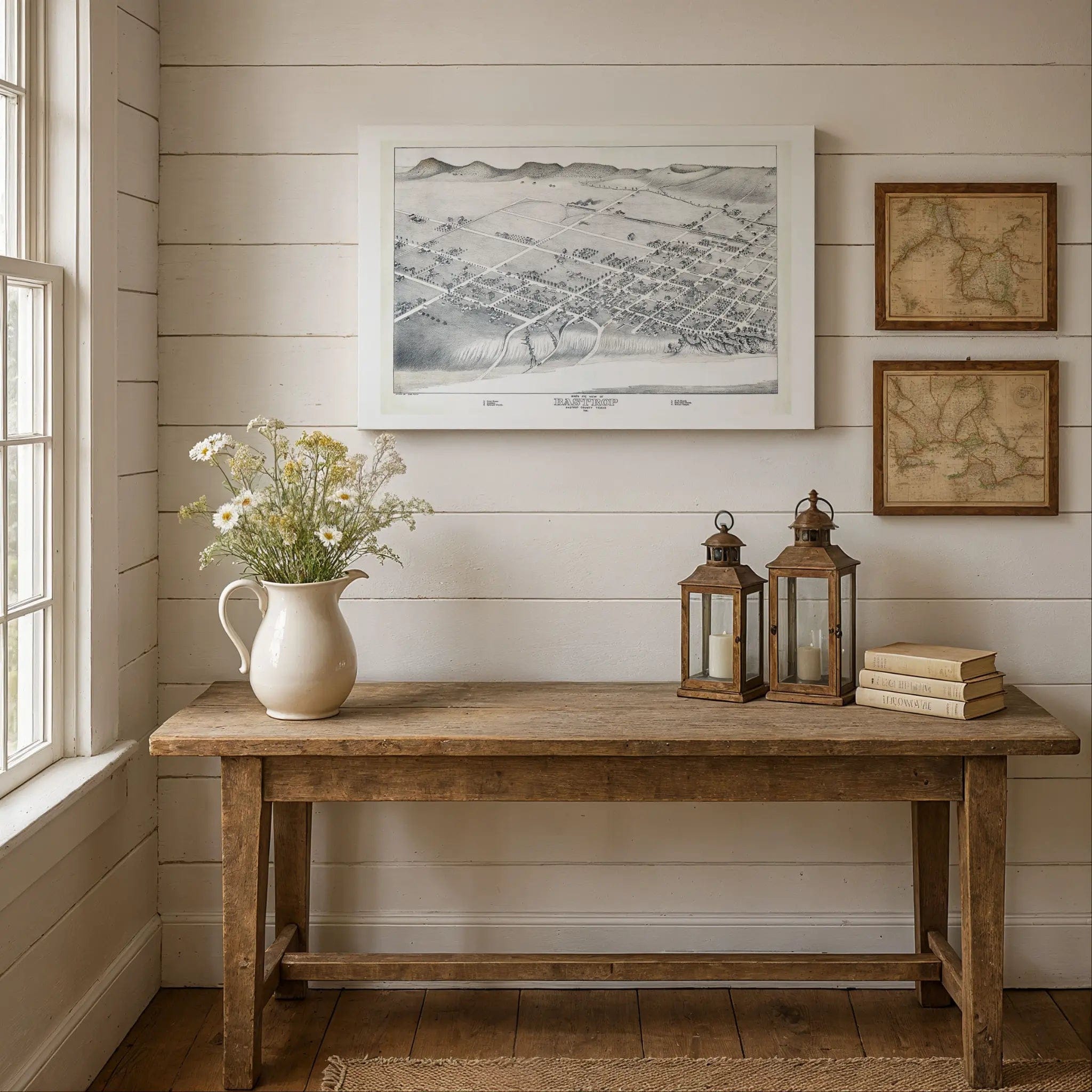
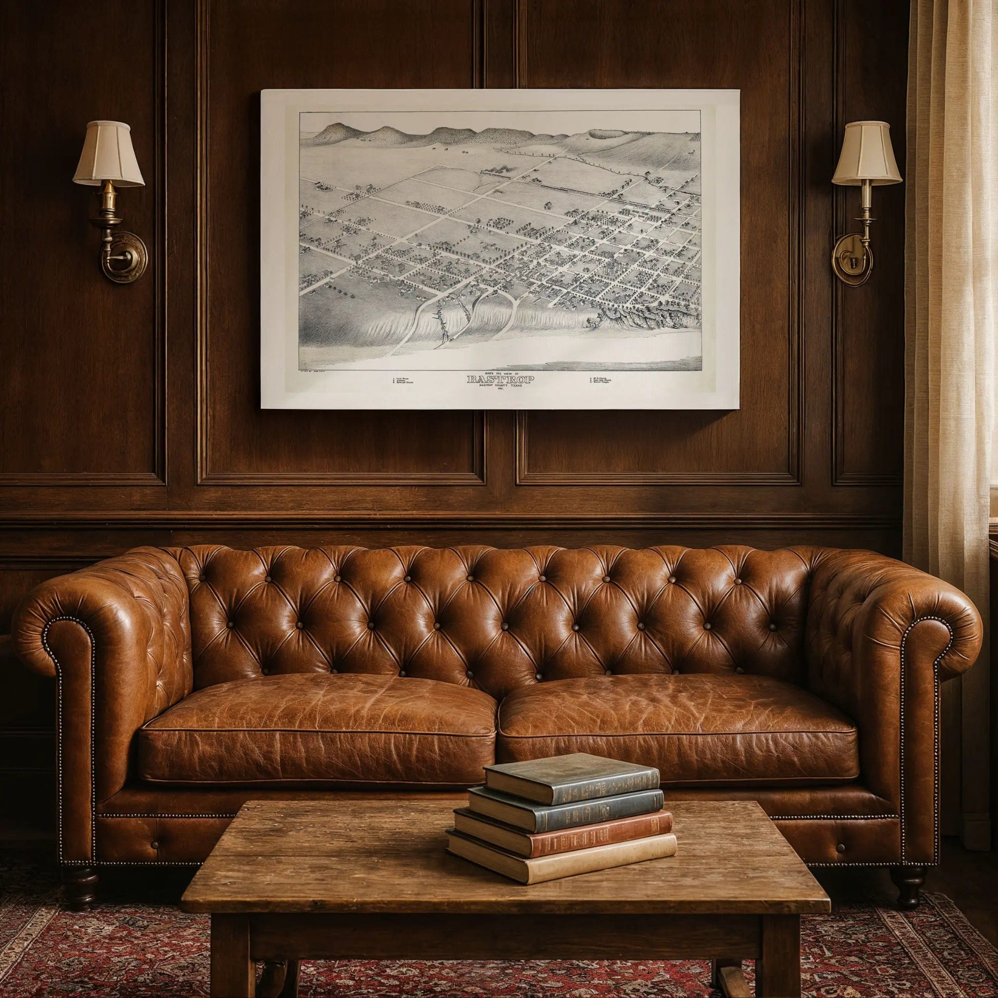

Bastrop Texas Historical Map - Vintage 1887 Koch Central Texas Bird's-Eye View
Discover the Heart of Central Texas
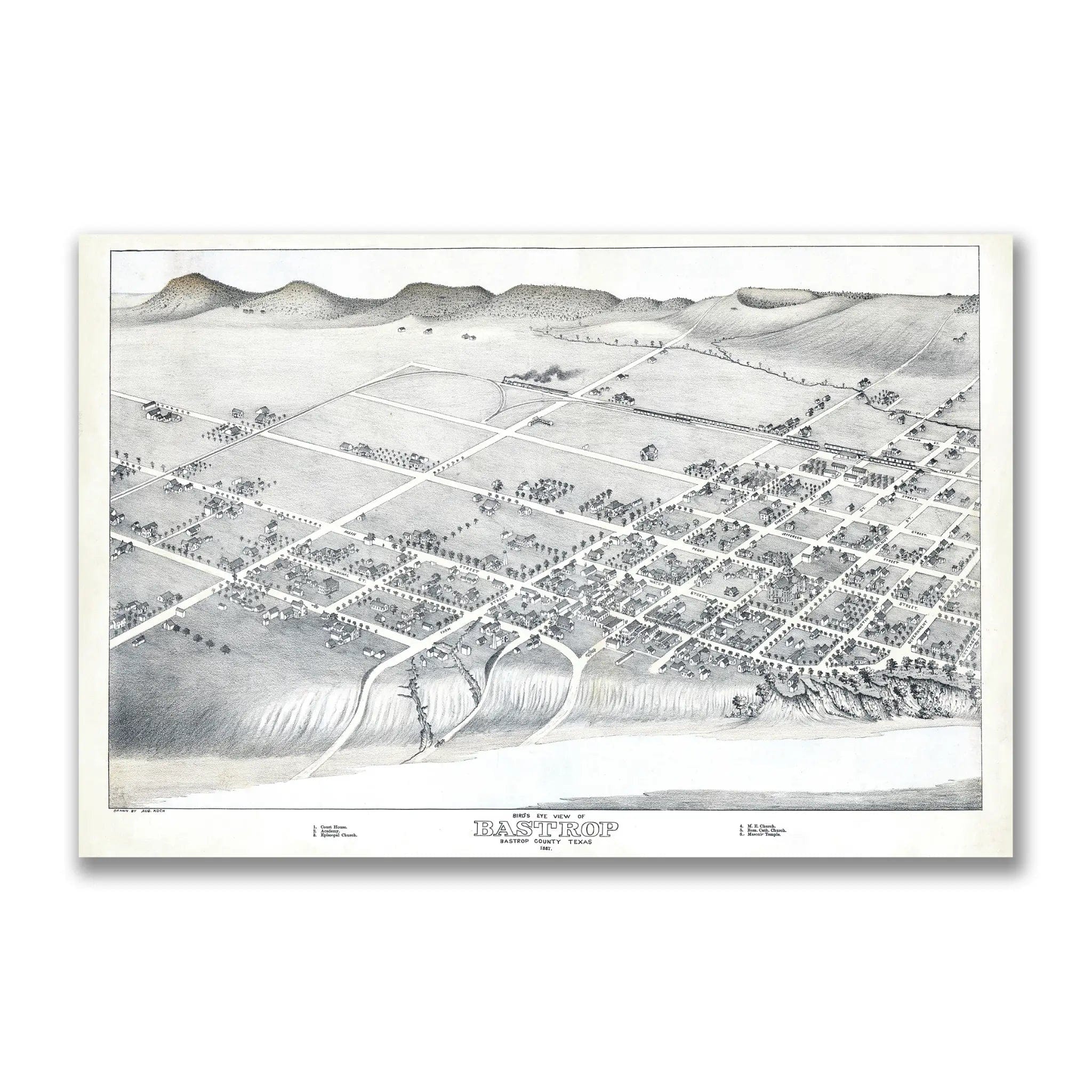
Step back into the frontier era of Texas with this extraordinary 1887 Bastrop Bird's-Eye View created by Augustus Koch, one of the most celebrated cartographers of the American West. This masterfully detailed map captures Bastrop at the height of its 19th-century prosperity, when the Colorado River town served as a vital crossroads for commerce, culture, and community in Central Texas. Every building, street, and natural feature tells the story of a region evolving from frontier settlement into a thriving county seat that balanced governmental importance with small-town charm.
Historical Significance
By 1887, Bastrop had become a symbol of Texas resilience and growth. Founded in 1832 as one of the earliest Anglo settlements in Texas, the town had weathered the challenges of frontier life to emerge as a prosperous community along the Colorado River. This bird's-eye view documents Bastrop during that crucial era—when the once-remote outpost had grown into a sophisticated county seat with tree-lined streets, substantial buildings, and a thriving commercial district. It reveals the foundation of a community that successfully bridged its frontier heritage with modern aspirations. Every structure and street bears witness to the determination that defined post-Civil War Texas and the vision that propelled Bastrop toward its future as a cherished Central Texas destination.
Cartographic Excellence
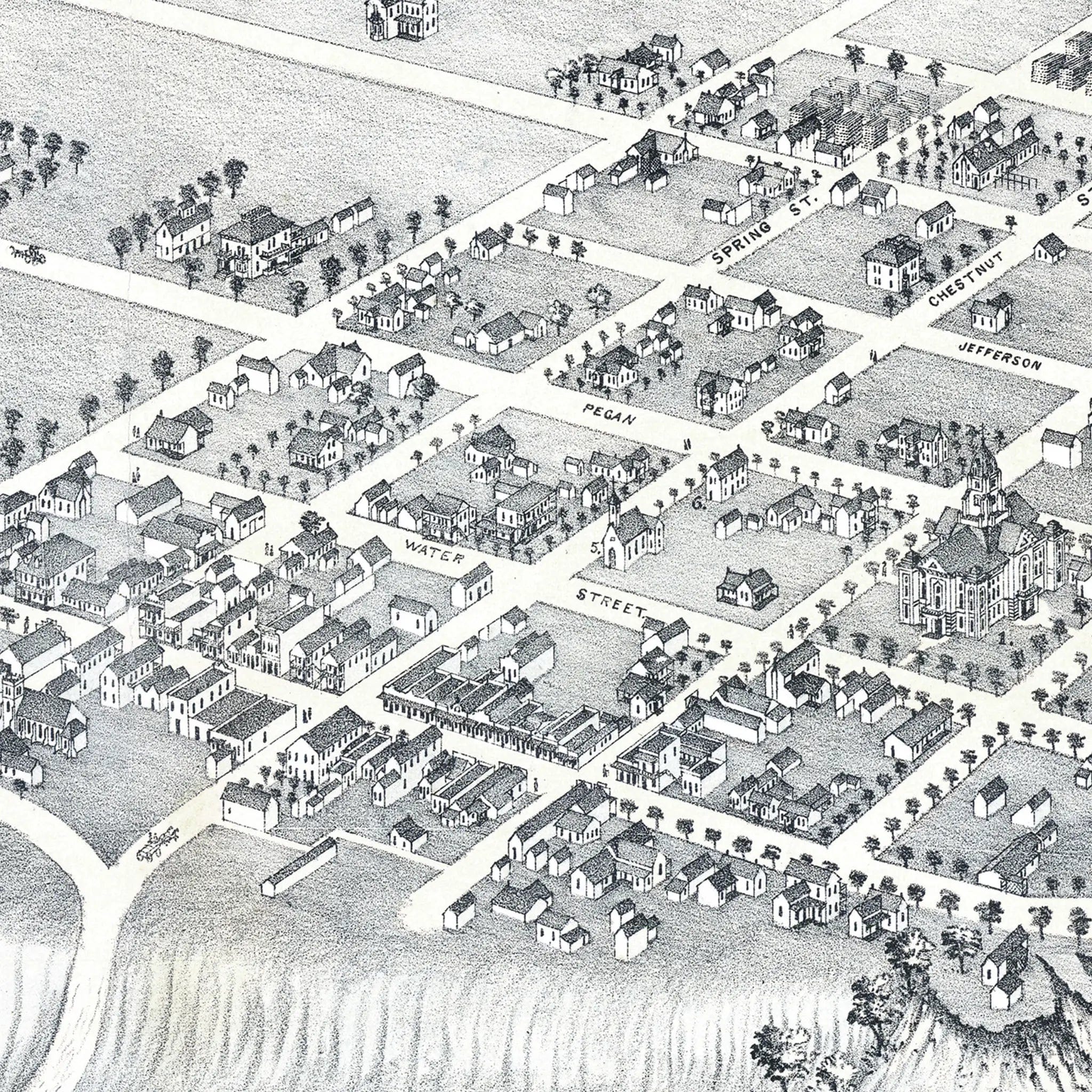
Augustus Koch was renowned for his artistic precision, and this map showcases his unmatched mastery of the bird's-eye view format. Produced with exacting attention to architectural detail, it illustrates every building, street, and natural feature with remarkable clarity. The accuracy of Koch's perspective was legendary—so reliable that his maps were treasured by residents and used by civic leaders for decades. This edition highlights the intricate relationship between Bastrop's orderly street grid and the meandering Colorado River, offering a complete visual record of a town perfectly positioned between rolling hills and fertile bottomland.
The Spirit of Progress
Beyond its technical beauty, this map embodies the optimism and community spirit of a town confident in its future. Bastrop in 1887 was a symbol of Central Texas character—a place where river met prairie, tradition met progress, and settlers transformed frontier challenges into lasting prosperity. Each building illustration, street name, and natural feature captures the forward-looking vision that shaped one of Texas's most beloved historic communities. It's not just a map - it's a portrait of the people who built Bastrop, rendered with artistic skill and historical precision.
A Legacy Preserved
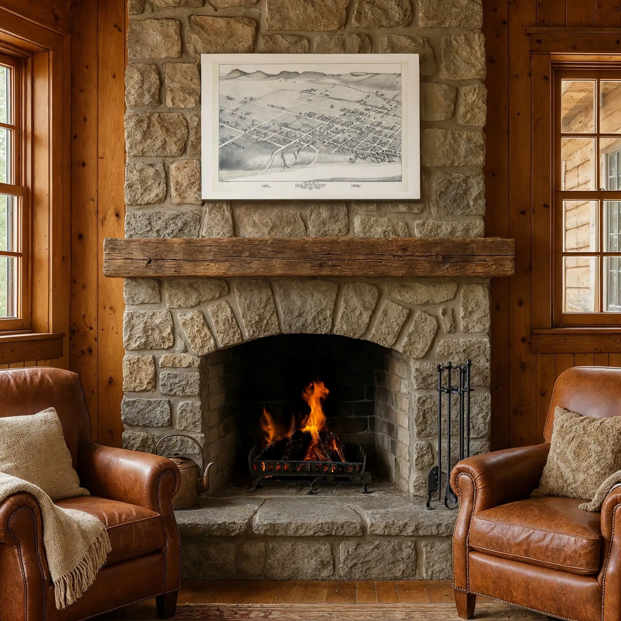
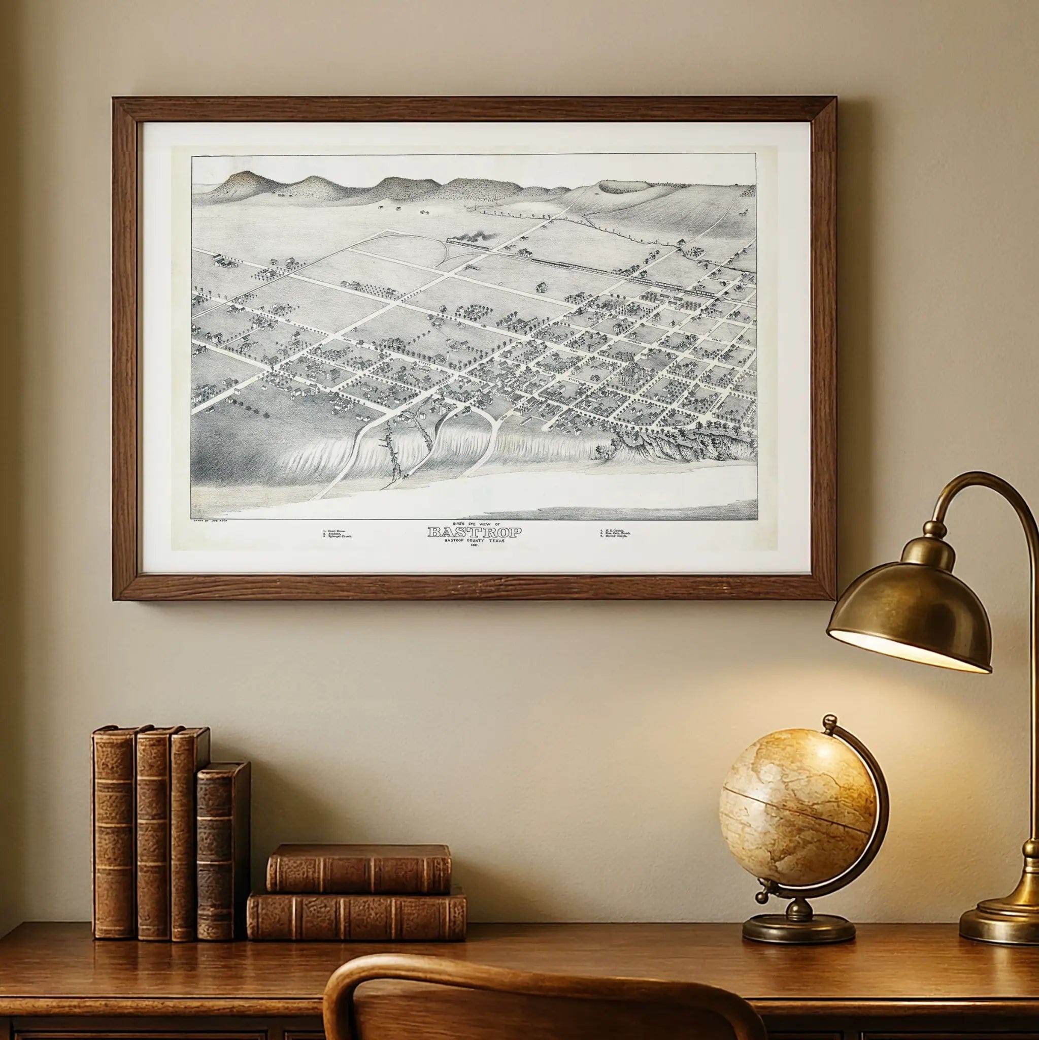
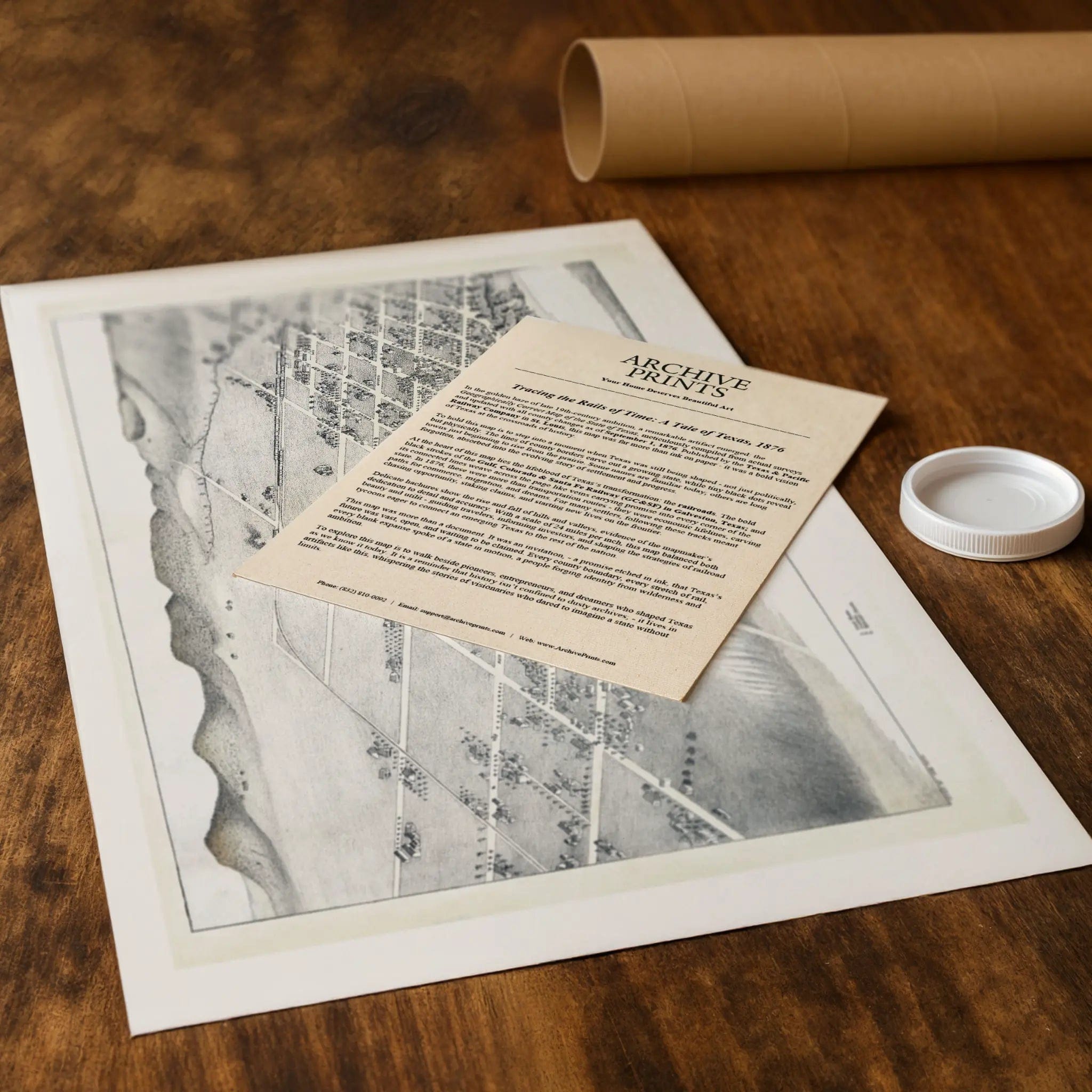
Expertly restored from the original archive, this reproduction preserves every detail with museum-quality precision. Printed on heavyweight archival paper or hand-stretched premium canvas, each piece delivers exceptional clarity and depth. Every reproduction includes a custom historical letter detailing Bastrop's role during the late 19th century, offering deeper insight into how the map reflects one of Central Texas's most charming and enduring communities.
Paper prints ship rolled in reinforced mailing tubes, while canvas editions arrive gallery-wrapped on solid pine stretcher bars, ready to hang and enjoy immediately.
Bring home a piece of Central Texas history with this captivating bird's-eye view of Bastrop - a timeless tribute to the pioneers, builders, and visionaries who turned frontier dreams into the historic river town that continues to charm visitors today.
The Map Story
In 1887, Bastrop, Texas was a small town standing at a crossroads—not quite a village anymore, but not yet a city either. Stretching along the banks of the Colorado River, it had grown from frontier settlement into a modest hub of local trade and county politics. The Bird’s-Eye View of Bastrop, 1887 map captures Bastrop in that delicate moment of transition, poised between nature, settlement, and aspiration.
From its vantage point high above, the viewer sees a town laid in ordered blocks, each street running straight and unbroken, every lot drawn with precision. Buildings cluster near the core—courthouse, churches, businesses—but most of the parcels farther out remain vacant or lightly built. That contrast between built and blank land is part of the story: a town with firm roots but still full of untapped possibility.
The Colorado River is drawn prominently, its curve a defining near-boundary to the town’s footprint. The river is more than a waterway; in 1887 it was lifeblood—a route for trade, a source of water for farms and mills, and a sometimes-fickle boundary between growth and flood. Across the river, hills and open land gently rise, promising space for expansion but also warning of the challenges terrain could impose.
The built structures themselves tell stories. Churches stand tall, signifying community, permanence, and moral foundations. The courthouse or municipal buildings signal authority and governance. The mapmaker gives these public edifices extra weight and clarity to show that Bastrop, though small, cared about civic order. Commercial blocks, shops, and residences cluster nearby, forming the spine of daily life.
Surrounding that heart, the map shows fences, fields, orchards, and farmsteads. These are the margins of civilization, where daily toil meets frontier. Many of these lands are likely used for crops or grazing. The map suggests the firm presence of agriculture underpinning the town’s economy—even as speculation and settlement press outward in all directions.
Today, this 1887 view of Bastrop survives as both record and prophecy. It shows a town that understood its identity even before its limits were defined. In its straight lines, shaded rooftops, and the winding river, one senses both the firm foundation already laid and the invisible lines of possibility still waiting to be crossed.
Materials
Choose options

Because every place has a story
Make History Personal
A vintage map is more than art.
It is a reminder of where life began.
Where memories were made.
Where hearts still live. Give the gift of place.
Beautifully preserved and made for the moments that matter.
Why Choose Us?
| Feature | Us | Competitor A | Competitor B |
|---|---|---|---|
| Hand Crafted | |||
| Museum Quality | |||
| 100 Year Guarantee | |||
| Restored by Hand | |||
| Certificate of Authenticity |

Art Prints
Archival quality colors. Best option if you'd like to frame it yourself

The Best Materials
We hand-stretched our canvas on solid American-grown pine stretcher bars. We use quality canvas and fade-resistant inks to create the lasting art. Canvases come with hardware already installed and ready to hang.
Need help?
Frequently Asked Questions
Order
All of our maps are meticulously restored reproductions of historic originals. Each piece is digitally repaired and color-corrected to bring out the finest details while preserving its authentic, vintage character.
Yes. All Archive Prints products are printed to order in the USA with archival materials.
We offer two premium formats:
- High-Quality Paper Posters – Printed on thick, archival-grade matte paper for rich, vibrant detail.
- Hand-Stretched Canvas Prints – Printed on premium polycotton canvas and mounted on 1.5" solid American pine stretcher bars for a gallery-quality finish.
We carefully digitally restore each map to enhance clarity and color while preserving its original look and historic charm. You’ll enjoy sharp details and a timeless vintage aesthetic that feels true to the original piece.
Yes, we do! We offer premium framing options to make your map ready to hang the moment it arrives. You can choose from Oak, Maple, Black, or Walnut frames directly on the product page. We also offer Stretched Canvas prints for a modern gallery look, as well as archival-quality Posters if you prefer to frame it yourself.
Yes! We offer free shipping on all products within the United States. Each map is carefully packaged to ensure it arrives in perfect condition.
If you’re not completely satisfied, you can return your order in new condition for a full refund. Return shipping costs are the responsibility of the customer.
Absolutely! Our maps make thoughtful, one-of-a-kind gifts for history lovers, map collectors, or anyone looking to add vintage character to their home or office. Choose between paper prints for framing or stretched canvas for a ready-to-hang presentation.
- Paper Posters → Shipped in durable, protective tubes to prevent creasing.
- Canvas Prints → Carefully wrapped, padded, and boxed to ensure safe delivery.
Our maps look stunning in a variety of settings, including:
- Living rooms and home offices
- Libraries and studies
- Corporate offices and conference rooms
- Restaurants, cafes, and boutique spaces