Brooklyn Bridge, New York Map 1883 - Opening Celebration
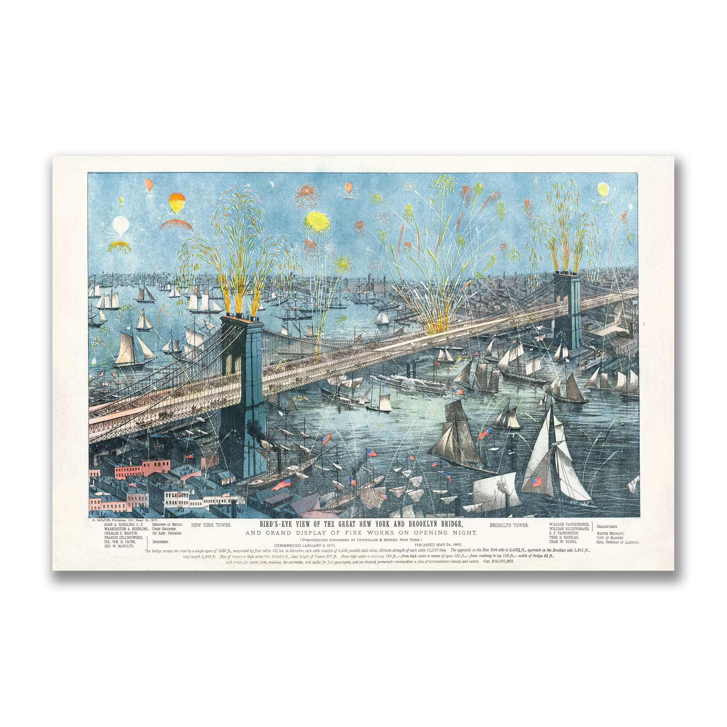
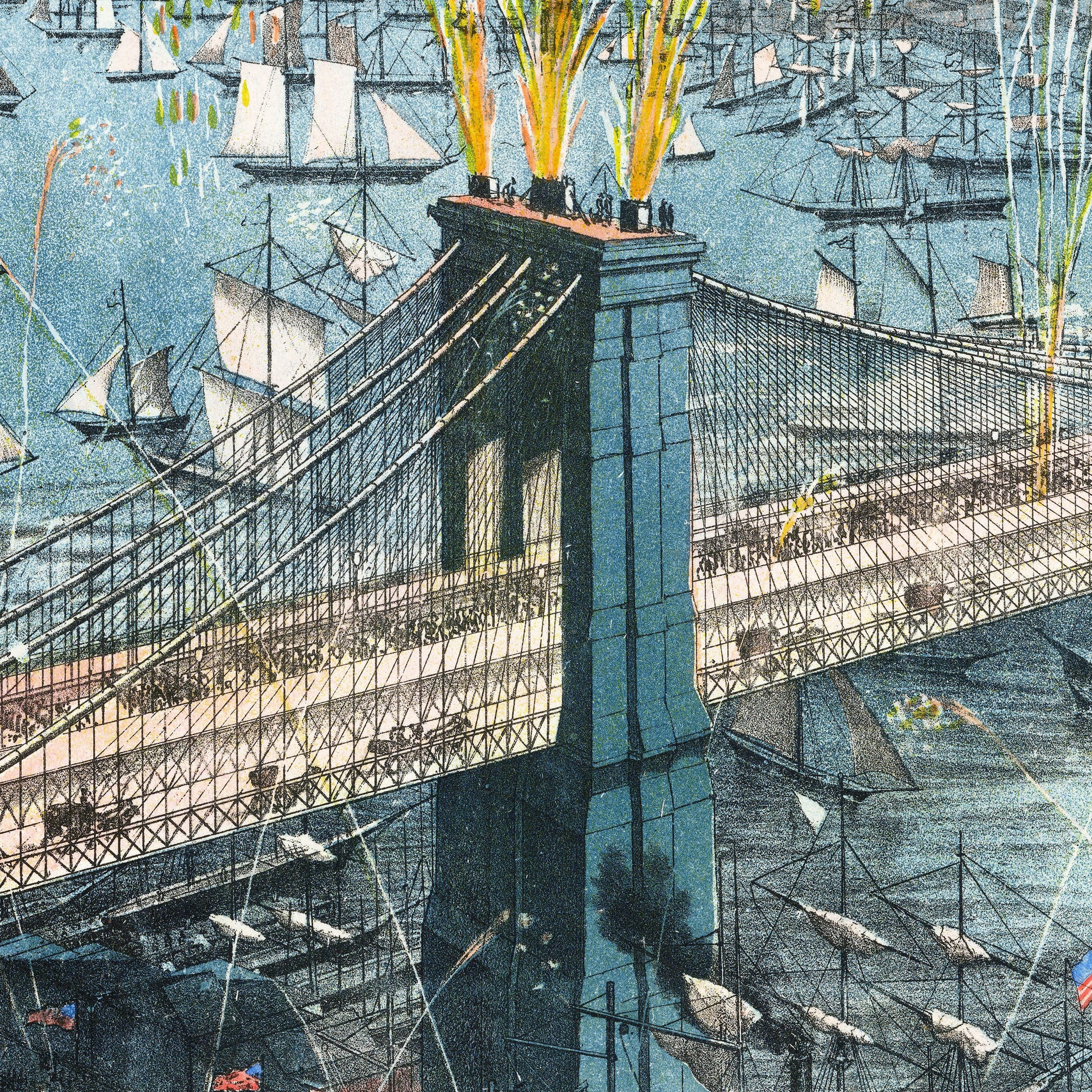
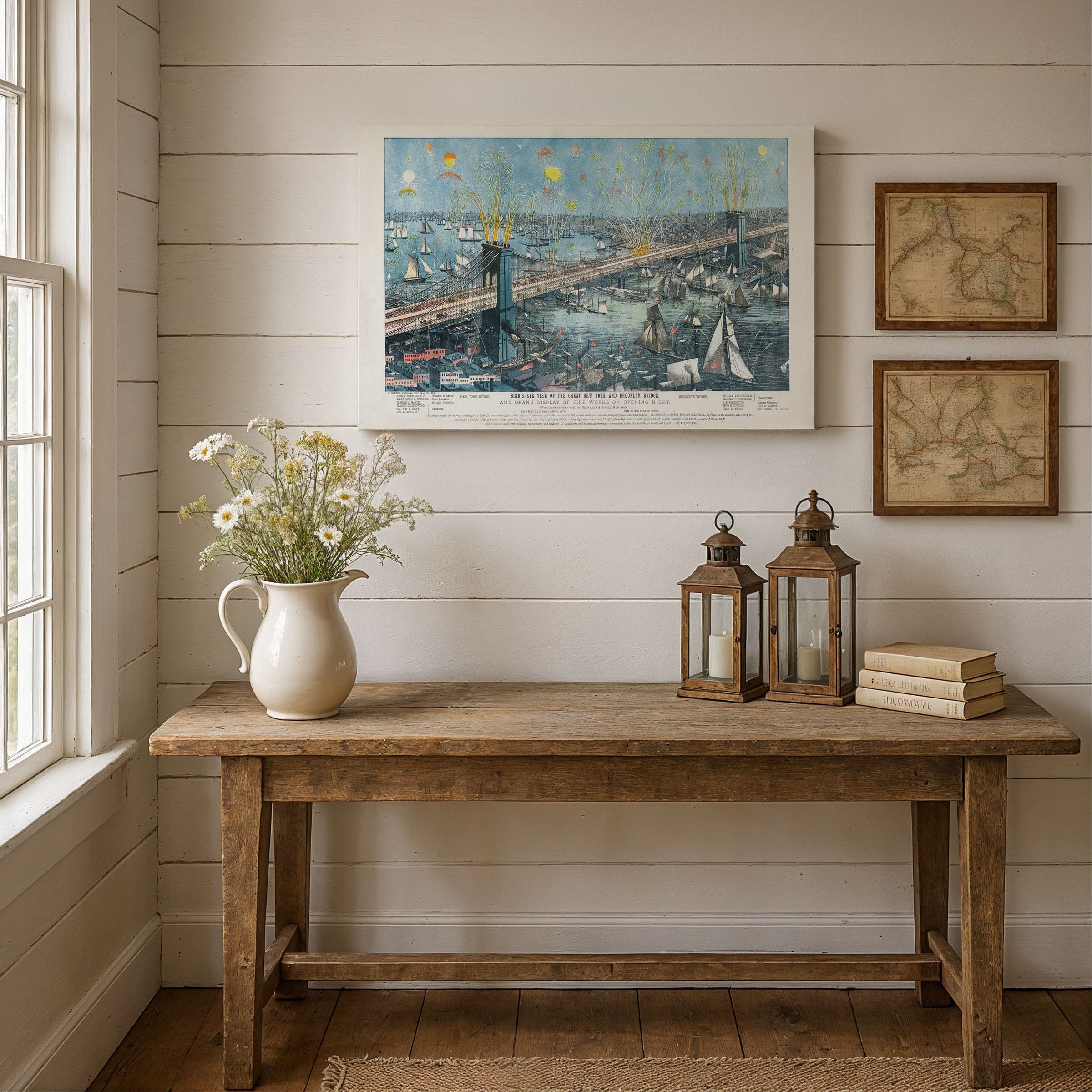
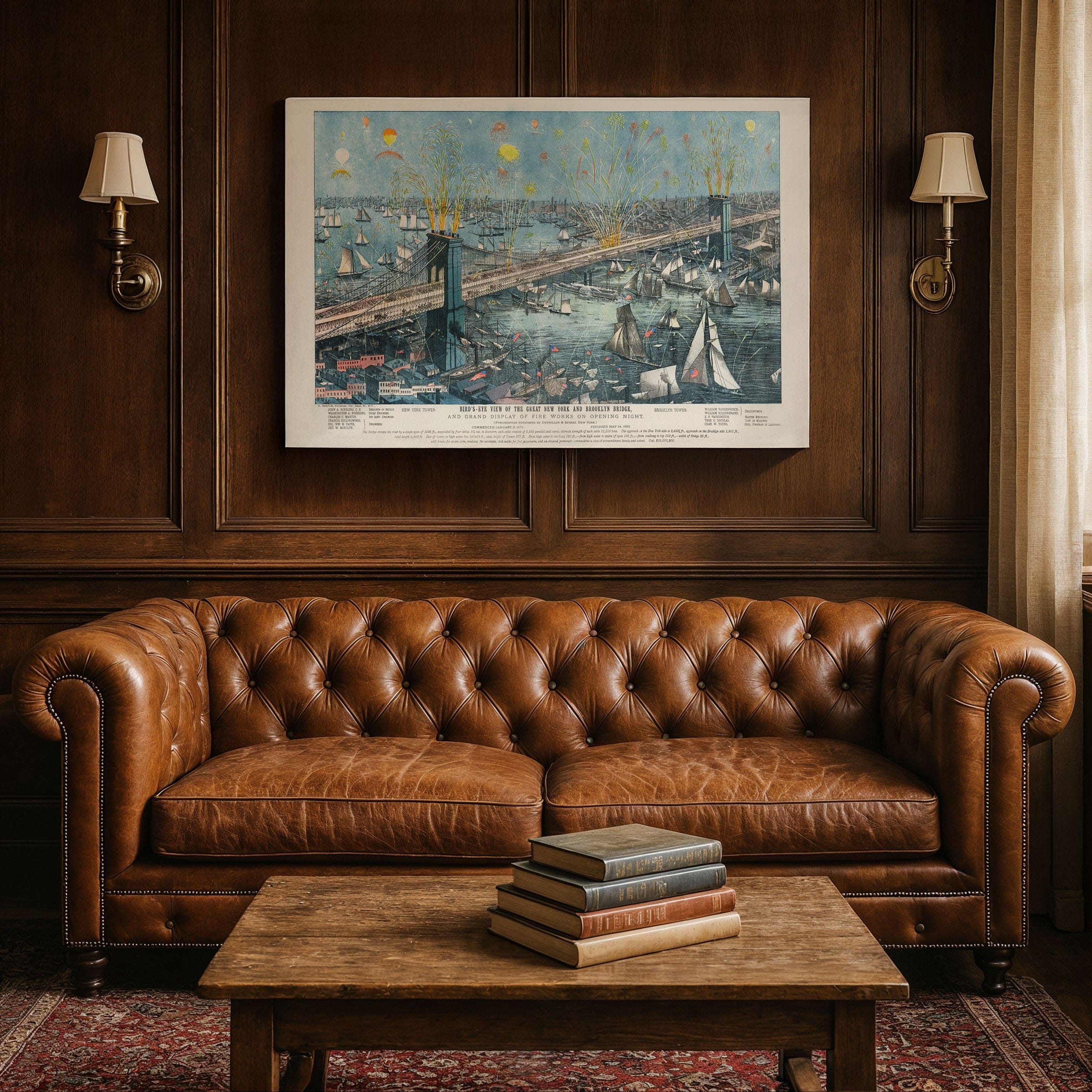
Experience the historic Brooklyn Bridge, New York Map from 1883 that captures one of the greatest engineering triumphs of the 19th century during the spectacular opening celebration. This vintage map style bird's-eye view by A. Major & Co. immortalizes the historic night when tens of thousands crowded the waterfronts and the East River exploded with light, motion, and color after fourteen years of construction marked by innovation, hardship, and national attention. The Brooklyn Bridge, New York Map showcases the bridge standing as a monument to American ingenuity and urban ambition in this old map aesthetic that looks west toward Manhattan, where a forest of ships crowds the harbor with masts and sails illuminated by cascading fireworks from the massive granite towers. Brilliant plumes of yellow, green, and red burst from the bridge's crowning points, filling the sky in celebration of the long-awaited completion of the world's longest suspension bridge, while boats of every kind—steamers, ferries, tugboats, and sailboats—throng the river with wakes shimmering beneath the incandescent glow. At the center of this vintage map, the bridge itself dominates the composition with graceful cables and sweeping roadway forming a luminous pathway between the two great cities. On the Manhattan and Brooklyn shores, crowds press forward in narrow streets and wide piers, eager to witness a moment that symbolized the unification of communities separated by the East River, while the towers rising over 270 feet above the water stand as architectural sentinels—part fortress, part cathedral, and wholly unprecedented. The old map highlights the engineering team whose vision shaped the structure, honoring John A. Roebling, the original designer, alongside his son Washington Roebling, who oversaw construction after his father's death and battled illness to see the project through. Their work, supported by engineers and laborers, produced a bridge that defied skeptics who once doubted such a span could stand. Surrounding neighborhoods of lower Manhattan and Brooklyn appear in careful detail—warehouses, docks, rail yards, factories, and tenements that reveal the dense, industrious character of the Gilded Age metropolis. The bridge was more than a crossing; it was a symbol of rising urban power, destined to reshape commerce, travel, and daily life for millions. Each reproduction includes a custom historical letter detailing the story behind the map, making it perfect for New York City collectors, Brooklyn Bridge enthusiasts, and engineering history lovers. Printed on heavyweight archival paper or hand-stretched polycotton canvas, every firework, ship, and architectural detail is rendered in museum-grade clarity for generations of enjoyment. Paper prints ship rolled in heavy-duty tubes, while canvas editions arrive gallery-wrapped on solid pine stretcher bars with pre-installed hardware—ready to display the moment it arrives. Bring home the spirit of 1883 New York and celebrate the moment the Brooklyn Bridge opened as a national triumph—a fusion of art, science, and civic pride.
The Map Story
Materials
Choose options

Because every place has a story
Make History Personal
A vintage map is more than art.
It is a reminder of where life began.
Where memories were made.
Where hearts still live. Give the gift of place.
Beautifully preserved and made for the moments that matter.
Why Choose Us?
| Feature | Us | Competitor A | Competitor B |
|---|---|---|---|
| Hand Crafted | |||
| Museum Quality | |||
| 100 Year Guarantee | |||
| Restored by Hand | |||
| Certificate of Authenticity |

Art Prints
Archival quality colors. Best option if you'd like to frame it yourself

The Best Materials
We hand-stretched our canvas on solid American-grown pine stretcher bars. We use quality canvas and fade-resistant inks to create the lasting art. Canvases come with hardware already installed and ready to hang.
Need help?
Frequently Asked Questions
Order
All of our maps are meticulously restored reproductions of historic originals. Each piece is digitally repaired and color-corrected to bring out the finest details while preserving its authentic, vintage character.
Yes. All Archive Prints products are printed to order in the USA with archival materials.
We offer two premium formats:
- High-Quality Paper Posters – Printed on thick, archival-grade matte paper for rich, vibrant detail.
- Hand-Stretched Canvas Prints – Printed on premium polycotton canvas and mounted on 1.5" solid American pine stretcher bars for a gallery-quality finish.
We carefully digitally restore each map to enhance clarity and color while preserving its original look and historic charm. You’ll enjoy sharp details and a timeless vintage aesthetic that feels true to the original piece.
Yes, we do! We offer premium framing options to make your map ready to hang the moment it arrives. You can choose from Oak, Maple, Black, or Walnut frames directly on the product page. We also offer Stretched Canvas prints for a modern gallery look, as well as archival-quality Posters if you prefer to frame it yourself.
Yes! We offer free shipping on all products within the United States. Each map is carefully packaged to ensure it arrives in perfect condition.
If you’re not completely satisfied, you can return your order in new condition for a full refund. Return shipping costs are the responsibility of the customer.
Absolutely! Our maps make thoughtful, one-of-a-kind gifts for history lovers, map collectors, or anyone looking to add vintage character to their home or office. Choose between paper prints for framing or stretched canvas for a ready-to-hang presentation.
- Paper Posters → Shipped in durable, protective tubes to prevent creasing.
- Canvas Prints → Carefully wrapped, padded, and boxed to ensure safe delivery.
Our maps look stunning in a variety of settings, including:
- Living rooms and home offices
- Libraries and studies
- Corporate offices and conference rooms
- Restaurants, cafes, and boutique spaces