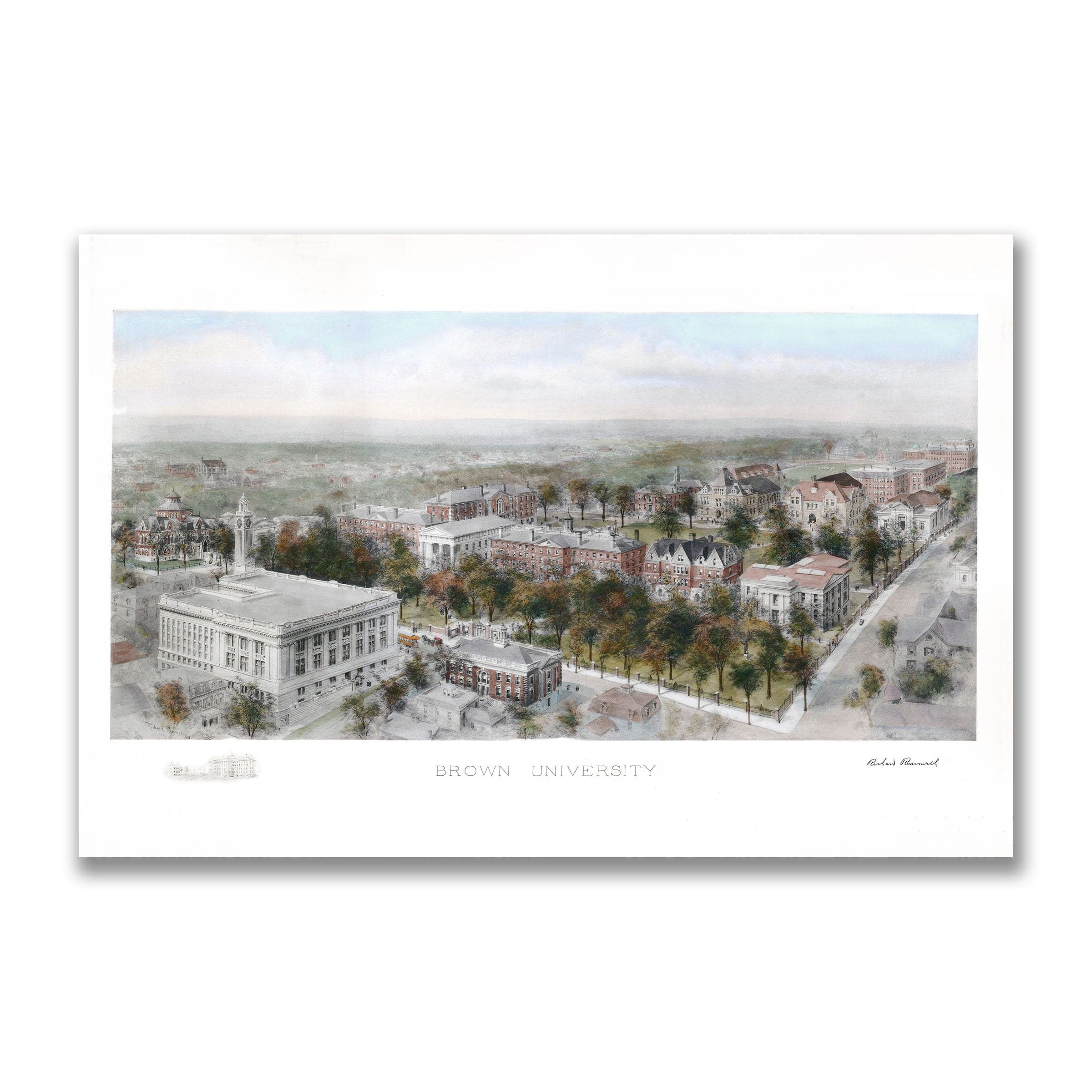
Brown University, Providence, Rhode Island Map 1908
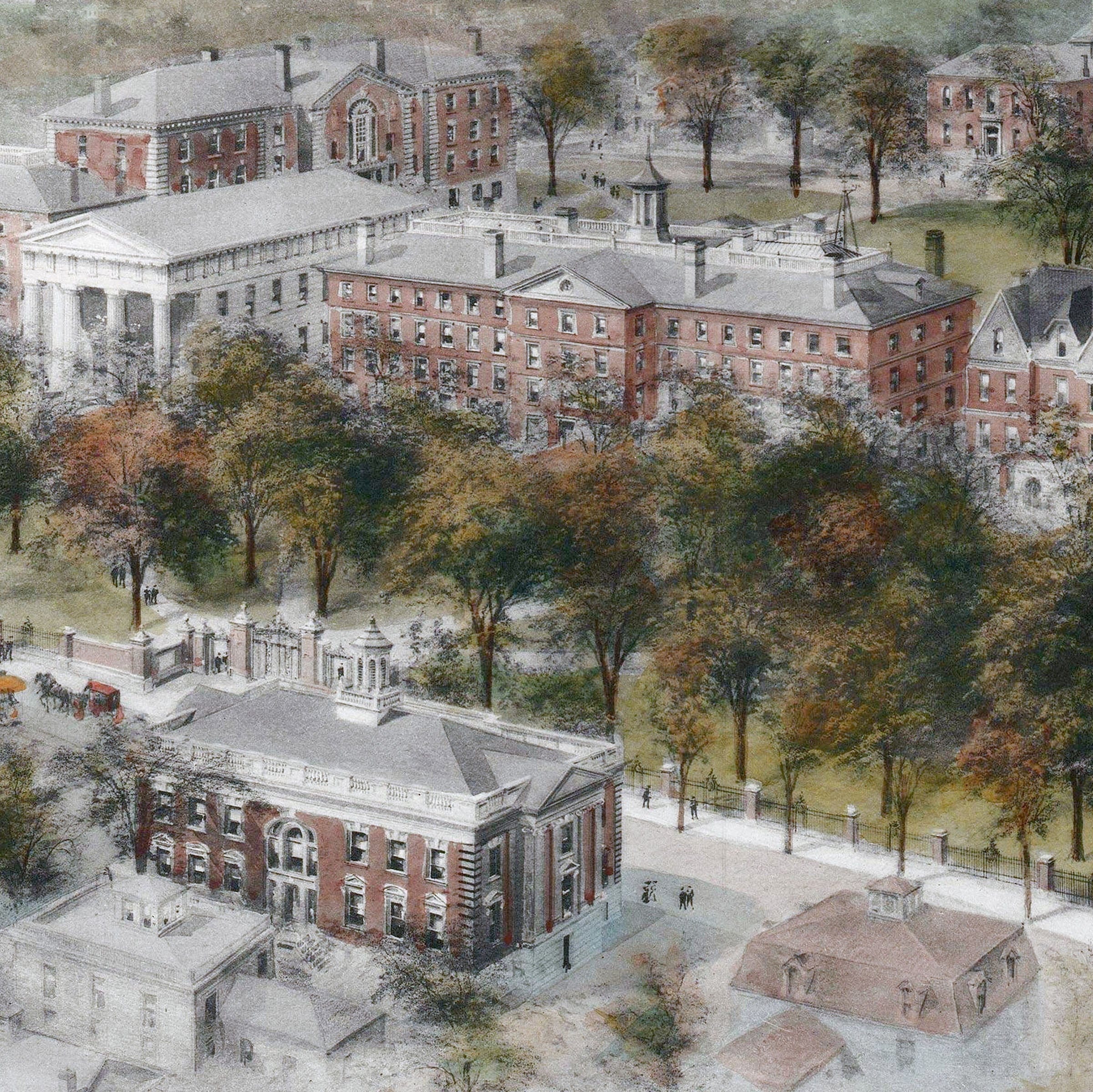
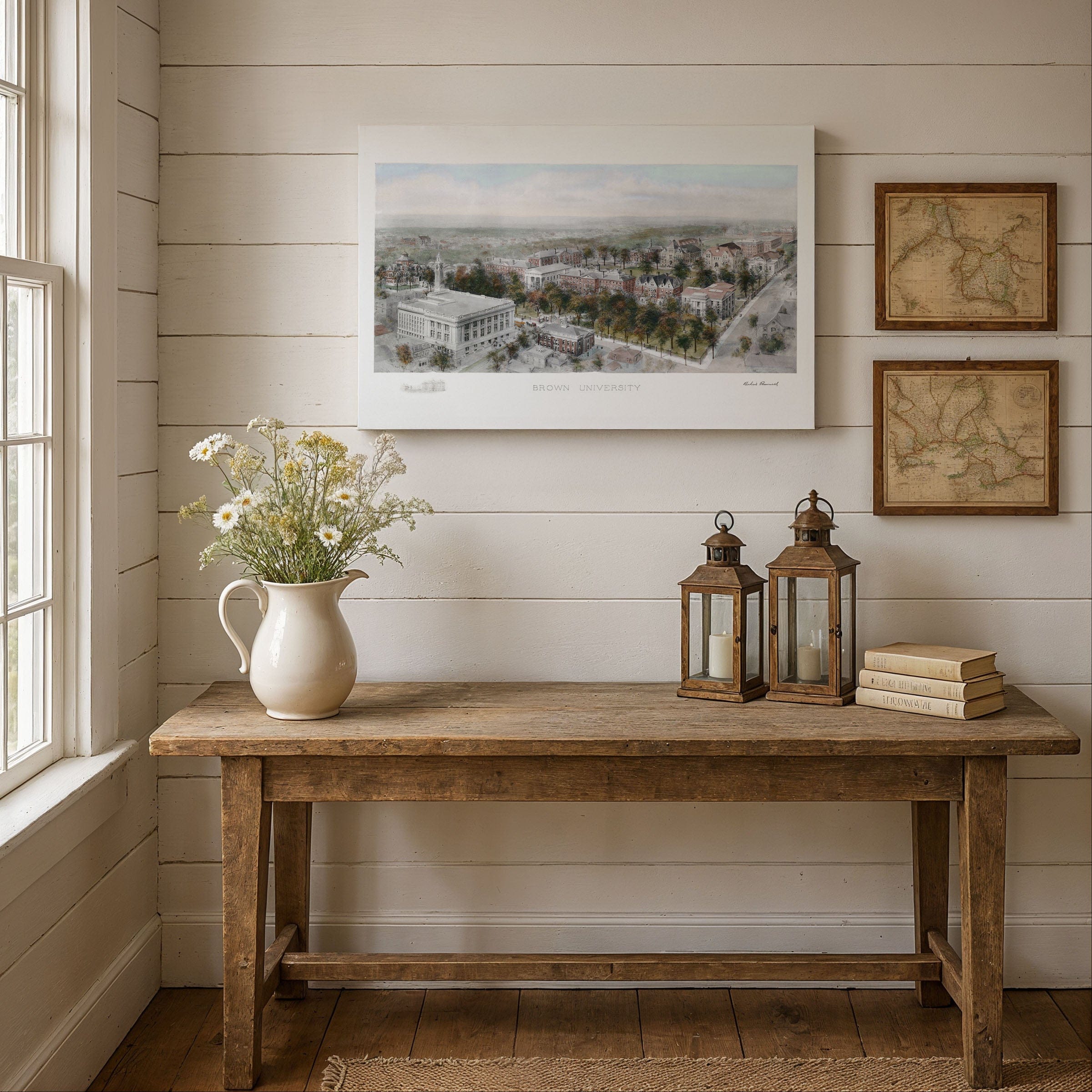
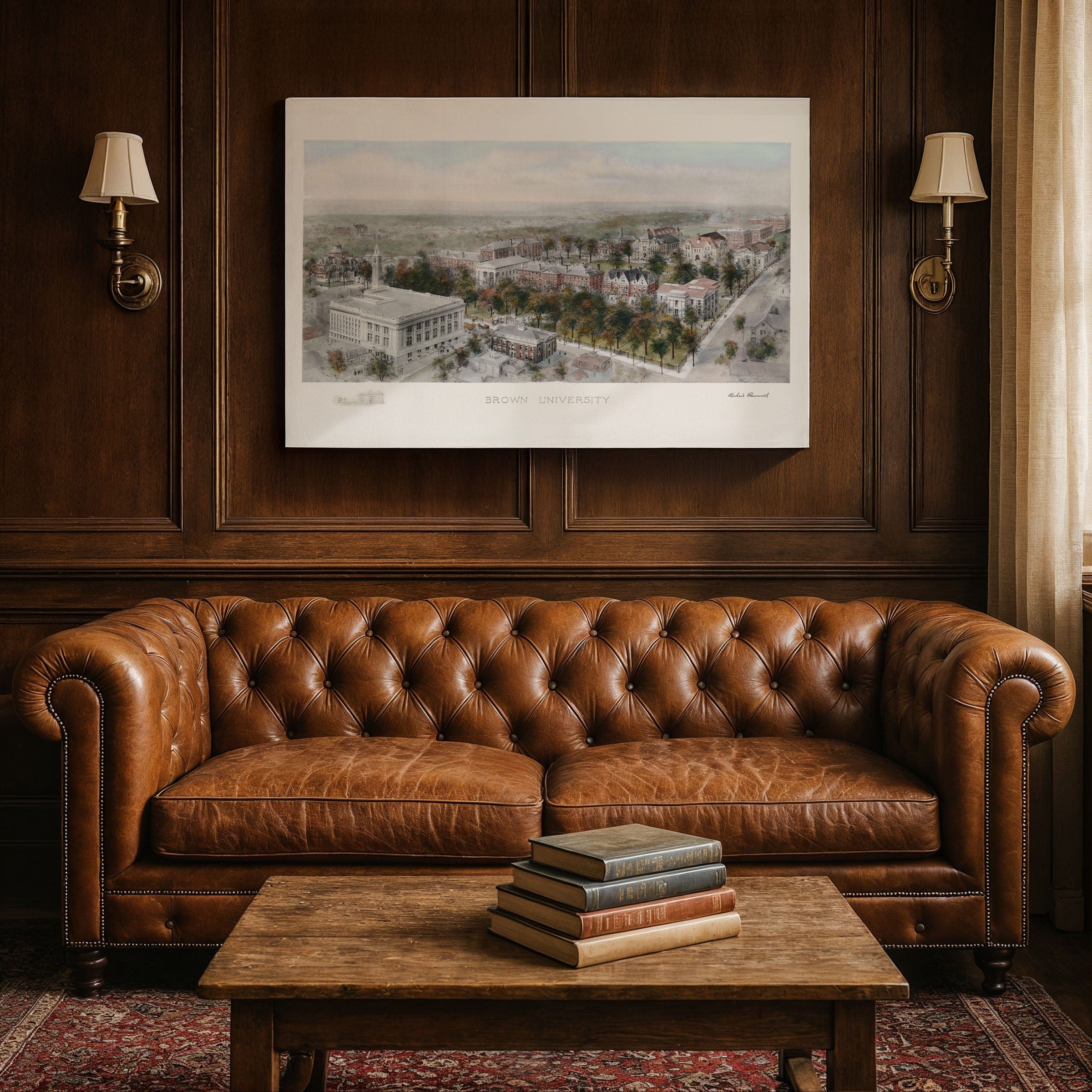
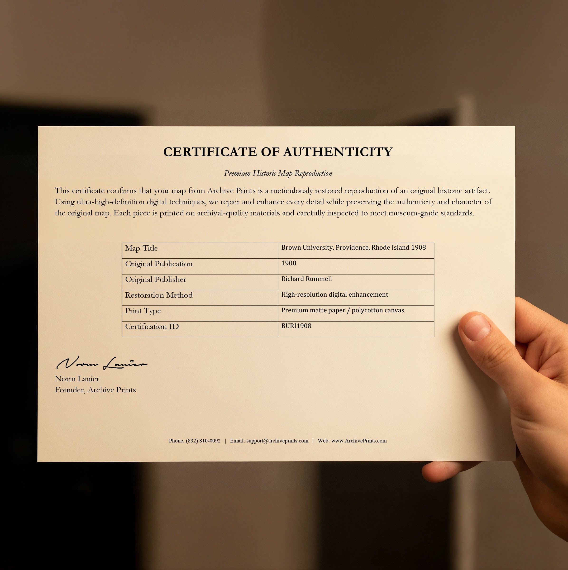
Discover the historic Brown University, Providence, Rhode Island Map from 1908 that captures the prestigious Ivy League campus at the threshold of a new century. This vintage map style panoramic view by renowned artist Richard Rummell reveals Brown University balancing its colonial heritage with the growing ambitions of a modern American research institution during a moment of profound transition when tradition, scholarship, and expansion shaped daily life on College Hill. The Brown University, Providence, Rhode Island Map showcases the harmonious campus arranged around historic greens that had long defined Brown's identity since its founding in 1764. University Hall, Manning Hall, and surrounding brick dormitories form the academic core with orderly facades echoing classical ideals, while mature trees fill the quads with texture and shade, suggesting a place where scholarship unfolded at a thoughtful, measured pace. This old map aesthetic captures the architectural evolution visible across the landscape, where Romanesque turrets, classical porticos, and early modern designs coexist along tree-lined paths. The grand Andrews Hall in the foreground symbolizes the university's academic expansion and rising prominence of specialized instruction, while nearby classrooms, laboratories, and libraries show how Brown had begun to broaden its intellectual mission, welcoming new disciplines and an increasingly diverse student body. The vintage map reveals the Pembroke College campus—Brown's coordinate women's college—appearing in the distance, marking a significant step in expanding educational opportunities during an era of social change. Electric streetcars at the edge hint at the modern world pressing in, connecting the hilltop campus more closely with Providence city. The surrounding neighborhoods, dotted with homes, churches, and civic buildings, demonstrate the close relationship between the university and the city it helped shape. By the early 1900s, Brown's enrollment was growing, its faculty expanding, and its reputation rising nationally as the campus preserved its past while preparing for modern university responsibilities. This old map perspective invites viewers to see Brown University as it once stood—rooted in tradition, enriched by architectural beauty, and energized by the promise of a new century. Each reproduction includes a custom historical letter detailing the story behind the map, making it perfect for Brown University alumni, Rhode Island collectors, and Ivy League enthusiasts. Printed on heavyweight archival paper or hand-stretched polycotton canvas, every building, pathway, and architectural detail is rendered in museum-grade clarity for generations of enjoyment. Paper prints ship rolled in heavy-duty tubes, while canvas editions arrive gallery-wrapped on solid pine stretcher bars with pre-installed hardware—ready to display the moment it arrives. Bring home the spirit of Brown University's golden age and celebrate the enduring legacy of one of America's most distinguished institutions of higher learning.
The Map Story
Materials
Choose options

Because every place has a story
Make History Personal
A vintage map is more than art.
It is a reminder of where life began.
Where memories were made.
Where hearts still live. Give the gift of place.
Beautifully preserved and made for the moments that matter.
Why Choose Us?
| Feature | Us | Competitor A | Competitor B |
|---|---|---|---|
| Hand Crafted | |||
| Museum Quality | |||
| 100 Year Guarantee | |||
| Restored by Hand | |||
| Certificate of Authenticity |

Art Prints
Archival quality colors. Best option if you'd like to frame it yourself

The Best Materials
We hand-stretched our canvas on solid American-grown pine stretcher bars. We use quality canvas and fade-resistant inks to create the lasting art. Canvases come with hardware already installed and ready to hang.
Need help?
Frequently Asked Questions
Order
All of our maps are meticulously restored reproductions of historic originals. Each piece is digitally repaired and color-corrected to bring out the finest details while preserving its authentic, vintage character.
Yes. All Archive Prints products are printed to order in the USA with archival materials.
We offer two premium formats:
- High-Quality Paper Posters – Printed on thick, archival-grade matte paper for rich, vibrant detail.
- Hand-Stretched Canvas Prints – Printed on premium polycotton canvas and mounted on 1.5" solid American pine stretcher bars for a gallery-quality finish.
We carefully digitally restore each map to enhance clarity and color while preserving its original look and historic charm. You’ll enjoy sharp details and a timeless vintage aesthetic that feels true to the original piece.
Yes, we do! We offer premium framing options to make your map ready to hang the moment it arrives. You can choose from Oak, Maple, Black, or Walnut frames directly on the product page. We also offer Stretched Canvas prints for a modern gallery look, as well as archival-quality Posters if you prefer to frame it yourself.
Yes! We offer free shipping on all products within the United States. Each map is carefully packaged to ensure it arrives in perfect condition.
If you’re not completely satisfied, you can return your order in new condition for a full refund. Return shipping costs are the responsibility of the customer.
Absolutely! Our maps make thoughtful, one-of-a-kind gifts for history lovers, map collectors, or anyone looking to add vintage character to their home or office. Choose between paper prints for framing or stretched canvas for a ready-to-hang presentation.
- Paper Posters → Shipped in durable, protective tubes to prevent creasing.
- Canvas Prints → Carefully wrapped, padded, and boxed to ensure safe delivery.
Our maps look stunning in a variety of settings, including:
- Living rooms and home offices
- Libraries and studies
- Corporate offices and conference rooms
- Restaurants, cafes, and boutique spaces