
Carson City, Ormsby County, Nevada Map 1875
Carson City, Ormsby County, Nevada Map 1875
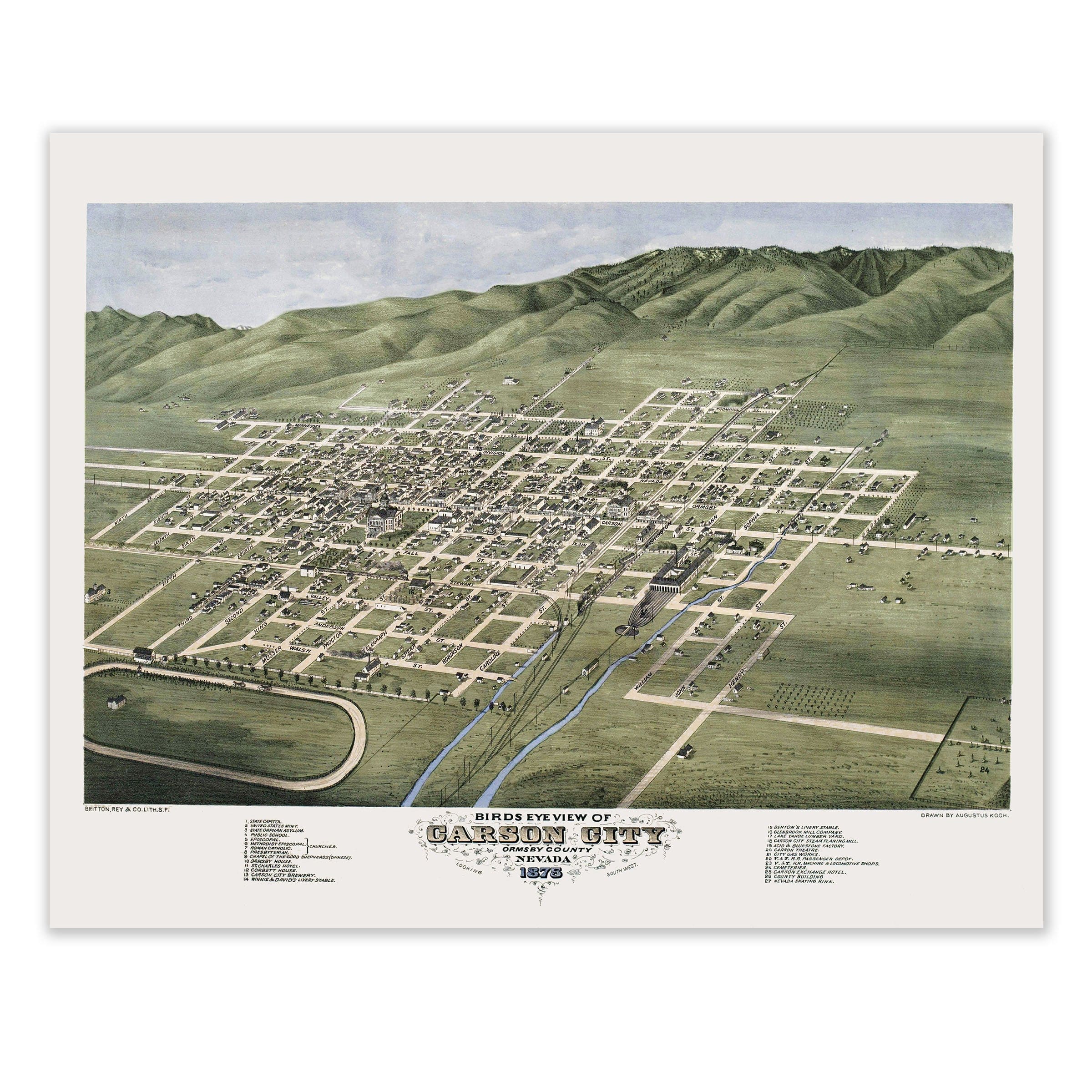
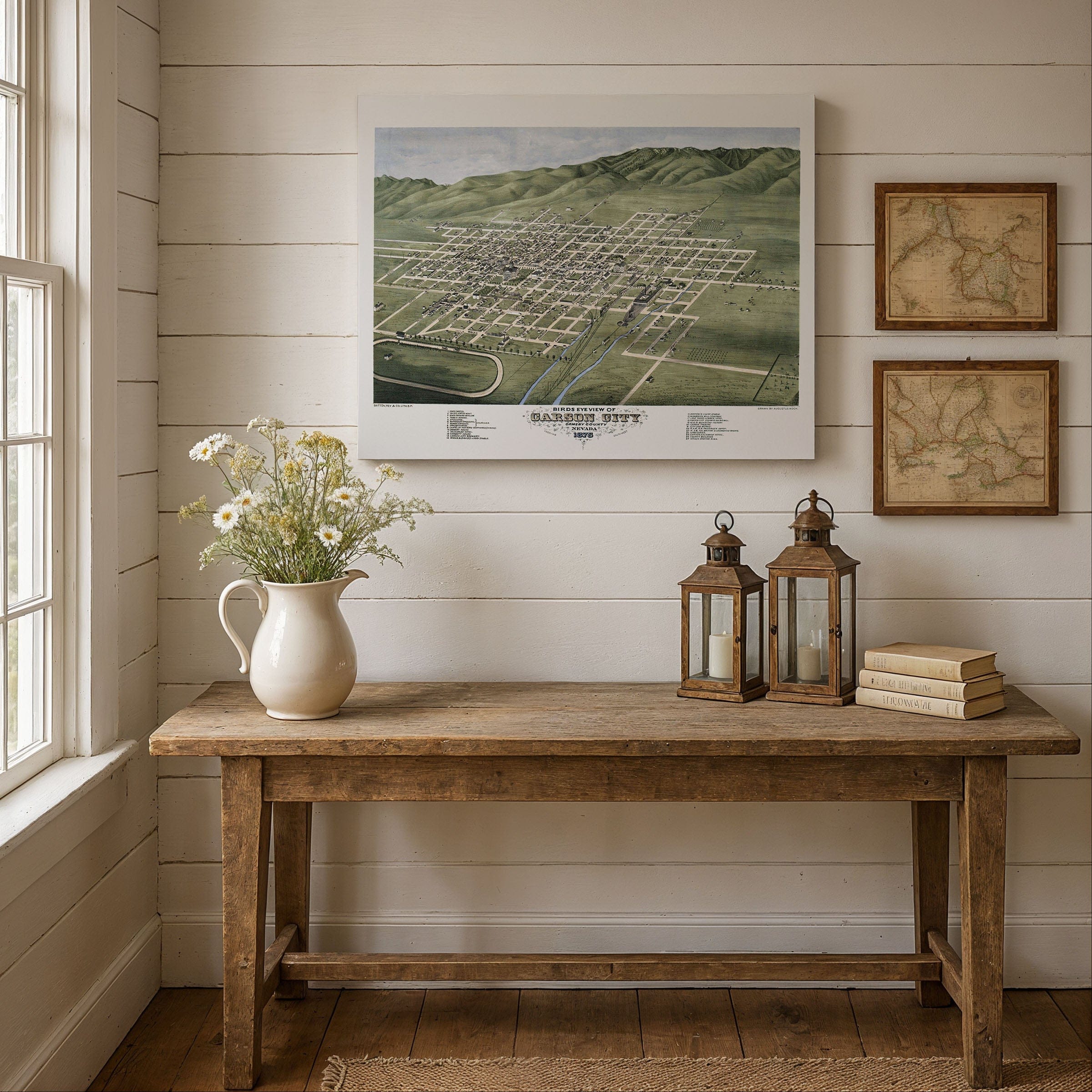
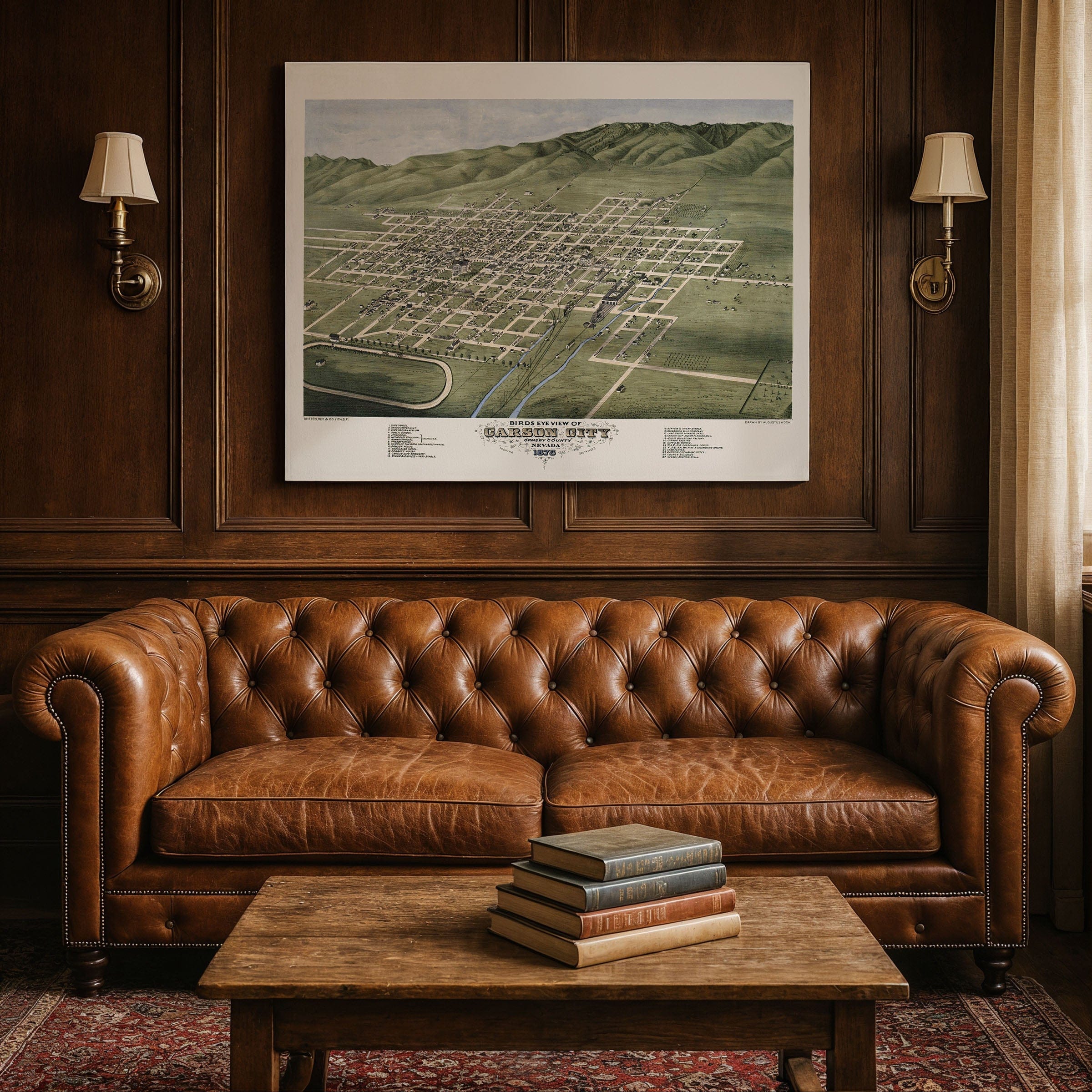
Discover the remarkable Carson City, Ormsby County, Nevada Map by Augustus Koch, capturing Carson City in 1875 as the young yet confident seat of Nevada governance—neatly ordered beneath the rising wall of the Sierra Nevada. This panoramic bird's-eye view preserves the city at a pivotal moment, when silver wealth from the Comstock Lode had forged a new identity for the region. The grid of streets reflects intention rather than accident: a capital city carved into the high desert with purpose, planning, and optimism.
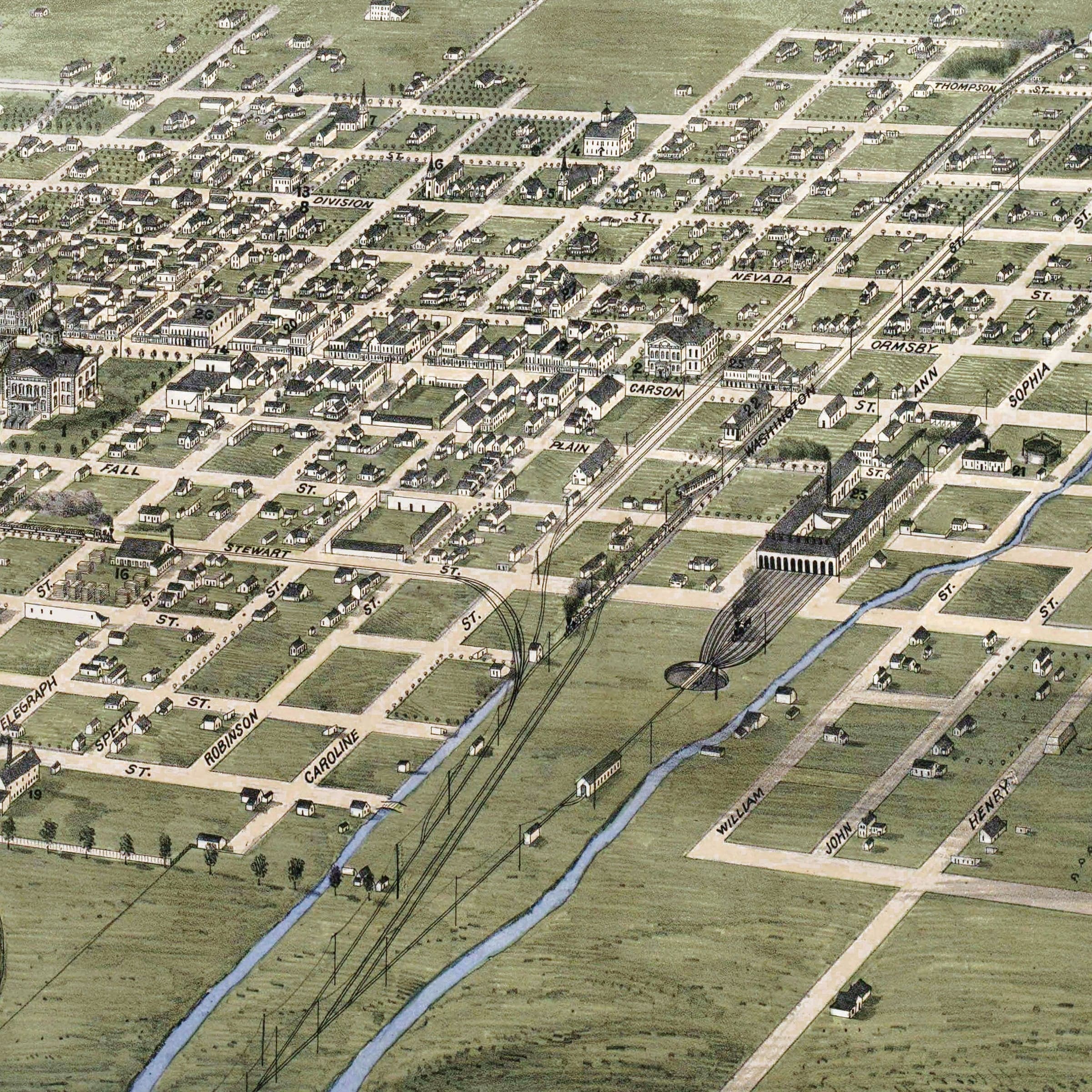
The Carson City, Ormsby County, Nevada Map shows blocks evenly measured, their symmetry broken only by notable landmarks. At the center stands the Nevada State Capitol, its dome rising above simpler wooden structures, signaling authority and statehood. Courthouses, schools, churches, and civic halls appear throughout the map, each one marking the growth of permanence in a place once defined by tents and ore wagons. Though settled, the city's edges remain open and green, a reminder that Nevada was still largely frontier in the 1870s.
To the west in this Carson City, Ormsby County, Nevada Map, the mountains dominate the horizon, providing timber, snowmelt, and the mineral riches that built not only Carson City but all of western Nevada. A spur of track leads toward the mines of Virginia City, where fortunes were won and lost with the swing of a pick. Along the depot, freight cars wait in long lines—supplies arriving, bullion departing, commerce looping restlessly across the state. The Carson River winds through the scene like a thread of life, turning mills, watering farms, and sustaining the capital in the dry basin.
Surrounding neighborhoods in this Carson City, Ormsby County, Nevada Map appear modest but hopeful. Orchards, fenced plots, and grazing land spread outward, suggesting families planting roots in a once-temporary landscape. Hotels, saloons, and boarding houses cluster near downtown, serving lawmakers, miners, and travelers heading deeper into the silver country. Broad avenues anticipate the future—streetcars, expansion, and the arrival of more settlers seeking opportunity in the West.
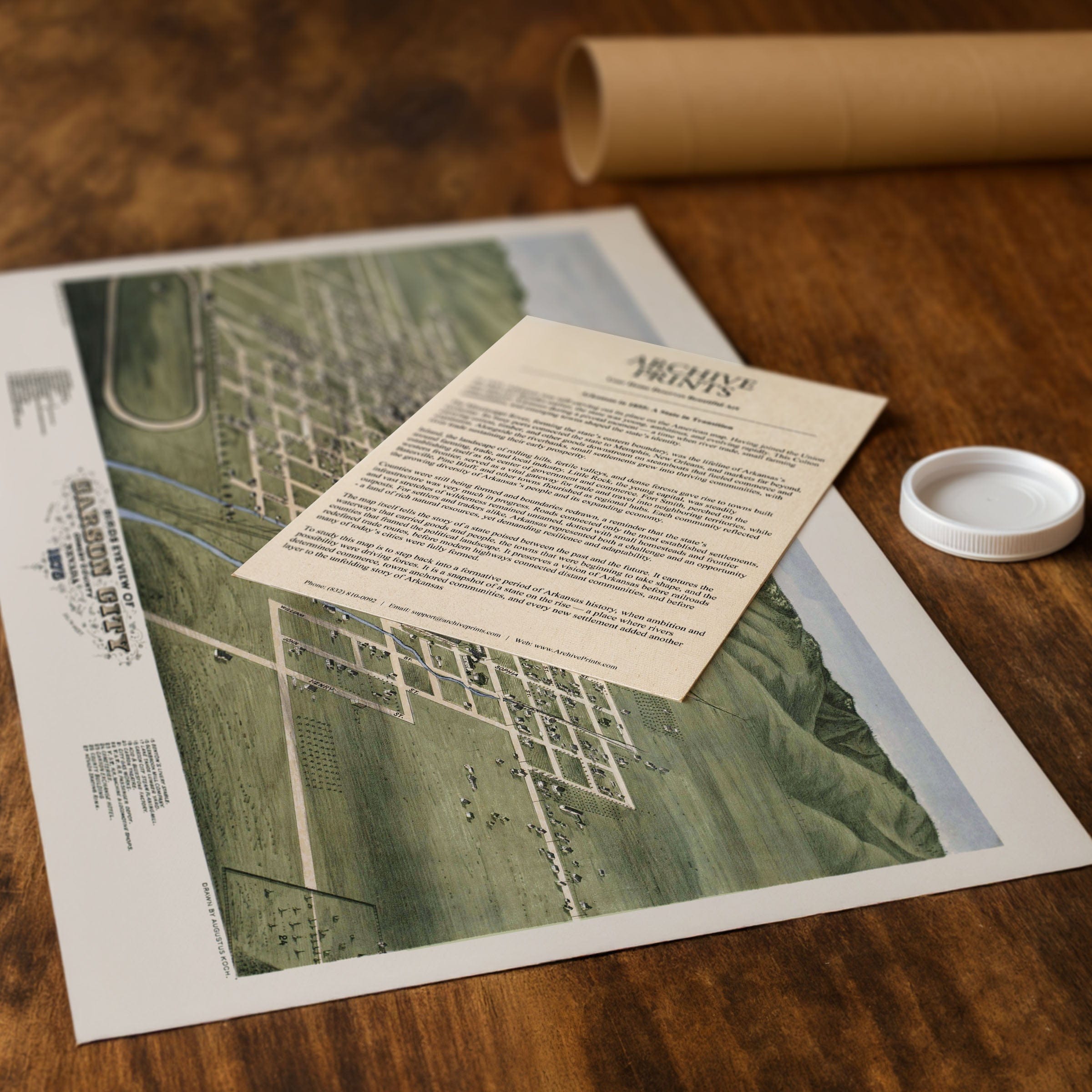
Perfect for Carson City residents, Nevada history enthusiasts, and collectors of Western cartography, this Carson City, Ormsby County, Nevada Map reproduction includes a custom historical certificate. Carson City in 1875 was both frontier and foundation—rugged in its surroundings yet orderly at its core. Printed on heavyweight archival paper or hand-stretched polycotton canvas, every street, building, and mountain is restored in museum-grade clarity for generations of enjoyment. Paper prints ship rolled in heavy-duty tubes, while canvas editions arrive gallery-wrapped on solid pine stretcher bars with pre-installed hardware—ready to display the moment it arrives. Bring home a piece of Nevada history and celebrate a capital emerging from the silver boom era.
The Map Story
Materials
Choose options

Because every place has a story
Make History Personal
A vintage map is more than art.
It is a reminder of where life began.
Where memories were made.
Where hearts still live. Give the gift of place.
Beautifully preserved and made for the moments that matter.
Why Choose Us?
| Feature | Us | Competitor A | Competitor B |
|---|---|---|---|
| Hand Crafted | |||
| Museum Quality | |||
| 100 Year Guarantee | |||
| Restored by Hand | |||
| Certificate of Authenticity |

Art Prints
Archival quality colors. Best option if you'd like to frame it yourself

The Best Materials
We hand-stretched our canvas on solid American-grown pine stretcher bars. We use quality canvas and fade-resistant inks to create the lasting art. Canvases come with hardware already installed and ready to hang.
Need help?
Frequently Asked Questions
Order
All of our maps are meticulously restored reproductions of historic originals. Each piece is digitally repaired and color-corrected to bring out the finest details while preserving its authentic, vintage character.
Yes. All Archive Prints products are printed to order in the USA with archival materials.
We offer two premium formats:
- High-Quality Paper Posters – Printed on thick, archival-grade matte paper for rich, vibrant detail.
- Hand-Stretched Canvas Prints – Printed on premium polycotton canvas and mounted on 1.5" solid American pine stretcher bars for a gallery-quality finish.
We carefully digitally restore each map to enhance clarity and color while preserving its original look and historic charm. You’ll enjoy sharp details and a timeless vintage aesthetic that feels true to the original piece.
Yes, we do! We offer premium framing options to make your map ready to hang the moment it arrives. You can choose from Oak, Maple, Black, or Walnut frames directly on the product page. We also offer Stretched Canvas prints for a modern gallery look, as well as archival-quality Posters if you prefer to frame it yourself.
Yes! We offer free shipping on all products within the United States. Each map is carefully packaged to ensure it arrives in perfect condition.
If you’re not completely satisfied, you can return your order in new condition for a full refund. Return shipping costs are the responsibility of the customer.
Absolutely! Our maps make thoughtful, one-of-a-kind gifts for history lovers, map collectors, or anyone looking to add vintage character to their home or office. Choose between paper prints for framing or stretched canvas for a ready-to-hang presentation.
- Paper Posters → Shipped in durable, protective tubes to prevent creasing.
- Canvas Prints → Carefully wrapped, padded, and boxed to ensure safe delivery.
Our maps look stunning in a variety of settings, including:
- Living rooms and home offices
- Libraries and studies
- Corporate offices and conference rooms
- Restaurants, cafes, and boutique spaces