

Charleston, South Carolina Map 1872
Charleston, South Carolina Map 1872
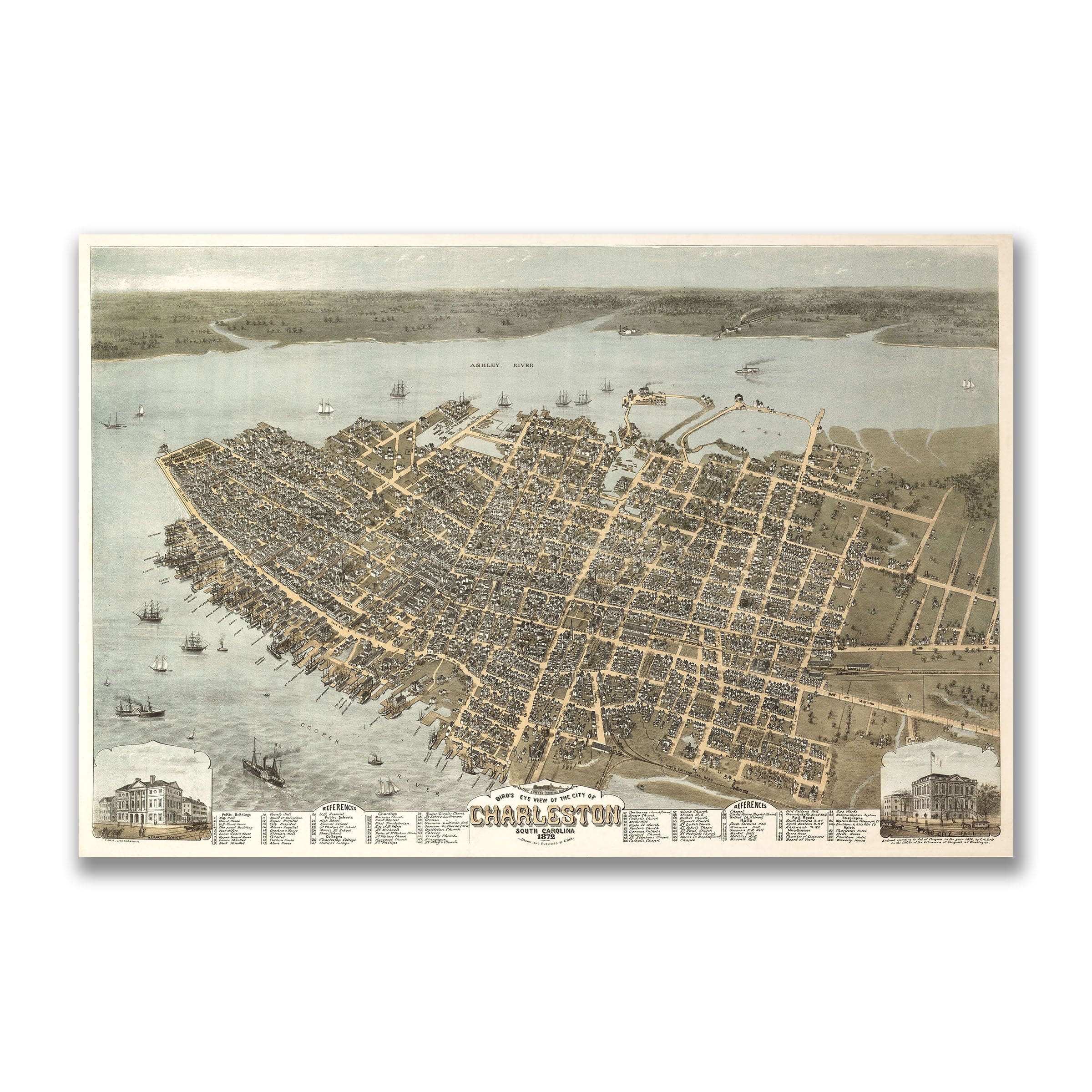
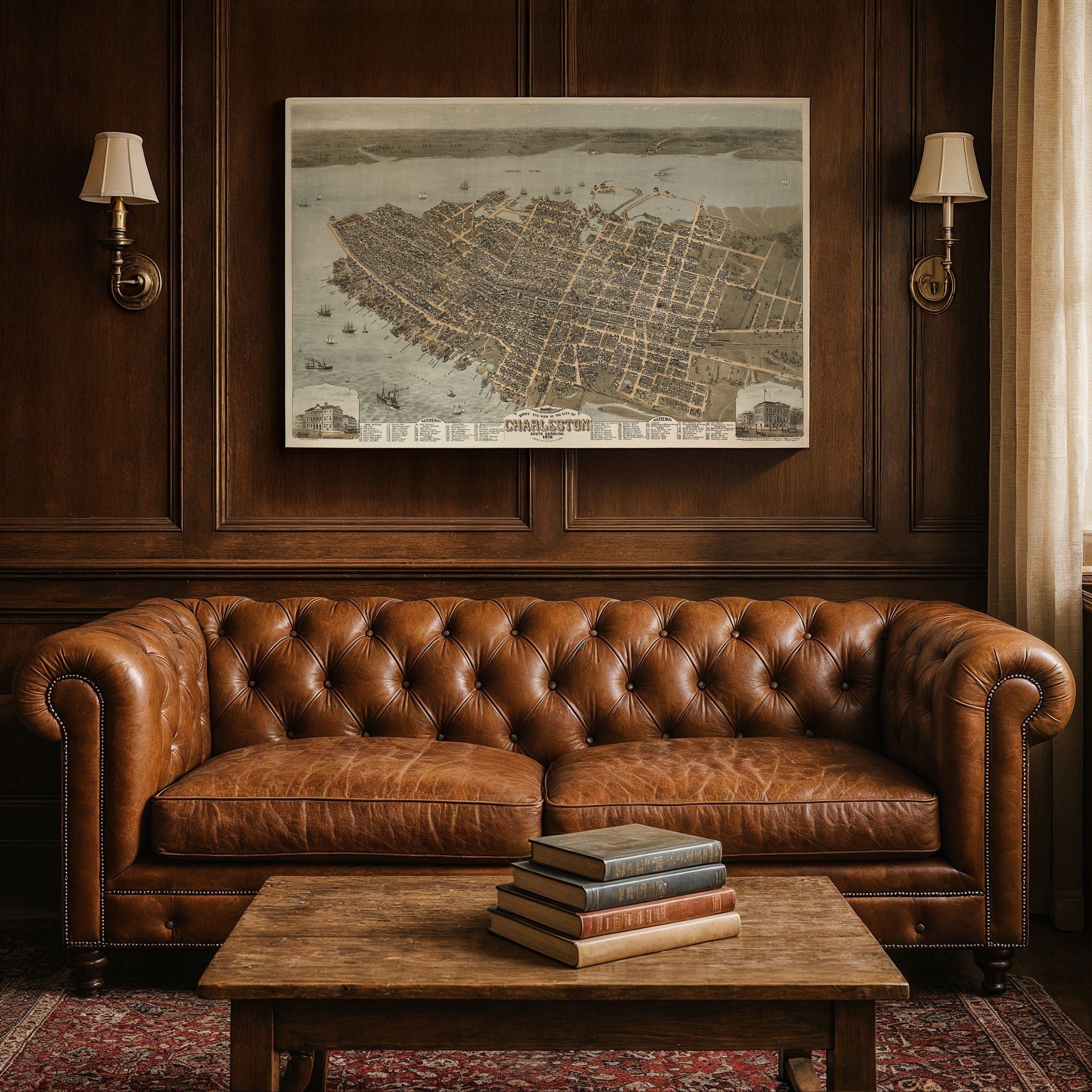
Discover the remarkable Charleston, South Carolina Map published by Currier & Ives, capturing Charleston in 1872 as a city rebuilding—still scarred by war yet determined to rise again as a cultural and commercial heart of the South. This sweeping bird's-eye view presents not a city in ruin, but one reclaiming its identity with resilience and grace. From high above the peninsula between the Ashley and Cooper Rivers, Charleston appears ordered, bustling, and alive with promise only seven years after the end of the Civil War.
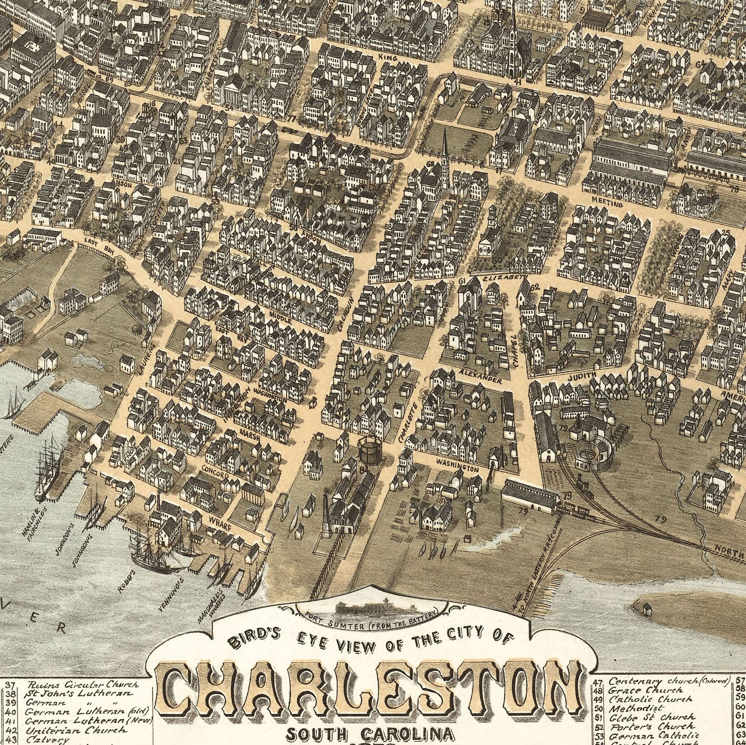
The Charleston, South Carolina Map looks southeast toward the harbor, where ships of every size dot the water—three-masted merchants, sleek schooners, and busy coastal steamers. Along the wharves, commerce hums back to life as cargo once again moves across the docks. Rice, cotton, lumber, and naval stores flow outward to the world, while goods from far-away ports come ashore. The waterfront had long defined Charleston's prosperity, and now, rebuilt piers and warehouses signal a city reconnected to sea and trade.
Grids of narrow streets spread inland in this Charleston, South Carolina Map, dense with homes, churches, and shopfronts. Meeting Street, King Street, and East Bay form the city's commercial spine, lined with mercantile houses, banks, and markets. St. Michael's steeple rises proudly above the rooftops—still a landmark for sailors approaching the harbor—while other churches stand like sentinels of endurance, reminders that Charleston's faith and identity survived even its darkest hours.
Public squares and shaded gardens soften the landscape in this Charleston, South Carolina Map. To the north and west, the city thins into open ground, where new development presses outward like a fresh heartbeat. Rail lines enter along the Cooper River side, linking Charleston inland to Columbia and beyond, pulling the city into the modern industrial age. Horse-drawn streetcars rattle along the avenues, and pedestrians crowd the sidewalks, moving with purpose through a city rediscovering its rhythm.
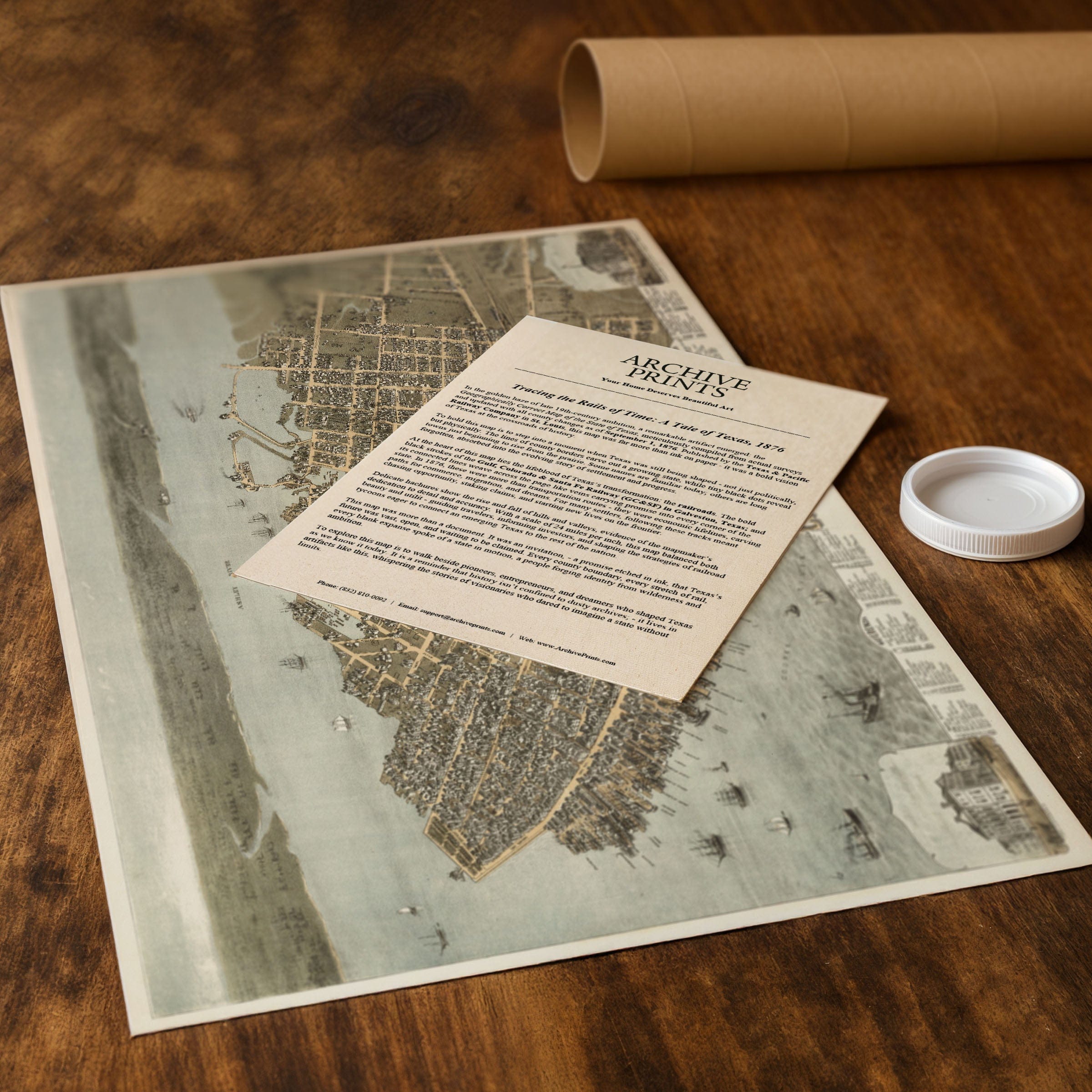
Perfect for Charleston residents, South Carolina history enthusiasts, and collectors of Reconstruction-era cartography, this Charleston, South Carolina Map reproduction includes a custom historical certificate. By 1872, Charleston was rebuilding homes, restoring wharves, reopening institutions, and reclaiming its role as a gateway between the American South and the wider world. Printed on heavyweight archival paper or hand-stretched polycotton canvas, every street, ship, steeple, and wharf is restored in museum-grade clarity for generations of enjoyment. Paper prints ship rolled in heavy-duty tubes, while canvas editions arrive gallery-wrapped on solid pine stretcher bars with pre-installed hardware—ready to display the moment it arrives. Bring home a piece of Charleston history and celebrate a city balancing heritage with rebirth.
The Map Story
Materials
Choose options

Because every place has a story
Make History Personal
A vintage map is more than art.
It is a reminder of where life began.
Where memories were made.
Where hearts still live. Give the gift of place.
Beautifully preserved and made for the moments that matter.
Why Choose Us?
| Feature | Us | Competitor A | Competitor B |
|---|---|---|---|
| Hand Crafted | |||
| Museum Quality | |||
| 100 Year Guarantee | |||
| Restored by Hand | |||
| Certificate of Authenticity |

Art Prints
Archival quality colors. Best option if you'd like to frame it yourself

The Best Materials
We hand-stretched our canvas on solid American-grown pine stretcher bars. We use quality canvas and fade-resistant inks to create the lasting art. Canvases come with hardware already installed and ready to hang.
Need help?
Frequently Asked Questions
Order
All of our maps are meticulously restored reproductions of historic originals. Each piece is digitally repaired and color-corrected to bring out the finest details while preserving its authentic, vintage character.
Yes. All Archive Prints products are printed to order in the USA with archival materials.
We offer two premium formats:
- High-Quality Paper Posters – Printed on thick, archival-grade matte paper for rich, vibrant detail.
- Hand-Stretched Canvas Prints – Printed on premium polycotton canvas and mounted on 1.5" solid American pine stretcher bars for a gallery-quality finish.
We carefully digitally restore each map to enhance clarity and color while preserving its original look and historic charm. You’ll enjoy sharp details and a timeless vintage aesthetic that feels true to the original piece.
Yes, we do! We offer premium framing options to make your map ready to hang the moment it arrives. You can choose from Oak, Maple, Black, or Walnut frames directly on the product page. We also offer Stretched Canvas prints for a modern gallery look, as well as archival-quality Posters if you prefer to frame it yourself.
Yes! We offer free shipping on all products within the United States. Each map is carefully packaged to ensure it arrives in perfect condition.
If you’re not completely satisfied, you can return your order in new condition for a full refund. Return shipping costs are the responsibility of the customer.
Absolutely! Our maps make thoughtful, one-of-a-kind gifts for history lovers, map collectors, or anyone looking to add vintage character to their home or office. Choose between paper prints for framing or stretched canvas for a ready-to-hang presentation.
- Paper Posters → Shipped in durable, protective tubes to prevent creasing.
- Canvas Prints → Carefully wrapped, padded, and boxed to ensure safe delivery.
Our maps look stunning in a variety of settings, including:
- Living rooms and home offices
- Libraries and studies
- Corporate offices and conference rooms
- Restaurants, cafes, and boutique spaces