Vintage Childress Texas City Map - 1890 Historical Bird's-Eye View
Vintage Childress Texas City Map
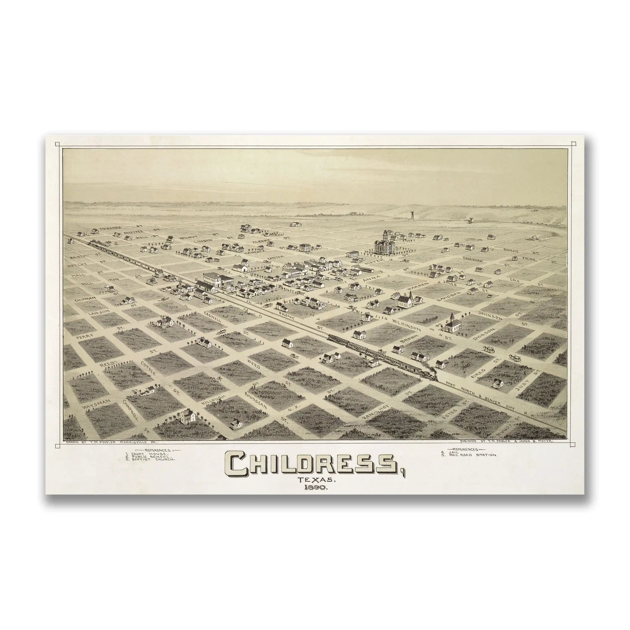
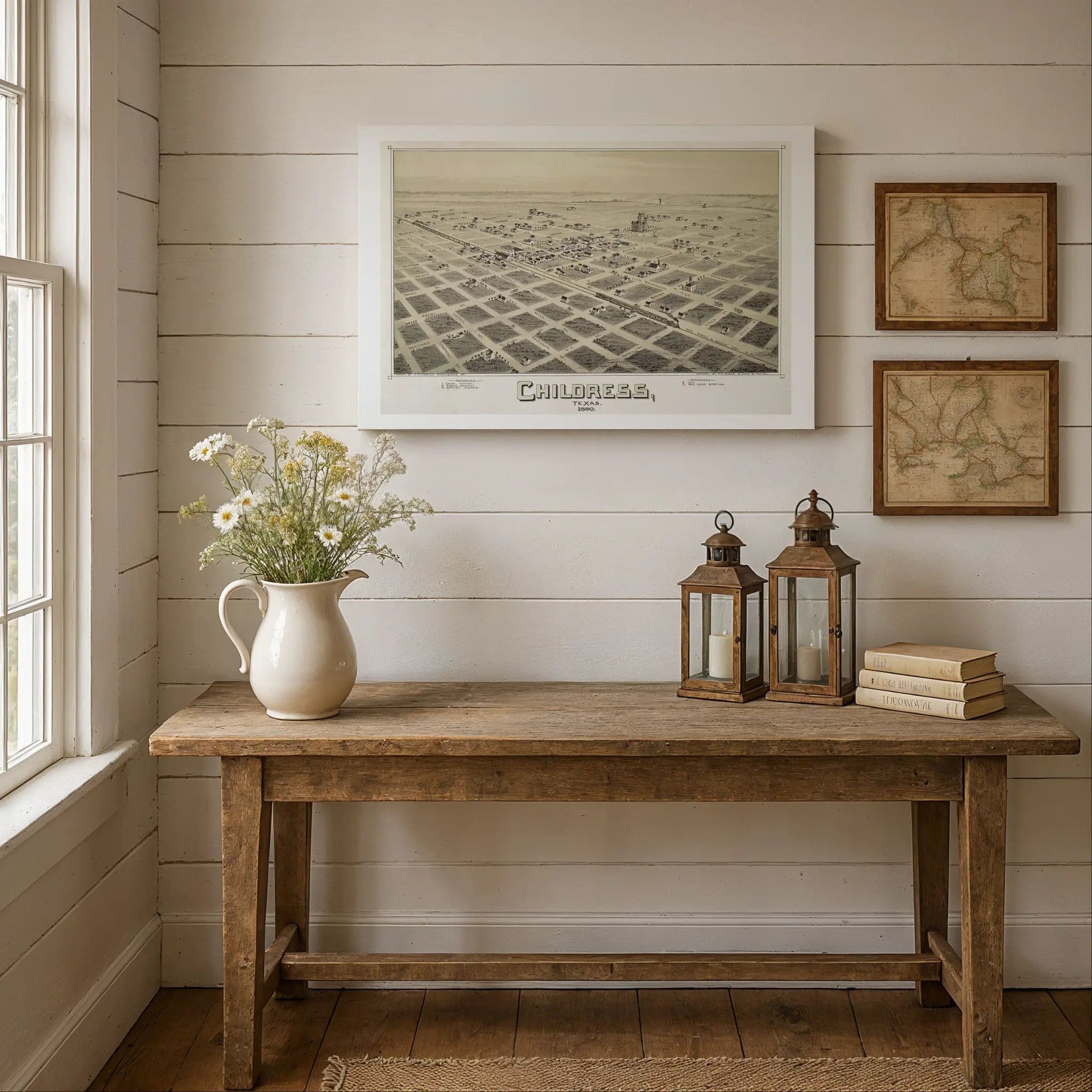
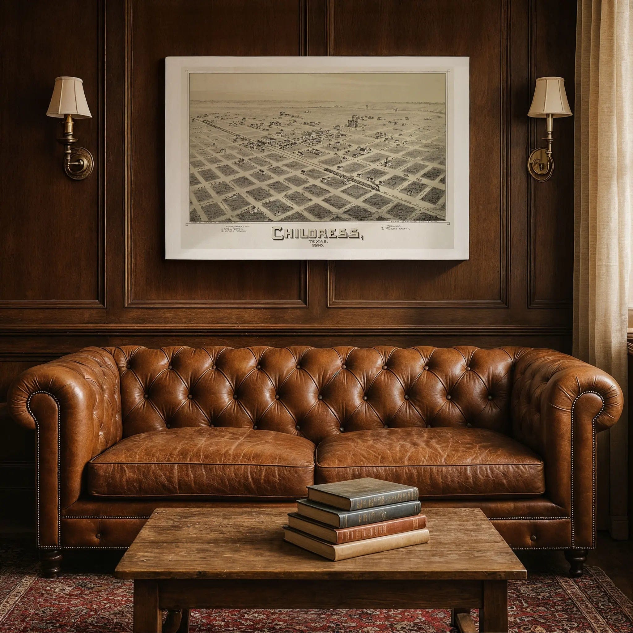
Step back into 1890 Texas with this extraordinary Bird's-Eye View of Childress by T.M. Fowler and James B. Moyer. This remarkable panoramic map captures the town at its very beginning—a small cluster of ambition surrounded by vast, untamed prairie. Every street and building reflects a frontier community just beginning to take shape, where surveyors' lines and settlers' dreams were still fresher than the buildings themselves.
Historical Significance
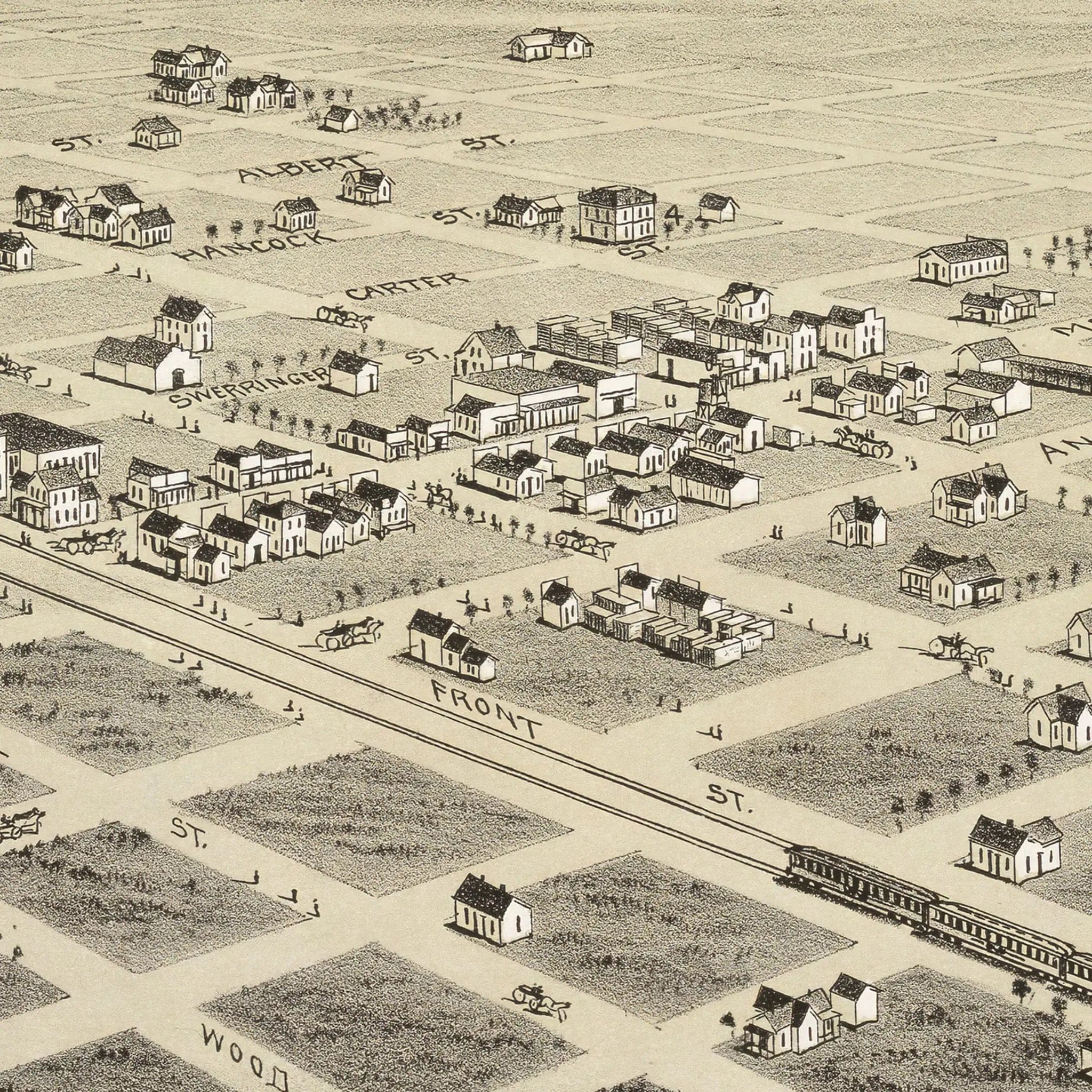
In 1890, Childress represented the raw optimism of Texas frontier development. This meticulously detailed map documents a town that was more promise than reality—a precise grid of streets stretching across the open plain with most lots remaining empty, their absence speaking louder than presence. The railroad runs straight through the center of town as the single most important artery of early life, bringing supplies, settlers, and vital connection to the rest of Texas. Near the tracks sit the depot, warehouses, and small shops—the early signs of trade that would define the community's growth.
Cartographic Excellence
Fowler and Moyer's masterful bird's-eye perspective showcases Childress with remarkable attention to both planning and potential. The courthouse, church, and schoolhouse stand as modest but determined symbols of order on the edge of the frontier. Beyond the town's neat grid lies endless horizon—rolling grasslands fading into sky, reminding viewers that this was still a land of weather, dust, and risk. The contrast between the tidy downtown and the empty expanse beyond tells the story of courage required to build civilization where wilderness still waited.
Urban Development Story
The artistry of this map lies in its balance of precision and imagination. Every line represents planning and pride, while the open spaces whisper of uncertainty. This was both a document and an advertisement, crafted to show that Childress was ready for growth, rail expansion, and settlers who believed in the promise of Texas. Ranchers and farmers worked the surrounding land, battling drought and isolation while nurturing the fragile beginnings of community that would eventually flourish.
A Vision of Perseverance
This map serves as a portrait of faith in the future, capturing Childress when it was not yet a bustling city but when its foundations were set in hope and perseverance. Each street drawn across that blank prairie represented a belief—that even here, far from the centers of commerce and power, a town could take root and thrive. The map documents the moment when frontier dreams began their transformation into lasting community.
A Piece of Texas History
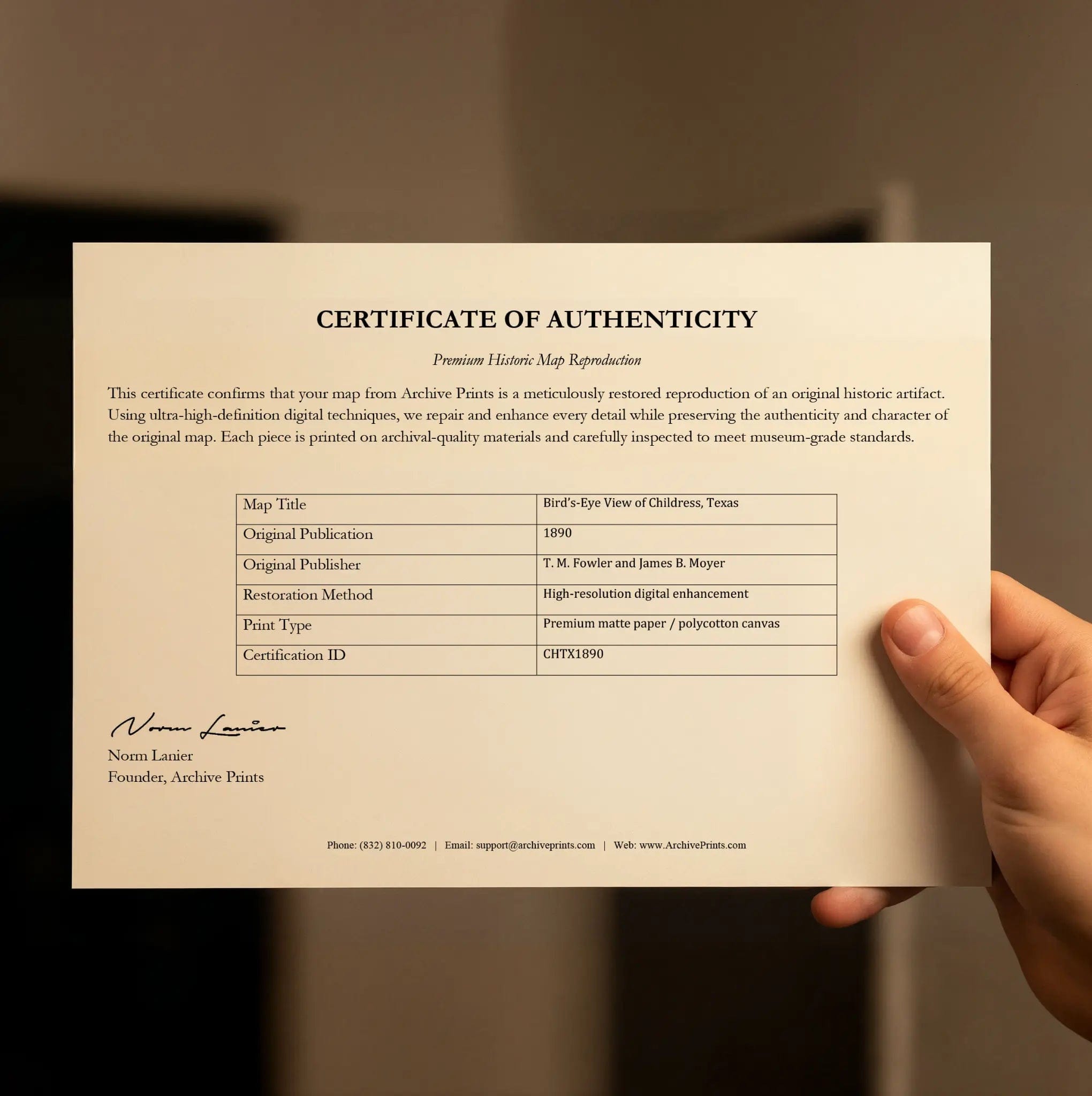
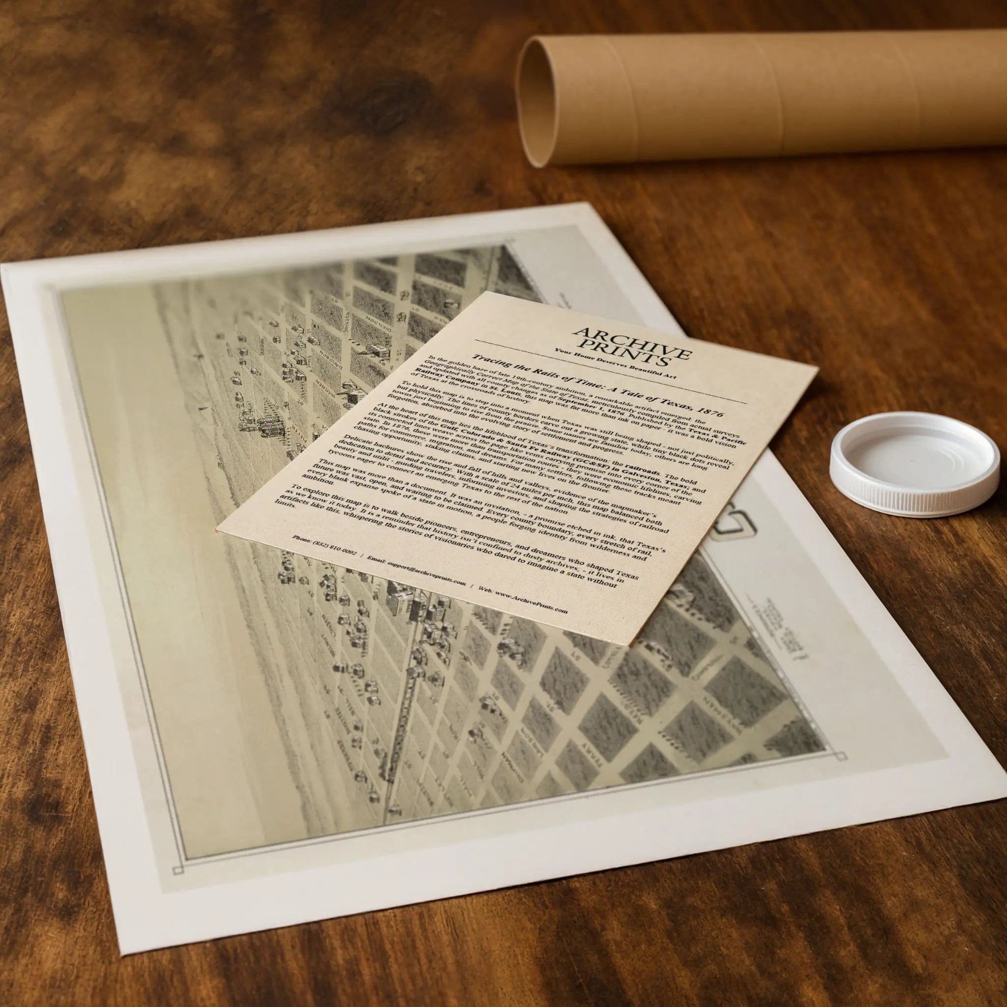
Each restored reproduction of this 1890 map is printed with museum-quality precision on heavyweight archival paper or hand-stretched premium canvas to preserve every original detail. Your purchase includes two companion documents:
Certificate of Authenticity verifying its restoration and reproduction quality
Historical Story Page detailing the origins, craftsmanship, and cultural significance of Fowler and Moyer's iconic map
Paper prints arrive rolled in reinforced mailing tubes for protection. Canvas prints come gallery-wrapped on solid pine stretcher bars with pre-installed hardware, ready to display upon arrival.
Bring home a vivid piece of Texas history—a timeless record of Childress's frontier spirit and the vision that transformed empty prairie into one of North Texas's enduring railroad communities.
The Map Story
In 1890, Childress, Texas, was a frontier town just beginning to take shape—a small cluster of ambition surrounded by vast, untamed prairie. The Bird’s-Eye View of Childress, Texas captures this moment of raw optimism, when surveyors’ lines and settlers’ dreams were still fresher than the buildings themselves.
At first glance, the town appears almost too orderly for its age. A precise grid of streets stretches across the open plain, with each block carefully drawn and labeled. Most of the lots remain empty, their absence speaking louder than presence. This was a map of intent, not completion—a promise that what was drawn in ink would one day rise in timber and brick.
The railroad runs straight through the center of town, the single most important artery of its early life. It was the reason Childress existed at all, bringing supplies, settlers, and a connection to the rest of Texas. Near the tracks sit the depot, warehouses, and small shops—the early signs of trade. Close by stand the courthouse, church, and schoolhouse, modest but determined symbols of order on the edge of the frontier.
Beyond the town’s neat grid lies endless horizon. Rolling grasslands fade into sky, reminding viewers that this was still a land of weather, dust, and risk. Ranchers and farmers worked the surrounding land, battling drought and isolation while nurturing the fragile beginnings of community. The contrast between the tidy downtown and the empty expanse beyond it tells the story of courage—the effort to build civilization where the wilderness still waited.
The artistry of this map lies in its balance of precision and imagination. Every line represents planning and pride, while the open spaces whisper of uncertainty. It was both a document and an advertisement, crafted to show that Childress was ready for growth, for rail expansion, for settlers who believed in the promise of Texas.
Seen today, the 1890 map stands as a portrait of faith in the future. Childress was not yet a bustling city, but its foundations were set in hope and perseverance. Each street drawn across that blank prairie represented a belief—that even here, far from the centers of commerce and power, a town could take root and thrive.
Materials
Choose options

Because every place has a story
Make History Personal
A vintage map is more than art.
It is a reminder of where life began.
Where memories were made.
Where hearts still live. Give the gift of place.
Beautifully preserved and made for the moments that matter.
Why Choose Us?
| Feature | Us | Competitor A | Competitor B |
|---|---|---|---|
| Hand Crafted | |||
| Museum Quality | |||
| 100 Year Guarantee | |||
| Restored by Hand | |||
| Certificate of Authenticity |

Art Prints
Archival quality colors. Best option if you'd like to frame it yourself

The Best Materials
We hand-stretched our canvas on solid American-grown pine stretcher bars. We use quality canvas and fade-resistant inks to create the lasting art. Canvases come with hardware already installed and ready to hang.
Need help?
Frequently Asked Questions
Order
All of our maps are meticulously restored reproductions of historic originals. Each piece is digitally repaired and color-corrected to bring out the finest details while preserving its authentic, vintage character.
Yes. All Archive Prints products are printed to order in the USA with archival materials.
We offer two premium formats:
- High-Quality Paper Posters – Printed on thick, archival-grade matte paper for rich, vibrant detail.
- Hand-Stretched Canvas Prints – Printed on premium polycotton canvas and mounted on 1.5" solid American pine stretcher bars for a gallery-quality finish.
We carefully digitally restore each map to enhance clarity and color while preserving its original look and historic charm. You’ll enjoy sharp details and a timeless vintage aesthetic that feels true to the original piece.
Yes, we do! We offer premium framing options to make your map ready to hang the moment it arrives. You can choose from Oak, Maple, Black, or Walnut frames directly on the product page. We also offer Stretched Canvas prints for a modern gallery look, as well as archival-quality Posters if you prefer to frame it yourself.
Yes! We offer free shipping on all products within the United States. Each map is carefully packaged to ensure it arrives in perfect condition.
If you’re not completely satisfied, you can return your order in new condition for a full refund. Return shipping costs are the responsibility of the customer.
Absolutely! Our maps make thoughtful, one-of-a-kind gifts for history lovers, map collectors, or anyone looking to add vintage character to their home or office. Choose between paper prints for framing or stretched canvas for a ready-to-hang presentation.
- Paper Posters → Shipped in durable, protective tubes to prevent creasing.
- Canvas Prints → Carefully wrapped, padded, and boxed to ensure safe delivery.
Our maps look stunning in a variety of settings, including:
- Living rooms and home offices
- Libraries and studies
- Corporate offices and conference rooms
- Restaurants, cafes, and boutique spaces