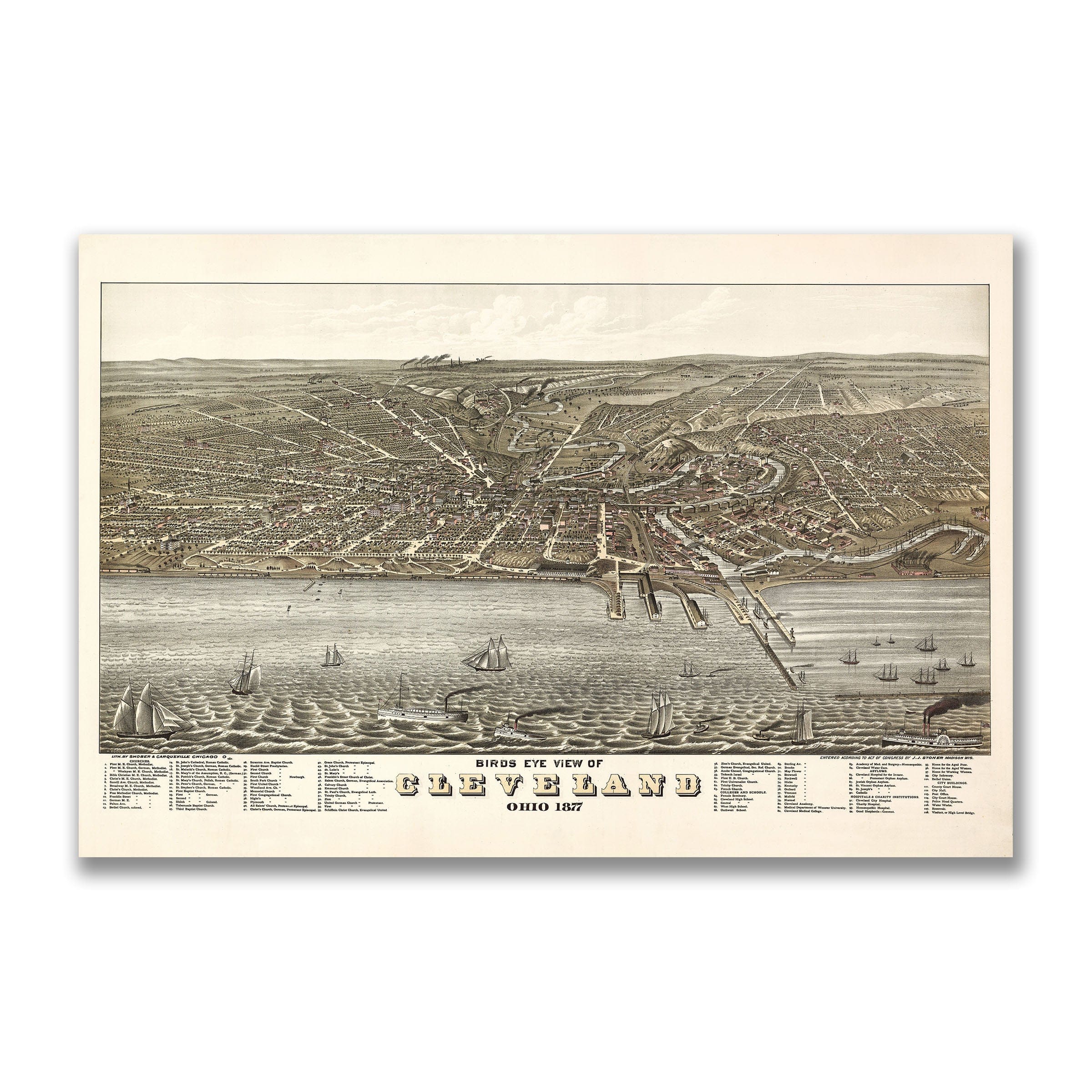
Cleveland, Ohio Map - 1877 Bird's Eye View
Cleveland, Ohio Map
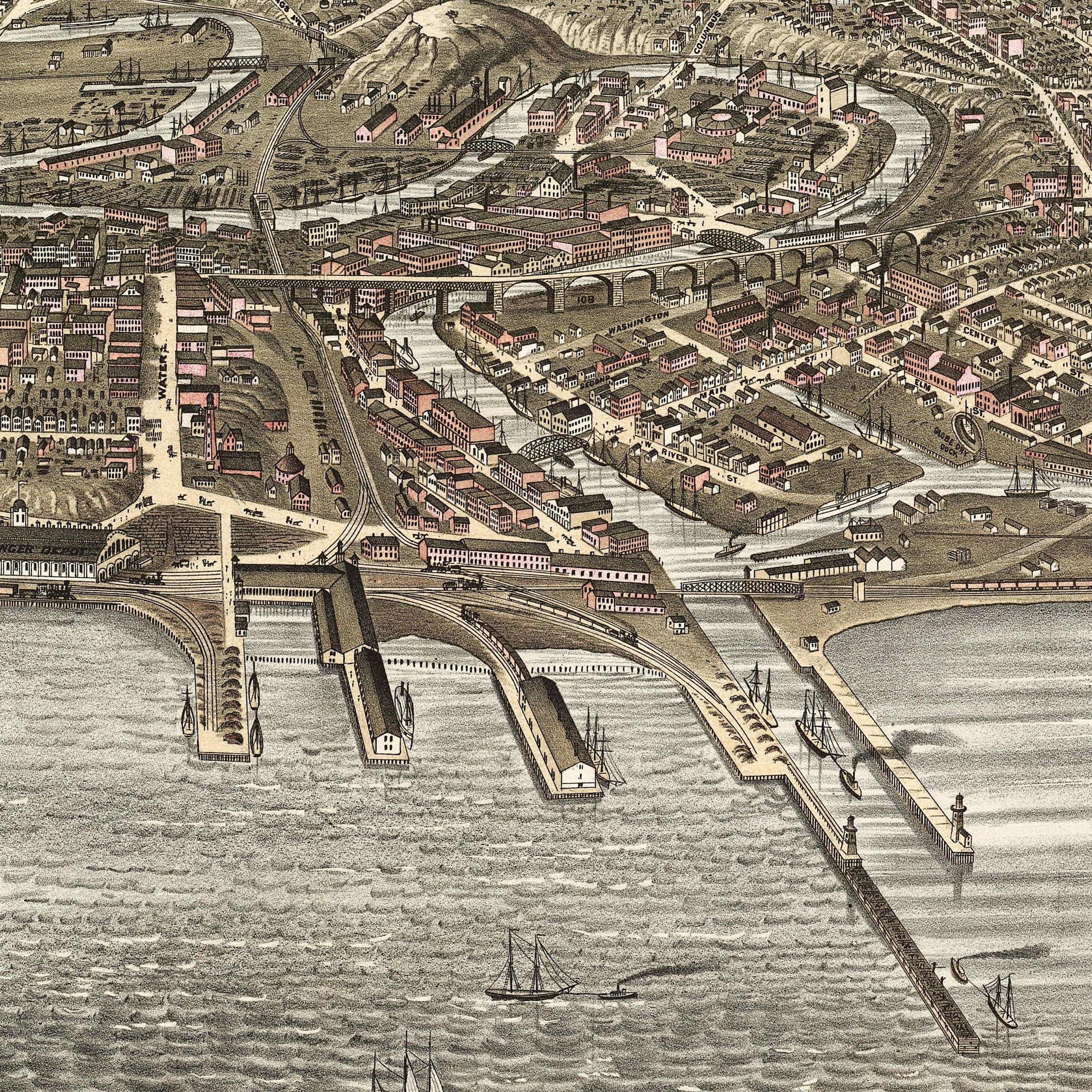
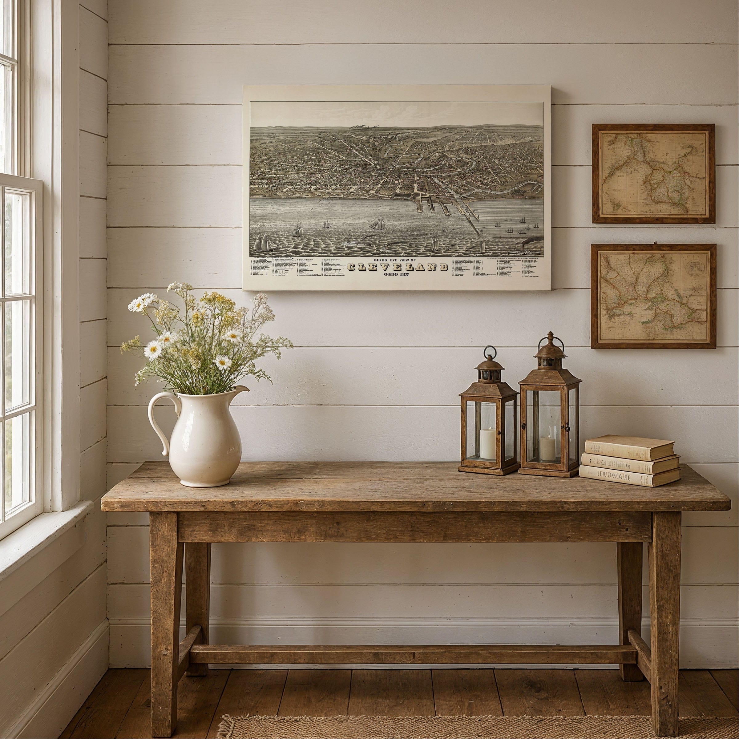
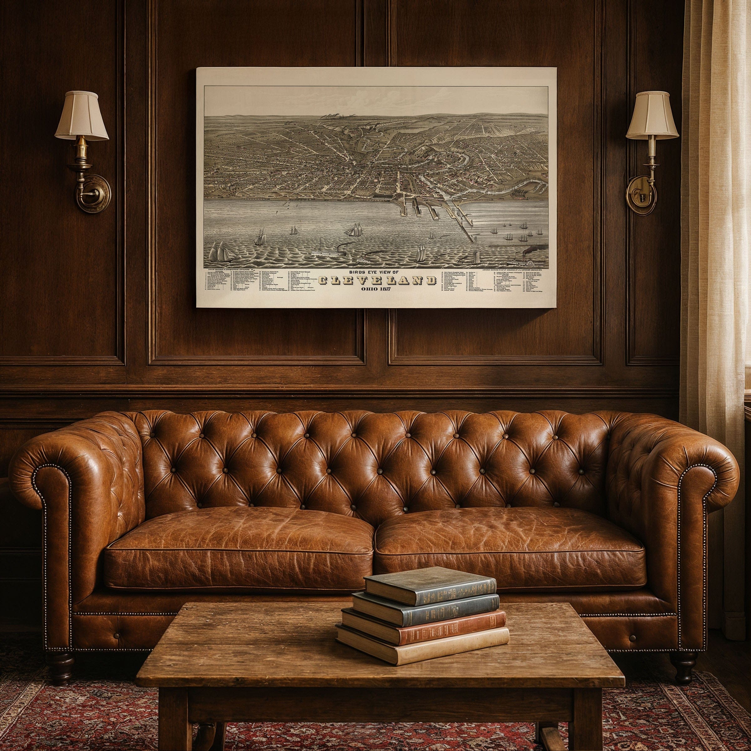
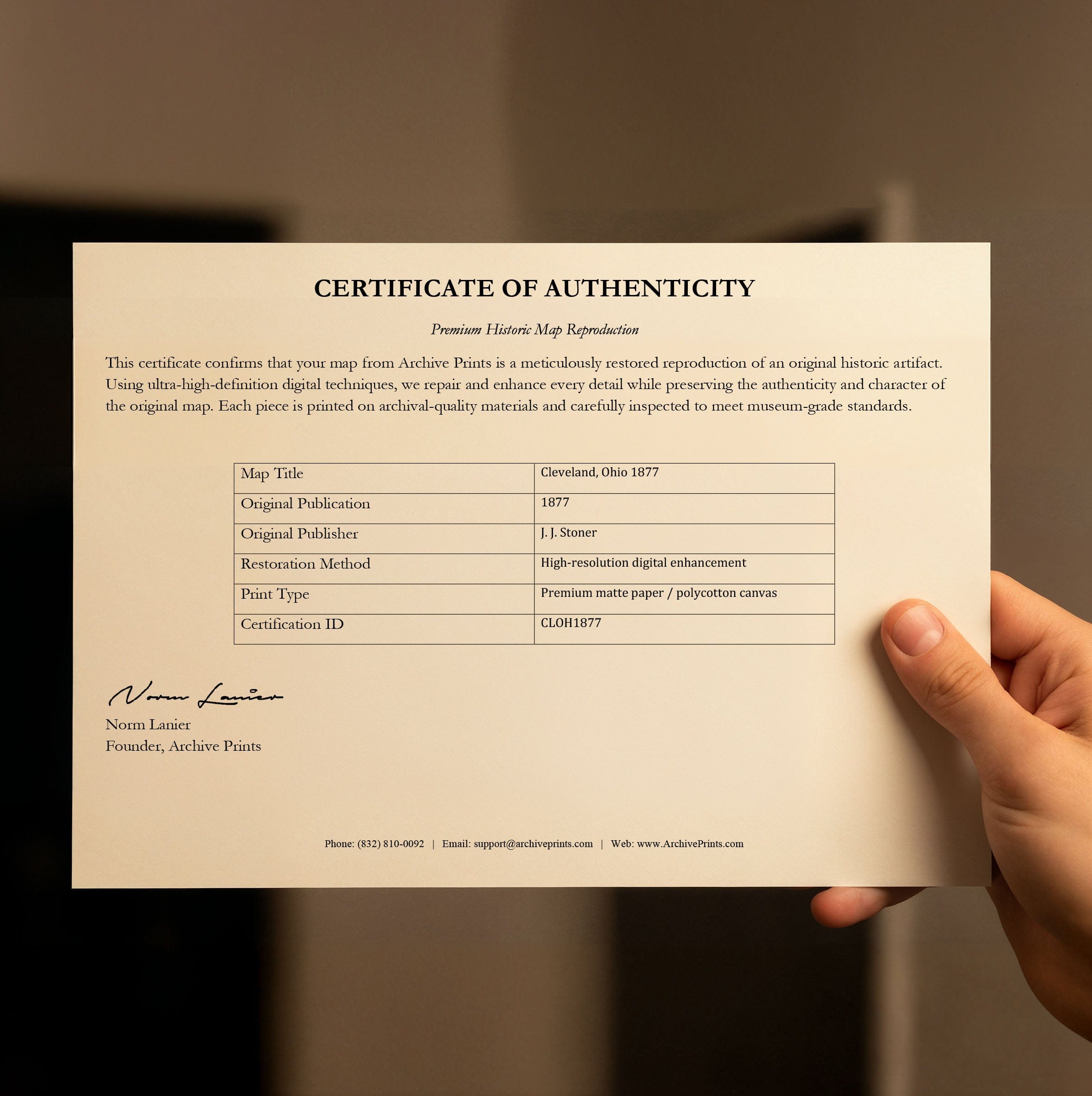
Step back to 1877 when this Cleveland, Ohio Map captured the city at the crossroads of industry and innovation—a Great Lakes port city rising as one of America's leading industrial centers. This isn't just a panoramic view—it's a portrait of a landscape shaped by water, steel, and enterprise, poised to lead the nation into the modern age. Published by J. J. Stoner and drawn by the Brothers Ruger & Company of Chicago, this sweeping bird's-eye view reveals Cleveland at a moment of expansion and optimism. The Cleveland, Ohio Map looks south from above Lake Erie, where restless waves meet a busy harbor filled with schooners, steamboats, and freighters. Along the shoreline, wooden piers and docks extend into the lake like the fingers of a city reaching for prosperity. The Cuyahoga River winds inland toward the valley's factories, mills, and rail lines—a living artery of commerce. Coal smoke drifts above the hills, a reminder that Cleveland's progress ran on steam and steel. At the heart of the map lies downtown Cleveland, a grid of orderly streets radiating from Public Square. Here stood the civic and commercial core: warehouses, hotels, churches, and the city's grand new buildings. Horse-drawn carriages move through busy avenues, while railroads connect the docks to Chicago, Pittsburgh, and New York. The surrounding neighborhoods—Ohio City to the west and the industrial valley to the south—show a patchwork of homes and workshops powering the city's growth. By the late 1870s, Cleveland was one of the Midwest's fastest-growing cities. Its population had passed 100,000, fed by immigrants drawn to jobs in steel, shipbuilding, and oil refining. Rockefeller's Standard Oil was reshaping the economy, while iron foundries and rolling mills supplied rails, engines, and ships for a nation on the move. This map reflects the confidence of the Reconstruction era, when cities looked boldly toward the future. Churches, schools, and civic halls stand proudly throughout the scene, symbols of progress and ambition. To the north, Lake Erie stretches toward the horizon—an open gateway to the world. Each reproduction includes a custom historical letter detailing the story behind the map, making it perfect for Cleveland collectors, Ohio history enthusiasts, and Great Lakes historians. Printed on heavyweight archival paper or hand-stretched polycotton canvas, every building, ship, and street is restored in museum-grade clarity for generations of enjoyment. Paper prints ship rolled in heavy-duty tubes, while canvas editions arrive gallery-wrapped on solid pine stretcher bars with pre-installed hardware—ready to display the moment it arrives. Bring home a piece of Cleveland history and celebrate the industrial transformation of the Great Lakes.
The Map Story
Materials
Choose options

Because every place has a story
Make History Personal
A vintage map is more than art.
It is a reminder of where life began.
Where memories were made.
Where hearts still live. Give the gift of place.
Beautifully preserved and made for the moments that matter.
Why Choose Us?
| Feature | Us | Competitor A | Competitor B |
|---|---|---|---|
| Hand Crafted | |||
| Museum Quality | |||
| 100 Year Guarantee | |||
| Restored by Hand | |||
| Certificate of Authenticity |

Art Prints
Archival quality colors. Best option if you'd like to frame it yourself

The Best Materials
We hand-stretched our canvas on solid American-grown pine stretcher bars. We use quality canvas and fade-resistant inks to create the lasting art. Canvases come with hardware already installed and ready to hang.
Need help?
Frequently Asked Questions
Order
All of our maps are meticulously restored reproductions of historic originals. Each piece is digitally repaired and color-corrected to bring out the finest details while preserving its authentic, vintage character.
Yes. All Archive Prints products are printed to order in the USA with archival materials.
We offer two premium formats:
- High-Quality Paper Posters – Printed on thick, archival-grade matte paper for rich, vibrant detail.
- Hand-Stretched Canvas Prints – Printed on premium polycotton canvas and mounted on 1.5" solid American pine stretcher bars for a gallery-quality finish.
We carefully digitally restore each map to enhance clarity and color while preserving its original look and historic charm. You’ll enjoy sharp details and a timeless vintage aesthetic that feels true to the original piece.
Yes, we do! We offer premium framing options to make your map ready to hang the moment it arrives. You can choose from Oak, Maple, Black, or Walnut frames directly on the product page. We also offer Stretched Canvas prints for a modern gallery look, as well as archival-quality Posters if you prefer to frame it yourself.
Yes! We offer free shipping on all products within the United States. Each map is carefully packaged to ensure it arrives in perfect condition.
If you’re not completely satisfied, you can return your order in new condition for a full refund. Return shipping costs are the responsibility of the customer.
Absolutely! Our maps make thoughtful, one-of-a-kind gifts for history lovers, map collectors, or anyone looking to add vintage character to their home or office. Choose between paper prints for framing or stretched canvas for a ready-to-hang presentation.
- Paper Posters → Shipped in durable, protective tubes to prevent creasing.
- Canvas Prints → Carefully wrapped, padded, and boxed to ensure safe delivery.
Our maps look stunning in a variety of settings, including:
- Living rooms and home offices
- Libraries and studies
- Corporate offices and conference rooms
- Restaurants, cafes, and boutique spaces