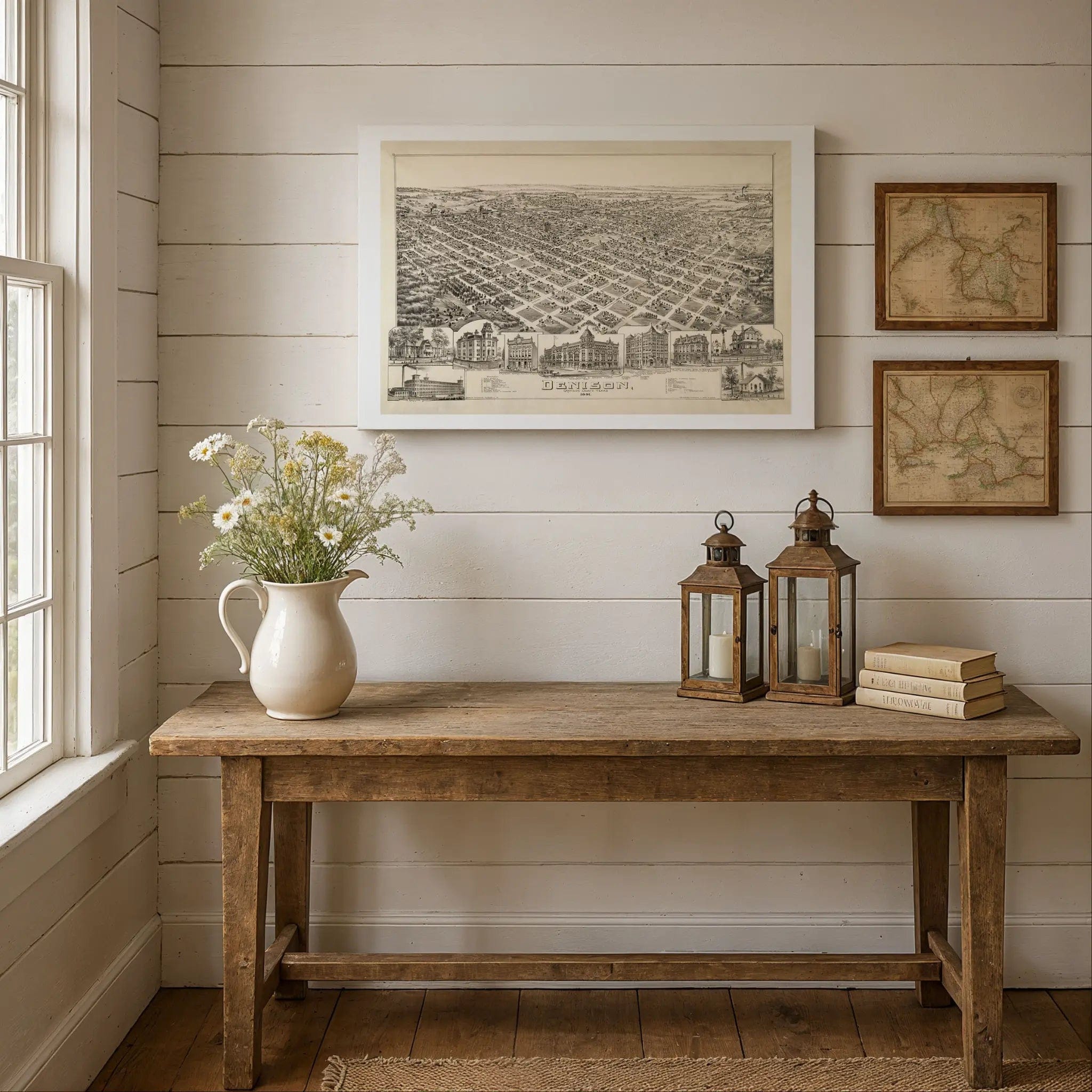
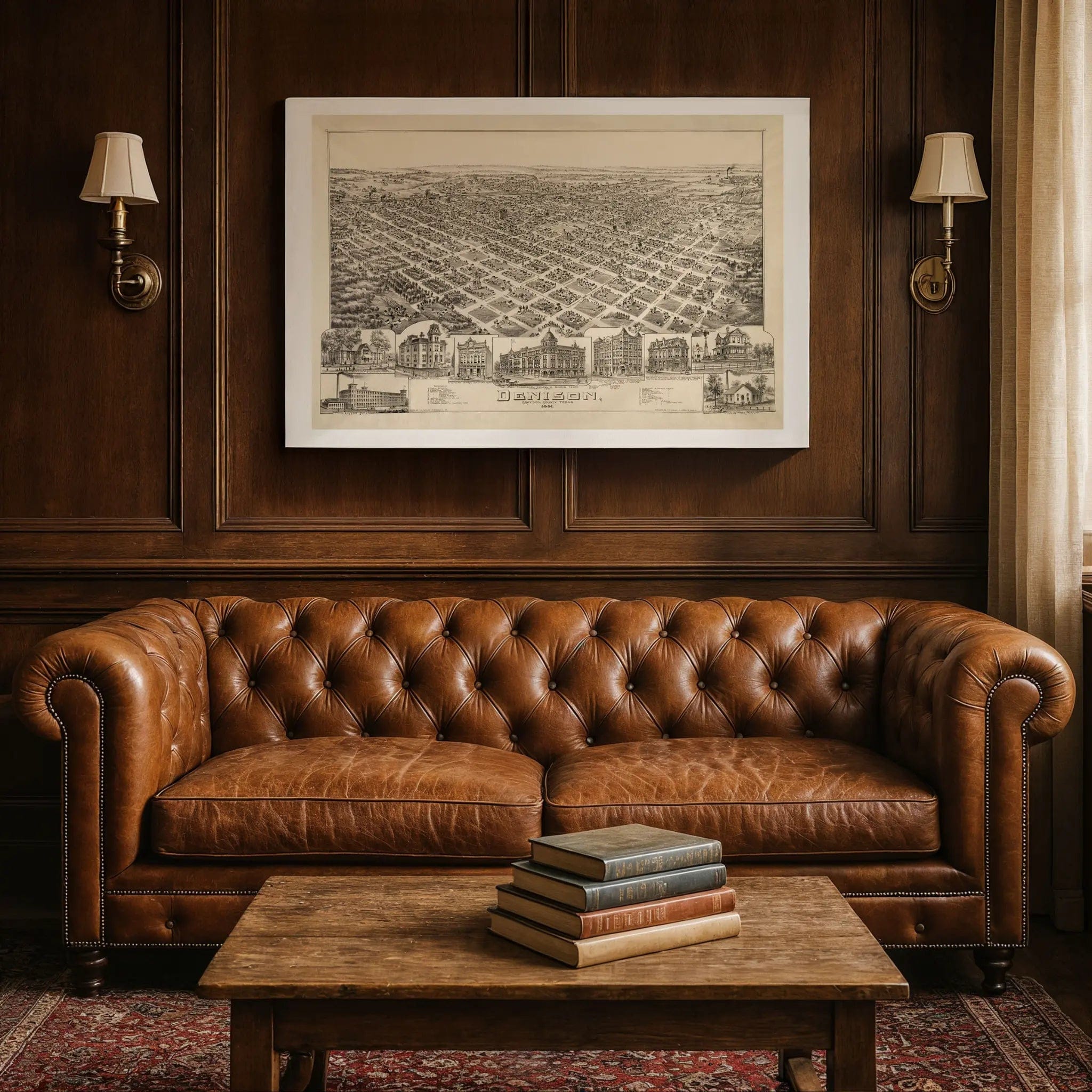

Denison Texas Historical Map - Vintage 1891 Bird's-Eye City View Print
Denison Texas Historical Map
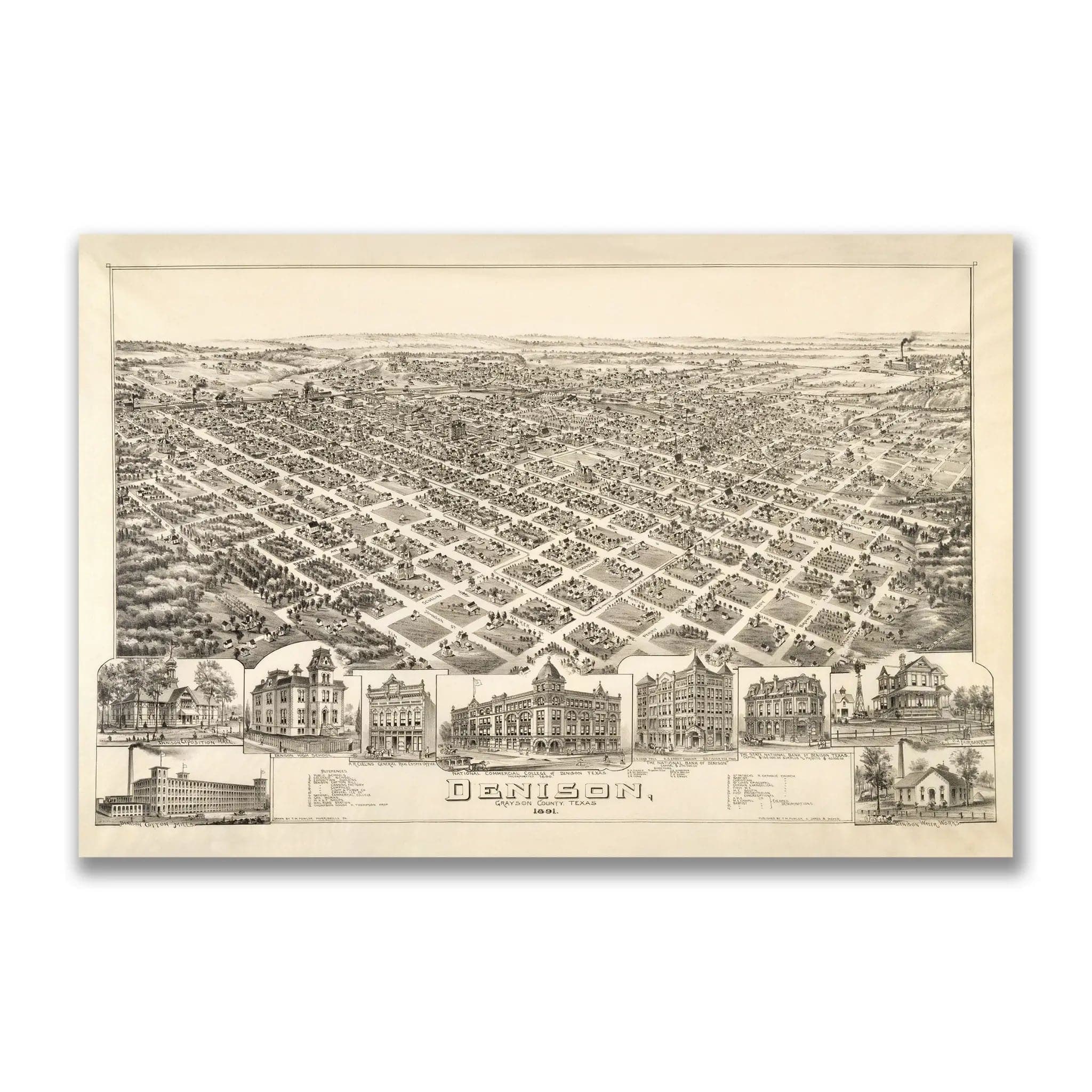
Step back into 1891 Texas with this extraordinary Bird's-Eye View of Denison, Grayson County by T.M. Fowler and James B. Moyer. This remarkable panoramic map captures the city during its golden age as a major railroad hub, when Denison served as the gateway between Texas and the rest of America. Every street, depot, and commercial building reflects a community built on the promise of transportation and trade, where the convergence of multiple rail lines created unprecedented prosperity in North Texas.
Historical Significance
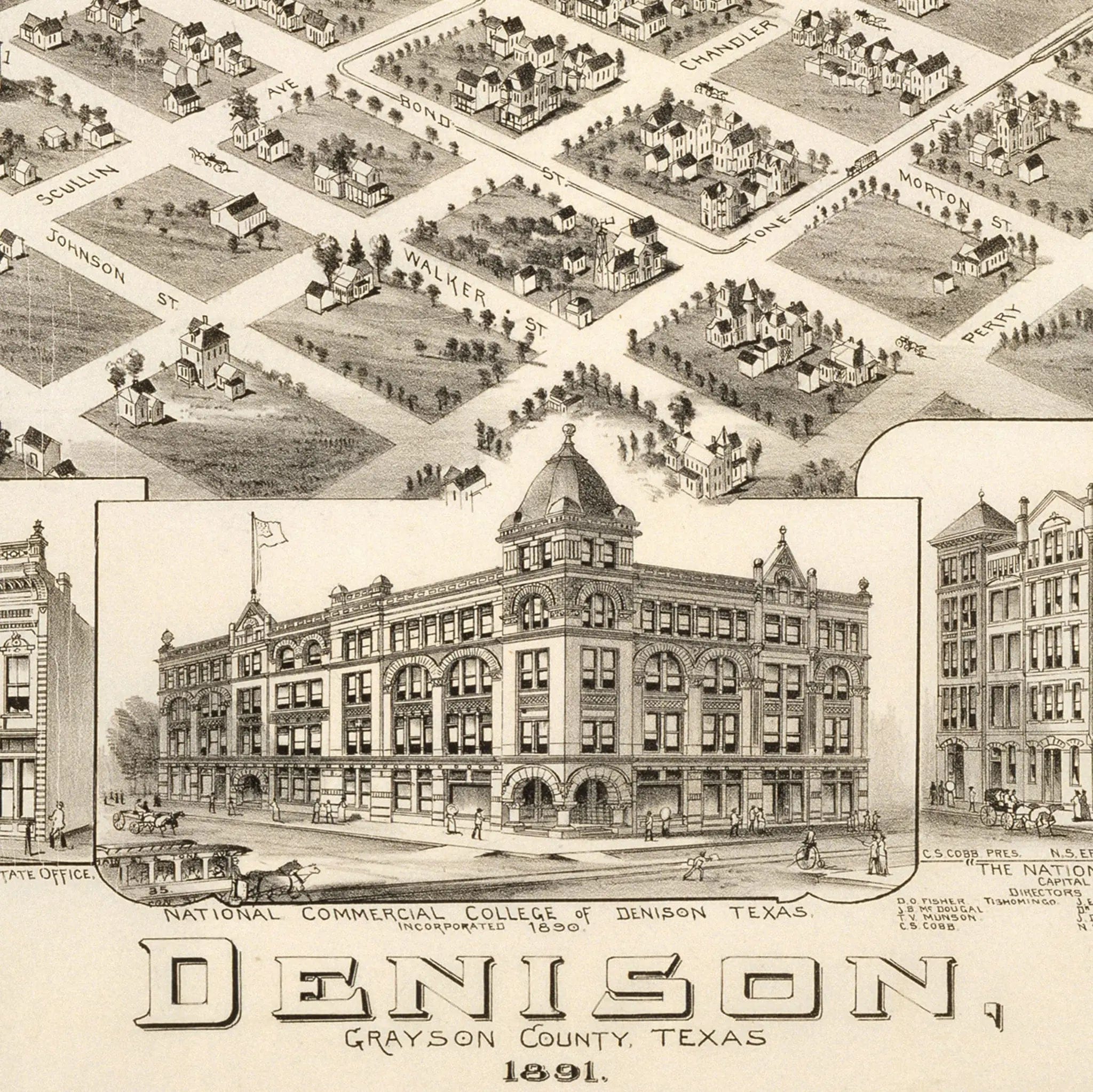
In 1891, Denison stood as one of the most important railroad centers in the Southwest, earning the nickname "Gateway City" for its role connecting Texas to national markets. This meticulously detailed map documents the city at the height of its railroad boom, when multiple lines converged here to create a bustling hub of commerce and industry. The massive railroad yards dominate the landscape, surrounded by hotels, warehouses, and businesses that catered to the constant flow of travelers and freight. The National Commercial College, prominently featured in the map's vignettes, symbolized Denison's role as a center of education and business training for the expanding railroad industry.
Cartographic Excellence
Fowler and Moyer's masterful bird's-eye perspective showcases Denison with remarkable attention to both industrial infrastructure and residential development. The detailed vignettes around the border highlight the city's most important buildings, from the grand railroad depot to the elegant commercial blocks that lined Main Street. The precise rendering captures the unique character of a railroad boomtown, where prosperity and progress moved at the speed of steam locomotives, and where the future seemed as limitless as the tracks stretching toward every horizon.
Urban Development Story
The artistry of this map lies in its documentation of a city shaped entirely by the railroad. Denison's streets radiate outward from the massive rail yards, creating a urban pattern unlike anywhere else in Texas. The substantial residential neighborhoods, tree-lined streets, and impressive public buildings all speak to the wealth and confidence that railroad commerce brought to this North Texas community. Every structure represents the transformation of raw prairie into a sophisticated city through the power of transportation technology.
A Vision of Industrial Progress
This map serves as a portrait of American industrial expansion at its peak, capturing Denison when it was the beating heart of Texas railroad commerce. The careful attention to both infrastructure and community amenities reflects a city that understood its crucial role in connecting the agricultural wealth of Texas to the industrial centers of the East. The balance between commercial enterprise and residential comfort shows a community that prospered by serving the needs of a rapidly expanding nation.
A Piece of Texas History
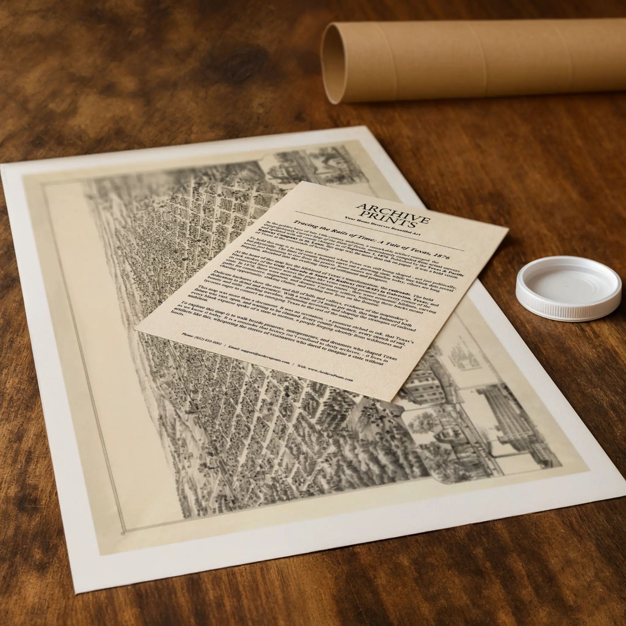
Each restored reproduction of this 1891 map is printed with museum-quality precision on heavyweight archival paper or hand-stretched premium canvas to preserve every original detail. Your purchase includes two companion documents:
Certificate of Authenticity verifying its restoration and reproduction quality
Historical Story Page detailing the origins, craftsmanship, and cultural significance of Fowler and Moyer's iconic map
Paper prints arrive rolled in reinforced mailing tubes for protection. Canvas prints come gallery-wrapped on solid pine stretcher bars with pre-installed hardware, ready to display upon arrival.
Bring home a vivid piece of Texas history—a timeless record of Denison's railroad heritage and the industrial spirit that transformed North Texas during the age of steam.
The Map Story
Materials
Choose options

Because every place has a story
Make History Personal
A vintage map is more than art.
It is a reminder of where life began.
Where memories were made.
Where hearts still live. Give the gift of place.
Beautifully preserved and made for the moments that matter.
Why Choose Us?
| Feature | Us | Competitor A | Competitor B |
|---|---|---|---|
| Hand Crafted | |||
| Museum Quality | |||
| 100 Year Guarantee | |||
| Restored by Hand | |||
| Certificate of Authenticity |

Art Prints
Archival quality colors. Best option if you'd like to frame it yourself

The Best Materials
We hand-stretched our canvas on solid American-grown pine stretcher bars. We use quality canvas and fade-resistant inks to create the lasting art. Canvases come with hardware already installed and ready to hang.
Need help?
Frequently Asked Questions
Order
All of our maps are meticulously restored reproductions of historic originals. Each piece is digitally repaired and color-corrected to bring out the finest details while preserving its authentic, vintage character.
Yes. All Archive Prints products are printed to order in the USA with archival materials.
We offer two premium formats:
- High-Quality Paper Posters – Printed on thick, archival-grade matte paper for rich, vibrant detail.
- Hand-Stretched Canvas Prints – Printed on premium polycotton canvas and mounted on 1.5" solid American pine stretcher bars for a gallery-quality finish.
We carefully digitally restore each map to enhance clarity and color while preserving its original look and historic charm. You’ll enjoy sharp details and a timeless vintage aesthetic that feels true to the original piece.
Yes, we do! We offer premium framing options to make your map ready to hang the moment it arrives. You can choose from Oak, Maple, Black, or Walnut frames directly on the product page. We also offer Stretched Canvas prints for a modern gallery look, as well as archival-quality Posters if you prefer to frame it yourself.
Yes! We offer free shipping on all products within the United States. Each map is carefully packaged to ensure it arrives in perfect condition.
If you’re not completely satisfied, you can return your order in new condition for a full refund. Return shipping costs are the responsibility of the customer.
Absolutely! Our maps make thoughtful, one-of-a-kind gifts for history lovers, map collectors, or anyone looking to add vintage character to their home or office. Choose between paper prints for framing or stretched canvas for a ready-to-hang presentation.
- Paper Posters → Shipped in durable, protective tubes to prevent creasing.
- Canvas Prints → Carefully wrapped, padded, and boxed to ensure safe delivery.
Our maps look stunning in a variety of settings, including:
- Living rooms and home offices
- Libraries and studies
- Corporate offices and conference rooms
- Restaurants, cafes, and boutique spaces