


Denton Bird's-Eye Map 1883 - Vintage Texas Historical City Map
Discover Denton's Educational Legacy
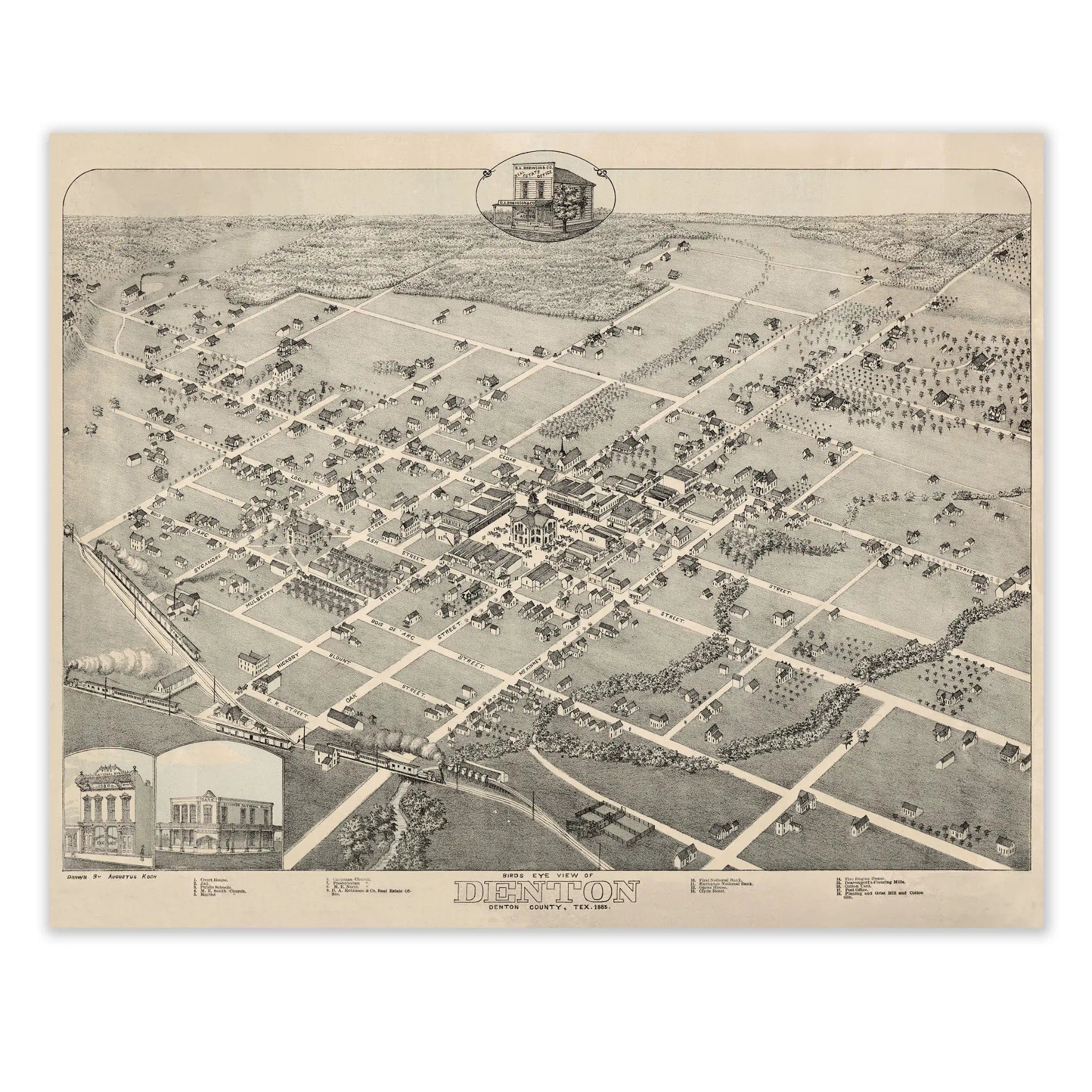
Step back into 1883 Texas with this extraordinary Bird's-Eye View of Denton, Denton County by Augustus Koch. This remarkable panoramic map captures the town during its formative years as an emerging center of education and agriculture in North Texas. Every street, building, and tree-lined avenue reflects a community built on the promise of learning and growth, where the foundations of what would become a major university town were already taking shape.
Historical Significance
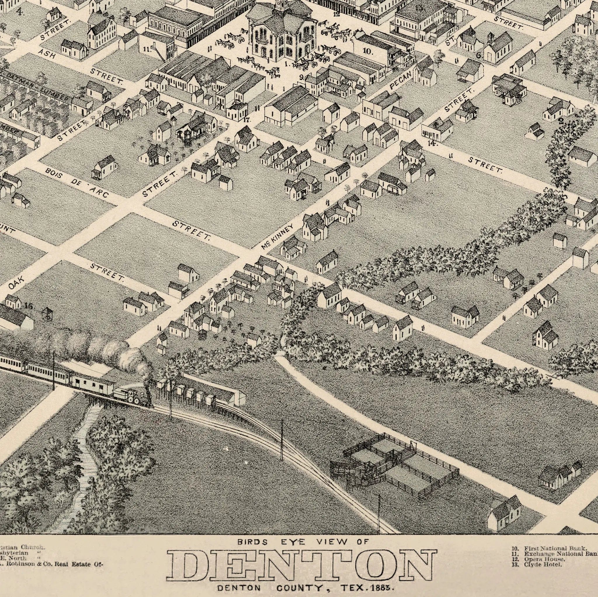
In 1883, Denton stood as a progressive community in the heart of North Texas, distinguished by its commitment to education and civic development. This meticulously detailed map documents the town just as it was establishing its identity as a center of learning, with the railroad bringing new residents and opportunities to the fertile blackland prairie. The courthouse square anchors the community, surrounded by neat residential streets and commercial buildings that speak to Denton's role as both county seat and agricultural hub. The careful planning evident in the street layout reflects a community with vision and ambition for the future.
Cartographic Excellence
Koch's masterful bird's-eye perspective showcases Denton with remarkable attention to both architectural detail and natural beauty. The tree-lined streets and spacious lots create a sense of order and prosperity, while the surrounding farmland stretches to the horizon, emphasizing the town's agricultural foundation. The precise rendering captures the unique character of a North Texas community that balanced rural traditions with progressive ideals, where education and enterprise worked hand in hand to build a lasting legacy.
Urban Development Story
The artistry of this map lies in its documentation of a town designed for growth and learning. Denton's wide streets and generous public spaces reflect the foresight of its founders, who understood that a community built on education needed room to expand and flourish. The railroad depot serves as a vital connection to the wider world, bringing students, teachers, and new ideas to this prairie town. Every building and street represents the careful planning that would eventually make Denton home to major educational institutions.
A Vision of Educational Excellence
This map serves as a portrait of a community that understood the transformative power of education, capturing Denton when it was laying the groundwork for its future as a university town. The orderly streets and substantial buildings reflect a town that valued both learning and civic pride, where the seeds of academic excellence were already taking root in the North Texas prairie. The balance between town and countryside shows a community that honored its agricultural heritage while embracing the promise of intellectual growth.
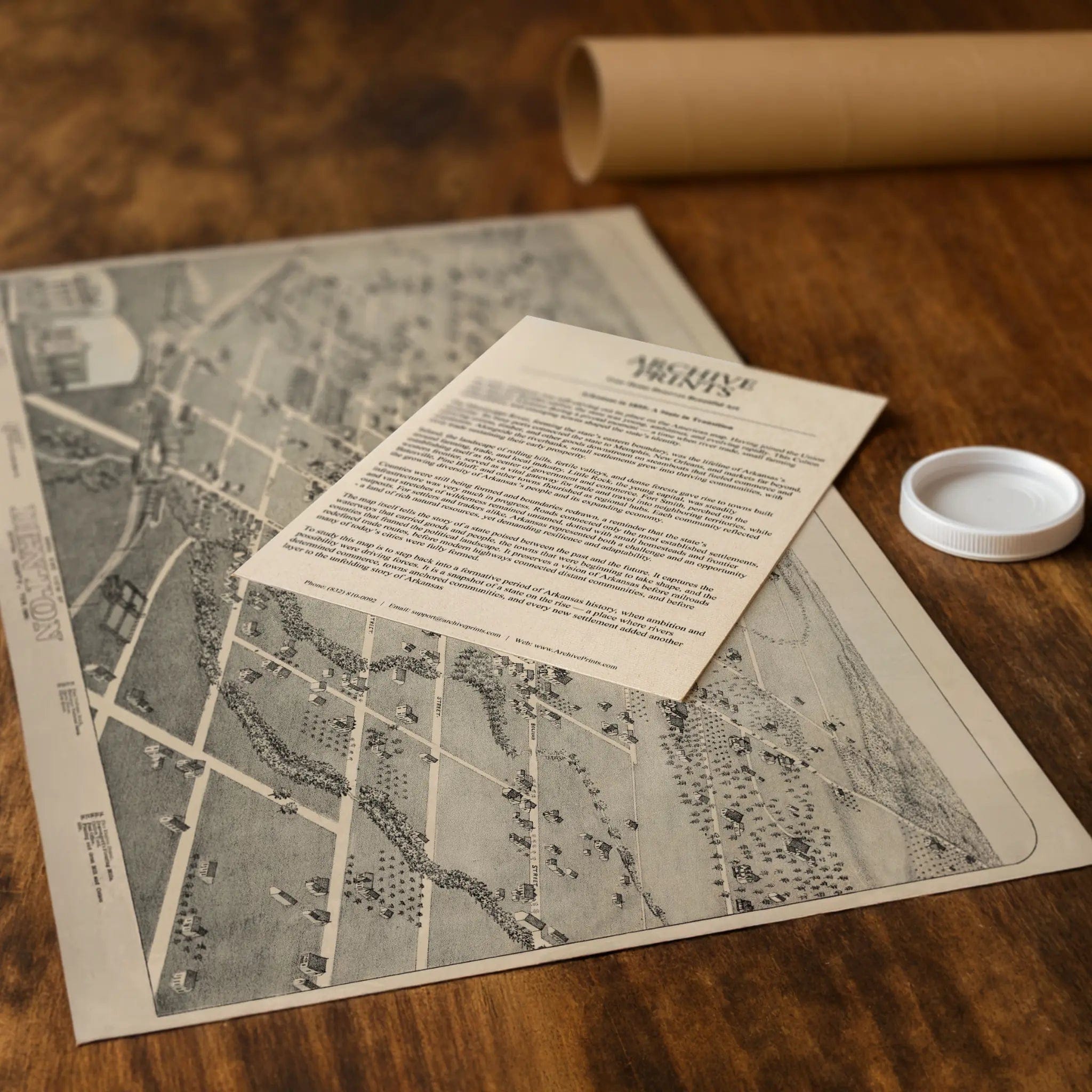
A Piece of Texas History
Each restored reproduction of this 1883 map is printed with museum-quality precision on heavyweight archival paper or hand-stretched premium canvas to preserve every original detail. Your purchase includes two companion documents:
Certificate of Authenticity verifying its restoration and reproduction quality
Historical Story Page detailing the origins, craftsmanship, and cultural significance of Koch's iconic map
Paper prints arrive rolled in reinforced mailing tubes for protection. Canvas prints come gallery-wrapped on solid pine stretcher bars with pre-installed hardware, ready to display upon arrival.
Bring home a vivid piece of Texas history—a timeless record of Denton's educational spirit and the vision that transformed a prairie town into one of North Texas's most important centers of learning.
The Map Story
In 1883, Denton, Texas was a small but determined town staking its future on the intersecting forces of settlement, railroads, and civic identity. The Bird’s Eye View of Denton, Denton County, Texas, 1883 presents a portrait of aspiration rather than completion—a grid of streets, scattered buildings, open land, and the shadow of rail lines threading their way into the panorama.
Seen from an elevated vantage, the map places the viewer above the town, where every street, roof, and fence is laid bare. The land beyond the compact core stretches open: pastures, farmland, and undeveloped lots waiting for hands to fence and claim them. The grid of roads projects order upon the terrain, holding nature at bay and promising expansion in every direction.
In the town’s nucleus, buildings cluster. Wood frame homes, small stores, a school or two, and churches signal the heart of community life. Their proximity to one another, and to the rail spur shown in the drawing, underscores how commerce, connectivity, and congregation were still tightly interlinked. The railroad, depicted with gentle but clear lines, is the promise of connection—of goods, people, and the wider economy reaching into this fledgling settlement.
The map grants importance to public structures, giving them slightly heavier weight or clearer form. They stand not just as buildings but as statements: we are here, and we intend to stay. Their presence suggests the town’s ambition for permanence, law, and order even as the frontier lay just beyond.
Beyond the built zones, the land returns to openness. Fences, creek lines, scrubby groves, and gentle rises silently tell of challenges: where water flows, where soil might support crops, where hills might slow progress. The map respects those margins, acknowledging that growth will depend on geography, not just human will.
As promotional and symbolic cartography, the map is as optimistic as it is descriptive. It imagines Denton not just as it was, but as what it could become. Every empty lot is an opportunity, every street an invitation, every parcel a claim. The balance between built and open space tells a story of a town that isn’t finished—because it hasn’t yet had to be.
Today, this 1883 view lives as more than a historical curiosity—it’s a visual record of nascent identity. In those lines we see the ambition, the risk, and the confidence of settlers who looked at open prairie and figured they could build a town. The map is a moment frozen between frontier and community, where the promise of Texas lay in every plotted lot.
Materials
Choose options

Because every place has a story
Make History Personal
A vintage map is more than art.
It is a reminder of where life began.
Where memories were made.
Where hearts still live. Give the gift of place.
Beautifully preserved and made for the moments that matter.
Why Choose Us?
| Feature | Us | Competitor A | Competitor B |
|---|---|---|---|
| Hand Crafted | |||
| Museum Quality | |||
| 100 Year Guarantee | |||
| Restored by Hand | |||
| Certificate of Authenticity |

Art Prints
Archival quality colors. Best option if you'd like to frame it yourself

The Best Materials
We hand-stretched our canvas on solid American-grown pine stretcher bars. We use quality canvas and fade-resistant inks to create the lasting art. Canvases come with hardware already installed and ready to hang.
Need help?
Frequently Asked Questions
Order
All of our maps are meticulously restored reproductions of historic originals. Each piece is digitally repaired and color-corrected to bring out the finest details while preserving its authentic, vintage character.
Yes. All Archive Prints products are printed to order in the USA with archival materials.
We offer two premium formats:
- High-Quality Paper Posters – Printed on thick, archival-grade matte paper for rich, vibrant detail.
- Hand-Stretched Canvas Prints – Printed on premium polycotton canvas and mounted on 1.5" solid American pine stretcher bars for a gallery-quality finish.
We carefully digitally restore each map to enhance clarity and color while preserving its original look and historic charm. You’ll enjoy sharp details and a timeless vintage aesthetic that feels true to the original piece.
Yes, we do! We offer premium framing options to make your map ready to hang the moment it arrives. You can choose from Oak, Maple, Black, or Walnut frames directly on the product page. We also offer Stretched Canvas prints for a modern gallery look, as well as archival-quality Posters if you prefer to frame it yourself.
Yes! We offer free shipping on all products within the United States. Each map is carefully packaged to ensure it arrives in perfect condition.
If you’re not completely satisfied, you can return your order in new condition for a full refund. Return shipping costs are the responsibility of the customer.
Absolutely! Our maps make thoughtful, one-of-a-kind gifts for history lovers, map collectors, or anyone looking to add vintage character to their home or office. Choose between paper prints for framing or stretched canvas for a ready-to-hang presentation.
- Paper Posters → Shipped in durable, protective tubes to prevent creasing.
- Canvas Prints → Carefully wrapped, padded, and boxed to ensure safe delivery.
Our maps look stunning in a variety of settings, including:
- Living rooms and home offices
- Libraries and studies
- Corporate offices and conference rooms
- Restaurants, cafes, and boutique spaces