Denver Colorado Map - 1874 Bird's-Eye View Historic Mile High City Map
Denver Colorado Map
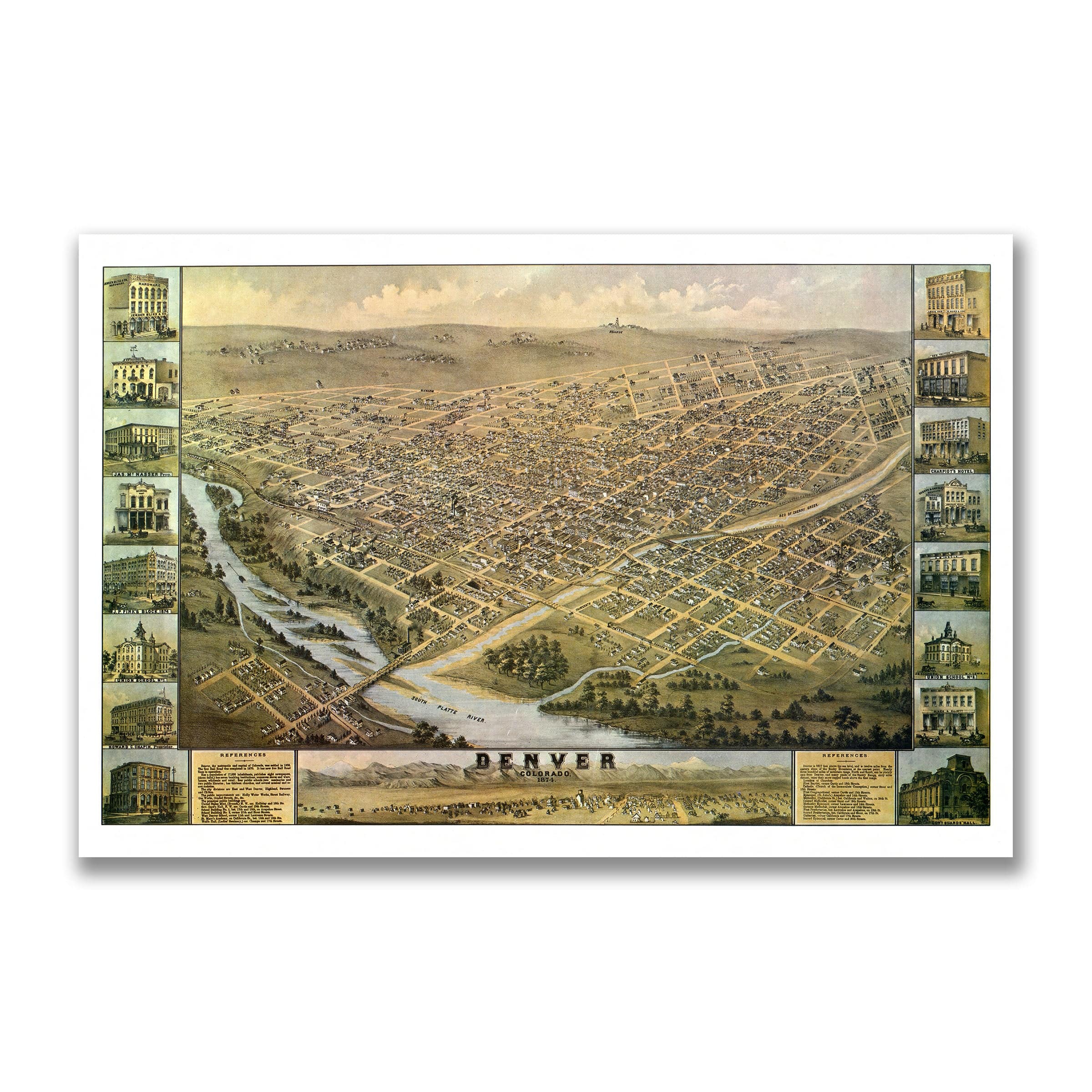
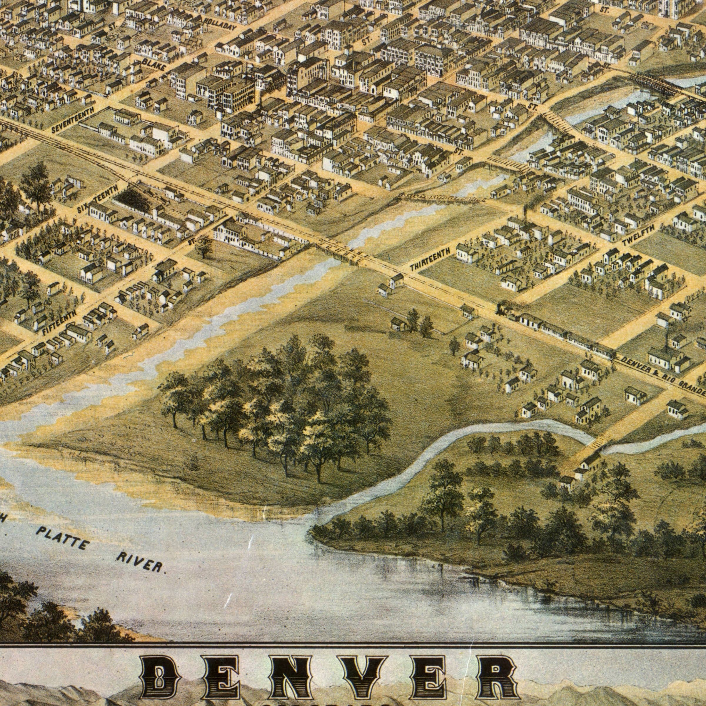
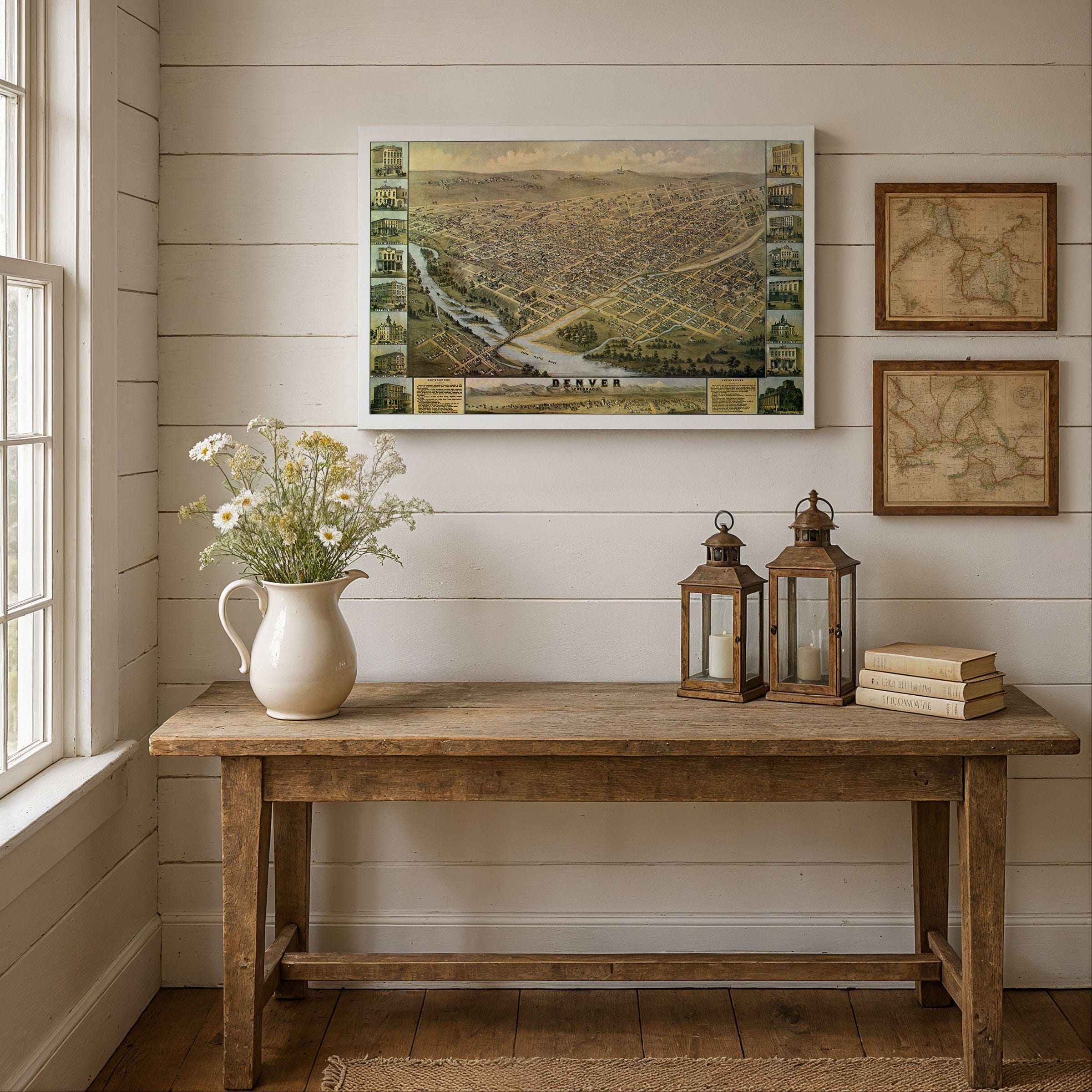
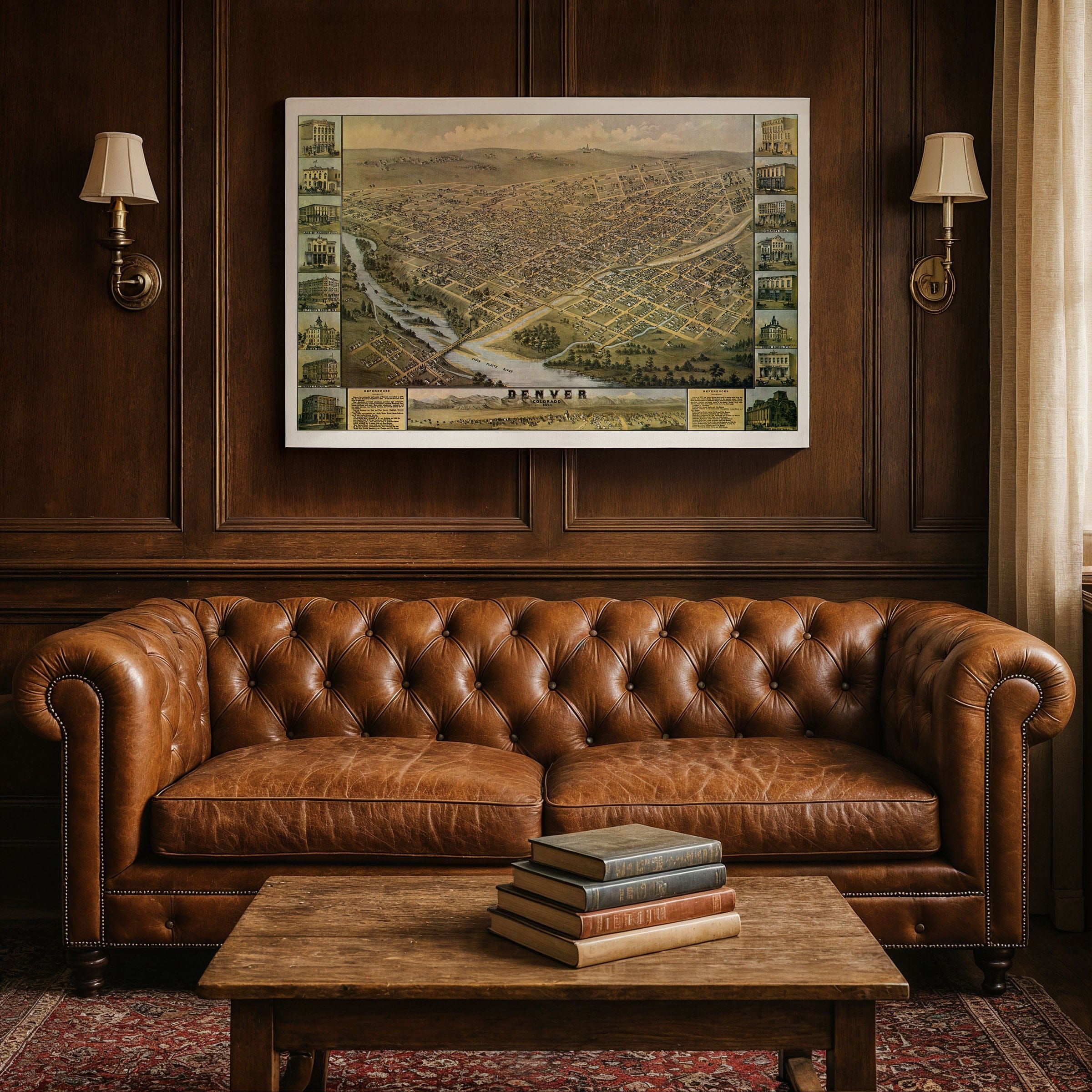
Step back to 1874 when this Denver Colorado Map captured the Mile High City at a pivotal moment in its transformation from frontier outpost to thriving metropolis. This isn't just geography—it's a portrait of ambition rising from the plains, published by H. H. Bailey & Co. when Denver was no longer the rough mining camp of its beginnings but a city coming into its own. The South Platte River winds through the valley at the bottom of the map, its course lined with mills, wagon roads, and railroad tracks—the lifelines that connected Denver to the distant cities of the East. Bridges span the water where horses and freight wagons cross daily, carrying supplies to the booming commercial blocks downtown. Above it all, the city grid fans out neatly across the plain, evidence of order and progress rising from the dust of the gold rush. The artist's eye captures a Denver poised between two eras. To the west, the hazy outline of the Front Range anchors the horizon—a reminder of the mining camps and silver claims that built the city's fortune. To the east, the open prairie stretches endlessly, symbolizing expansion and opportunity. In the center, new churches, hotels, and civic halls stand proudly beside modest homes and scattered trees, showing a young city still defining its skyline. Inset illustrations celebrate Denver's pride—its finest hotels, theaters, banks, and government buildings including the Tabor Block, the Court House, and the St. James Hotel appearing as monuments to prosperity and permanence. By 1874, Denver's population had climbed above 10,000, its streets alive with the sound of carriages, peddlers, and railroad whistles. Each reproduction includes a custom historical letter detailing the story behind the map, making it perfect for collectors, historians, and Colorado enthusiasts. Printed on heavyweight archival paper or hand-stretched polycotton canvas, every street, bridge, and building is restored in museum-grade clarity for generations of enjoyment. Paper prints ship rolled in heavy-duty tubes, while canvas editions arrive gallery-wrapped on solid pine stretcher bars with pre-installed hardware—ready to display the moment it arrives. Bring home a piece of Colorado's pioneering legacy and celebrate the Mile High City's remarkable transformation.
The Map Story
Materials
Choose options

Because every place has a story
Make History Personal
A vintage map is more than art.
It is a reminder of where life began.
Where memories were made.
Where hearts still live. Give the gift of place.
Beautifully preserved and made for the moments that matter.
Why Choose Us?
| Feature | Us | Competitor A | Competitor B |
|---|---|---|---|
| Hand Crafted | |||
| Museum Quality | |||
| 100 Year Guarantee | |||
| Restored by Hand | |||
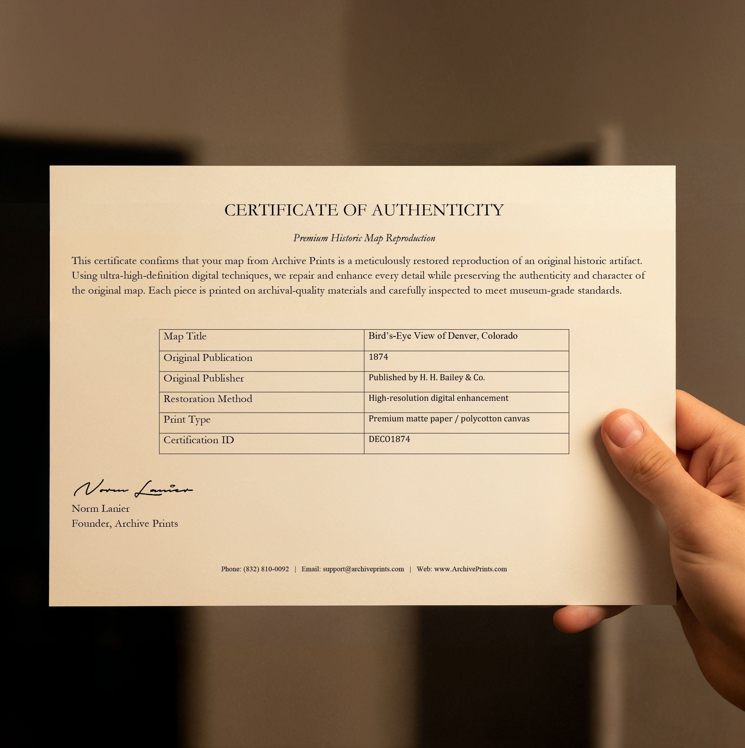
| Certificate of Authenticity |

Art Prints
Archival quality colors. Best option if you'd like to frame it yourself

The Best Materials
We hand-stretched our canvas on solid American-grown pine stretcher bars. We use quality canvas and fade-resistant inks to create the lasting art. Canvases come with hardware already installed and ready to hang.
Need help?
Frequently Asked Questions
Order
All of our maps are meticulously restored reproductions of historic originals. Each piece is digitally repaired and color-corrected to bring out the finest details while preserving its authentic, vintage character.
Yes. All Archive Prints products are printed to order in the USA with archival materials.
We offer two premium formats:
- High-Quality Paper Posters – Printed on thick, archival-grade matte paper for rich, vibrant detail.
- Hand-Stretched Canvas Prints – Printed on premium polycotton canvas and mounted on 1.5" solid American pine stretcher bars for a gallery-quality finish.
We carefully digitally restore each map to enhance clarity and color while preserving its original look and historic charm. You’ll enjoy sharp details and a timeless vintage aesthetic that feels true to the original piece.
Yes, we do! We offer premium framing options to make your map ready to hang the moment it arrives. You can choose from Oak, Maple, Black, or Walnut frames directly on the product page. We also offer Stretched Canvas prints for a modern gallery look, as well as archival-quality Posters if you prefer to frame it yourself.
Yes! We offer free shipping on all products within the United States. Each map is carefully packaged to ensure it arrives in perfect condition.
If you’re not completely satisfied, you can return your order in new condition for a full refund. Return shipping costs are the responsibility of the customer.
Absolutely! Our maps make thoughtful, one-of-a-kind gifts for history lovers, map collectors, or anyone looking to add vintage character to their home or office. Choose between paper prints for framing or stretched canvas for a ready-to-hang presentation.
- Paper Posters → Shipped in durable, protective tubes to prevent creasing.
- Canvas Prints → Carefully wrapped, padded, and boxed to ensure safe delivery.
Our maps look stunning in a variety of settings, including:
- Living rooms and home offices
- Libraries and studies
- Corporate offices and conference rooms
- Restaurants, cafes, and boutique spaces