Fayette County Texas Land Ownership Map 1879 - Historical Official Map
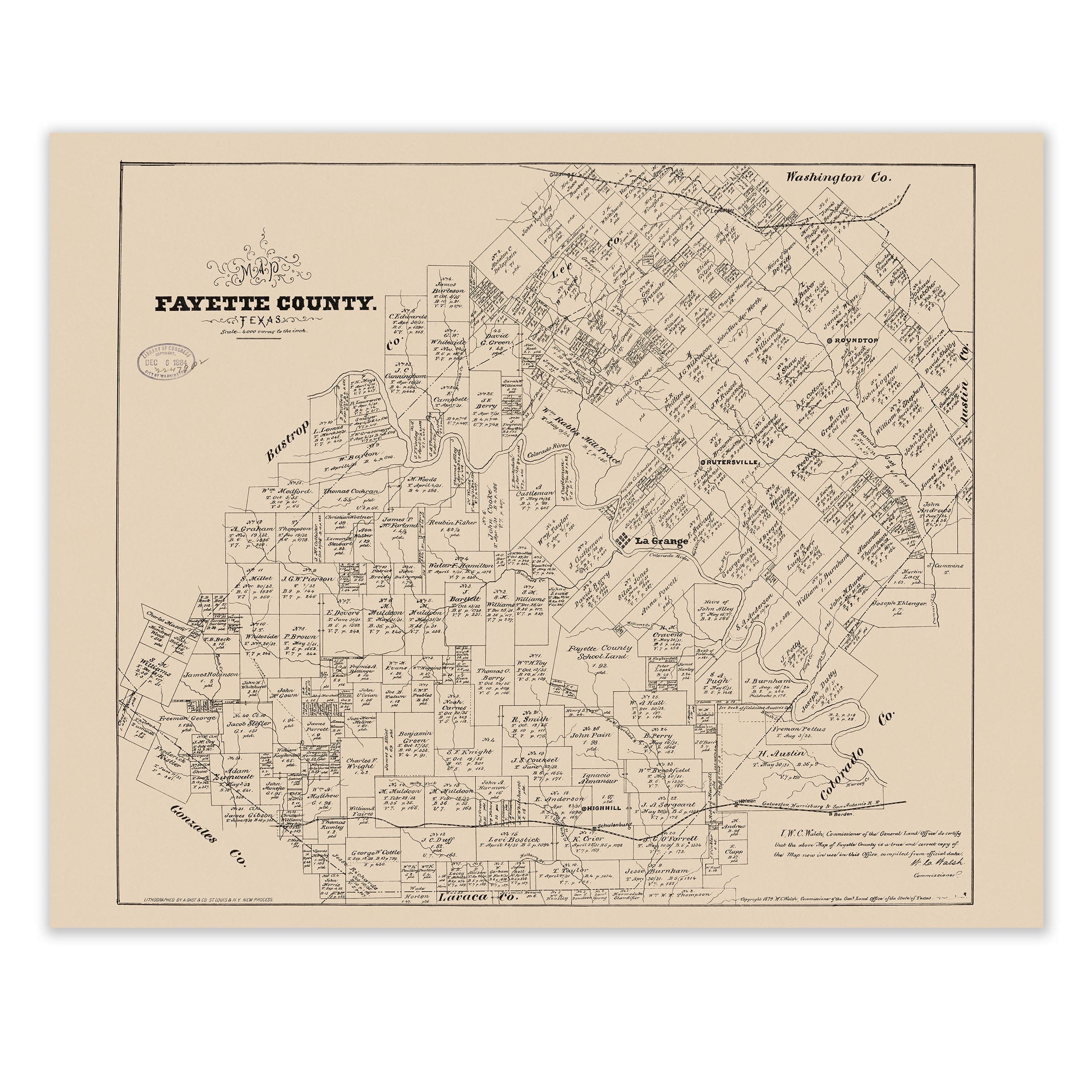
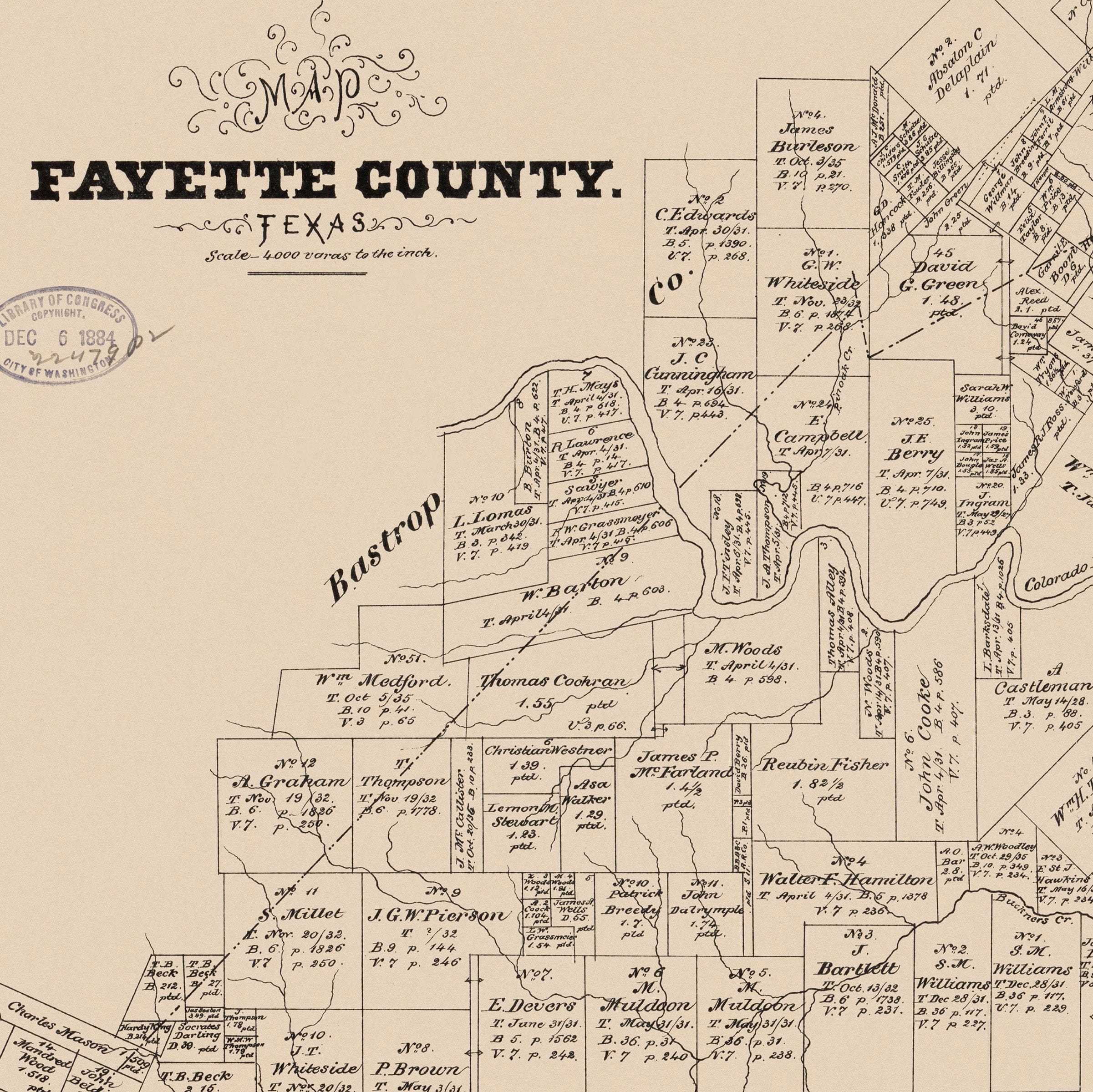
Step into the heart of 1879 Texas with this meticulously detailed land ownership map of Fayette County. Unlike fanciful bird's-eye views, this Official Map of Fayette County, Texas is a precise surveyor's document—a careful record of every parcel, road, creek, and claim that defined the county during the late 19th century.
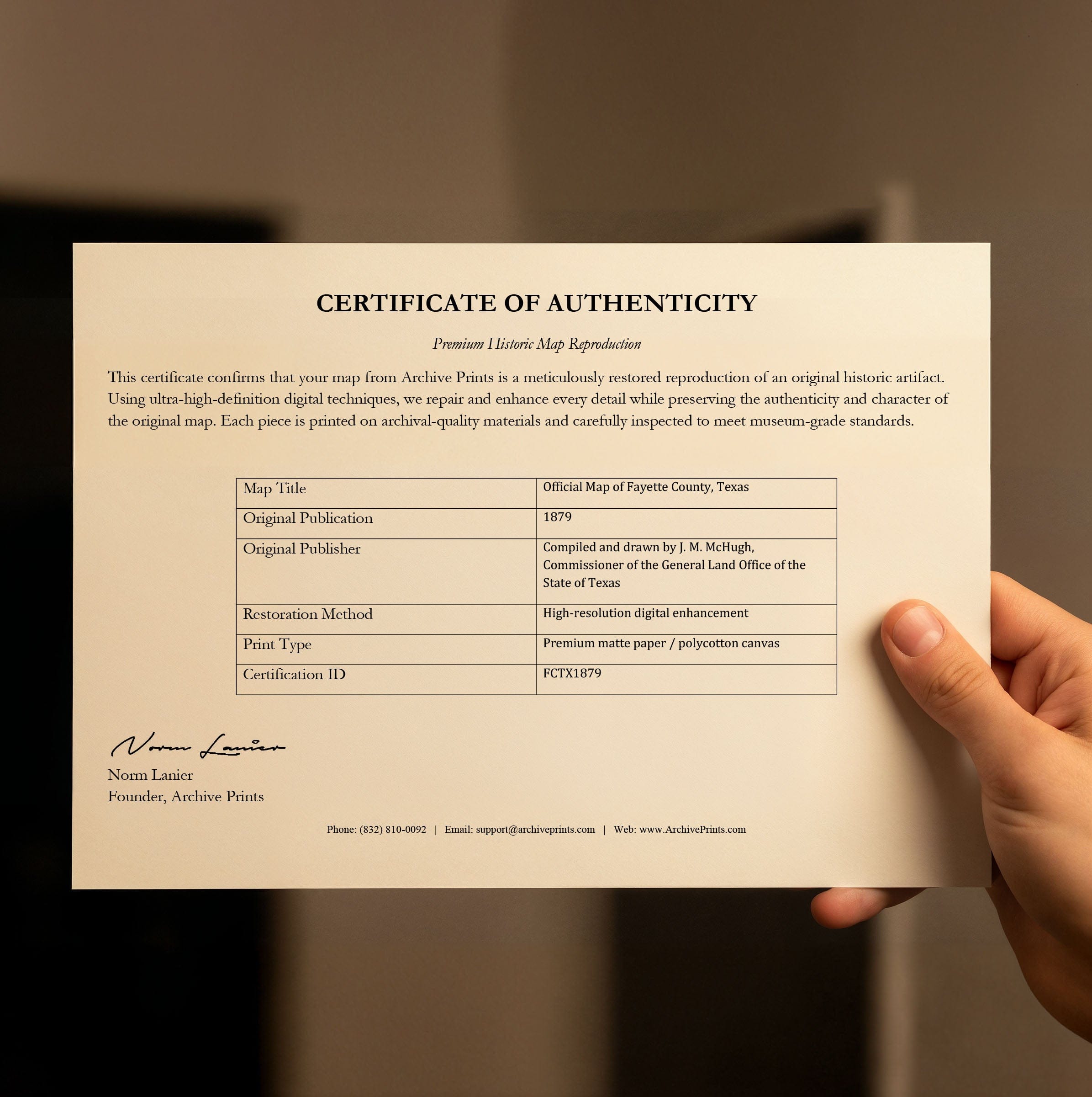
Compiled and drawn by J. M. McHugh, Commissioner of the General Land Office of the State of Texas, this map reads like a ledger of order and aspiration. Every lot is delimited, named, and measured with precision. The names of families who claimed the land, tended the fields, and built their futures are inscribed across the landscape. These boundaries represent more than property lines—they are declarations of permanence, stakes driven into the Texas soil by those who believed in the promise of the land.
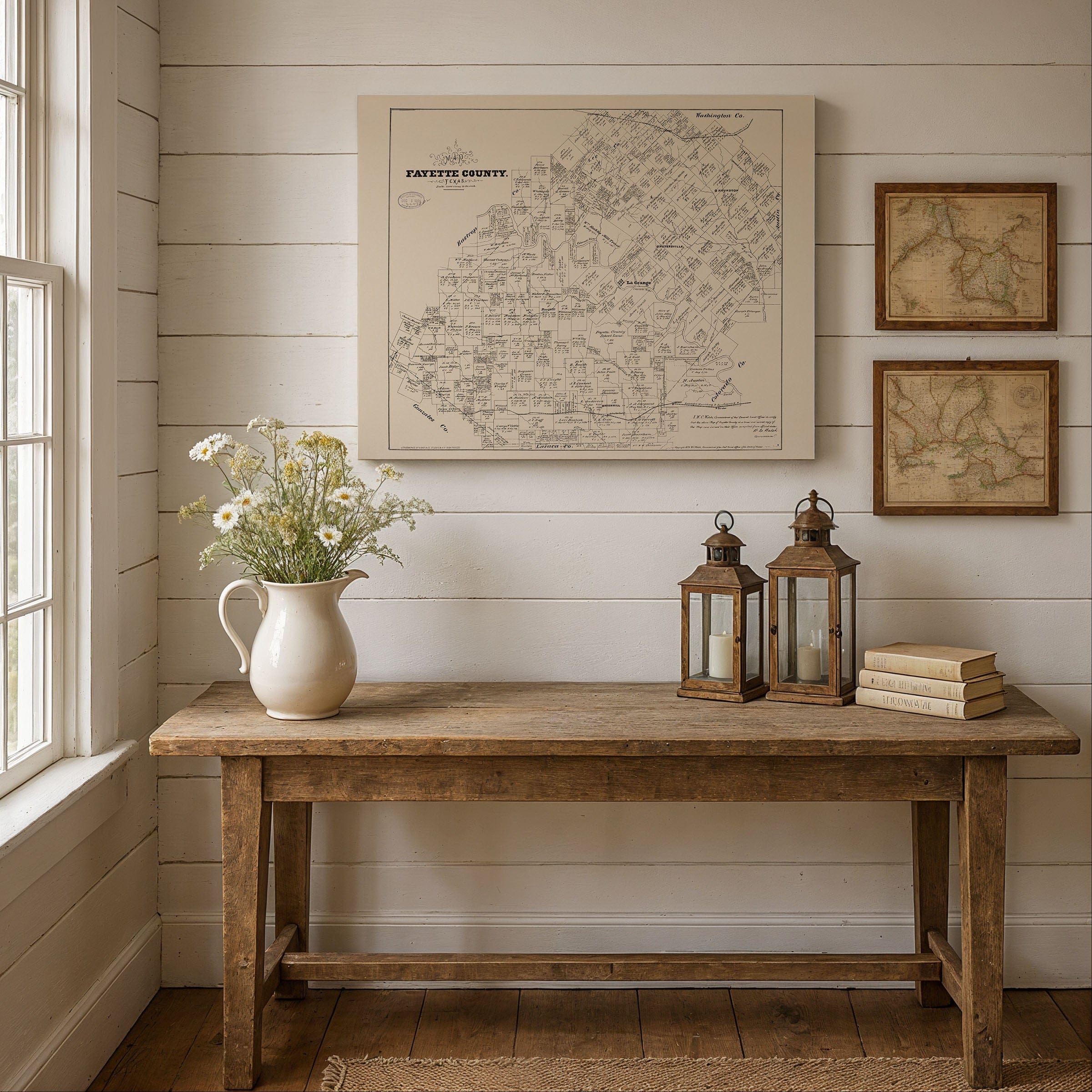
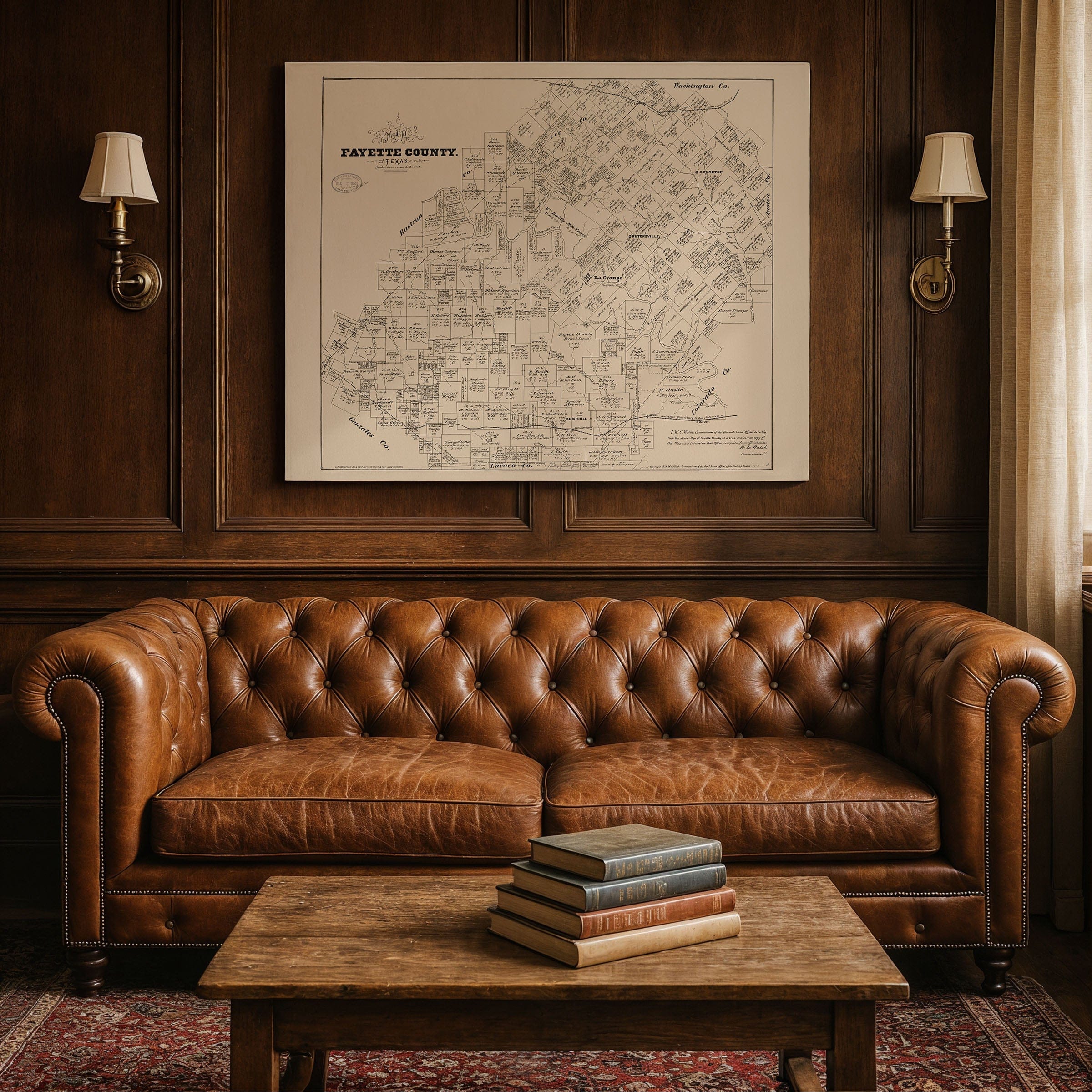
Rivers and creeks thread through the drawing like lifelines, shaping settlement patterns and determining which tracts would flourish. The Colorado River winds through the county, alongside smaller waterways that dictated where farms could thrive, where bridges were needed, and where towns would emerge. La Grange, the county seat, appears prominently, along with Fayetteville and smaller settlements connected by the web of roads that followed the natural contours of the landscape.
What's striking about this map is its emptiness—not the absence of detail, but the presence of possibility. Large sections remain open, lots drawn but not yet built upon. That blankness isn't failure; it's invitation. It suggests a county still in the process of becoming, with room for growth, migration, and new claims. The map captures Fayette County at a moment of transformation, when land was everything: possession, identity, and potential rolled into one.
Behind the orderly grid lies the reality of frontier life. Surveying techniques were rough, boundaries often uncertain, and success depended on factors the map couldn't show—flood risk, soil quality, access to markets. Yet the very existence of this document represents a triumph of organization over wilderness, of law over chaos. It's a snapshot of a community working to impose order on the vast Texas prairie.
Today, this 1879 map serves as a window into lineage and landscape. It preserves family names now faded, claims now transformed, roads now paved over or abandoned. For descendants of Fayette County settlers, it's a genealogical treasure. For history enthusiasts, it's a portrait of how Texas counties were carved from raw land into organized communities. For map lovers, it's a beautiful example of 19th-century cartographic precision.
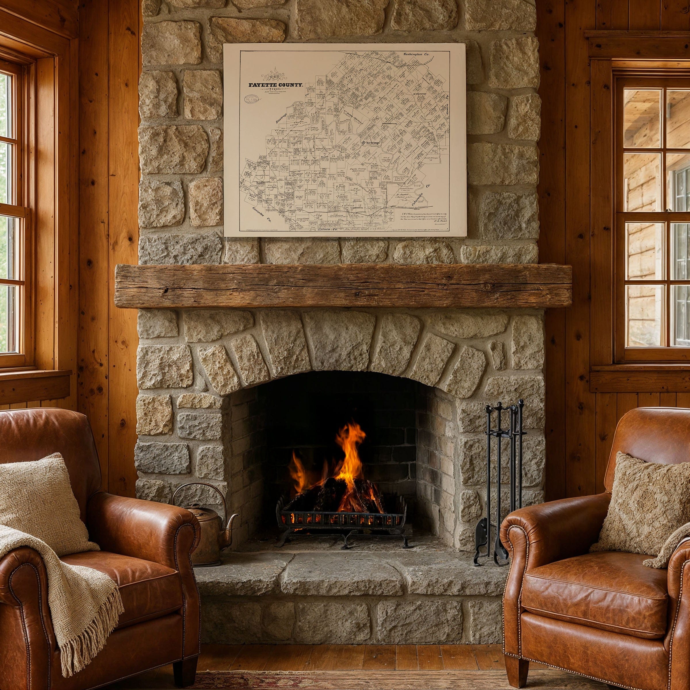
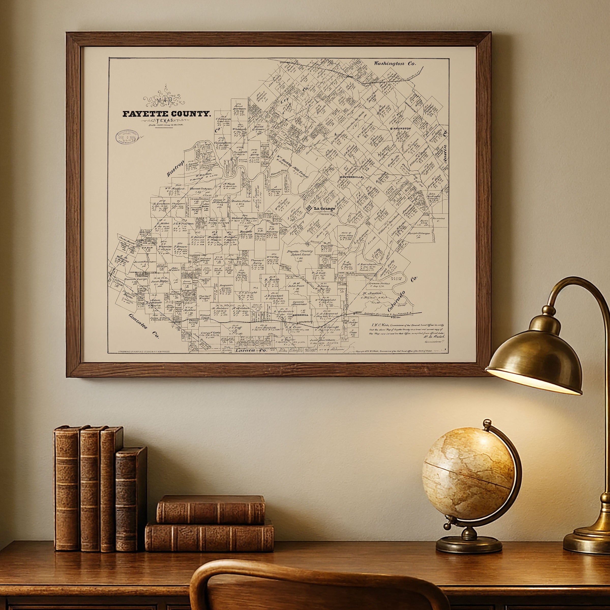
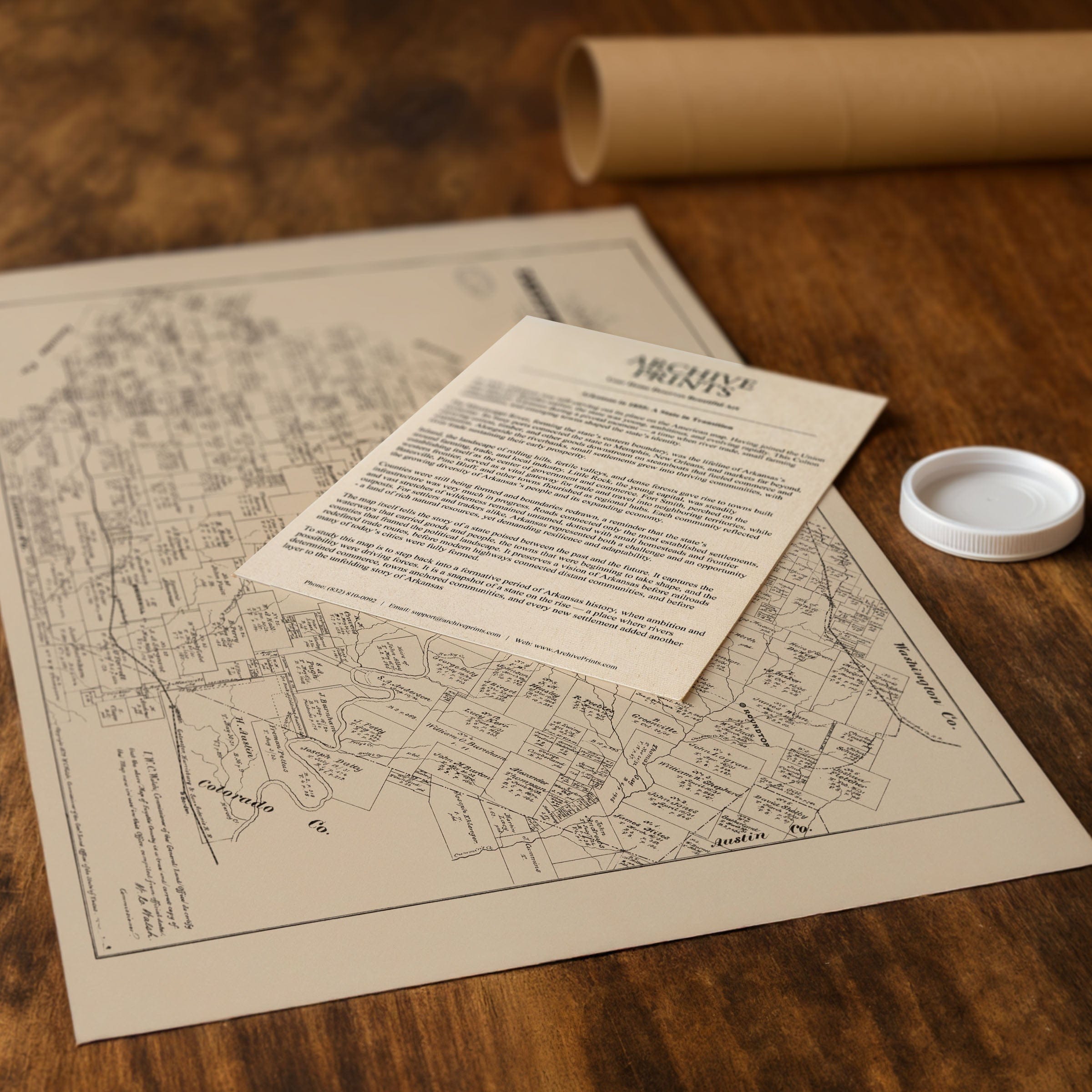
Each reproduction includes a custom historical letter detailing the story behind the map, making it perfect for Fayette County families, Texas history collectors, genealogy researchers, and anyone fascinated by land ownership and settlement patterns. Printed on heavyweight archival paper or hand-stretched polycotton canvas, every parcel line, family name, and creek is restored in museum-grade clarity for generations of study and appreciation.
Paper prints ship rolled in heavy-duty tubes, while canvas editions arrive gallery-wrapped on solid pine stretcher bars with pre-installed hardware—ready to display the moment it arrives. Bring home a piece of Fayette County heritage and celebrate the families who built Texas one claim at a time.
The Map Story
Materials
Choose options

Because every place has a story
Make History Personal
A vintage map is more than art.
It is a reminder of where life began.
Where memories were made.
Where hearts still live. Give the gift of place.
Beautifully preserved and made for the moments that matter.
Why Choose Us?
| Feature | Us | Competitor A | Competitor B |
|---|---|---|---|
| Hand Crafted | |||
| Museum Quality | |||
| 100 Year Guarantee | |||
| Restored by Hand | |||
| Certificate of Authenticity |

Art Prints
Archival quality colors. Best option if you'd like to frame it yourself

The Best Materials
We hand-stretched our canvas on solid American-grown pine stretcher bars. We use quality canvas and fade-resistant inks to create the lasting art. Canvases come with hardware already installed and ready to hang.
Need help?
Frequently Asked Questions
Order
All of our maps are meticulously restored reproductions of historic originals. Each piece is digitally repaired and color-corrected to bring out the finest details while preserving its authentic, vintage character.
Yes. All Archive Prints products are printed to order in the USA with archival materials.
We offer two premium formats:
- High-Quality Paper Posters – Printed on thick, archival-grade matte paper for rich, vibrant detail.
- Hand-Stretched Canvas Prints – Printed on premium polycotton canvas and mounted on 1.5" solid American pine stretcher bars for a gallery-quality finish.
We carefully digitally restore each map to enhance clarity and color while preserving its original look and historic charm. You’ll enjoy sharp details and a timeless vintage aesthetic that feels true to the original piece.
Yes, we do! We offer premium framing options to make your map ready to hang the moment it arrives. You can choose from Oak, Maple, Black, or Walnut frames directly on the product page. We also offer Stretched Canvas prints for a modern gallery look, as well as archival-quality Posters if you prefer to frame it yourself.
Yes! We offer free shipping on all products within the United States. Each map is carefully packaged to ensure it arrives in perfect condition.
If you’re not completely satisfied, you can return your order in new condition for a full refund. Return shipping costs are the responsibility of the customer.
Absolutely! Our maps make thoughtful, one-of-a-kind gifts for history lovers, map collectors, or anyone looking to add vintage character to their home or office. Choose between paper prints for framing or stretched canvas for a ready-to-hang presentation.
- Paper Posters → Shipped in durable, protective tubes to prevent creasing.
- Canvas Prints → Carefully wrapped, padded, and boxed to ensure safe delivery.
Our maps look stunning in a variety of settings, including:
- Living rooms and home offices
- Libraries and studies
- Corporate offices and conference rooms
- Restaurants, cafes, and boutique spaces