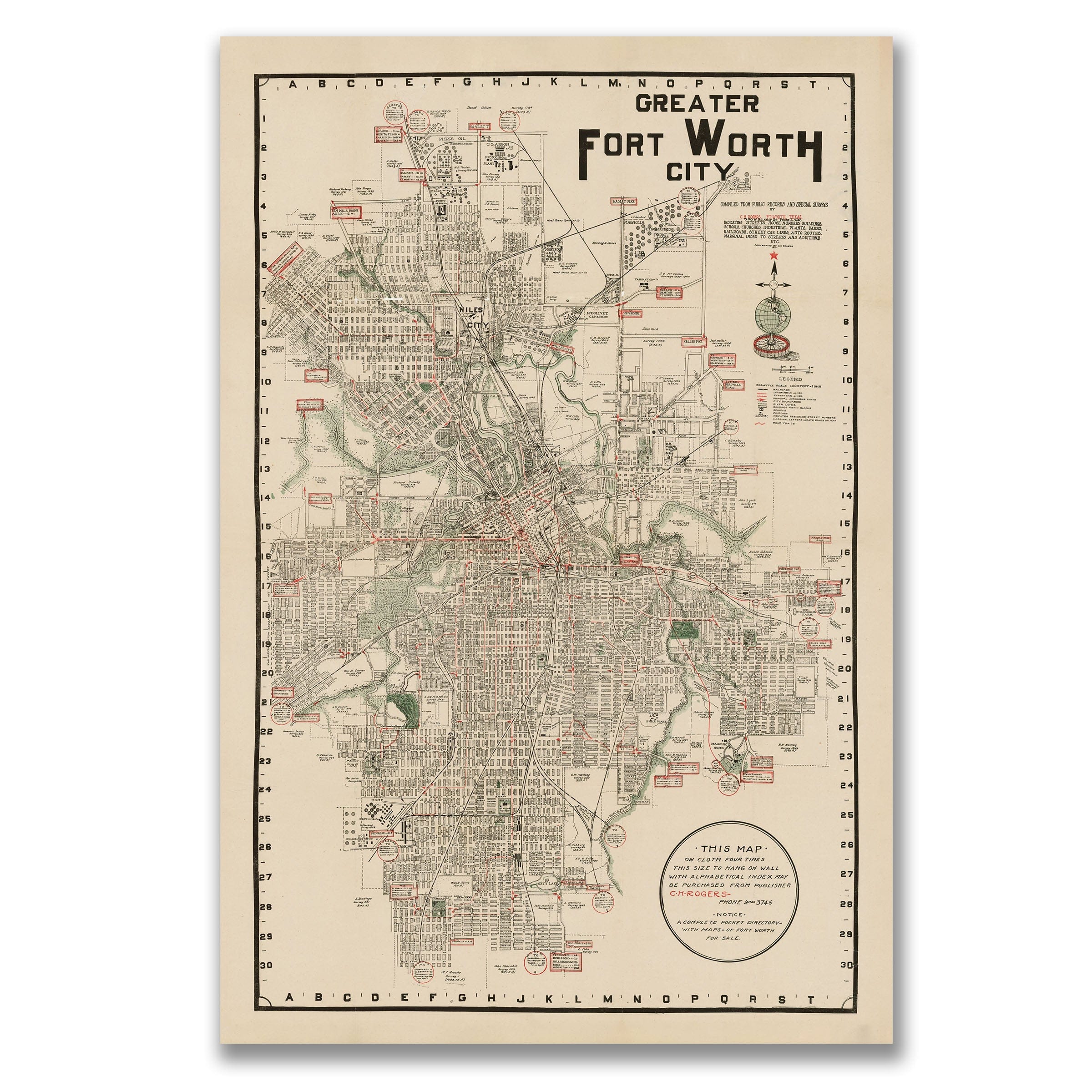
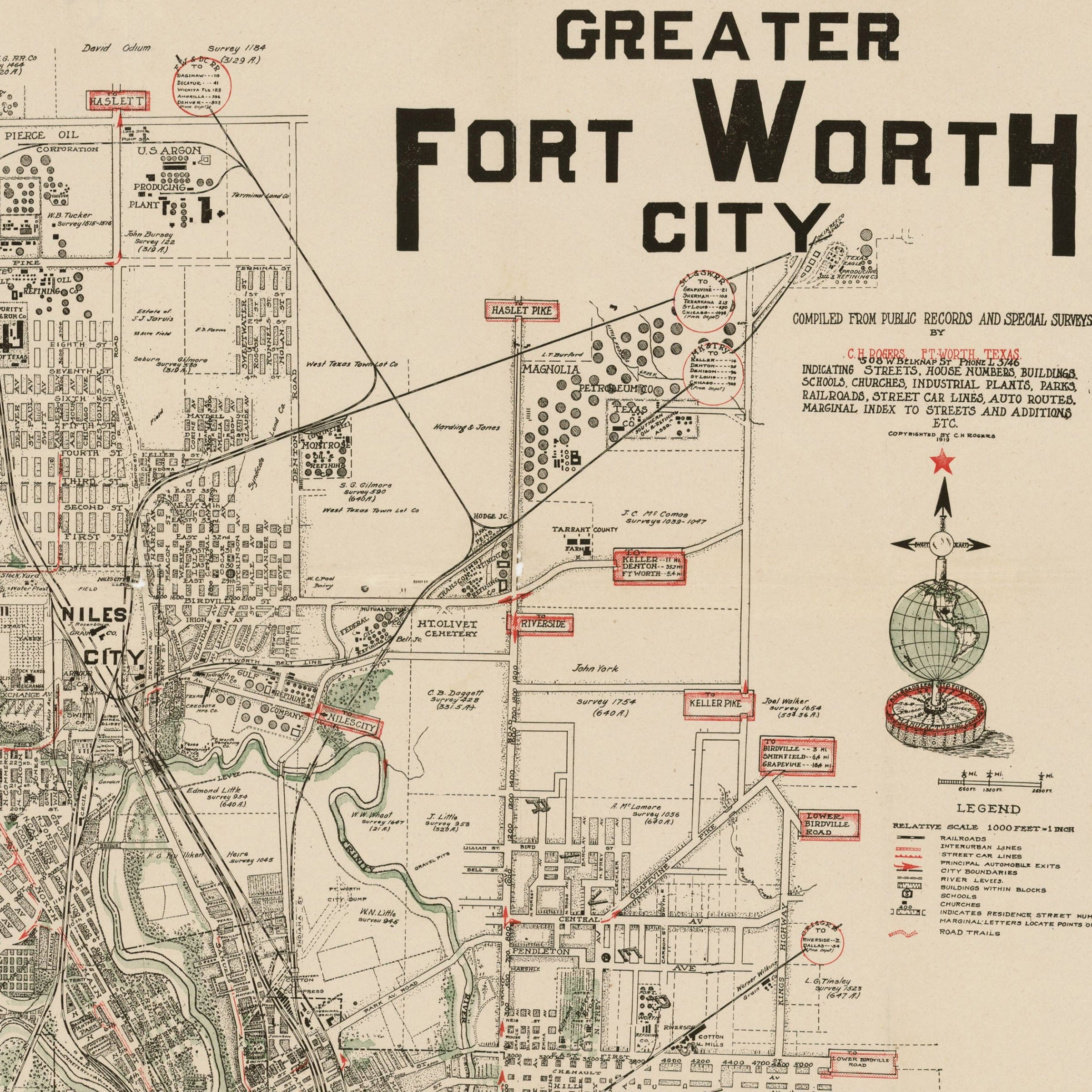
Fort Worth Texas Map - 1928 Greater Fort Worth City Historic Map
Fort Worth Texas Map
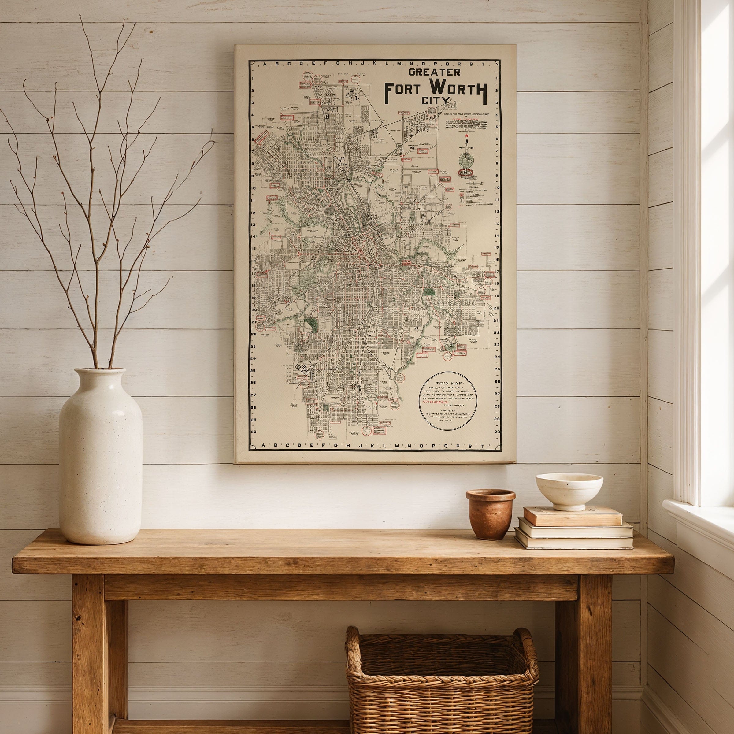
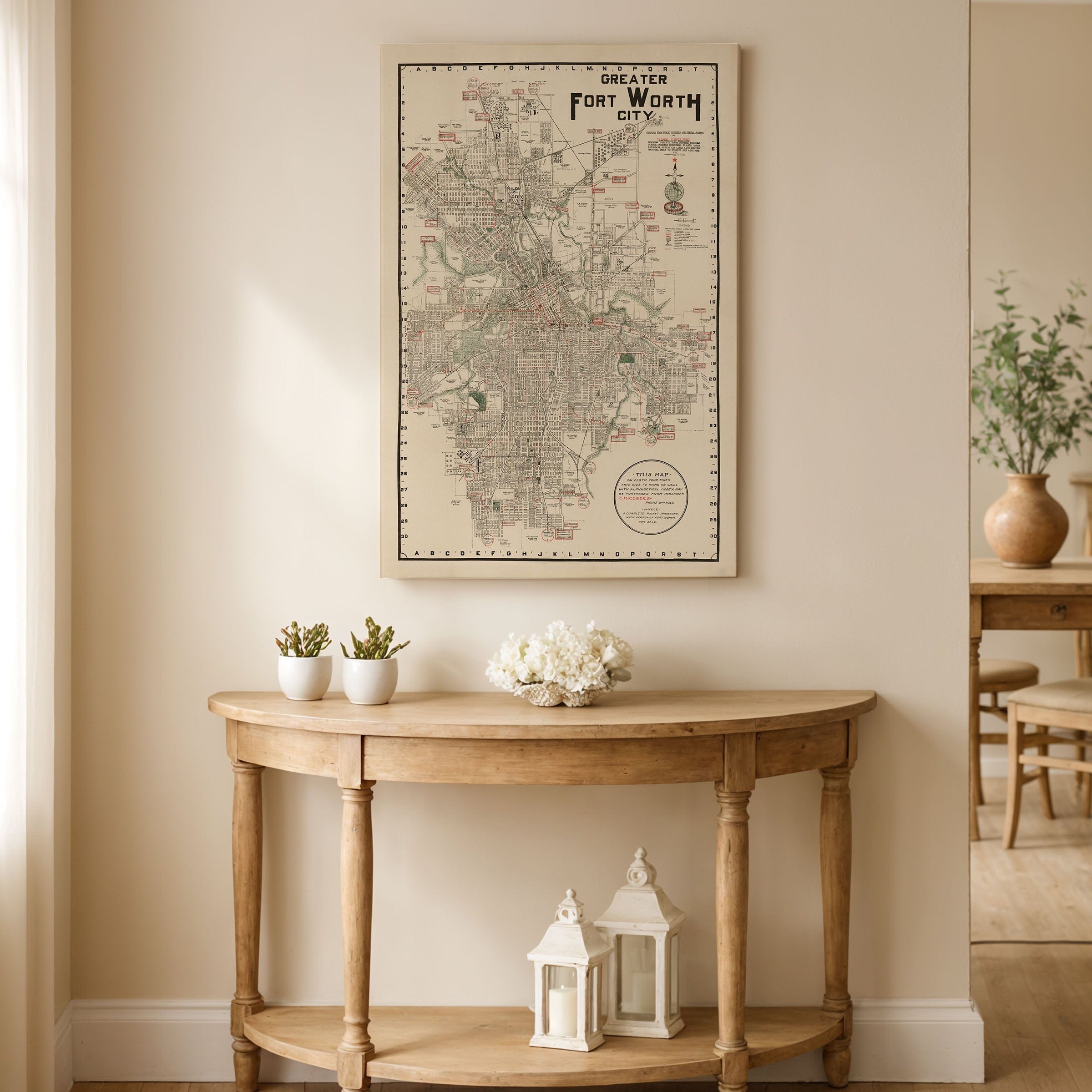
Step back to 1928 when this Fort Worth Texas Map captured the city at the crossroads of Texas ambition and American modernity. This isn't just geography—it's a portrait of transformation, published by C.H. Rogers when Fort Worth was shedding its frontier skin and embracing the new century's pace with confidence. Oil wealth from nearby fields fueled a skyline in motion, while the stockyards still roared with the grit that had earned the city its nickname—Cowtown. The rail lines that once brought cattle now carried automobiles, building materials, and people chasing opportunity. Camp Bowie and the remnants of World War I training grounds had evolved into new neighborhoods, and paved boulevards cut clean through what had once been prairie. Downtown, the rise of the W.T. Waggoner Building and the Blackstone Hotel announced a city eager to be counted among the nation's great urban centers. Yet Fort Worth's character remained proudly its own—independent, resilient, and rooted in the West. The Stockyards district, drawn clearly here, continued to define its soul. Longhorn drives had faded, but the rhythms of trade, ranching, and entertainment endured in the dance halls and warehouses along Exchange Avenue. By 1928, aviation had joined the rails as the new frontier of mobility. Meacham Field was open to passenger service, making Fort Worth one of the first Texas cities connected by air. Surrounding farmland gave way to subdivisions, a sign that the city's future would spread far beyond its historic heart. This map stands at the threshold between eras: Fort Worth still raw from its cattle-town past but ready to stake its place as a modern metropolis. Each reproduction includes a custom historical letter detailing the story behind the map, making it perfect for collectors, historians, and Texas enthusiasts. Printed on heavyweight archival paper or hand-stretched polycotton canvas, every street, rail line, and building is restored in museum-grade clarity for generations of enjoyment. Paper prints ship rolled in heavy-duty tubes, while canvas editions arrive gallery-wrapped on solid pine stretcher bars with pre-installed hardware—ready to display the moment it arrives. Bring home a piece of Texas history and celebrate the city that bridged the Old West and the modern age.
The Map Story
Materials
Choose options

Because every place has a story
Make History Personal
A vintage map is more than art.
It is a reminder of where life began.
Where memories were made.
Where hearts still live. Give the gift of place.
Beautifully preserved and made for the moments that matter.
Why Choose Us?
| Feature | Us | Competitor A | Competitor B |
|---|---|---|---|
| Hand Crafted | |||
| Museum Quality | |||
| 100 Year Guarantee | |||
| Restored by Hand | |||
| Certificate of Authenticity |

Art Prints
Archival quality colors. Best option if you'd like to frame it yourself

The Best Materials
We hand-stretched our canvas on solid American-grown pine stretcher bars. We use quality canvas and fade-resistant inks to create the lasting art. Canvases come with hardware already installed and ready to hang.
Need help?
Frequently Asked Questions
Order
All of our maps are meticulously restored reproductions of historic originals. Each piece is digitally repaired and color-corrected to bring out the finest details while preserving its authentic, vintage character.
Yes. All Archive Prints products are printed to order in the USA with archival materials.
We offer two premium formats:
- High-Quality Paper Posters – Printed on thick, archival-grade matte paper for rich, vibrant detail.
- Hand-Stretched Canvas Prints – Printed on premium polycotton canvas and mounted on 1.5" solid American pine stretcher bars for a gallery-quality finish.
We carefully digitally restore each map to enhance clarity and color while preserving its original look and historic charm. You’ll enjoy sharp details and a timeless vintage aesthetic that feels true to the original piece.
Yes, we do! We offer premium framing options to make your map ready to hang the moment it arrives. You can choose from Oak, Maple, Black, or Walnut frames directly on the product page. We also offer Stretched Canvas prints for a modern gallery look, as well as archival-quality Posters if you prefer to frame it yourself.
Yes! We offer free shipping on all products within the United States. Each map is carefully packaged to ensure it arrives in perfect condition.
If you’re not completely satisfied, you can return your order in new condition for a full refund. Return shipping costs are the responsibility of the customer.
Absolutely! Our maps make thoughtful, one-of-a-kind gifts for history lovers, map collectors, or anyone looking to add vintage character to their home or office. Choose between paper prints for framing or stretched canvas for a ready-to-hang presentation.
- Paper Posters → Shipped in durable, protective tubes to prevent creasing.
- Canvas Prints → Carefully wrapped, padded, and boxed to ensure safe delivery.
Our maps look stunning in a variety of settings, including:
- Living rooms and home offices
- Libraries and studies
- Corporate offices and conference rooms
- Restaurants, cafes, and boutique spaces