1856 Alabama Map - Restored Vintage State Map Wall Art
Alabama Map
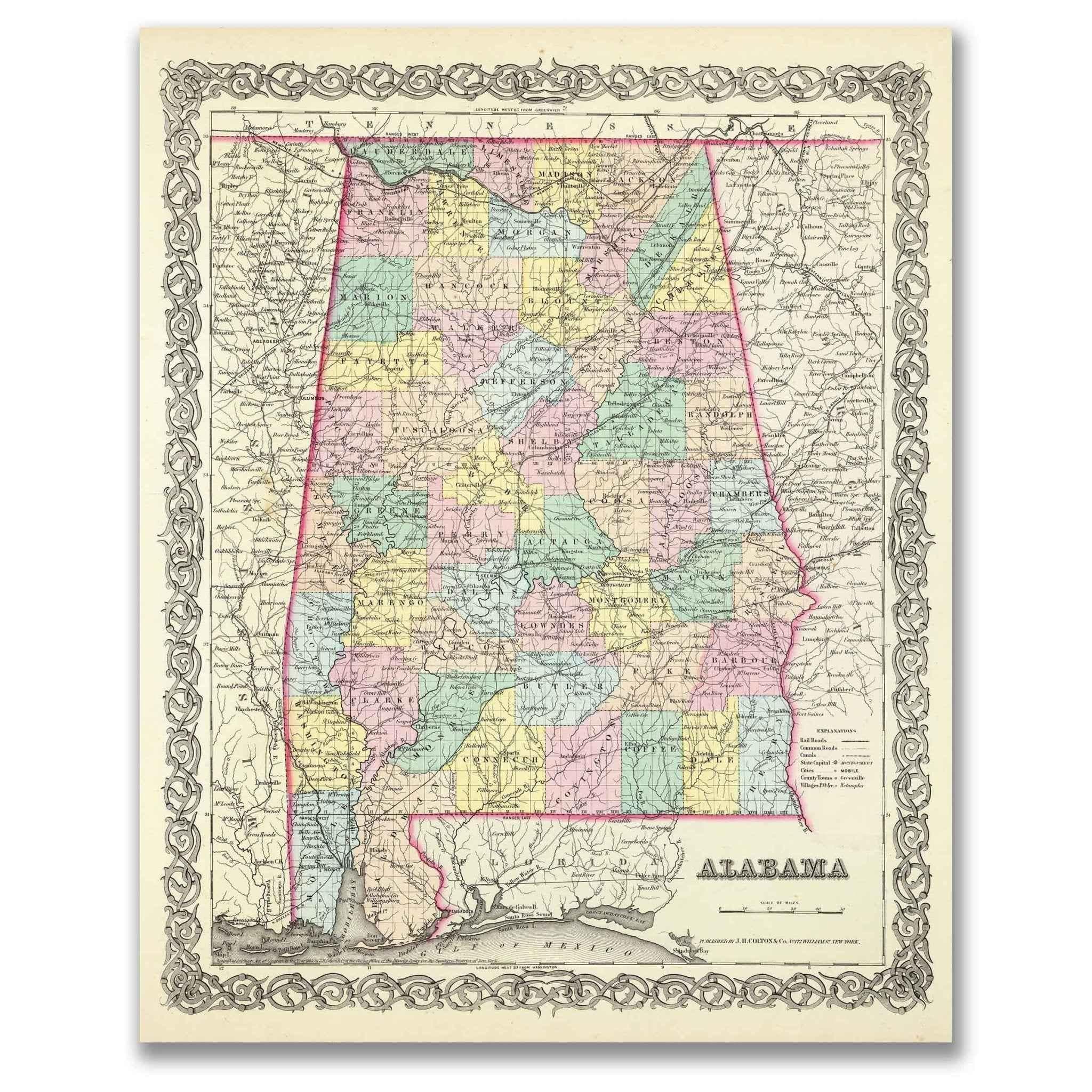
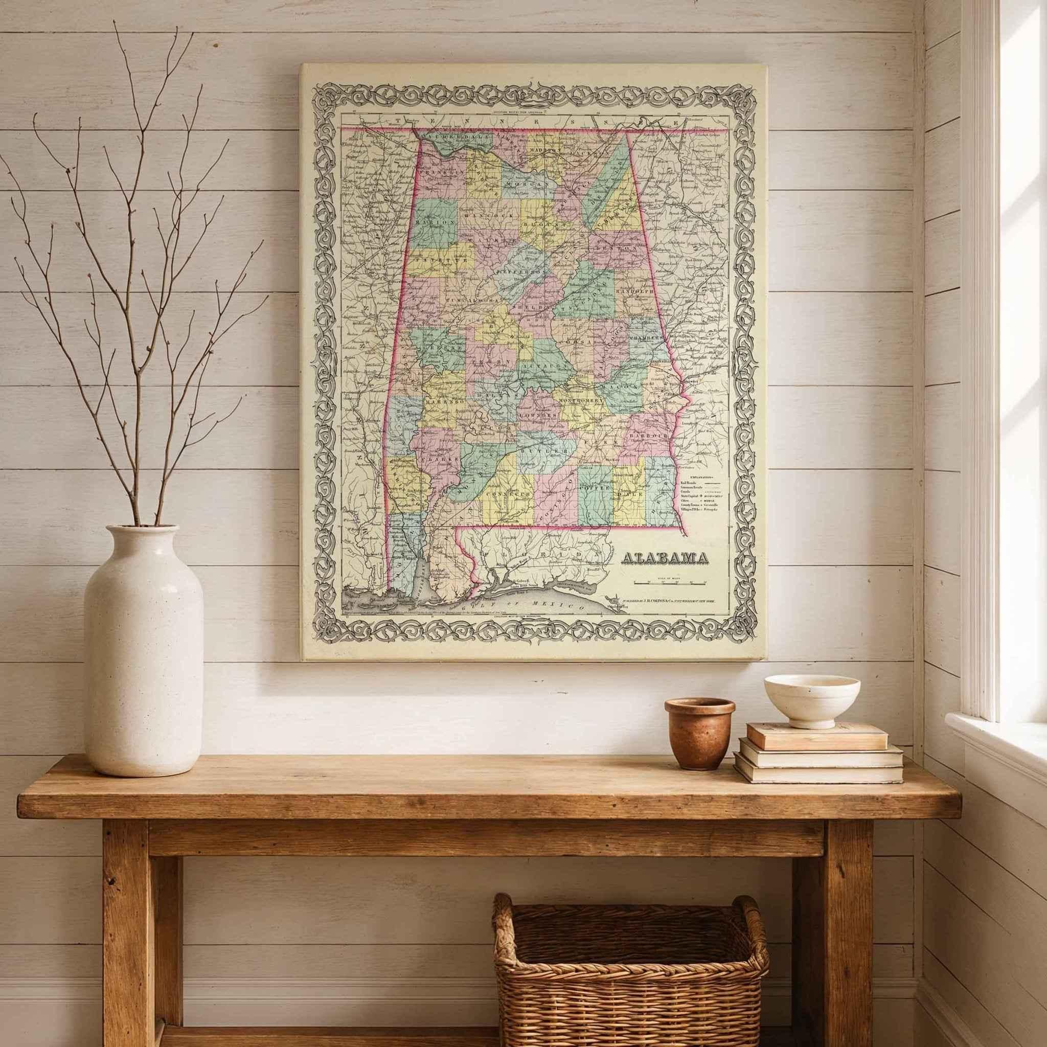
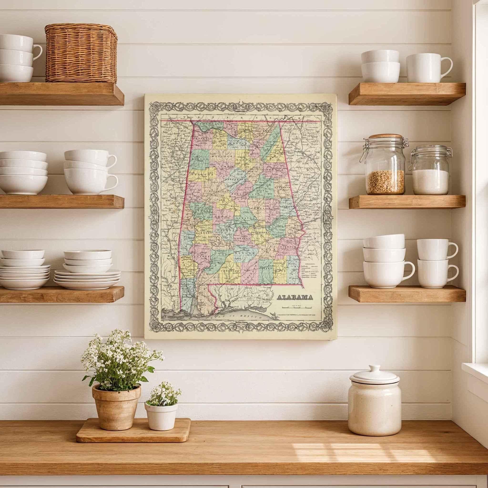
Step back into the mid-1800sAlabama map and experience Alabama as it once was with this beautifully restored 1856 Colton Map of Alabama. Originally published by J.H. Colton & Co., one of America’s most renowned cartographers, this detailed map offers a rare glimpse into the state’s early counties, river systems, and growing towns during a period of rapid change and expansion.
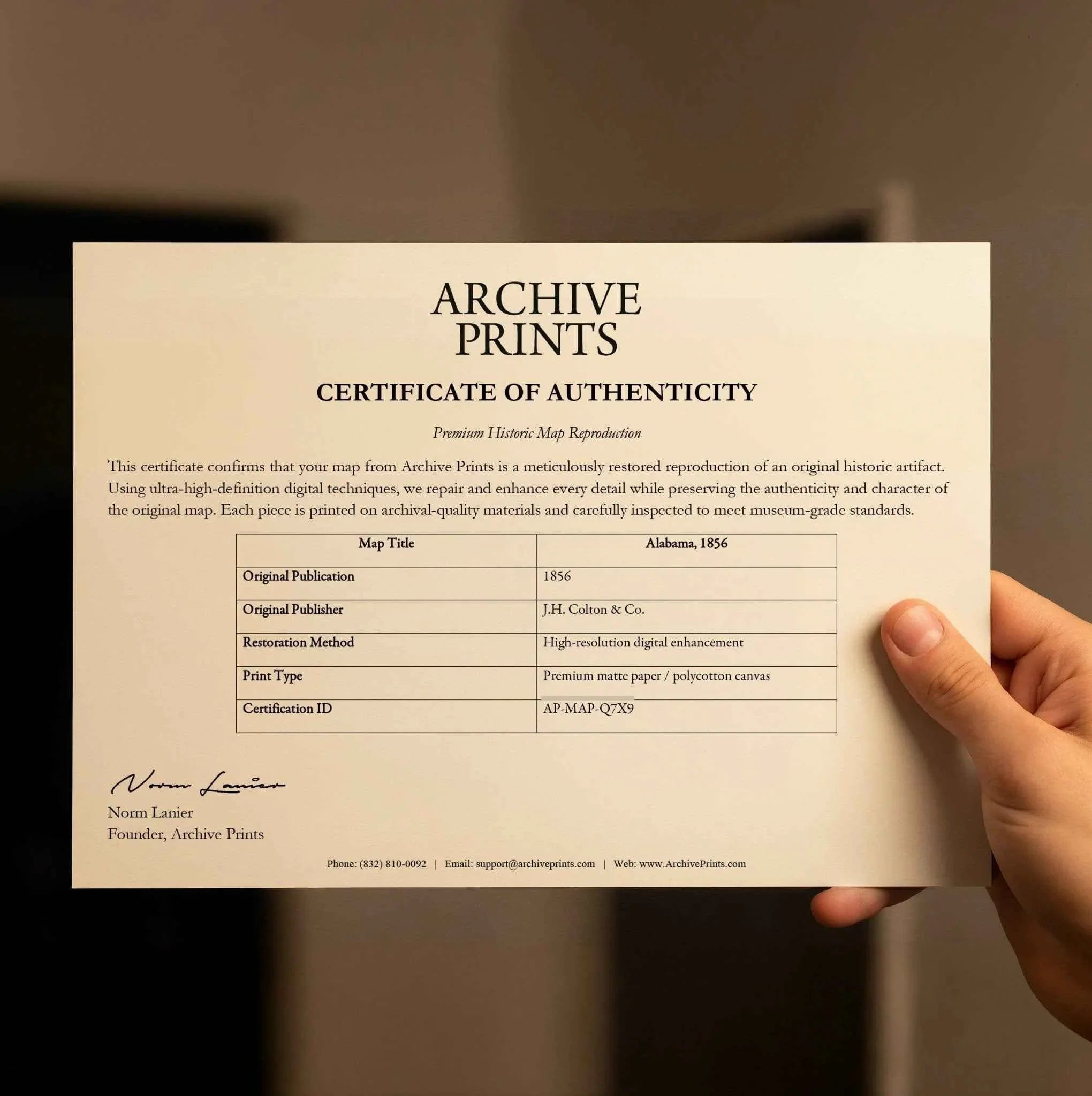
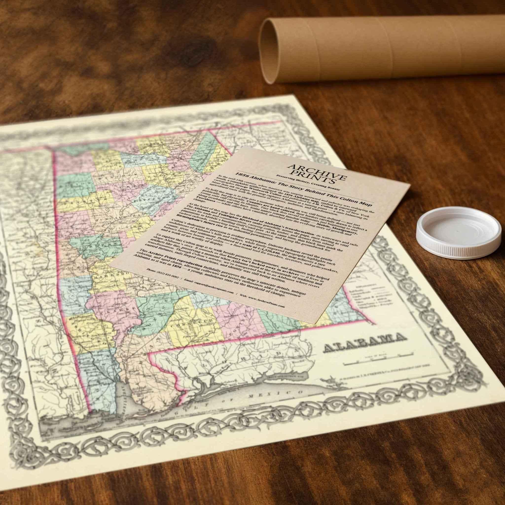
Each reproduction includes a custom historical letter telling the story behind the map, making it the perfect gift for collectors, history enthusiasts, and anyone who cherishes Alabama’s rich heritage. Printed on heavyweight archival paper or premium polycotton canvas, every line, label, and detail is preserved in ultra-high-definition clarity thanks to our meticulous digital restoration process.
To ensure your map arrives safely, paper prints are carefully rolled in a sturdy cardboard mailing tube, while canvases ship in reinforced boxes for maximum protection. From presentation to preservation, every detail is crafted with care.
Bring home more than wall art — bring home a story, a conversation piece, and a striking centerpiece that celebrates the enduring history of Alabama.
The Map Story
In the mid-19th century, when America was surging westward and industry was reshaping the South, a remarkable artifact emerged: the 1856 Alabama map, crafted by renowned cartographer George Woolworth Colton and published by J.H. Colton & Co. of New York. More than ink on paper, this map captures Alabama at a turning point — a state balancing its agricultural roots with the promise of progress, ambition, and transformation.
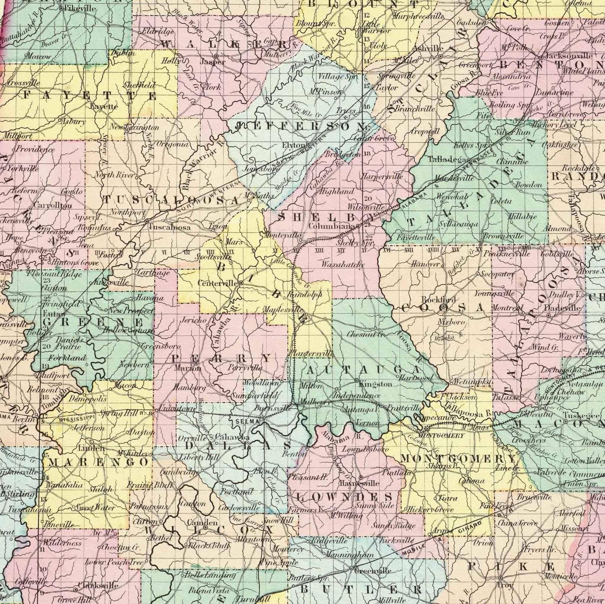
To hold this map is to step into a moment when Alabama was still being defined — not just politically, but physically. Counties are hand-colored, their borders carefully drawn to reflect a young state still carving its identity. Tiny black dots reveal settlements just beginning to rise along riverbanks and rail lines. Some names remain familiar today — Mobile, Montgomery, Tuscaloosa — while others have vanished, absorbed into the evolving story of growth and change.
At the heart of this map lies the lifeblood of Alabama’s transformation: its waterways and rails. The Alabama and Tombigbee Rivers snake gracefully across the page, once serving as vital arteries for trade and communication, carrying cotton, timber, and dreams from inland plantations to Mobile’s bustling Gulf Coast port. At the same time, thin black lines mark the earliest railroads, connecting towns, fueling commerce, and laying the groundwork for Birmingham’s future rise as an industrial powerhouse.
Colton’s dedication to precision is evident everywhere. Delicate hachures reveal the gentle undulations of Alabama’s hills and valleys, while finely engraved typography highlights each county, river, and settlement. Produced at a scale of 1:1,520,640, the map achieves a rare balance between beauty and utility — a functional tool for travelers, investors, and policymakers, and a work of art worthy of display.
To explore this Colton map is to walk beside pioneers, entrepreneurs, and dreamers who helped shape Alabama’s story. It reminds us that history isn’t locked away in archives — it lives in artifacts like this, preserving a moment when Alabama stood at the crossroads of tradition and transformation. Through Colton’s artistry, we’re transported back to an Alabama where rivers carried fortunes, rails forged connections, and identity was still being written.
This Archive Prints reproduction faithfully preserves the map’s intricate details, antique coloring, and aged charm, allowing collectors and history enthusiasts alike to experience Alabama as it was in 1856 — a young, ambitious state on the threshold of change.
Materials
Hand‑Stretched Canvas: If you choose canvas, we use a premium cotton‑poly blend stretched over solid pine frames. Each canvas is carefully hand‑stretched for a tight, gallery‑quality finish that’s ready to hang right out of the box.
Vivid, Fade‑Resistant Inks: We use professional‑grade inks that are UV‑resistant, so your print retains its rich colors even when displayed in bright rooms.
Expert Restoration: Every map is digitally restored by skilled artisans. We preserve the character of the original while enhancing clarity, so you see the map as it was meant to be seen.
Secure Packaging: Paper prints are rolled in heavy‑duty mailing tubes, and canvases are cushioned in reinforced boxes to ensure they arrive in pristine condition.
Choosing one of our prints means investing in craftsmanship. We combine historical authenticity with modern print technology and premium materials, giving you a work of art built to stand the test of time.
Choose options

Because every place has a story
Make History Personal
A vintage map is more than art.
It is a reminder of where life began.
Where memories were made.
Where hearts still live. Give the gift of place.
Beautifully preserved and made for the moments that matter.
Why Choose Us?
| Feature | Us | Competitor A | Competitor B |
|---|---|---|---|
| Hand Crafted | |||
| Museum Quality | |||
| 100 Year Guarantee | |||
| Restored by Hand | |||
| Certificate of Authenticity |

Art Prints
Archival quality colors. Best option if you'd like to frame it yourself

The Best Materials
We hand-stretched our canvas on solid American-grown pine stretcher bars. We use quality canvas and fade-resistant inks to create the lasting art. Canvases come with hardware already installed and ready to hang.
Need help?
Frequently Asked Questions
Order
All of our maps are meticulously restored reproductions of historic originals. Each piece is digitally repaired and color-corrected to bring out the finest details while preserving its authentic, vintage character.
Yes. All Archive Prints products are printed to order in the USA with archival materials.
We offer two premium formats:
- High-Quality Paper Posters – Printed on thick, archival-grade matte paper for rich, vibrant detail.
- Hand-Stretched Canvas Prints – Printed on premium polycotton canvas and mounted on 1.5" solid American pine stretcher bars for a gallery-quality finish.
We carefully digitally restore each map to enhance clarity and color while preserving its original look and historic charm. You’ll enjoy sharp details and a timeless vintage aesthetic that feels true to the original piece.
Yes, we do! We offer premium framing options to make your map ready to hang the moment it arrives. You can choose from Oak, Maple, Black, or Walnut frames directly on the product page. We also offer Stretched Canvas prints for a modern gallery look, as well as archival-quality Posters if you prefer to frame it yourself.
Yes! We offer free shipping on all products within the United States. Each map is carefully packaged to ensure it arrives in perfect condition.
If you’re not completely satisfied, you can return your order in new condition for a full refund. Return shipping costs are the responsibility of the customer.
Absolutely! Our maps make thoughtful, one-of-a-kind gifts for history lovers, map collectors, or anyone looking to add vintage character to their home or office. Choose between paper prints for framing or stretched canvas for a ready-to-hang presentation.
- Paper Posters → Shipped in durable, protective tubes to prevent creasing.
- Canvas Prints → Carefully wrapped, padded, and boxed to ensure safe delivery.
Our maps look stunning in a variety of settings, including:
- Living rooms and home offices
- Libraries and studies
- Corporate offices and conference rooms
- Restaurants, cafes, and boutique spaces