Houston Heights Map - 1896 Historic Map of Houston Heights, Texas
Houston Heights Map
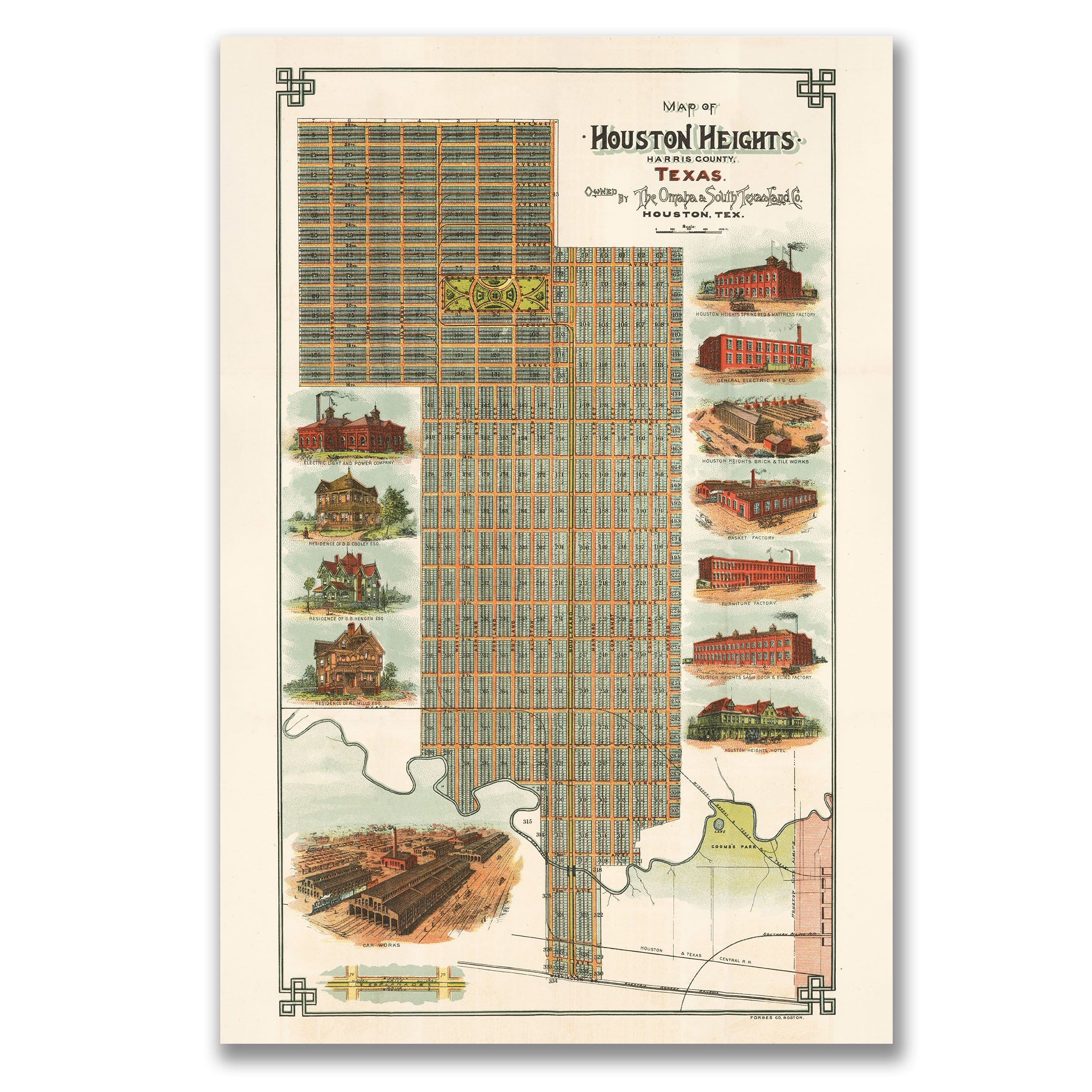
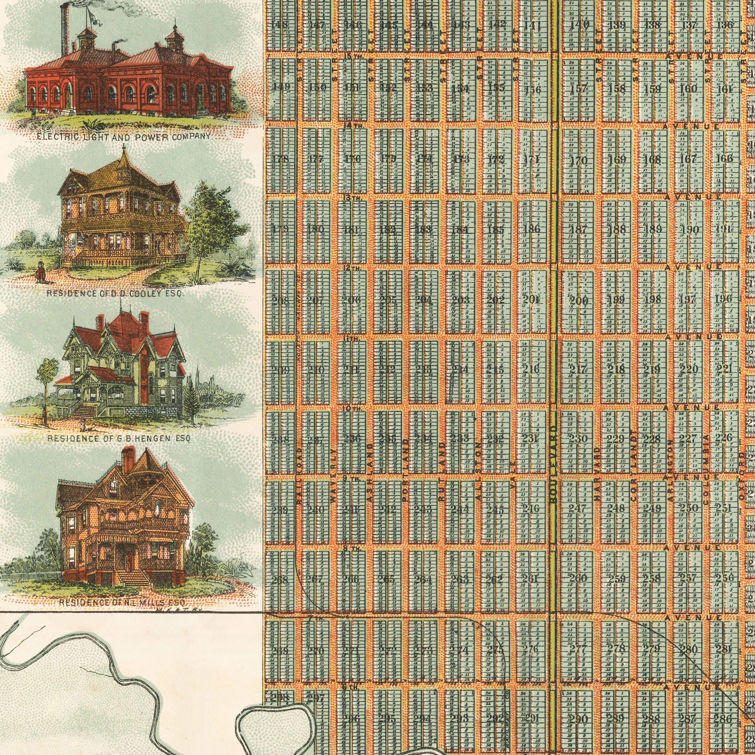
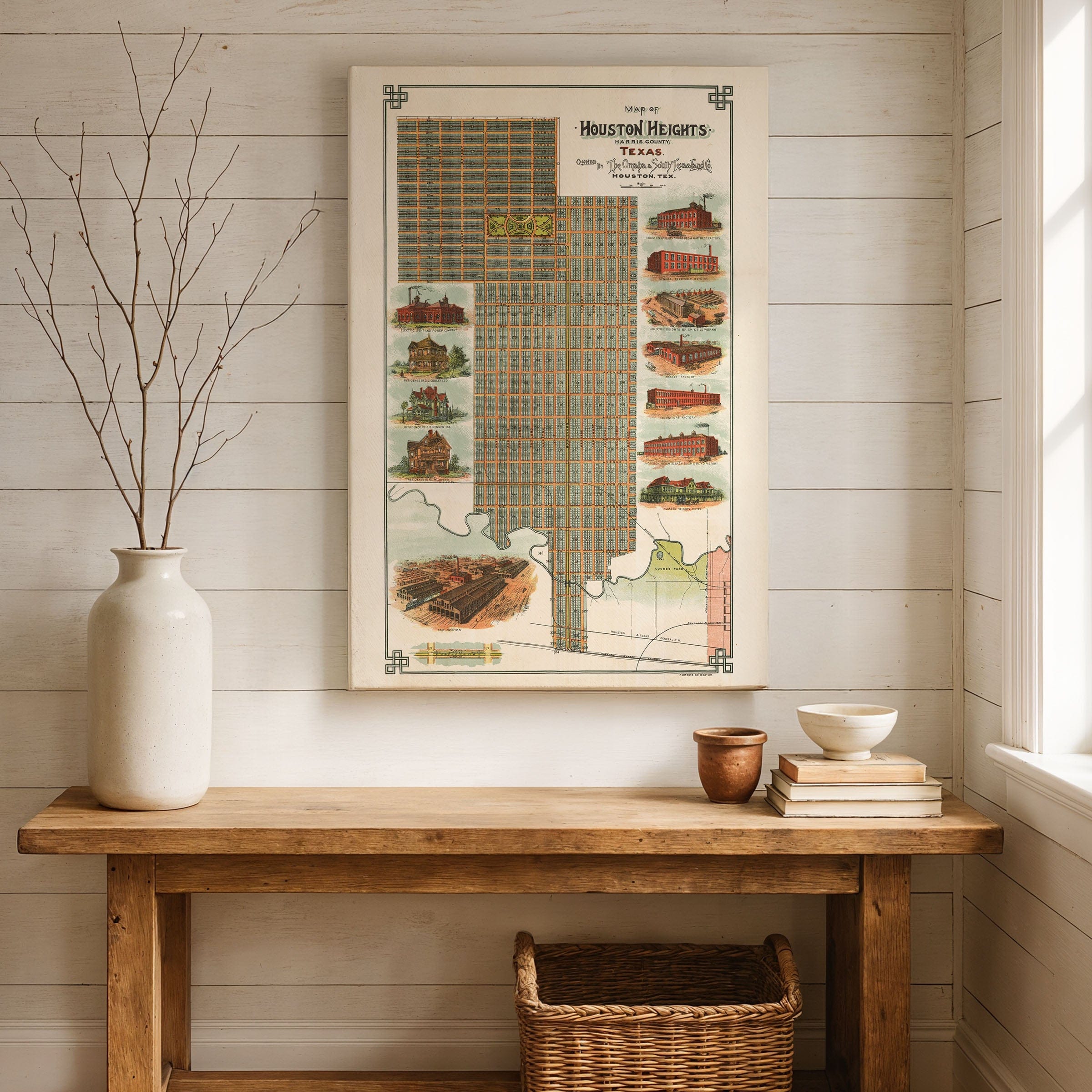
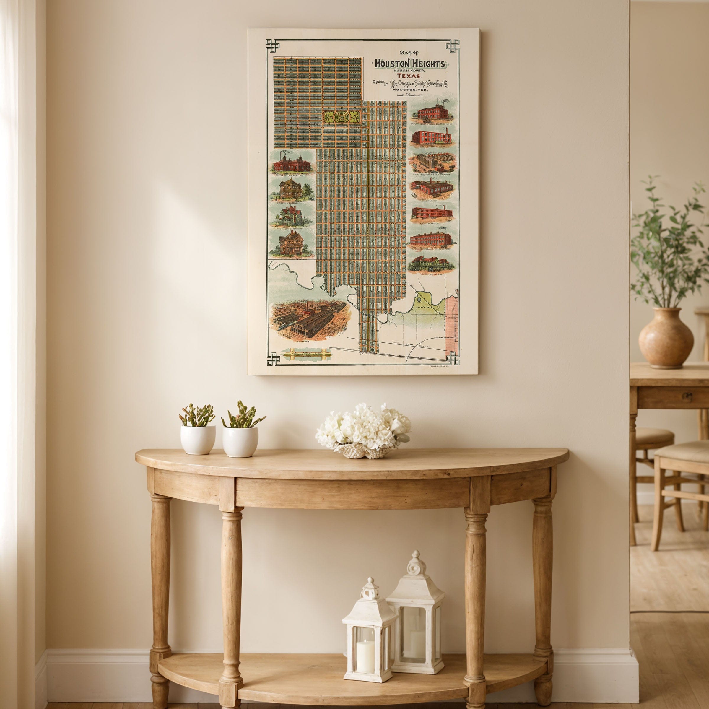
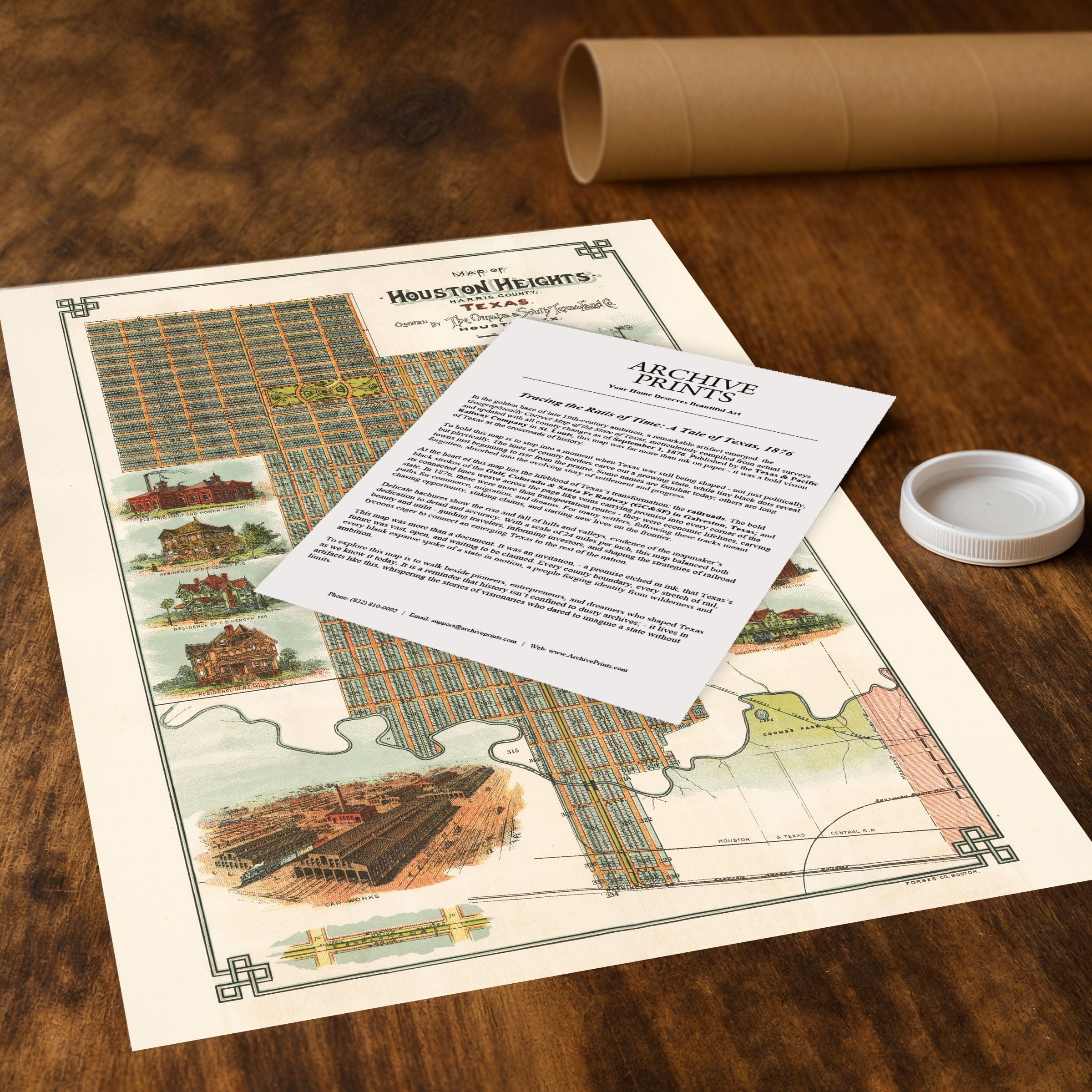
Step back to 1896 when this Houston Heights Map captured one of America's earliest planned suburban communities. This isn't just a city plan—it's a marketing vision that showcases the optimism and order of the great suburban experiment at the turn of the century. Published by The Omaha and South Texas Land Company, this beautifully illustrated map reveals Houston Heights as it was designed: a self-contained suburb for middle- and upper-class families seeking clean air, tree-lined streets, and modern conveniences away from the industrial bustle of downtown Houston. The map showcases the community's precise grid layout, accented by the grand Heights Boulevard Esplanade, which served as its verdant spine and social heart. Around the edges, vivid lithographic illustrations feature the neighborhood's hallmarks: the Electric Light and Power Company, which provided residents with one of Texas's first electrified suburbs; the Houston Heights Brick & Tile Works and Sash Door & Blind Factory, evidence of thriving local industry; and stately residences such as those of Dr. B. A. Coady and Dr. B. R. McAshan, representing the prosperity of early inhabitants. Houston Heights was envisioned as a place where urban convenience met pastoral living. With electric streetcars linking it to Houston's downtown, wide avenues, and access to schools, churches, and parks, it embodied the ideals of late 19th-century city planning—community, health, and progress. Even the inclusion of Coombs Park at the southern edge reflects a vision of leisure and civic pride that was ahead of its time. This map is not merely a survey—it's a statement of aspiration. The fine detail, decorative borders, and glowing depictions of industry and homesteads speak to a moment when Houston Heights was marketed as the model of Southern modernity. Each reproduction includes a custom historical letter detailing the story behind the map, making it perfect for collectors, historians, and Texas enthusiasts. Printed on heavyweight archival paper or hand-stretched polycotton canvas, every street, building, and illustrated detail is restored in museum-grade clarity for generations of enjoyment. Paper prints ship rolled in heavy-duty tubes, while canvas editions arrive gallery-wrapped on solid pine stretcher bars with pre-installed hardware—ready to display the moment it arrives. Bring home a piece of Houston history and celebrate the neighborhood that pioneered suburban living in Texas.
The Map Story
Materials
Choose options

Because every place has a story
Make History Personal
A vintage map is more than art.
It is a reminder of where life began.
Where memories were made.
Where hearts still live. Give the gift of place.
Beautifully preserved and made for the moments that matter.
Why Choose Us?
| Feature | Us | Competitor A | Competitor B |
|---|---|---|---|
| Hand Crafted | |||
| Museum Quality | |||
| 100 Year Guarantee | |||
| Restored by Hand | |||
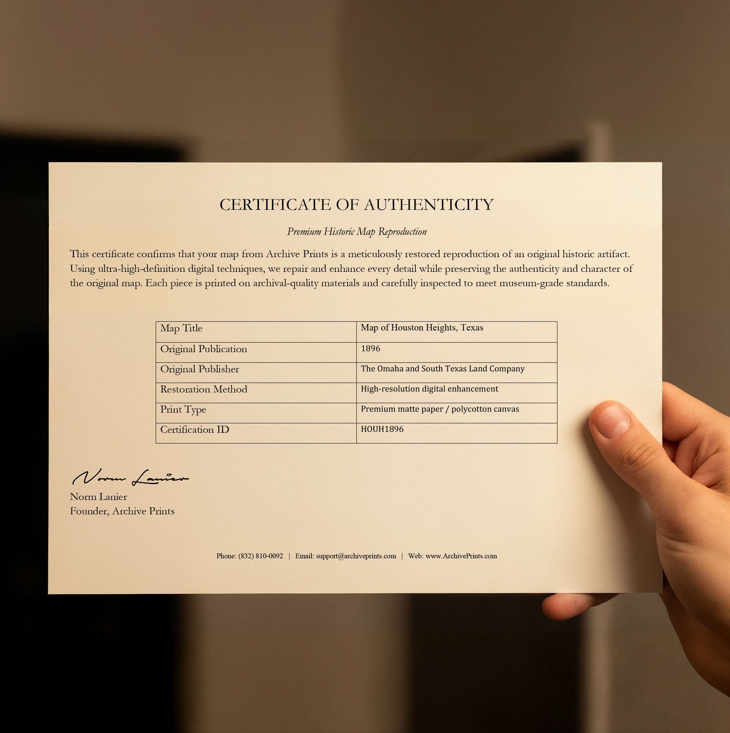
| Certificate of Authenticity |

Art Prints
Archival quality colors. Best option if you'd like to frame it yourself

The Best Materials
We hand-stretched our canvas on solid American-grown pine stretcher bars. We use quality canvas and fade-resistant inks to create the lasting art. Canvases come with hardware already installed and ready to hang.
Need help?
Frequently Asked Questions
Order
All of our maps are meticulously restored reproductions of historic originals. Each piece is digitally repaired and color-corrected to bring out the finest details while preserving its authentic, vintage character.
Yes. All Archive Prints products are printed to order in the USA with archival materials.
We offer two premium formats:
- High-Quality Paper Posters – Printed on thick, archival-grade matte paper for rich, vibrant detail.
- Hand-Stretched Canvas Prints – Printed on premium polycotton canvas and mounted on 1.5" solid American pine stretcher bars for a gallery-quality finish.
We carefully digitally restore each map to enhance clarity and color while preserving its original look and historic charm. You’ll enjoy sharp details and a timeless vintage aesthetic that feels true to the original piece.
Yes, we do! We offer premium framing options to make your map ready to hang the moment it arrives. You can choose from Oak, Maple, Black, or Walnut frames directly on the product page. We also offer Stretched Canvas prints for a modern gallery look, as well as archival-quality Posters if you prefer to frame it yourself.
Yes! We offer free shipping on all products within the United States. Each map is carefully packaged to ensure it arrives in perfect condition.
If you’re not completely satisfied, you can return your order in new condition for a full refund. Return shipping costs are the responsibility of the customer.
Absolutely! Our maps make thoughtful, one-of-a-kind gifts for history lovers, map collectors, or anyone looking to add vintage character to their home or office. Choose between paper prints for framing or stretched canvas for a ready-to-hang presentation.
- Paper Posters → Shipped in durable, protective tubes to prevent creasing.
- Canvas Prints → Carefully wrapped, padded, and boxed to ensure safe delivery.
Our maps look stunning in a variety of settings, including:
- Living rooms and home offices
- Libraries and studies
- Corporate offices and conference rooms
- Restaurants, cafes, and boutique spaces