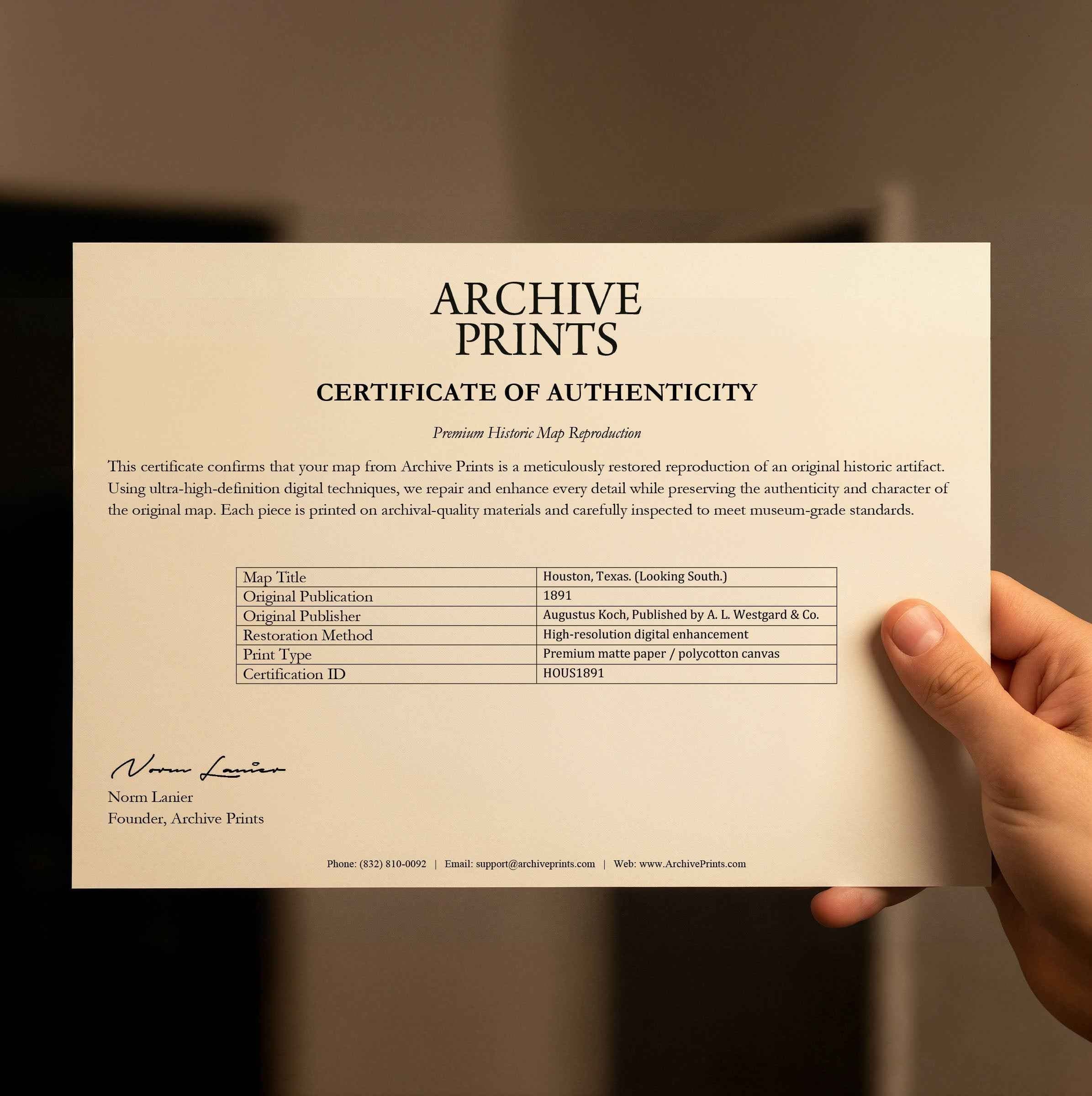
Houston Vintage City Map - 1891 Koch Historical Map of Houston
Discover Houston Heritage
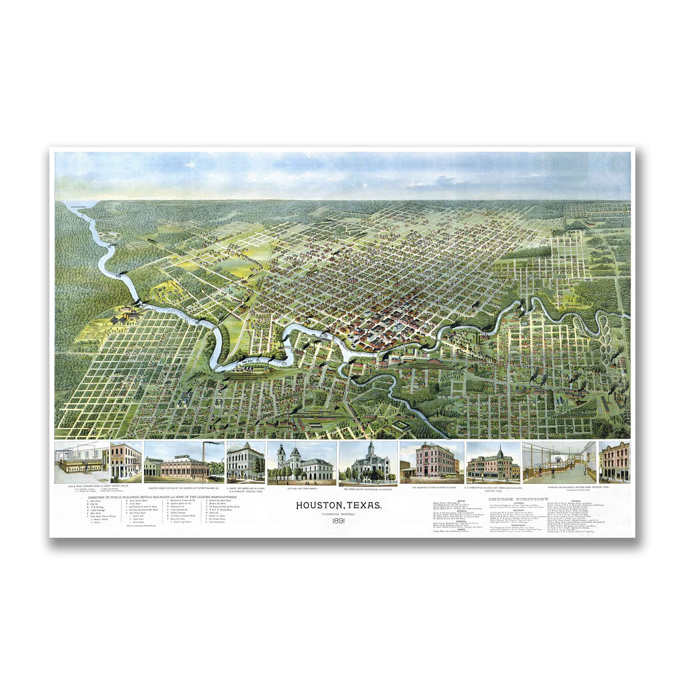
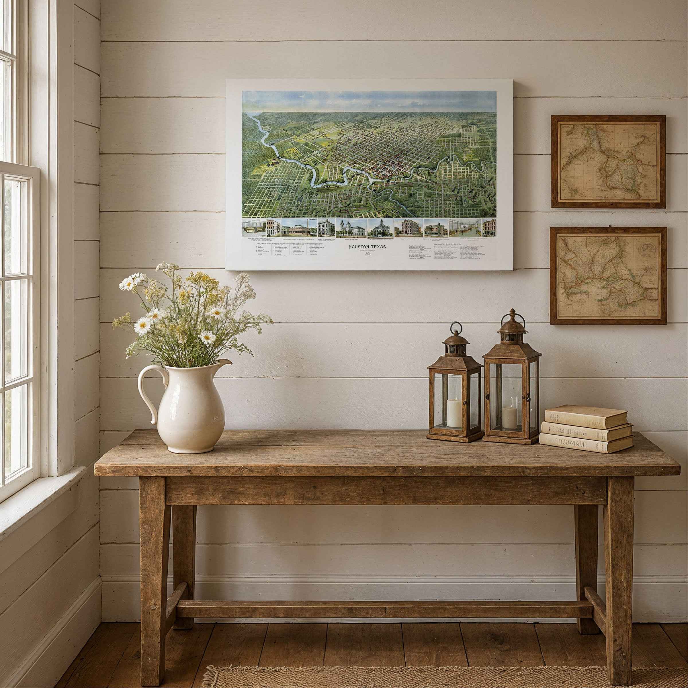
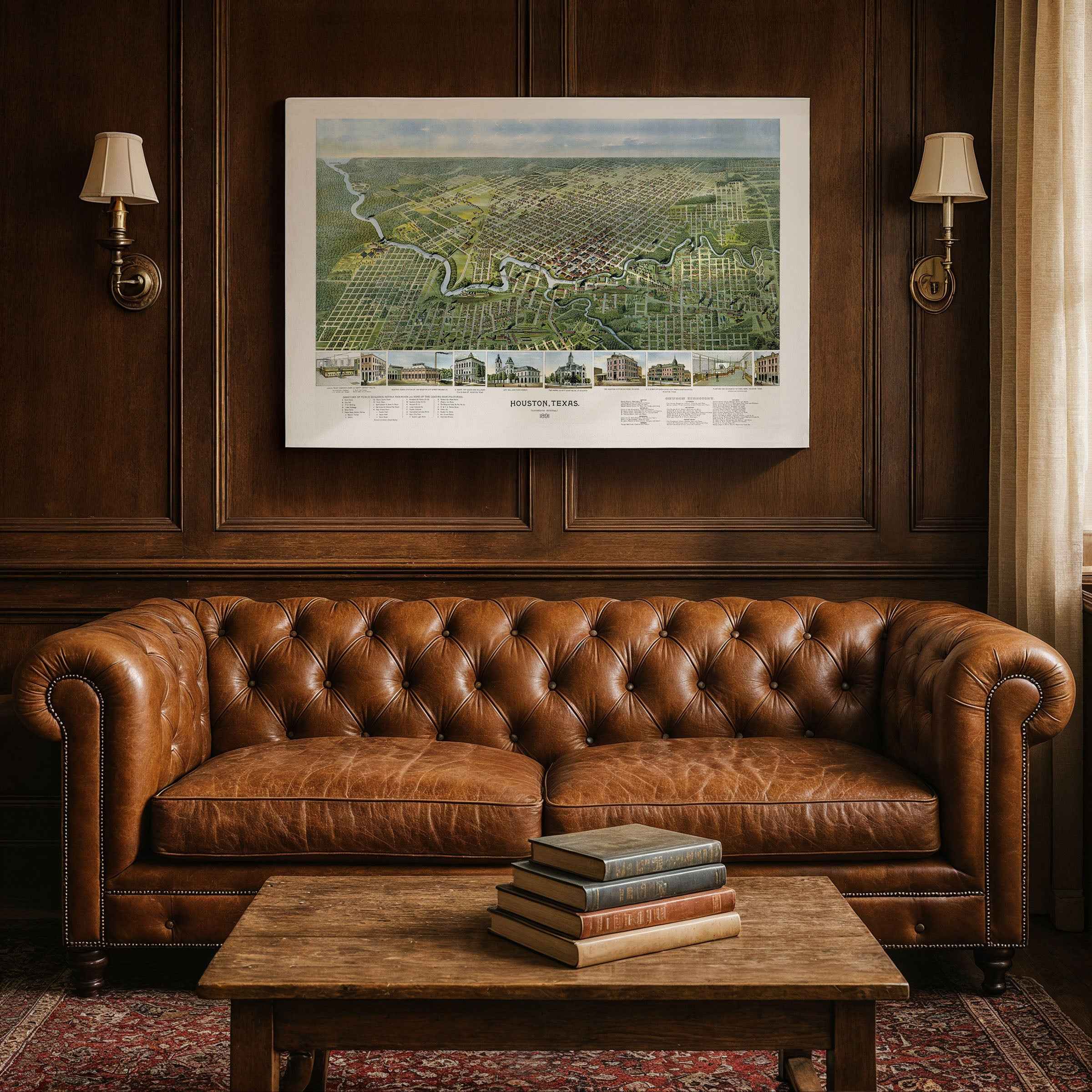
Step back to 1891 and explore the remarkable transformation of Houston from frontier settlement to commercial powerhouse with this beautifully restored map by renowned cartographer Augustus Koch. This extraordinary piece of urban cartography captures Houston during a pivotal moment when the city was establishing itself as the crossroads of Texas commerce, where railroad lines converged and Buffalo Bayou connected inland enterprise to the Gulf of Mexico.
Historical Significance
Created by Augustus Koch in 1891, this map documents Houston at a crucial juncture in its development. The city had evolved from its founding in 1836 into a thriving commercial center, with the completion of railroad connections linking Houston to markets across Texas and beyond. The map showcases the grid pattern of downtown streets, the emerging industrial districts along the bayou, and the residential neighborhoods that housed the growing population of merchants, railroad workers, and entrepreneurs who were building modern Houston.
Geographic Excellence
Koch's masterful bird's-eye perspective reveals Houston's strategic advantages that made it a natural hub for commerce and transportation. Buffalo Bayou winds through the heart of the city, providing the water access that connected Houston to Galveston Bay and international shipping routes. The map clearly shows the convergence of multiple railroad lines that made Houston the "Crossroads of the Southwest," with depots and rail yards that facilitated the movement of cotton, lumber, and other Texas products to national markets.
Urban Development Story
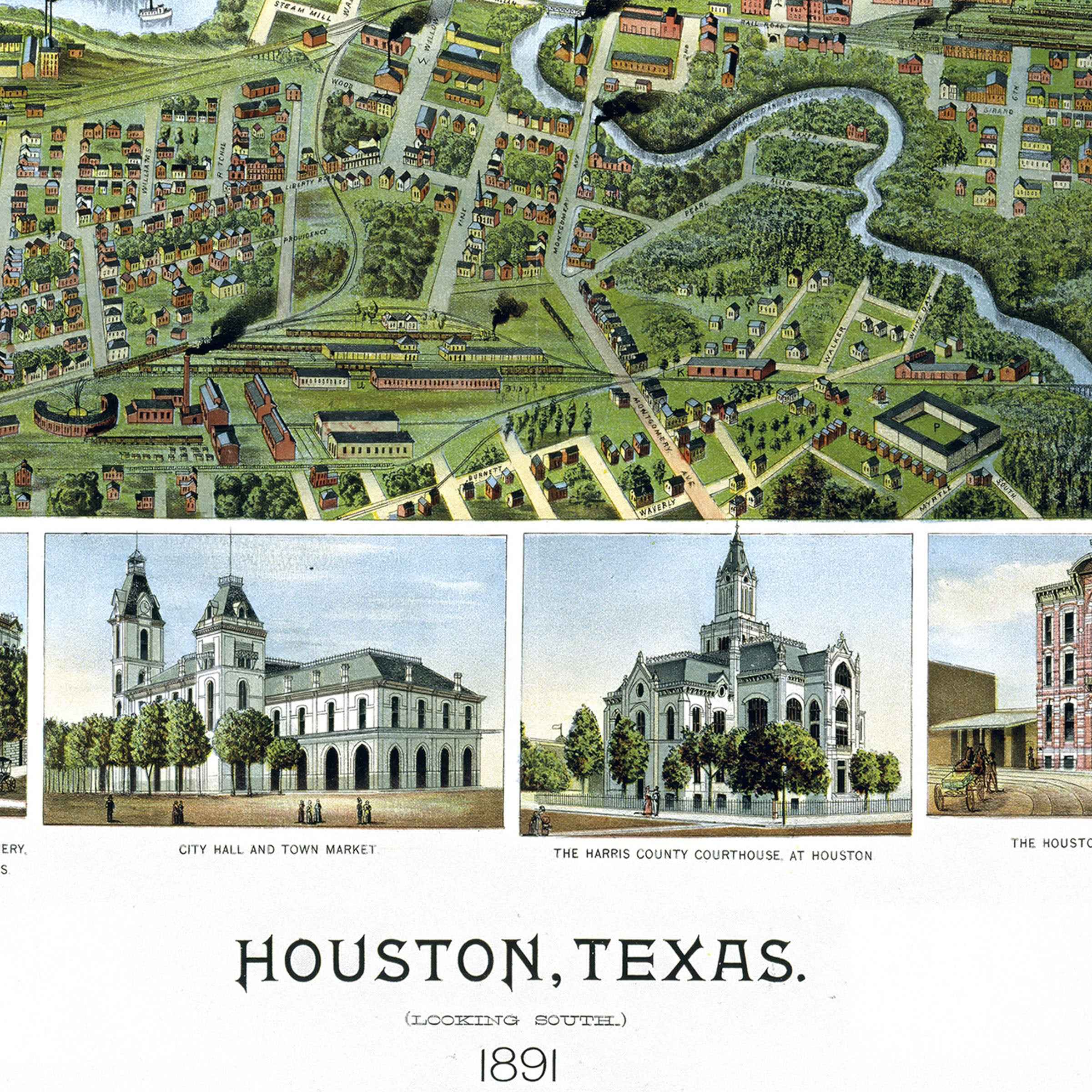
By 1891, Houston balanced frontier heritage with metropolitan ambition. The map captures iconic buildings that defined the city's skyline, including the Cotton Exchange, courthouse, hotels, and commercial blocks that served the bustling trade in agricultural products. Residential areas show the tree-lined streets and substantial homes of the merchants and professionals who were establishing Houston's reputation as a center of business and culture in the post-Civil War South.
Commercial Heritage
This detailed cartographic record preserves Houston during its emergence as a major American city. The railroad depots, cotton warehouses, lumber yards, and shipping facilities documented here represent the infrastructure that would make Houston one of the most important commercial centers in the South. The map serves as a testament to the vision and determination of the entrepreneurs and civic leaders who transformed a bayou settlement into a thriving metropolis.
Perfect for Houston history enthusiasts, collectors of Texas memorabilia, and those with connections to the Bayou City, this restored map serves as both an educational treasure and a stunning piece of wall art that celebrates the pioneering spirit and commercial heritage that defined Houston's rise to prominence.
Printed with museum-grade clarity on premium archival paper or polycotton canvas, each reproduction showcases every street, building, and waterway with precision and authenticity. Bring home a tangible connection to Houston history—an enduring reminder of the vision and enterprise that built the Space City.
The Map Story
This beautifully detailed 1891 panoramic map of Houston captures a young but ambitious city transforming from a river port into a major commercial hub. Viewed from above, the city stretches outward from the winding path of Buffalo Bayou, its gridded streets and busy wharves revealing both order and opportunity. Though still framed by open prairie, Houston’s destiny as an industrial and transportation center is already visible.
The map shows a thriving downtown filled with landmarks of progress: the Cotton Exchange, City Hall, the Courthouse, and multiple rail depots that connected Houston to Galveston, Dallas, and beyond. Steamboats crowd the bayou, where lumber, cotton, and grain moved toward Gulf ports. Along the lower edge of the print, vignettes of civic buildings and businesses celebrate a city confident in its prosperity.
By 1891, Houston was a place defined by connection. The railroads stitched Texas together, and Houston sat at the crossroads. Factories, mills, and warehouses filled the blocks near the bayou, while electric lights and new streetcars signaled a modern age arriving in real time. Yet outside the city core, wide tracts of undeveloped land remind us how new this progress was—an expanding frontier of promise and possibility.
To its citizens, this map was both a source of pride and a glimpse of the future. It captured a city balancing its pioneer roots with bold ambition—a port town becoming a metropolis. Every building drawn, every street labeled, tells of Houston’s growing influence, its economy booming on cotton, commerce, and the iron lines of the railroad.
Today, this 1891 map remains a portrait of Houston at the threshold of greatness—a city born on the bayou, rising swiftly toward the modern world.
Materials
Hand‑Stretched Canvas: If you choose canvas, we use a premium cotton‑poly blend stretched over solid pine frames. Each canvas is carefully hand‑stretched for a tight, gallery‑quality finish that's ready to hang right out of the box.
Vivid, Fade‑Resistant Inks: We use professional‑grade inks that are UV‑resistant, so your print retains its rich colors even when displayed in bright rooms.
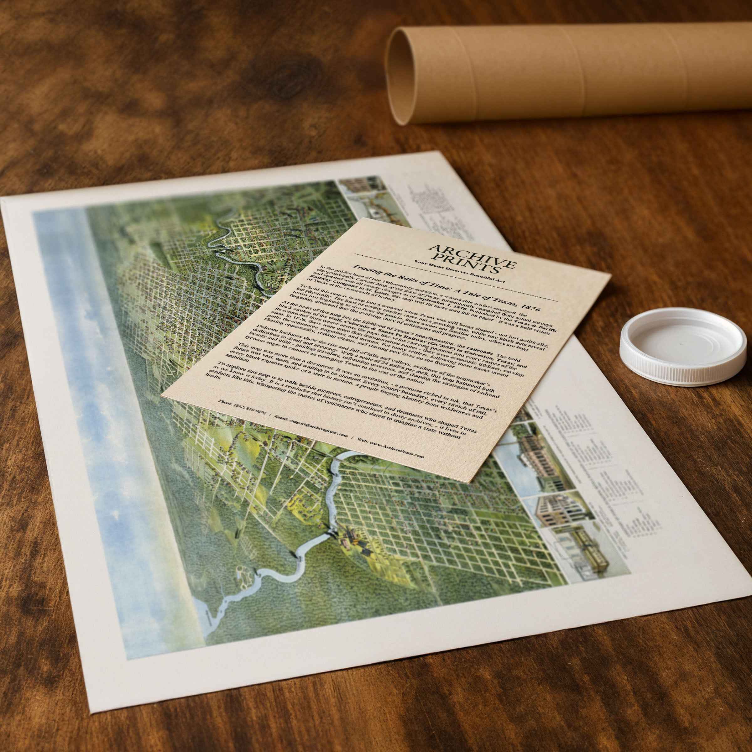
Expert Restoration: Every map is digitally restored by skilled artisans. We preserve the character of the original while enhancing clarity, so you see the map as it was meant to be seen.
Secure Packaging: Paper prints are rolled in heavy‑duty mailing tubes, and canvases are cushioned in reinforced boxes to ensure they arrive in pristine condition.
Choosing one of our prints means investing in craftsmanship. We combine historical authenticity with modern print technology and premium materials, giving you a work of art built to stand the test of time.
Choose options

Because every place has a story
Make History Personal
A vintage map is more than art.
It is a reminder of where life began.
Where memories were made.
Where hearts still live. Give the gift of place.
Beautifully preserved and made for the moments that matter.
Why Choose Us?
| Feature | Us | Competitor A | Competitor B |
|---|---|---|---|
| Hand Crafted | |||
| Museum Quality | |||
| 100 Year Guarantee | |||
| Restored by Hand | |||
| Certificate of Authenticity |

Art Prints
Archival quality colors. Best option if you'd like to frame it yourself

The Best Materials
We hand-stretched our canvas on solid American-grown pine stretcher bars. We use quality canvas and fade-resistant inks to create the lasting art. Canvases come with hardware already installed and ready to hang.
Need help?
Frequently Asked Questions
Order
All of our maps are meticulously restored reproductions of historic originals. Each piece is digitally repaired and color-corrected to bring out the finest details while preserving its authentic, vintage character.
Yes. All Archive Prints products are printed to order in the USA with archival materials.
We offer two premium formats:
- High-Quality Paper Posters – Printed on thick, archival-grade matte paper for rich, vibrant detail.
- Hand-Stretched Canvas Prints – Printed on premium polycotton canvas and mounted on 1.5" solid American pine stretcher bars for a gallery-quality finish.
We carefully digitally restore each map to enhance clarity and color while preserving its original look and historic charm. You’ll enjoy sharp details and a timeless vintage aesthetic that feels true to the original piece.
Yes, we do! We offer premium framing options to make your map ready to hang the moment it arrives. You can choose from Oak, Maple, Black, or Walnut frames directly on the product page. We also offer Stretched Canvas prints for a modern gallery look, as well as archival-quality Posters if you prefer to frame it yourself.
Yes! We offer free shipping on all products within the United States. Each map is carefully packaged to ensure it arrives in perfect condition.
If you’re not completely satisfied, you can return your order in new condition for a full refund. Return shipping costs are the responsibility of the customer.
Absolutely! Our maps make thoughtful, one-of-a-kind gifts for history lovers, map collectors, or anyone looking to add vintage character to their home or office. Choose between paper prints for framing or stretched canvas for a ready-to-hang presentation.
- Paper Posters → Shipped in durable, protective tubes to prevent creasing.
- Canvas Prints → Carefully wrapped, padded, and boxed to ensure safe delivery.
Our maps look stunning in a variety of settings, including:
- Living rooms and home offices
- Libraries and studies
- Corporate offices and conference rooms
- Restaurants, cafes, and boutique spaces