Kansas Map - Vintage State Map by Colton for Home Décor and Collectors
Discover a Piece of Kansas History
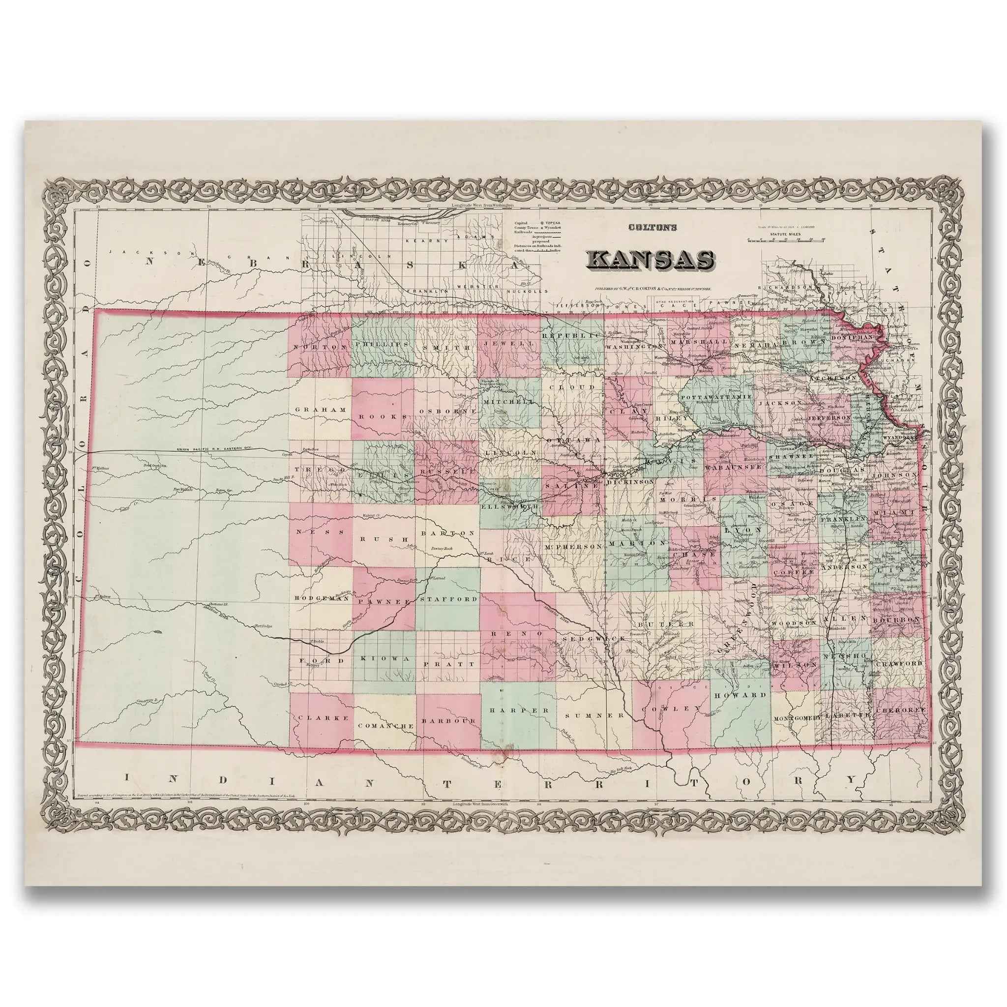
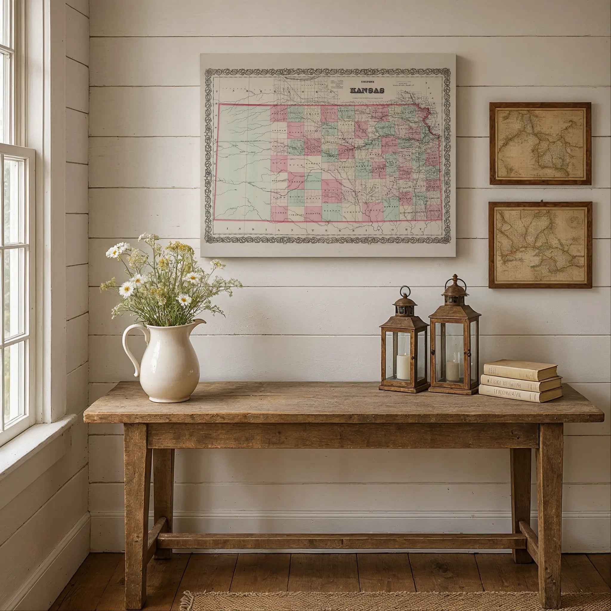
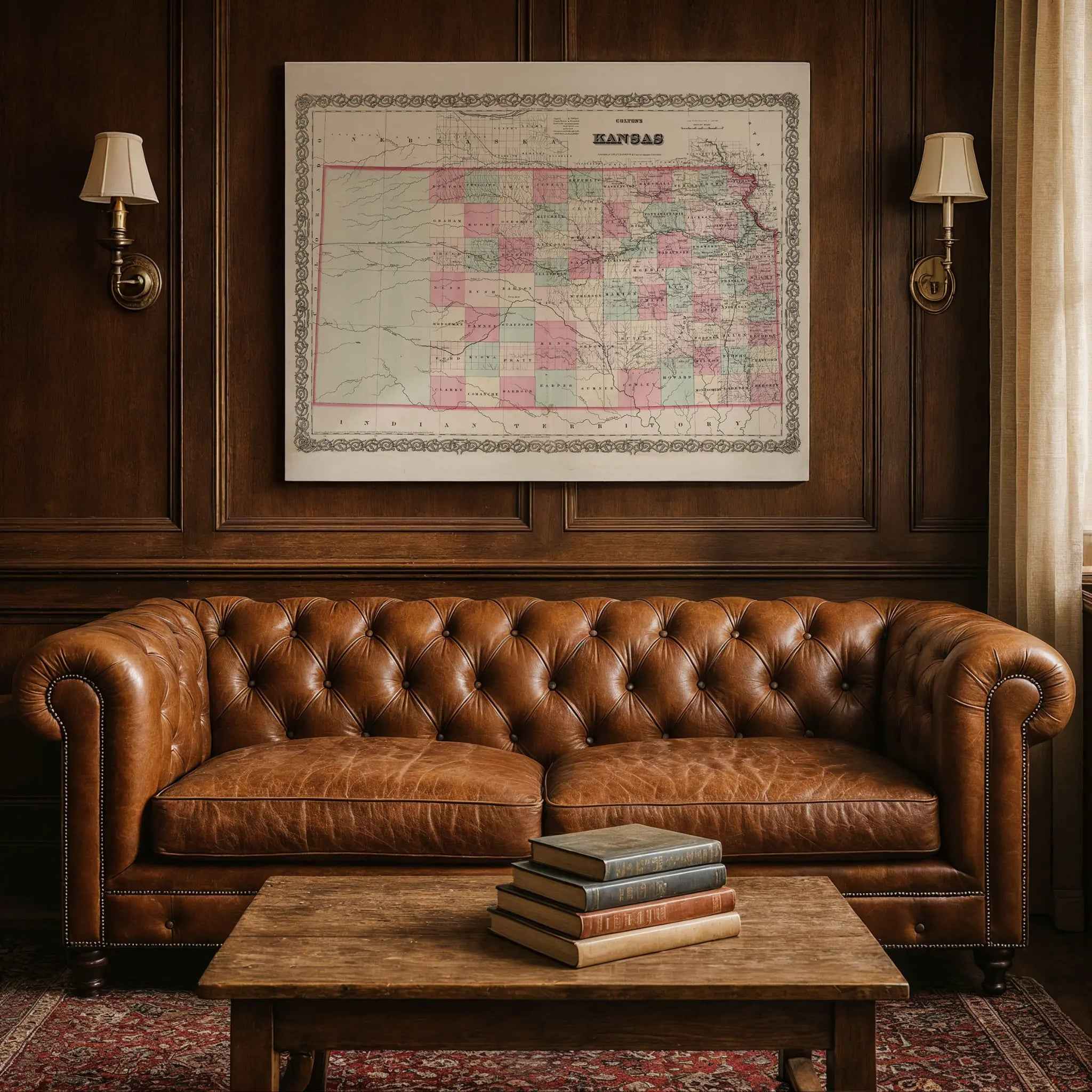
Step back into the 1860s and witness the dynamic transformation of the American frontier with this beautifully restored 1869 Kansas Map. Framed by an elegant decorative border and shaded county colors, the map captures a state rapidly evolving after its admission to the Union. It’s a vivid portrait of Kansas at a pivotal moment in the nineteenth century—a land of vast prairies, emerging towns, and the relentless spirit of pioneers, all meticulously drawn.
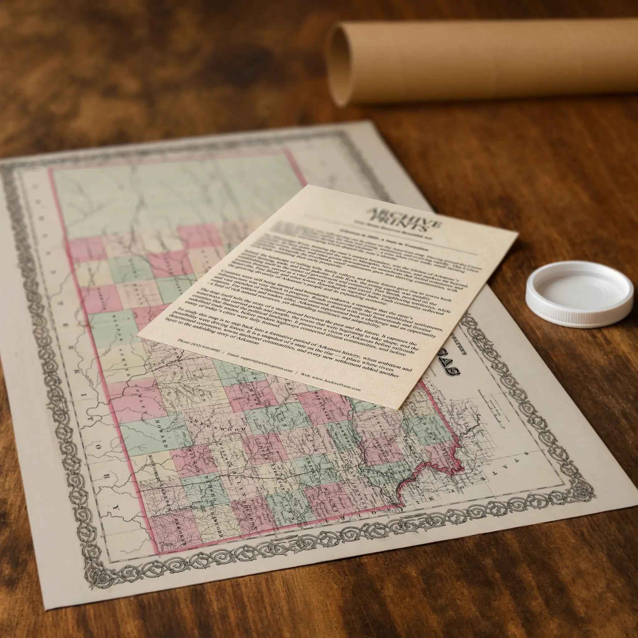
Each reproduction includes a custom historical letter that tells the story behind the map, making it an ideal gift for collectors, cartography fans, and anyone who loves American history. Printed on heavyweight archival paper or premium poly-cotton canvas, every label, county line, and river is preserved in ultra-high-definition clarity thanks to meticulous digital restoration—rich ink tones, crisp linework, and the warm vintage patina intact.
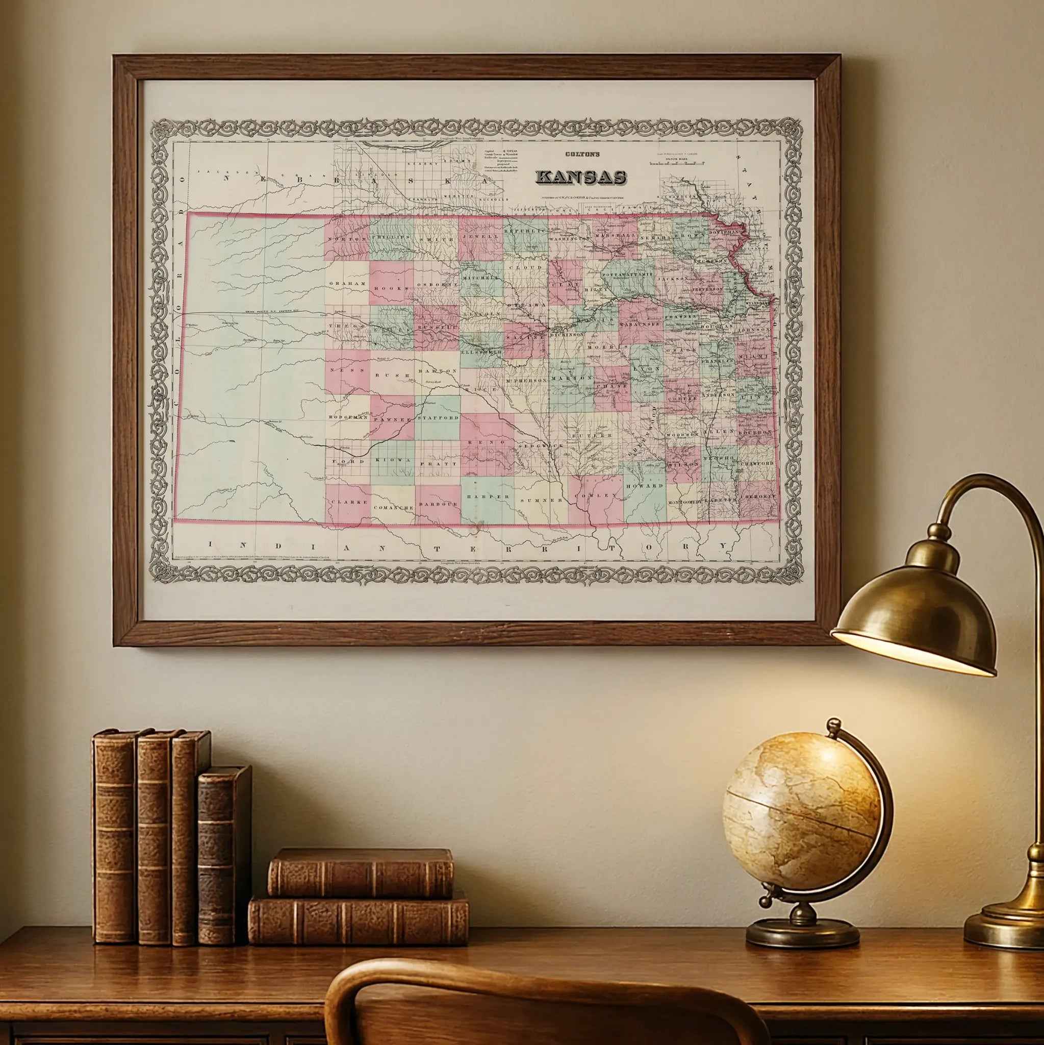
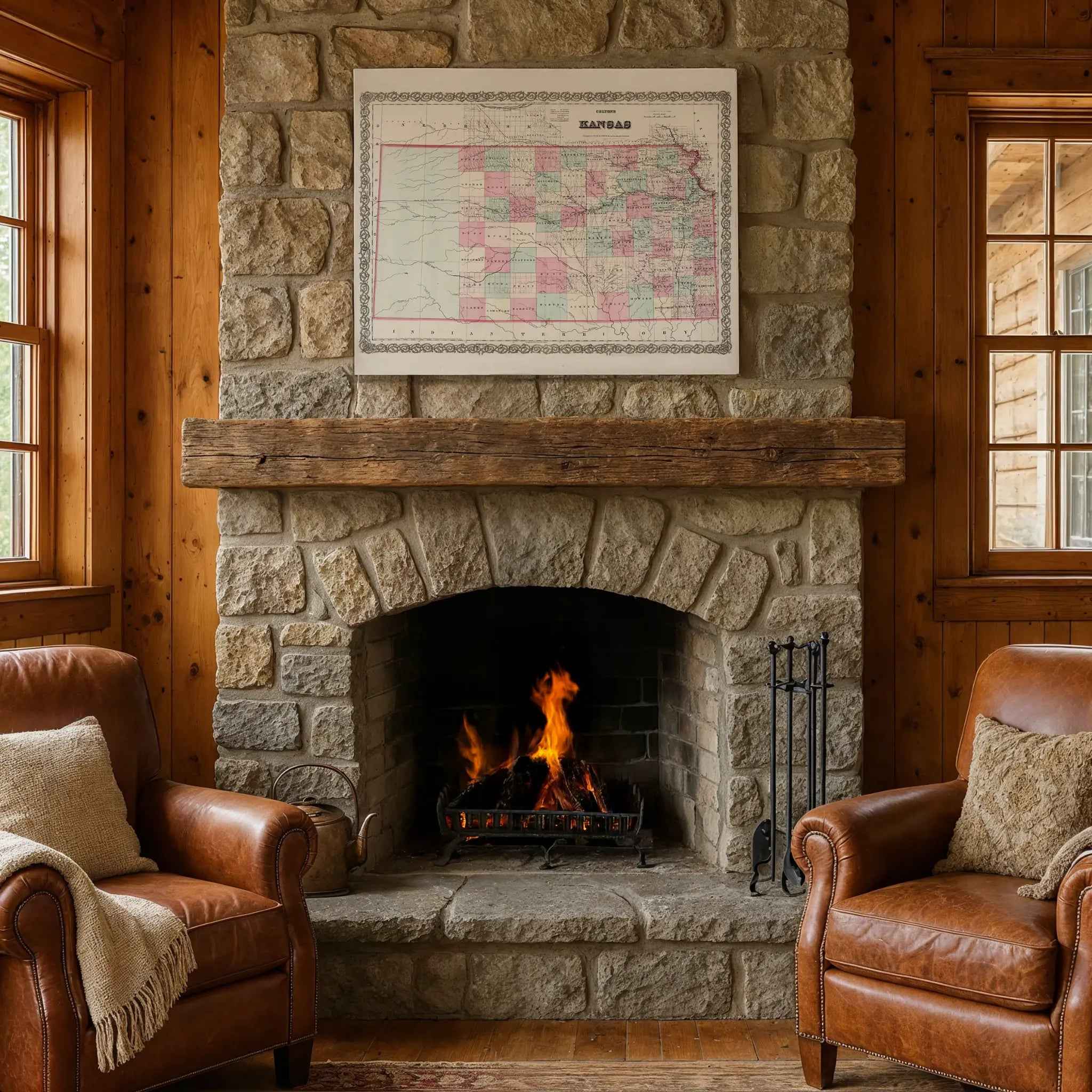
For protection and presentation, we craft every detail with care. Paper prints are rolled in a sturdy cardboard mailing tube and sized for easy framing. Canvas prints are gallery-wrapped on solid 1.5″ pine stretcher bars and ship in reinforced boxes—ready to hang with a pre-installed sawtooth hanger.
Bring home more than wall art. Bring home a story, a conversation piece, and a striking centerpiece that celebrates Kansas’s pioneering spirit, rich agricultural heritage, and timeless Midwestern charm.
The Map Story
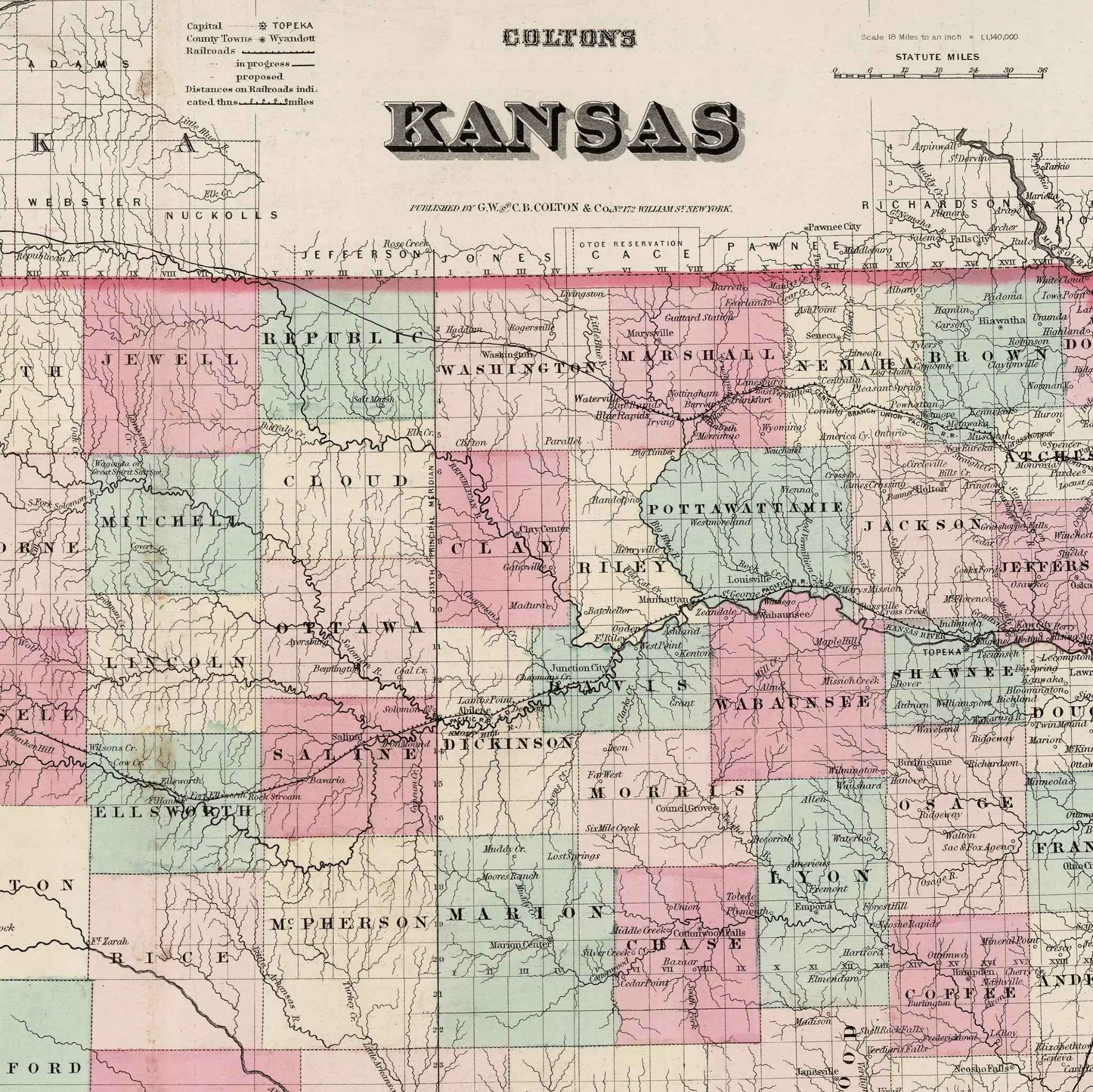
Colton’s 1869 map of Kansas presents a young state carved into neat counties of pink, yellow, and green, framed by an ornate border. The engraved lines look orderly, yet behind them lies the story of a state forged in fire and transformed by steel.
It is 1869, and Ulysses S. Grant is president. The Civil War has ended only four years earlier, but Kansas still carries the scars of its turbulent birth. Less than a decade before, “Bleeding Kansas” turned prairies into battlegrounds as pro-slavery and free-soil settlers clashed with rifles and ballots. By the time Colton’s map was printed, Kansas had secured its place in the Union, its politics settled but its landscape restless with change.
Counties march across the paper, many newly drawn to accommodate a flood of settlers. Railroads slash westward, steel lines that promise connection and commerce. The Union Pacific pushes across the plains, bringing with it depots, telegraph poles, and the hum of migration. Towns rise along these tracks almost overnight—Abilene, Topeka, Lawrence—each dot on the map a beacon for opportunity.
Farming anchors Kansas life. Families break the prairie sod with steel plows, planting wheat and corn in a sea of grass. Homesteaders from the East, as well as immigrants from Germany and Scandinavia, carve out claims, their cabins huddled against fierce winds. The map’s rivers—the Kansas, the Arkansas, the Smoky Hill—are not just lines; they are lifelines, carrying timber, grain, and livestock toward distant markets.
But the story is not only of settlers. South of the Kansas border, “Indian Territory” still looms, a reminder of the forced removals that displaced Native peoples to make way for the new state. Within Kansas itself, conflict over land rights and treaties continues, even as the map presents the land as cleanly divided and neatly owned.
Kansas in 1869 is a place of contradiction: a state that bled for freedom, now selling farmland to newcomers; a landscape shaped by violence, now marketed as promise. Railroads knit it into the nation, but they also carry cattle drives, gamblers, and gunslingers into towns that gain reputations as both boomtowns and battlegrounds.
Hold Colton’s map at a distance and it looks serene, counties balanced, borders firm. Step closer and you can almost hear the iron wheels clattering over the prairie, the voices of settlers arguing claims, the wind sweeping across fields not yet tamed. Kansas in 1869 is not simply geography—it is a story of rebirth, of struggle remade into order, of a state that fought to define itself and then rushed headlong into the future.
Materials
Hand‑Stretched Canvas: If you choose canvas, we use a premium cotton‑poly blend stretched over solid pine frames. Each canvas is carefully hand‑stretched for a tight, gallery‑quality finish that’s ready to hang right out of the box.
Vivid, Fade‑Resistant Inks: We use professional‑grade inks that are UV‑resistant, so your print retains its rich colors even when displayed in bright rooms.
Expert Restoration: Every map is digitally restored by skilled artisans. We preserve the character of the original while enhancing clarity, so you see the map as it was meant to be seen.
Secure Packaging: Paper prints are rolled in heavy‑duty mailing tubes, and canvases are cushioned in reinforced boxes to ensure they arrive in pristine condition.
Choosing one of our prints means investing in craftsmanship. We combine historical authenticity with modern print technology and premium materials, giving you a work of art built to stand the test of time.
Choose options

Because every place has a story
Make History Personal
A vintage map is more than art.
It is a reminder of where life began.
Where memories were made.
Where hearts still live. Give the gift of place.
Beautifully preserved and made for the moments that matter.
Why Choose Us?
| Feature | Us | Competitor A | Competitor B |
|---|---|---|---|
| Hand Crafted | |||
| Museum Quality | |||
| 100 Year Guarantee | |||
| Restored by Hand | |||
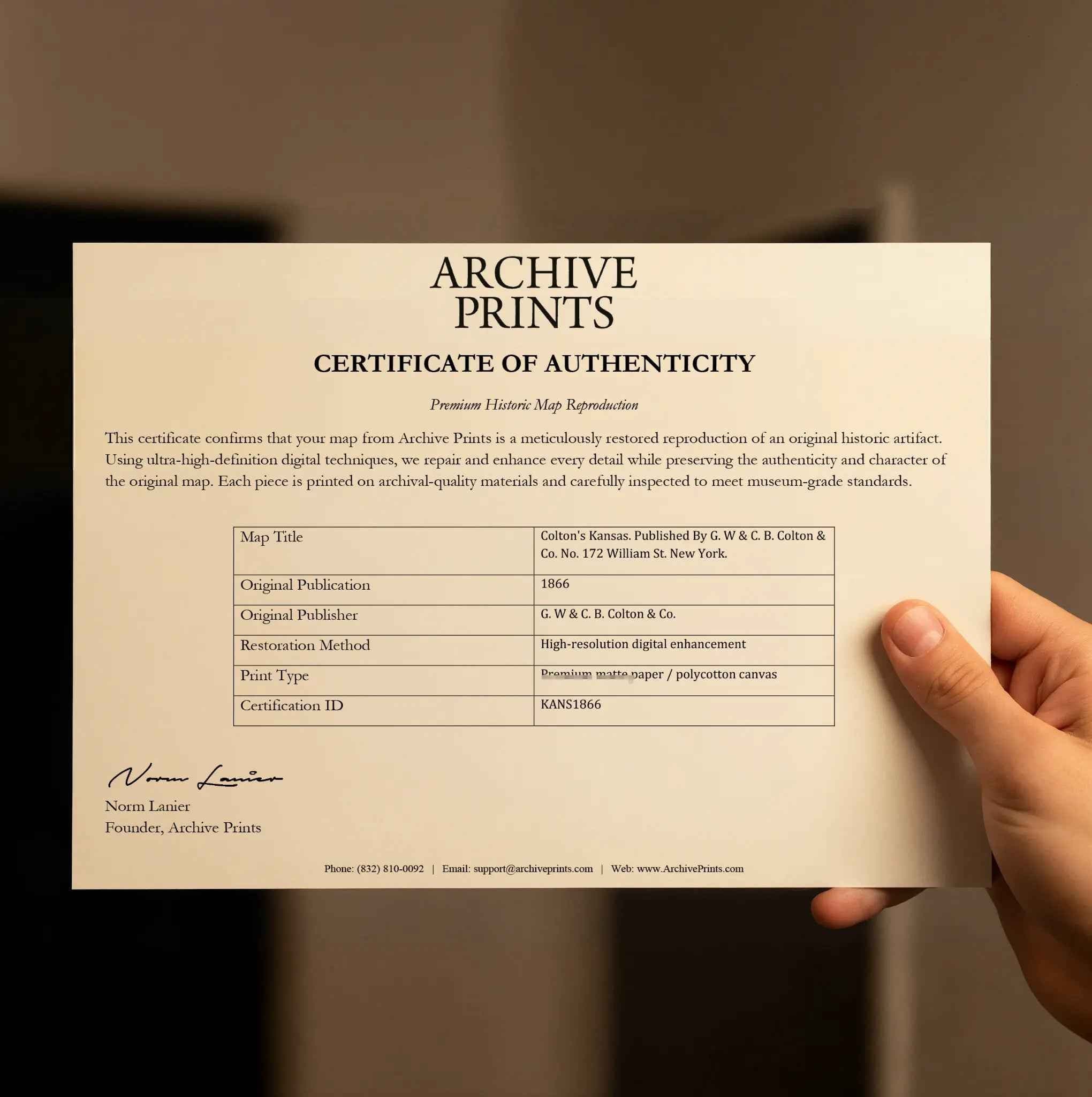
| Certificate of Authenticity |

Art Prints
Archival quality colors. Best option if you'd like to frame it yourself

The Best Materials
We hand-stretched our canvas on solid American-grown pine stretcher bars. We use quality canvas and fade-resistant inks to create the lasting art. Canvases come with hardware already installed and ready to hang.
Need help?
Frequently Asked Questions
Order
All of our maps are meticulously restored reproductions of historic originals. Each piece is digitally repaired and color-corrected to bring out the finest details while preserving its authentic, vintage character.
Yes. All Archive Prints products are printed to order in the USA with archival materials.
We offer two premium formats:
- High-Quality Paper Posters – Printed on thick, archival-grade matte paper for rich, vibrant detail.
- Hand-Stretched Canvas Prints – Printed on premium polycotton canvas and mounted on 1.5" solid American pine stretcher bars for a gallery-quality finish.
We carefully digitally restore each map to enhance clarity and color while preserving its original look and historic charm. You’ll enjoy sharp details and a timeless vintage aesthetic that feels true to the original piece.
Yes, we do! We offer premium framing options to make your map ready to hang the moment it arrives. You can choose from Oak, Maple, Black, or Walnut frames directly on the product page. We also offer Stretched Canvas prints for a modern gallery look, as well as archival-quality Posters if you prefer to frame it yourself.
Yes! We offer free shipping on all products within the United States. Each map is carefully packaged to ensure it arrives in perfect condition.
If you’re not completely satisfied, you can return your order in new condition for a full refund. Return shipping costs are the responsibility of the customer.
Absolutely! Our maps make thoughtful, one-of-a-kind gifts for history lovers, map collectors, or anyone looking to add vintage character to their home or office. Choose between paper prints for framing or stretched canvas for a ready-to-hang presentation.
- Paper Posters → Shipped in durable, protective tubes to prevent creasing.
- Canvas Prints → Carefully wrapped, padded, and boxed to ensure safe delivery.
Our maps look stunning in a variety of settings, including:
- Living rooms and home offices
- Libraries and studies
- Corporate offices and conference rooms
- Restaurants, cafes, and boutique spaces