Lake Arrowhead, California Map 1940
Lake Arrowhead, California Map 1940s
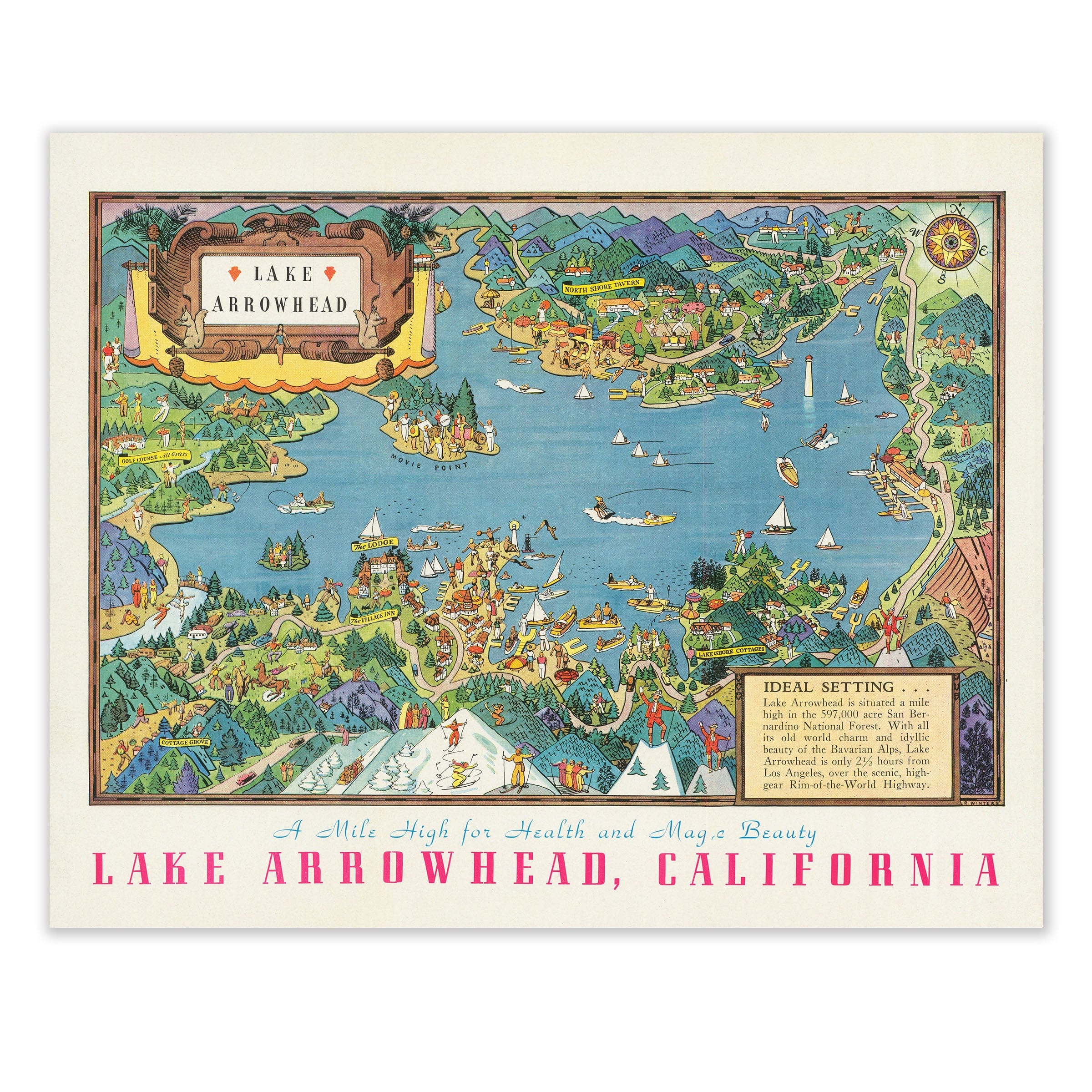
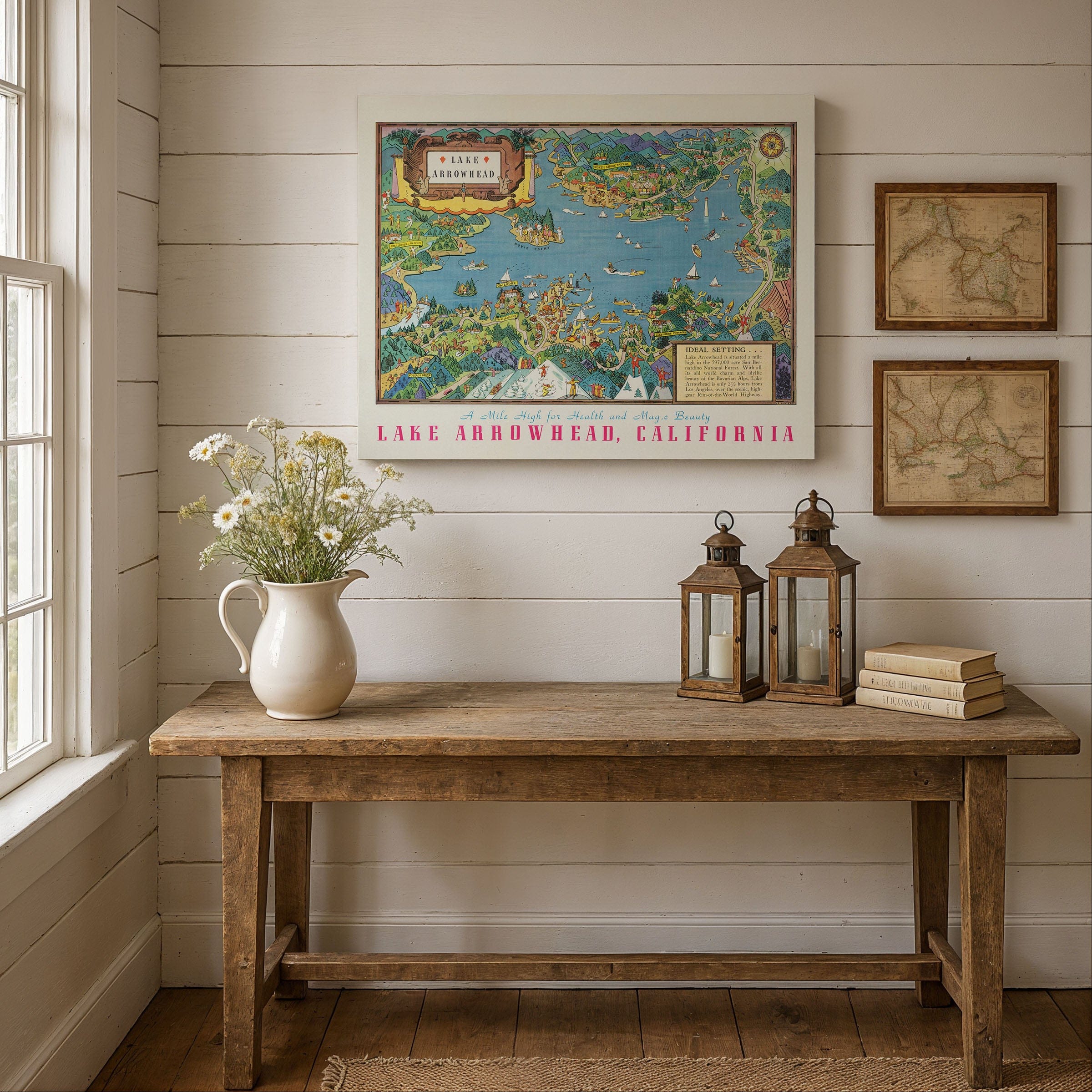
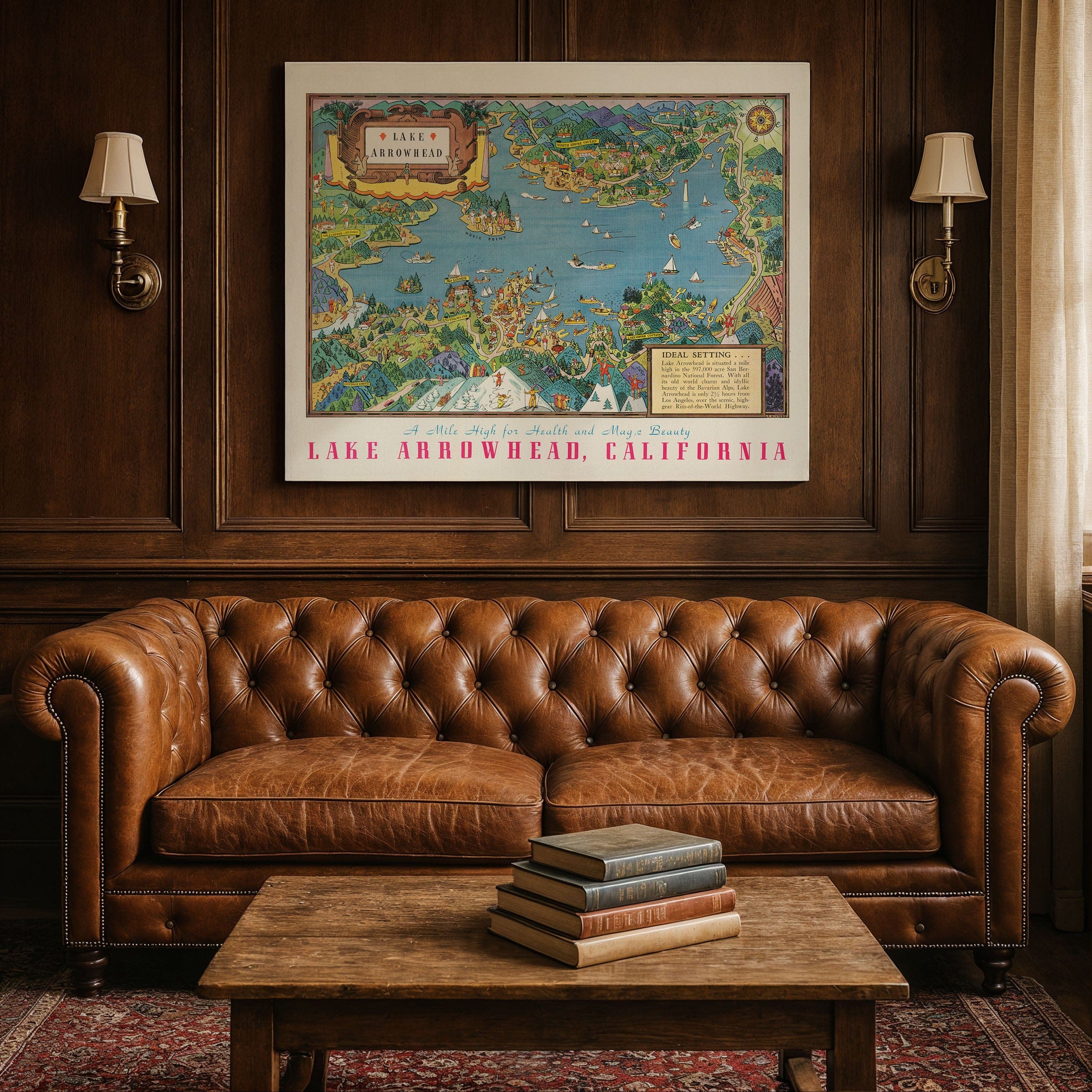
Discover the enchanting Lake Arrowhead, California Map from the 1940s, celebrating Lake Arrowhead as one of Southern California's most beloved mountain retreats—a mile-high haven where clear alpine air, deep forests, and lakeside leisure drew visitors seeking escape from the heat and pace of the lowlands. This vibrant pictorial map presents the lake and its surrounding communities with playful illustration and colorful detail, capturing the spirit of a resort landscape shaped by nature, imagination, and the growing popularity of year-round outdoor living.
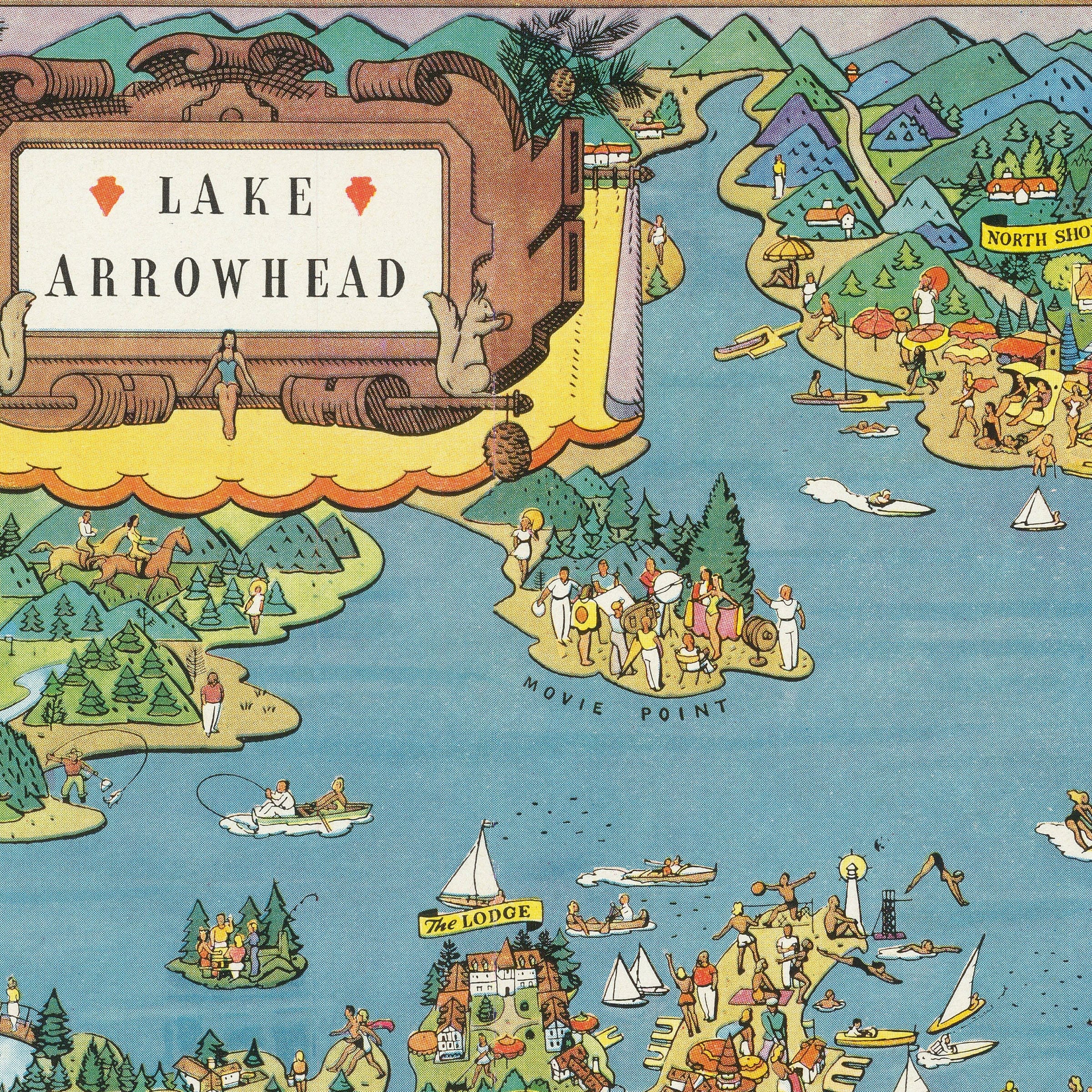
The Lake Arrowhead, California Map looks across the sparkling blue lake toward the forests and ridges of the San Bernardino Mountains. Cabins, inns, taverns, and small clusters of cottages appear along the shoreline, each rendered with whimsical animation. Boats drift across the water—sailboats catching mountain breezes, motorboats towing skiers, and canoes gliding toward quiet coves. On the hillsides, hikers, picnickers, and horseback riders explore wooded trails, while children splash in shallow inlets and families gather along sandy beaches.
Lake Arrowhead Village, shown bustling with visitors in this Lake Arrowhead, California Map, anchors the center of the illustration. Its shops, docks, and lodges form the social heart of the community, where travelers arriving from Los Angeles found a blend of rustic charm and modern resort comforts. Scenic drives curve around the lake's edge, connecting beloved landmarks such as North Shore Tavern, the Saddleback Inn, Blue Jay, and the small summer colonies tucked among pine forests. The Rim-of-the-World Highway—one of California's most spectacular routes—winds through the mountains in the background.
Winter scenes appear along the bottom of this Lake Arrowhead, California Map, reminding viewers that Lake Arrowhead was more than a summer playground. Snow sports, skating, and cozy fireside gatherings were part of its identity, attracting visitors who sought both recreation and rejuvenation at high elevation. The surrounding San Bernardino National Forest, illustrated in lush greens, frames the lake as part of a larger wilderness landscape protected for its beauty and wildlife.
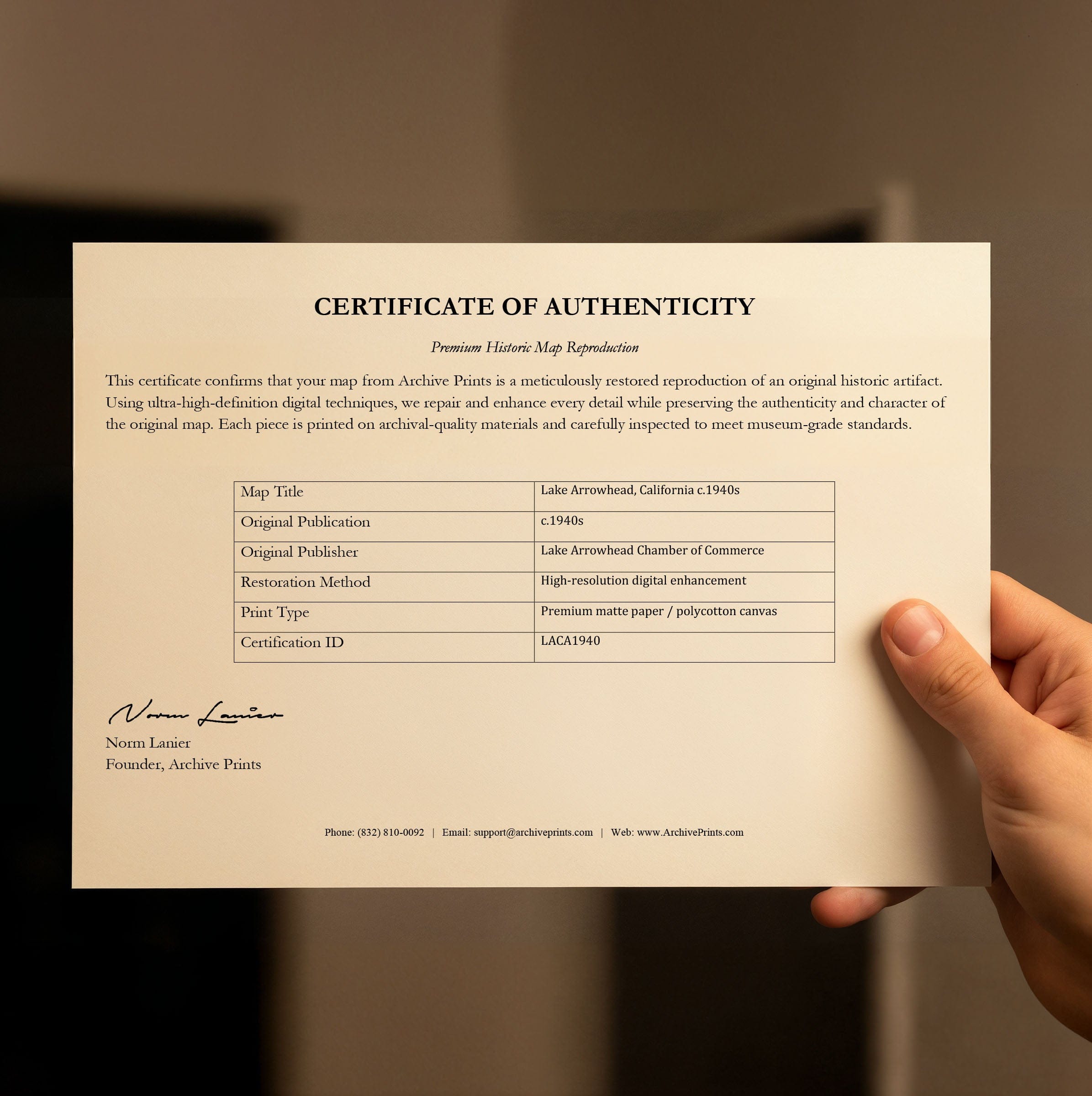
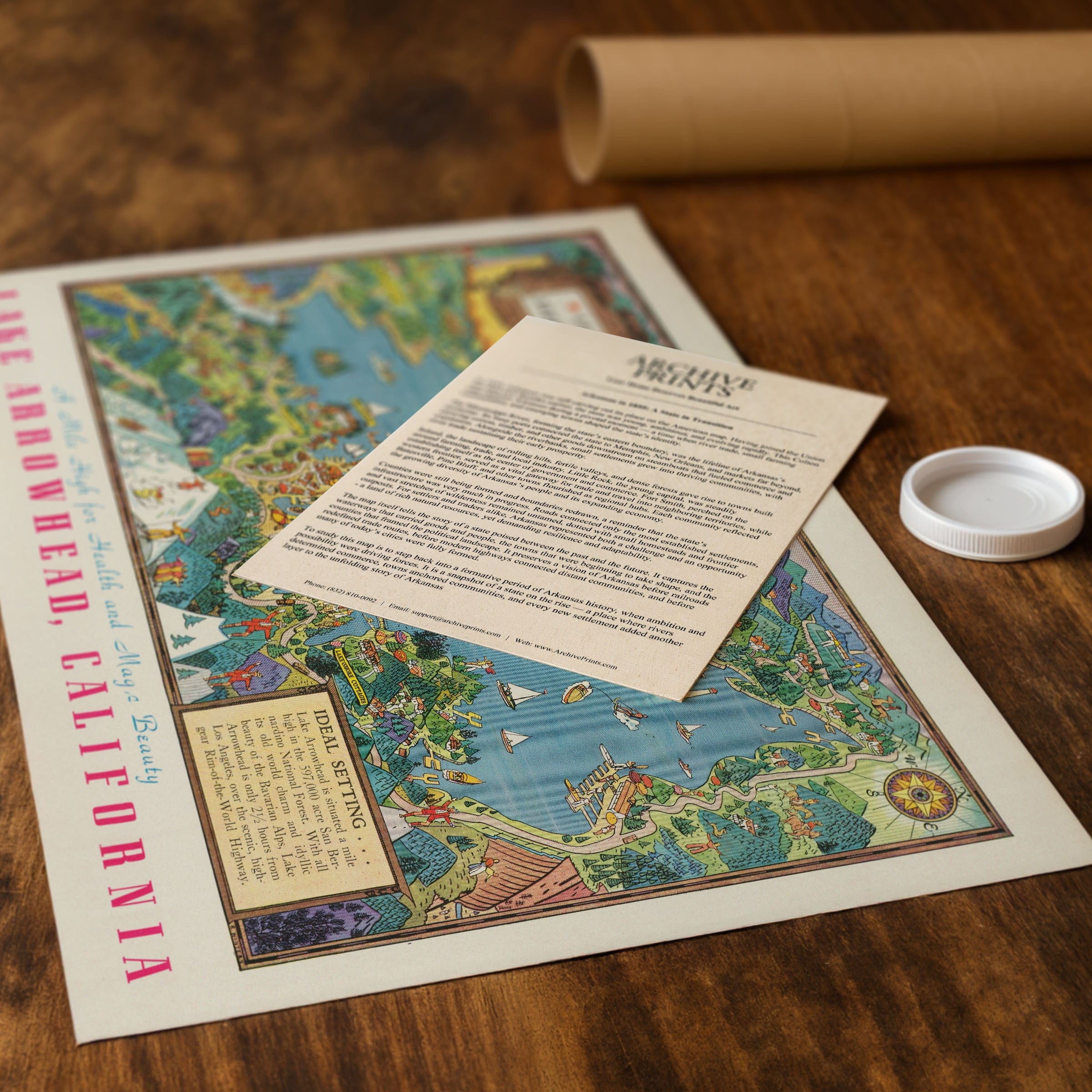
Perfect for Lake Arrowhead residents, Southern California history enthusiasts, and collectors of vintage resort maps, this Lake Arrowhead, California Map reproduction includes a custom historical certificate. The pictorial map reflects a time when Lake Arrowhead marketed itself not only as a destination but as a feeling—carefree, refreshing, and touched by a bit of mountain magic. Printed on heavyweight archival paper or hand-stretched polycotton canvas, every illustration, boat, cabin, and trail is restored in museum-grade clarity for generations of enjoyment. Paper prints ship rolled in heavy-duty tubes, while canvas editions arrive gallery-wrapped on solid pine stretcher bars with pre-installed hardware—ready to display the moment it arrives. Bring home a piece of Lake Arrowhead heritage and celebrate California's alpine escape at the height of its golden-age charm.
The Map Story
The map looks across the sparkling blue lake toward the forests and ridges of the San Bernardino Mountains. Cabins, inns, taverns, and small clusters of cottages appear along the shoreline, each rendered with whimsical animation. Boats drift across the water—sailboats catching mountain breezes, motorboats towing skiers, and canoes gliding toward quiet coves. On the hillsides, hikers, picnickers, and horseback riders explore wooded trails, while children splash in shallow inlets and families gather along sandy beaches.
Lake Arrowhead Village, shown bustling with visitors, anchors the center of the illustration. Its shops, docks, and lodges form the social heart of the community, where travelers arriving from Los Angeles found a blend of rustic charm and modern resort comforts. Scenic drives curve around the lake's edge, connecting beloved spotlights such as North Shore Tavern, the Saddleback Inn, Blue Jay, and the small summer colonies tucked among pine forests. The Rim-of-the-World Highway—one of California's most spectacular routes—winds through the mountains, carrying vacationers toward sweeping views and crisp alpine air.
Winter scenes appear along the bottom of the map, reminding viewers that Lake Arrowhead was more than a summer playground. Snow sports, skating, and cozy fireside gatherings were part of its identity, attracting visitors who sought both recreation and rejuvenation at high elevation. The surrounding San Bernardino National Forest, illustrated in lush greens, frames the lake as part of a larger wilderness landscape protected for its beauty and wildlife.
This pictorial map reflects a time when Lake Arrowhead marketed itself not only as a destination but as a feeling—carefree, refreshing, and touched by a bit of mountain magic. Its lively drawings invite the viewer to step into a world where leisure and landscape blend seamlessly, offering a portrait of California's alpine escape at the height of its golden-age charm.
Materials
Choose options

Because every place has a story
Make History Personal
A vintage map is more than art.
It is a reminder of where life began.
Where memories were made.
Where hearts still live. Give the gift of place.
Beautifully preserved and made for the moments that matter.
Why Choose Us?
| Feature | Us | Competitor A | Competitor B |
|---|---|---|---|
| Hand Crafted | |||
| Museum Quality | |||
| 100 Year Guarantee | |||
| Restored by Hand | |||
| Certificate of Authenticity |

Art Prints
Archival quality colors. Best option if you'd like to frame it yourself

The Best Materials
We hand-stretched our canvas on solid American-grown pine stretcher bars. We use quality canvas and fade-resistant inks to create the lasting art. Canvases come with hardware already installed and ready to hang.
Need help?
Frequently Asked Questions
Order
All of our maps are meticulously restored reproductions of historic originals. Each piece is digitally repaired and color-corrected to bring out the finest details while preserving its authentic, vintage character.
Yes. All Archive Prints products are printed to order in the USA with archival materials.
We offer two premium formats:
- High-Quality Paper Posters – Printed on thick, archival-grade matte paper for rich, vibrant detail.
- Hand-Stretched Canvas Prints – Printed on premium polycotton canvas and mounted on 1.5" solid American pine stretcher bars for a gallery-quality finish.
We carefully digitally restore each map to enhance clarity and color while preserving its original look and historic charm. You’ll enjoy sharp details and a timeless vintage aesthetic that feels true to the original piece.
Yes, we do! We offer premium framing options to make your map ready to hang the moment it arrives. You can choose from Oak, Maple, Black, or Walnut frames directly on the product page. We also offer Stretched Canvas prints for a modern gallery look, as well as archival-quality Posters if you prefer to frame it yourself.
Yes! We offer free shipping on all products within the United States. Each map is carefully packaged to ensure it arrives in perfect condition.
If you’re not completely satisfied, you can return your order in new condition for a full refund. Return shipping costs are the responsibility of the customer.
Absolutely! Our maps make thoughtful, one-of-a-kind gifts for history lovers, map collectors, or anyone looking to add vintage character to their home or office. Choose between paper prints for framing or stretched canvas for a ready-to-hang presentation.
- Paper Posters → Shipped in durable, protective tubes to prevent creasing.
- Canvas Prints → Carefully wrapped, padded, and boxed to ensure safe delivery.
Our maps look stunning in a variety of settings, including:
- Living rooms and home offices
- Libraries and studies
- Corporate offices and conference rooms
- Restaurants, cafes, and boutique spaces