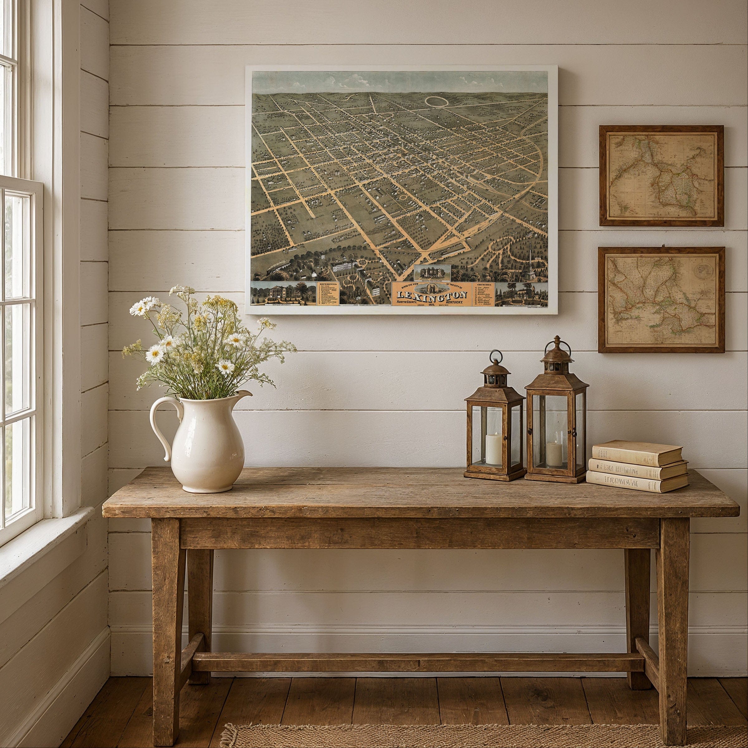
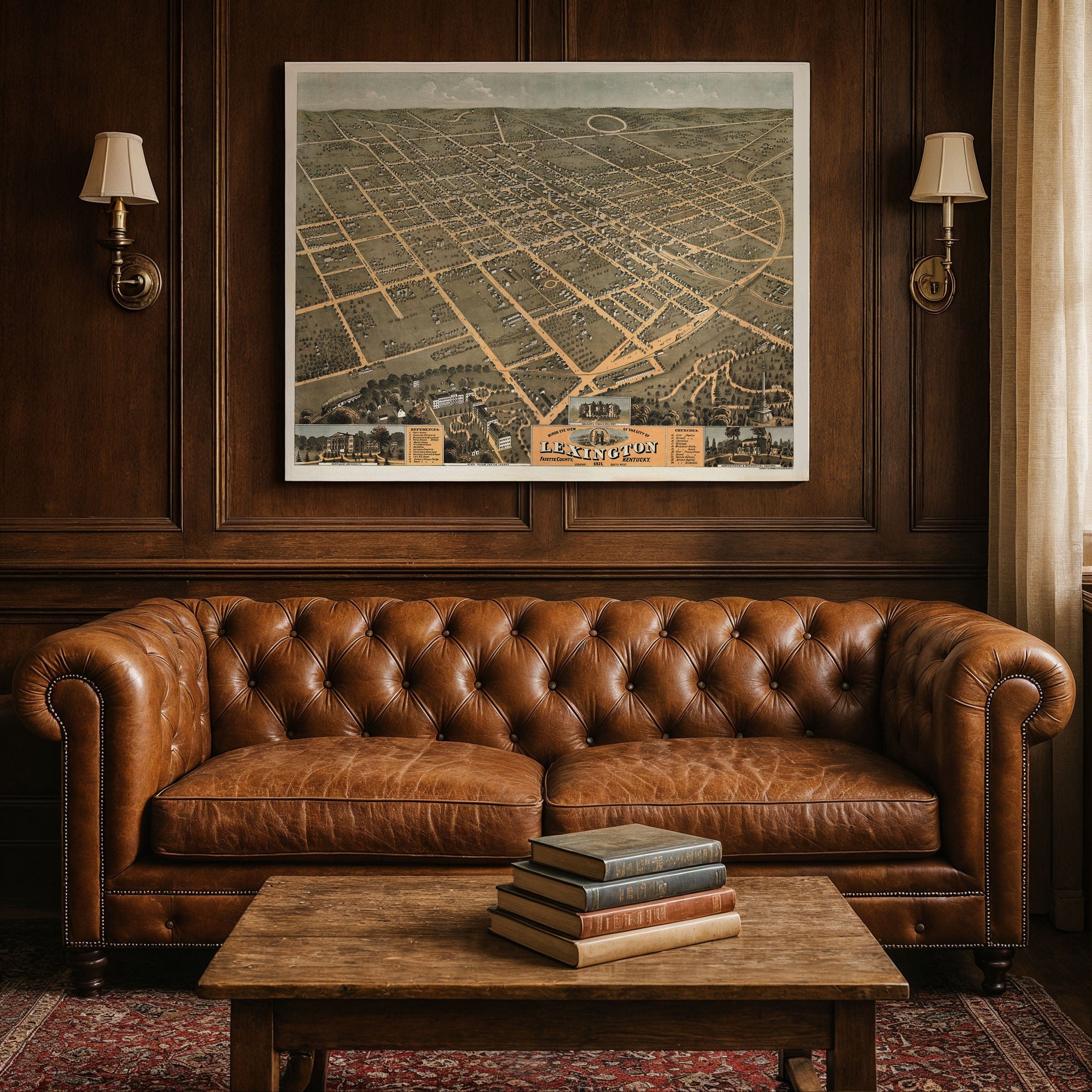
Lexington, Fayette County, KY Map 1871
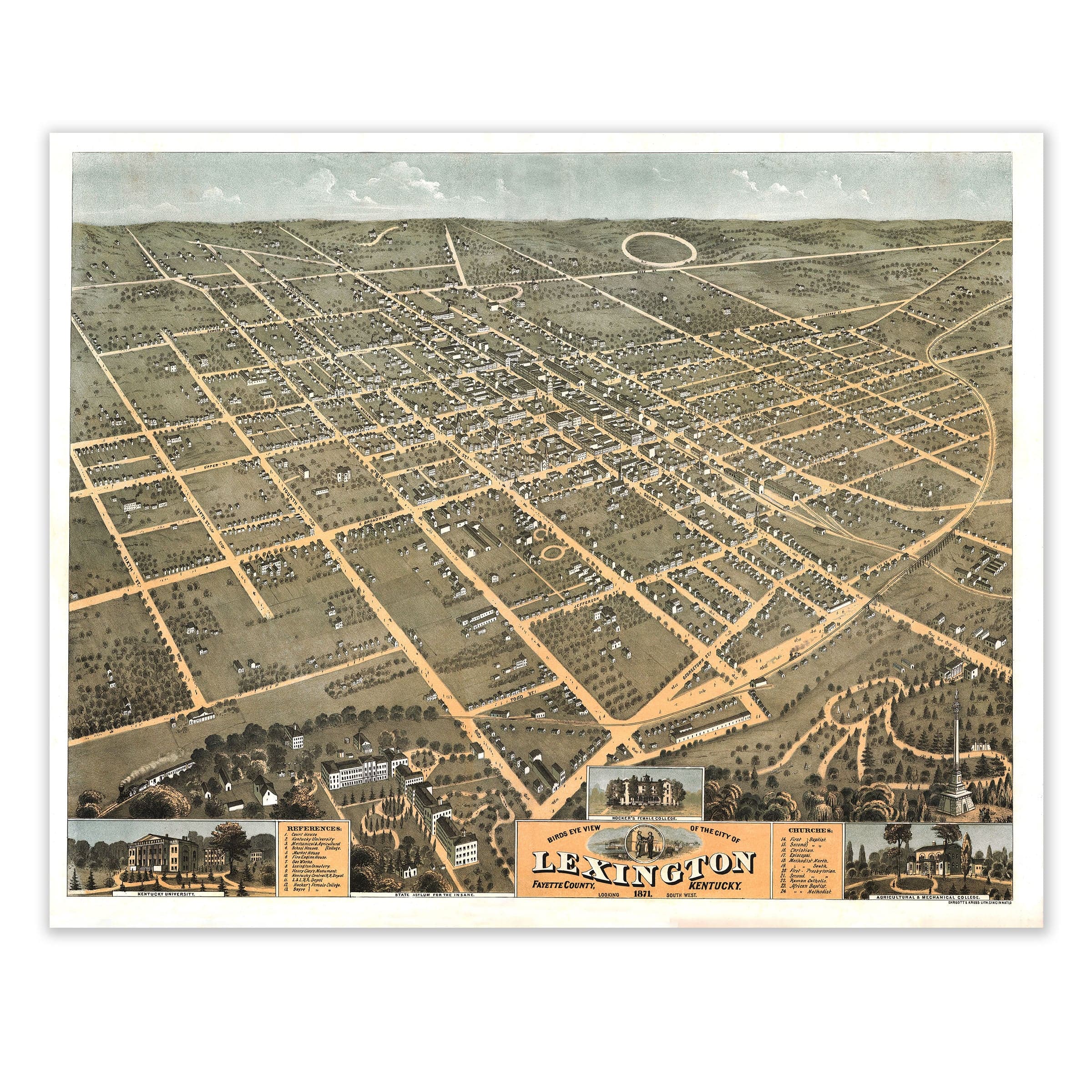
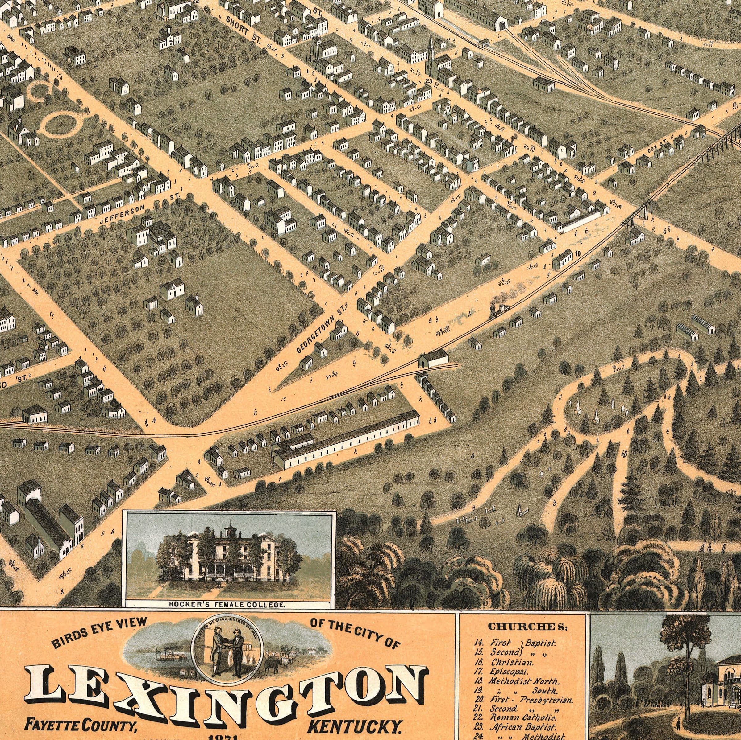
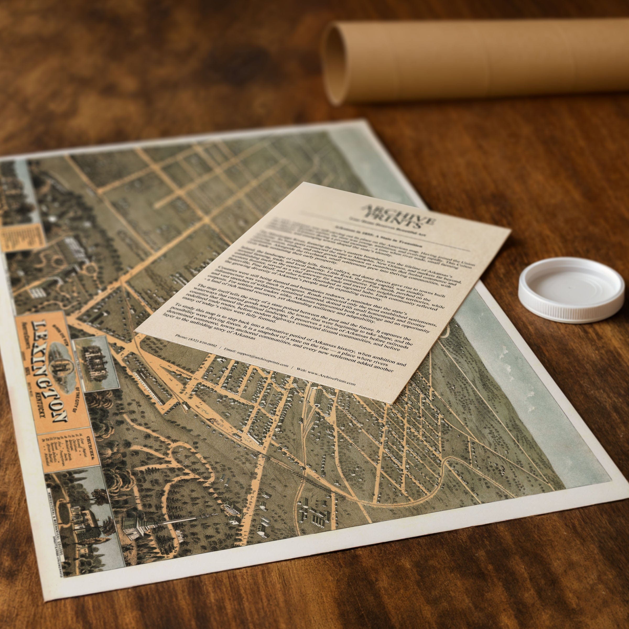
Discover the historic Lexington, Fayette County, KY Map from 1871 that captures a city rooted in the traditions of the Bluegrass while stepping confidently toward modernization. This vintage map style expansive bird's-eye view by renowned cartographer Albert Ruger showcases Lexington at a pivotal moment when its reputation as the "Athens of the West" blended with the growing energy of a post–Civil War Southern town during the early years of Reconstruction. The Lexington, Fayette County, KY Map spreads across the rolling Bluegrass landscape from above the southern outskirts, revealing a neatly ordered grid of streets lined with tidy homes, workshops, and small businesses, with broad avenues radiating from the city center—Main, Short, High, and Jefferson Streets—forming the civic framework where commerce, community, and culture converged. This old map aesthetic features horse-drawn carriages and pedestrians animating these thoroughfares, evoking the calm rhythm of daily life in a prosperous Kentucky town during the height of the Bluegrass region's agricultural prominence. At the heart of this vintage map stands the Courthouse Square, an anchor of civic pride and public gathering, surrounded by churches, banks, schools, and hotels, all rendered with Ruger's characteristic precision that reflects Lexington's status as an educational and cultural hub—home to Transylvania University, one of the oldest institutions of higher learning west of the Alleghenies. The university's handsome campus appears prominently in the foreground, reinforcing the city's long-standing commitment to scholarship and intellectual life that earned it the nickname "Athens of the West." Beyond the central district, Lexington's celebrated agricultural heritage comes into focus in this old map, with spacious lots, tree groves, and farmland bordering the town, hinting at the horse farms and bluegrass pastures that defined the region, while to the northeast, the circular race track signals the city's deep connection to thoroughbred breeding and racing—a tradition that would soon bring Lexington worldwide acclaim. This vintage map also highlights the city's growing infrastructure, with rail lines stretching toward the horizon, linking Lexington to Louisville, Cincinnati, and other major markets, as the arrival of rail transportation in the mid-nineteenth century had already begun transforming the city into a commercial crossroads, facilitating the movement of livestock, goods, and travelers throughout the Bluegrass region. Ruger's view captures Lexington at a moment when old and new coexisted in harmony, with tranquil residential streets, the thriving town center, and the surrounding countryside together reflecting a community grounded in heritage but eager for progress, preserving the character of Lexington before its expansion in the late nineteenth and early twentieth centuries—when it was still a compact, graceful town at the heart of the Bluegrass. Each reproduction includes a custom historical letter detailing the story behind the map, making it perfect for Kentucky collectors, Lexington residents, and thoroughbred racing enthusiasts. Printed on heavyweight archival paper or hand-stretched polycotton canvas, every street, building, and pasture detail is rendered in museum-grade clarity for generations of enjoyment. Paper prints ship rolled in heavy-duty tubes, while canvas editions arrive gallery-wrapped on solid pine stretcher bars with pre-installed hardware—ready to display the moment it arrives. Bring home the spirit of 1871 Lexington and celebrate the Athens of the West at the heart of Kentucky's Bluegrass country.
The Map Story
Materials
Choose options

Because every place has a story
Make History Personal
A vintage map is more than art.
It is a reminder of where life began.
Where memories were made.
Where hearts still live. Give the gift of place.
Beautifully preserved and made for the moments that matter.
Why Choose Us?
| Feature | Us | Competitor A | Competitor B |
|---|---|---|---|
| Hand Crafted | |||
| Museum Quality | |||
| 100 Year Guarantee | |||
| Restored by Hand | |||
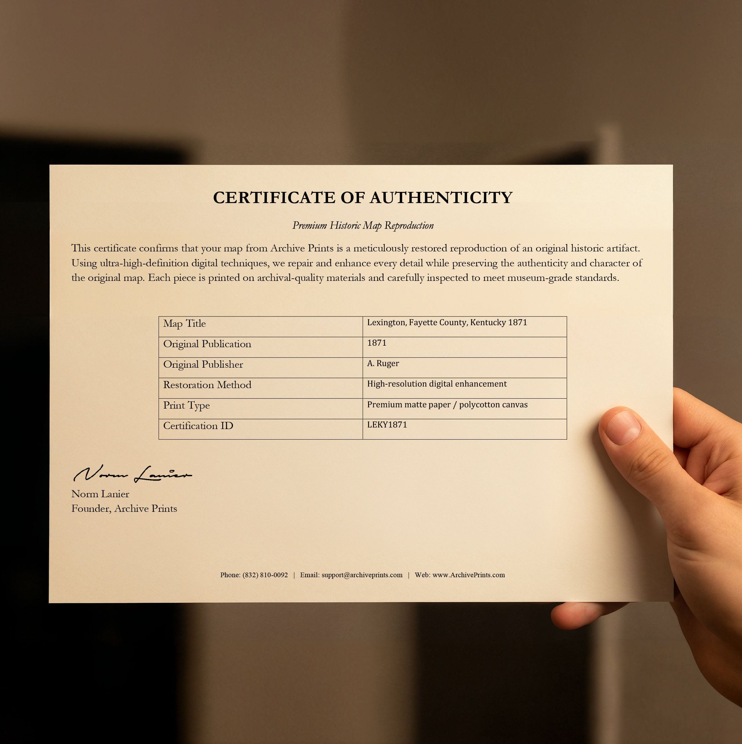
| Certificate of Authenticity |

Art Prints
Archival quality colors. Best option if you'd like to frame it yourself

The Best Materials
We hand-stretched our canvas on solid American-grown pine stretcher bars. We use quality canvas and fade-resistant inks to create the lasting art. Canvases come with hardware already installed and ready to hang.
Need help?
Frequently Asked Questions
Order
All of our maps are meticulously restored reproductions of historic originals. Each piece is digitally repaired and color-corrected to bring out the finest details while preserving its authentic, vintage character.
Yes. All Archive Prints products are printed to order in the USA with archival materials.
We offer two premium formats:
- High-Quality Paper Posters – Printed on thick, archival-grade matte paper for rich, vibrant detail.
- Hand-Stretched Canvas Prints – Printed on premium polycotton canvas and mounted on 1.5" solid American pine stretcher bars for a gallery-quality finish.
We carefully digitally restore each map to enhance clarity and color while preserving its original look and historic charm. You’ll enjoy sharp details and a timeless vintage aesthetic that feels true to the original piece.
Yes, we do! We offer premium framing options to make your map ready to hang the moment it arrives. You can choose from Oak, Maple, Black, or Walnut frames directly on the product page. We also offer Stretched Canvas prints for a modern gallery look, as well as archival-quality Posters if you prefer to frame it yourself.
Yes! We offer free shipping on all products within the United States. Each map is carefully packaged to ensure it arrives in perfect condition.
If you’re not completely satisfied, you can return your order in new condition for a full refund. Return shipping costs are the responsibility of the customer.
Absolutely! Our maps make thoughtful, one-of-a-kind gifts for history lovers, map collectors, or anyone looking to add vintage character to their home or office. Choose between paper prints for framing or stretched canvas for a ready-to-hang presentation.
- Paper Posters → Shipped in durable, protective tubes to prevent creasing.
- Canvas Prints → Carefully wrapped, padded, and boxed to ensure safe delivery.
Our maps look stunning in a variety of settings, including:
- Living rooms and home offices
- Libraries and studies
- Corporate offices and conference rooms
- Restaurants, cafes, and boutique spaces