


Little Rock, Arkansas Map 1887
Little Rock, Arkansas Map 1887
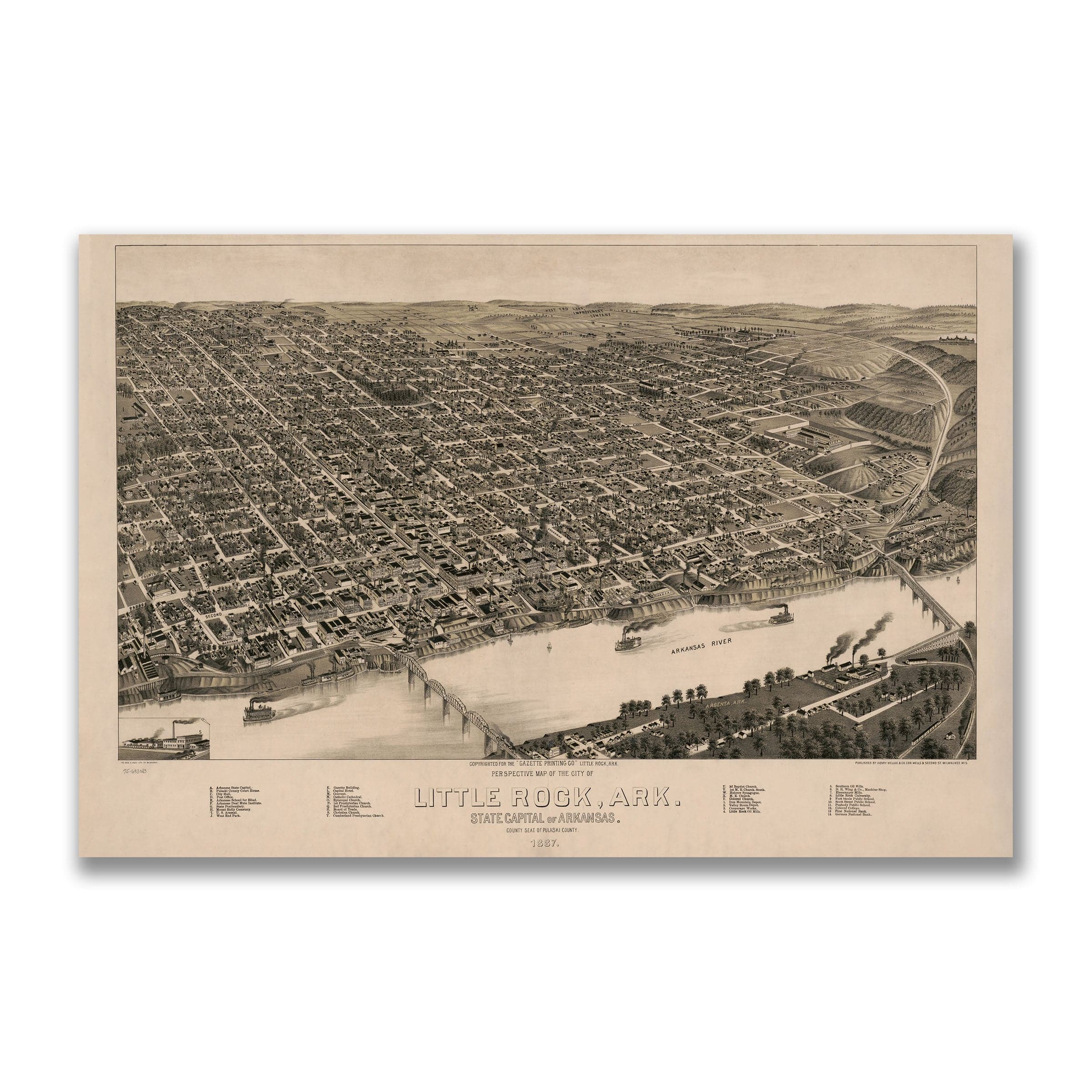
Discover the remarkable Little Rock, Arkansas Map by Henry Wellge, capturing Little Rock in 1887 at a defining moment in its growth—a Southern capital reshaping itself with new rail lines, rising neighborhoods, and a renewed sense of purpose. Published for the Arkansas Gazette, this panoramic bird's-eye view reveals a community expanding confidently along the bluffs of the Arkansas River, transforming from a frontier outpost into a modern regional center.
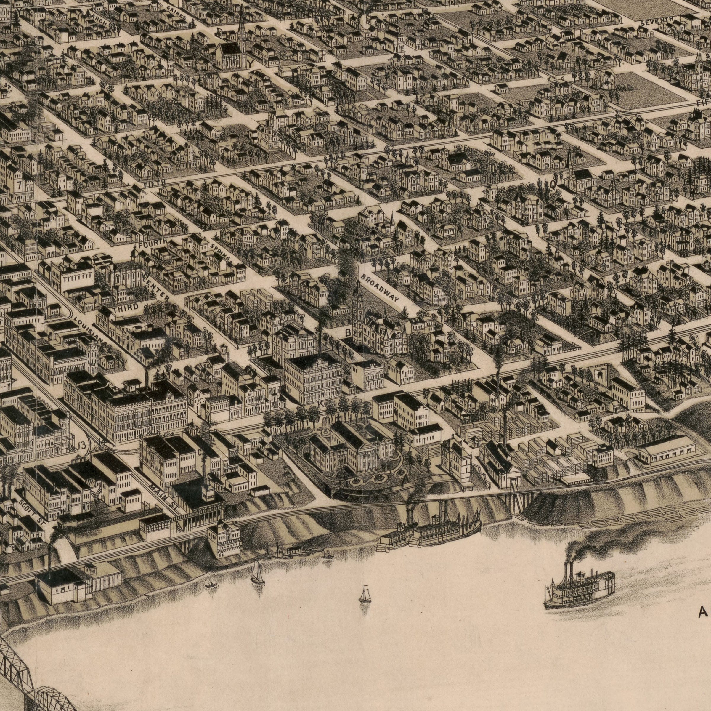
The Little Rock, Arkansas Map highlights the city's growing urban grid, where neatly aligned streets stretch outward in every direction. From the bustling riverfront to the newly developing neighborhoods on higher ground, blocks fill with homes, churches, warehouses, and shops. The density of detail—thousands of individual structures rendered with Wellge's characteristic precision—reflects the remarkable transformation taking place as Little Rock established itself as Arkansas's capital city.
The Arkansas River dominates the foreground of this Little Rock, Arkansas Map, where paddlewheel steamers and freight boats ply the busy waterway. The great bridges linking Little Rock with Argenta stand as engineering triumphs of the era, carrying rail cars and travelers across the river and binding the region into the expansive networks of the American South and Midwest. Along the riverbank, mills, depots, and industrial yards underscore the city's growing importance as a transportation and commercial hub.
Downtown in this Little Rock, Arkansas Map, prominent buildings include the U.S. Arsenal, city schools, the courthouse, and the old Statehouse—still serving as the seat of Arkansas government. Market Street and Main Street run north toward the river, lined with hotels, shops, and civic establishments that pulsed with daily activity in the late 19th century. Smokestacks rise from factories and rail yards, signaling the industrial vigor that fueled the city's expansion. Beyond the central districts, Wellge's map captures the rolling hills, fields, and emerging suburbs that surrounded the capital.
Perfect for Little Rock residents, Arkansas history enthusiasts, and collectors of Southern urban cartography, this Little Rock, Arkansas Map reproduction includes a custom historical certificate. Railroads thread through the terrain, connecting Little Rock to Memphis, St. Louis, and Texas, while new institutions anchor the expanding cityscape. Printed on heavyweight archival paper or hand-stretched polycotton canvas, every building, street, bridge, and riverboat is restored in museum-grade clarity for generations of enjoyment. Paper prints ship rolled in heavy-duty tubes, while canvas editions arrive gallery-wrapped on solid pine stretcher bars with pre-installed hardware—ready to display the moment it arrives. Bring home a piece of Little Rock history and celebrate the capital at the dawn of its metropolitan future.
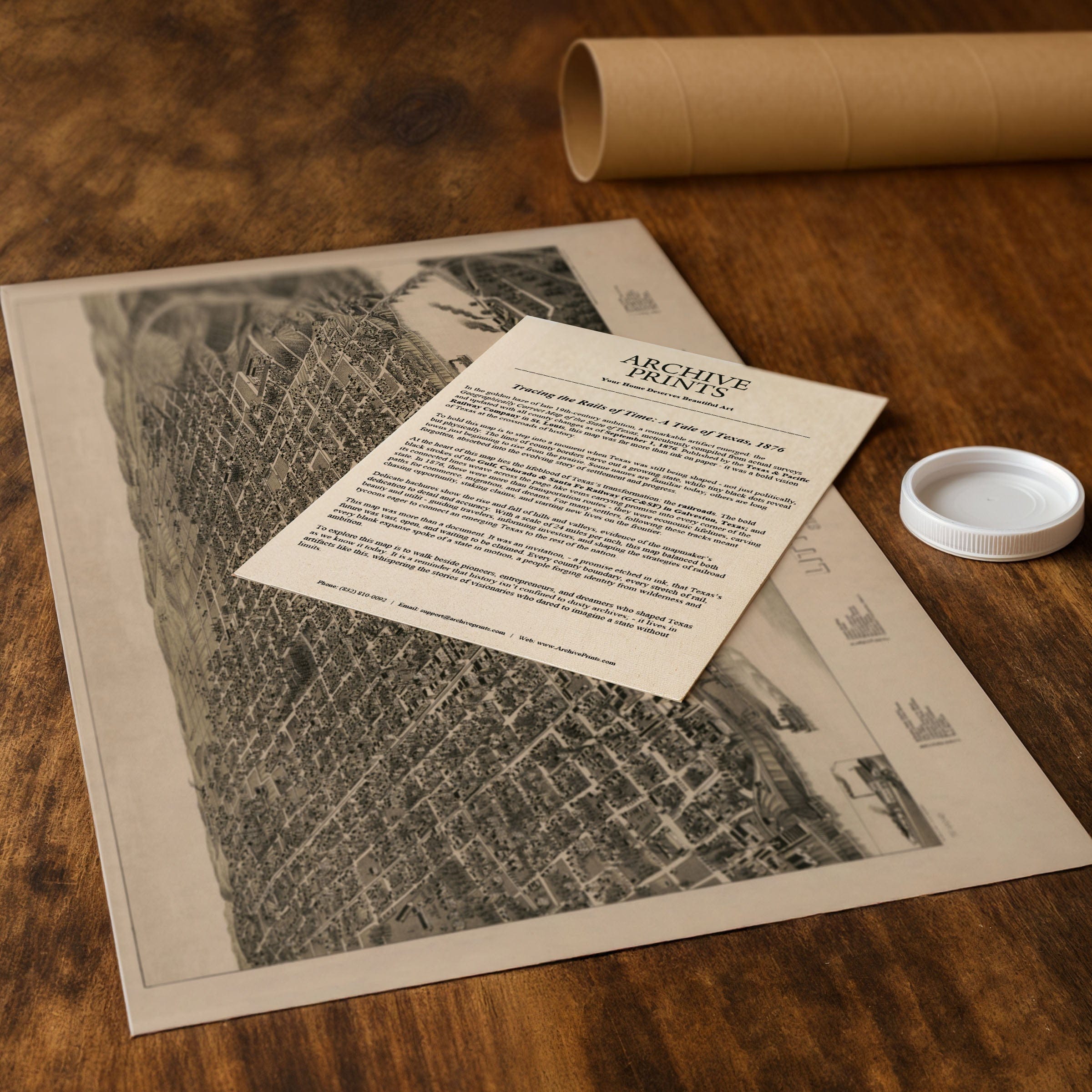
The Map Story
Materials
Choose options

Because every place has a story
Make History Personal
A vintage map is more than art.
It is a reminder of where life began.
Where memories were made.
Where hearts still live. Give the gift of place.
Beautifully preserved and made for the moments that matter.
Why Choose Us?
| Feature | Us | Competitor A | Competitor B |
|---|---|---|---|
| Hand Crafted | |||
| Museum Quality | |||
| 100 Year Guarantee | |||
| Restored by Hand | |||
| Certificate of Authenticity |

Art Prints
Archival quality colors. Best option if you'd like to frame it yourself

The Best Materials
We hand-stretched our canvas on solid American-grown pine stretcher bars. We use quality canvas and fade-resistant inks to create the lasting art. Canvases come with hardware already installed and ready to hang.
Need help?
Frequently Asked Questions
Order
All of our maps are meticulously restored reproductions of historic originals. Each piece is digitally repaired and color-corrected to bring out the finest details while preserving its authentic, vintage character.
Yes. All Archive Prints products are printed to order in the USA with archival materials.
We offer two premium formats:
- High-Quality Paper Posters – Printed on thick, archival-grade matte paper for rich, vibrant detail.
- Hand-Stretched Canvas Prints – Printed on premium polycotton canvas and mounted on 1.5" solid American pine stretcher bars for a gallery-quality finish.
We carefully digitally restore each map to enhance clarity and color while preserving its original look and historic charm. You’ll enjoy sharp details and a timeless vintage aesthetic that feels true to the original piece.
Yes, we do! We offer premium framing options to make your map ready to hang the moment it arrives. You can choose from Oak, Maple, Black, or Walnut frames directly on the product page. We also offer Stretched Canvas prints for a modern gallery look, as well as archival-quality Posters if you prefer to frame it yourself.
Yes! We offer free shipping on all products within the United States. Each map is carefully packaged to ensure it arrives in perfect condition.
If you’re not completely satisfied, you can return your order in new condition for a full refund. Return shipping costs are the responsibility of the customer.
Absolutely! Our maps make thoughtful, one-of-a-kind gifts for history lovers, map collectors, or anyone looking to add vintage character to their home or office. Choose between paper prints for framing or stretched canvas for a ready-to-hang presentation.
- Paper Posters → Shipped in durable, protective tubes to prevent creasing.
- Canvas Prints → Carefully wrapped, padded, and boxed to ensure safe delivery.
Our maps look stunning in a variety of settings, including:
- Living rooms and home offices
- Libraries and studies
- Corporate offices and conference rooms
- Restaurants, cafes, and boutique spaces