Louisiana Map - Vintage State Map by Colton for Home Decor
Discover a Piece of Louisiana History
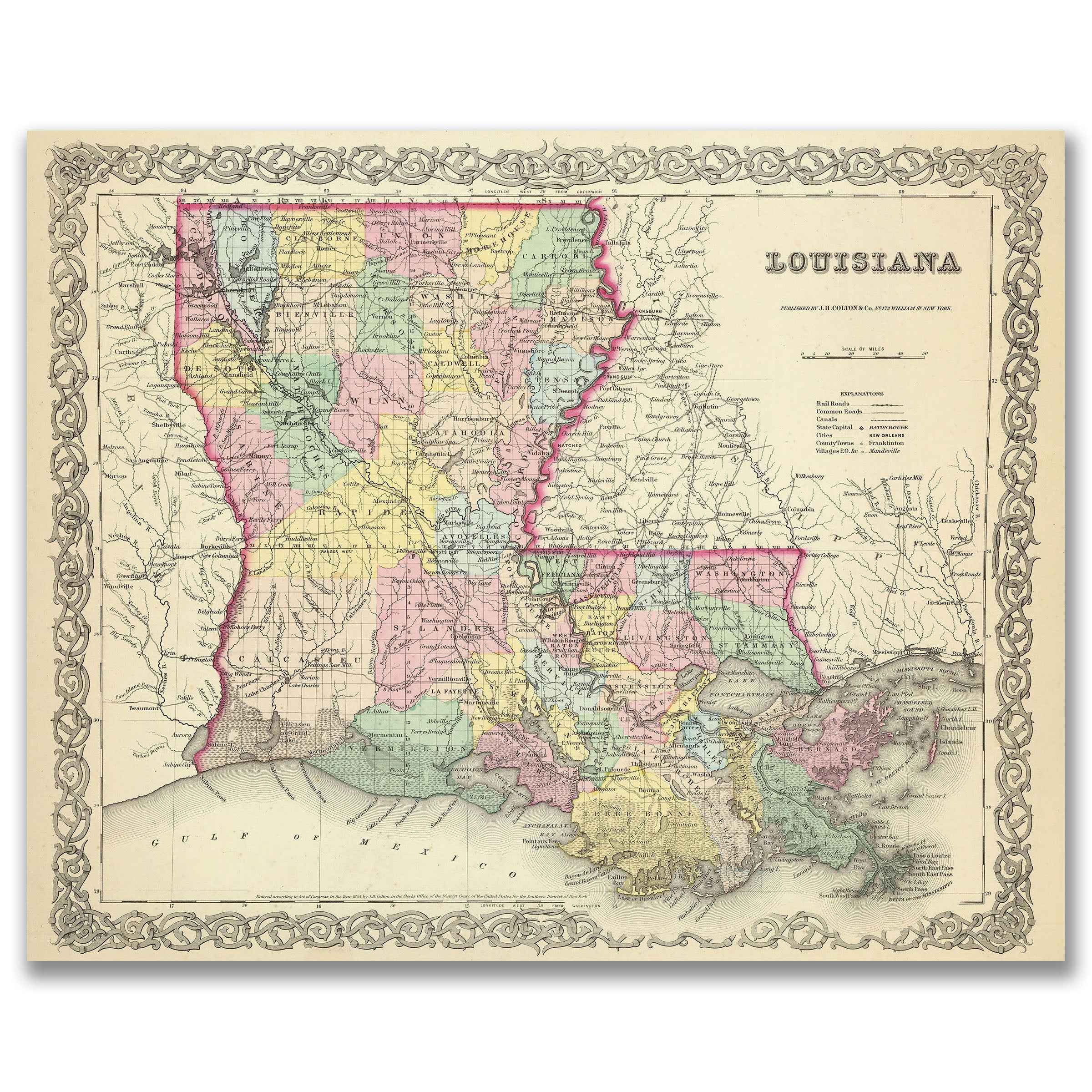
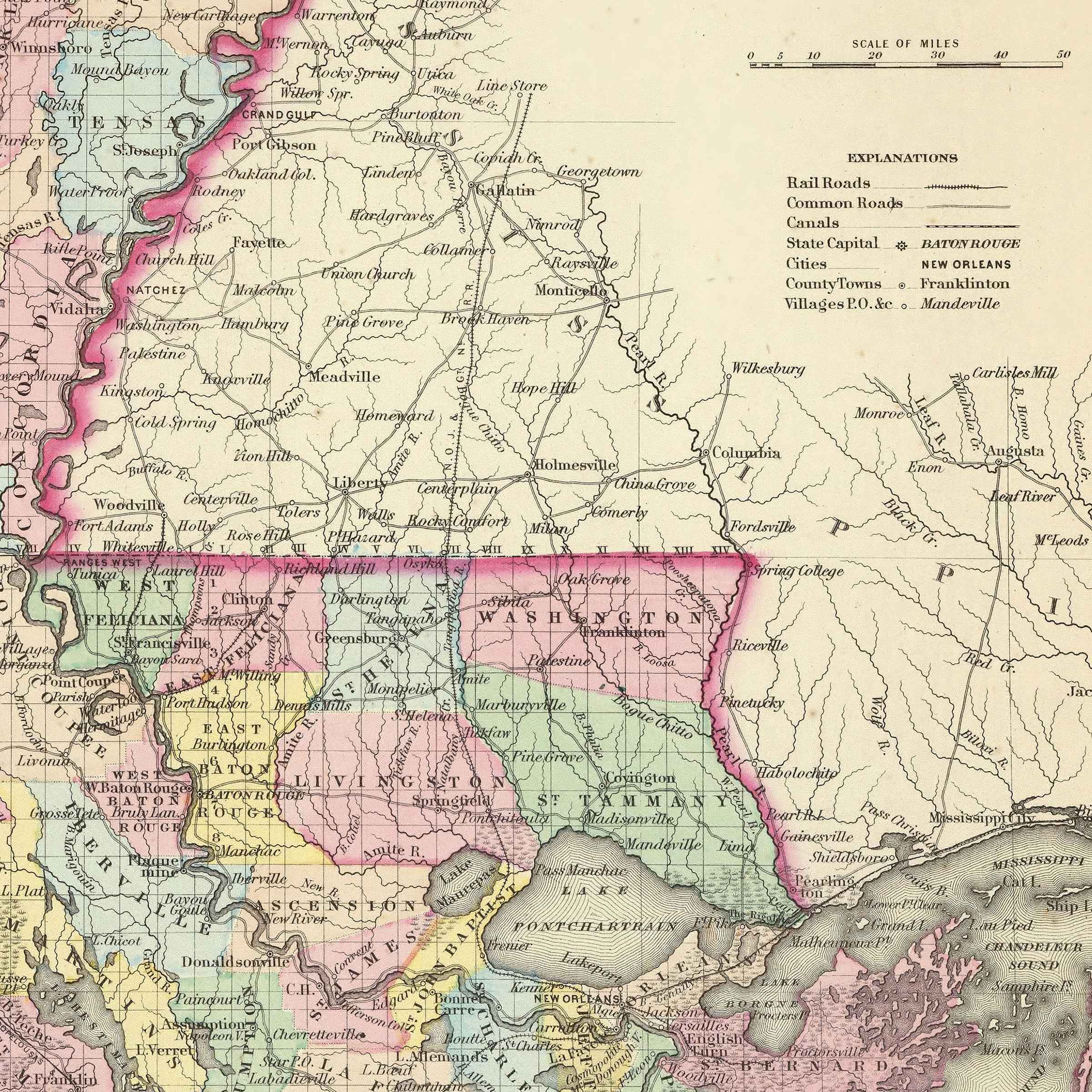
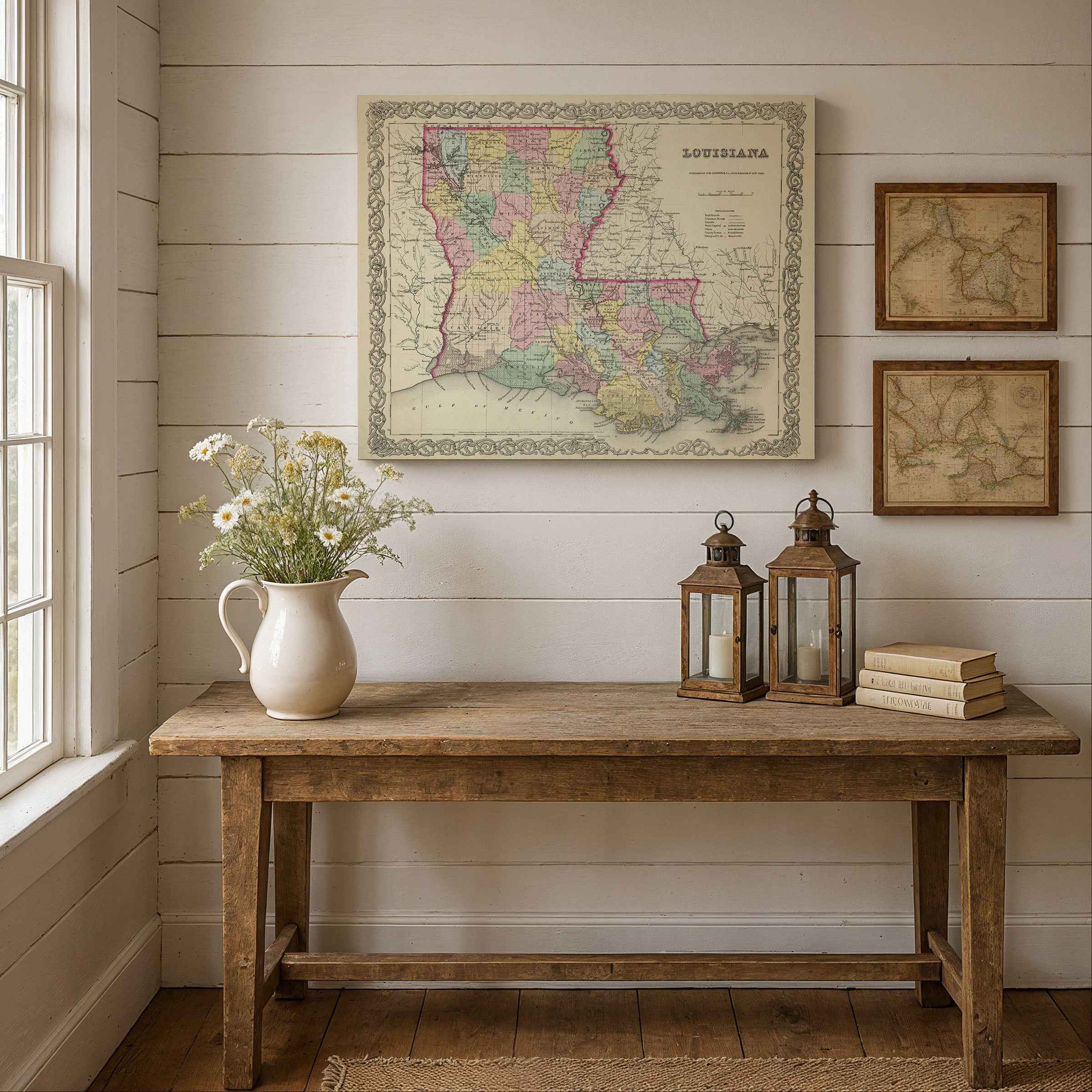
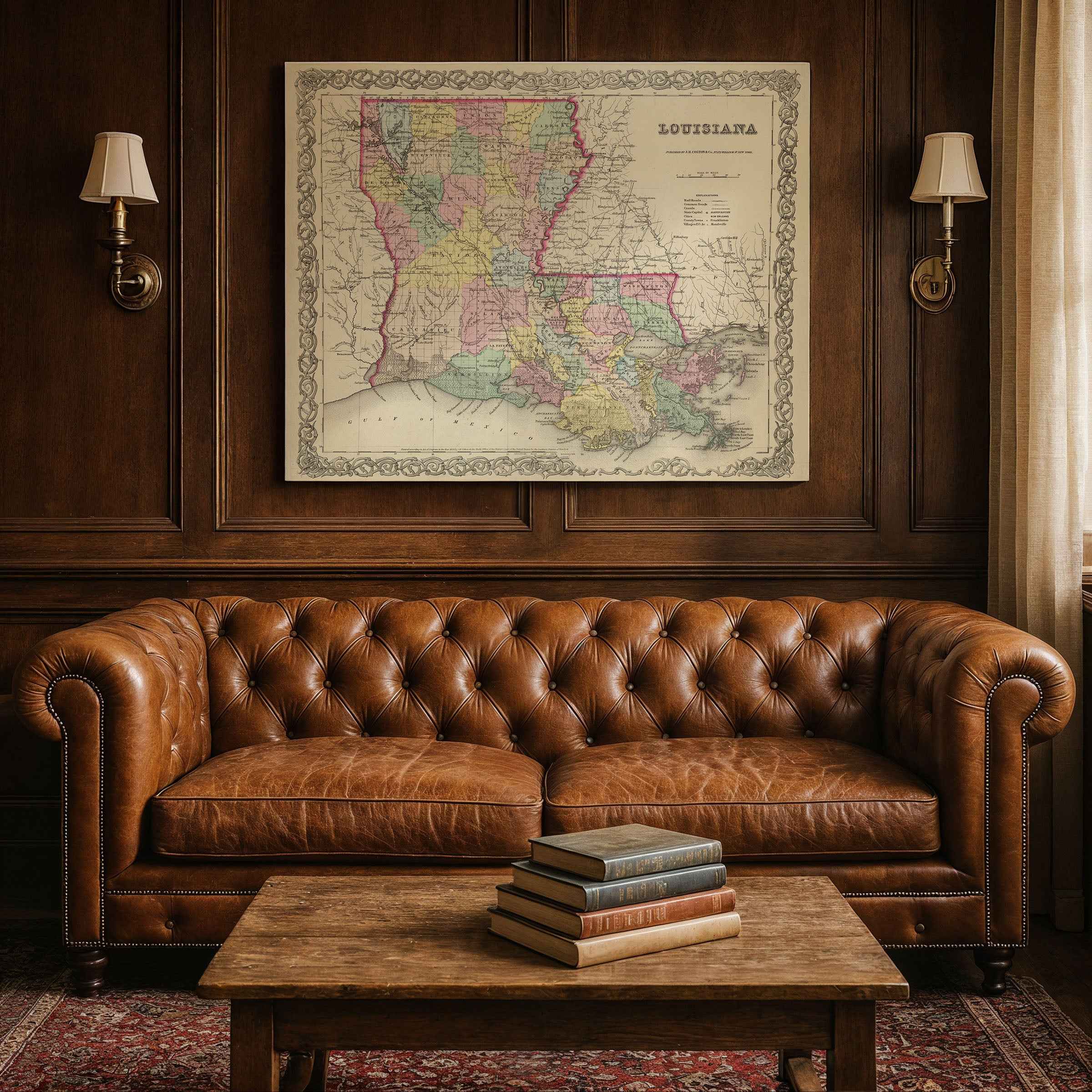
Step back into the 1850s and explore the vibrant tapestry of the American South with this beautifully restored 1856 Louisiana Map. Created by the renowned cartographer G.W. Colton, this map is more than a geographical record; it’s a vivid portrait of a state at a pivotal moment in the nineteenth century. Framed by an elegant decorative border and featuring detailed insets, it meticulously charts Louisiana’s parishes, highlighting vital waterways and early transportation routes that connected its growing towns and communities.
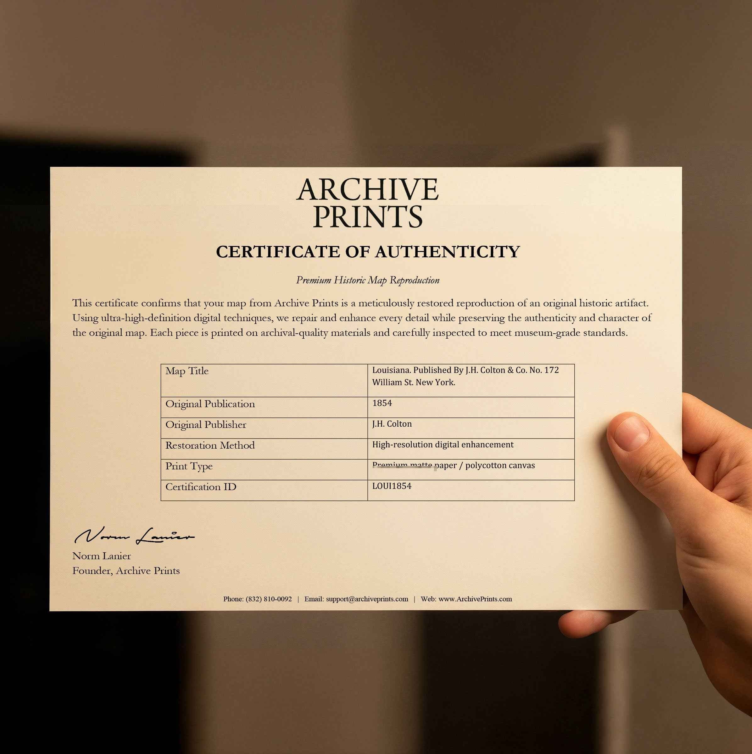
Each reproduction includes a custom historical letter that tells the story behind the map, making it an ideal gift for collectors, cartography fans, and anyone who loves American history. Printed on heavyweight archival paper or premium poly-cotton canvas, every label, parish line, and bayou is preserved in ultra-high-definition clarity thanks to meticulous digital restoration—rich ink tones, crisp linework, and the warm vintage patina intact.
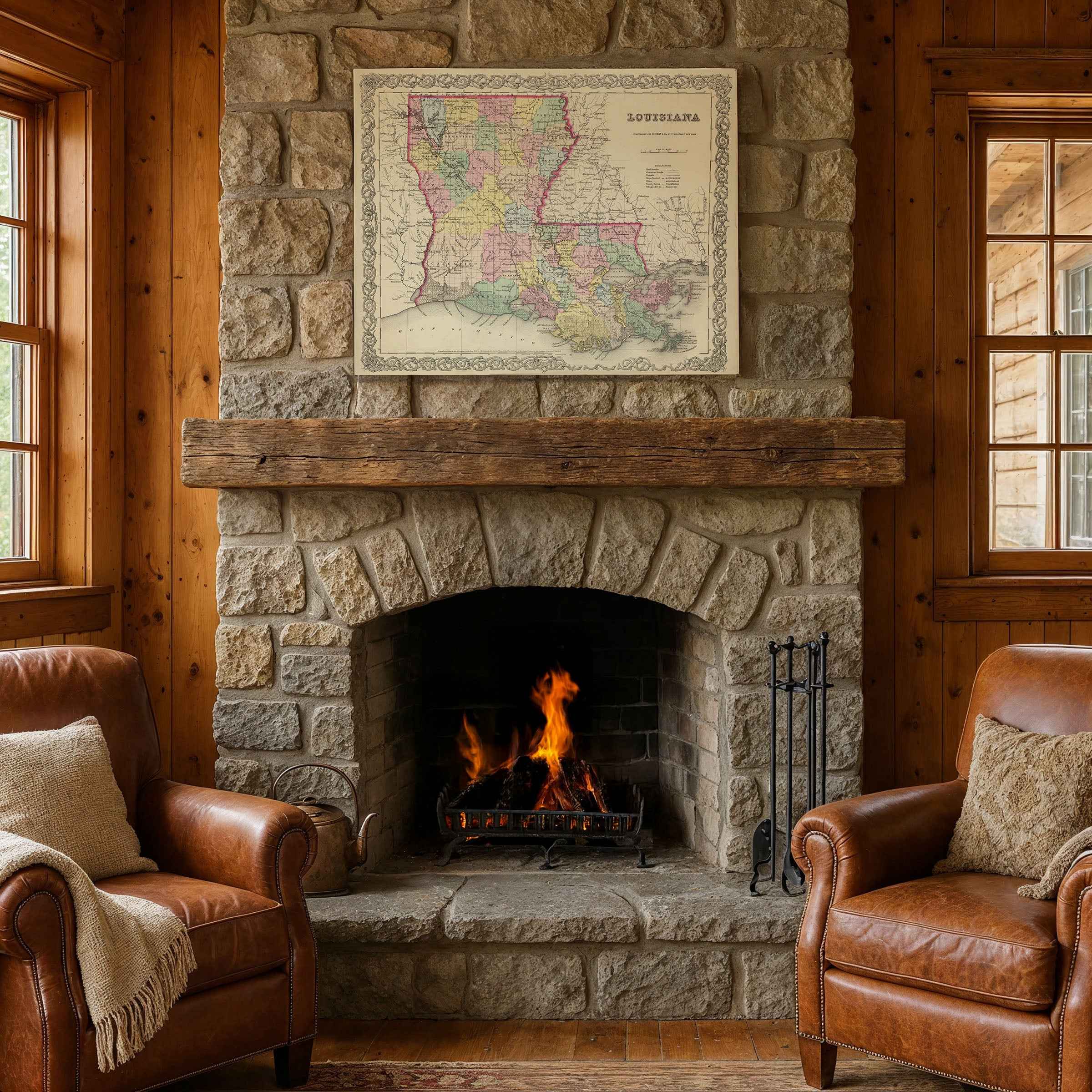
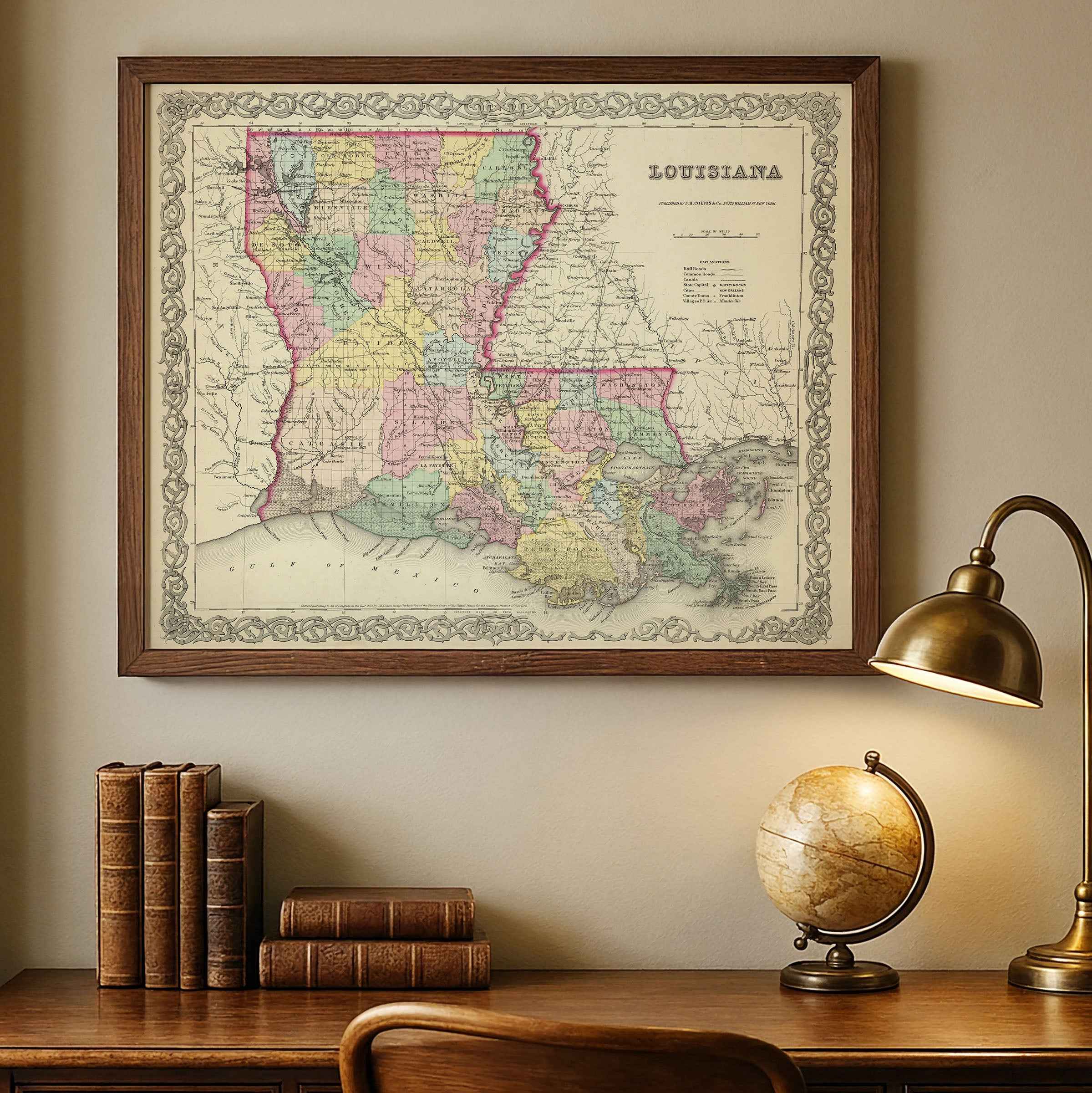
For protection and presentation, we craft every detail with care. Paper prints are rolled in a sturdy cardboard mailing tube and sized for easy framing. Canvas prints are gallery-wrapped on solid 1.5″ pine stretcher bars and ship in reinforced boxes—ready to hang with a pre-installed sawtooth hanger.
Bring home more than wall art. Bring home a story, a conversation piece, and a striking centerpiece that celebrates Louisiana’s rich heritage, its unique cultural blend, and the timeless spirit of its people.
The Map Story
Colton’s 1856 map of Louisiana presents the state in rich county colors, bound by the Mississippi River’s sinuous course and the Gulf’s endless horizon. Behind the engraved lines is a society alive with contradictions—wealth and want, progress and resistance, tradition and transformation.
It is 1856, and Franklin Pierce is president. The nation trembles under debates about slavery’s expansion, and in Louisiana the stakes are visceral. Cotton and sugar roll out from plantations strung along the river, their profits measured in bales and barrels, their labor rooted in bondage. The steamboats at New Orleans docks release a haze of smoke and commerce, tying Louisiana’s fate to markets as far as Liverpool and Havana. Yet in the same streets, immigrants from Ireland and Germany crowd boardinghouses, looking for footholds in a city where fortunes could be made or lost overnight.
New Orleans stands as the South’s commercial capital. Its levees are stacked with cargo, its French Quarter still echoing with Creole music and conversation, its new American sector pulsing with banks, auction houses, and cotton exchanges. French and English newspapers compete for readers, while Creole families guard traditions even as Anglophone newcomers expand their influence. Yellow fever seasons sweep through with merciless rhythm, shaping every summer with dread.
Beyond the city, parishes stretch into bayou and pine forest. In the north, small farmers coax corn and hogs from upland fields, while pine tar and timber feed steamboats and mills. In the south, the plantations rule, lined with sugar mills clanging and smoking, wealth concentrated in a few hands. In Acadiana, French-speaking communities hold onto language and custom, their towns slower to change, their Catholic churches anchoring daily life.
Louisiana is a place where lines blur—between French and English, Catholic and Protestant, free and enslaved, Creole and American. Free people of color carve out lives in New Orleans, running businesses and shaping culture, even as laws tighten against them. The Mississippi itself is both lifeline and threat, bringing goods, news, and wealth downstream, while each spring flood reminds residents that water can sweep away fields, cabins, and lives with little warning.
In 1856 Louisiana feels both established and unsettled. Railroads stretch tentatively outward, promising to link interior parishes with distant markets. Politicians argue in Baton Rouge over states’ rights and federal power, while planters debate whether to embrace or resist change. For now, the plantations thrive, the steamboats whistle, and the city glitters, but beneath it all, tension builds.
Life in Louisiana in 1856 was never neat, no matter how clean Colton’s borders appear. The map suggests balance, but the state’s rhythm was unpredictable—floods could upend harvests, fever could empty streets, and politics could ignite into flame. What endured was the persistence of its people: planters and merchants chasing fortune, fishermen and boatmen living by the tides, Creole families passing down language and song, immigrants carving out new lives in crowded wards. Louisiana was not simply a place on paper; it was a living crossroads where river smoke met salt air, where cultures overlapped, and where the future felt both promising and precarious.
Materials
Hand‑Stretched Canvas: If you choose canvas, we use a premium cotton‑poly blend stretched over solid pine frames. Each canvas is carefully hand‑stretched for a tight, gallery‑quality finish that’s ready to hang right out of the box.
Vivid, Fade‑Resistant Inks: We use professional‑grade inks that are UV‑resistant, so your print retains its rich colors even when displayed in bright rooms.
Expert Restoration: Every map is digitally restored by skilled artisans. We preserve the character of the original while enhancing clarity, so you see the map as it was meant to be seen.
Secure Packaging: Paper prints are rolled in heavy‑duty mailing tubes, and canvases are cushioned in reinforced boxes to ensure they arrive in pristine condition.
Choosing one of our prints means investing in craftsmanship. We combine historical authenticity with modern print technology and premium materials, giving you a work of art built to stand the test of time.
Choose options

Because every place has a story
Make History Personal
A vintage map is more than art.
It is a reminder of where life began.
Where memories were made.
Where hearts still live. Give the gift of place.
Beautifully preserved and made for the moments that matter.
Why Choose Us?
| Feature | Us | Competitor A | Competitor B |
|---|---|---|---|
| Hand Crafted | |||
| Museum Quality | |||
| 100 Year Guarantee | |||
| Restored by Hand | |||
| Certificate of Authenticity |

Art Prints
Archival quality colors. Best option if you'd like to frame it yourself

The Best Materials
We hand-stretched our canvas on solid American-grown pine stretcher bars. We use quality canvas and fade-resistant inks to create the lasting art. Canvases come with hardware already installed and ready to hang.
Need help?
Frequently Asked Questions
Order
All of our maps are meticulously restored reproductions of historic originals. Each piece is digitally repaired and color-corrected to bring out the finest details while preserving its authentic, vintage character.
Yes. All Archive Prints products are printed to order in the USA with archival materials.
We offer two premium formats:
- High-Quality Paper Posters – Printed on thick, archival-grade matte paper for rich, vibrant detail.
- Hand-Stretched Canvas Prints – Printed on premium polycotton canvas and mounted on 1.5" solid American pine stretcher bars for a gallery-quality finish.
We carefully digitally restore each map to enhance clarity and color while preserving its original look and historic charm. You’ll enjoy sharp details and a timeless vintage aesthetic that feels true to the original piece.
Yes, we do! We offer premium framing options to make your map ready to hang the moment it arrives. You can choose from Oak, Maple, Black, or Walnut frames directly on the product page. We also offer Stretched Canvas prints for a modern gallery look, as well as archival-quality Posters if you prefer to frame it yourself.
Yes! We offer free shipping on all products within the United States. Each map is carefully packaged to ensure it arrives in perfect condition.
If you’re not completely satisfied, you can return your order in new condition for a full refund. Return shipping costs are the responsibility of the customer.
Absolutely! Our maps make thoughtful, one-of-a-kind gifts for history lovers, map collectors, or anyone looking to add vintage character to their home or office. Choose between paper prints for framing or stretched canvas for a ready-to-hang presentation.
- Paper Posters → Shipped in durable, protective tubes to prevent creasing.
- Canvas Prints → Carefully wrapped, padded, and boxed to ensure safe delivery.
Our maps look stunning in a variety of settings, including:
- Living rooms and home offices
- Libraries and studies
- Corporate offices and conference rooms
- Restaurants, cafes, and boutique spaces