Lower Manhattan, New York City Map 1911
Lower Manhattan, New York City Map 1911
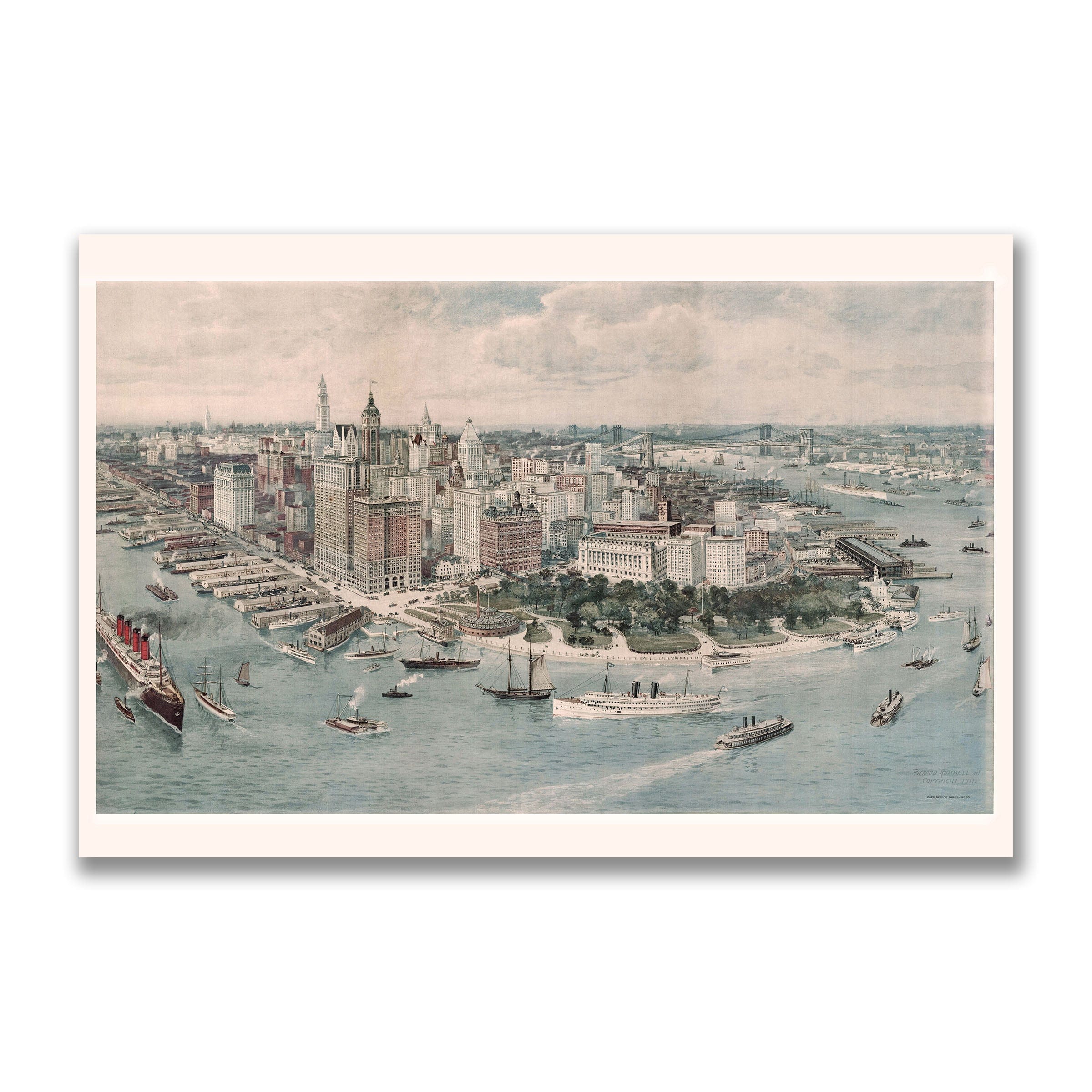
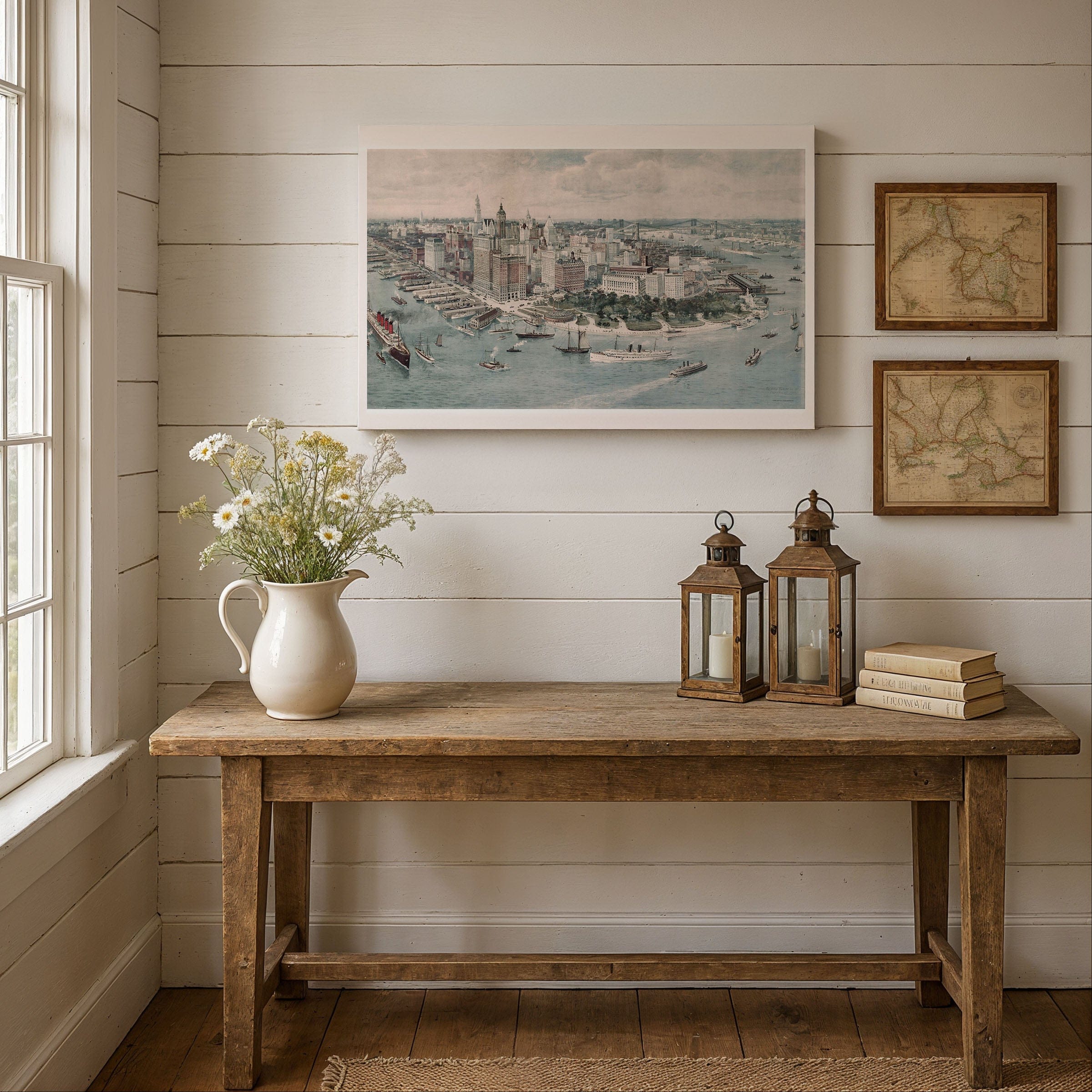
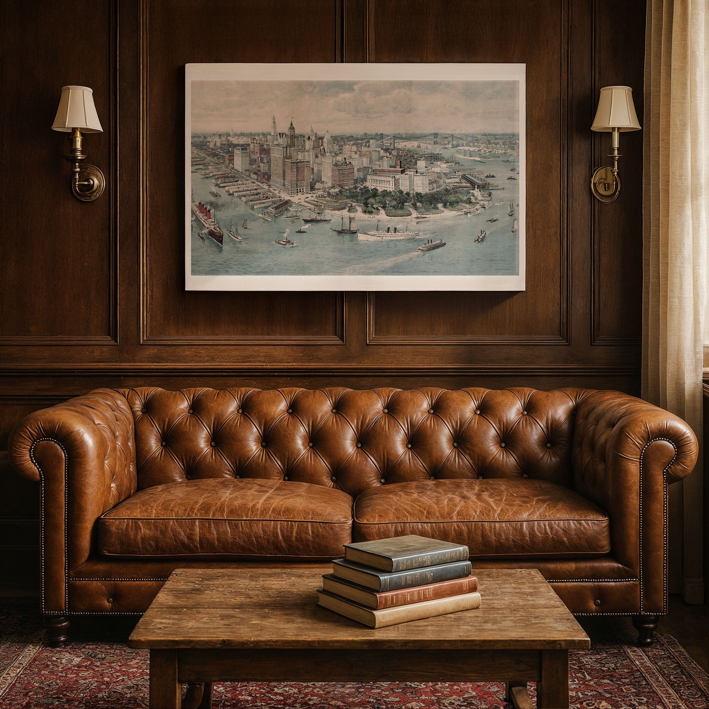
Discover the spectacular Lower Manhattan, New York City Map by Richard Rummell, capturing New York City in 1911 as the unrivaled gateway to America—an island of steel towers, steamship piers, and boundless ambition. This sweeping panoramic bird's-eye view preserves Lower Manhattan at the dawn of the skyscraper age, a moment when the city was transforming from a crowded mercantile port into the global metropolis that would define the 20th century.
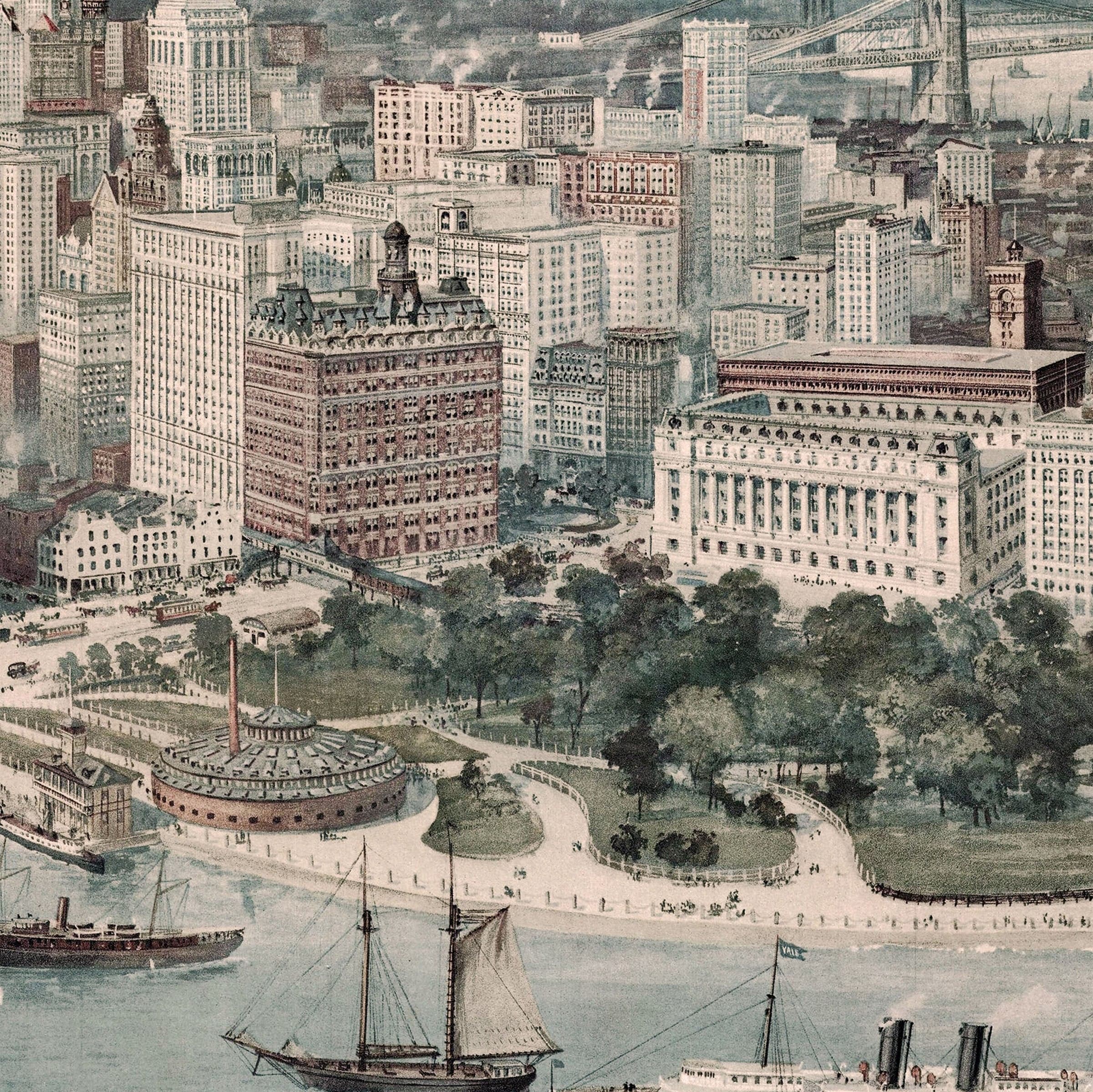
Seen from above New York Harbor, this Lower Manhattan, New York City Map reveals a skyline rising with unprecedented energy. The towering Woolworth Building—soon to be the tallest in the world—shares the horizon with the Singer Tower, the Park Row Building, and the ornate spires of the financial district. Their clustered silhouettes testify to a city racing skyward, driven by commerce, immigration, and the optimism of a booming industrial economy that made New York the center of American enterprise.
Below these architectural giants in this Lower Manhattan, New York City Map, Battery Park forms a peaceful crescent of green at the island's tip, offering contrast to the dense grid of streets and masonry behind it. Its promenades, fountains, and shaded lawns served as a refuge for workers, travelers, and newly arrived immigrants—millions of whom passed through Ellis Island just across the water. From this vantage, the harbor feels like the true heart of the city, connecting New York with the world through trade, travel, and culture.
Along the busy waterfront shown in this Lower Manhattan, New York City Map, rows of piers extend into the Hudson and East Rivers, each one alive with motion. Massive ocean liners, sleek passenger ferries, and sturdy tugboats crowd the harbor, their smokestacks signaling constant departures and arrivals. The great liners of the era—symbols of speed and luxury—reflect New York's stature as the primary portal between the Old World and the New. To the east, the Brooklyn Bridge arcs gracefully across the river, an engineering marvel still heralded as a triumph of American ingenuity.
Perfect for New York City residents, urban history enthusiasts, and collectors of vintage city maps, this Lower Manhattan, New York City Map reproduction includes a custom historical certificate. Rummell's illustration preserves this dynamic moment—when New York was bursting with confidence, its horizons filled with progress, its harbor alive with the movement of nations. Printed on heavyweight archival paper or hand-stretched polycotton canvas, every skyscraper, pier, bridge, and vessel is restored in museum-grade clarity for generations of enjoyment. Paper prints ship rolled in heavy-duty tubes, while canvas editions arrive gallery-wrapped on solid pine stretcher bars with pre-installed hardware—ready to display the moment it arrives. Bring home a piece of New York City history and celebrate Manhattan at the dawn of the skyscraper age.
The Map Story
Materials
Choose options

Because every place has a story
Make History Personal
A vintage map is more than art.
It is a reminder of where life began.
Where memories were made.
Where hearts still live. Give the gift of place.
Beautifully preserved and made for the moments that matter.
Why Choose Us?
| Feature | Us | Competitor A | Competitor B |
|---|---|---|---|
| Hand Crafted | |||
| Museum Quality | |||
| 100 Year Guarantee | |||
| Restored by Hand | |||
| Certificate of Authenticity |

Art Prints
Archival quality colors. Best option if you'd like to frame it yourself

The Best Materials
We hand-stretched our canvas on solid American-grown pine stretcher bars. We use quality canvas and fade-resistant inks to create the lasting art. Canvases come with hardware already installed and ready to hang.
Need help?
Frequently Asked Questions
Order
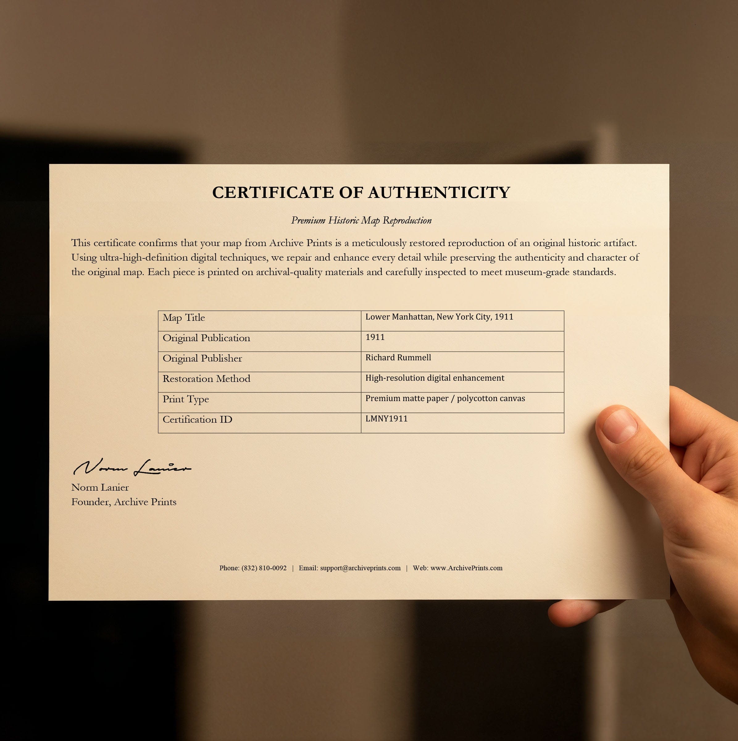
All of our maps are meticulously restored reproductions of historic originals. Each piece is digitally repaired and color-corrected to bring out the finest details while preserving its authentic, vintage character.
Yes. All Archive Prints products are printed to order in the USA with archival materials.
We offer two premium formats:
- High-Quality Paper Posters – Printed on thick, archival-grade matte paper for rich, vibrant detail.
- Hand-Stretched Canvas Prints – Printed on premium polycotton canvas and mounted on 1.5" solid American pine stretcher bars for a gallery-quality finish.
We carefully digitally restore each map to enhance clarity and color while preserving its original look and historic charm. You’ll enjoy sharp details and a timeless vintage aesthetic that feels true to the original piece.
Yes, we do! We offer premium framing options to make your map ready to hang the moment it arrives. You can choose from Oak, Maple, Black, or Walnut frames directly on the product page. We also offer Stretched Canvas prints for a modern gallery look, as well as archival-quality Posters if you prefer to frame it yourself.
Yes! We offer free shipping on all products within the United States. Each map is carefully packaged to ensure it arrives in perfect condition.
If you’re not completely satisfied, you can return your order in new condition for a full refund. Return shipping costs are the responsibility of the customer.
Absolutely! Our maps make thoughtful, one-of-a-kind gifts for history lovers, map collectors, or anyone looking to add vintage character to their home or office. Choose between paper prints for framing or stretched canvas for a ready-to-hang presentation.
- Paper Posters → Shipped in durable, protective tubes to prevent creasing.
- Canvas Prints → Carefully wrapped, padded, and boxed to ensure safe delivery.
Our maps look stunning in a variety of settings, including:
- Living rooms and home offices
- Libraries and studies
- Corporate offices and conference rooms
- Restaurants, cafes, and boutique spaces