
Madison County, Kentucky Map - 1876 Historic County Map
Madison County, Kentucky Map
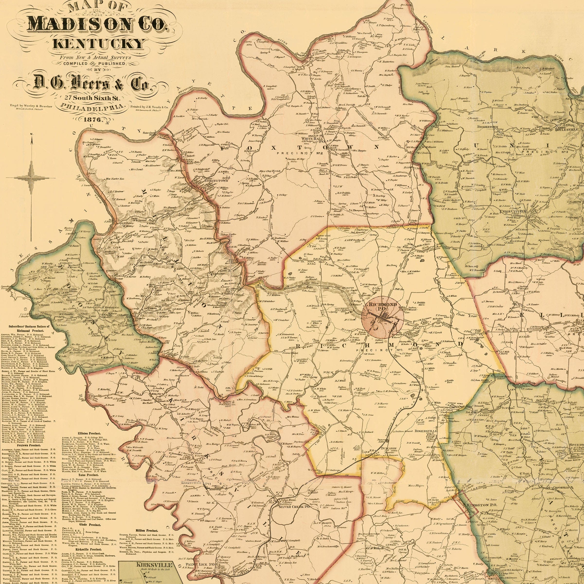
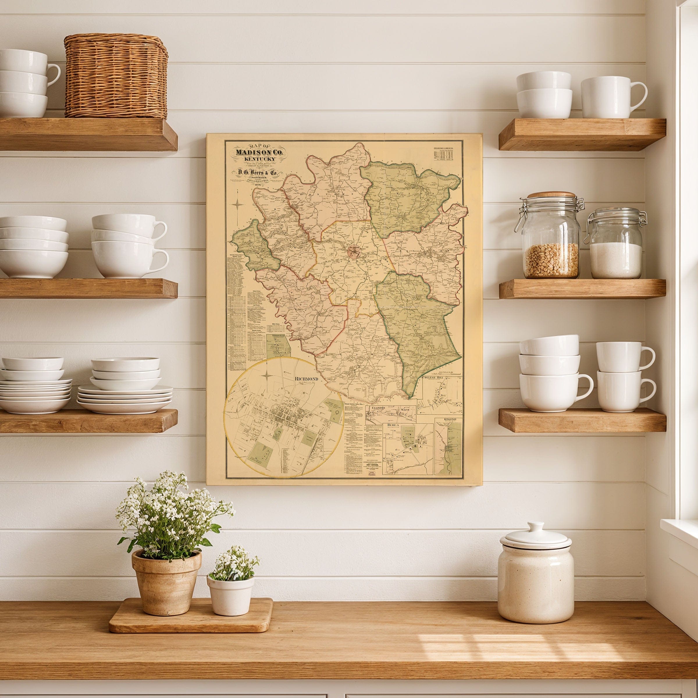
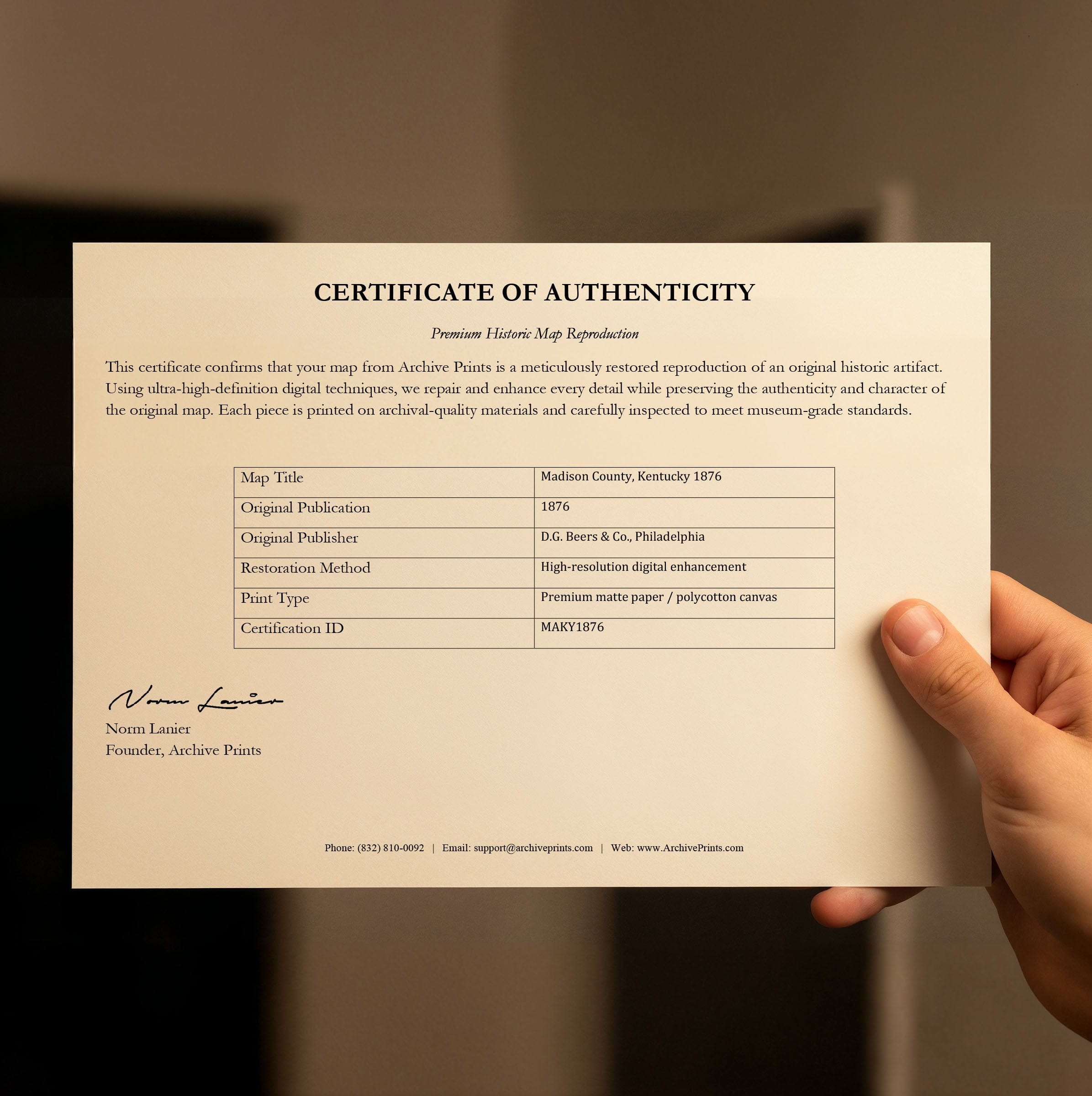
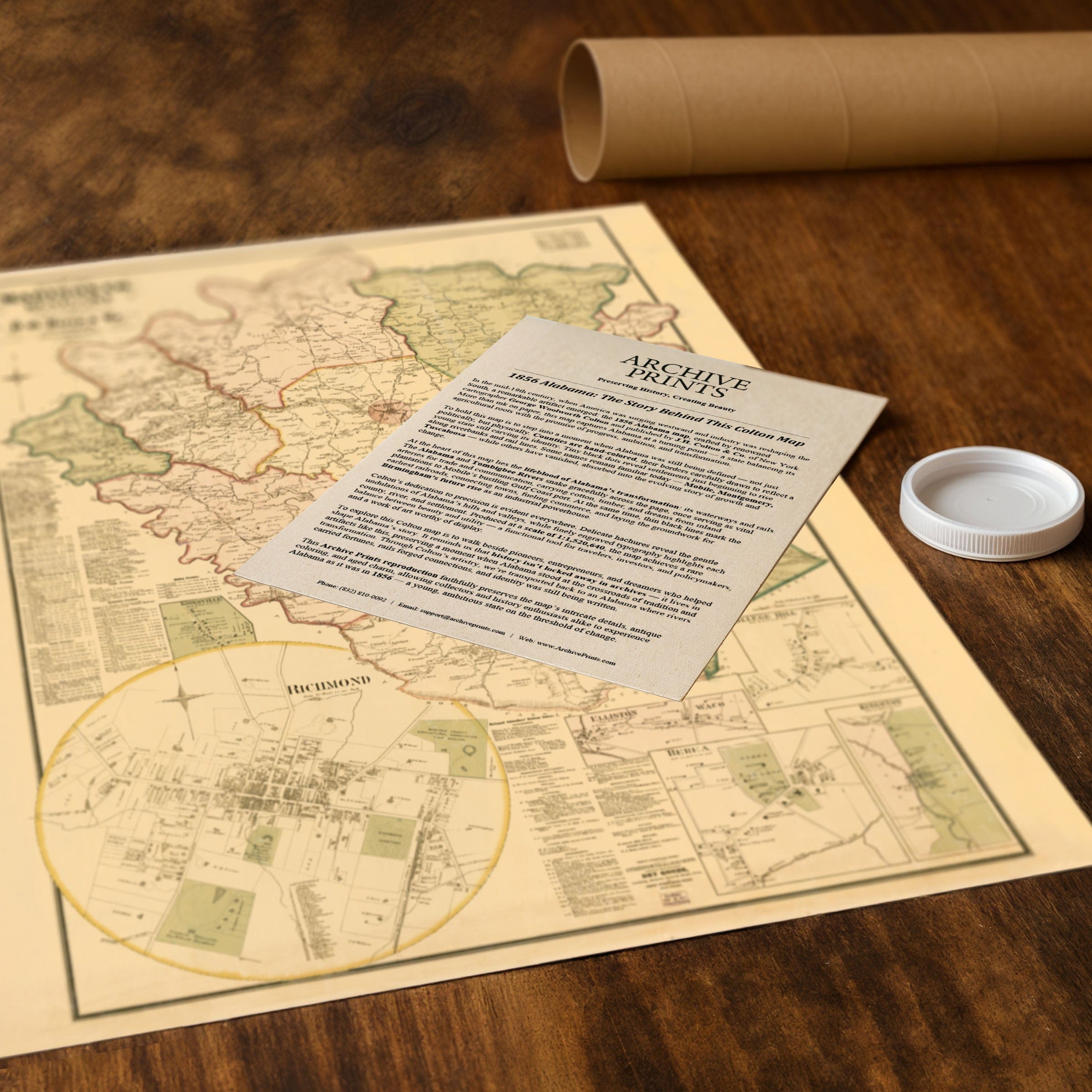
Step back to 1876 when this Madison County, Kentucky Map captured a region at the crossroads of tradition and transformation. This isn't just a county survey—it's a portrait of Kentucky's heartland as it emerged from the upheavals of the Civil War and entered a new era of reconstruction and modernization. Published by D.G. Beers & Co. of Philadelphia during America's Centennial year, this beautifully detailed map reveals Madison County balancing its agricultural heritage with the promise of industrial progress. At the heart of the map lies Richmond, the county seat, shown in a circular inset that highlights its growing civic pride. Streets radiate from the courthouse square, lined with schools, churches, hotels, and small businesses—a testament to the town's role as both the political and commercial center of the county. Inset maps of Berea, Kingston, College Hill, Waco, and Elliston illustrate the smaller but vital communities that dotted the landscape, each connected by a network of turnpikes and railroads weaving commerce and culture together. Madison County's rolling hills and fertile soils—visible in the careful delineation of farms and estates—tell the story of a land long tied to tobacco, hemp, and livestock. Yet the arrival of the Kentucky Central Railroad and other lines, clearly traced across this Madison County, Kentucky map, signaled the rise of industrial opportunity and easier access to markets in Lexington, Louisville, and beyond. For farmers and merchants alike, these iron pathways promised a new rhythm of life, uniting the county's rural character with the nation's expanding economic frontier. Beyond the lines and borders, the map reflects a deep sense of local identity. Dozens of family names appear beside homesteads and mills—echoes of the pioneers who had settled the Bluegrass region nearly a century earlier. Schools, churches, and post offices mark the steady spread of community life, while boundaries of precincts and districts reveal the organized framework of civic growth. Each reproduction includes a custom historical letter detailing the story behind the map, making it perfect for collectors, historians, and Kentucky enthusiasts. Printed on heavyweight archival paper or hand-stretched polycotton canvas, every road, township, and family name is restored in museum-grade clarity for generations of enjoyment. Paper prints ship rolled in heavy-duty tubes, while canvas editions arrive gallery-wrapped on solid pine stretcher bars with pre-installed hardware—ready to display the moment it arrives. Bring home a piece of Kentucky history and celebrate the county that embodied the enduring geometry of the Bluegrass State.
The Map Story
Materials
Choose options

Because every place has a story
Make History Personal
A vintage map is more than art.
It is a reminder of where life began.
Where memories were made.
Where hearts still live. Give the gift of place.
Beautifully preserved and made for the moments that matter.
Why Choose Us?
| Feature | Us | Competitor A | Competitor B |
|---|---|---|---|
| Hand Crafted | |||
| Museum Quality | |||
| 100 Year Guarantee | |||
| Restored by Hand | |||
| Certificate of Authenticity |

Art Prints
Archival quality colors. Best option if you'd like to frame it yourself

The Best Materials
We hand-stretched our canvas on solid American-grown pine stretcher bars. We use quality canvas and fade-resistant inks to create the lasting art. Canvases come with hardware already installed and ready to hang.
Need help?
Frequently Asked Questions
Order
All of our maps are meticulously restored reproductions of historic originals. Each piece is digitally repaired and color-corrected to bring out the finest details while preserving its authentic, vintage character.
Yes. All Archive Prints products are printed to order in the USA with archival materials.
We offer two premium formats:
- High-Quality Paper Posters – Printed on thick, archival-grade matte paper for rich, vibrant detail.
- Hand-Stretched Canvas Prints – Printed on premium polycotton canvas and mounted on 1.5" solid American pine stretcher bars for a gallery-quality finish.
We carefully digitally restore each map to enhance clarity and color while preserving its original look and historic charm. You’ll enjoy sharp details and a timeless vintage aesthetic that feels true to the original piece.
Yes, we do! We offer premium framing options to make your map ready to hang the moment it arrives. You can choose from Oak, Maple, Black, or Walnut frames directly on the product page. We also offer Stretched Canvas prints for a modern gallery look, as well as archival-quality Posters if you prefer to frame it yourself.
Yes! We offer free shipping on all products within the United States. Each map is carefully packaged to ensure it arrives in perfect condition.
If you’re not completely satisfied, you can return your order in new condition for a full refund. Return shipping costs are the responsibility of the customer.
Absolutely! Our maps make thoughtful, one-of-a-kind gifts for history lovers, map collectors, or anyone looking to add vintage character to their home or office. Choose between paper prints for framing or stretched canvas for a ready-to-hang presentation.
- Paper Posters → Shipped in durable, protective tubes to prevent creasing.
- Canvas Prints → Carefully wrapped, padded, and boxed to ensure safe delivery.
Our maps look stunning in a variety of settings, including:
- Living rooms and home offices
- Libraries and studies
- Corporate offices and conference rooms
- Restaurants, cafes, and boutique spaces