Maine Map - Vintage Colton State Map for Home Decor and Collection
Discover a Piece of Maine History
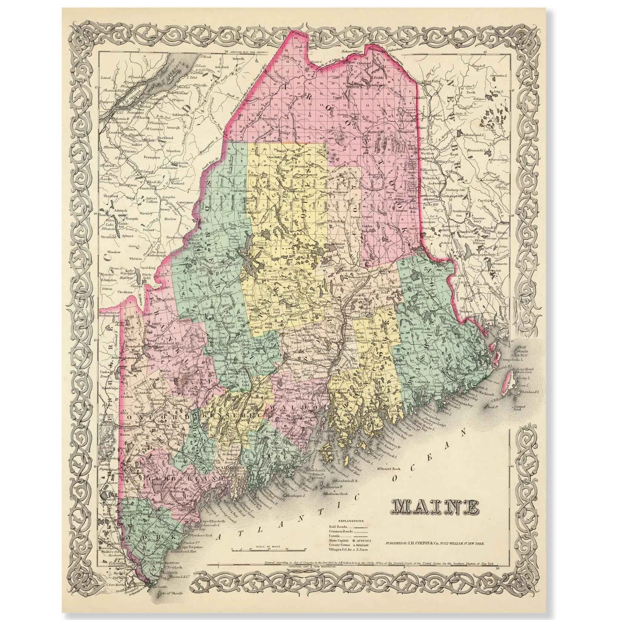
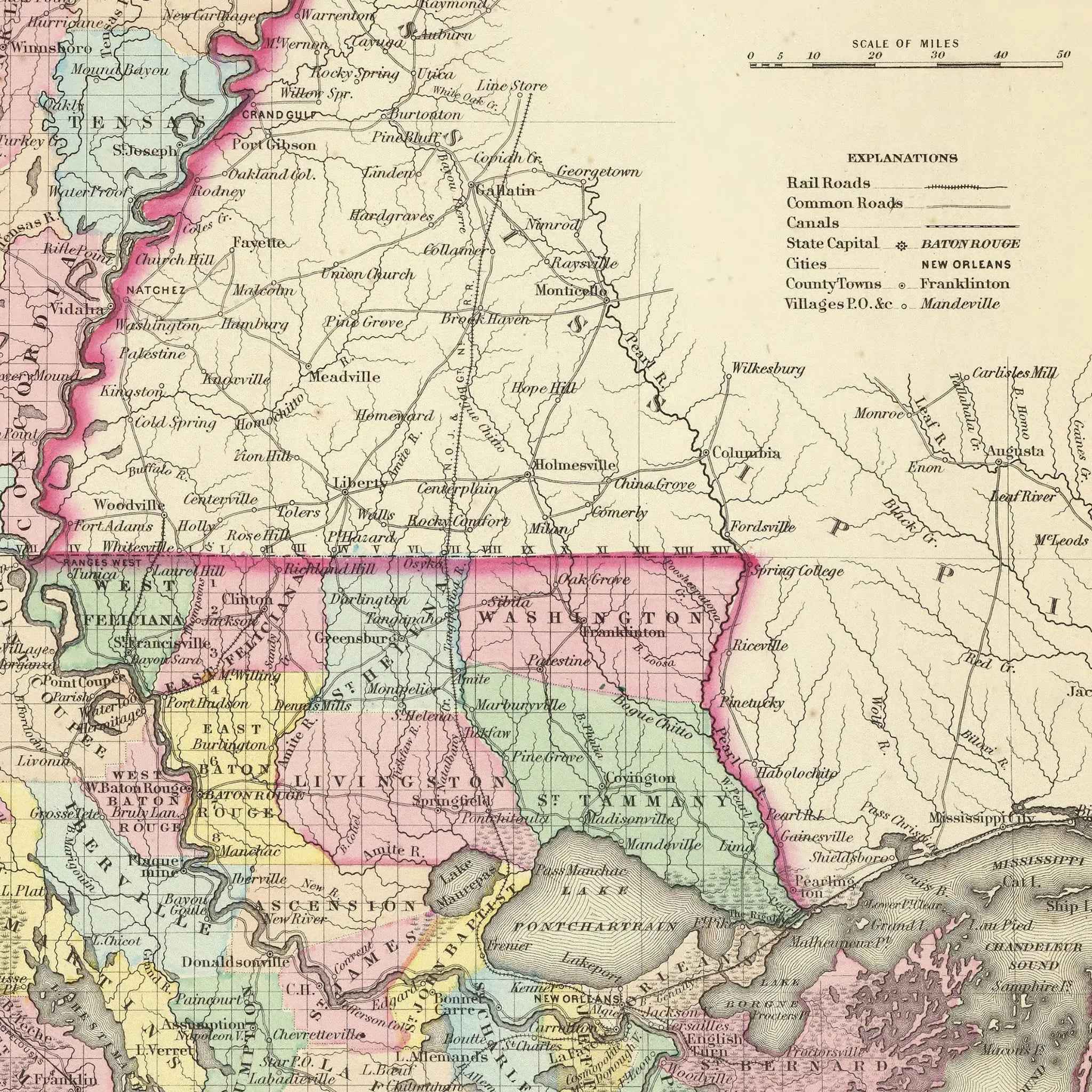
Step back into the 1850s and explore the rugged beauty of the American Northeast with this beautifully restored 1856 Maine Map. Created by the renowned cartographer G.W. Colton, this map is more than a geographical record; it’s a vivid portrait of a state at a pivotal moment in the nineteenth century. Framed by an elegant decorative border, it meticulously charts Maine’s counties, highlighting its intricate coastline, numerous lakes, and early transportation routes that connected its growing towns and communities.
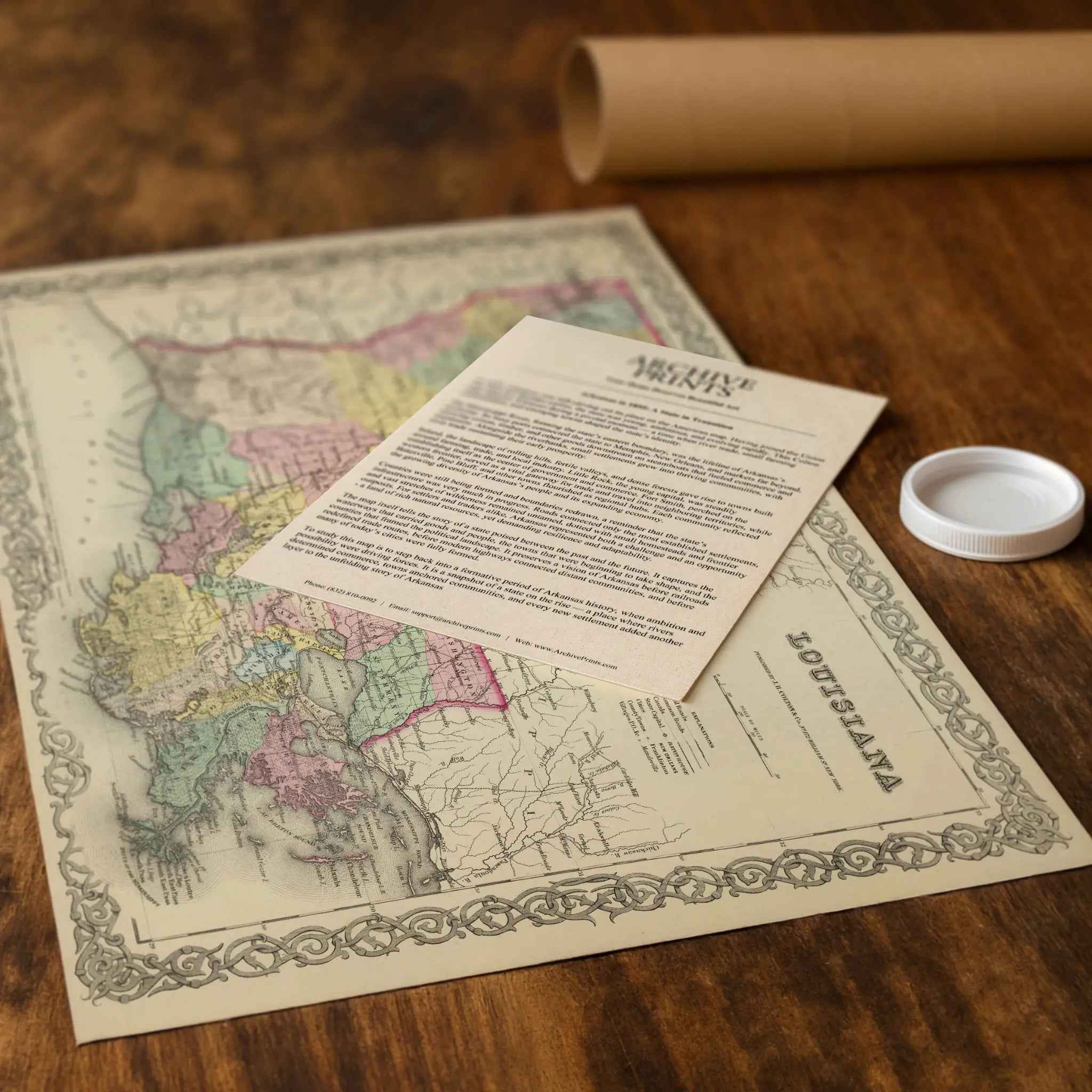
Each reproduction includes a custom historical letter that tells the story behind the map, making it an ideal gift for collectors, cartography fans, and anyone who loves American history. Printed on heavyweight archival paper or premium poly-cotton canvas, every label, county line, and waterway is preserved in ultra-high-definition clarity thanks to meticulous digital restoration—rich ink tones, crisp linework, and the warm vintage patina intact.
For protection and presentation, we craft every detail with care. Paper prints are rolled in a sturdy cardboard mailing tube and sized for easy framing. Canvas prints are gallery-wrapped on solid 1.5″ pine stretcher bars and ship in reinforced boxes—ready to hang with a pre-installed sawtooth hanger.
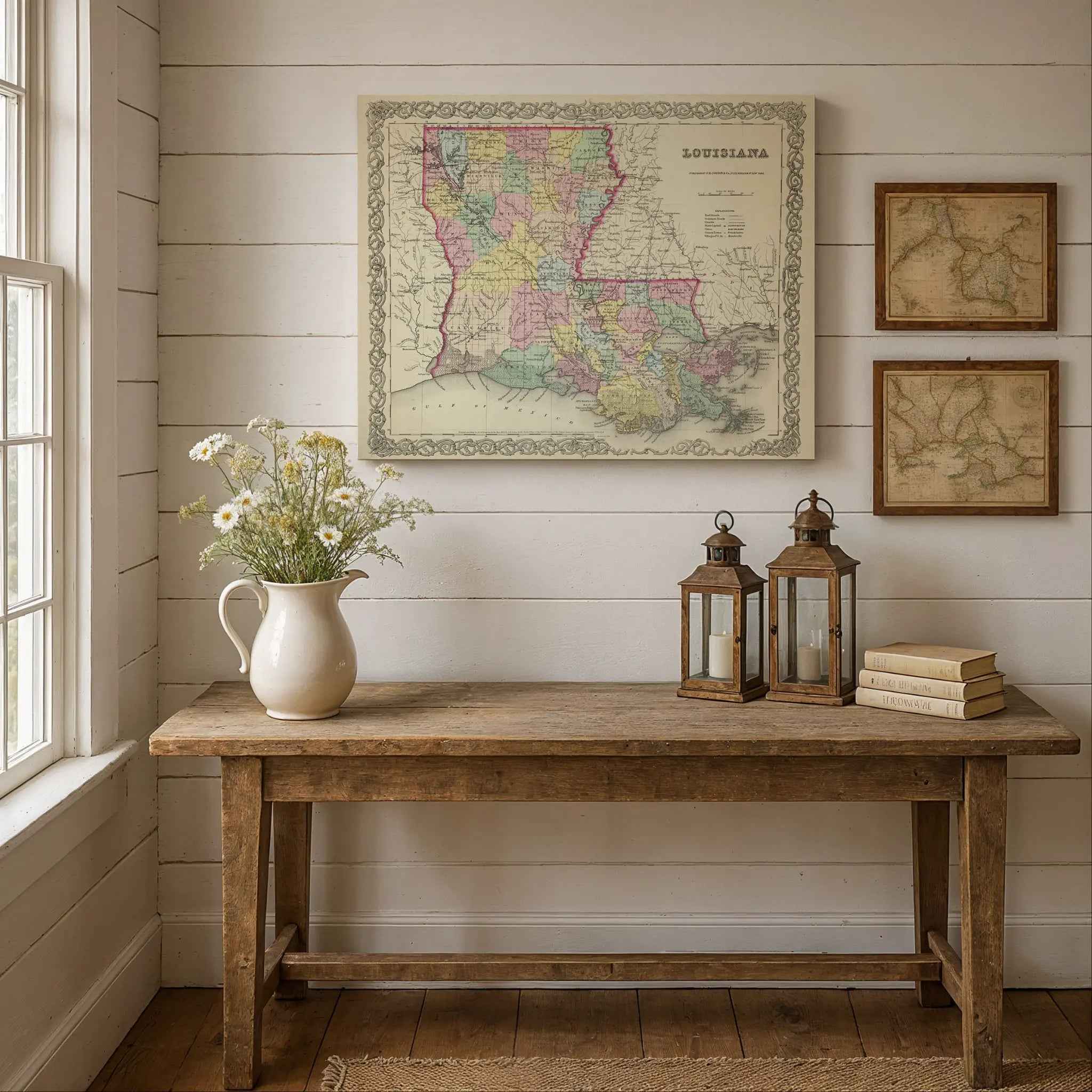
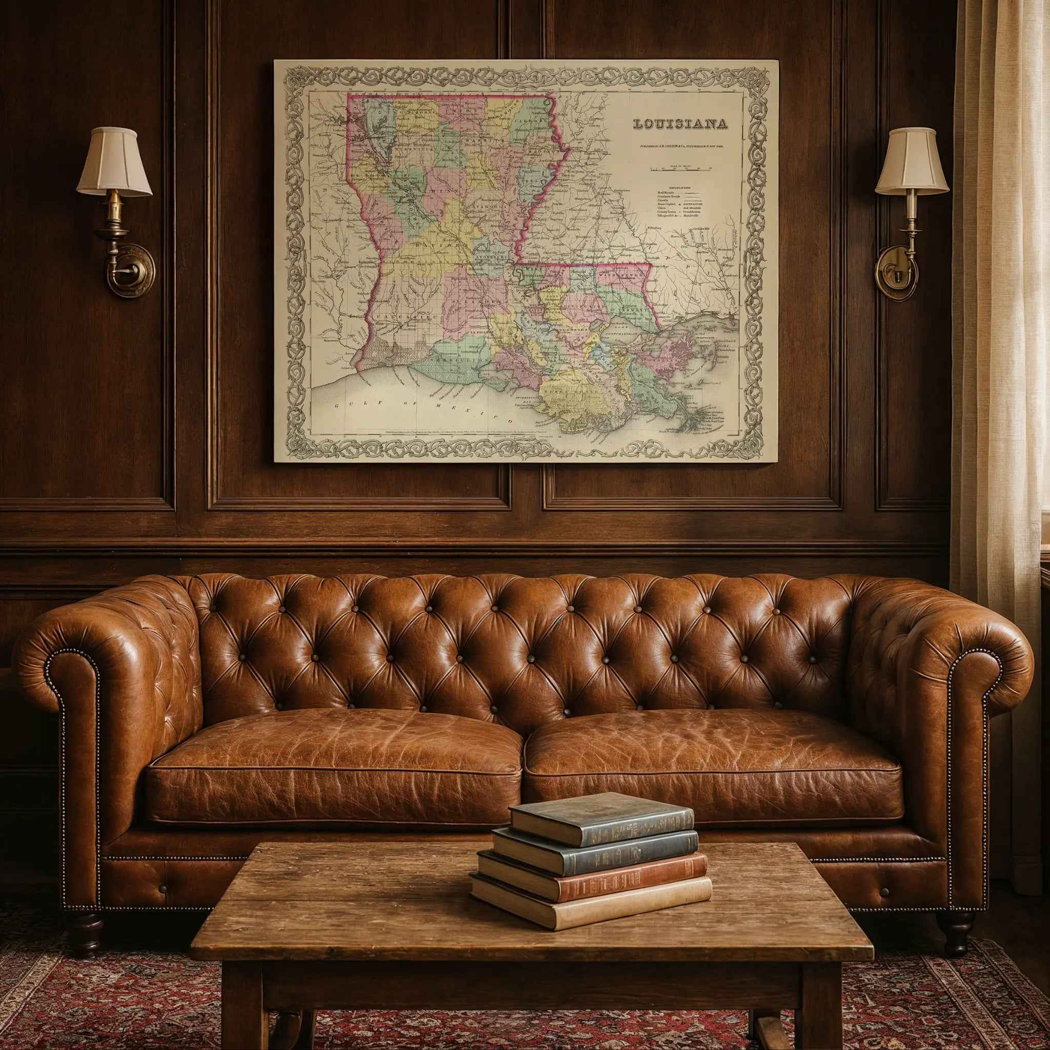
Bring home more than wall art. Bring home a story, a conversation piece, and a striking centerpiece that celebrates Maine’s rich maritime heritage, its pristine wilderness, and the timeless spirit of its people.
The Map Story
Colton’s 1856 map of Maine shows counties shaded in soft colors, its coast cut into bays and harbors, and its border running ruggedly into Canada. Yet behind the engraved lines is a state still shaping its future, restless with industry and debate.
It is 1856, and Franklin Pierce is president. National arguments over slavery and expansion divide the Union, and though Maine is far from the battlefields to come, its people feel the tremors. This is a state defined by work—by men felling pines in the north woods, by shipwrights hammering in yards along the Kennebec, by fishermen hauling cod from cold waters. Lumber and ice slide downriver toward Portland and Bangor, where schooners wait to carry them to Boston, New York, and beyond.
In coastal towns, clapboard houses cluster around church spires and ship chandlers. Sailmakers stitch canvas by lamplight, and coopers ring barrels that will hold fish, molasses, and salt. In Bangor, newly swollen with sawmills, fortunes rise as logs float down the Penobscot. The scent of pitch and pine drifts across the town, mingling with the clamor of axes, saws, and steamboat whistles.
Inland, Maine is quieter but no less vital. Farmers coax potatoes and grain from rocky soil, while families rely on stone walls, woodlots, and fields small enough to clear by hand. Winter grips hard, yet sleigh bells brighten snowbound roads, and ice itself becomes an export—cut from frozen lakes and shipped south, sawdust packed tight to keep it from melting.
Maine’s politics hum with Yankee fervor. Only a few years earlier, in 1851, the state enacted one of the nation’s first prohibition laws, a sign of the reformist spirit running through town halls and pulpits. Abolitionist voices carry across lecture halls, and newspapers fill with editorials calling for change. Though distant from Kansas and its bloody strife, Mainers know the Union’s questions will reach their doorstep.
Life here balances on thresholds: wilderness and village, tidewater and farm, tradition and reform. French-speaking Acadian families in the north keep their culture alive, while Yankee merchants in Portland and Bath think in terms of tonnage and trade. The state’s identity is part New England grit, part maritime daring, part frontier resilience.
Look past Colton’s neat borders, and Maine in 1856 is alive with motion: schooners riding the tide, oxen dragging logs through snow, children reading by lamplight while winds batter the shingles. It is a place both remote and central, carved by ice and salt, where the people’s labor and ideals would carry far beyond its rocky shores.
Materials
Hand‑Stretched Canvas: If you choose canvas, we use a premium cotton‑poly blend stretched over solid pine frames. Each canvas is carefully hand‑stretched for a tight, gallery‑quality finish that’s ready to hang right out of the box.
Vivid, Fade‑Resistant Inks: We use professional‑grade inks that are UV‑resistant, so your print retains its rich colors even when displayed in bright rooms.
Expert Restoration: Every map is digitally restored by skilled artisans. We preserve the character of the original while enhancing clarity, so you see the map as it was meant to be seen.
Secure Packaging: Paper prints are rolled in heavy‑duty mailing tubes, and canvases are cushioned in reinforced boxes to ensure they arrive in pristine condition.
Choosing one of our prints means investing in craftsmanship. We combine historical authenticity with modern print technology and premium materials, giving you a work of art built to stand the test of time.
Choose options

Because every place has a story
Make History Personal
A vintage map is more than art.
It is a reminder of where life began.
Where memories were made.
Where hearts still live. Give the gift of place.
Beautifully preserved and made for the moments that matter.
Why Choose Us?
| Feature | Us | Competitor A | Competitor B |
|---|---|---|---|
| Hand Crafted | |||
| Museum Quality | |||
| 100 Year Guarantee | |||
| Restored by Hand | |||
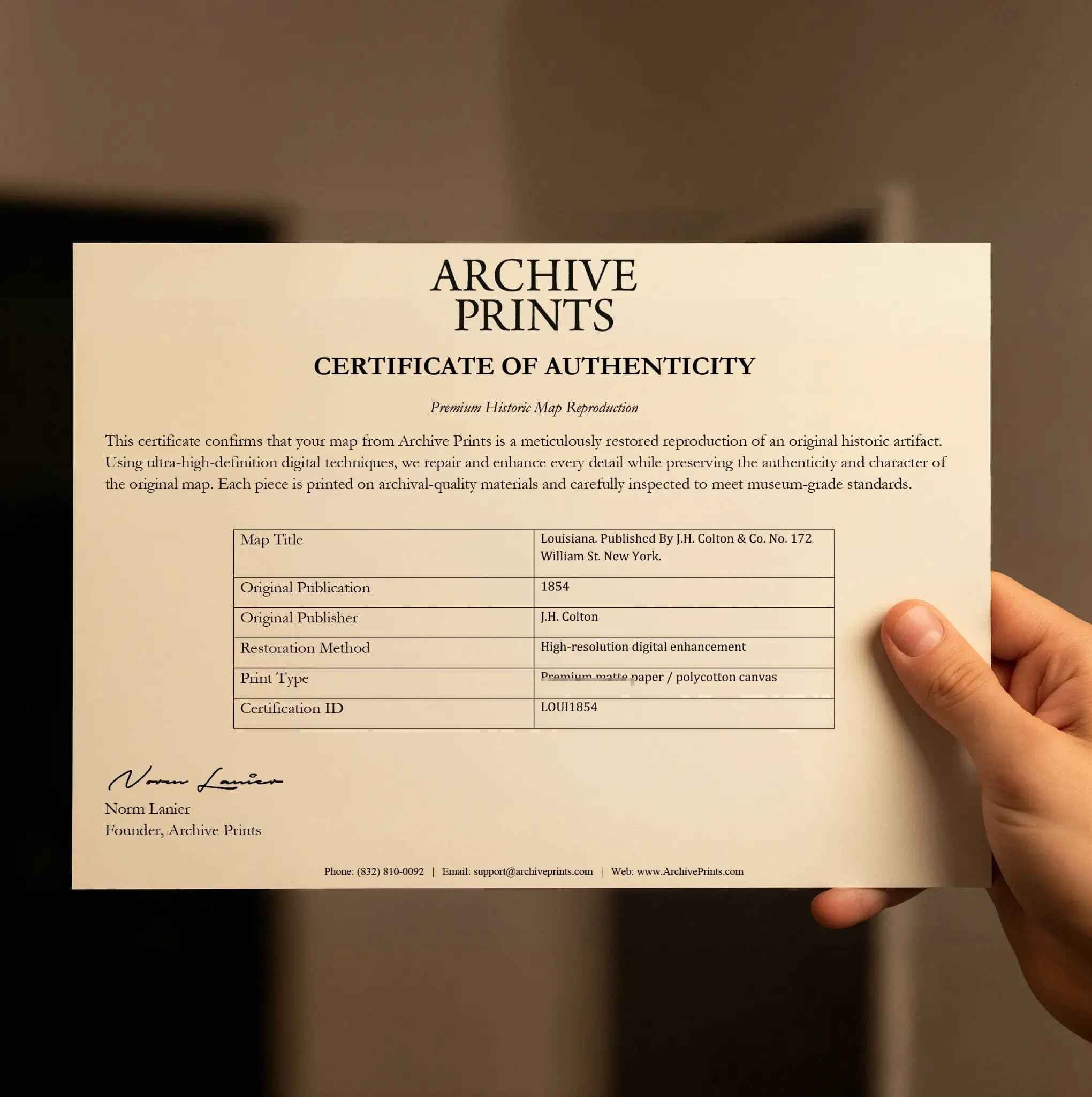
| Certificate of Authenticity |

Art Prints
Archival quality colors. Best option if you'd like to frame it yourself

The Best Materials
We hand-stretched our canvas on solid American-grown pine stretcher bars. We use quality canvas and fade-resistant inks to create the lasting art. Canvases come with hardware already installed and ready to hang.
Need help?
Frequently Asked Questions
Order
All of our maps are meticulously restored reproductions of historic originals. Each piece is digitally repaired and color-corrected to bring out the finest details while preserving its authentic, vintage character.
Yes. All Archive Prints products are printed to order in the USA with archival materials.
We offer two premium formats:
- High-Quality Paper Posters – Printed on thick, archival-grade matte paper for rich, vibrant detail.
- Hand-Stretched Canvas Prints – Printed on premium polycotton canvas and mounted on 1.5" solid American pine stretcher bars for a gallery-quality finish.
We carefully digitally restore each map to enhance clarity and color while preserving its original look and historic charm. You’ll enjoy sharp details and a timeless vintage aesthetic that feels true to the original piece.
Yes, we do! We offer premium framing options to make your map ready to hang the moment it arrives. You can choose from Oak, Maple, Black, or Walnut frames directly on the product page. We also offer Stretched Canvas prints for a modern gallery look, as well as archival-quality Posters if you prefer to frame it yourself.
Yes! We offer free shipping on all products within the United States. Each map is carefully packaged to ensure it arrives in perfect condition.
If you’re not completely satisfied, you can return your order in new condition for a full refund. Return shipping costs are the responsibility of the customer.
Absolutely! Our maps make thoughtful, one-of-a-kind gifts for history lovers, map collectors, or anyone looking to add vintage character to their home or office. Choose between paper prints for framing or stretched canvas for a ready-to-hang presentation.
- Paper Posters → Shipped in durable, protective tubes to prevent creasing.
- Canvas Prints → Carefully wrapped, padded, and boxed to ensure safe delivery.
Our maps look stunning in a variety of settings, including:
- Living rooms and home offices
- Libraries and studies
- Corporate offices and conference rooms
- Restaurants, cafes, and boutique spaces