Manhattan Pictorial Map - Vintage 1939 New York City Map for Collectors
Discover Manhattan's Golden Age
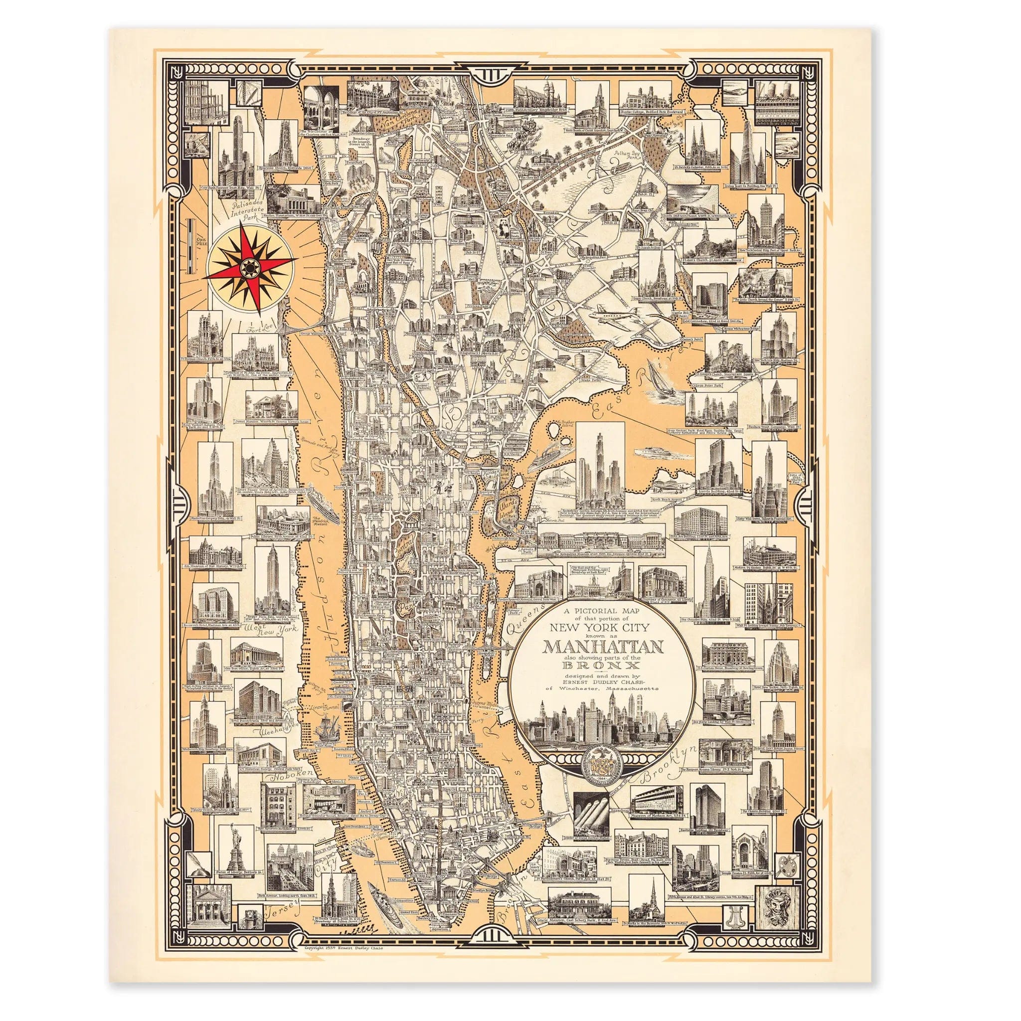
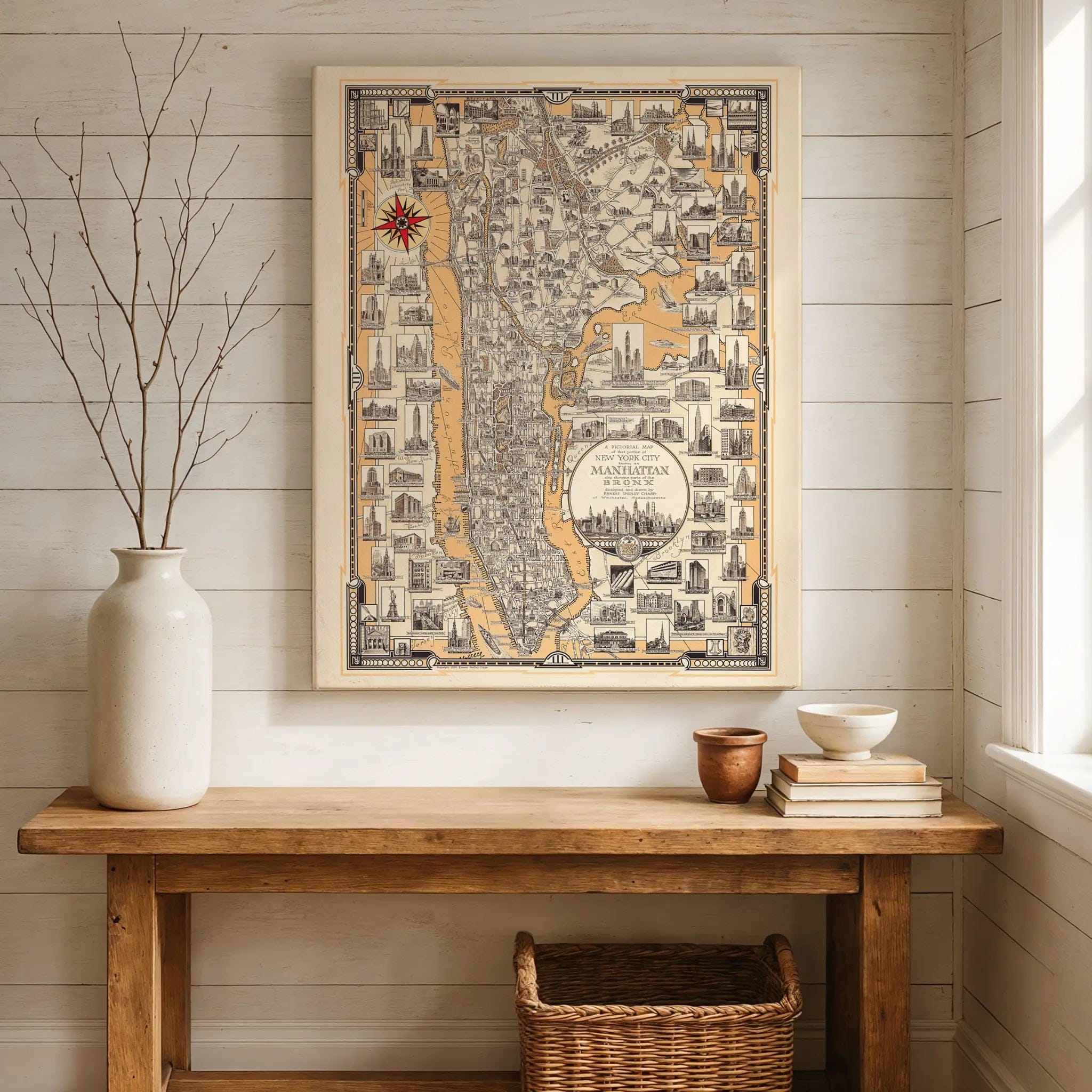
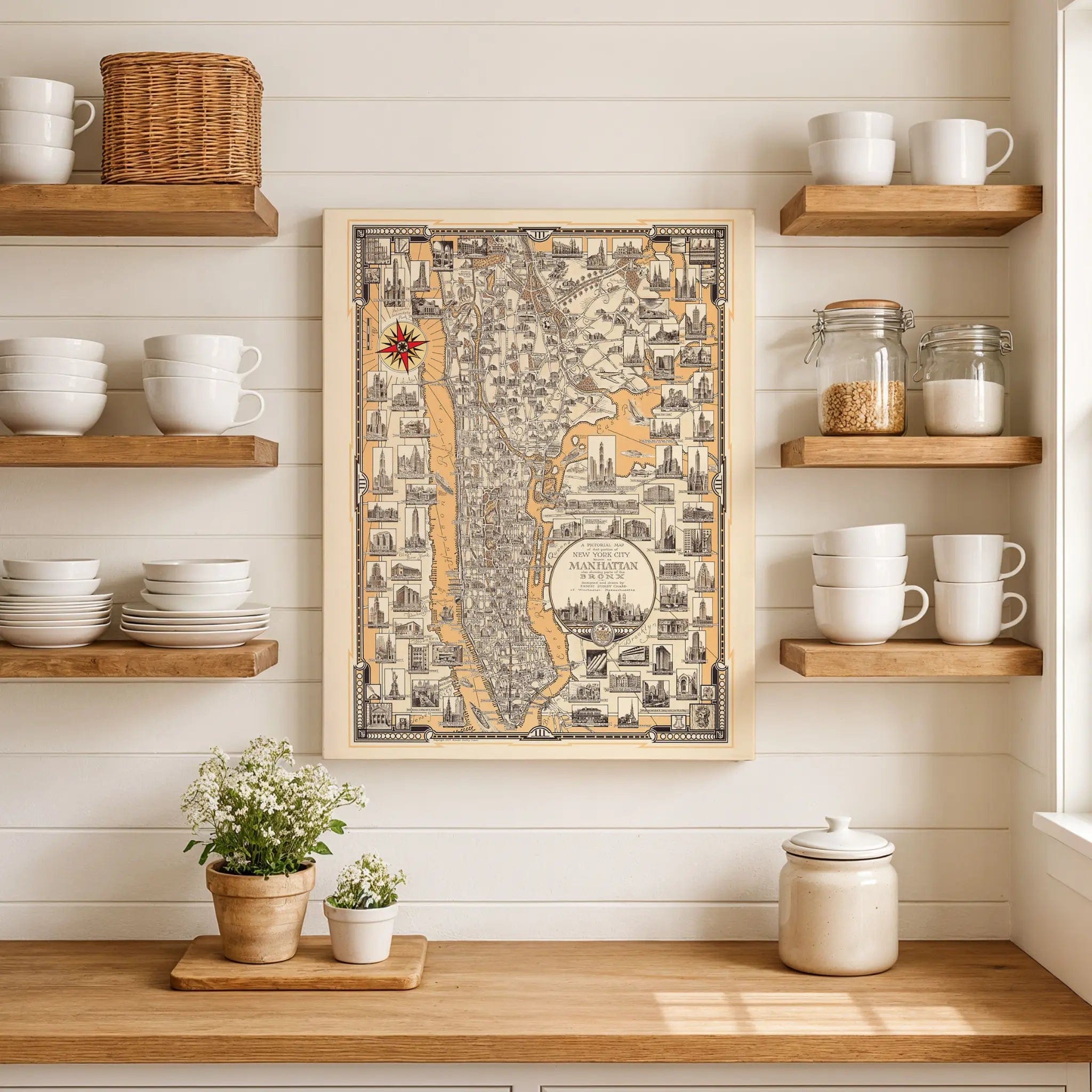
Step into the vibrant heart of New York City with this extraordinary Pictorial Map of That Portion of New York City Known as Manhattan, designed and drawn by Ernest Dudley Chase in 1939. This remarkable illustrated map captures Manhattan at the height of its prewar grandeur, when the city stood as the undisputed capital of commerce, culture, and energy. Every street, building, and landmark reflects a metropolis that had become the beating heart of modern America, rendered with artistic precision and boundless imagination.
Historical Significance
Created in 1939, this map documents New York at a pivotal moment in its history—the end of the Great Depression and the dawn of the World's Fair era. Chase's pictorial masterpiece captures Manhattan when its skyline had already become an icon of American achievement, with the Empire State Building, Chrysler Building, and Rockefeller Center defining a new architectural language. This was New York preparing to host the 1939 World's Fair, a vision of optimism that matched Chase's artistic tone, presenting the city as both a living museum of progress and a promise of the future.
Cartographic Excellence
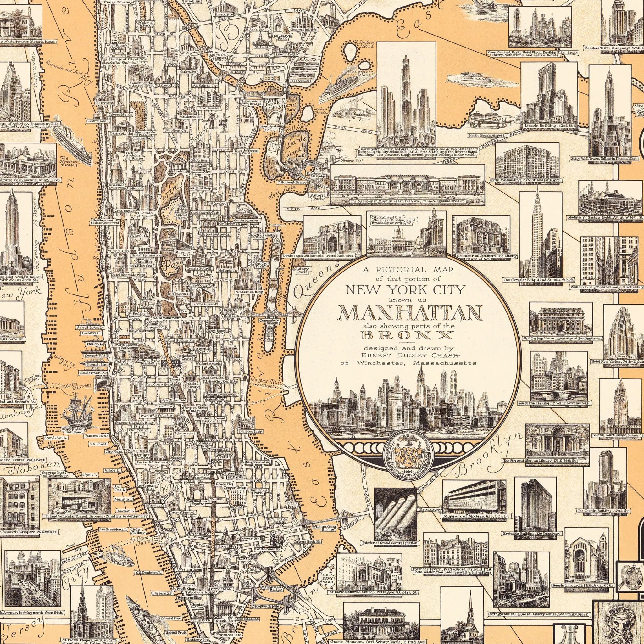
Ernest Dudley Chase's signature pictorial style transforms Manhattan into both precise geography and living art. Every block pulses with detail—skyscrapers pierce the skyline, bridges stretch majestically across the East and Hudson Rivers, and Central Park forms a calm, green heart amid the steel and stone. The surrounding vignettes showcase the city's architectural treasures with affection and precision, while the decorative border and compass rose elevate the piece beyond cartography into a celebration of urban grandeur.
Urban Legacy Story
This map stands as a portrait of Manhattan's cultural zenith, capturing the city's essence through intricate linework and careful composition. Chase's warm and humorous approach brings daily life to the streets—ships navigating the harbor, crowds filling Times Square, and trains racing across bridges. Each illustrated scene is a snapshot of a city constantly in motion, united by movement and aspiration. The inclusion of parts of the Bronx further expands the story, showing a New York that was not just vertical but vast.
A Vision of American Metropolis
Beyond its artistic beauty, this map represents the culmination of Manhattan's transformation into the world's most dynamic urban center. The careful rendering of architectural landmarks and street patterns reflects a city that had mastered the balance between human scale and monumental ambition. The decorative elements and pictorial vignettes show a metropolis that succeeded by combining serious purpose with cultural vitality, creating an urban environment that inspired both residents and visitors from around the world.
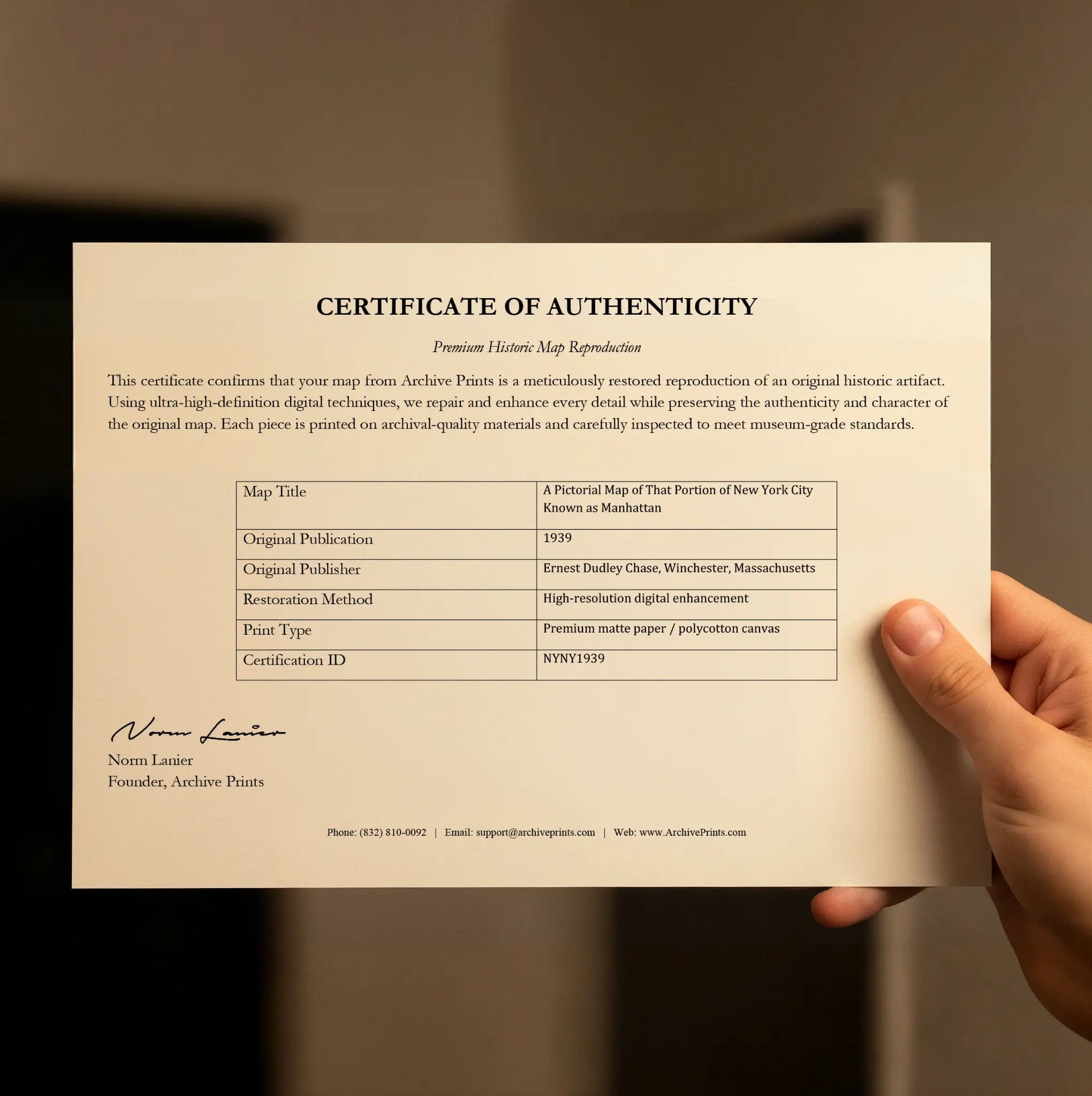
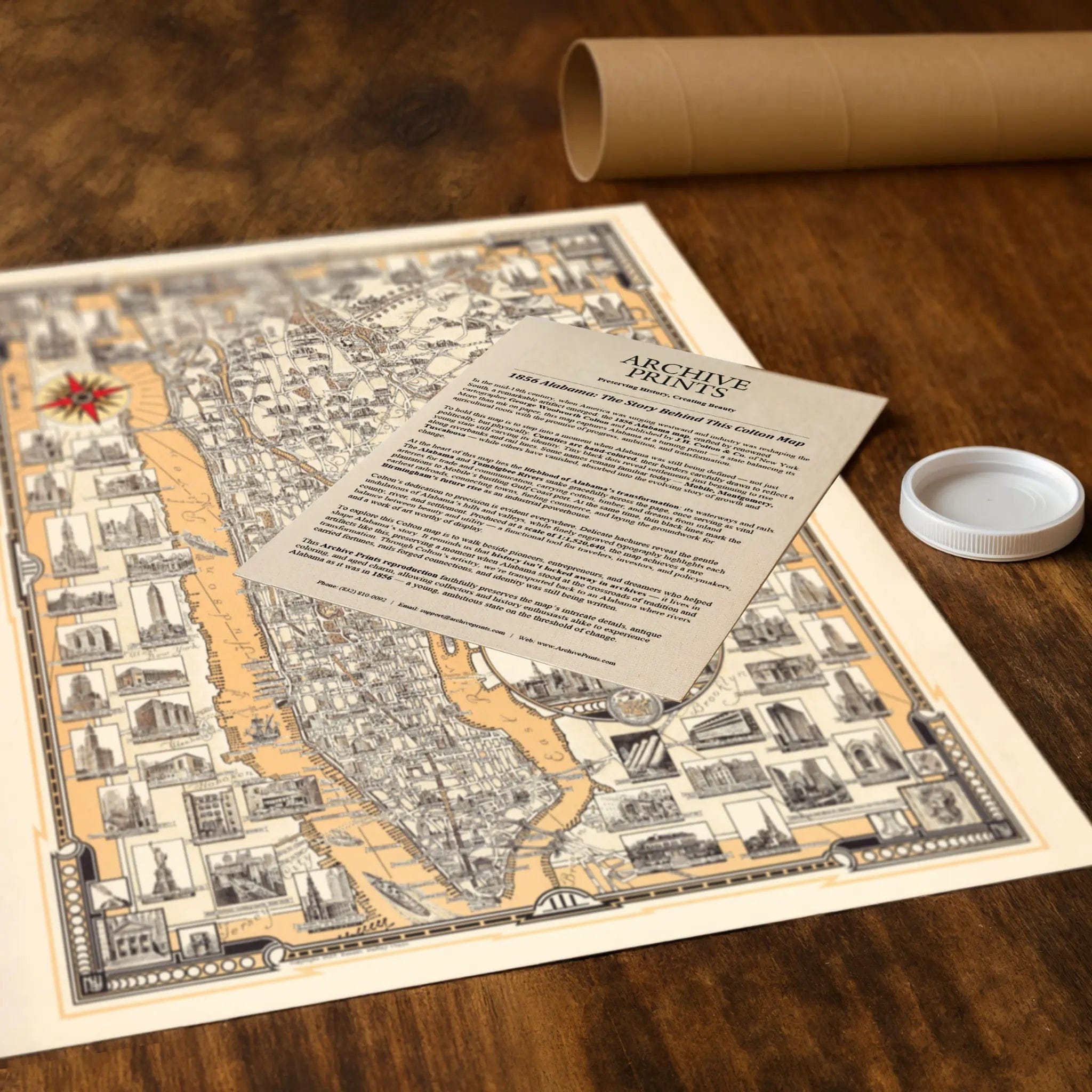
A Piece of New York History
Each restored reproduction of this 1939 map is printed with museum-quality precision on heavyweight archival paper or hand-stretched premium canvas to preserve every original detail. Your purchase includes two companion documents:
Certificate of Authenticity verifying its restoration and reproduction quality
Historical Story Page detailing the origins, craftsmanship, and cultural significance of Chase's iconic pictorial map
Paper prints arrive rolled in reinforced mailing tubes for protection. Canvas prints come gallery-wrapped on solid pine stretcher bars with pre-installed hardware, ready to display upon arrival.
Bring home a vivid piece of New York history—a timeless record of Manhattan's golden age when the city stood as the world's capital of commerce, culture, and boundless energy.
The Map Story
Materials
Choose options

Because every place has a story
Make History Personal
A vintage map is more than art.
It is a reminder of where life began.
Where memories were made.
Where hearts still live. Give the gift of place.
Beautifully preserved and made for the moments that matter.
Why Choose Us?
| Feature | Us | Competitor A | Competitor B |
|---|---|---|---|
| Hand Crafted | |||
| Museum Quality | |||
| 100 Year Guarantee | |||
| Restored by Hand | |||
| Certificate of Authenticity |

Art Prints
Archival quality colors. Best option if you'd like to frame it yourself

The Best Materials
We hand-stretched our canvas on solid American-grown pine stretcher bars. We use quality canvas and fade-resistant inks to create the lasting art. Canvases come with hardware already installed and ready to hang.
Need help?
Frequently Asked Questions
Order
All of our maps are meticulously restored reproductions of historic originals. Each piece is digitally repaired and color-corrected to bring out the finest details while preserving its authentic, vintage character.
Yes. All Archive Prints products are printed to order in the USA with archival materials.
We offer two premium formats:
- High-Quality Paper Posters – Printed on thick, archival-grade matte paper for rich, vibrant detail.
- Hand-Stretched Canvas Prints – Printed on premium polycotton canvas and mounted on 1.5" solid American pine stretcher bars for a gallery-quality finish.
We carefully digitally restore each map to enhance clarity and color while preserving its original look and historic charm. You’ll enjoy sharp details and a timeless vintage aesthetic that feels true to the original piece.
Yes, we do! We offer premium framing options to make your map ready to hang the moment it arrives. You can choose from Oak, Maple, Black, or Walnut frames directly on the product page. We also offer Stretched Canvas prints for a modern gallery look, as well as archival-quality Posters if you prefer to frame it yourself.
Yes! We offer free shipping on all products within the United States. Each map is carefully packaged to ensure it arrives in perfect condition.
If you’re not completely satisfied, you can return your order in new condition for a full refund. Return shipping costs are the responsibility of the customer.
Absolutely! Our maps make thoughtful, one-of-a-kind gifts for history lovers, map collectors, or anyone looking to add vintage character to their home or office. Choose between paper prints for framing or stretched canvas for a ready-to-hang presentation.
- Paper Posters → Shipped in durable, protective tubes to prevent creasing.
- Canvas Prints → Carefully wrapped, padded, and boxed to ensure safe delivery.
Our maps look stunning in a variety of settings, including:
- Living rooms and home offices
- Libraries and studies
- Corporate offices and conference rooms
- Restaurants, cafes, and boutique spaces