

Map of the City of Atlanta, Georgia 1912 - Kauffman Survey
Map of Atlanta Georgia 1912 - Kauffman Civil Engineers Survey
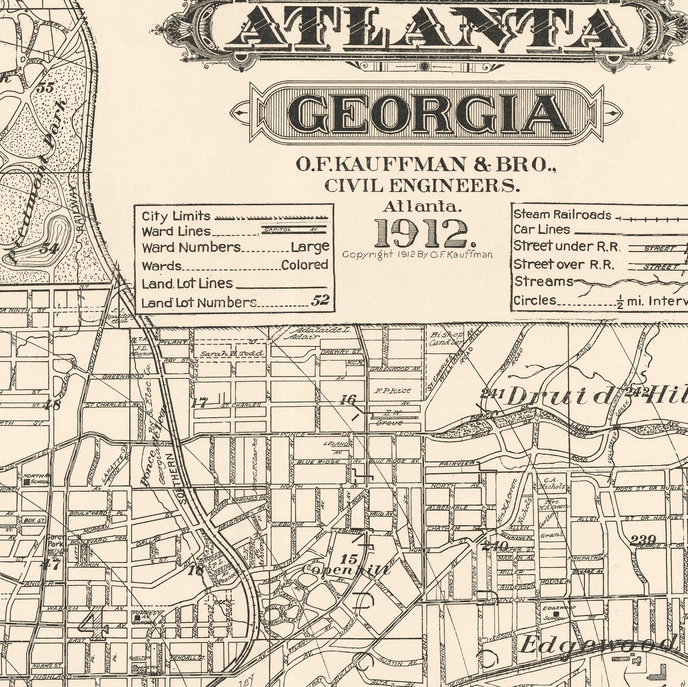
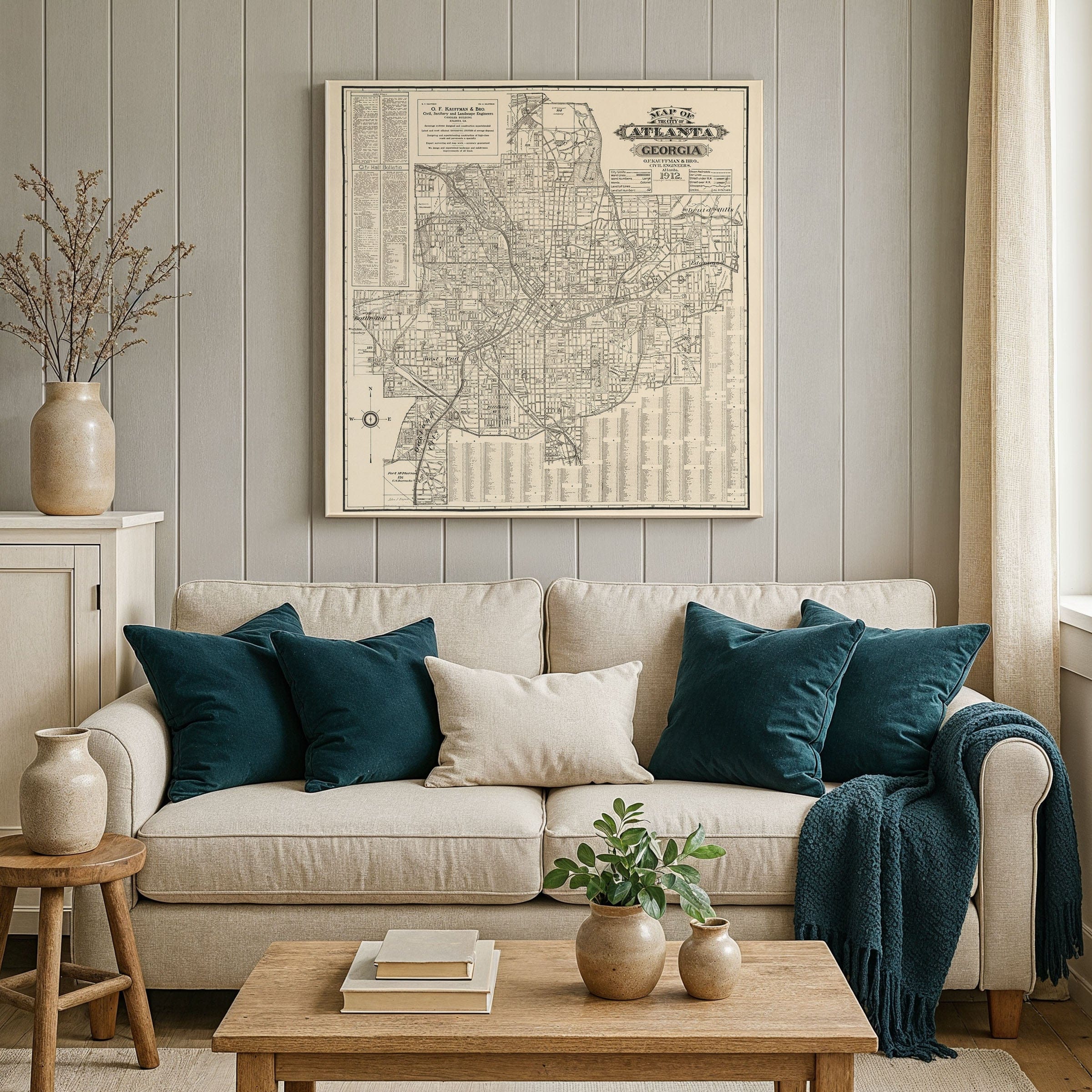
Explore the Gate City of the South with this remarkable Map of Atlanta Georgia from 1912, created by O. F. Kauffman & Bro., Civil Engineers. This extraordinary Map of Atlanta Georgia captures Atlanta alive with ambition—rebuilt from Civil War ashes into the beating heart of the New South where railroads, commerce, and modern ideas converged in a city halfway between its rough-edged past and gleaming industrial future.
The precision of this Map of Atlanta Georgia reflects a city obsessed with progress. Streets extend in every direction around the bustling Five Points downtown core, where rail lines linked Atlanta to every major Southern city. Electric streetcars hummed along Peachtree and Decatur Streets while neighborhoods like Inman Park and West End spread outward with tree-lined streets and homes built for permanence.
By 1912, Atlanta's population had soared past 150,000, making it one of America's fastest-growing cities. This detailed Map of Atlanta Georgia shows factories lining rail corridors, warehouses filled with cotton and manufactured goods, water mains, property lines, parks, and new subdivisions—every detail of a city determined to plan its future. Trace the curved lines of depots and freight yards that symbolized Atlanta's railroad dominance.
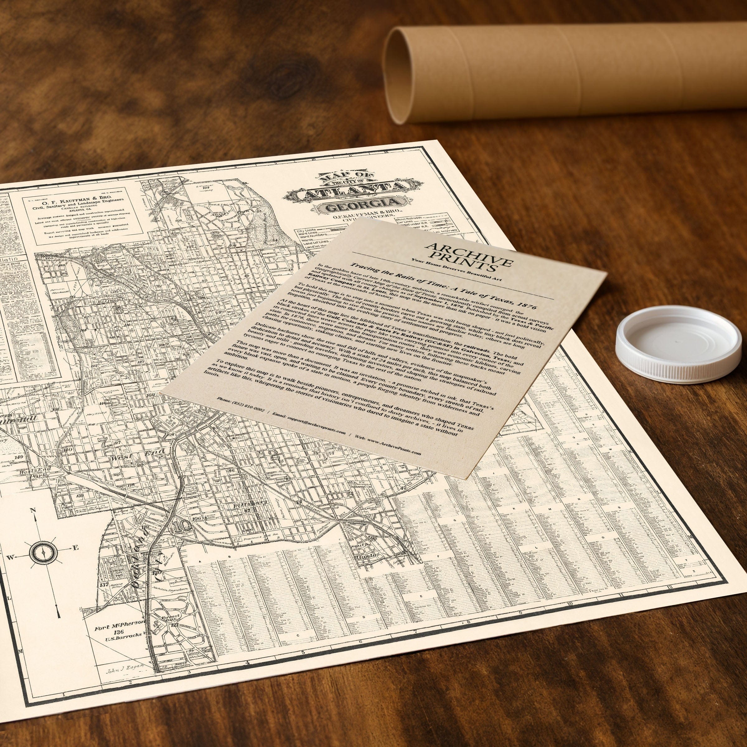
Each reproduction includes a custom historical letter detailing the map's significance, making it perfect for collectors, [location] history enthusiasts, and anyone with [region] connections. Printed on heavyweight archival paper or premium canvas, every [relevant detail] is preserved with museum-quality clarity through expert digital restoration.
For protection and presentation, paper prints arrive rolled in sturdy mailing tubes, while canvas prints come gallery-wrapped on solid pine stretcher bars with pre-installed hanging hardware. Framed prints are protected under crystal-clear acrylic and arrive ready to hang—perfect for immediate display.
Perfect for Atlanta residents, Georgia history enthusiasts, New South historians, and anyone fascinated by urban development, this museum-quality reproduction of the Map of Atlanta Georgia brings the resilient spirit of early 20th century Atlanta to stunning life.
The Map Story
Materials
Choose options

Because every place has a story
Make History Personal
A vintage map is more than art.
It is a reminder of where life began.
Where memories were made.
Where hearts still live. Give the gift of place.
Beautifully preserved and made for the moments that matter.
Why Choose Us?
| Feature | Us | Competitor A | Competitor B |
|---|---|---|---|
| Hand Crafted | |||
| Museum Quality | |||
| 100 Year Guarantee | |||
| Restored by Hand | |||
| Certificate of Authenticity |

Art Prints
Archival quality colors. Best option if you'd like to frame it yourself

The Best Materials
We hand-stretched our canvas on solid American-grown pine stretcher bars. We use quality canvas and fade-resistant inks to create the lasting art. Canvases come with hardware already installed and ready to hang.
Need help?
Frequently Asked Questions
Order
All of our maps are meticulously restored reproductions of historic originals. Each piece is digitally repaired and color-corrected to bring out the finest details while preserving its authentic, vintage character.
Yes. All Archive Prints products are printed to order in the USA with archival materials.
We offer two premium formats:
- High-Quality Paper Posters – Printed on thick, archival-grade matte paper for rich, vibrant detail.
- Hand-Stretched Canvas Prints – Printed on premium polycotton canvas and mounted on 1.5" solid American pine stretcher bars for a gallery-quality finish.
We carefully digitally restore each map to enhance clarity and color while preserving its original look and historic charm. You’ll enjoy sharp details and a timeless vintage aesthetic that feels true to the original piece.
Yes, we do! We offer premium framing options to make your map ready to hang the moment it arrives. You can choose from Oak, Maple, Black, or Walnut frames directly on the product page. We also offer Stretched Canvas prints for a modern gallery look, as well as archival-quality Posters if you prefer to frame it yourself.
Yes! We offer free shipping on all products within the United States. Each map is carefully packaged to ensure it arrives in perfect condition.
If you’re not completely satisfied, you can return your order in new condition for a full refund. Return shipping costs are the responsibility of the customer.
Absolutely! Our maps make thoughtful, one-of-a-kind gifts for history lovers, map collectors, or anyone looking to add vintage character to their home or office. Choose between paper prints for framing or stretched canvas for a ready-to-hang presentation.
- Paper Posters → Shipped in durable, protective tubes to prevent creasing.
- Canvas Prints → Carefully wrapped, padded, and boxed to ensure safe delivery.
Our maps look stunning in a variety of settings, including:
- Living rooms and home offices
- Libraries and studies
- Corporate offices and conference rooms
- Restaurants, cafes, and boutique spaces