Massachusetts & Rhode Island Map - Vintage State Map by O.W. Gray for Collectors
Discover a Piece of New England History
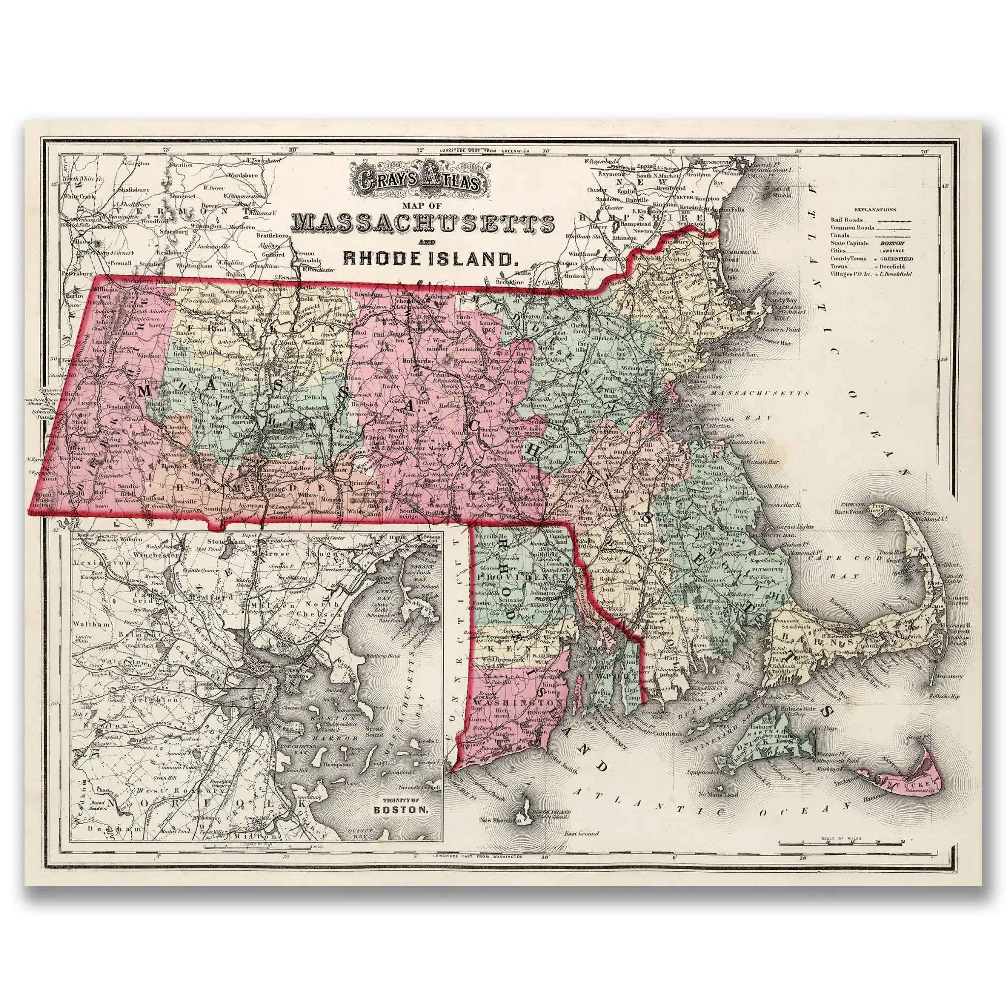
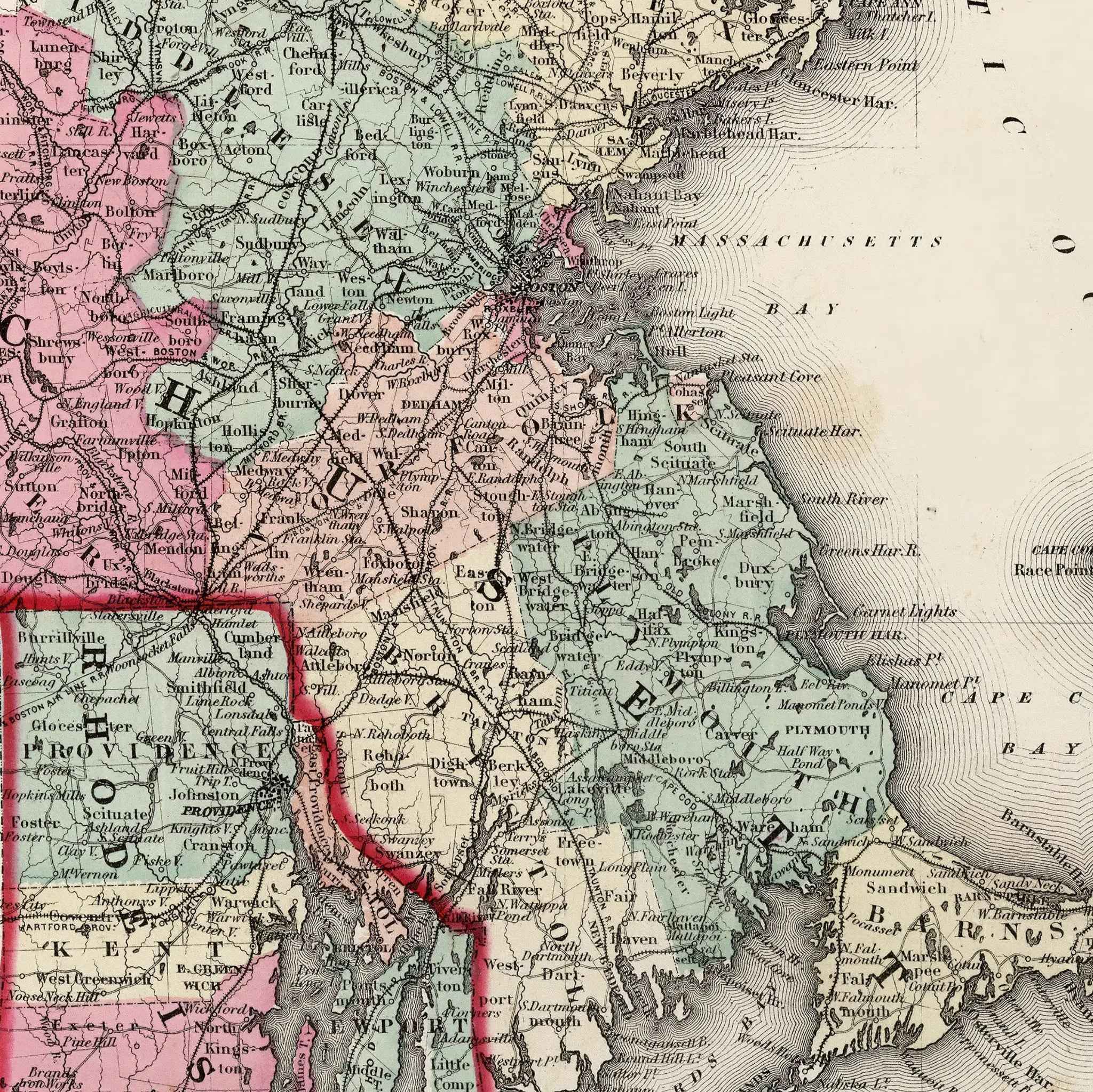
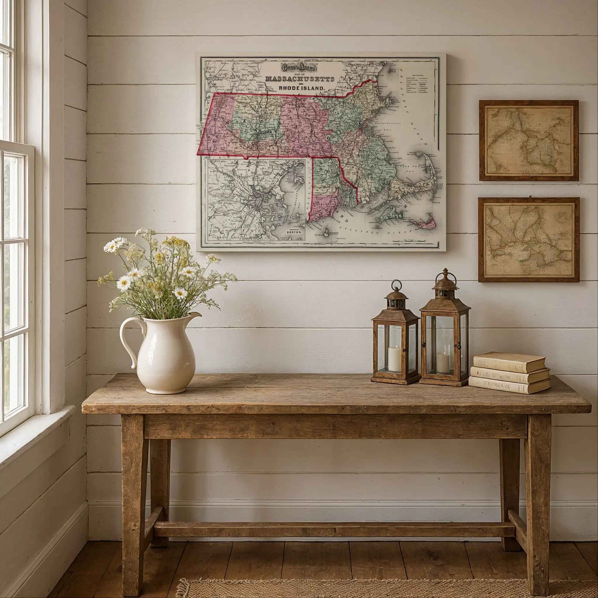
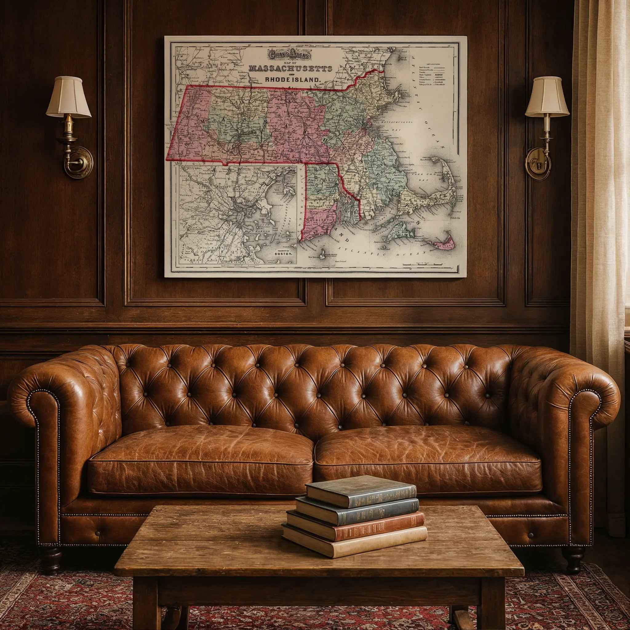
Step back into the 1870s and explore the bustling heart of New England with this beautifully restored 1873 Massachusetts and Rhode Island Map. Created by the renowned cartographer O.W. Gray, this map is more than a geographical record; it’s a vivid portrait of two states at a pivotal moment in the nineteenth century. Framed by an elegant decorative border and featuring a detailed inset of the Vicinity of Boston, it meticulously charts counties, highlighting vital transportation routes like railroads that connected its growing towns and communities.
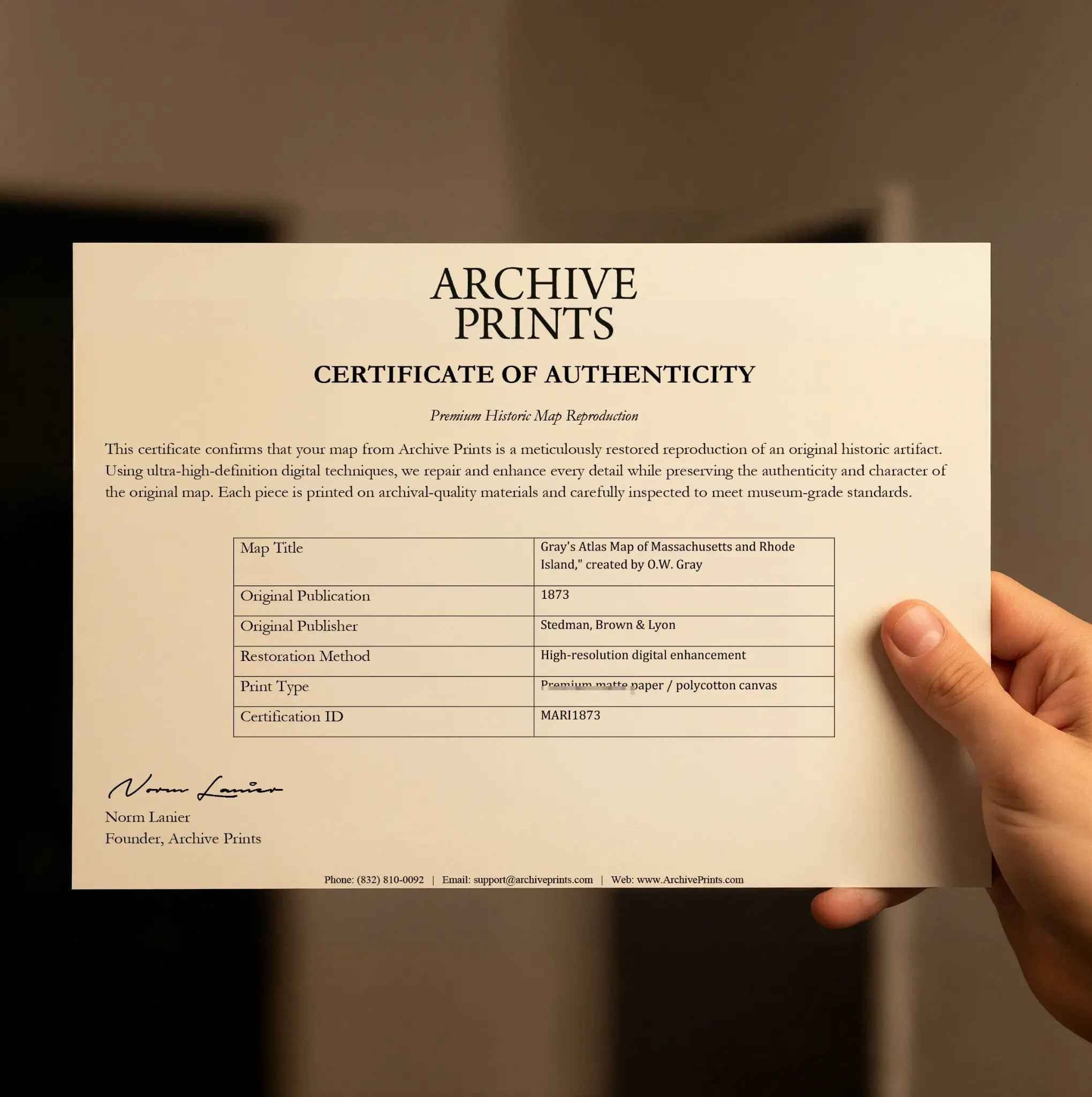
Each reproduction includes a custom historical letter that tells the story behind the map, making it an ideal gift for collectors, cartography fans, and anyone who loves American history. Printed on heavyweight archival paper or premium poly-cotton canvas, every label, county line, and coastline is preserved in ultra-high-definition clarity thanks to meticulous digital restoration—rich ink tones, crisp linework, and the warm vintage patina intact.
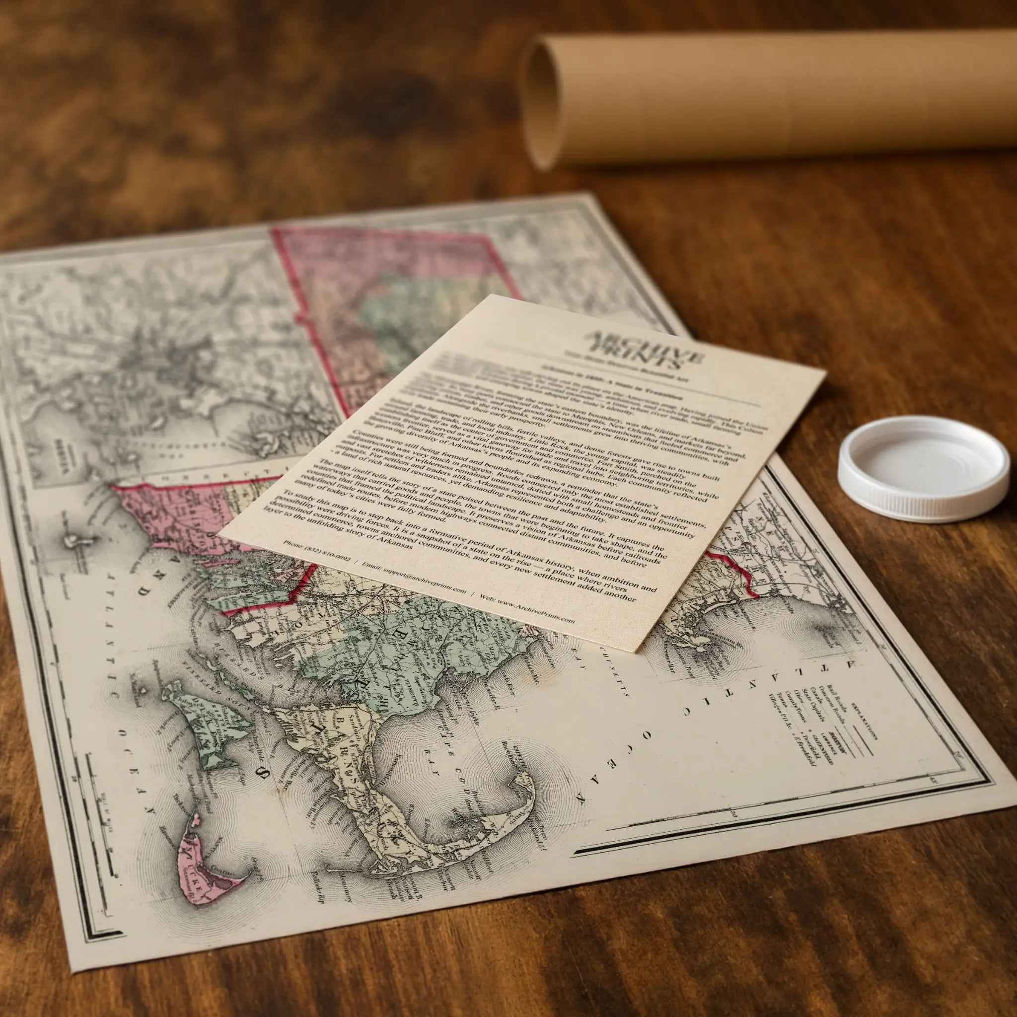
For protection and presentation, we craft every detail with care. Paper prints are rolled in a sturdy cardboard mailing tube and sized for easy framing. Canvas prints are gallery-wrapped on solid 1.5″ pine stretcher bars and ship in reinforced boxes—ready to hang with a pre-installed sawtooth hanger.
Bring home more than wall art. Bring home a story, a conversation piece, and a striking centerpiece that celebrates New England’s rich maritime heritage, its industrial prowess, and the timeless spirit of its people.
The Map Story
Gray’s 1873 map of Massachusetts and Rhode Island spreads counties in neat colors, with Boston inset like a jewel in the corner. Rail lines weave across both states, the steel threads binding towns to markets, ports, and one another. The engraving suggests order, but the story it captures is restless—a pair of states balancing their proud history with the demands of a modern industrial nation.
It is 1873, and Ulysses S. Grant serves his second term as president. The Civil War is less than a decade past, yet New England already hums with a new kind of struggle: economic transformation. Mills along the Merrimack and Blackstone churn with textile production, their brick walls rising like fortresses of labor. Whistles cut through factory towns each morning, summoning waves of workers—immigrant families from Ireland, French Canada, and beyond—whose lives are measured in shifts and wages.
Boston thrives as a hub of shipping, finance, and reform. The harbor bristles with masts and steam funnels, while newspapers debate temperance, labor rights, and the lingering politics of Reconstruction. Along Beacon Hill, abolitionists who had spoken fiercely before the war now turn their voices to new causes: suffrage, education, and worker protection. Across the river in Cambridge, the clamor of students and professors at Harvard reminds the nation that New England’s power is not only in its mills but also in its ideas.
Rhode Island, though smaller, beats with similar energy. Providence and Pawtucket bristle with factories, their machinery spinning cotton into fabric that finds buyers across the globe. Newport, once the jewel of colonial commerce, reinvents itself as a retreat for wealth, where new mansions rise along the shore, symbols of industrial profits turned to leisure.
Life in 1873 is not without unease. The Panic of that year rattles markets, closing banks and idling mills. Workers march, demanding dignity in the face of layoffs, while reformers argue over how to reconcile profit with principle. Yet daily life presses on: fishermen pull cod from Cape waters, farmers tend orchards in the Connecticut Valley, and families gather in wooden churches that still ring with hymns of both faith and reform.
This map shows more than borders. It reflects a moment when Massachusetts and Rhode Island stood as engines of industry and conscience, where the clang of machines met the murmur of debate. To trace its lines is to see a region remaking itself—proud of its past, braced for uncertainty, and bound together by rails, rivers, and the unyielding drive of its people.
Materials
Hand‑Stretched Canvas: If you choose canvas, we use a premium cotton‑poly blend stretched over solid pine frames. Each canvas is carefully hand‑stretched for a tight, gallery‑quality finish that’s ready to hang right out of the box.
Vivid, Fade‑Resistant Inks: We use professional‑grade inks that are UV‑resistant, so your print retains its rich colors even when displayed in bright rooms.
Expert Restoration: Every map is digitally restored by skilled artisans. We preserve the character of the original while enhancing clarity, so you see the map as it was meant to be seen.
Secure Packaging: Paper prints are rolled in heavy‑duty mailing tubes, and canvases are cushioned in reinforced boxes to ensure they arrive in pristine condition.
Choosing one of our prints means investing in craftsmanship. We combine historical authenticity with modern print technology and premium materials, giving you a work of art built to stand the test of time.
Choose options

Because every place has a story
Make History Personal
A vintage map is more than art.
It is a reminder of where life began.
Where memories were made.
Where hearts still live. Give the gift of place.
Beautifully preserved and made for the moments that matter.
Why Choose Us?
| Feature | Us | Competitor A | Competitor B |
|---|---|---|---|
| Hand Crafted | |||
| Museum Quality | |||
| 100 Year Guarantee | |||
| Restored by Hand | |||
| Certificate of Authenticity |

Art Prints
Archival quality colors. Best option if you'd like to frame it yourself

The Best Materials
We hand-stretched our canvas on solid American-grown pine stretcher bars. We use quality canvas and fade-resistant inks to create the lasting art. Canvases come with hardware already installed and ready to hang.
Need help?
Frequently Asked Questions
Order
All of our maps are meticulously restored reproductions of historic originals. Each piece is digitally repaired and color-corrected to bring out the finest details while preserving its authentic, vintage character.
Yes. All Archive Prints products are printed to order in the USA with archival materials.
We offer two premium formats:
- High-Quality Paper Posters – Printed on thick, archival-grade matte paper for rich, vibrant detail.
- Hand-Stretched Canvas Prints – Printed on premium polycotton canvas and mounted on 1.5" solid American pine stretcher bars for a gallery-quality finish.
We carefully digitally restore each map to enhance clarity and color while preserving its original look and historic charm. You’ll enjoy sharp details and a timeless vintage aesthetic that feels true to the original piece.
Yes, we do! We offer premium framing options to make your map ready to hang the moment it arrives. You can choose from Oak, Maple, Black, or Walnut frames directly on the product page. We also offer Stretched Canvas prints for a modern gallery look, as well as archival-quality Posters if you prefer to frame it yourself.
Yes! We offer free shipping on all products within the United States. Each map is carefully packaged to ensure it arrives in perfect condition.
If you’re not completely satisfied, you can return your order in new condition for a full refund. Return shipping costs are the responsibility of the customer.
Absolutely! Our maps make thoughtful, one-of-a-kind gifts for history lovers, map collectors, or anyone looking to add vintage character to their home or office. Choose between paper prints for framing or stretched canvas for a ready-to-hang presentation.
- Paper Posters → Shipped in durable, protective tubes to prevent creasing.
- Canvas Prints → Carefully wrapped, padded, and boxed to ensure safe delivery.
Our maps look stunning in a variety of settings, including:
- Living rooms and home offices
- Libraries and studies
- Corporate offices and conference rooms
- Restaurants, cafes, and boutique spaces