Mountain Playground of the University of Colorado 1940 - University of Colorado Fantastical Map
Discover a Fantastical Vision of Colorado's Mountain Paradise
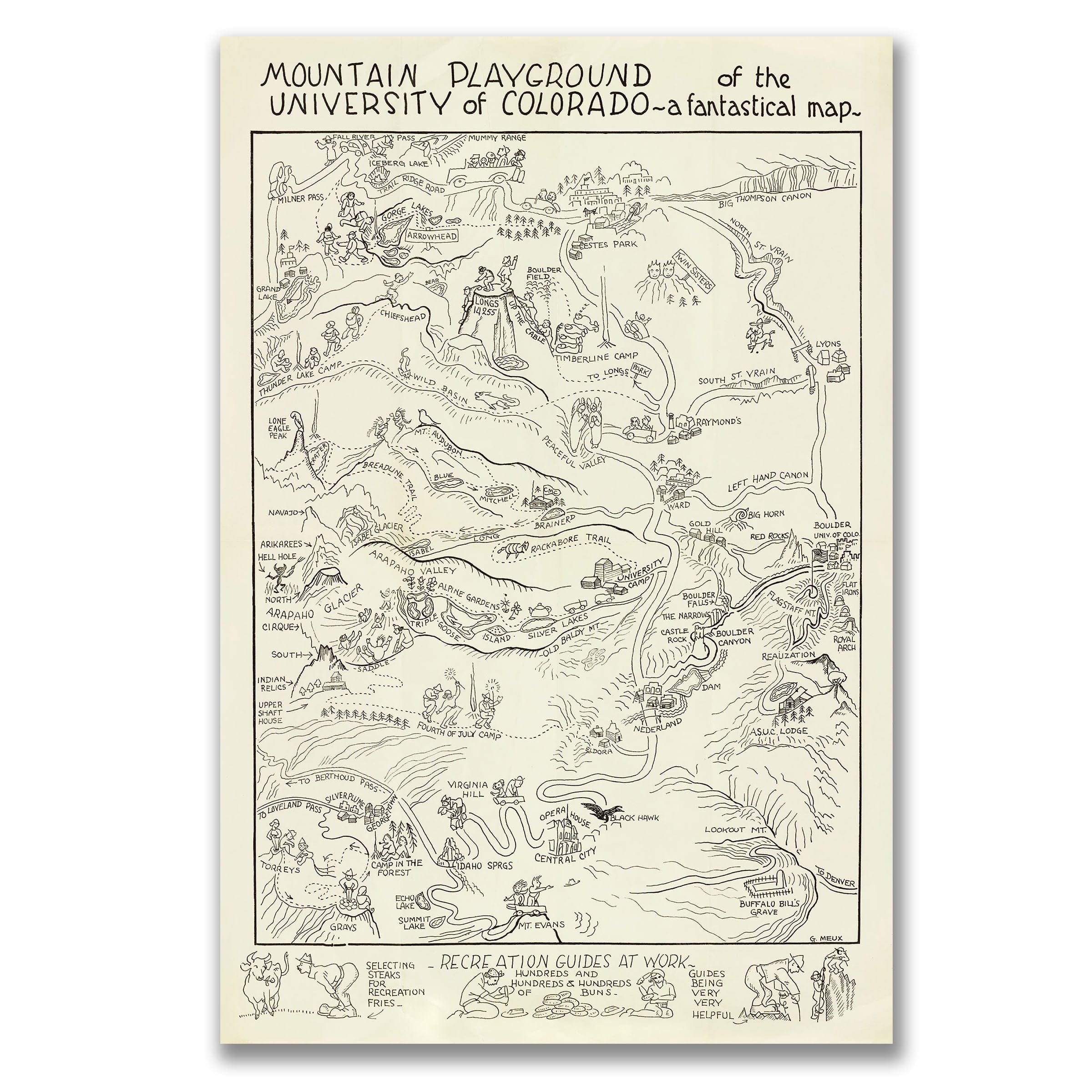
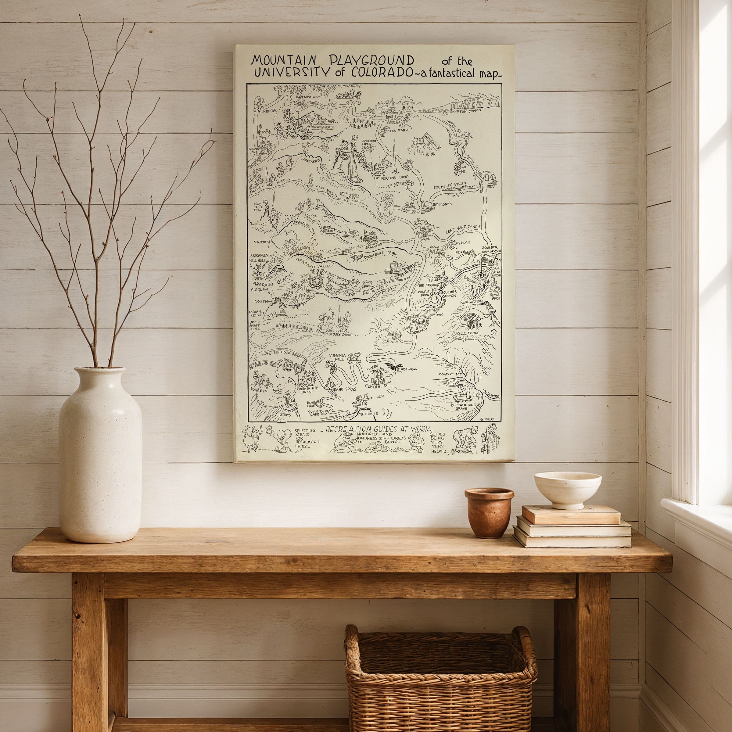
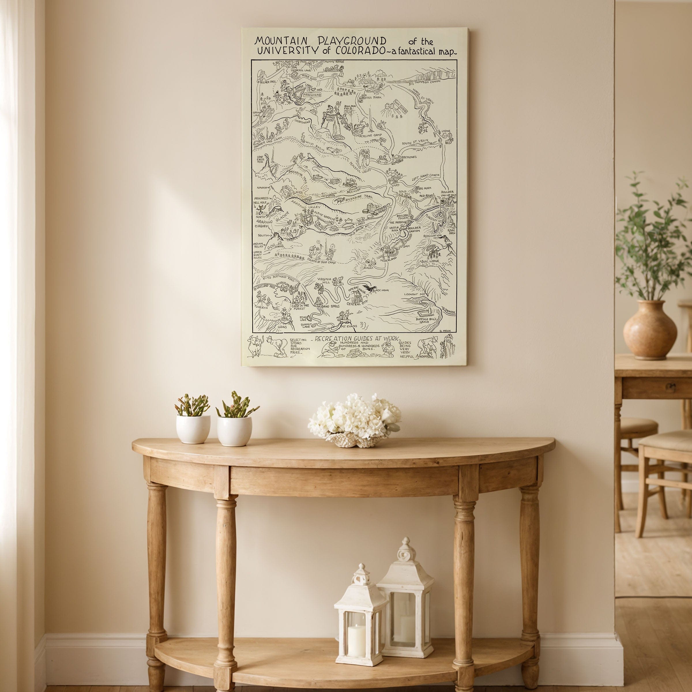
Step into 1940, when Gwendolyn Dufill Meux created Mountain Playground of the University of Colorado—a map not meant for navigation but for inspiration. This is a fantastical vision of the Rocky Mountains rendered through the eyes of imagination and pride, where geography and daydreams share the same space. Every brushstroke reflects affection for both the land and the spirit of exploration that defines Colorado.
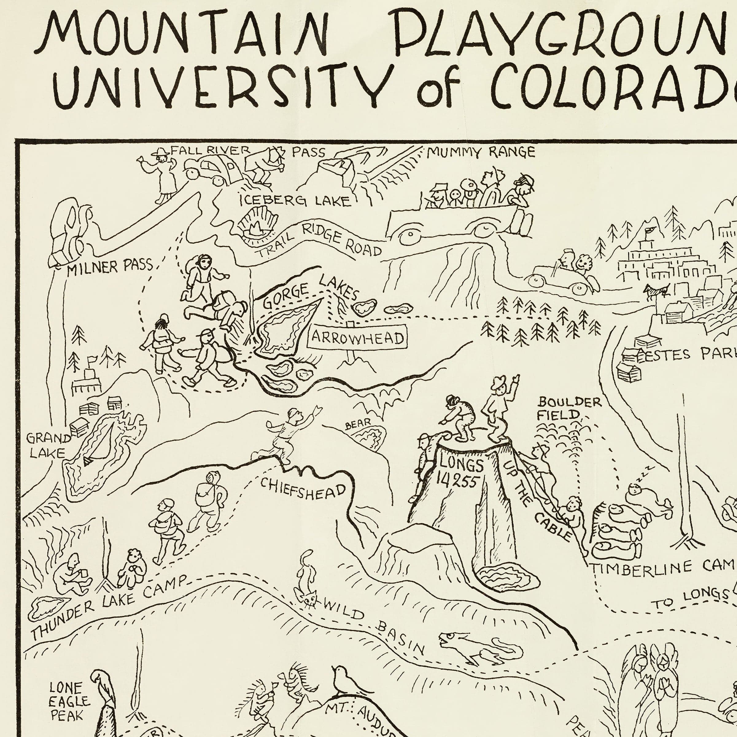
At the map's center lies the University of Colorado, nestled in Boulder beneath the shadow of the Flatirons. The campus stands as both landmark and metaphor—the heart of learning, discovery, and youthful adventure. From this symbolic hub, mountain trails radiate outward like paths of curiosity. They lead to ski lodges, alpine lakes, wildflower meadows, and distant peaks drawn not in strict scale but in poetic arrangement.
The mountains are alive in Meux's design. Each one rises with personality, its slopes populated by tiny hikers, climbers, and skiers. Bears, deer, and mountain goats wander across the ridges, while trout leap through streams that wind down to sun-lit valleys. Every element is vibrant and deliberate, as if the entire range has been invited to celebrate the joy of motion and discovery.
The map's style captures a moment when America's love affair with travel and outdoor recreation was accelerating. It was the dawn of the automobile age, when the open road and the national park were symbols of freedom. For students and visitors alike, Colorado's mountains promised more than scenery—they offered renewal, adventure, and escape. Meux's work channels that spirit with wit and wonder.
Even the smallest details tell a story. Roads twist through exaggerated canyons, trains curve across impossible bridges, and clouds drift like watercolor brushstrokes above peaks labeled with playful names. The entire composition reads like an illustrated song of the West—half guide, half fantasy.
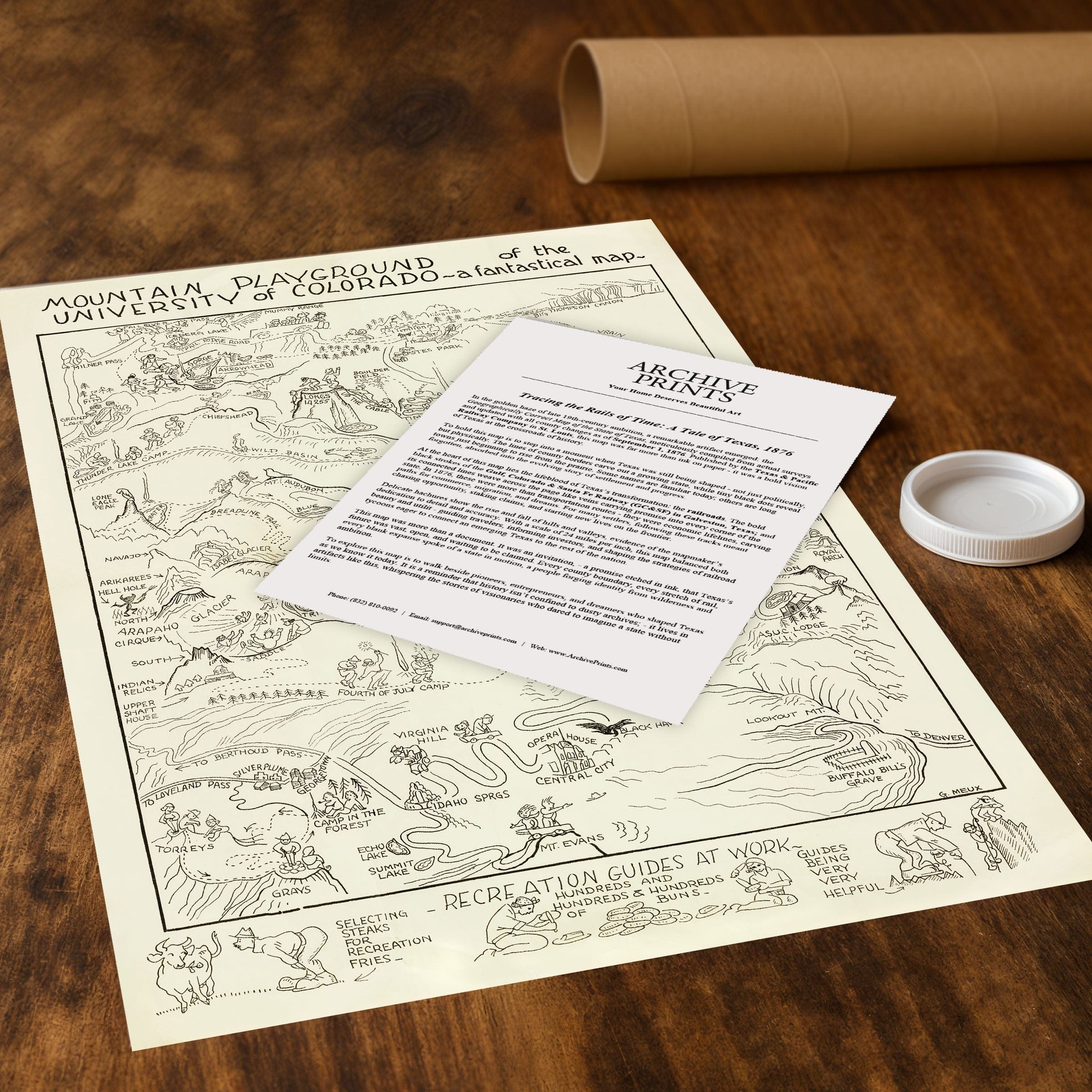
Seen today, Mountain Playground of the University of Colorado stands as both art and artifact. It preserves a vision of a state proud of its mountains and of a university rooted in them. Meux's work invites the viewer to wander not by compass, but by curiosity—to climb toward knowledge and joy, one trail at a time. Each reproduction includes a custom historical letter detailing the story behind the map, making it perfect for University of Colorado alumni, Colorado history enthusiasts, and lovers of whimsical cartography.
Printed on heavyweight archival paper or hand-stretched polycotton canvas, every playful detail and vibrant color is restored in museum-grade clarity for generations of enjoyment. Paper prints ship rolled in heavy-duty tubes, while canvas editions arrive gallery-wrapped on solid pine stretcher bars with pre-installed hardware—ready to display the moment it arrives.
Bring home this fantastical celebration of Colorado's mountain spirit and the timeless joy of exploration.
The Map Story
Materials
Choose options

Because every place has a story
Make History Personal
A vintage map is more than art.
It is a reminder of where life began.
Where memories were made.
Where hearts still live. Give the gift of place.
Beautifully preserved and made for the moments that matter.
Why Choose Us?
| Feature | Us | Competitor A | Competitor B |
|---|---|---|---|
| Hand Crafted | |||
| Museum Quality | |||
| 100 Year Guarantee | |||
| Restored by Hand | |||
| Certificate of Authenticity |

Art Prints
Archival quality colors. Best option if you'd like to frame it yourself

The Best Materials
We hand-stretched our canvas on solid American-grown pine stretcher bars. We use quality canvas and fade-resistant inks to create the lasting art. Canvases come with hardware already installed and ready to hang.
Need help?
Frequently Asked Questions
Order
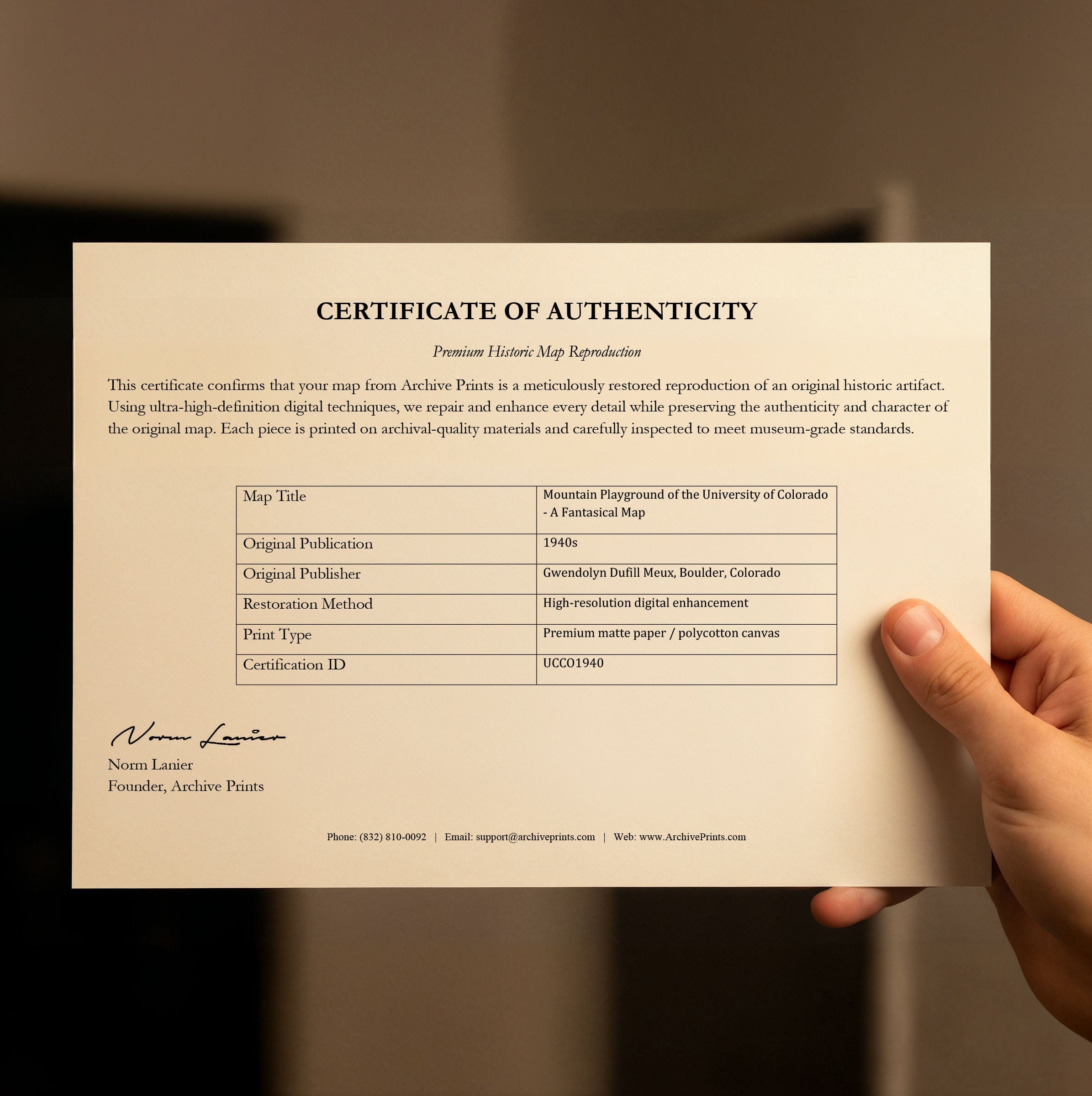
All of our maps are meticulously restored reproductions of historic originals. Each piece is digitally repaired and color-corrected to bring out the finest details while preserving its authentic, vintage character.
Yes. All Archive Prints products are printed to order in the USA with archival materials.
We offer two premium formats:
- High-Quality Paper Posters – Printed on thick, archival-grade matte paper for rich, vibrant detail.
- Hand-Stretched Canvas Prints – Printed on premium polycotton canvas and mounted on 1.5" solid American pine stretcher bars for a gallery-quality finish.
We carefully digitally restore each map to enhance clarity and color while preserving its original look and historic charm. You’ll enjoy sharp details and a timeless vintage aesthetic that feels true to the original piece.
Yes, we do! We offer premium framing options to make your map ready to hang the moment it arrives. You can choose from Oak, Maple, Black, or Walnut frames directly on the product page. We also offer Stretched Canvas prints for a modern gallery look, as well as archival-quality Posters if you prefer to frame it yourself.
Yes! We offer free shipping on all products within the United States. Each map is carefully packaged to ensure it arrives in perfect condition.
If you’re not completely satisfied, you can return your order in new condition for a full refund. Return shipping costs are the responsibility of the customer.
Absolutely! Our maps make thoughtful, one-of-a-kind gifts for history lovers, map collectors, or anyone looking to add vintage character to their home or office. Choose between paper prints for framing or stretched canvas for a ready-to-hang presentation.
- Paper Posters → Shipped in durable, protective tubes to prevent creasing.
- Canvas Prints → Carefully wrapped, padded, and boxed to ensure safe delivery.
Our maps look stunning in a variety of settings, including:
- Living rooms and home offices
- Libraries and studies
- Corporate offices and conference rooms
- Restaurants, cafes, and boutique spaces