Vintage New York City Map - 1856 Currier & Ives Lithograph for Collectors
Vintage New York City Map
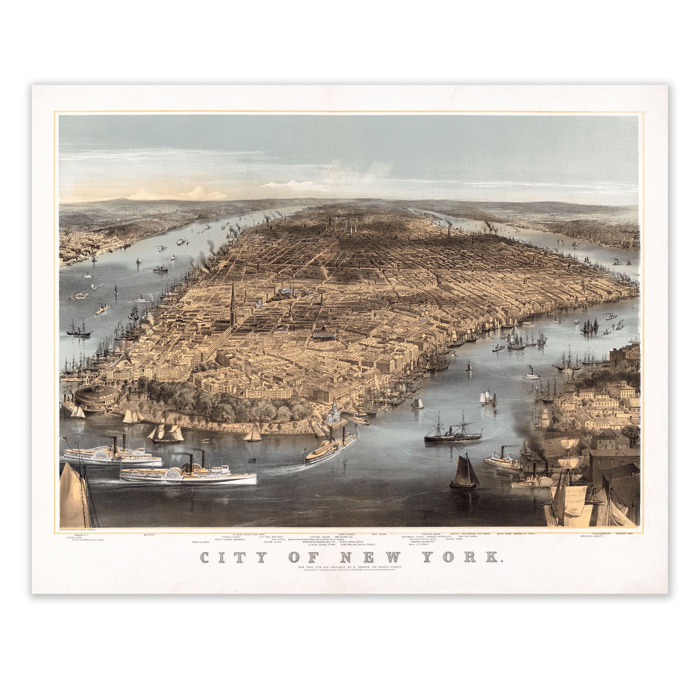
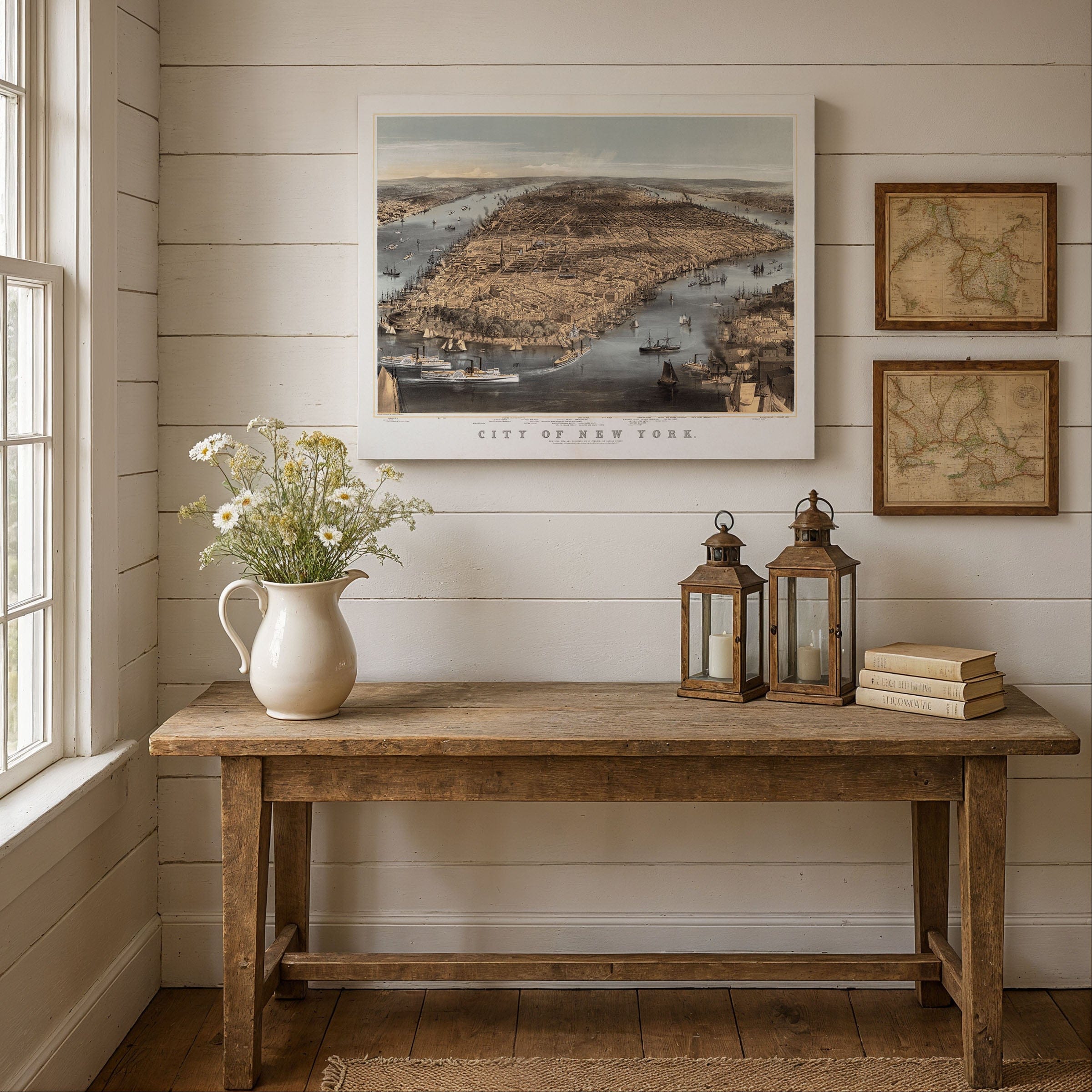
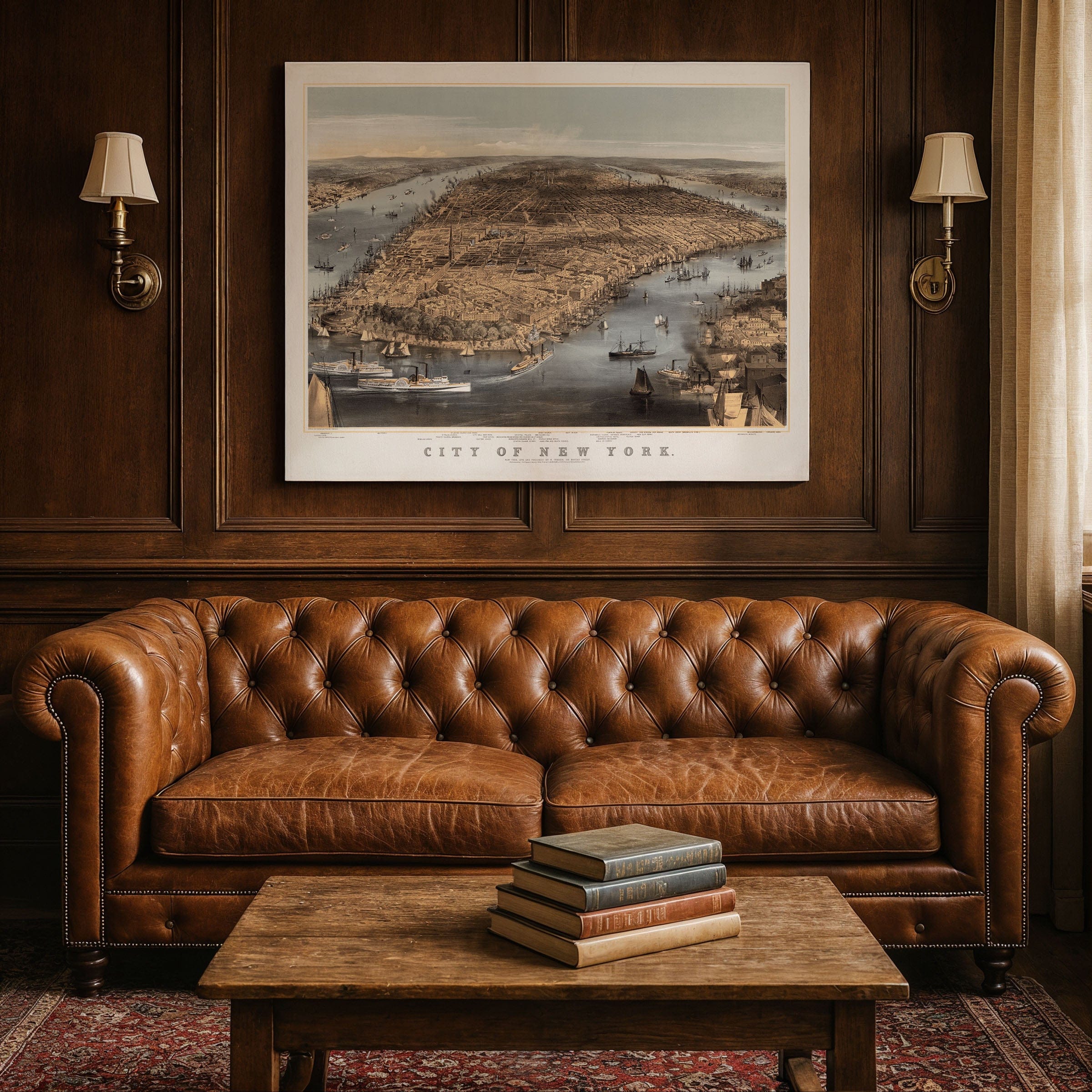
Step into the heart of 19th-century America with this magnificent City of New York lithograph, sketched and drawn on stone by Charles Parsons and published by the legendary N. Currier (Currier & Ives) around 1856. This extraordinary panoramic view captures New York City at a pivotal moment in its transformation from colonial port to the cosmopolitan giant that would define the modern American metropolis.
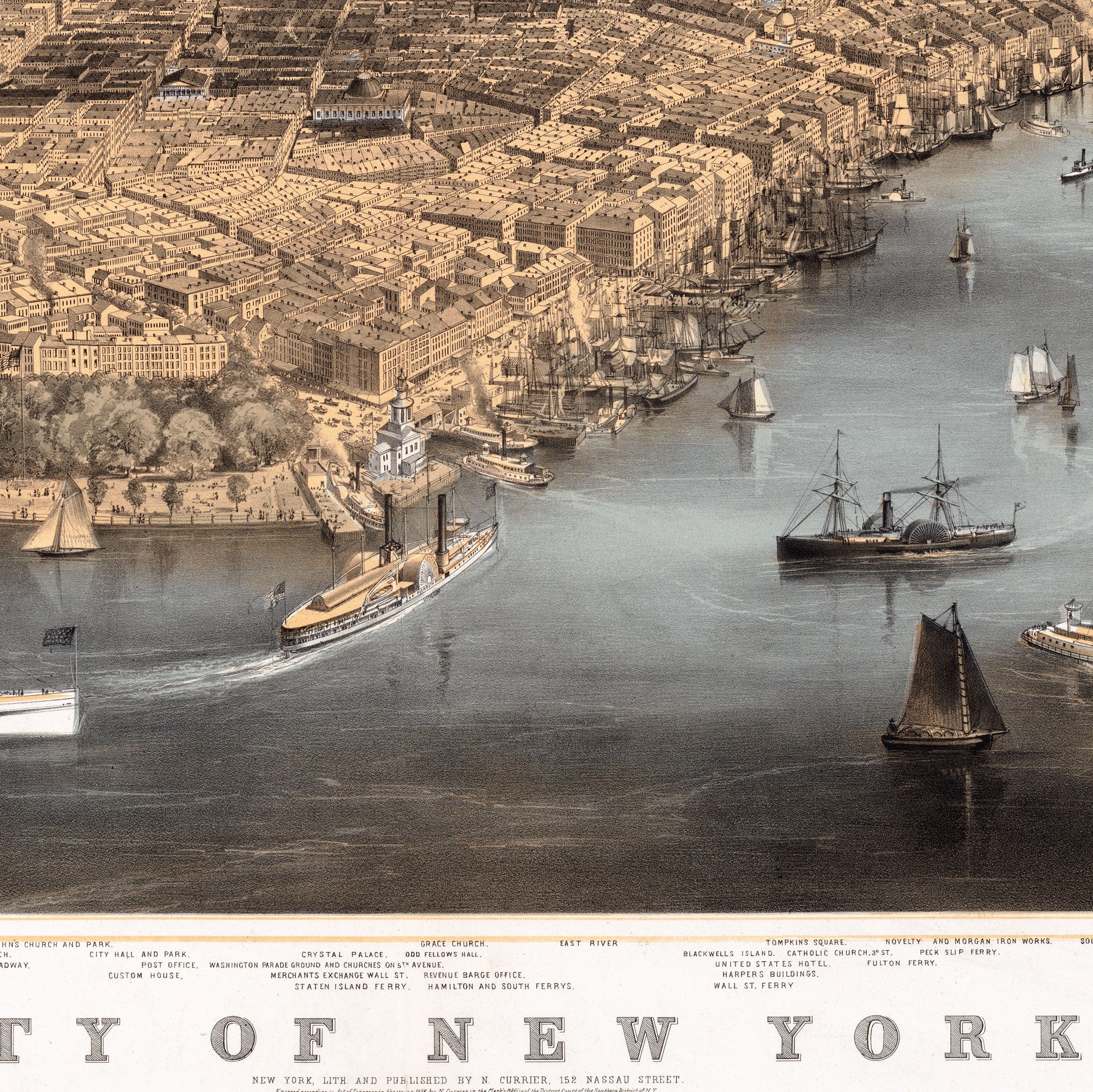
From a commanding vantage point high above the harbor, this sweeping vista reveals Manhattan in all its mid-century glory. Battery Park anchors the foreground while Brooklyn Heights rises majestically to the right, and Manhattan stretches northward in an intricate tapestry of streets, piers, and public buildings. The bustling harbor teems with maritime life - brigantines, packet ships, and sloops crowd the waterways, each vessel meticulously detailed to showcase New York's supremacy as America's maritime gateway.
This remarkable lithograph represents far more than mere cartography - it stands as a piece of civic propaganda, a marketing masterpiece, and an urban manifesto rolled into one. Currier & Ives were renowned for creating accessible lithographs, famously dubbed prints for the people, and here they present New York as a metropolis worthy of wonder, investment, and admiration. Parsons's masterful sweeping lines impose elegant order on the dynamic chaos of urban growth, depicting the city not as raw wilderness but as a geometrical, deliberate, and disciplined vision of progress.
The year 1856 found New York pulsing with unprecedented change and opportunity. The Erie Canal had already established the metropolis as the crucial hub linking East Coast commerce to the expanding Midwest. Steam and sail traffic filled every corner of the harbor, while waves of immigration swelled the population with dreams and determination. The city was actively transforming from its colonial origins into a cosmopolitan powerhouse, and this lithographic view captures a community absolutely convinced of its magnificent destiny.
Yet beneath the confident presentation lies fascinating tension and complexity. The orderly grid extends toward undeveloped territories that remain pure wilderness - speculative plots awaiting development, neighborhoods yet to rise from imagination into reality. Roads terminate abruptly at forested edges, and while the harbor lanes bustle with activity, they remain crowded and narrow, subtle reminders of limitations even amid explosive expansion. The established buildings cluster near the waterfront and southern tip, but venture northward and imagination must fill the compelling gaps.
Perfect for history enthusiasts, New York natives, lovers of maritime heritage, and anyone who appreciates the artistry of 19th-century lithography, this museum-quality reproduction brings one of America's most dynamic periods to vivid life with stunning clarity and historical authenticity.
The Map Story
Materials
Choose options

Because every place has a story
Make History Personal
A vintage map is more than art.
It is a reminder of where life began.
Where memories were made.
Where hearts still live. Give the gift of place.
Beautifully preserved and made for the moments that matter.
Why Choose Us?
| Feature | Us | Competitor A | Competitor B |
|---|---|---|---|
| Hand Crafted | |||
| Museum Quality | |||
| 100 Year Guarantee | |||
| Restored by Hand | |||
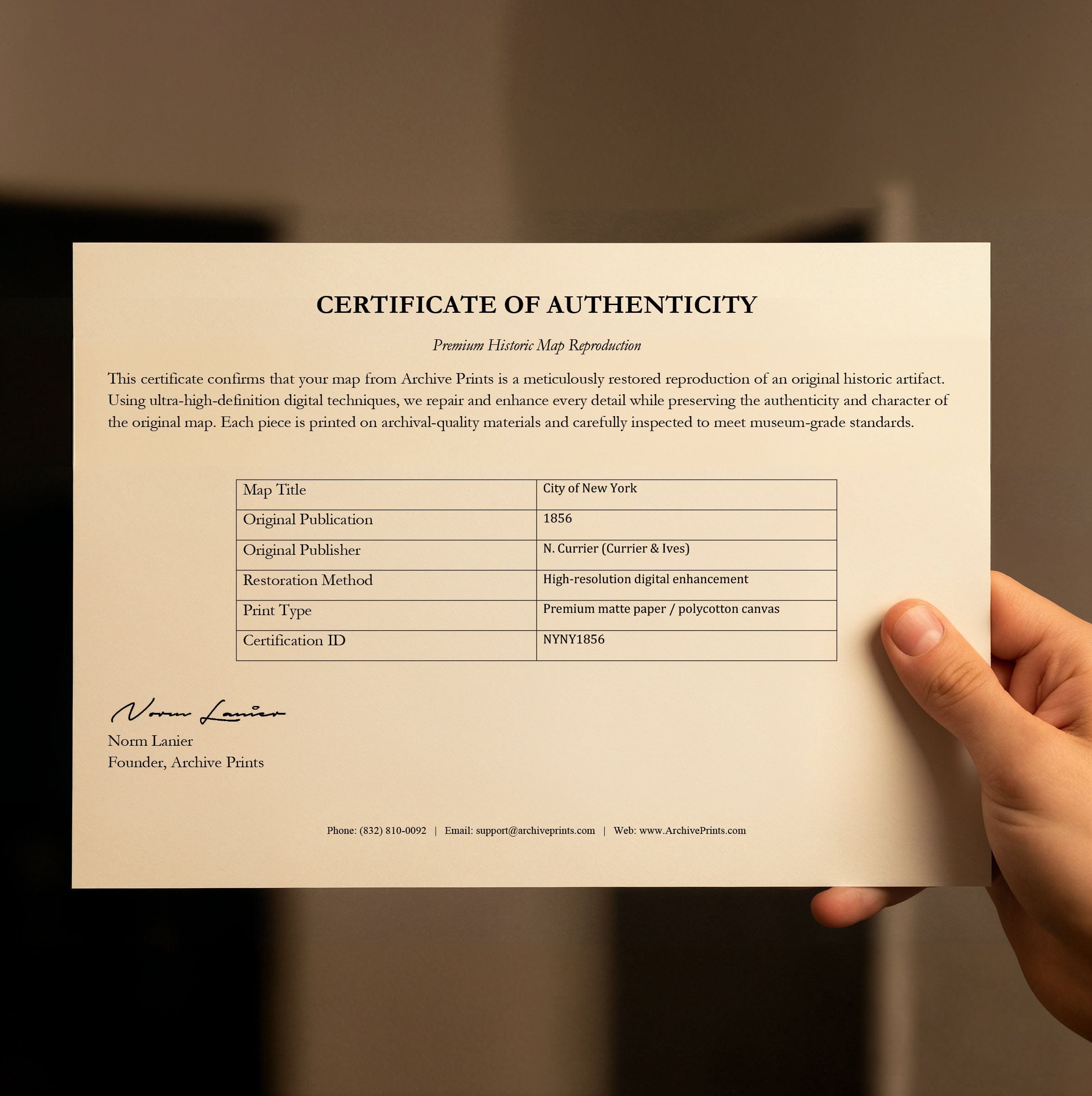
| Certificate of Authenticity |

Art Prints
Archival quality colors. Best option if you'd like to frame it yourself

The Best Materials
We hand-stretched our canvas on solid American-grown pine stretcher bars. We use quality canvas and fade-resistant inks to create the lasting art. Canvases come with hardware already installed and ready to hang.
Need help?
Frequently Asked Questions
Order
All of our maps are meticulously restored reproductions of historic originals. Each piece is digitally repaired and color-corrected to bring out the finest details while preserving its authentic, vintage character.
Yes. All Archive Prints products are printed to order in the USA with archival materials.
We offer two premium formats:
- High-Quality Paper Posters – Printed on thick, archival-grade matte paper for rich, vibrant detail.
- Hand-Stretched Canvas Prints – Printed on premium polycotton canvas and mounted on 1.5" solid American pine stretcher bars for a gallery-quality finish.
We carefully digitally restore each map to enhance clarity and color while preserving its original look and historic charm. You’ll enjoy sharp details and a timeless vintage aesthetic that feels true to the original piece.
Yes, we do! We offer premium framing options to make your map ready to hang the moment it arrives. You can choose from Oak, Maple, Black, or Walnut frames directly on the product page. We also offer Stretched Canvas prints for a modern gallery look, as well as archival-quality Posters if you prefer to frame it yourself.
Yes! We offer free shipping on all products within the United States. Each map is carefully packaged to ensure it arrives in perfect condition.
If you’re not completely satisfied, you can return your order in new condition for a full refund. Return shipping costs are the responsibility of the customer.
Absolutely! Our maps make thoughtful, one-of-a-kind gifts for history lovers, map collectors, or anyone looking to add vintage character to their home or office. Choose between paper prints for framing or stretched canvas for a ready-to-hang presentation.
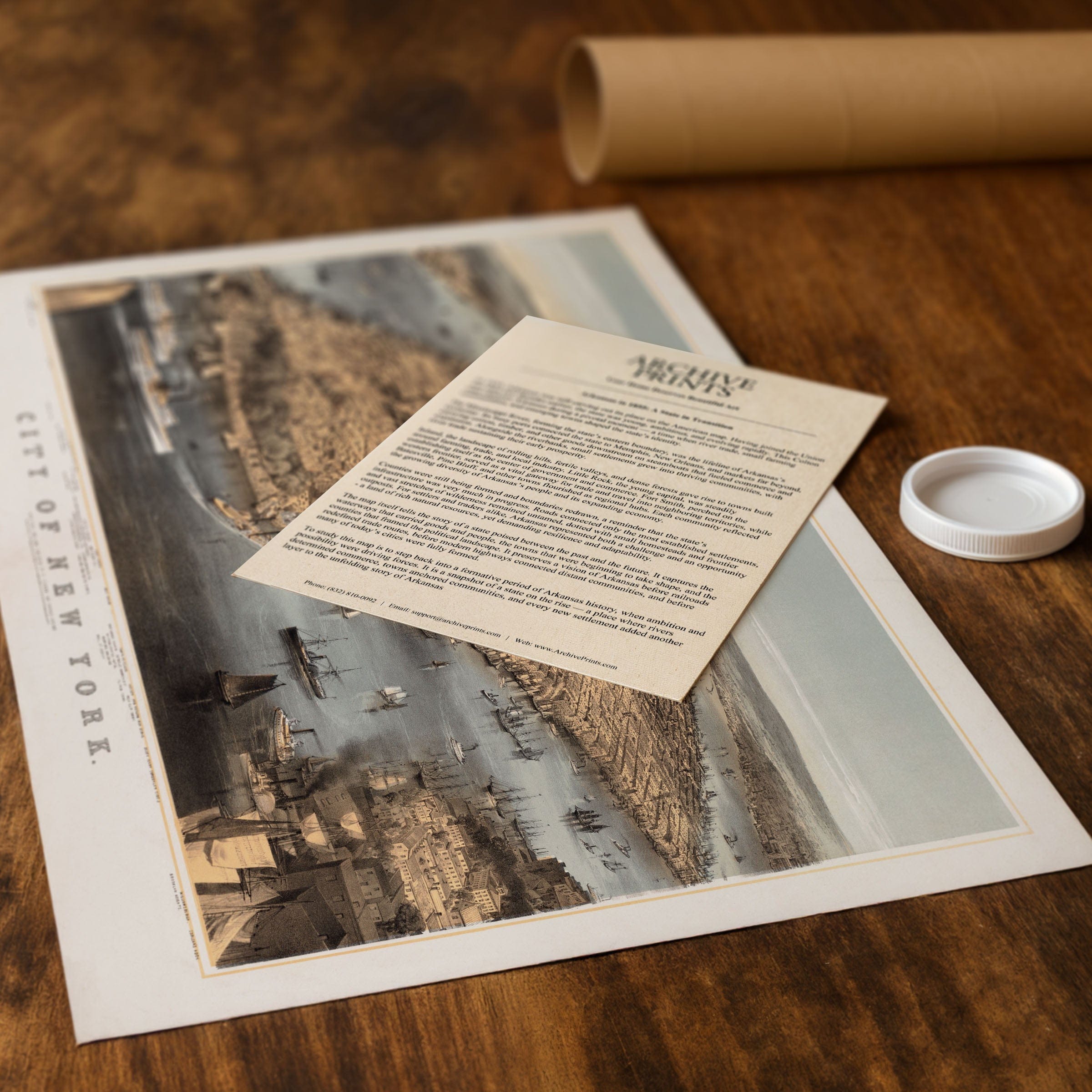
- Paper Posters → Shipped in durable, protective tubes to prevent creasing.
- Canvas Prints → Carefully wrapped, padded, and boxed to ensure safe delivery.
Our maps look stunning in a variety of settings, including:
- Living rooms and home offices
- Libraries and studies
- Corporate offices and conference rooms
- Restaurants, cafes, and boutique spaces