Northborough, Massachusetts Map 1887
Northborough, Massachusetts Map 1887
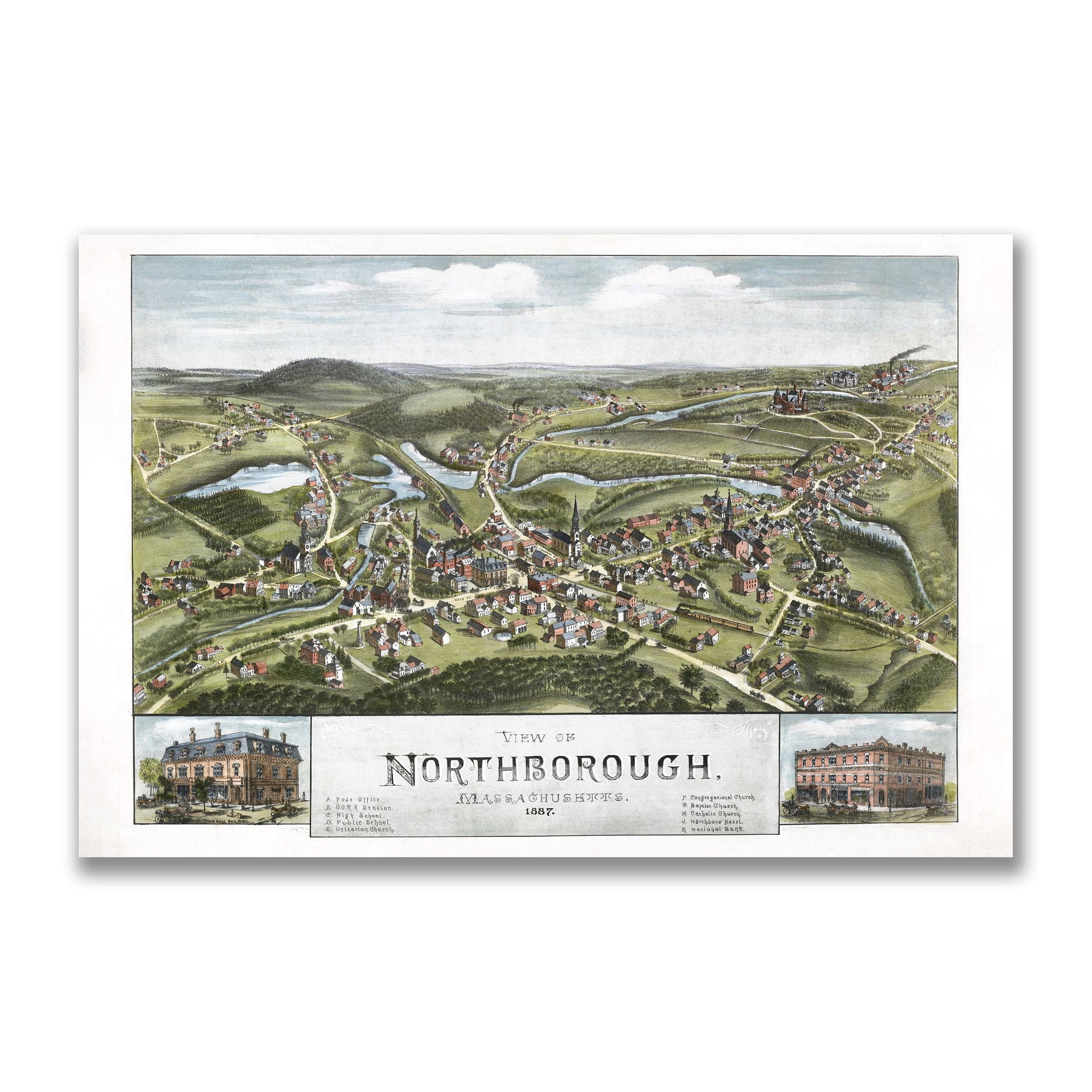
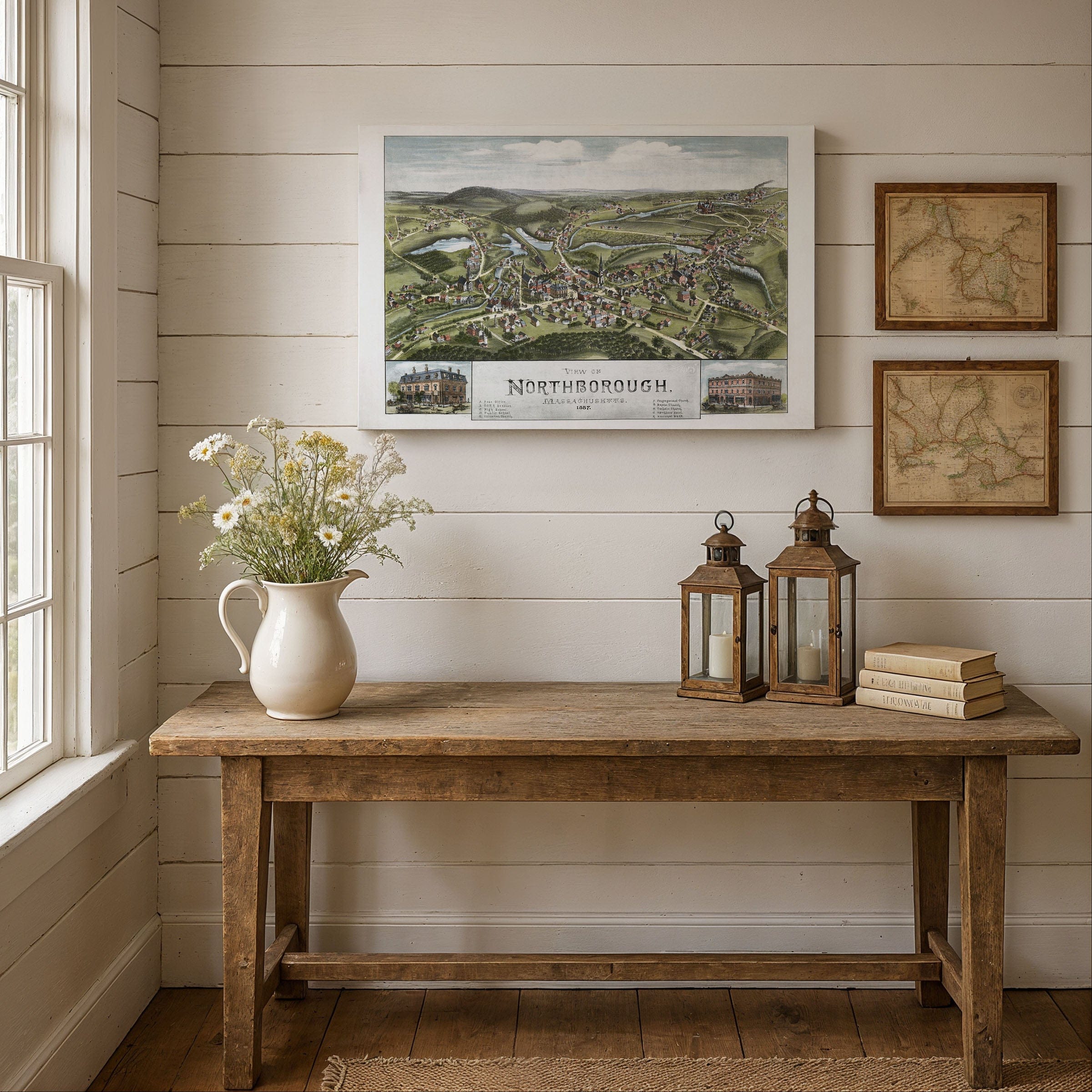
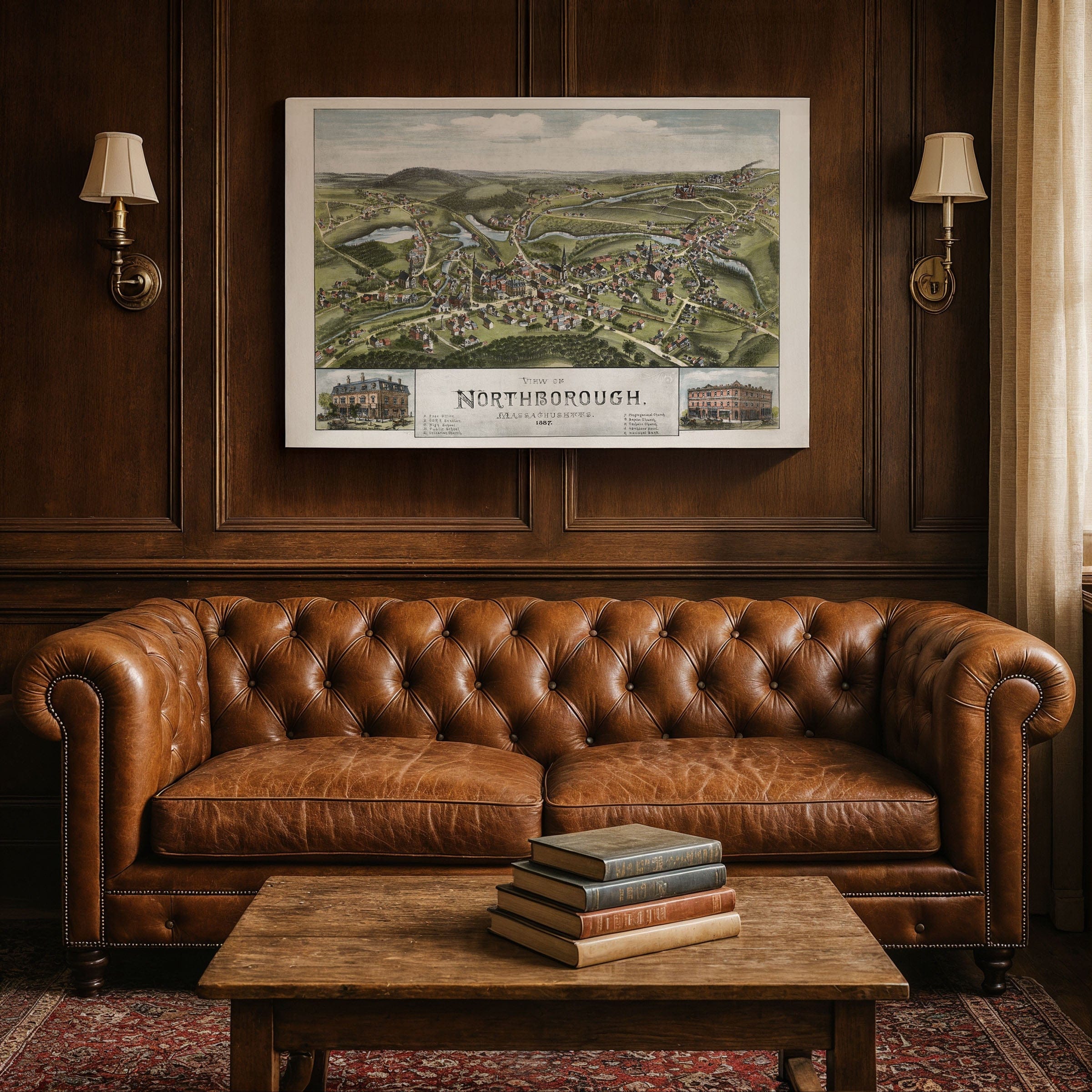
Discover the charming Northborough, Massachusetts Map from 1887, capturing Northborough as a classic New England town—defined by rolling hills, quiet ponds, and the steady work of farms and mills. This panoramic bird's-eye view preserves the community at a moment when its rural heritage and modest industrial growth blended into a landscape rich with tradition and gentle progress, showcasing the quintessential New England character of central Massachusetts.
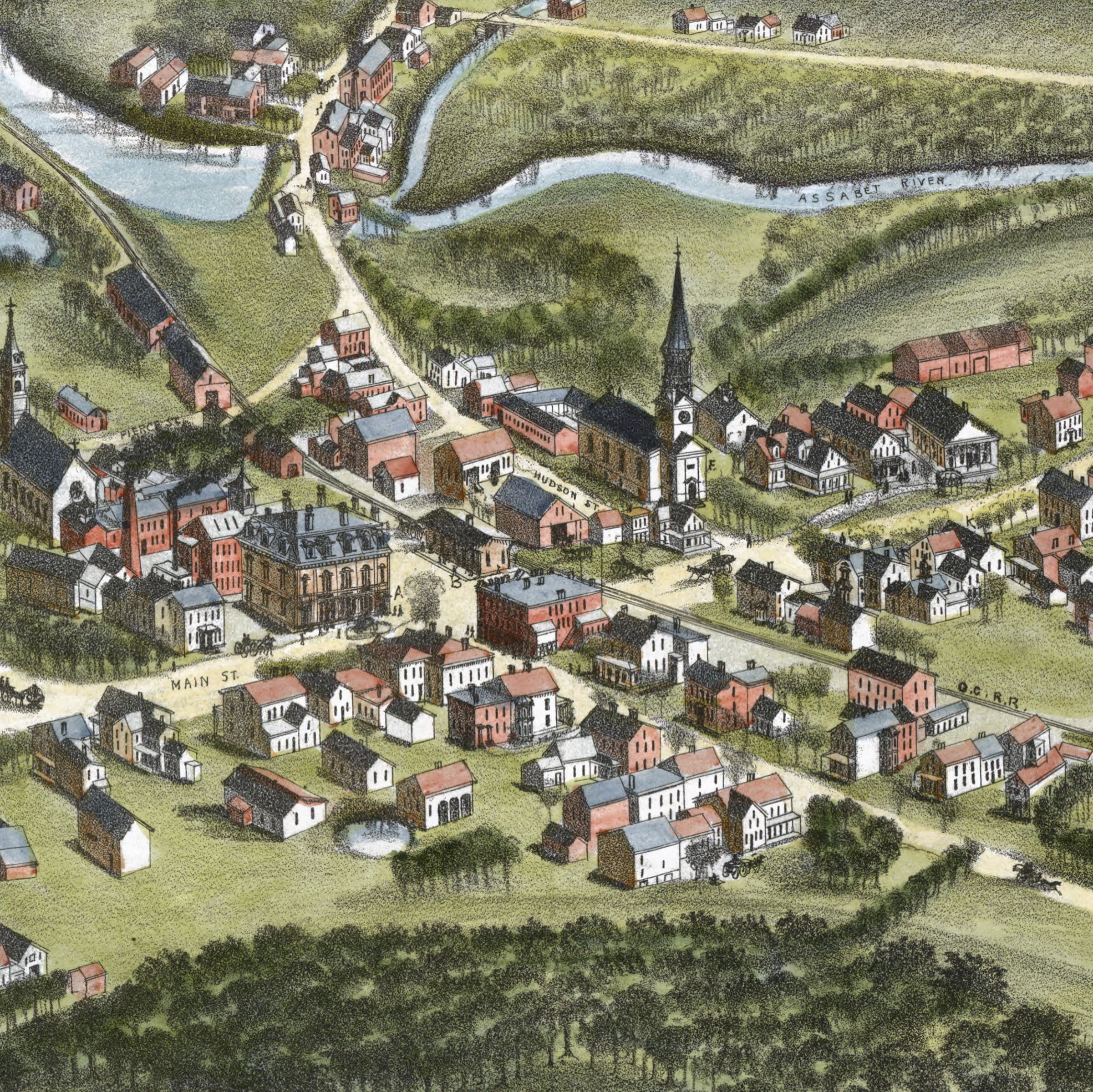
From an elevated vantage, the village center in this Northborough, Massachusetts Map forms the focal point of the illustration. Homes, workshops, and small shops line the main road, reflecting a town whose daily rhythms revolved around local trade, school activities, and community gatherings. Rising above the rooftops, the steeple of the Congregational Church anchors the scene, symbolizing faith, continuity, and civic pride that defined 19th-century New England communities.
Northborough's waterways shown in this Northborough, Massachusetts Map—its brooks, millponds, and dams—appear throughout the map, highlighting the industries they powered. Small factories, mills, and workshops line the streams, showing how waterpower supported a varied local economy of grist milling, woodworking, and light manufacturing. These enterprises reveal a town maintaining its agricultural character while gradually embracing the opportunities of the late 19th century.
Beyond the village core in this Northborough, Massachusetts Map, the countryside stretches outward in graceful expanses of fields, orchards, and pastures. Farmhouses sit comfortably within the landscape, emphasizing the region's long agricultural tradition. The rolling hills and scattered woodlots give the map a peaceful, pastoral quality typical of central Massachusetts before rapid industrialization altered the region's pace. Roads leading toward neighboring towns hint at Northborough's connections within the region.
Perfect for Northborough residents, Massachusetts history enthusiasts, and collectors of New England town maps, this Northborough, Massachusetts Map reproduction includes a custom historical certificate. Inset illustrations of notable local buildings—such as the prominent bank and commercial block—underscore the town's aspirations and civic pride. Printed on heavyweight archival paper or hand-stretched polycotton canvas, every church, mill, farm, and village building is restored in museum-grade clarity for generations of enjoyment. Paper prints ship rolled in heavy-duty tubes, while canvas editions arrive gallery-wrapped on solid pine stretcher bars with pre-installed hardware—ready to display the moment it arrives. Bring home a piece of Northborough history and celebrate a New England town rooted in tradition yet quietly moving toward change.
The Map Story
Materials
Choose options

Because every place has a story
Make History Personal
A vintage map is more than art.
It is a reminder of where life began.
Where memories were made.
Where hearts still live. Give the gift of place.
Beautifully preserved and made for the moments that matter.
Why Choose Us?
| Feature | Us | Competitor A | Competitor B |
|---|---|---|---|
| Hand Crafted | |||
| Museum Quality | |||
| 100 Year Guarantee | |||
| Restored by Hand | |||
| Certificate of Authenticity |

Art Prints
Archival quality colors. Best option if you'd like to frame it yourself

The Best Materials
We hand-stretched our canvas on solid American-grown pine stretcher bars. We use quality canvas and fade-resistant inks to create the lasting art. Canvases come with hardware already installed and ready to hang.
Need help?
Frequently Asked Questions
Order
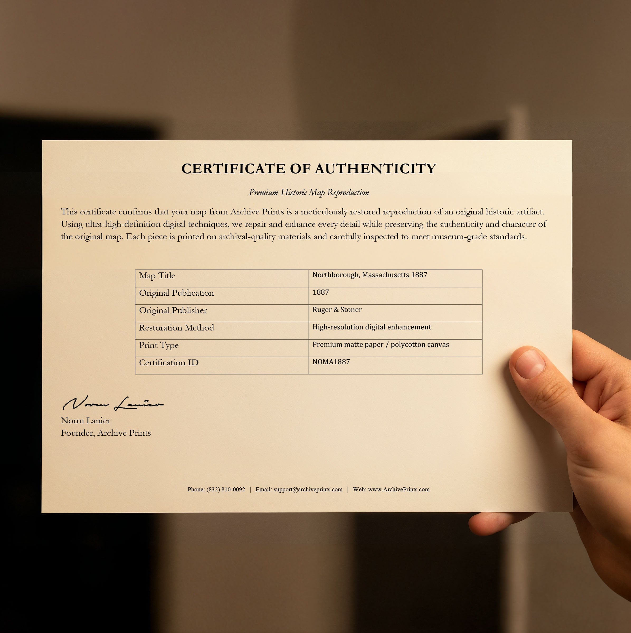
All of our maps are meticulously restored reproductions of historic originals. Each piece is digitally repaired and color-corrected to bring out the finest details while preserving its authentic, vintage character.
Yes. All Archive Prints products are printed to order in the USA with archival materials.
We offer two premium formats:
- High-Quality Paper Posters – Printed on thick, archival-grade matte paper for rich, vibrant detail.
- Hand-Stretched Canvas Prints – Printed on premium polycotton canvas and mounted on 1.5" solid American pine stretcher bars for a gallery-quality finish.
We carefully digitally restore each map to enhance clarity and color while preserving its original look and historic charm. You’ll enjoy sharp details and a timeless vintage aesthetic that feels true to the original piece.
Yes, we do! We offer premium framing options to make your map ready to hang the moment it arrives. You can choose from Oak, Maple, Black, or Walnut frames directly on the product page. We also offer Stretched Canvas prints for a modern gallery look, as well as archival-quality Posters if you prefer to frame it yourself.
Yes! We offer free shipping on all products within the United States. Each map is carefully packaged to ensure it arrives in perfect condition.
If you’re not completely satisfied, you can return your order in new condition for a full refund. Return shipping costs are the responsibility of the customer.
Absolutely! Our maps make thoughtful, one-of-a-kind gifts for history lovers, map collectors, or anyone looking to add vintage character to their home or office. Choose between paper prints for framing or stretched canvas for a ready-to-hang presentation.
- Paper Posters → Shipped in durable, protective tubes to prevent creasing.
- Canvas Prints → Carefully wrapped, padded, and boxed to ensure safe delivery.
Our maps look stunning in a variety of settings, including:
- Living rooms and home offices
- Libraries and studies
- Corporate offices and conference rooms
- Restaurants, cafes, and boutique spaces