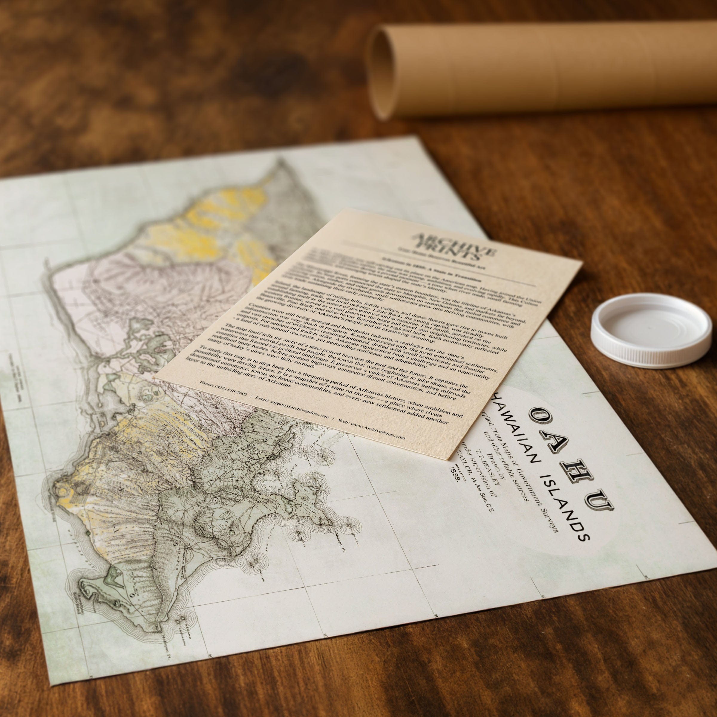
Oahu, Hawaiian Islands Map 1899
Oahu, Hawaiian Islands Map 1899
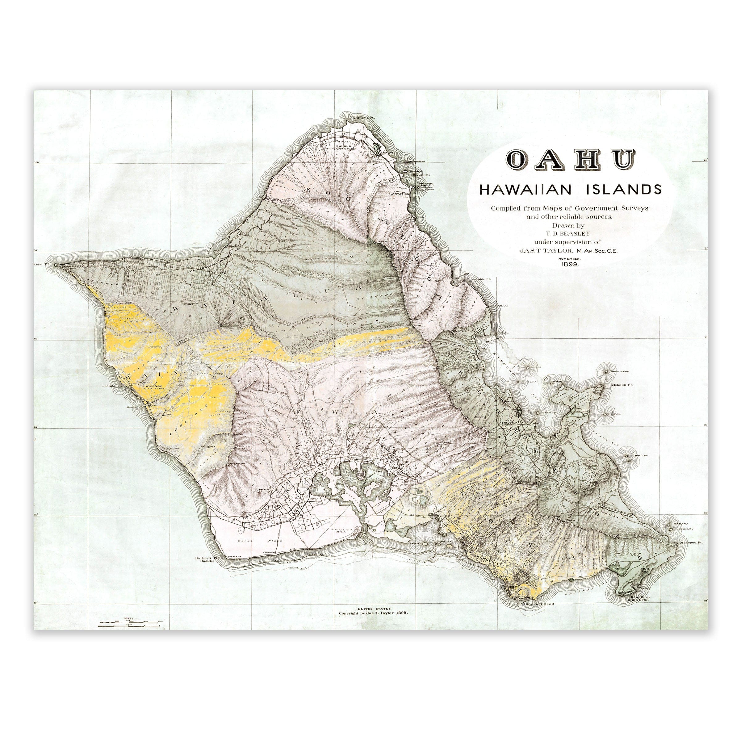
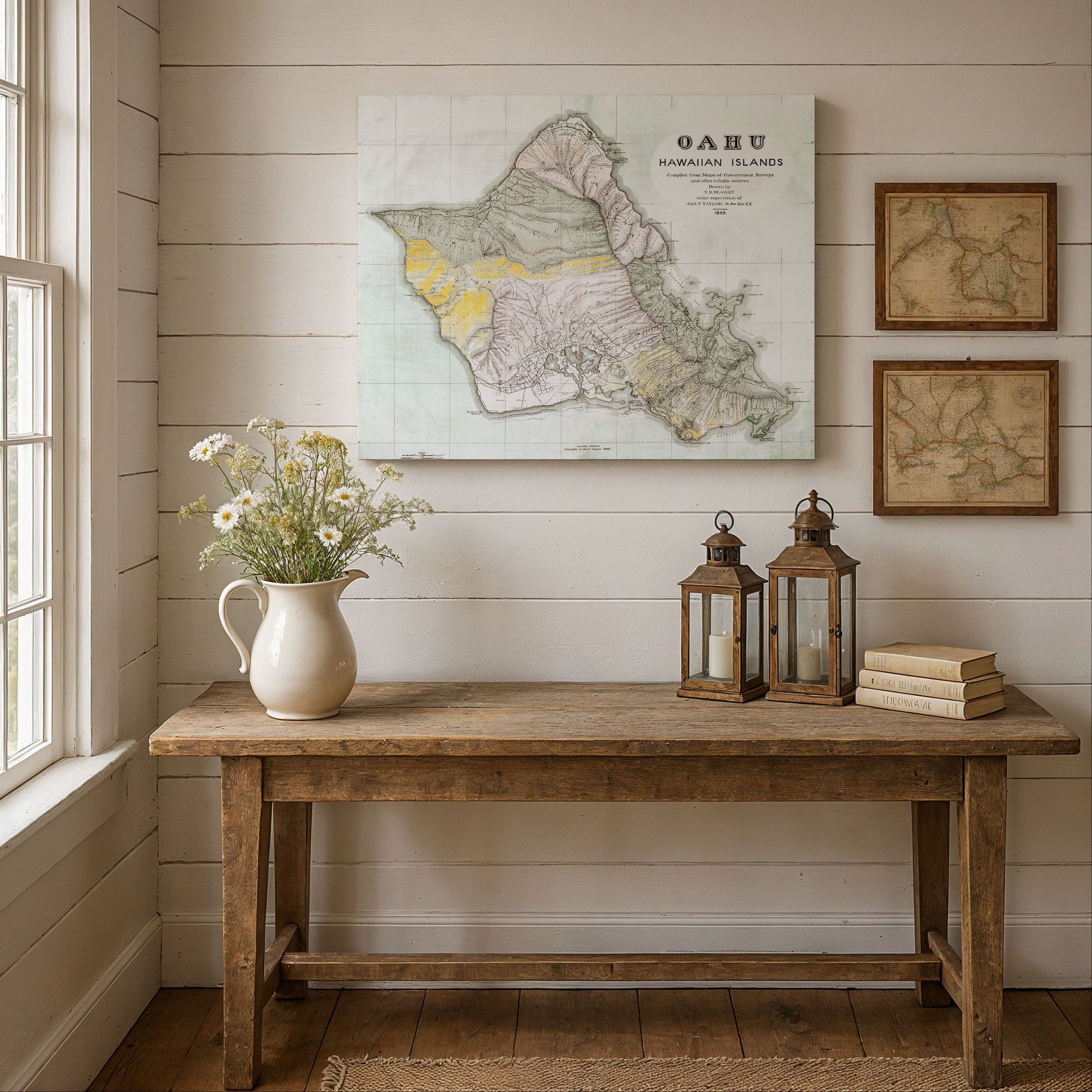
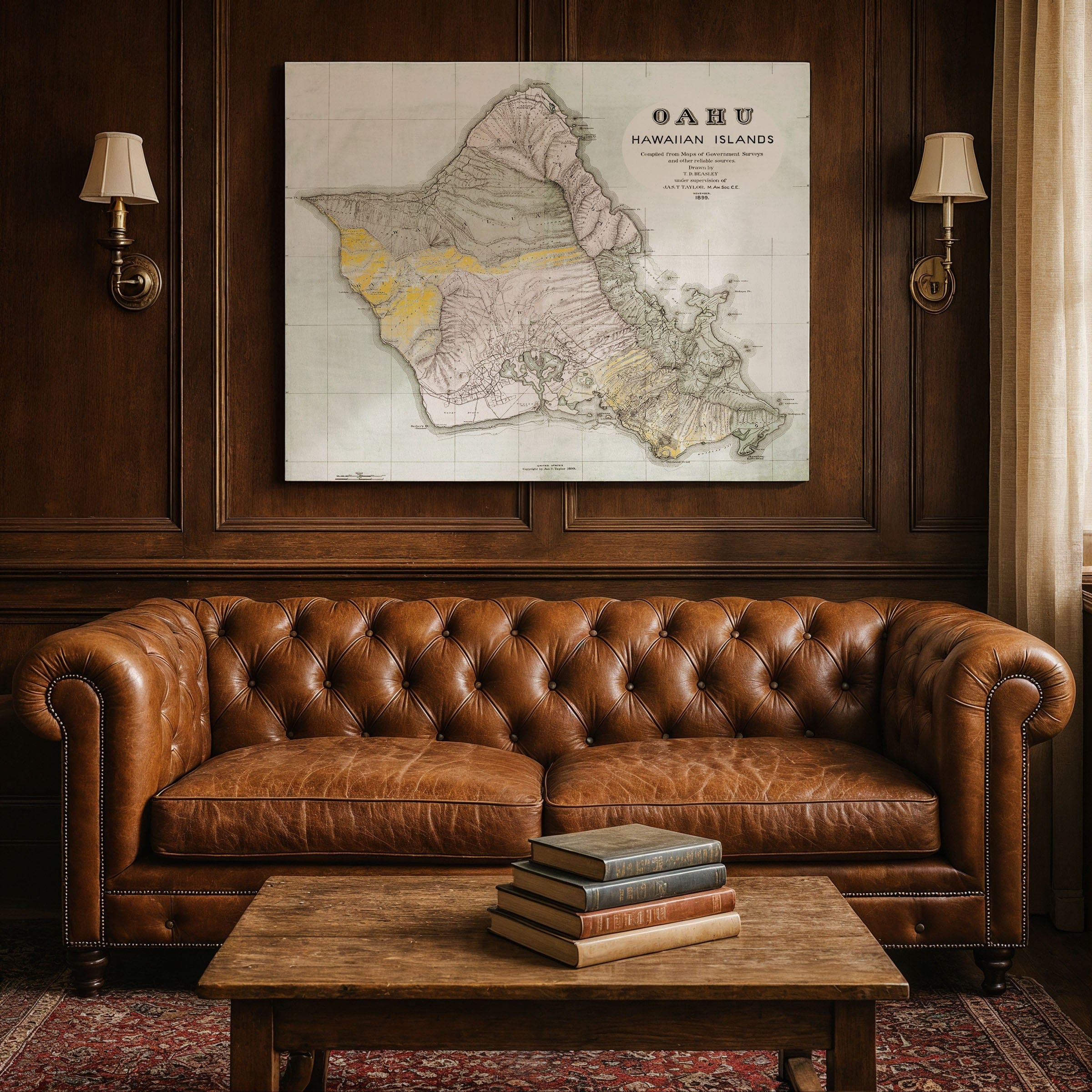
Discover the historic Oahu, Hawaiian Islands Map from 1899, capturing Oahu at a transformative moment in Hawaiian history—just one year after annexation to the United States. This detailed map preserves the island as it evolved from an independent kingdom into an American territory, showing Honolulu as the bustling capital and port city that connected the Pacific world through commerce, culture, and maritime trade.
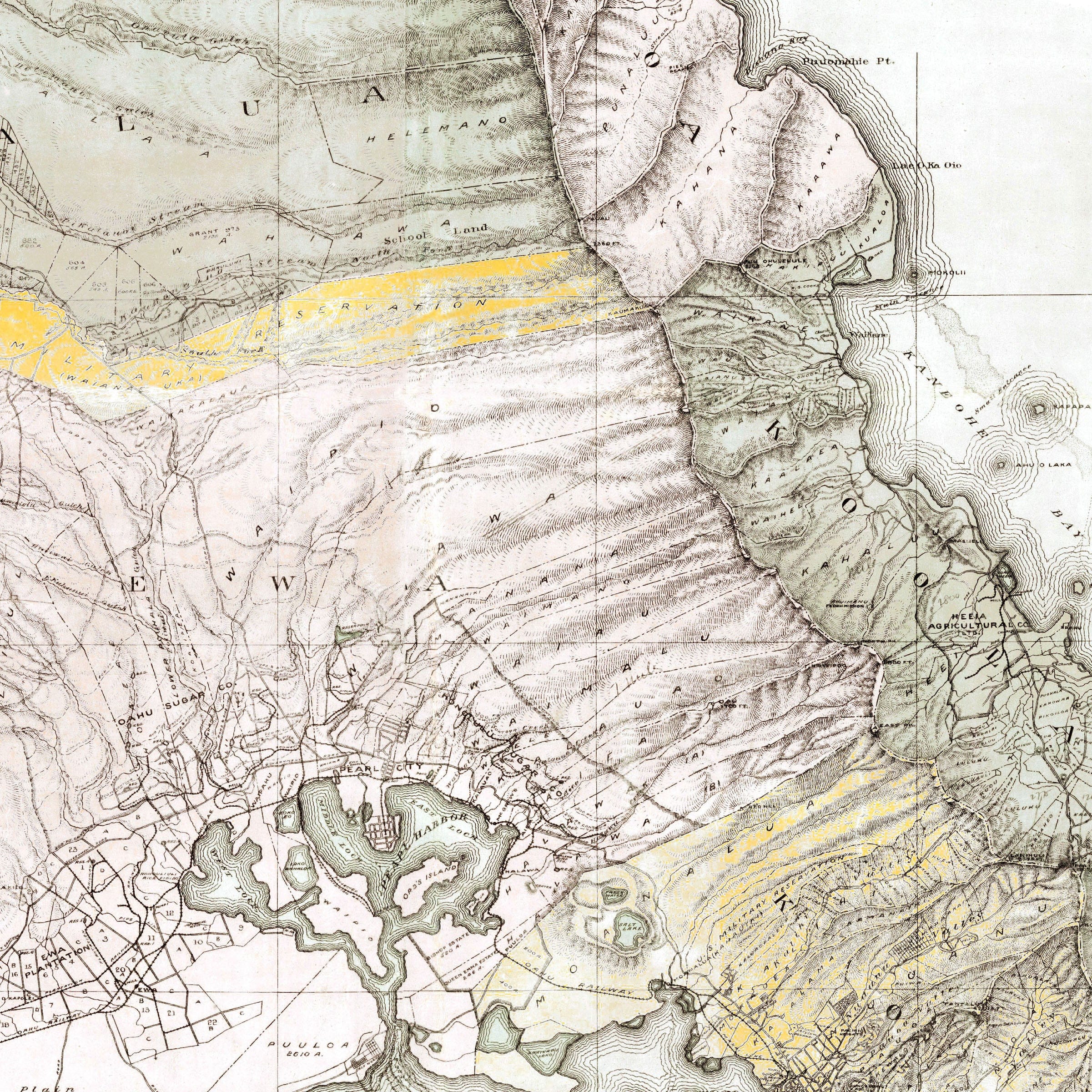
The Oahu, Hawaiian Islands Map reveals the island's remarkable geography: dramatic mountain ranges rising from coastal plains, deep valleys carved by ancient streams, and harbors that made Oahu the crossroads of the Pacific. Honolulu's streets and buildings cluster around the waterfront, where wharves extended into the harbor to accommodate steamships traveling between San Francisco, Asia, and the South Pacific. Beyond the city, the map shows plantation lands spreading across the fertile valleys—sugarcane fields that had transformed the island's economy.
Small towns and villages shown in this Oahu, Hawaiian Islands Map dot the coastline, connected by roads that wound around the island's perimeter. Pearl Harbor appears on the map's southern coast, its strategic importance already recognized though the great naval base was still years away. The map captures the blend of traditional Hawaiian settlements with the growing influence of American and international commerce that characterized turn-of-the-century Oahu.
This Oahu, Hawaiian Islands Map preserves transportation routes, agricultural lands, and the early development of what would become modern Honolulu. Mountain ranges, valleys, and coastal features are carefully detailed, showing the dramatic topography that defines the island. The map reflects Oahu's role as the political and economic center of the Hawaiian Islands during a period of profound change.
Perfect for Hawaii residents, Pacific history enthusiasts, and collectors of vintage island cartography, this Oahu, Hawaiian Islands Map reproduction includes a custom historical certificate. The map captures Oahu at the threshold of the 20th century, balancing its rich Polynesian heritage with the forces of modernization and American influence. Printed on heavyweight archival paper or hand-stretched polycotton canvas, every valley, harbor, plantation, and settlement is restored in museum-grade clarity for generations of enjoyment. Paper prints ship rolled in heavy-duty tubes, while canvas editions arrive gallery-wrapped on solid pine stretcher bars with pre-installed hardware—ready to display the moment it arrives. Bring home a piece of Hawaiian history and celebrate Oahu during a pivotal era of transformation.
The Map Story
Materials
Choose options

Because every place has a story
Make History Personal
A vintage map is more than art.
It is a reminder of where life began.
Where memories were made.
Where hearts still live. Give the gift of place.
Beautifully preserved and made for the moments that matter.
Why Choose Us?
| Feature | Us | Competitor A | Competitor B |
|---|---|---|---|
| Hand Crafted | |||
| Museum Quality | |||
| 100 Year Guarantee | |||
| Restored by Hand | |||
| Certificate of Authenticity |

Art Prints
Archival quality colors. Best option if you'd like to frame it yourself

The Best Materials
We hand-stretched our canvas on solid American-grown pine stretcher bars. We use quality canvas and fade-resistant inks to create the lasting art. Canvases come with hardware already installed and ready to hang.
Need help?
Frequently Asked Questions
Order
All of our maps are meticulously restored reproductions of historic originals. Each piece is digitally repaired and color-corrected to bring out the finest details while preserving its authentic, vintage character.
Yes. All Archive Prints products are printed to order in the USA with archival materials.
We offer two premium formats:
- High-Quality Paper Posters – Printed on thick, archival-grade matte paper for rich, vibrant detail.
- Hand-Stretched Canvas Prints – Printed on premium polycotton canvas and mounted on 1.5" solid American pine stretcher bars for a gallery-quality finish.
We carefully digitally restore each map to enhance clarity and color while preserving its original look and historic charm. You’ll enjoy sharp details and a timeless vintage aesthetic that feels true to the original piece.
Yes, we do! We offer premium framing options to make your map ready to hang the moment it arrives. You can choose from Oak, Maple, Black, or Walnut frames directly on the product page. We also offer Stretched Canvas prints for a modern gallery look, as well as archival-quality Posters if you prefer to frame it yourself.
Yes! We offer free shipping on all products within the United States. Each map is carefully packaged to ensure it arrives in perfect condition.
If you’re not completely satisfied, you can return your order in new condition for a full refund. Return shipping costs are the responsibility of the customer.
Absolutely! Our maps make thoughtful, one-of-a-kind gifts for history lovers, map collectors, or anyone looking to add vintage character to their home or office. Choose between paper prints for framing or stretched canvas for a ready-to-hang presentation.
- Paper Posters → Shipped in durable, protective tubes to prevent creasing.
- Canvas Prints → Carefully wrapped, padded, and boxed to ensure safe delivery.
Our maps look stunning in a variety of settings, including:
- Living rooms and home offices
- Libraries and studies
- Corporate offices and conference rooms
- Restaurants, cafes, and boutique spaces