
Ocean City, New Jersey Map 1903
Ocean City, New Jersey Map 1903
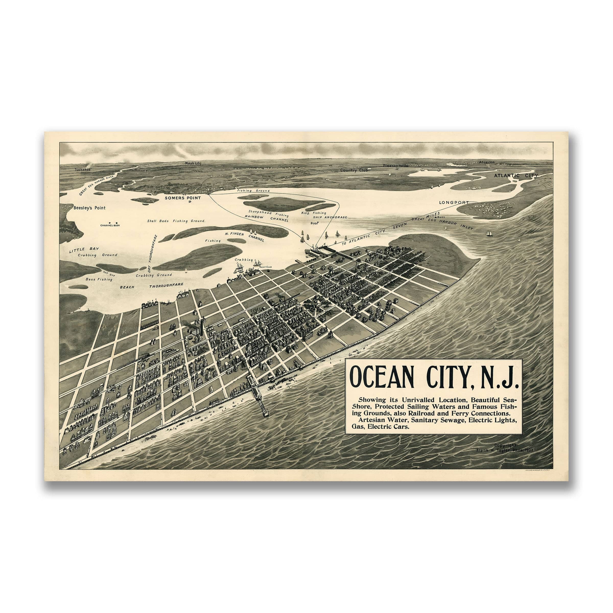
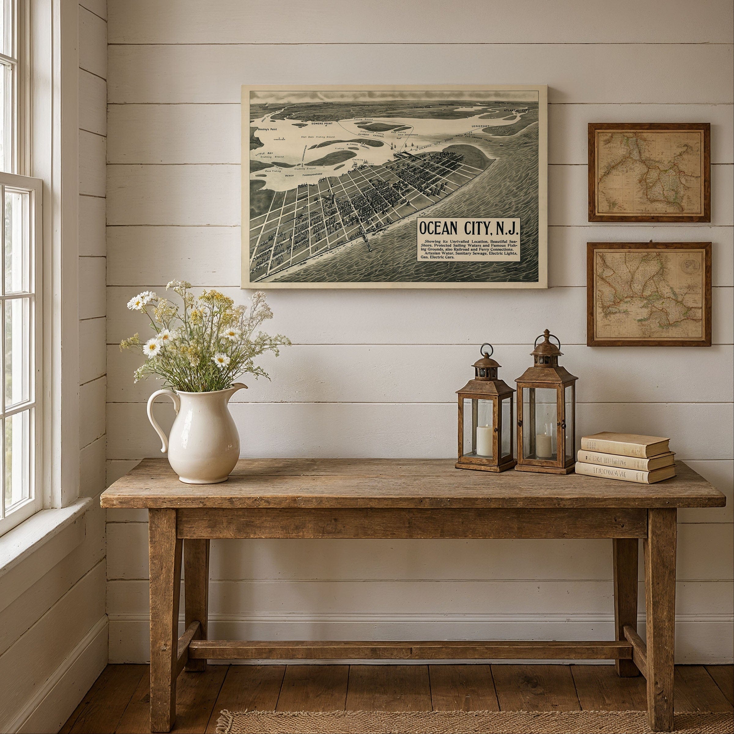
Travel back to 1903 when this breathtaking bird's-eye map by Frank H. Taylor captured Ocean City at the dawn of its golden age as one of the Atlantic Coast's premier seaside resorts. This isn't just a map—it's a window into an era when Americans discovered the Jersey Shore, when steamers crossed Great Egg Harbor Bay, and when Ocean City transformed from a quiet island retreat into a thriving resort town complete with electric streetcars, grand hotels, and miles of pristine beaches.
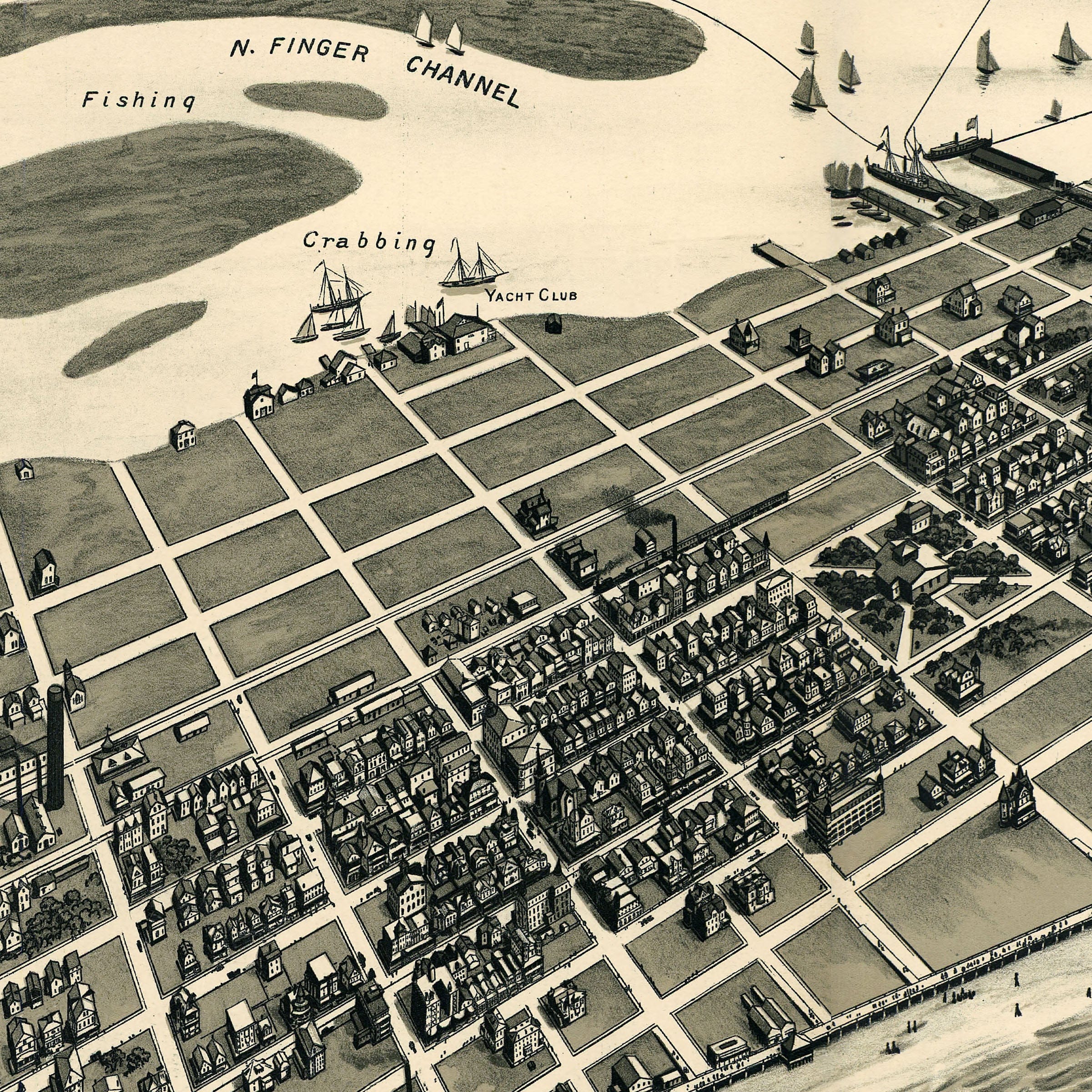
The Ocean City, New Jersey Map presents a sweeping northwest view across the island, showcasing the city's meticulously planned grid stretching from the oceanfront boardwalk to the calm waters of the bay. Along the Atlantic shoreline, rows of bathhouses, piers, and elegant cottages line the beach, while visitors dot the sand and promenade—capturing the essence of turn-of-the-century seaside leisure. The iconic pier extends confidently into the ocean, symbolizing Ocean City's embrace of modern resort culture.
Across Great Egg Harbor Bay, the map reveals the maritime world that sustained the region long before tourism arrived. Carefully labeled fishing grounds, crabbing spots, and sailing routes highlight the natural abundance that drew both sportsmen and vacationers to these protected waters. Ferry routes connect the island to Somers Point and the mainland, while channels and inlets wind through the coastal landscape, reminding viewers of Ocean City's rich maritime heritage.
Within the town itself, rising rows of homes, churches, and public buildings tell the story of a community investing in its future. By 1903, Ocean City boasted modern amenities that rivaled any city: artesian water systems, sanitary sewage, electric lighting, gas service, and an electric streetcar network connecting neighborhoods to the beach. These improvements reflected the city's ambition to be more than a seasonal destination—it was becoming a year-round community built on progress and natural beauty.
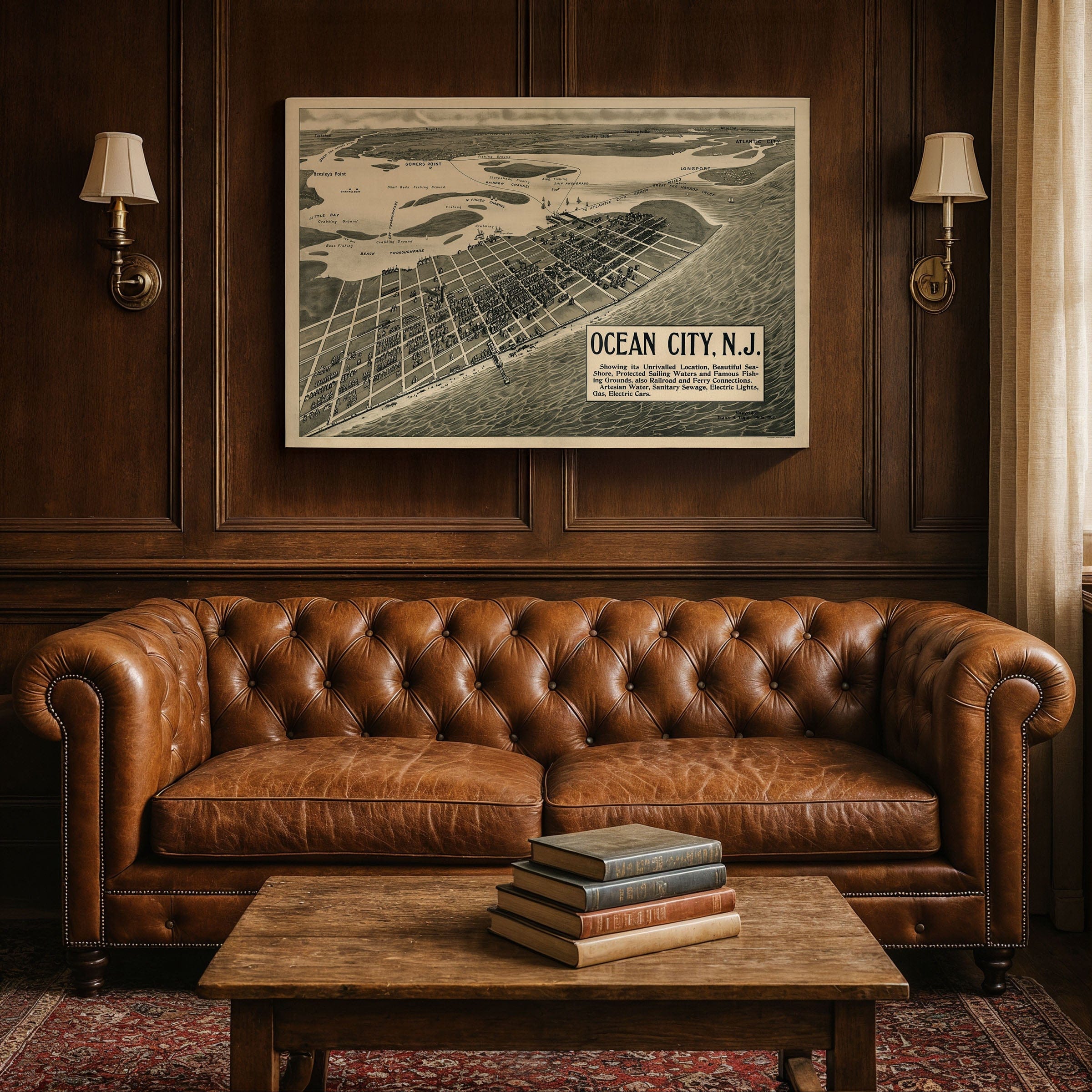
Taylor's artistic rendering captures Ocean City during a moment of optimism and expansion. The clean geometry of its avenues, the orderly rhythm of its streets, and the bustling waterfront all suggest a resort confident in its identity. Positioned perfectly between ocean and bay, the city appears both serene and alive with possibility—a place offering unspoiled beaches, protected waterways, and a slower pace of life that continues to define the Jersey Shore experience.
This map is more than a geographic document—it's a celebration of a pivotal moment in Ocean City's history, when the island balanced tradition with progress, nature with development, and local character with cosmopolitan ambition. Every reproduction includes a custom historical certificate detailing the story behind the map, making it perfect for Jersey Shore enthusiasts, Ocean City collectors, and anyone who cherishes the timeless appeal of America's coastal resort towns.
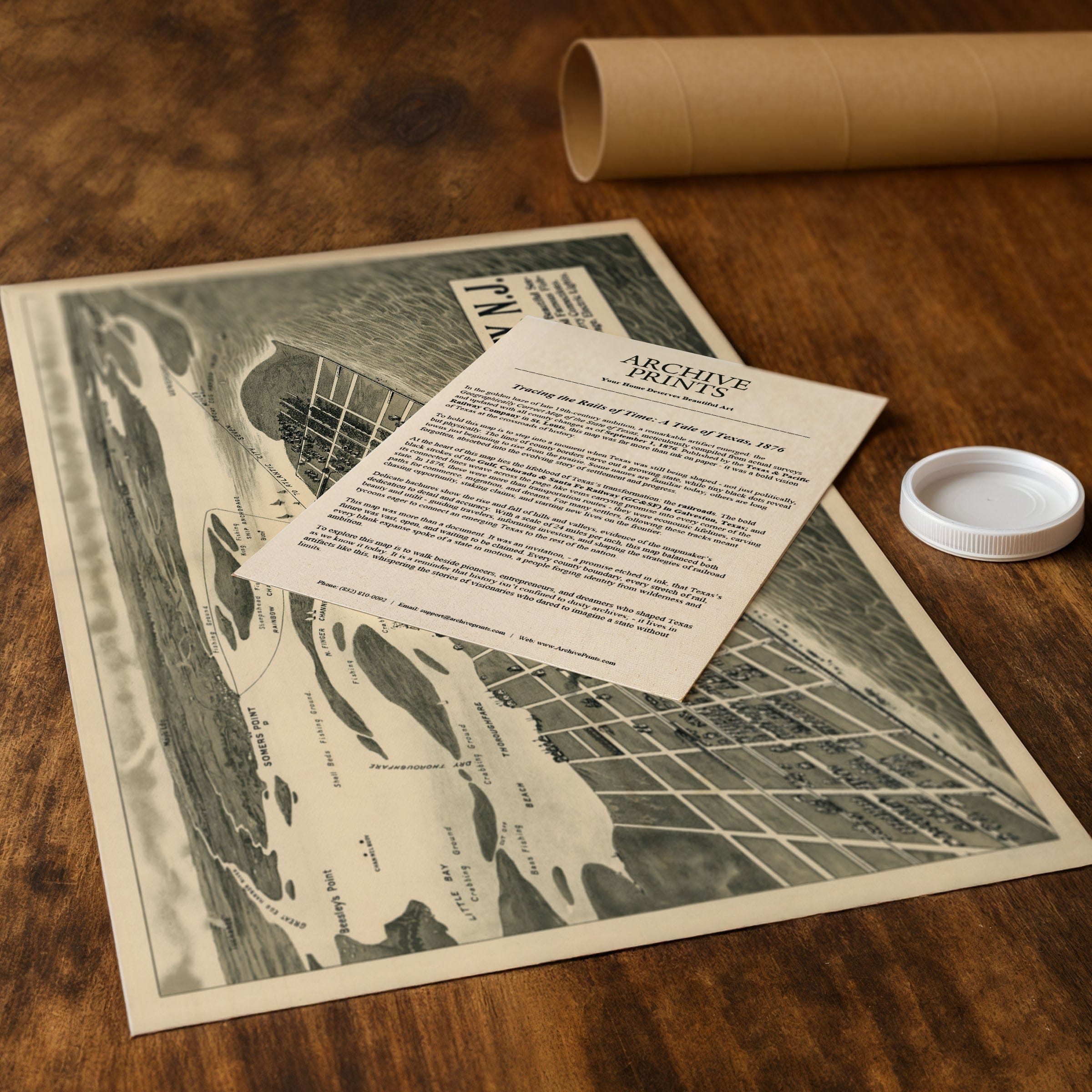
Printed on heavyweight archival paper or hand-stretched polycotton canvas, every street, building, and wave is restored in museum-grade clarity for generations of enjoyment. Paper prints ship rolled in heavy-duty tubes, while canvas editions arrive gallery-wrapped on solid pine stretcher bars with pre-installed hardware—ready to display the moment it arrives. Bring home a piece of Jersey Shore heritage and celebrate Ocean City's enduring legacy as one of America's most beloved seaside destinations.
The Map Story
The view looks northwest across the island, revealing a meticulously laid-out grid of streets stretching from the boardwalk and oceanfront hotels toward the calm waters of Great Egg Harbor Bay. At the shoreline, the surf rolls gently toward rows of bathhouses, piers, and cottages—structures that defined the city's identity as a family-friendly retreat. The beach is dotted with visitors, while the pier extends confidently into the Atlantic, a symbol of the seaside culture Ocean City was rapidly shaping.
Across the bay, the map details the surrounding inlets, channels, and fishing grounds that supported the region's maritime traditions long before the resort era. Crabbing, bass fishing, and sailing routes are all carefully labeled, emphasizing the natural abundance that drew sportsmen and vacationers alike. Ferries and small steamers cross the thoroughfare toward Somers Point, connecting the island to the mainland and to neighboring destinations, including the bustling attractions of Atlantic City to the north.
Within the town grid, the rising rows of homes, churches, and public buildings illustrate a community growing with purpose. By 1903, Ocean City had invested in modern amenities: artesian water, sanitary sewage, electric lights, gas service, and an electric streetcar system that linked neighborhoods to the beach. These improvements signaled the city's ambition to be not just a seasonal destination but a thriving year-round community.
Taylor's rendering showcases Ocean City during a period of optimism and expansion. The clean lines of its avenues, the orderly rhythm of its streets, and the bustling waterfront suggest a resort confident in its identity—a place offering visitors unspoiled beaches, protected waterways, and a slower pace of life. Positioned between the ocean and the bay, the city appears both serene and full of promise.
This map preserves a moment when Ocean City was balancing tradition and progress, nature and development. Taylor invites viewers to step into a resort town shaped by sun, sea, and the enduring appeal of the Jersey Shore, capturing the island just as it entered a new century of growth.
Materials
Choose options

Because every place has a story
Make History Personal
A vintage map is more than art.
It is a reminder of where life began.
Where memories were made.
Where hearts still live. Give the gift of place.
Beautifully preserved and made for the moments that matter.
Why Choose Us?
| Feature | Us | Competitor A | Competitor B |
|---|---|---|---|
| Hand Crafted | |||
| Museum Quality | |||
| 100 Year Guarantee | |||
| Restored by Hand | |||
| Certificate of Authenticity |

Art Prints
Archival quality colors. Best option if you'd like to frame it yourself

The Best Materials
We hand-stretched our canvas on solid American-grown pine stretcher bars. We use quality canvas and fade-resistant inks to create the lasting art. Canvases come with hardware already installed and ready to hang.
Need help?
Frequently Asked Questions
Order
All of our maps are meticulously restored reproductions of historic originals. Each piece is digitally repaired and color-corrected to bring out the finest details while preserving its authentic, vintage character.
Yes. All Archive Prints products are printed to order in the USA with archival materials.
We offer two premium formats:
- High-Quality Paper Posters – Printed on thick, archival-grade matte paper for rich, vibrant detail.
- Hand-Stretched Canvas Prints – Printed on premium polycotton canvas and mounted on 1.5" solid American pine stretcher bars for a gallery-quality finish.
We carefully digitally restore each map to enhance clarity and color while preserving its original look and historic charm. You’ll enjoy sharp details and a timeless vintage aesthetic that feels true to the original piece.
Yes, we do! We offer premium framing options to make your map ready to hang the moment it arrives. You can choose from Oak, Maple, Black, or Walnut frames directly on the product page. We also offer Stretched Canvas prints for a modern gallery look, as well as archival-quality Posters if you prefer to frame it yourself.
Yes! We offer free shipping on all products within the United States. Each map is carefully packaged to ensure it arrives in perfect condition.
If you’re not completely satisfied, you can return your order in new condition for a full refund. Return shipping costs are the responsibility of the customer.
Absolutely! Our maps make thoughtful, one-of-a-kind gifts for history lovers, map collectors, or anyone looking to add vintage character to their home or office. Choose between paper prints for framing or stretched canvas for a ready-to-hang presentation.
- Paper Posters → Shipped in durable, protective tubes to prevent creasing.
- Canvas Prints → Carefully wrapped, padded, and boxed to ensure safe delivery.
Our maps look stunning in a variety of settings, including:
- Living rooms and home offices
- Libraries and studies
- Corporate offices and conference rooms
- Restaurants, cafes, and boutique spaces