Pebble Beach Golf Links Map c.1968
Pebble Beach Golf Links Map - Historic 1968 Course Illustration
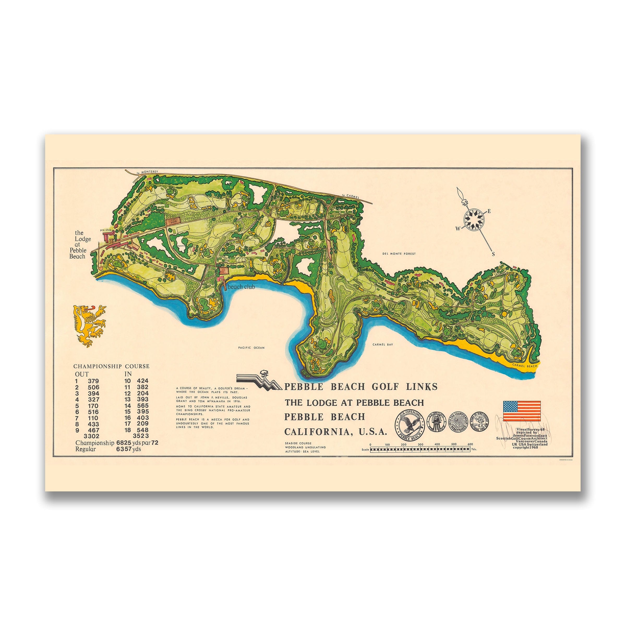
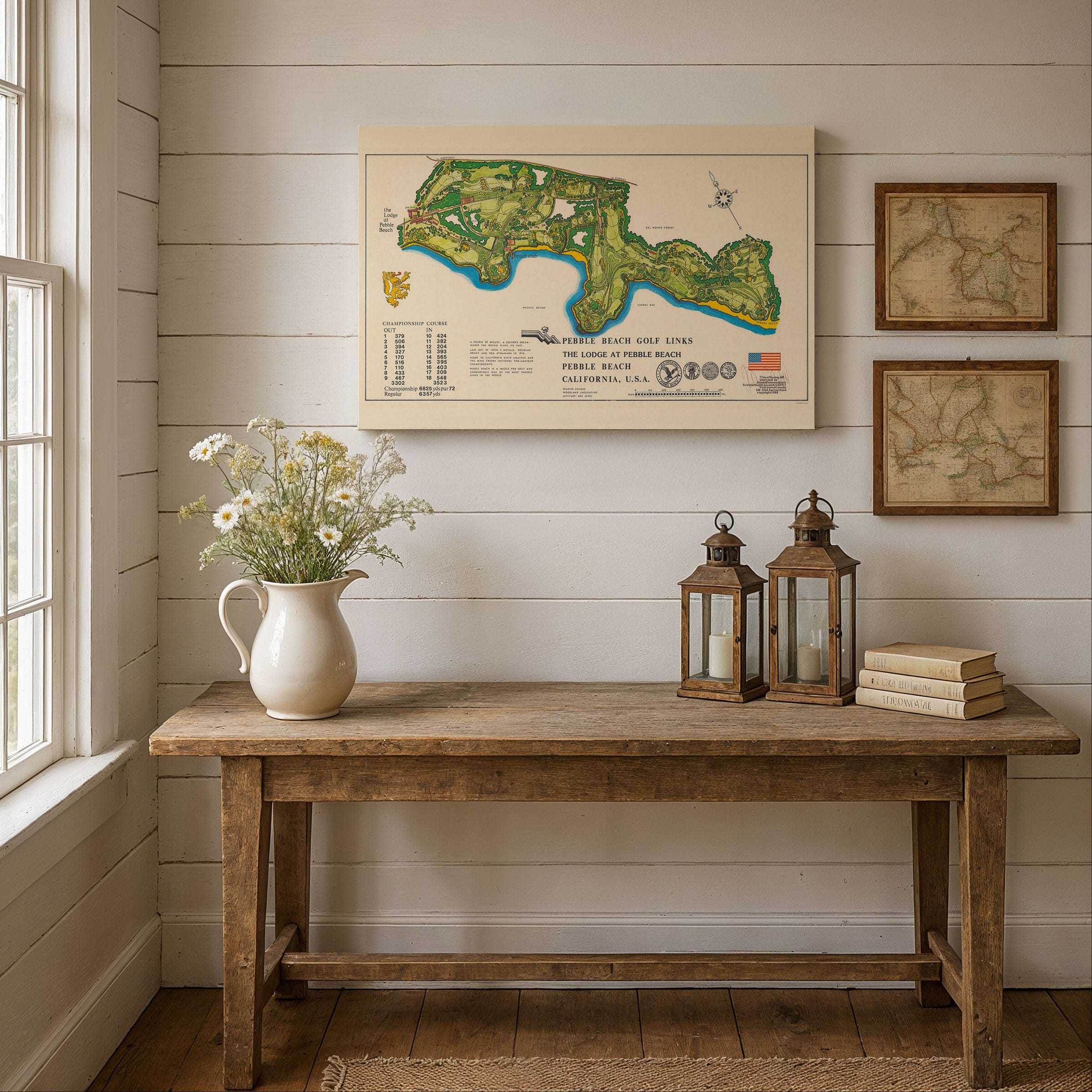
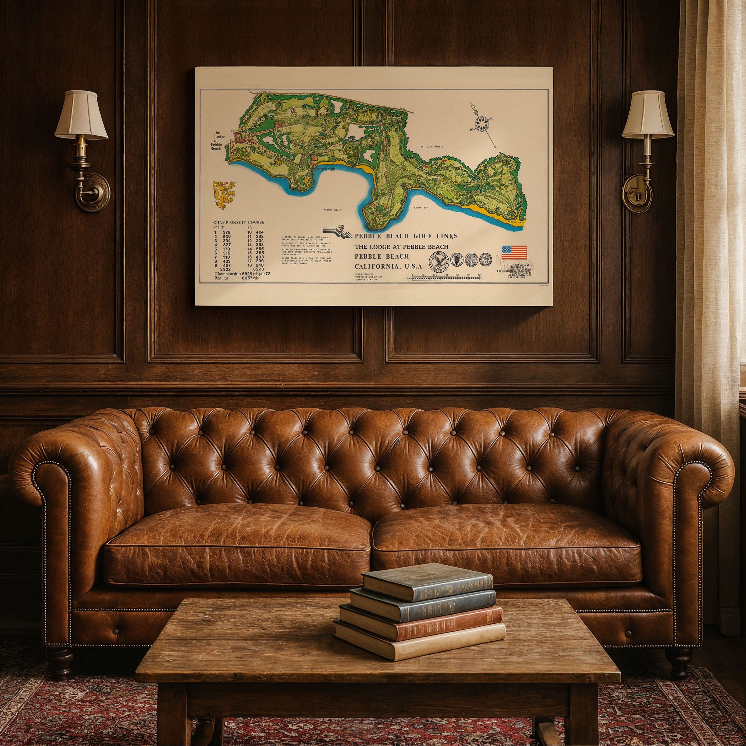
This stunning Pebble Beach Golf Links Map captures one of the world's most celebrated golf courses at a defining moment in its storied history. Created circa 1968 by Scottie McQueen, this Pebble Beach Golf Links Map presents the legendary Monterey Peninsula course as both strategic guide and artistic portrait of California's dramatic coastline.
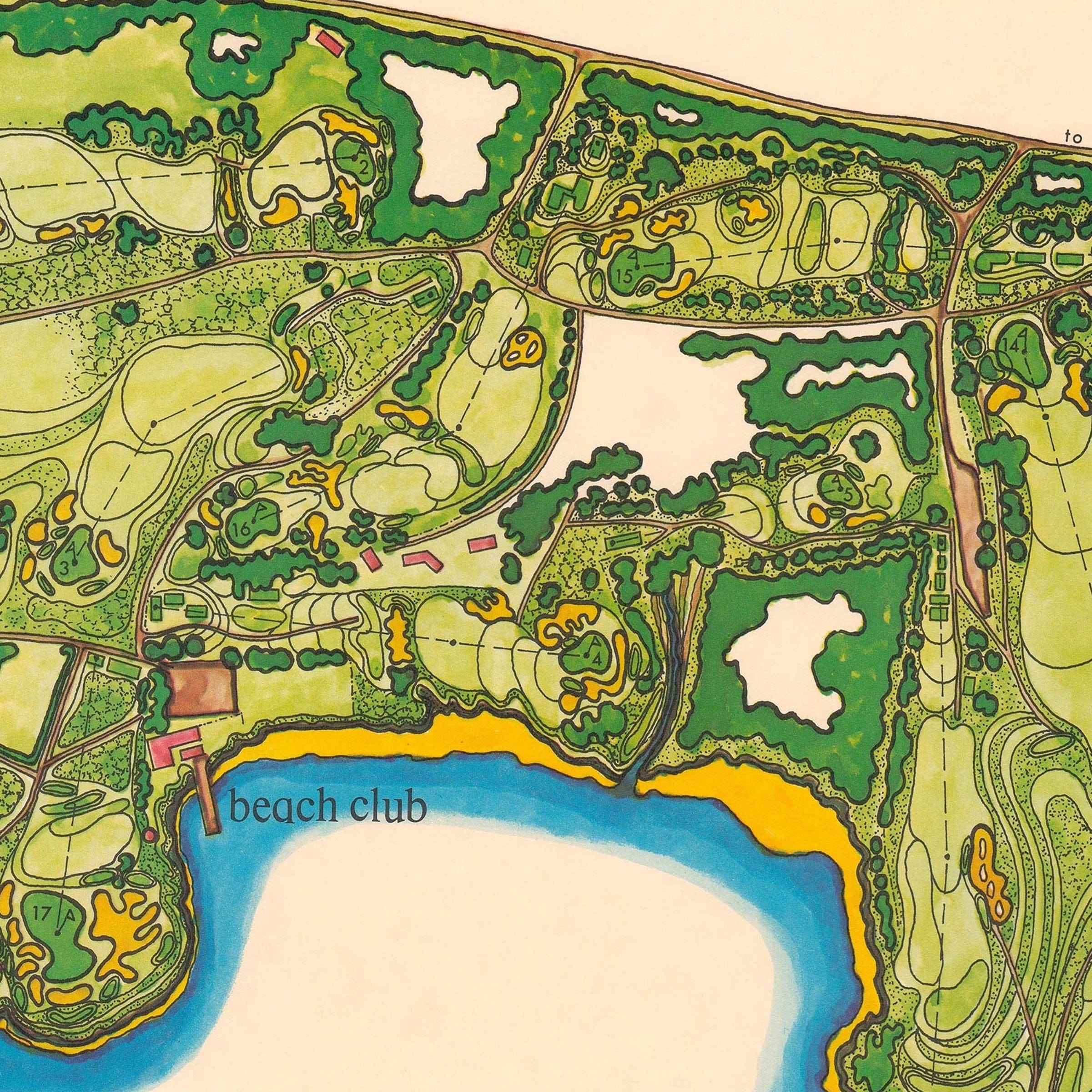
The Pebble Beach Golf Links Map traces every fairway clinging to oceanside cliffs, every green perched above crashing Pacific waves. From the iconic Lodge at Pebble Beach near the first tee to the famous oceanfront holes that have challenged generations of champions, this illustrated course map reveals the brilliant harmony between golf course architecture and natural coastal drama.
Stretching along the edge of the Monterey Peninsula, this Pebble Beach Golf Links Map unfolds the course from above, with the Pacific Ocean rendered in deep blues and gold-edged surf. Carmel Bay curves gently to the south, while rocky headlands and sandy beaches frame holes that have become legendary in golf history. Each hole is carefully numbered with hazards, greens, and bunkers precisely laid out.
More than a simple course guide, this Pebble Beach Golf Links Map serves as a portrait of place—celebrating how the course was shaped to follow the land rather than dominate it. Championship references and course statistics reinforce Pebble Beach's status as a global stage for competition, from amateur championships to the U.S. Open.
This Pebble Beach Golf Links Map captures the course at a mature moment in its history—confident, world-famous, and inseparable from the rugged beauty of the California coast. A perfect piece for golf enthusiasts, collectors of vintage sports memorabilia, or anyone who appreciates the intersection of sport, landscape, and mid-century design.
Print Information:
Each reproduction is printed on premium archival materials designed to last generations. Choose from museum-quality poster paper, gallery-wrapped canvas, or elegantly framed options.
The Map Story
Materials
Choose options

Because every place has a story
Make History Personal
A vintage map is more than art.
It is a reminder of where life began.
Where memories were made.
Where hearts still live. Give the gift of place.
Beautifully preserved and made for the moments that matter.
Why Choose Us?
| Feature | Us | Competitor A | Competitor B |
|---|---|---|---|
| Hand Crafted | |||
| Museum Quality | |||
| 100 Year Guarantee | |||
| Restored by Hand | |||
| Certificate of Authenticity |

Art Prints
Archival quality colors. Best option if you'd like to frame it yourself

The Best Materials
We hand-stretched our canvas on solid American-grown pine stretcher bars. We use quality canvas and fade-resistant inks to create the lasting art. Canvases come with hardware already installed and ready to hang.
Need help?
Frequently Asked Questions
Order
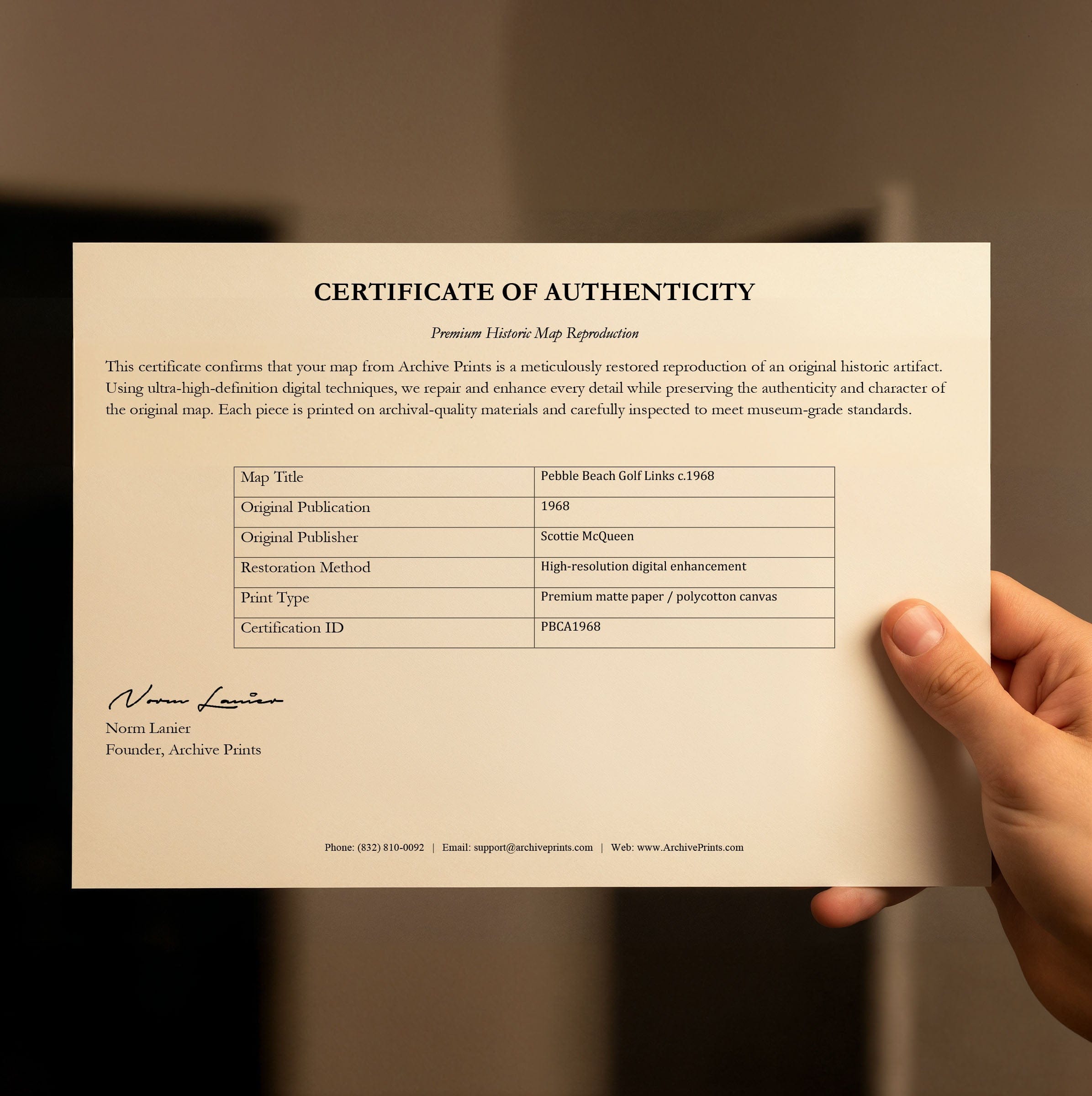
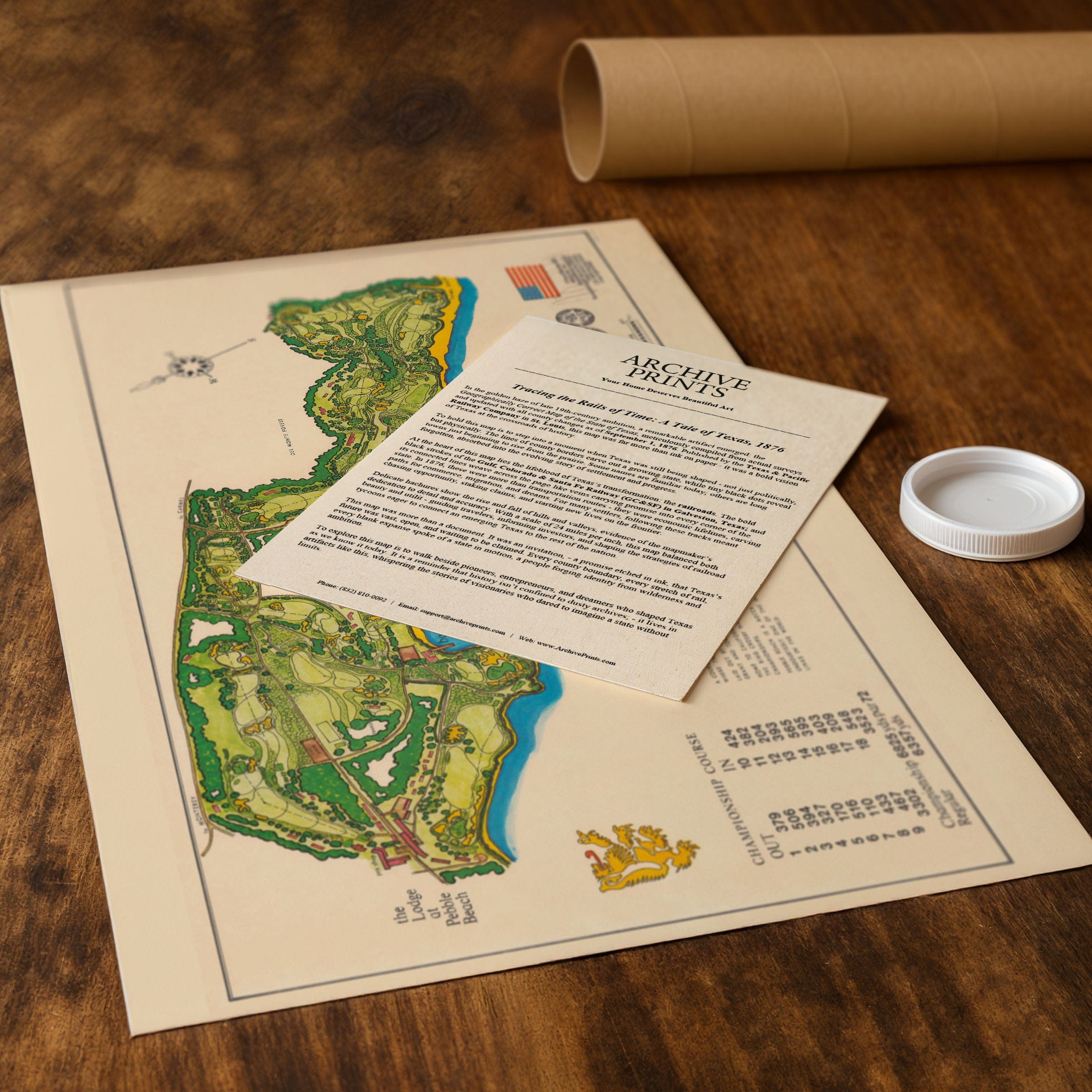
All of our maps are meticulously restored reproductions of historic originals. Each piece is digitally repaired and color-corrected to bring out the finest details while preserving its authentic, vintage character.
Yes. All Archive Prints products are printed to order in the USA with archival materials.
We offer two premium formats:
- High-Quality Paper Posters – Printed on thick, archival-grade matte paper for rich, vibrant detail.
- Hand-Stretched Canvas Prints – Printed on premium polycotton canvas and mounted on 1.5" solid American pine stretcher bars for a gallery-quality finish.
We carefully digitally restore each map to enhance clarity and color while preserving its original look and historic charm. You’ll enjoy sharp details and a timeless vintage aesthetic that feels true to the original piece.
Yes, we do! We offer premium framing options to make your map ready to hang the moment it arrives. You can choose from Oak, Maple, Black, or Walnut frames directly on the product page. We also offer Stretched Canvas prints for a modern gallery look, as well as archival-quality Posters if you prefer to frame it yourself.
Yes! We offer free shipping on all products within the United States. Each map is carefully packaged to ensure it arrives in perfect condition.
If you’re not completely satisfied, you can return your order in new condition for a full refund. Return shipping costs are the responsibility of the customer.
Absolutely! Our maps make thoughtful, one-of-a-kind gifts for history lovers, map collectors, or anyone looking to add vintage character to their home or office. Choose between paper prints for framing or stretched canvas for a ready-to-hang presentation.
- Paper Posters → Shipped in durable, protective tubes to prevent creasing.
- Canvas Prints → Carefully wrapped, padded, and boxed to ensure safe delivery.
Our maps look stunning in a variety of settings, including:
- Living rooms and home offices
- Libraries and studies
- Corporate offices and conference rooms
- Restaurants, cafes, and boutique spaces