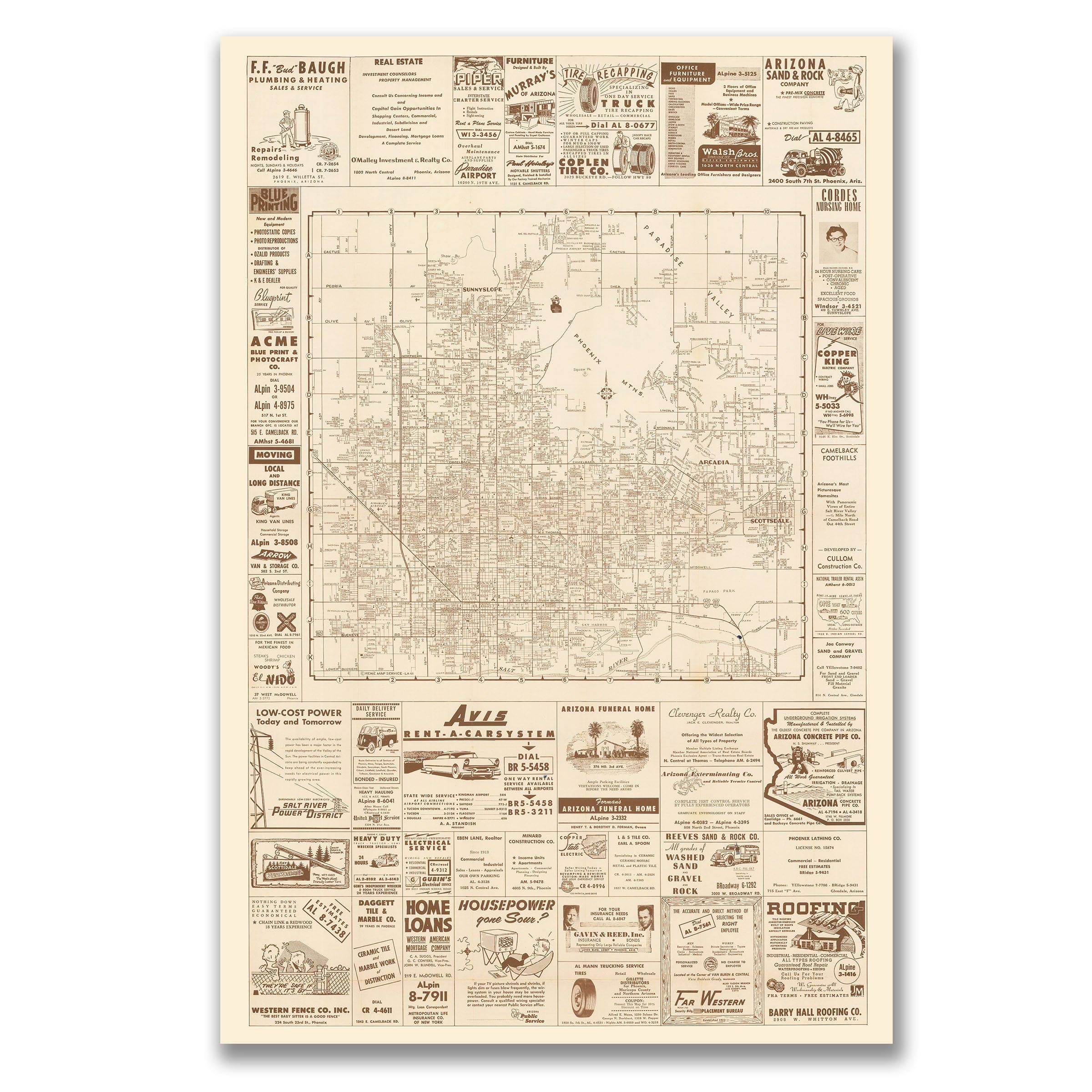
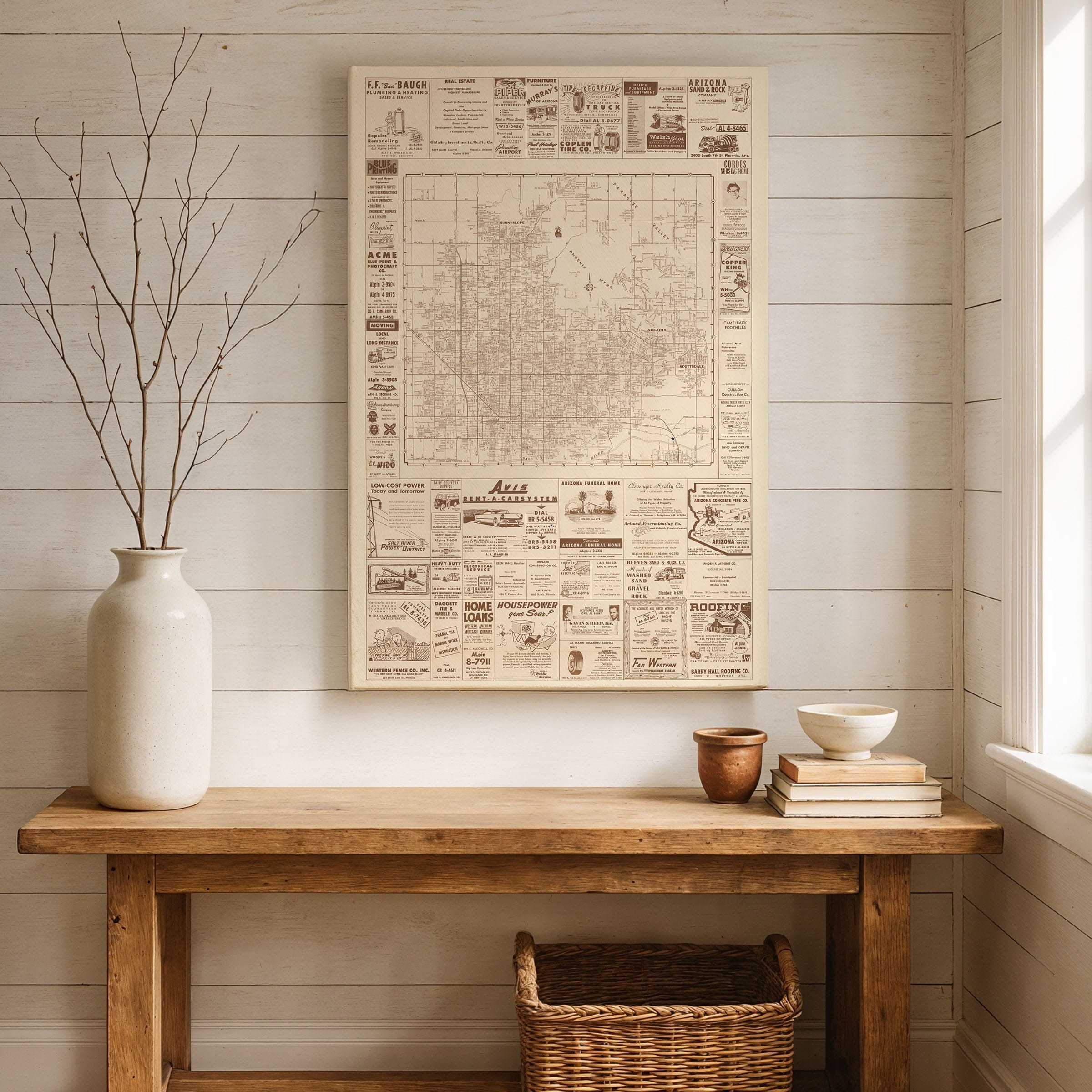
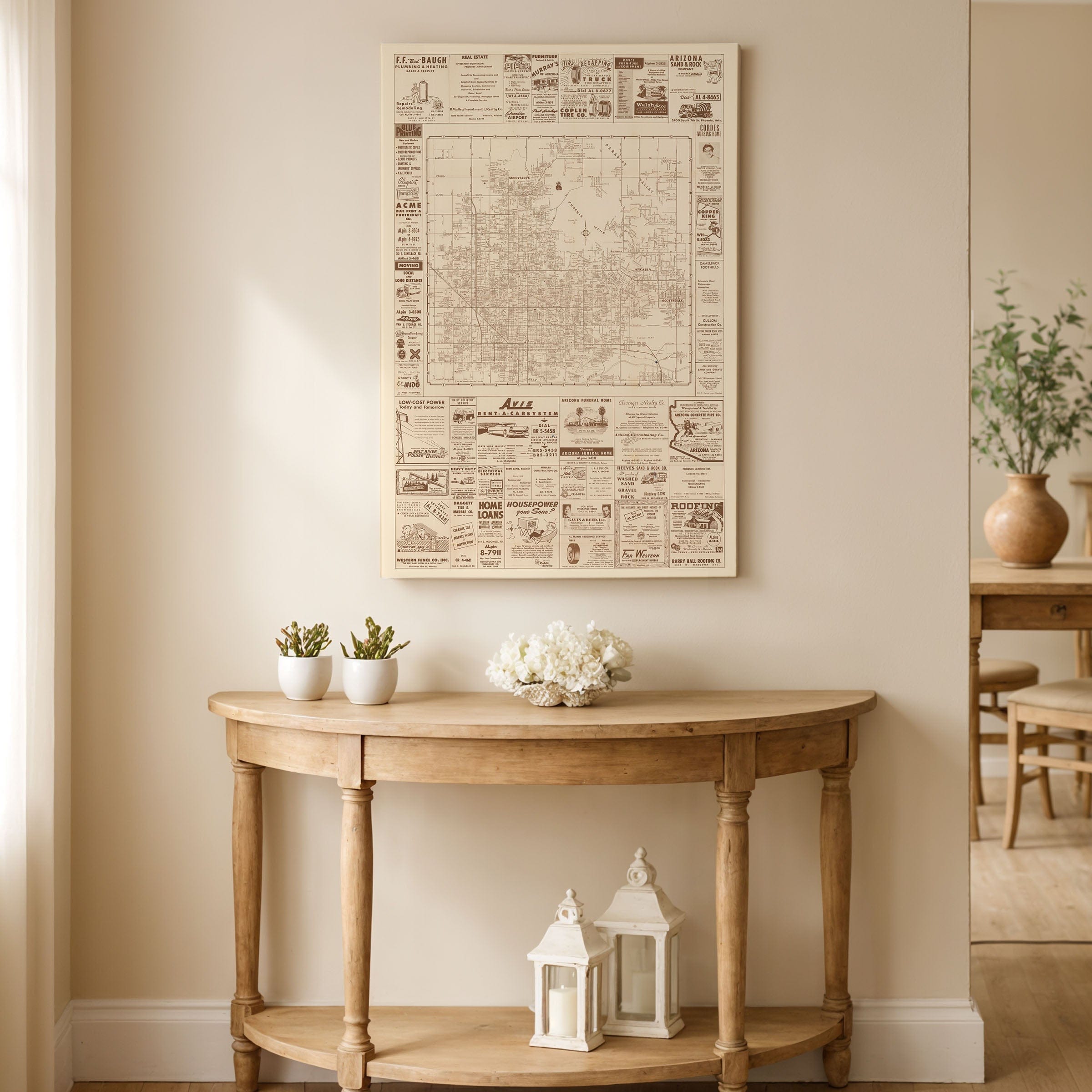
Phoenix, Arizona Map c.1956
Phoenix, Arizona Map - Historic 1956 Street Map
This remarkable Phoenix, Arizona Map captures the desert city at a defining moment of explosive postwar growth. Created circa 1956, this Phoenix, Arizona Map presents the Southwest metropolis as it transformed from a modest desert capital into one of the fastest-growing cities in America, when postwar optimism and suburban ambition converged beneath the wide Arizona sky.
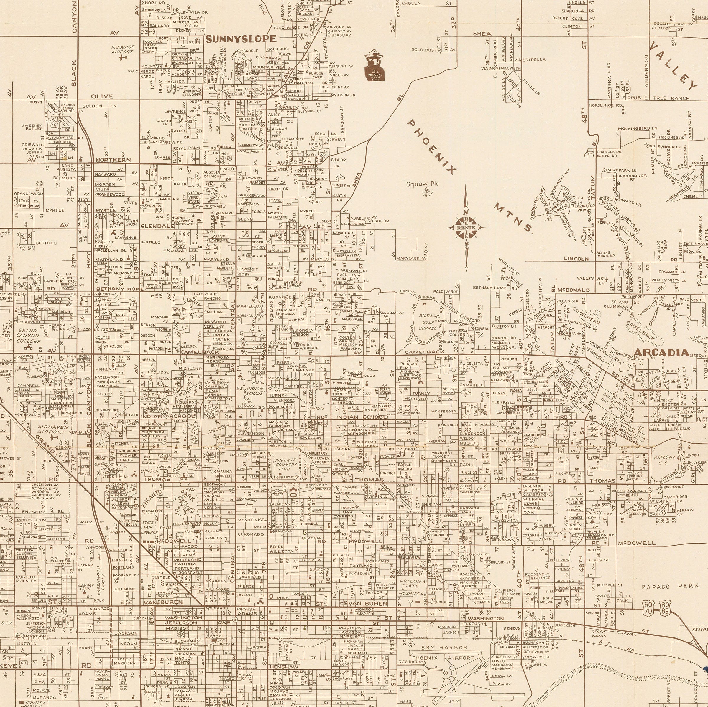
Laid out in a precise grid, this Phoenix, Arizona Map reveals a city spreading steadily outward from its historic core. Central Phoenix anchors the view, while neighborhoods such as Sunnyslope, Arcadia, Paradise Valley, and Scottsdale appear as emerging districts shaped by new roads and residential development. The Phoenix Mountains interrupt the orderly geometry, reminding viewers that even as the city expanded, it remained inseparable from its desert landscape.
Automobile culture dominates this Phoenix, Arizona Map. Broad arterial roads stretch across the valley, linking homes, businesses, and new subdivisions made viable by air conditioning and inexpensive land. Unlike earlier river-based cities, Phoenix's growth followed pavement rather than waterways, reflecting a modern Sun Belt identity built on mobility and technological adaptation.
Framing this Phoenix, Arizona Map is a dense border of period advertisements—roofing companies, plumbers, fence builders, and car rental agencies—forming a commercial portrait of a city under construction. These businesses reflect houses rising, roads being paved, and infrastructure rapidly catching up with booming demand.
This Phoenix, Arizona Map captures a city poised between its agricultural past and its metropolitan future, advertising a bold vision of permanence, prosperity, and progress in the heart of the Arizona desert. Perfect for Phoenix natives, Arizona history enthusiasts, or collectors of mid-century Americana.
Print Information:
Each reproduction is printed on premium archival materials designed to last generations. Choose from museum-quality poster paper, gallery-wrapped canvas, or elegantly framed options.
The Map Story
Materials
Choose options

Because every place has a story
Make History Personal
A vintage map is more than art.
It is a reminder of where life began.
Where memories were made.
Where hearts still live. Give the gift of place.
Beautifully preserved and made for the moments that matter.
Why Choose Us?
| Feature | Us | Competitor A | Competitor B |
|---|---|---|---|
| Hand Crafted | |||
| Museum Quality | |||
| 100 Year Guarantee | |||
| Restored by Hand | |||
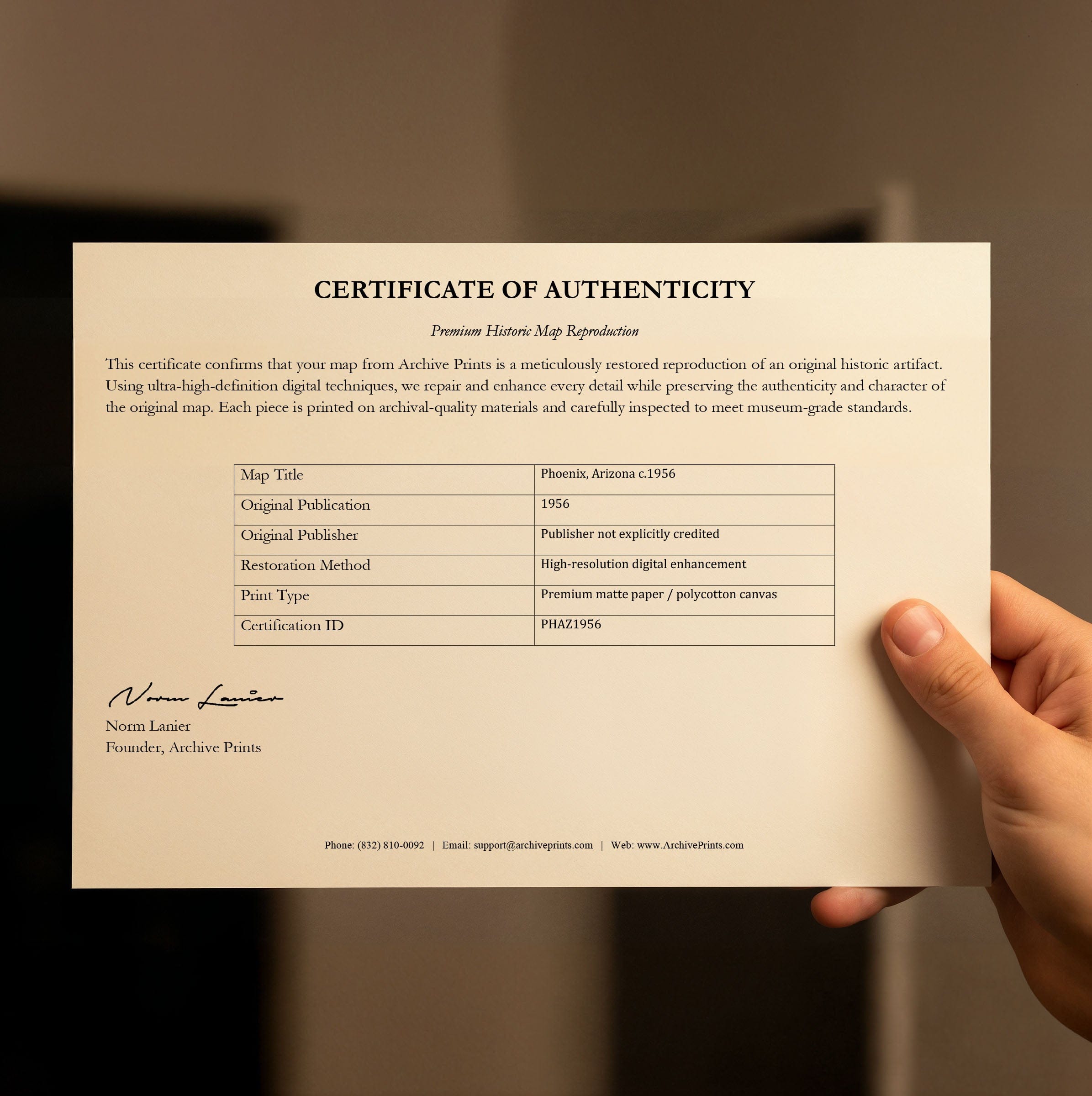
| Certificate of Authenticity |

Art Prints
Archival quality colors. Best option if you'd like to frame it yourself

The Best Materials
We hand-stretched our canvas on solid American-grown pine stretcher bars. We use quality canvas and fade-resistant inks to create the lasting art. Canvases come with hardware already installed and ready to hang.
Need help?
Frequently Asked Questions
Order
All of our maps are meticulously restored reproductions of historic originals. Each piece is digitally repaired and color-corrected to bring out the finest details while preserving its authentic, vintage character.
Yes. All Archive Prints products are printed to order in the USA with archival materials.
We offer two premium formats:
- High-Quality Paper Posters – Printed on thick, archival-grade matte paper for rich, vibrant detail.
- Hand-Stretched Canvas Prints – Printed on premium polycotton canvas and mounted on 1.5" solid American pine stretcher bars for a gallery-quality finish.
We carefully digitally restore each map to enhance clarity and color while preserving its original look and historic charm. You’ll enjoy sharp details and a timeless vintage aesthetic that feels true to the original piece.
Yes, we do! We offer premium framing options to make your map ready to hang the moment it arrives. You can choose from Oak, Maple, Black, or Walnut frames directly on the product page. We also offer Stretched Canvas prints for a modern gallery look, as well as archival-quality Posters if you prefer to frame it yourself.
Yes! We offer free shipping on all products within the United States. Each map is carefully packaged to ensure it arrives in perfect condition.
If you’re not completely satisfied, you can return your order in new condition for a full refund. Return shipping costs are the responsibility of the customer.
Absolutely! Our maps make thoughtful, one-of-a-kind gifts for history lovers, map collectors, or anyone looking to add vintage character to their home or office. Choose between paper prints for framing or stretched canvas for a ready-to-hang presentation.
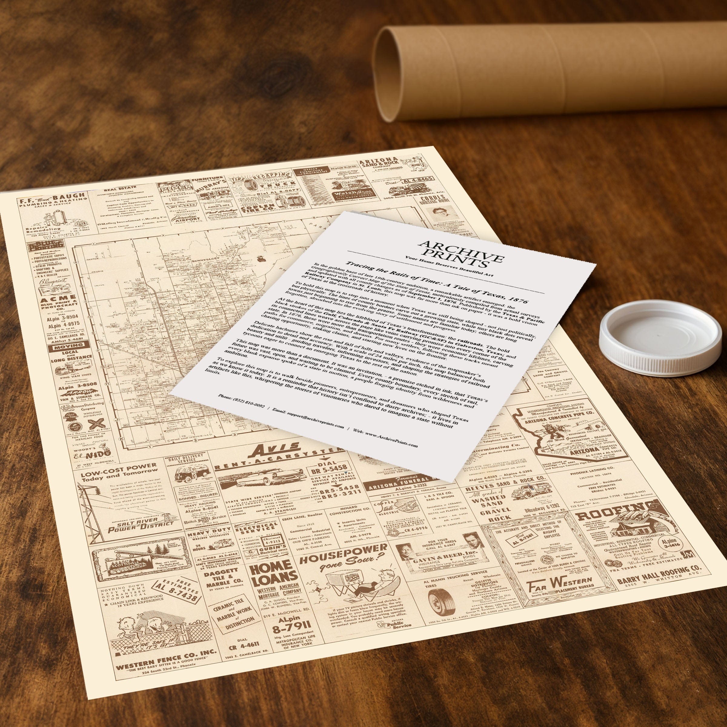
- Paper Posters → Shipped in durable, protective tubes to prevent creasing.
- Canvas Prints → Carefully wrapped, padded, and boxed to ensure safe delivery.
Our maps look stunning in a variety of settings, including:
- Living rooms and home offices
- Libraries and studies
- Corporate offices and conference rooms
- Restaurants, cafes, and boutique spaces