Prospect Park, Brooklyn Map - 1868 Olmsted & Vaux Design
Prospect Park, Brooklyn Map
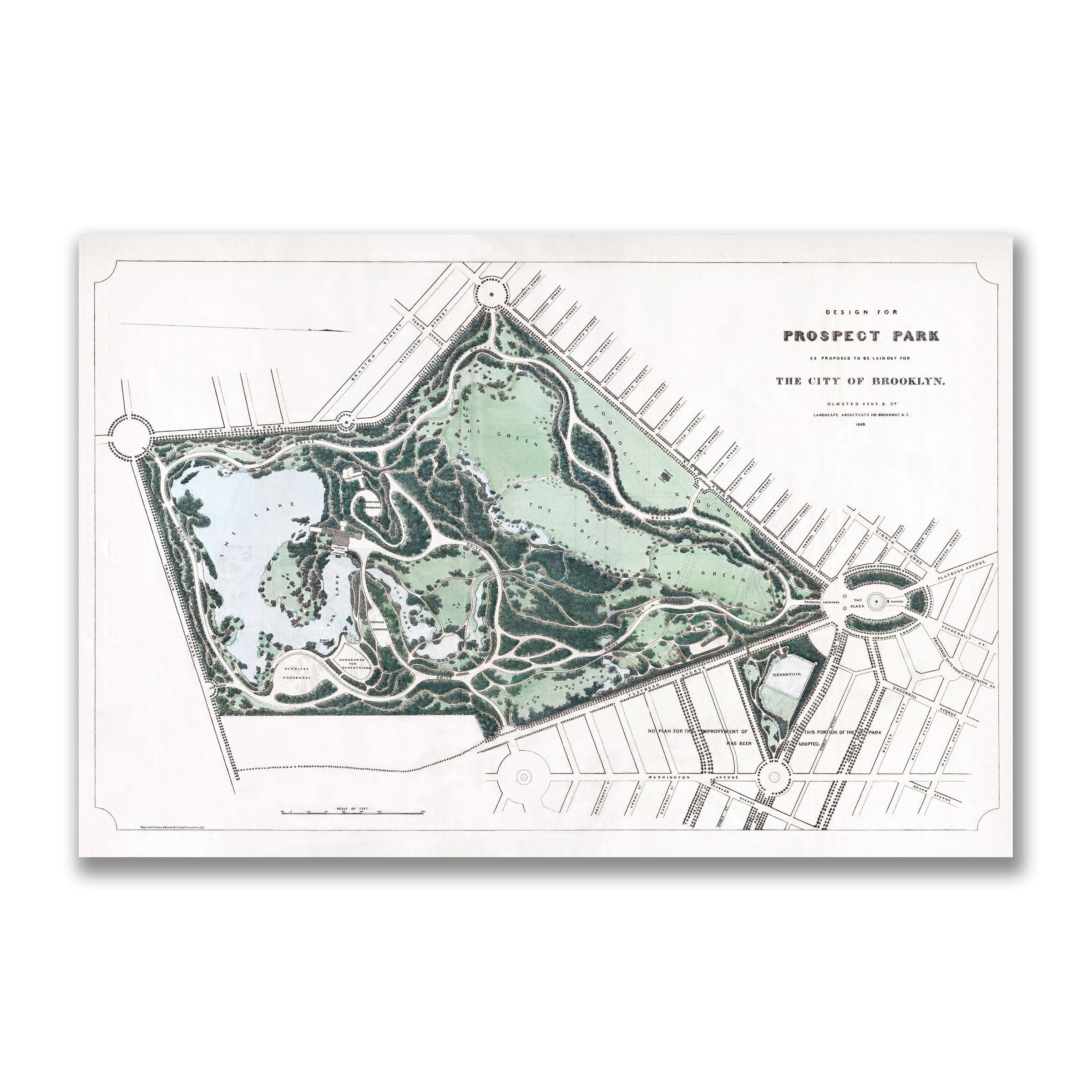
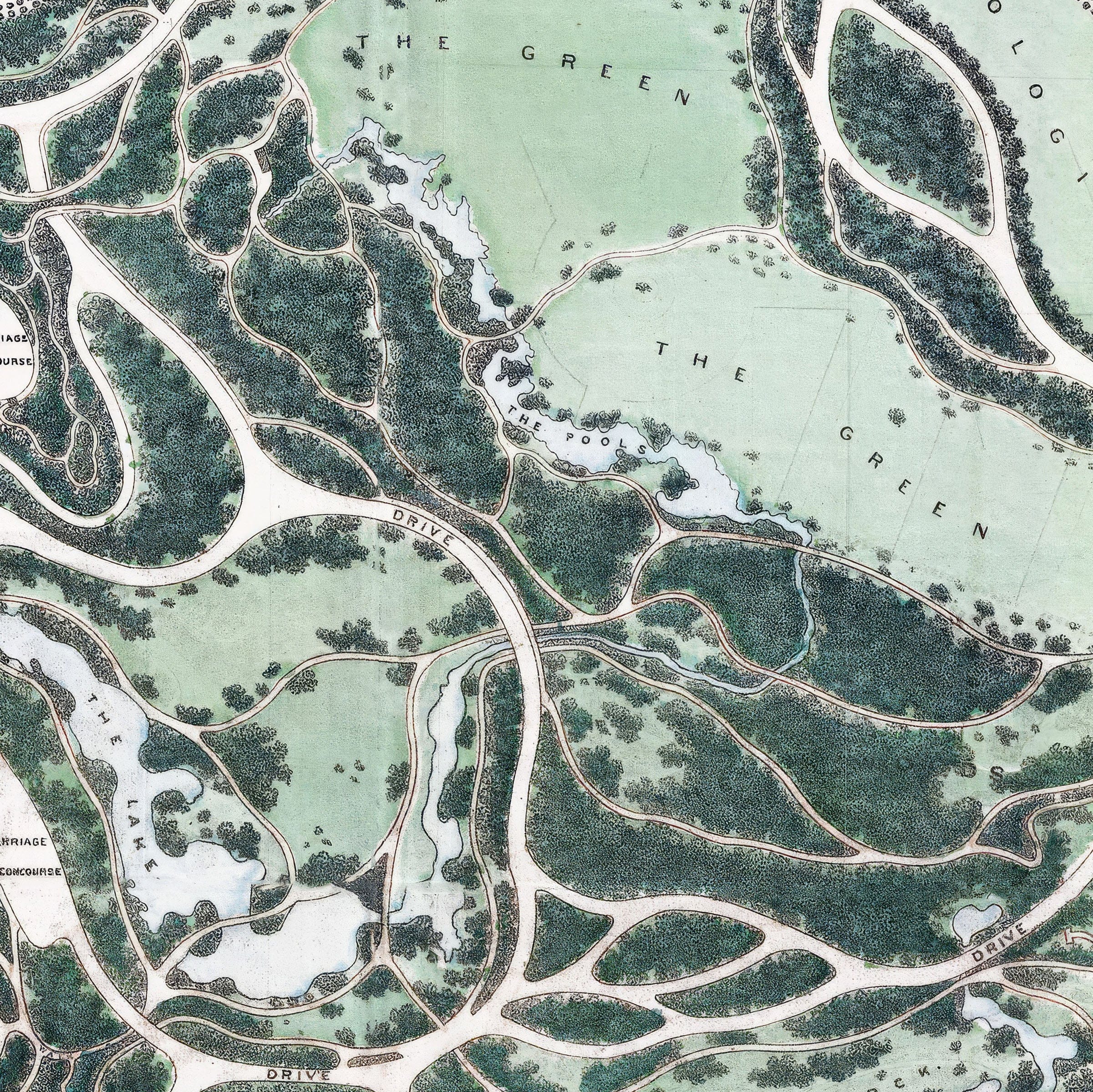
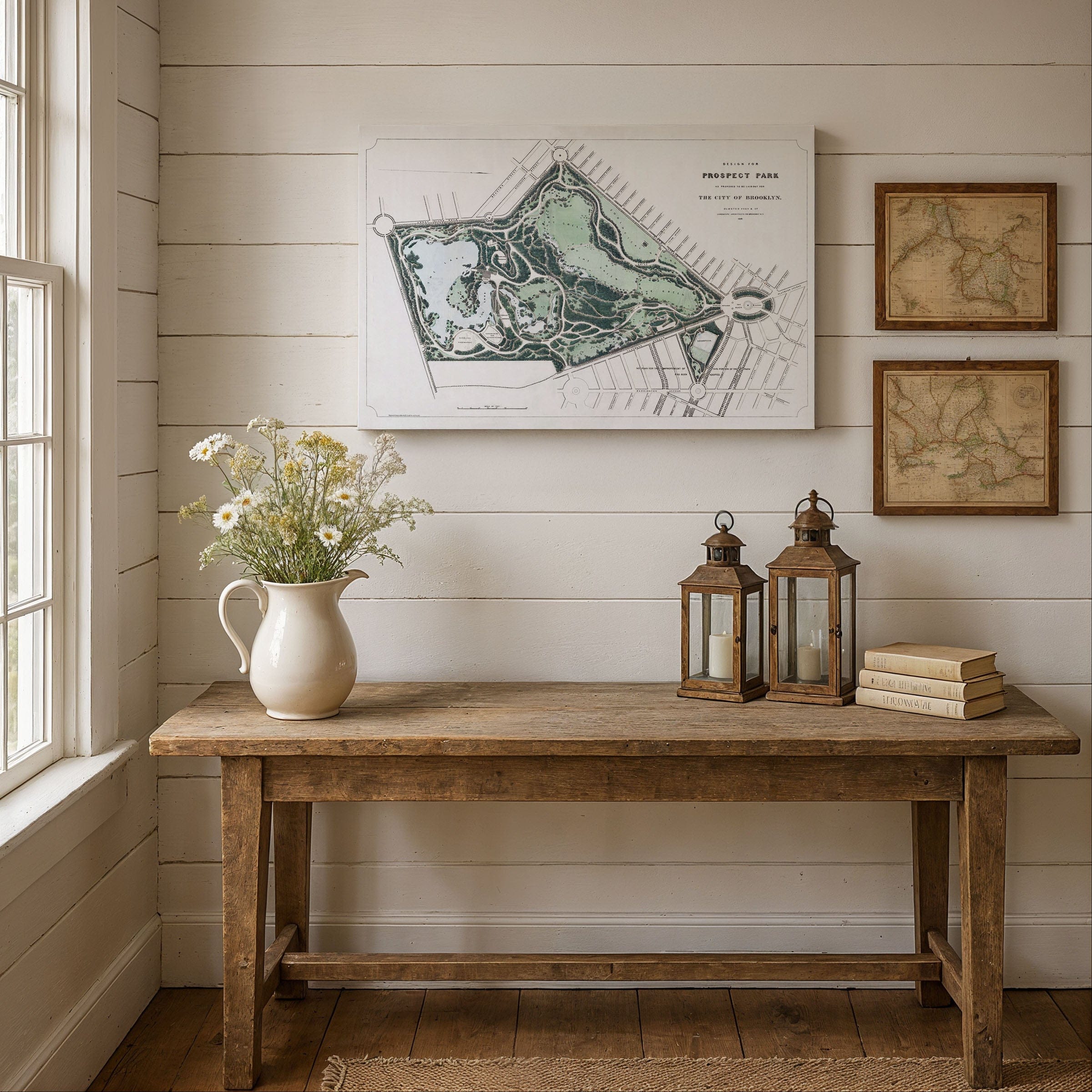
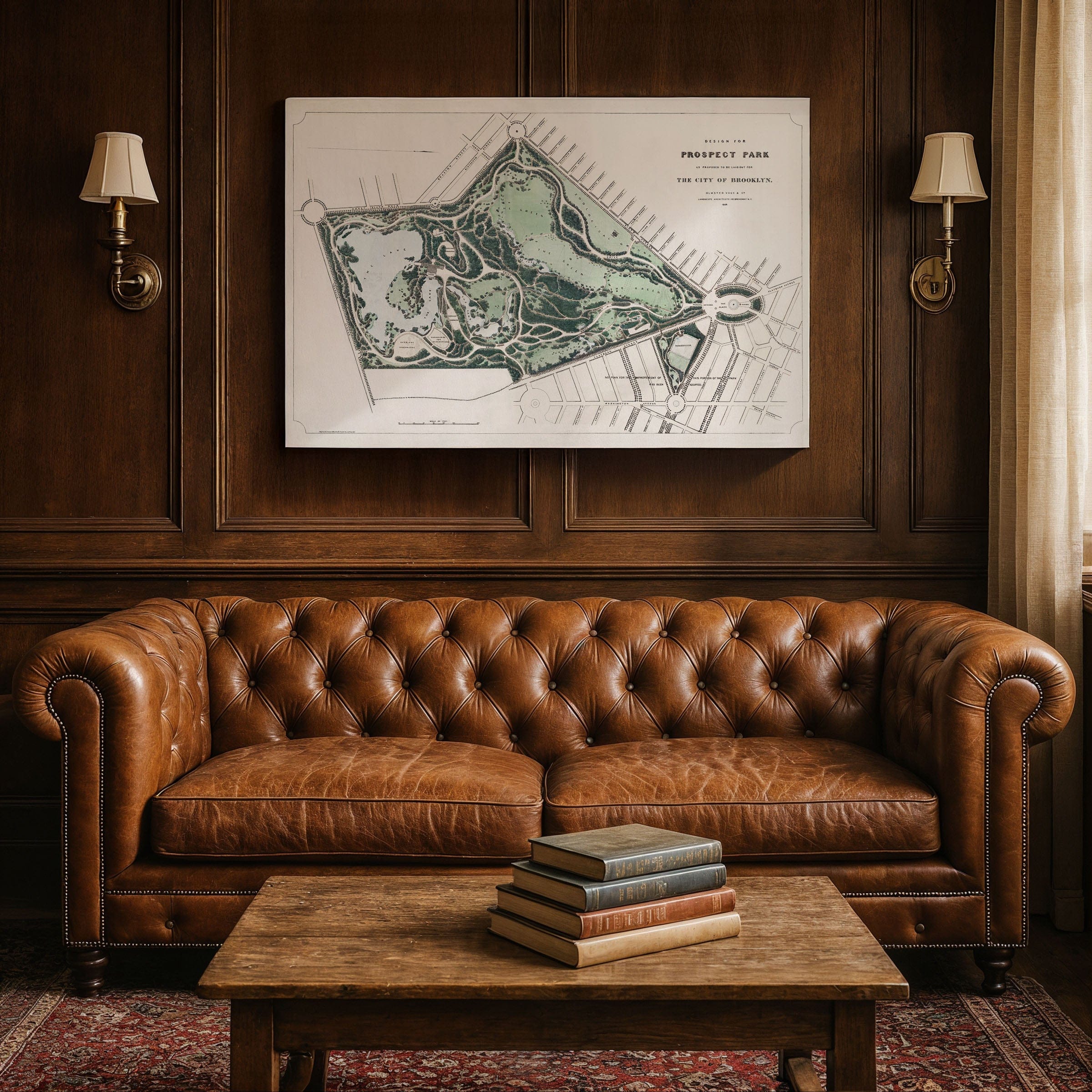
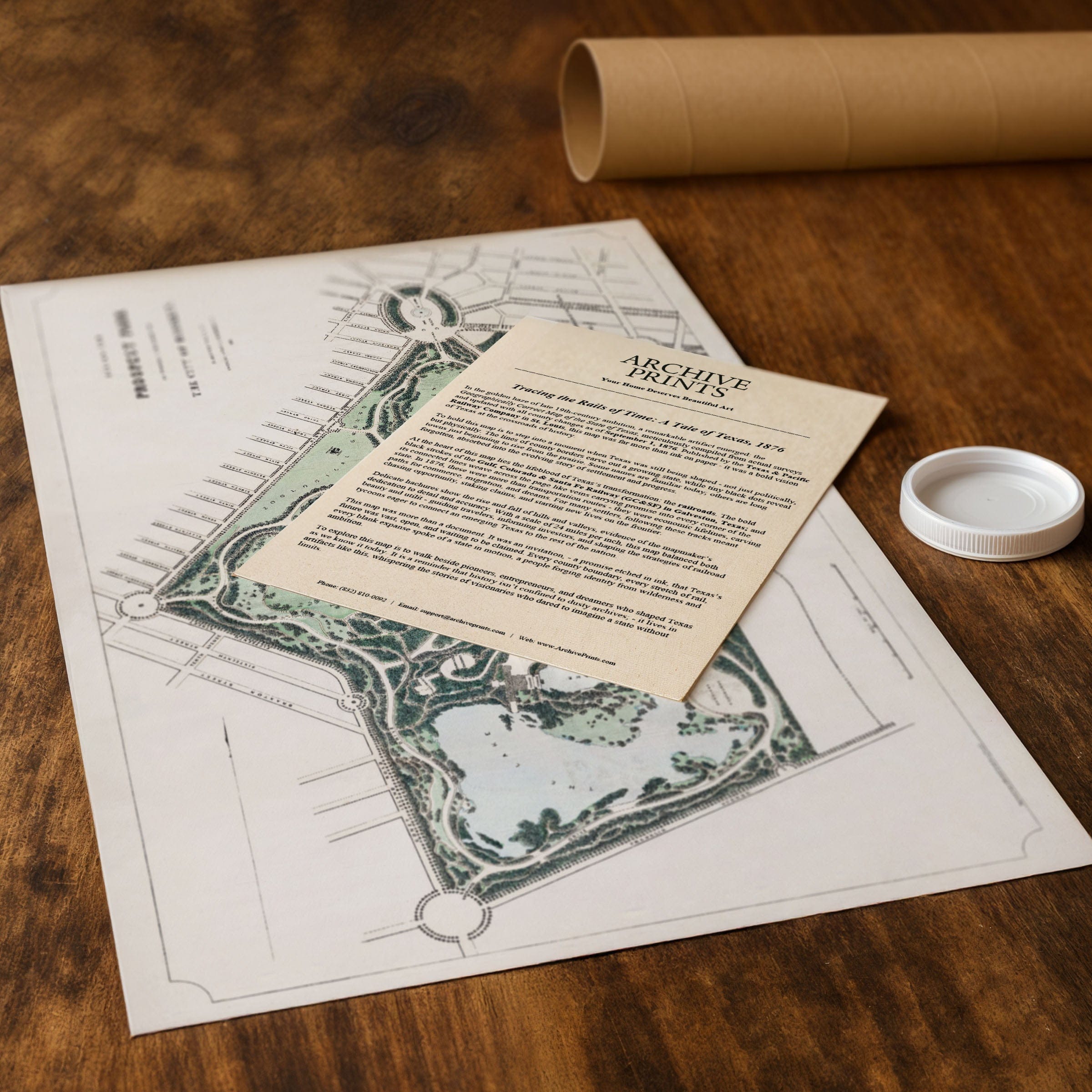
Step back to 1868 when this Prospect Park, Brooklyn Map captured the early vision for one of America's greatest urban parks, presenting the landscape not simply as recreational ground but as a purposeful escape from the pressures of urban life. This isn't just an official design map—it's a testament to the civic power of parks and the democratic landscape envisioned by Frederick Law Olmsted and Calvert Vaux for Brooklyn's fast-growing community. Created by Olmsted, Vaux & Co., this detailed plan reveals Prospect Park as a deliberate departure from urban rigidity, offering Brooklyn residents a restorative sense of space and light through carefully orchestrated natural beauty. The Prospect Park, Brooklyn Map showcases The Green at its center, a broad pastoral meadow intended to evoke the calm of the English countryside. Its sweeping openness stands in contrast to Brooklyn's rigid street grid, while curving carriage drives frame the meadow and guide visitors through a sequence of unfolding vistas that would define the designers' celebrated style. To the west, the map highlights The Lake, a shimmering body of water with varied shoreline of quiet coves and wooded edges, where meandering paths trace the perimeter and bridges create a sense of depth and discovery for boating and leisurely afternoons. The park's eastern side features woodland and ravine landscapes inspired by the rugged forests of upstate New York. Streams, planned waterfalls, and dense plantings were designed to create a feeling of wilderness, carefully constructed yet appearing entirely natural. These wooded areas allowed visitors to wander shaded paths and experience peaceful retreat without leaving the city. Throughout the map, the designers emphasize thoughtful circulation with carriage roads, bridle paths, and pedestrian walkways weaving through the park without interfering with one another—a deliberate system meant to preserve calm and order. The surrounding city blocks appear as strict grids, but the park breaks free with organic curves and sweeping lines, symbolizing a deliberate departure from urban constraints. Olmsted and Vaux's design reflects deep belief in the civic power of parks, conceiving Prospect Park as a democratic landscape open to all, uplifting in spirit, and essential to public well-being. Each reproduction includes a custom historical letter detailing the story behind the map, making it perfect for Brooklyn history enthusiasts, urban planning scholars, and landscape architecture collectors. Printed on heavyweight archival paper or hand-stretched polycotton canvas, every pathway, waterway, and designed landscape is restored in museum-grade clarity for generations of enjoyment. Paper prints ship rolled in heavy-duty tubes, while canvas editions arrive gallery-wrapped on solid pine stretcher bars with pre-installed hardware—ready to display the moment it arrives. Bring home a piece of Brooklyn's park legacy and celebrate the visionary design that created one of America's most beloved urban landscapes.
The Map Story
Materials
Choose options

Because every place has a story
Make History Personal
A vintage map is more than art.
It is a reminder of where life began.
Where memories were made.
Where hearts still live. Give the gift of place.
Beautifully preserved and made for the moments that matter.
Why Choose Us?
| Feature | Us | Competitor A | Competitor B |
|---|---|---|---|
| Hand Crafted | |||
| Museum Quality | |||
| 100 Year Guarantee | |||
| Restored by Hand | |||
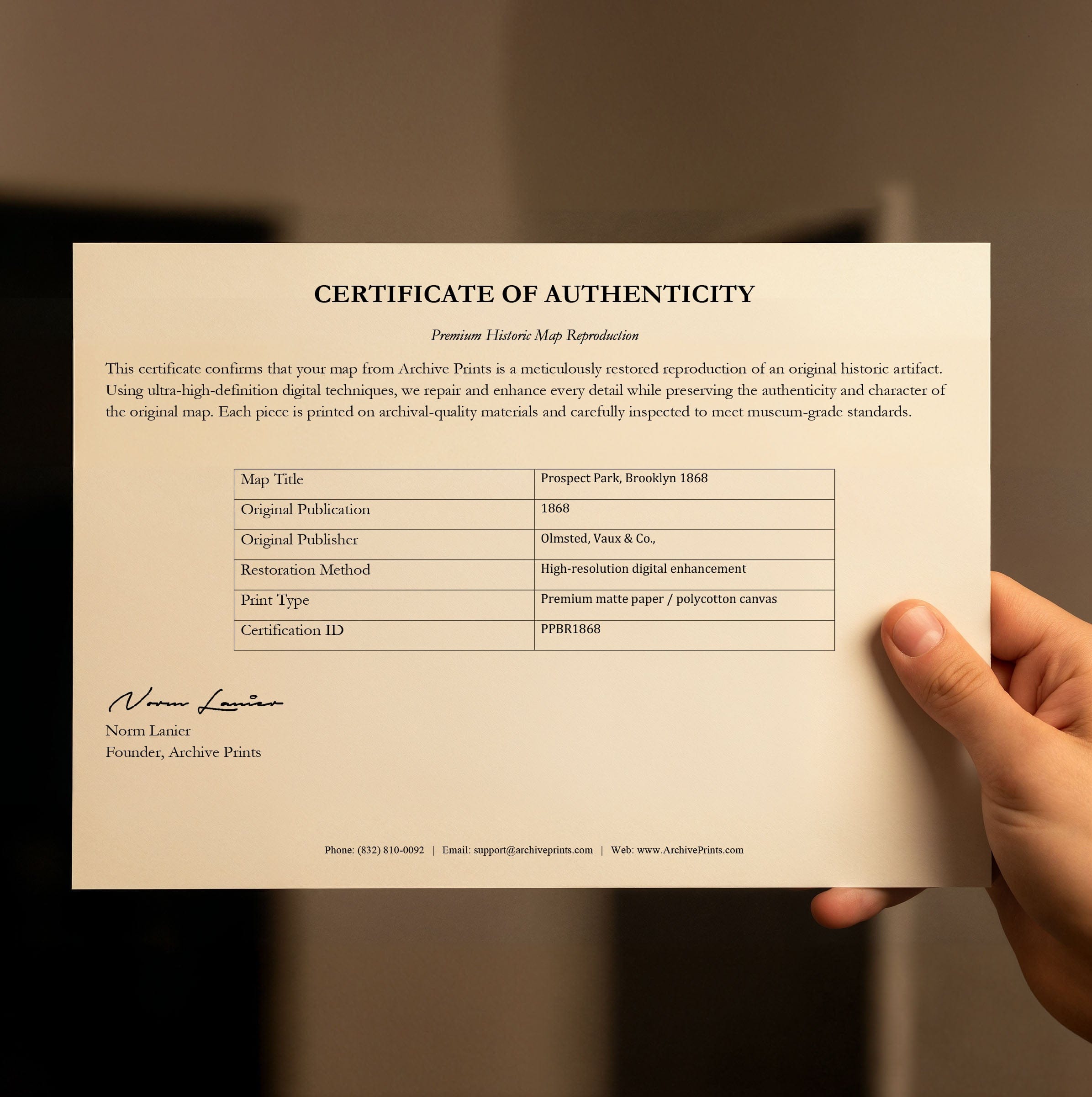
| Certificate of Authenticity |

Art Prints
Archival quality colors. Best option if you'd like to frame it yourself

The Best Materials
We hand-stretched our canvas on solid American-grown pine stretcher bars. We use quality canvas and fade-resistant inks to create the lasting art. Canvases come with hardware already installed and ready to hang.
Need help?
Frequently Asked Questions
Order
All of our maps are meticulously restored reproductions of historic originals. Each piece is digitally repaired and color-corrected to bring out the finest details while preserving its authentic, vintage character.
Yes. All Archive Prints products are printed to order in the USA with archival materials.
We offer two premium formats:
- High-Quality Paper Posters – Printed on thick, archival-grade matte paper for rich, vibrant detail.
- Hand-Stretched Canvas Prints – Printed on premium polycotton canvas and mounted on 1.5" solid American pine stretcher bars for a gallery-quality finish.
We carefully digitally restore each map to enhance clarity and color while preserving its original look and historic charm. You’ll enjoy sharp details and a timeless vintage aesthetic that feels true to the original piece.
Yes, we do! We offer premium framing options to make your map ready to hang the moment it arrives. You can choose from Oak, Maple, Black, or Walnut frames directly on the product page. We also offer Stretched Canvas prints for a modern gallery look, as well as archival-quality Posters if you prefer to frame it yourself.
Yes! We offer free shipping on all products within the United States. Each map is carefully packaged to ensure it arrives in perfect condition.
If you’re not completely satisfied, you can return your order in new condition for a full refund. Return shipping costs are the responsibility of the customer.
Absolutely! Our maps make thoughtful, one-of-a-kind gifts for history lovers, map collectors, or anyone looking to add vintage character to their home or office. Choose between paper prints for framing or stretched canvas for a ready-to-hang presentation.
- Paper Posters → Shipped in durable, protective tubes to prevent creasing.
- Canvas Prints → Carefully wrapped, padded, and boxed to ensure safe delivery.
Our maps look stunning in a variety of settings, including:
- Living rooms and home offices
- Libraries and studies
- Corporate offices and conference rooms
- Restaurants, cafes, and boutique spaces