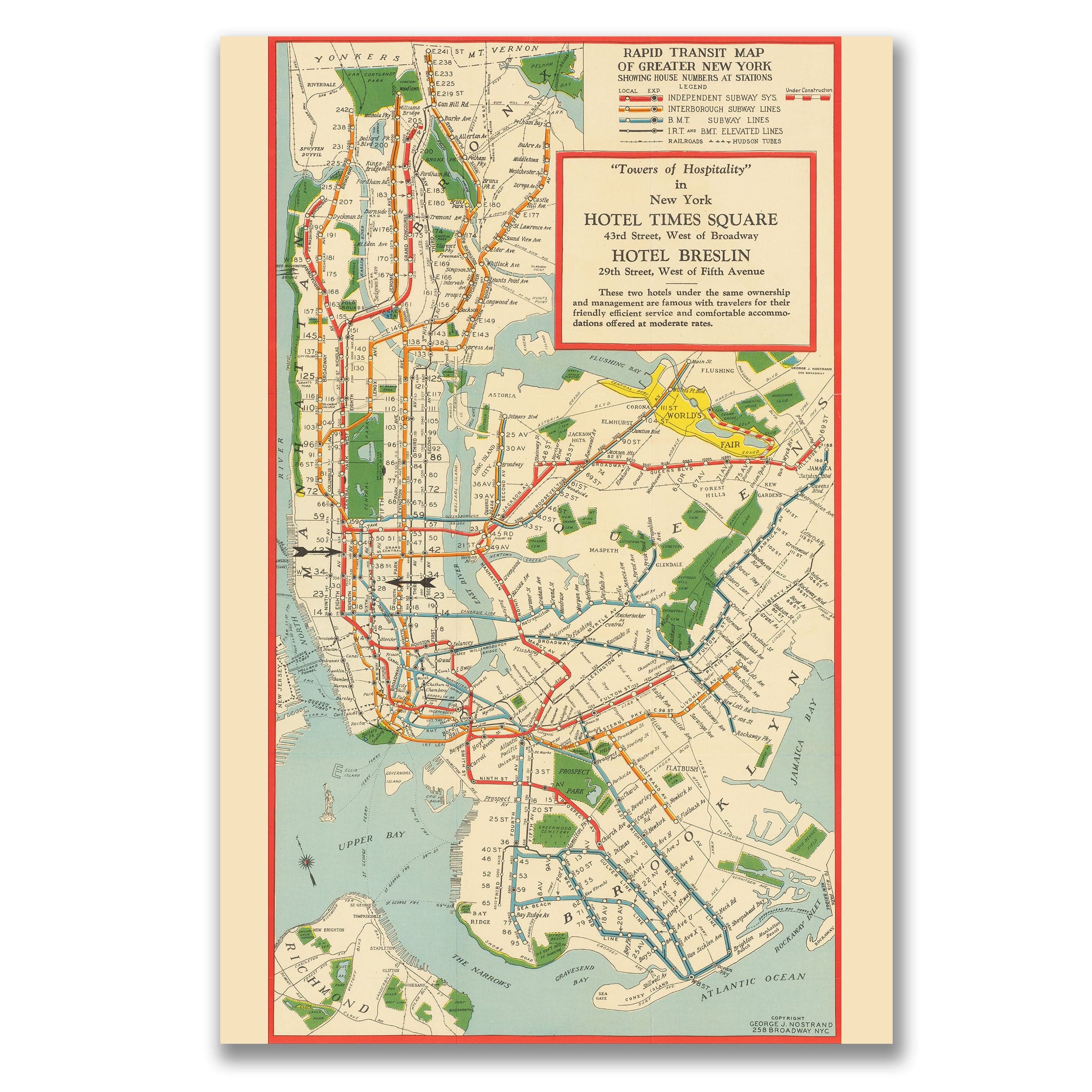
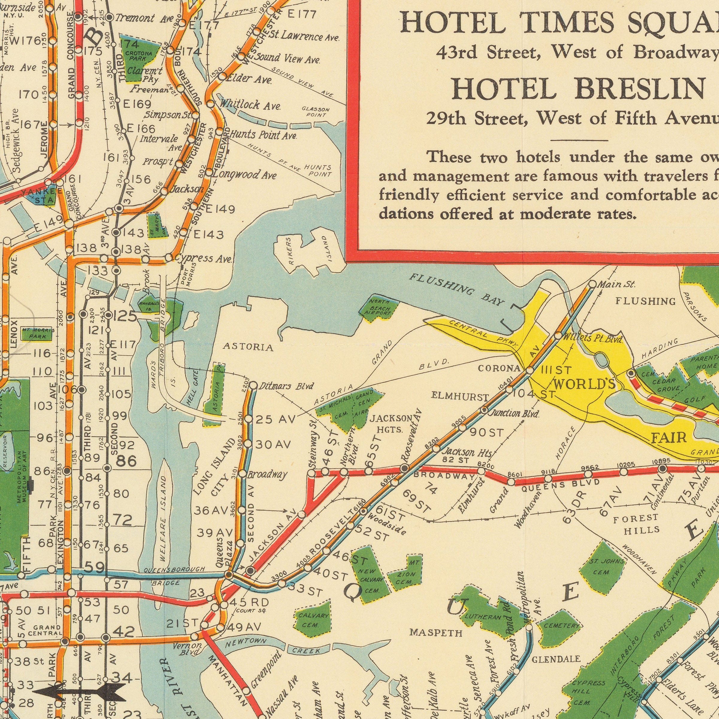
Rapid Transit Vintage Map of Greater New York 1939 - Subway Map
New York Subway Map 1939 - Greater New York Rapid Transit
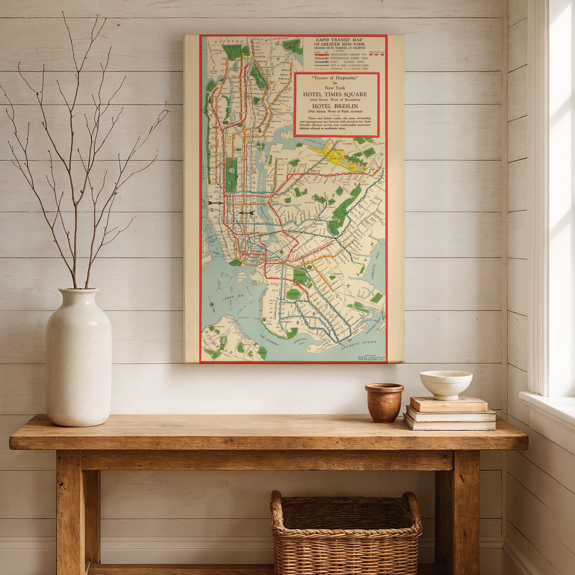
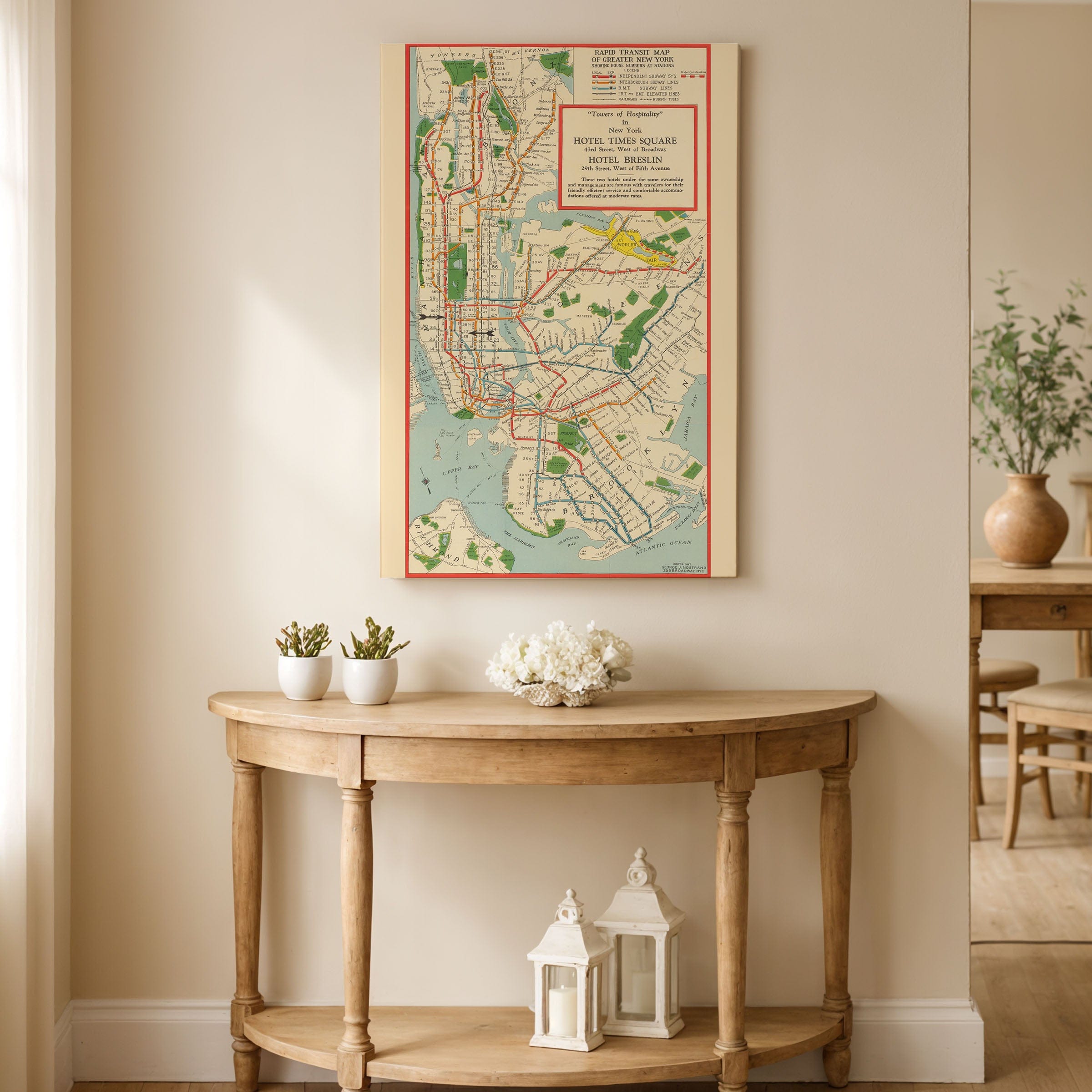
Navigate the golden age of New York transit with this remarkable New York Subway Map from 1939, capturing the city's legendary subway system during the year of the World's Fair. This extraordinary New York Subway Map showcases Greater New York's rapid transit network at its mid-century peak—a web of lines connecting Manhattan, Brooklyn, the Bronx, and Queens that moved millions of New Yorkers through the city that never sleeps.
This detailed New York Subway Map reveals the complexity of a transit system built by competing companies now unified under city control. The IRT, BMT, and IND lines weave through the five boroughs, their routes threading beneath bustling streets, crossing rivers, and connecting neighborhoods from Coney Island to the northern Bronx. Each station name evokes the city's character—Times Square, Grand Central, Fulton Street, Atlantic Avenue.
The New York Subway Map captures New York in 1939—the year La Guardia led City Hall, the World's Fair dazzled in Flushing Meadows, and the subway carried dreamers and workers alike through the greatest city on earth. This was mass transit as urban lifeline, democratic and essential, the underground pulse of a metropolis.
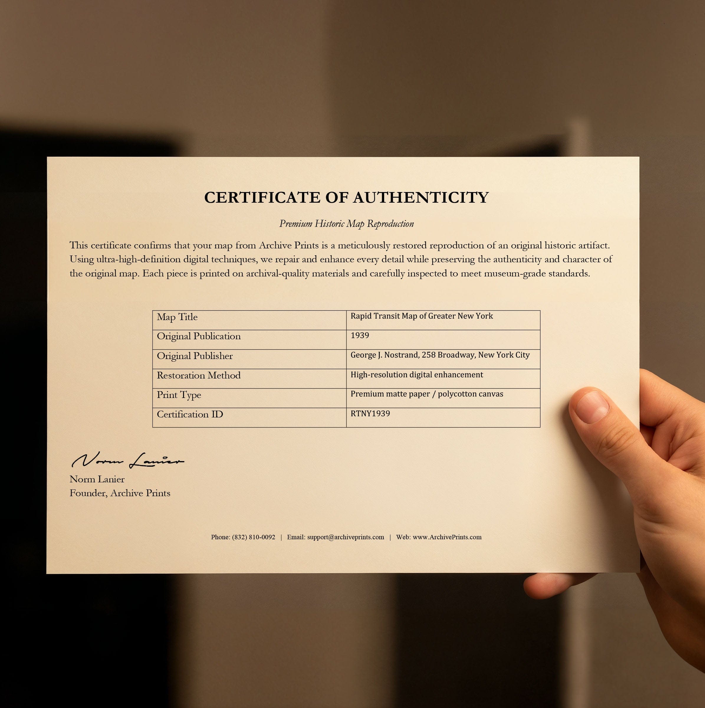
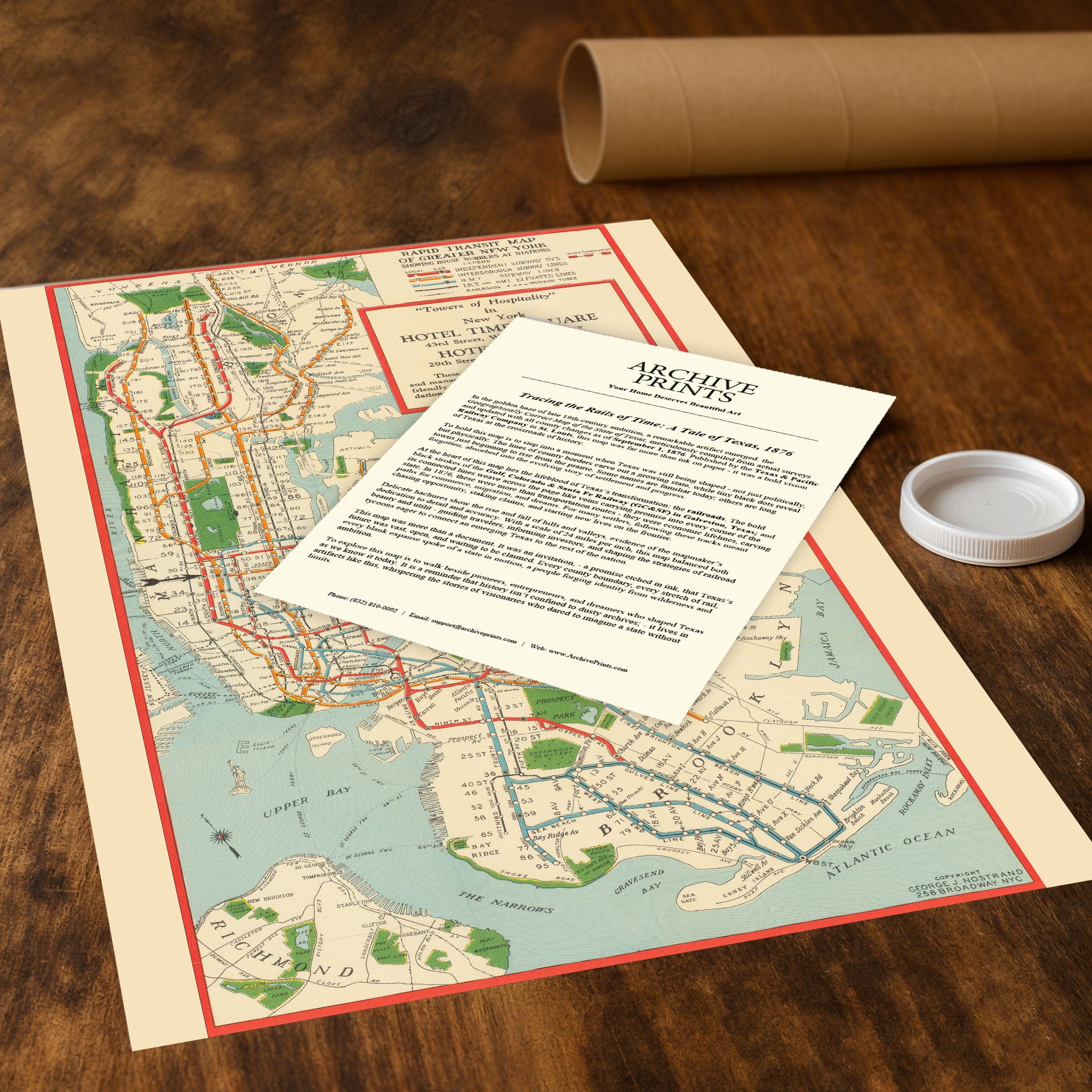
Each reproduction includes a custom historical letter detailing the map's significance, making it perfect for collectors, New York history enthusiasts, and anyone with subway memories or NYC connections. Printed on heavyweight archival paper or premium canvas, every line, station, and connection is preserved with museum-quality clarity through expert digital restoration.
For protection and presentation, paper prints arrive rolled in sturdy mailing tubes, while canvas prints come gallery-wrapped on solid pine stretcher bars with pre-installed hanging hardware. Framed prints are protected under crystal-clear acrylic and arrive ready to hang—perfect for immediate display.
The Map Story
Materials
Choose options

Because every place has a story
Make History Personal
A vintage map is more than art.
It is a reminder of where life began.
Where memories were made.
Where hearts still live. Give the gift of place.
Beautifully preserved and made for the moments that matter.
Why Choose Us?
| Feature | Us | Competitor A | Competitor B |
|---|---|---|---|
| Hand Crafted | |||
| Museum Quality | |||
| 100 Year Guarantee | |||
| Restored by Hand | |||
| Certificate of Authenticity |

Art Prints
Archival quality colors. Best option if you'd like to frame it yourself

The Best Materials
We hand-stretched our canvas on solid American-grown pine stretcher bars. We use quality canvas and fade-resistant inks to create the lasting art. Canvases come with hardware already installed and ready to hang.
Need help?
Frequently Asked Questions
Order
All of our maps are meticulously restored reproductions of historic originals. Each piece is digitally repaired and color-corrected to bring out the finest details while preserving its authentic, vintage character.
Yes. All Archive Prints products are printed to order in the USA with archival materials.
We offer two premium formats:
- High-Quality Paper Posters – Printed on thick, archival-grade matte paper for rich, vibrant detail.
- Hand-Stretched Canvas Prints – Printed on premium polycotton canvas and mounted on 1.5" solid American pine stretcher bars for a gallery-quality finish.
We carefully digitally restore each map to enhance clarity and color while preserving its original look and historic charm. You’ll enjoy sharp details and a timeless vintage aesthetic that feels true to the original piece.
Yes, we do! We offer premium framing options to make your map ready to hang the moment it arrives. You can choose from Oak, Maple, Black, or Walnut frames directly on the product page. We also offer Stretched Canvas prints for a modern gallery look, as well as archival-quality Posters if you prefer to frame it yourself.
Yes! We offer free shipping on all products within the United States. Each map is carefully packaged to ensure it arrives in perfect condition.
If you’re not completely satisfied, you can return your order in new condition for a full refund. Return shipping costs are the responsibility of the customer.
Absolutely! Our maps make thoughtful, one-of-a-kind gifts for history lovers, map collectors, or anyone looking to add vintage character to their home or office. Choose between paper prints for framing or stretched canvas for a ready-to-hang presentation.
- Paper Posters → Shipped in durable, protective tubes to prevent creasing.
- Canvas Prints → Carefully wrapped, padded, and boxed to ensure safe delivery.
Our maps look stunning in a variety of settings, including:
- Living rooms and home offices
- Libraries and studies
- Corporate offices and conference rooms
- Restaurants, cafes, and boutique spaces