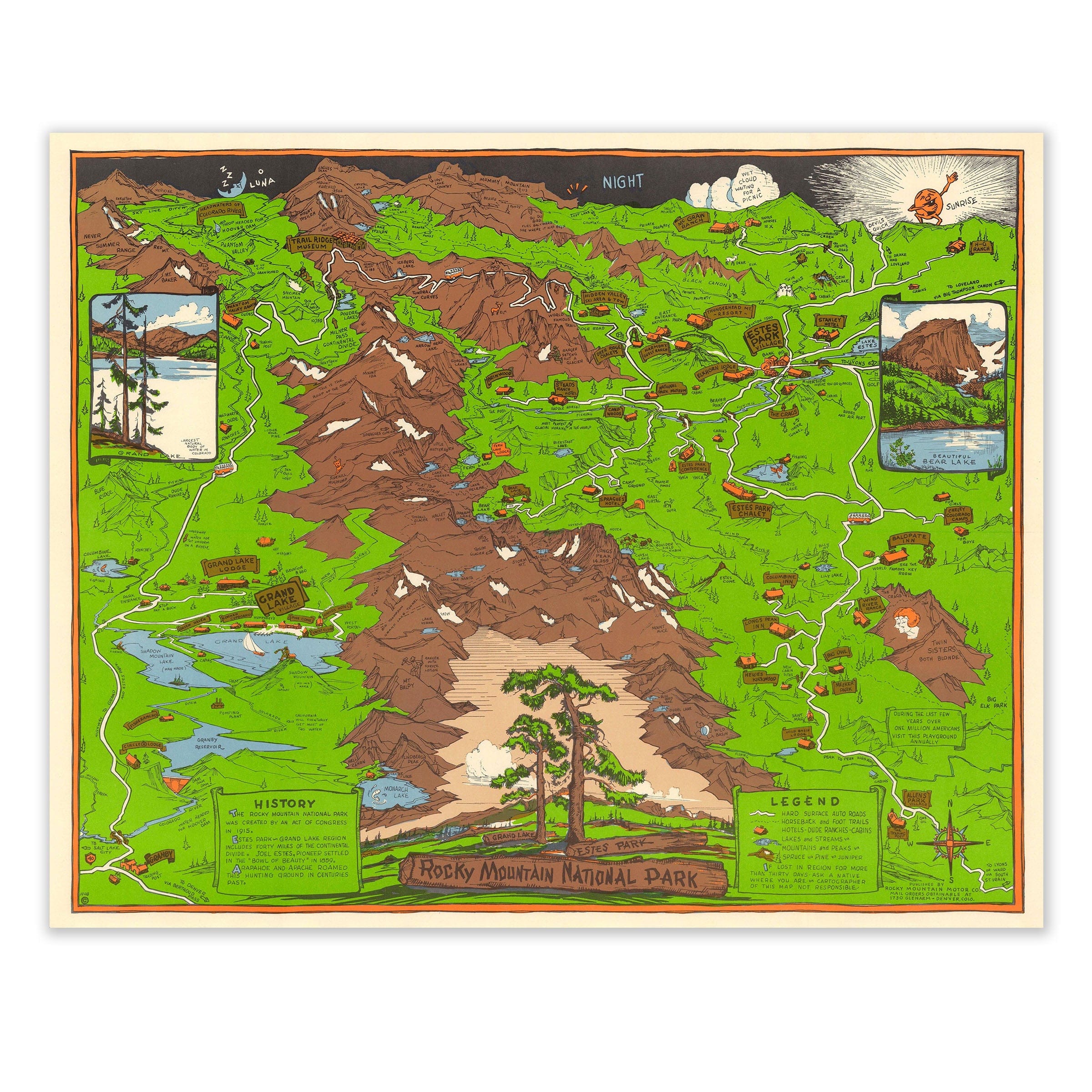
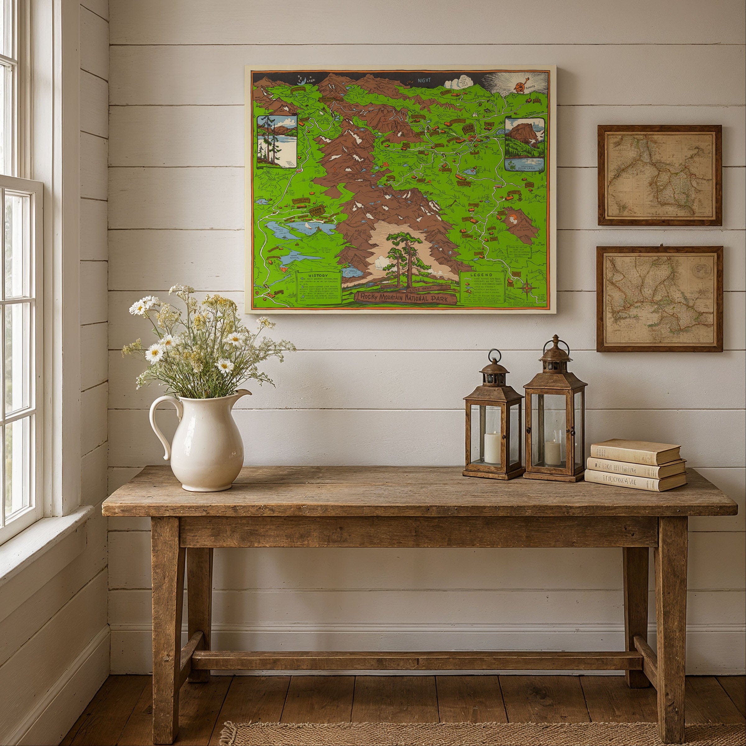
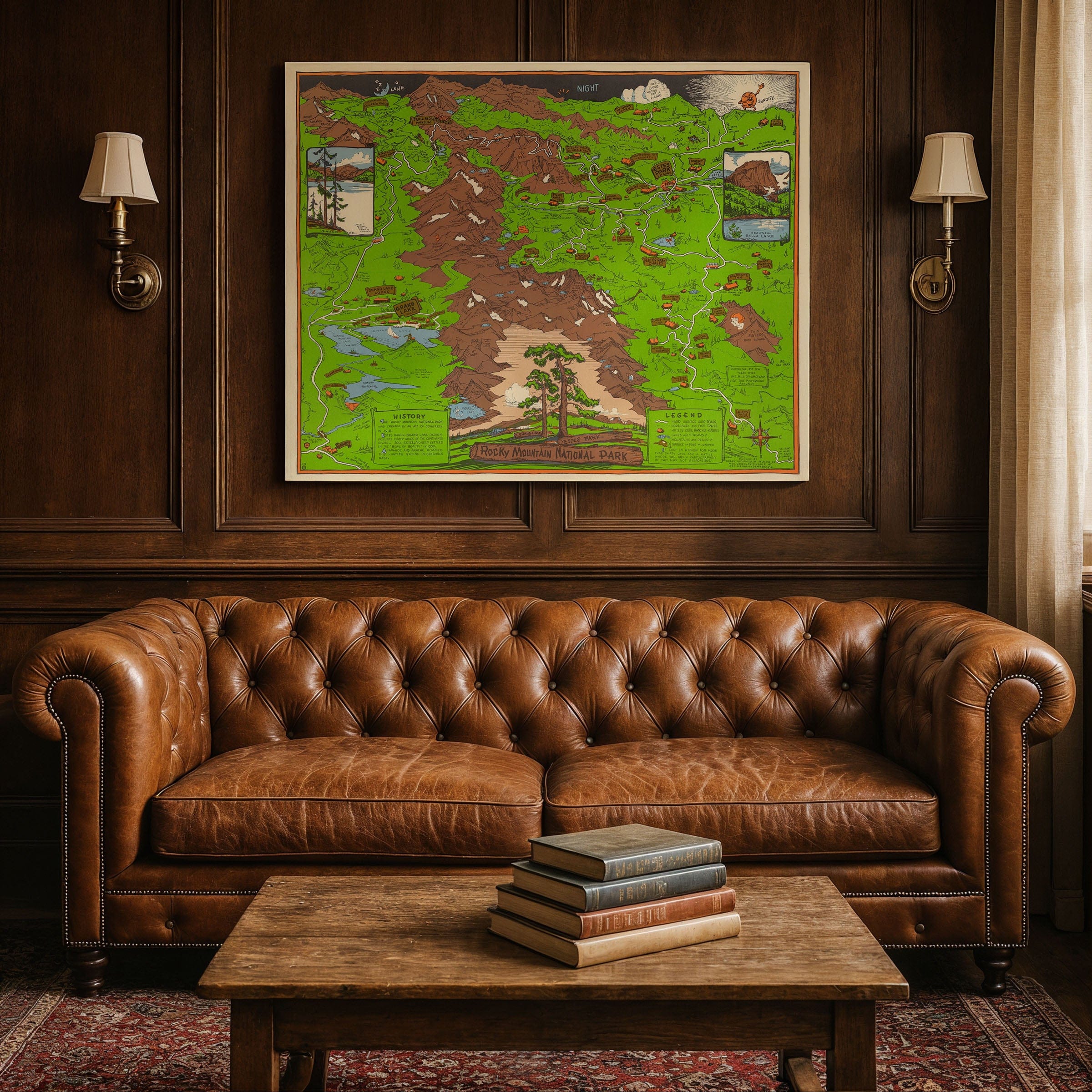
Rocky Mountain National Park (Estes Park) 1948 - Richardson Rome Pictorial Map
Experience the golden age of American road trips with this spectacular 1948 pictorial map of Rocky Mountain National Park and Estes Park by Richardson Rome. Created for the Rocky Mountain Motor Company, this isn't just a navigation tool—it's a love letter to the Colorado high country, designed to entice postwar travelers to discover the majesty of the Rockies by automobile.
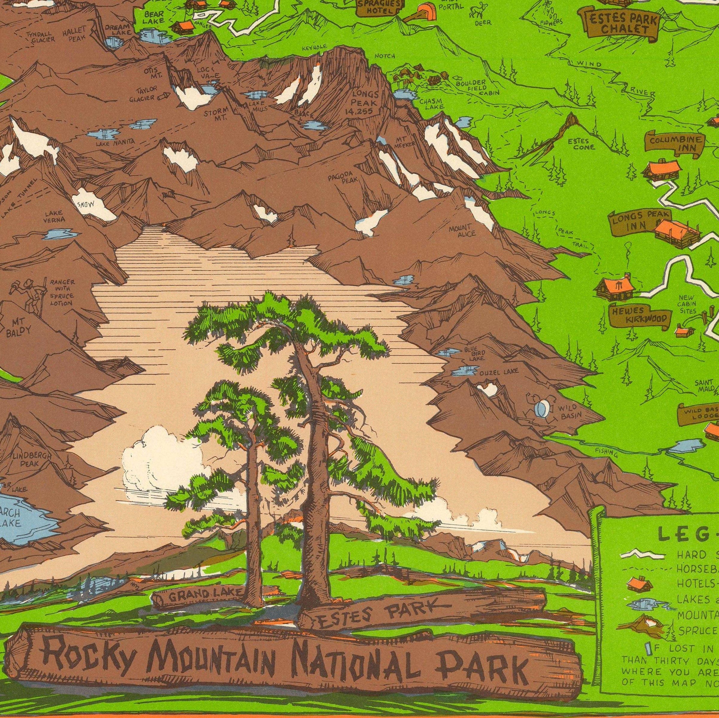
The map places Estes Park at the gateway to wilderness, where civilization meets untamed nature. Towering peaks loom over valleys, trails snake upward through forests, and ridges frame endless sky. Roads curve gracefully along high passes, while cabins, lodges, and guesthouses dot the landscape with welcoming detail. Visitors can trace iconic routes like Trail Ridge Road, passing landmarks such as Harmony Guest Ranch and the Trail Ridge Museum before crossing the Continental Divide.
Named peaks command attention across the composition. Longs Peak rises boldly, while lakes like Bear Lake and Dream Lake nestle in quiet valley pockets. Grand Lake appears on the western side, connected by the network of scenic highways that made the park accessible to ordinary Americans. Wildlife populates the ridgelines—elk, deer, mountain sheep, even a playful bat—reminding viewers that this remains wild country, not a domesticated garden.
What sets this map apart is its promotional spirit. Rome didn't just chart geography; he created invitation. Routes are highlighted, lodgings labeled, vistas promised. In a delightful touch of whimsy, Phantom Valley's water drop has legs and a face, marching toward the Grand Canyon like a character in a storybook. This playful detail captures the map's essence: the landscape is alive, full of stories, waiting to be explored.
The year 1948 was pivotal for American tourism. World War II had ended, gas rationing was lifted, car ownership soared, and families were eager for adventure. National parks experienced unprecedented visitation as Americans rediscovered their own backyard. This map speaks directly to that moment—promising scenic drives, camping trips, family excursions, and photographic opportunities in equal measure.
Rome masterfully balances contrasts: rugged peaks versus domesticated trails, wild animals versus human cabins, deep forests versus linear roads. The result transforms cartography into storytelling, turning mountain passes into narrative journeys. The map invites readers not just to visit, but to become explorers themselves.
Today, this 1948 pictorial map endures as a vibrant time capsule. It captures the optimism of postwar America and the belief that nature's vastness could be made accessible through imagination and infrastructure—yet never fully tamed. The mountains still challenge, the lakes still beckon, the roads still wind. Like an old postcard from a cherished trip, this map promises: come see, wander, remember.
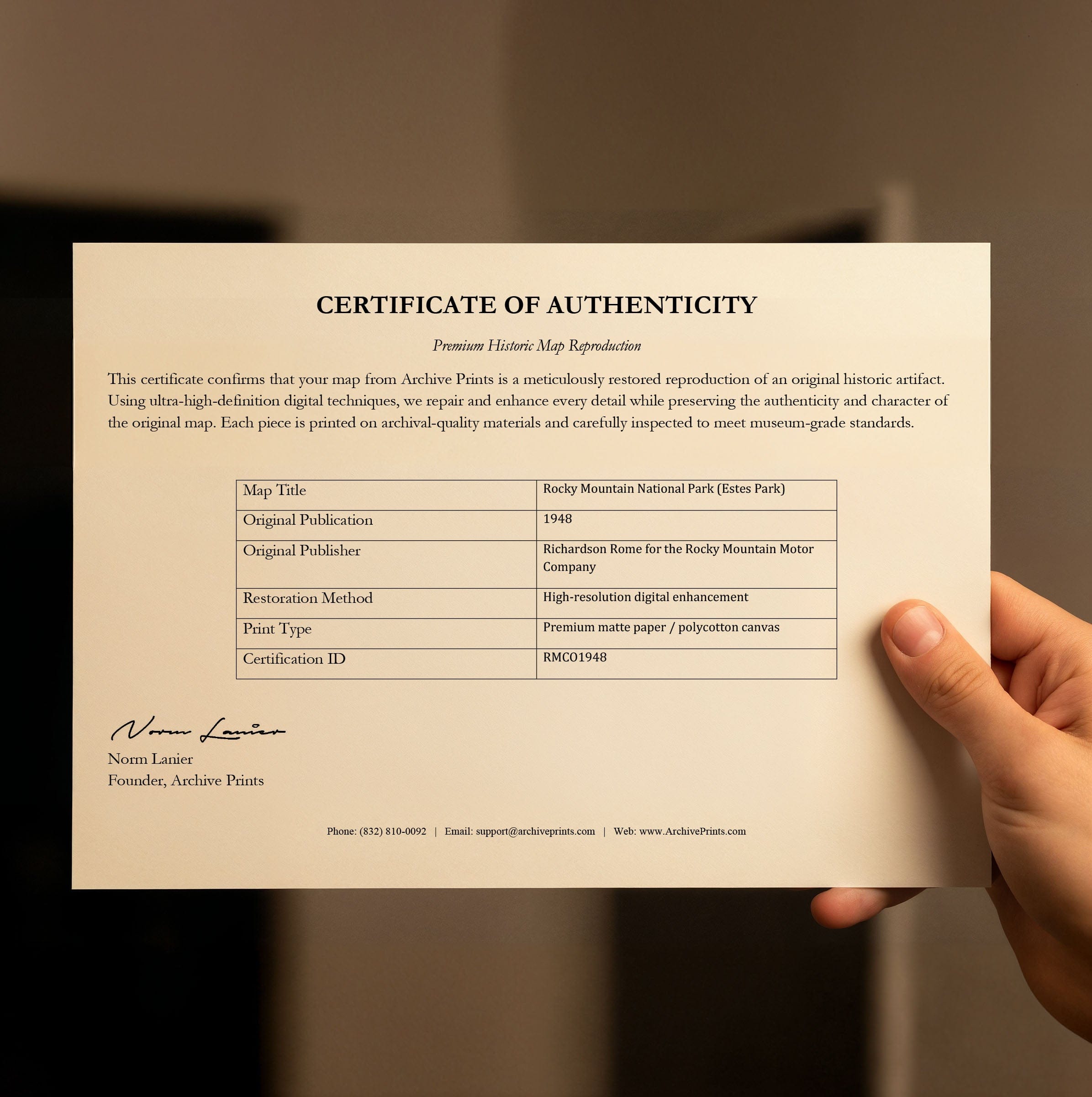
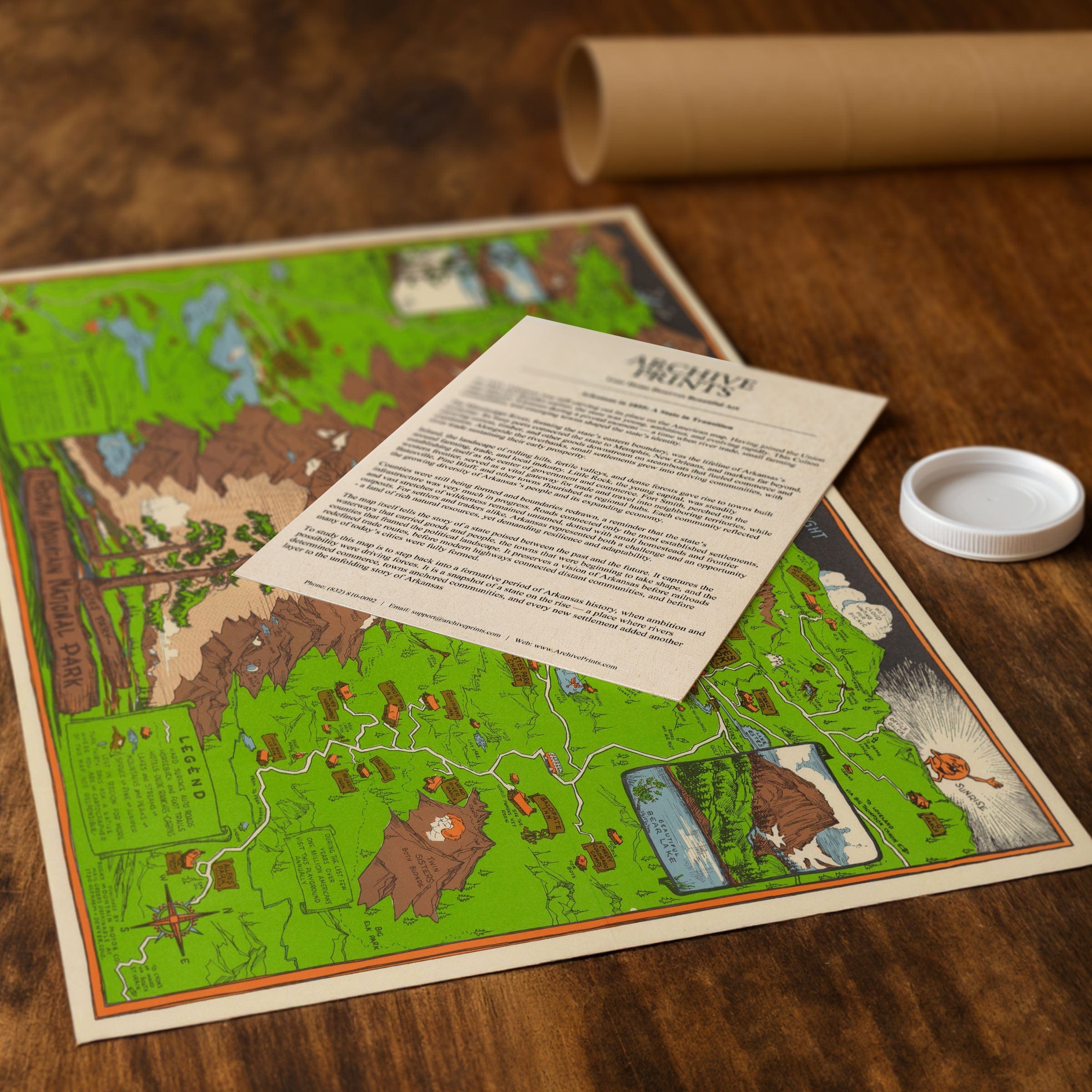
Each reproduction includes a custom historical letter detailing the story behind the map, making it perfect for Colorado enthusiasts, national park lovers, vintage travel collectors, and anyone who appreciates midcentury cartographic artistry. Printed on heavyweight archival paper or hand-stretched polycotton canvas, every peak, trail, and illustrated detail is restored in museum-grade clarity for generations of enjoyment.
Paper prints ship rolled in heavy-duty tubes, while canvas editions arrive gallery-wrapped on solid pine stretcher bars with pre-installed hardware—ready to display the moment it arrives. Bring home a piece of Colorado's pictorial mapping tradition and celebrate the spirit of adventure that defined postwar America.
The Map Story
Materials
Choose options

Because every place has a story
Make History Personal
A vintage map is more than art.
It is a reminder of where life began.
Where memories were made.
Where hearts still live. Give the gift of place.
Beautifully preserved and made for the moments that matter.
Why Choose Us?
| Feature | Us | Competitor A | Competitor B |
|---|---|---|---|
| Hand Crafted | |||
| Museum Quality | |||
| 100 Year Guarantee | |||
| Restored by Hand | |||
| Certificate of Authenticity |

Art Prints
Archival quality colors. Best option if you'd like to frame it yourself

The Best Materials
We hand-stretched our canvas on solid American-grown pine stretcher bars. We use quality canvas and fade-resistant inks to create the lasting art. Canvases come with hardware already installed and ready to hang.
Need help?
Frequently Asked Questions
Order
All of our maps are meticulously restored reproductions of historic originals. Each piece is digitally repaired and color-corrected to bring out the finest details while preserving its authentic, vintage character.
Yes. All Archive Prints products are printed to order in the USA with archival materials.
We offer two premium formats:
- High-Quality Paper Posters – Printed on thick, archival-grade matte paper for rich, vibrant detail.
- Hand-Stretched Canvas Prints – Printed on premium polycotton canvas and mounted on 1.5" solid American pine stretcher bars for a gallery-quality finish.
We carefully digitally restore each map to enhance clarity and color while preserving its original look and historic charm. You’ll enjoy sharp details and a timeless vintage aesthetic that feels true to the original piece.
Yes, we do! We offer premium framing options to make your map ready to hang the moment it arrives. You can choose from Oak, Maple, Black, or Walnut frames directly on the product page. We also offer Stretched Canvas prints for a modern gallery look, as well as archival-quality Posters if you prefer to frame it yourself.
Yes! We offer free shipping on all products within the United States. Each map is carefully packaged to ensure it arrives in perfect condition.
If you’re not completely satisfied, you can return your order in new condition for a full refund. Return shipping costs are the responsibility of the customer.
Absolutely! Our maps make thoughtful, one-of-a-kind gifts for history lovers, map collectors, or anyone looking to add vintage character to their home or office. Choose between paper prints for framing or stretched canvas for a ready-to-hang presentation.
- Paper Posters → Shipped in durable, protective tubes to prevent creasing.
- Canvas Prints → Carefully wrapped, padded, and boxed to ensure safe delivery.
Our maps look stunning in a variety of settings, including:
- Living rooms and home offices
- Libraries and studies
- Corporate offices and conference rooms
- Restaurants, cafes, and boutique spaces