


San Antonio Vintage Map - Authentic 1873 Historical City Bird's-Eye View
Discover San Antonio's Historic Heart
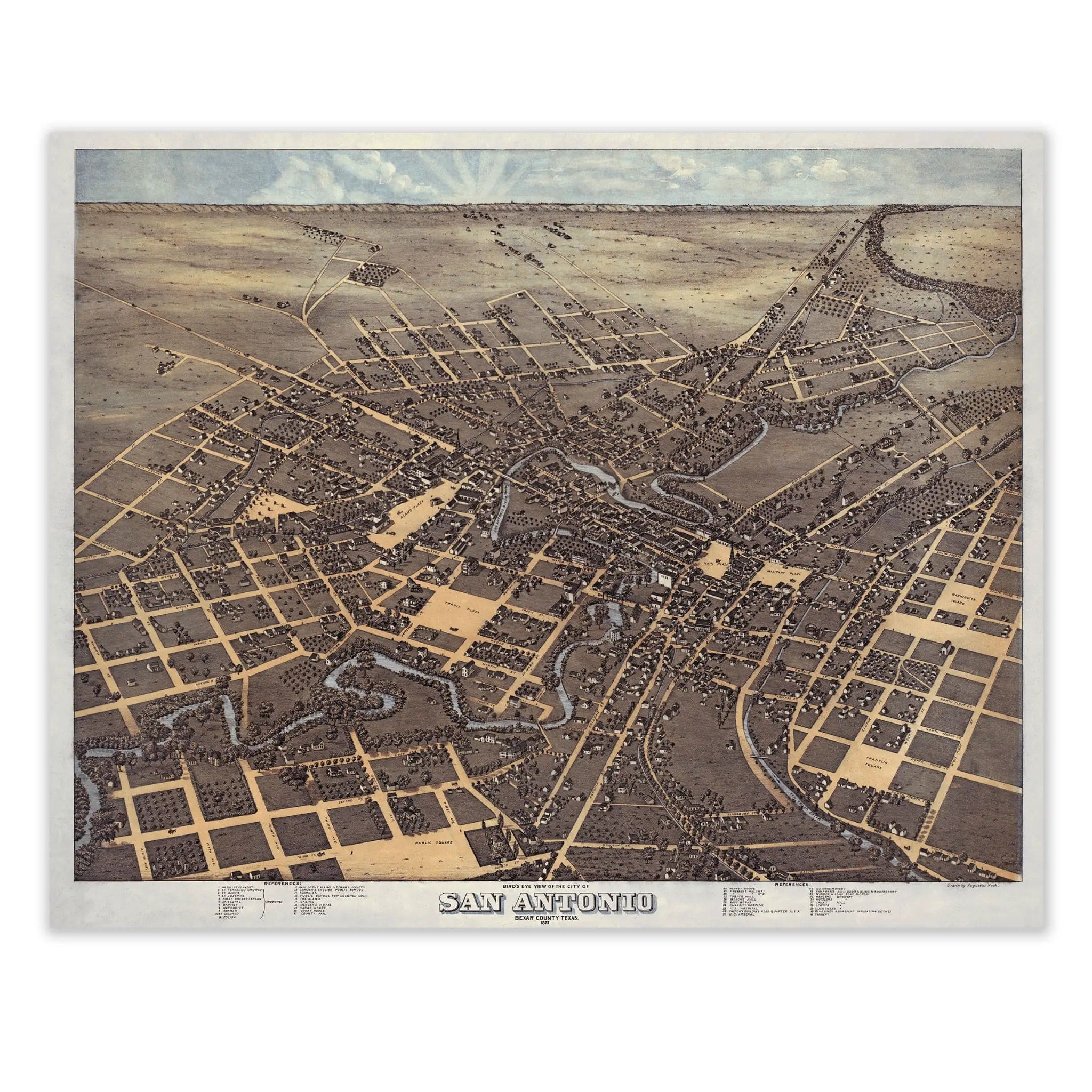
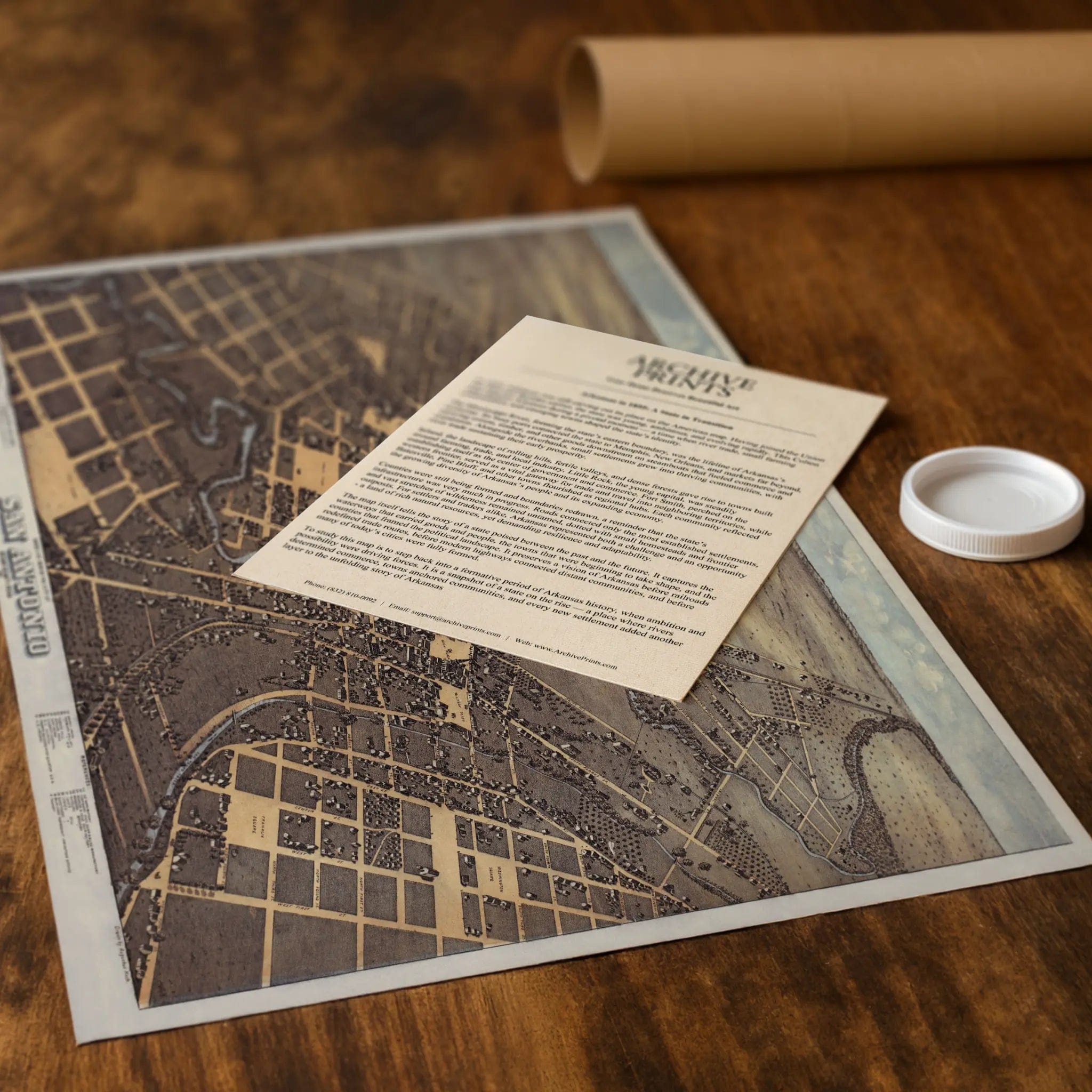
Step back into 1873 Texas with this extraordinary Bird's-Eye View of San Antonio, Bexar County by J.J. Stoner. This remarkable panoramic map captures the Alamo City during a pivotal moment in its transformation from frontier settlement to thriving commercial center. Every street, plaza, and building reflects a community balancing its Spanish colonial heritage with the rapid changes brought by American expansion and railroad development.
Historical Significance
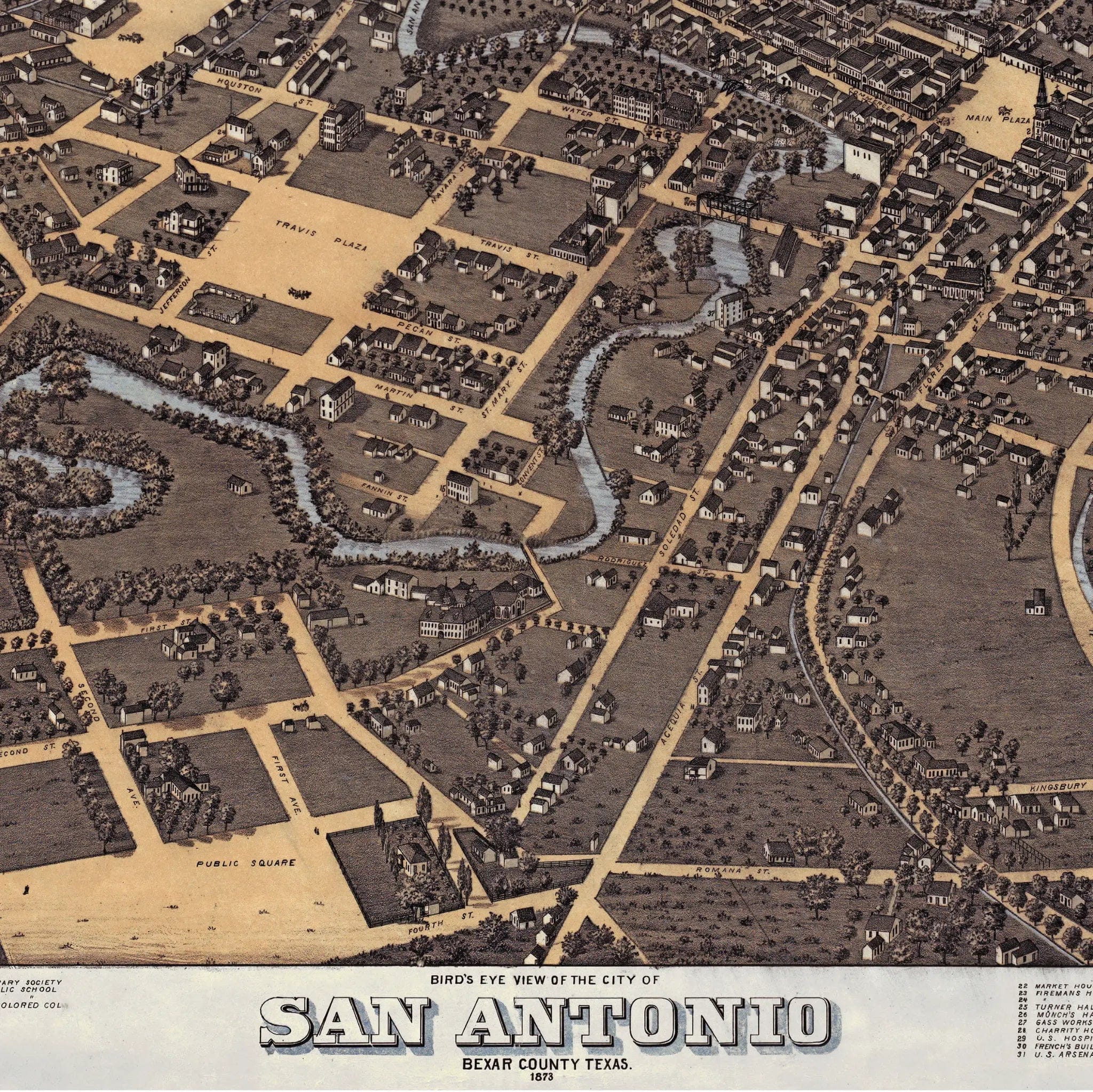
In 1873, San Antonio stood as the largest city in Texas, a bustling crossroads where cultures, commerce, and history converged. This meticulously detailed map documents the city at a crucial turning point—still anchored by its historic plazas and missions, yet embracing the infrastructure and growth that would define its modern identity. The San Antonio River winds through the heart of the city, connecting neighborhoods and powering the mills that drove local industry. From Main Plaza to the military installations, every landmark tells the story of a city that served as both guardian of Texas heritage and gateway to its future.
Cartographic Excellence
Stoner's masterful bird's-eye perspective showcases San Antonio with remarkable attention to architectural detail and urban planning. The historic missions stand as enduring symbols of the city's Spanish colonial past, while new commercial buildings and residential districts reflect the energy of Reconstruction-era growth. The precise rendering captures the unique character of San Antonio's neighborhoods—from the bustling market squares to the quiet residential streets lined with adobe and limestone buildings that gave the city its distinctive southwestern character.
Urban Development Story
The artistry of this map lies in its documentation of cultural continuity amid rapid change. San Antonio's famous plazas remain the heart of civic life, surrounded by a mix of traditional and modern architecture that speaks to the city's role as a bridge between old and new Texas. The military presence, railroad connections, and growing commercial district all point to San Antonio's emergence as a regional center of trade and transportation, while the preservation of historic landmarks shows a community proud of its unique heritage.
A Vision of Cultural Harmony
This map serves as a portrait of a city that successfully balanced preservation with progress, capturing San Antonio when it was establishing itself as the cultural and commercial capital of South Texas. The careful attention to both historic missions and modern infrastructure reflects a community that understood the value of its past while embracing the opportunities of its future. Every street and building represents the convergence of Spanish, Mexican, and American influences that created San Antonio's distinctive identity.
A Piece of Texas History
Each restored reproduction of this 1873 map is printed with museum-quality precision on heavyweight archival paper or hand-stretched premium canvas to preserve every original detail. Your purchase includes two companion documents:
Certificate of Authenticity verifying its restoration and reproduction quality
Historical Story Page detailing the origins, craftsmanship, and cultural significance of Stoner's iconic map
Paper prints arrive rolled in reinforced mailing tubes for protection. Canvas prints come gallery-wrapped on solid pine stretcher bars with pre-installed hardware, ready to display upon arrival.
Bring home a vivid piece of Texas history—a timeless record of San Antonio's unique blend of heritage and progress during one of the most important periods in the city's development.
The Map Story
In 1873, San Antonio stood at a crossroads—neither remote frontier outpost nor fully mature metropolis, but something in between. The Bird’s Eye View of the City of San Antonio captures this tension in ink and shadow: a town with deep roots in Spanish and Mexican history, now adjusting to the pace of Reconstruction, commerce, and expansion.
From its lofty vantage, the map reveals a city shaped by its rivers, plazas, and fortifications. The San Antonio River snakes through the drawing, slicing neighborhoods and gardens, and giving life to farms and orchards that cluster along its banks. Narrow streets radiate outward in grid and curve, converging on plazas, mission churches, and civic buildings. Roofs, steeples, and balconies crowd the center; the flanks of the map are lighter, showing fields, outbuildings, and scattered homes.
Every element speaks of layered identity. The Mission San Antonio de Valero (the Alamo) appears as a fortified node, still tied to memory yet embedded in the urban pattern. The Cathedral, commercial blocks, and residential areas bustle around plazas. The map includes steamboats on the river, carriages on roads, and figures in everyday poses—this is not a static picture but a living snapshot.
Trade is obvious. The waterfront and shipping areas, warehouses, and docks point to San Antonio’s role as a trade hub for goods coming from deeper in Texas and beyond. The roads linking it to other towns convey the town’s ambition to be a crossroads, not an endpoint. Commerce, movement, and exchange are part of the narrative.
Yet the edges remind us of uncertainty. On the periphery, the density fades. Farms, groves, dirt tracks, and open land dominate. The map does not pretend the city already owns the land—it shows it still in contest, a frontier shading into settlement. This balance between built blocks and blank margins is essential: the map is as much a projection of expectation as a record of fact.
The drawing is also a statement of civic pride. The careful rendering of streets, buildings, and public structures suggests a community intent on presentation. The map offers dignity: San Antonio is not a hastily assembled settlement, but a city of substance, history, and ambition.
Viewed today, that 1873 rendering is a portal. It reminds us that the city’s present—its towers, highways, sprawling neighborhoods—was once only concept and contour. In the map’s streets, plazas, and wings of wilderness, one sees a city being drawn into possibility, negotiating between past and future, claiming land and identity one block at a time.
Materials
Choose options

Because every place has a story
Make History Personal
A vintage map is more than art.
It is a reminder of where life began.
Where memories were made.
Where hearts still live. Give the gift of place.
Beautifully preserved and made for the moments that matter.
Why Choose Us?
| Feature | Us | Competitor A | Competitor B |
|---|---|---|---|
| Hand Crafted | |||
| Museum Quality | |||
| 100 Year Guarantee | |||
| Restored by Hand | |||
| Certificate of Authenticity |

Art Prints
Archival quality colors. Best option if you'd like to frame it yourself

The Best Materials
We hand-stretched our canvas on solid American-grown pine stretcher bars. We use quality canvas and fade-resistant inks to create the lasting art. Canvases come with hardware already installed and ready to hang.
Need help?
Frequently Asked Questions
Order
All of our maps are meticulously restored reproductions of historic originals. Each piece is digitally repaired and color-corrected to bring out the finest details while preserving its authentic, vintage character.
Yes. All Archive Prints products are printed to order in the USA with archival materials.
We offer two premium formats:
- High-Quality Paper Posters – Printed on thick, archival-grade matte paper for rich, vibrant detail.
- Hand-Stretched Canvas Prints – Printed on premium polycotton canvas and mounted on 1.5" solid American pine stretcher bars for a gallery-quality finish.
We carefully digitally restore each map to enhance clarity and color while preserving its original look and historic charm. You’ll enjoy sharp details and a timeless vintage aesthetic that feels true to the original piece.
Yes, we do! We offer premium framing options to make your map ready to hang the moment it arrives. You can choose from Oak, Maple, Black, or Walnut frames directly on the product page. We also offer Stretched Canvas prints for a modern gallery look, as well as archival-quality Posters if you prefer to frame it yourself.
Yes! We offer free shipping on all products within the United States. Each map is carefully packaged to ensure it arrives in perfect condition.
If you’re not completely satisfied, you can return your order in new condition for a full refund. Return shipping costs are the responsibility of the customer.
Absolutely! Our maps make thoughtful, one-of-a-kind gifts for history lovers, map collectors, or anyone looking to add vintage character to their home or office. Choose between paper prints for framing or stretched canvas for a ready-to-hang presentation.
- Paper Posters → Shipped in durable, protective tubes to prevent creasing.
- Canvas Prints → Carefully wrapped, padded, and boxed to ensure safe delivery.
Our maps look stunning in a variety of settings, including:
- Living rooms and home offices
- Libraries and studies
- Corporate offices and conference rooms
- Restaurants, cafes, and boutique spaces