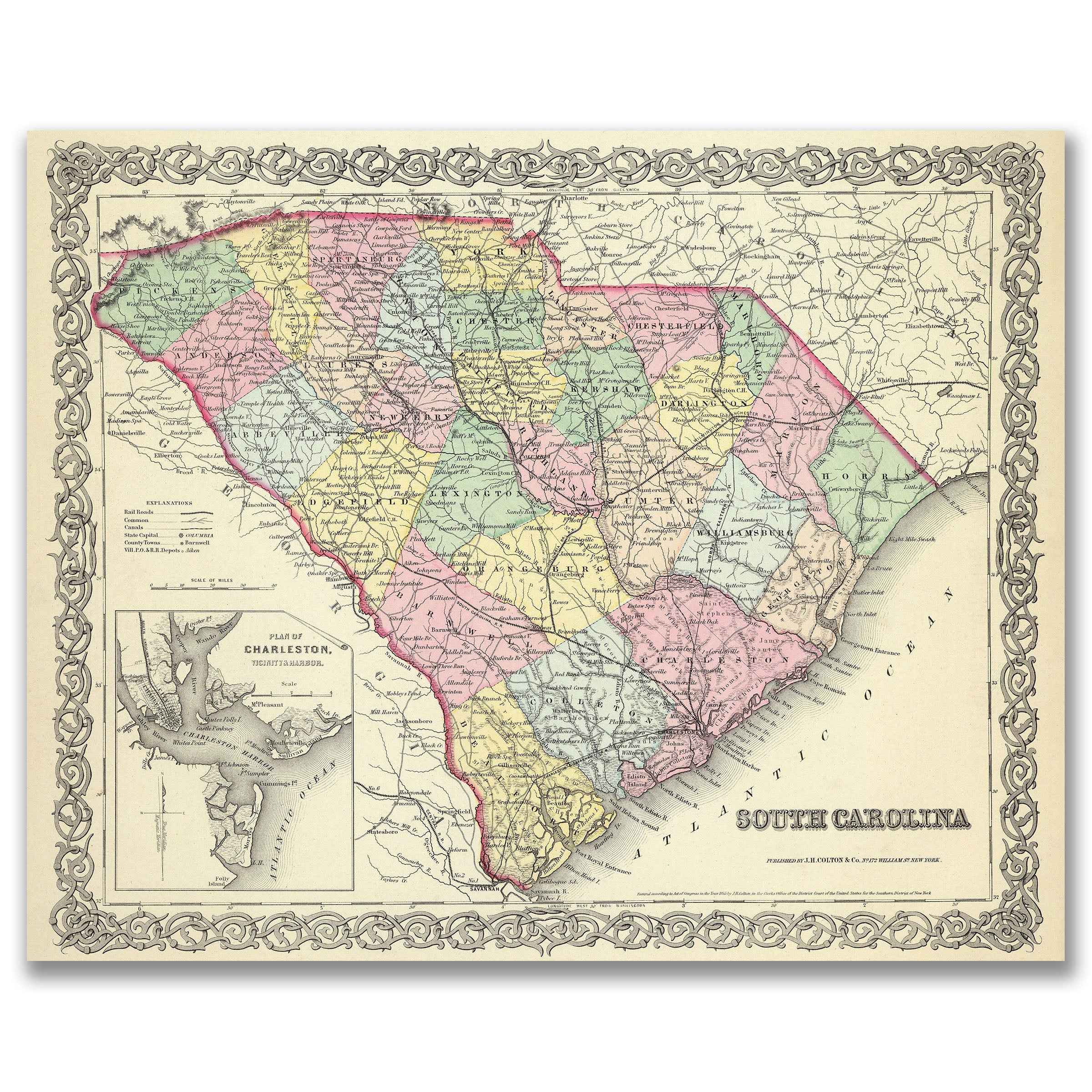
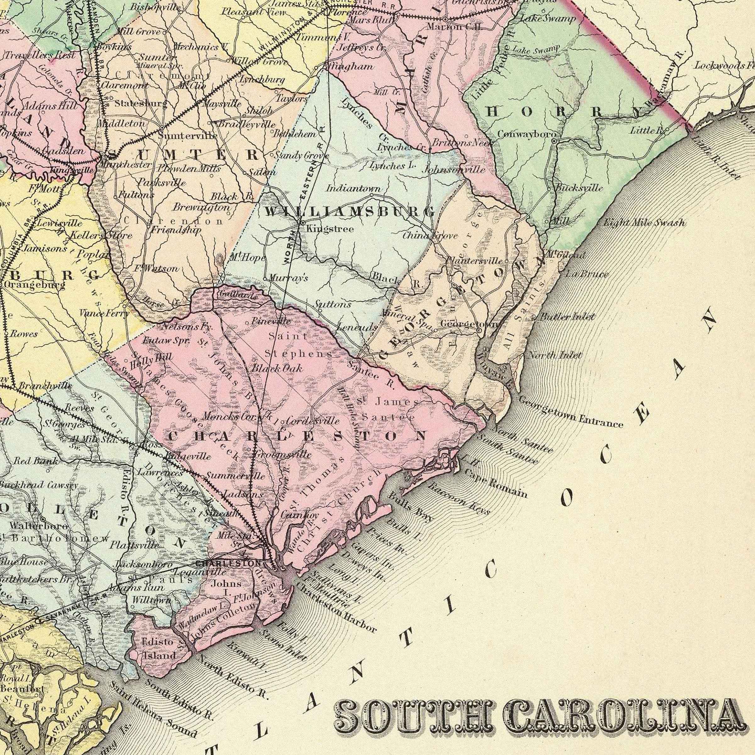
South Carolina Map - Vintage 1856 Colton Historical Map with Charleston Harbor
Discover the Palmetto State
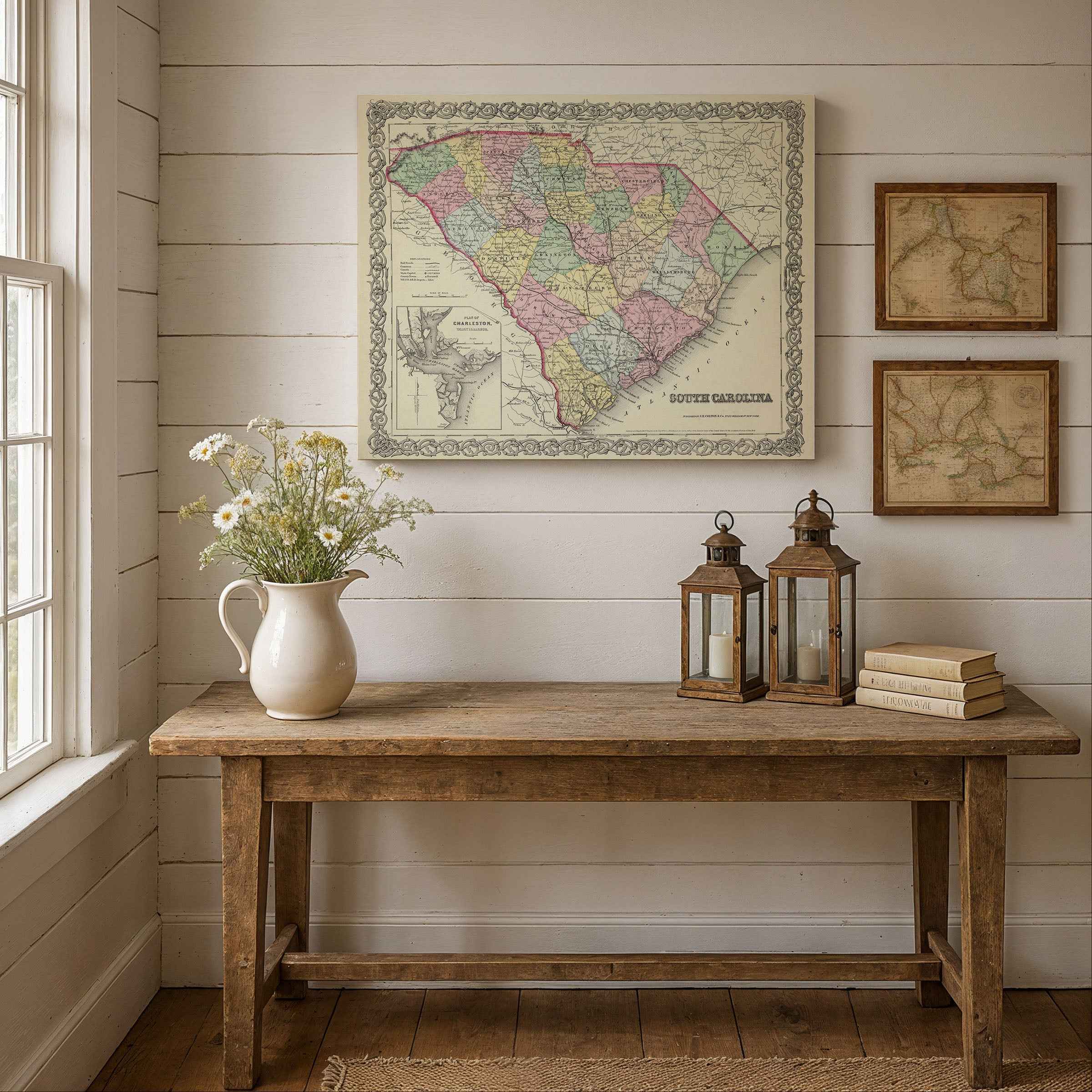
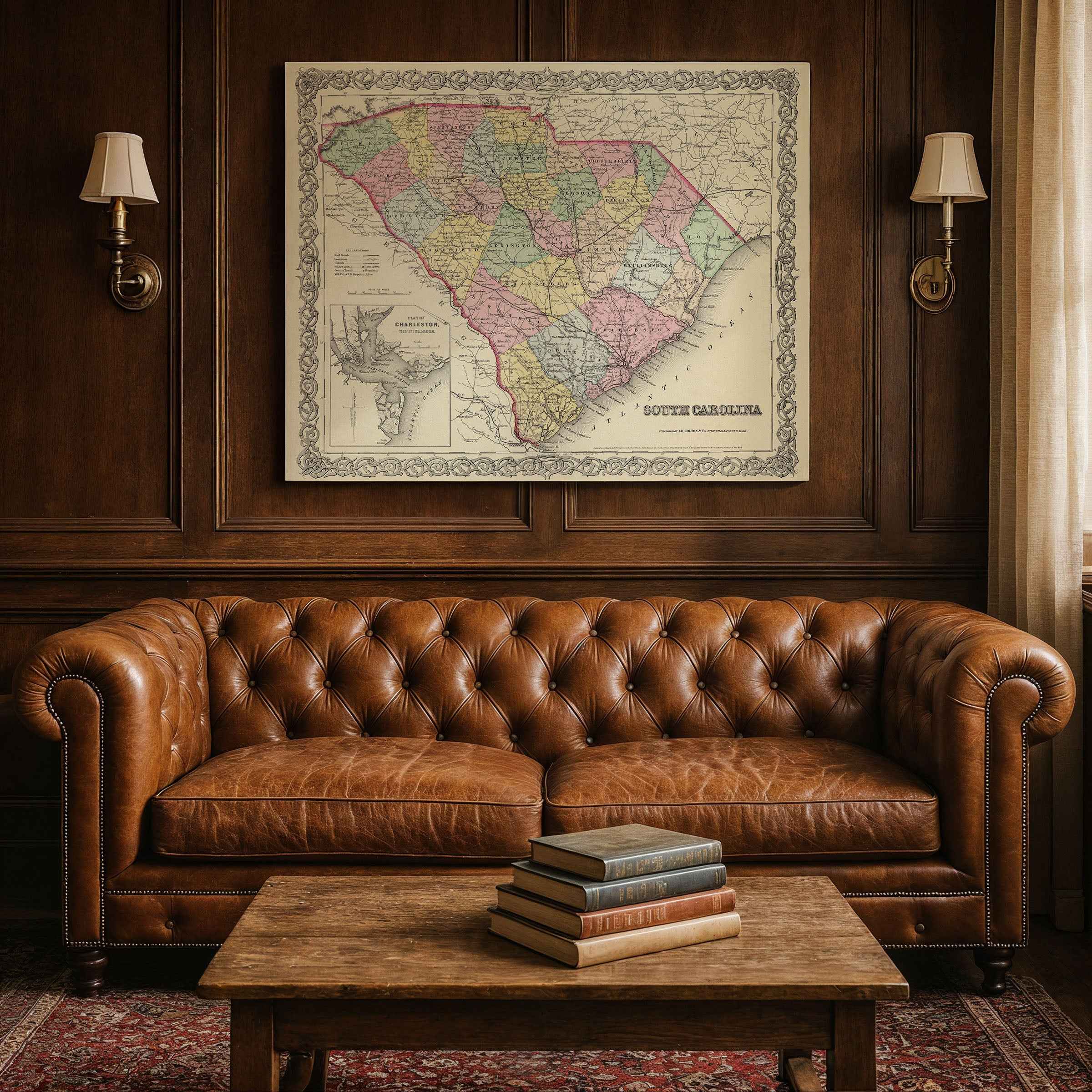
Journey into the rich history of the Palmetto State with this meticulously restored 1856 South Carolina Map by J.H. Colton & Co., featuring the detailed Charleston Harbor vicinity inset. This exceptional cartographic treasure captures South Carolina during the height of the antebellum period, showcasing the detailed county boundaries, transportation networks, and thriving communities that defined this influential southeastern state.
Created during the mid-19th century era of plantation agriculture and coastal commerce, this map illustrates South Carolina at a time when cotton cultivation, rice production, and maritime trade were flourishing throughout the state. The intricate detail shows every county, township, and geographic feature with the precision and artistry that made Colton maps the premier choice of their era.
From the Blue Ridge Mountains in the northwest to the Atlantic coastal plains in the southeast, this map captures the essence of South Carolina's diverse geography and cultural heritage. The special Charleston Harbor inset provides detailed information about one of the South's most important commercial ports, showcasing the strategic harbor that connected the region with global markets.
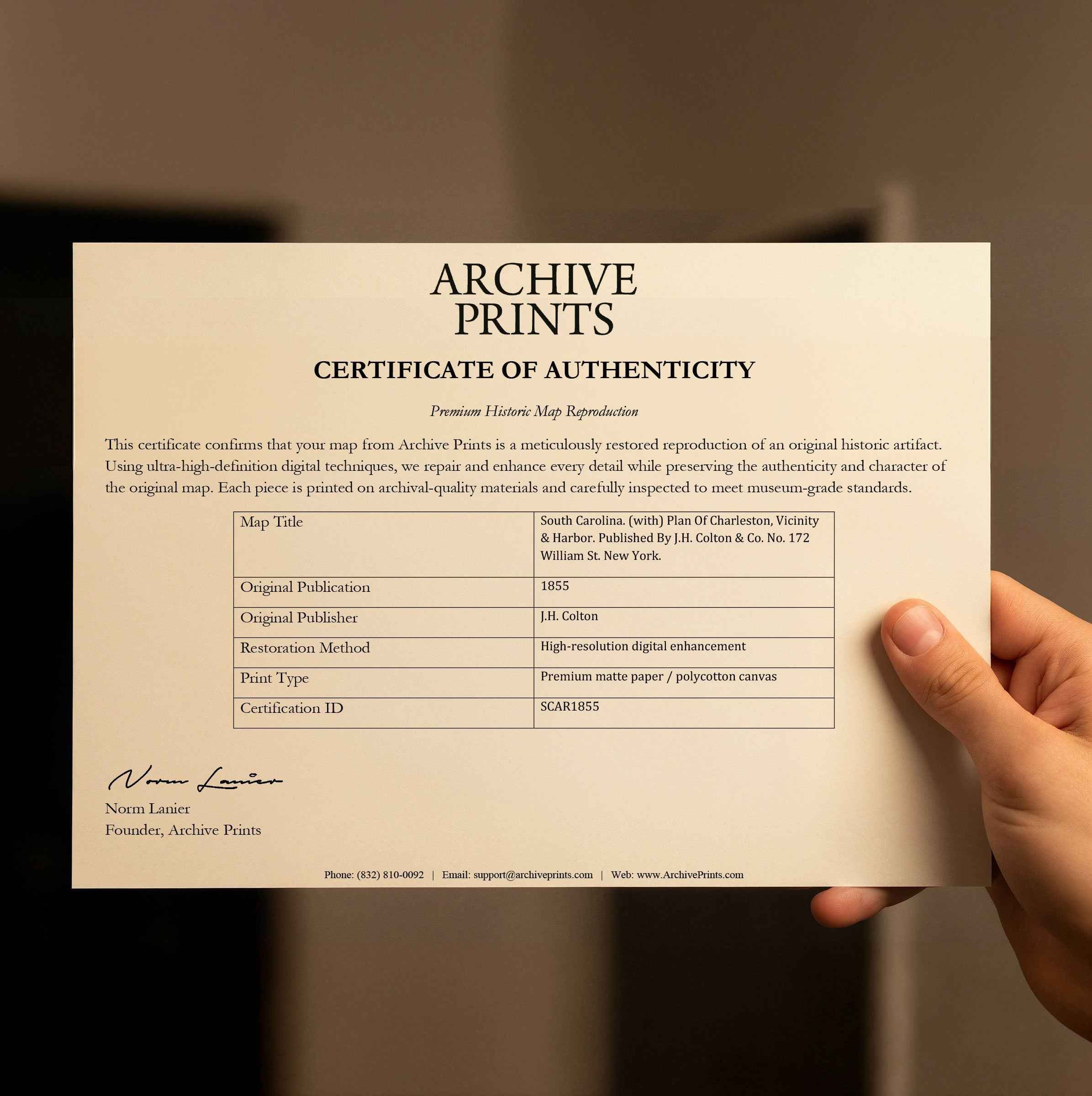
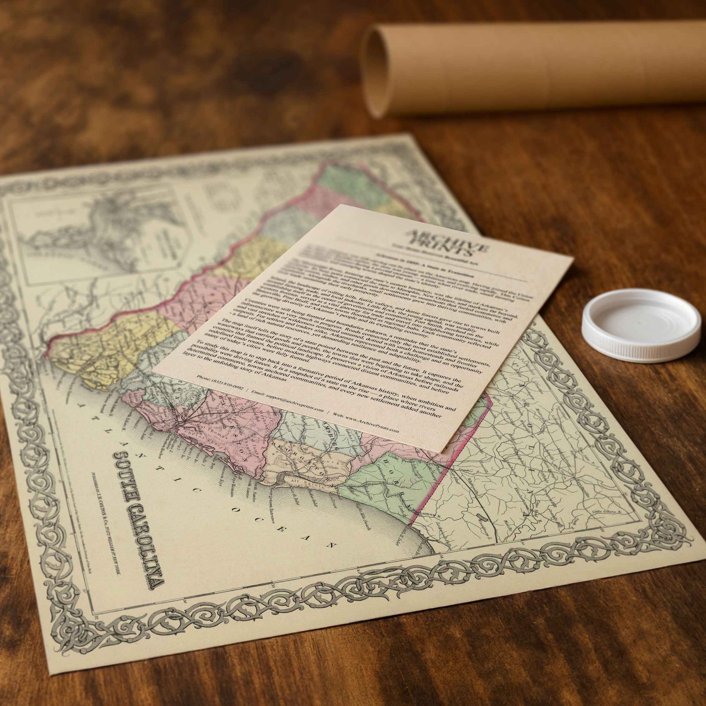
Each reproduction includes a custom historical letter detailing the map's significance, making it perfect for collectors, South Carolina history enthusiasts, and anyone with Palmetto State connections. Printed on heavyweight archival paper or premium canvas, every county line, railroad route, and waterway is preserved with museum-quality clarity through expert digital restoration.
For protection and presentation, paper prints arrive rolled in sturdy mailing tubes, while canvas prints come gallery-wrapped on solid pine stretcher bars with pre-installed hanging hardware—ready to display immediately.
Bring home a piece of Palmetto heritage and celebrate South Carolina's rich history with this stunning cartographic centerpiece.
The Map Story
Discover the history of the map
Materials
Hand‑Stretched Canvas: If you choose canvas, we use a premium cotton‑poly blend stretched over solid pine frames. Each canvas is carefully hand‑stretched for a tight, gallery‑quality finish that's ready to hang right out of the box.
Vivid, Fade‑Resistant Inks: We use professional‑grade inks that are UV‑resistant, so your print retains its rich colors even when displayed in bright rooms.
Expert Restoration: Every map is digitally restored by skilled artisans. We preserve the character of the original while enhancing clarity, so you see the map as it was meant to be seen.
Secure Packaging: Paper prints are rolled in heavy‑duty mailing tubes, and canvases are cushioned in reinforced boxes to ensure they arrive in pristine condition.
Choosing one of our prints means investing in craftsmanship. We combine historical authenticity with modern print technology and premium materials, giving you a work of art built to stand the test of time.
Choose options

Because every place has a story
Make History Personal
A vintage map is more than art.
It is a reminder of where life began.
Where memories were made.
Where hearts still live. Give the gift of place.
Beautifully preserved and made for the moments that matter.
Why Choose Us?
| Feature | Us | Competitor A | Competitor B |
|---|---|---|---|
| Hand Crafted | |||
| Museum Quality | |||
| 100 Year Guarantee | |||
| Restored by Hand | |||
| Certificate of Authenticity |

Art Prints
Archival quality colors. Best option if you'd like to frame it yourself

The Best Materials
We hand-stretched our canvas on solid American-grown pine stretcher bars. We use quality canvas and fade-resistant inks to create the lasting art. Canvases come with hardware already installed and ready to hang.
Need help?
Frequently Asked Questions
Order
All of our maps are meticulously restored reproductions of historic originals. Each piece is digitally repaired and color-corrected to bring out the finest details while preserving its authentic, vintage character.
Yes. All Archive Prints products are printed to order in the USA with archival materials.
We offer two premium formats:
- High-Quality Paper Posters – Printed on thick, archival-grade matte paper for rich, vibrant detail.
- Hand-Stretched Canvas Prints – Printed on premium polycotton canvas and mounted on 1.5" solid American pine stretcher bars for a gallery-quality finish.
We carefully digitally restore each map to enhance clarity and color while preserving its original look and historic charm. You’ll enjoy sharp details and a timeless vintage aesthetic that feels true to the original piece.
Yes, we do! We offer premium framing options to make your map ready to hang the moment it arrives. You can choose from Oak, Maple, Black, or Walnut frames directly on the product page. We also offer Stretched Canvas prints for a modern gallery look, as well as archival-quality Posters if you prefer to frame it yourself.
Yes! We offer free shipping on all products within the United States. Each map is carefully packaged to ensure it arrives in perfect condition.
If you’re not completely satisfied, you can return your order in new condition for a full refund. Return shipping costs are the responsibility of the customer.
Absolutely! Our maps make thoughtful, one-of-a-kind gifts for history lovers, map collectors, or anyone looking to add vintage character to their home or office. Choose between paper prints for framing or stretched canvas for a ready-to-hang presentation.
- Paper Posters → Shipped in durable, protective tubes to prevent creasing.
- Canvas Prints → Carefully wrapped, padded, and boxed to ensure safe delivery.
Our maps look stunning in a variety of settings, including:
- Living rooms and home offices
- Libraries and studies
- Corporate offices and conference rooms
- Restaurants, cafes, and boutique spaces