Vintage St. Louis Map 1876
St. Louis Map 1876
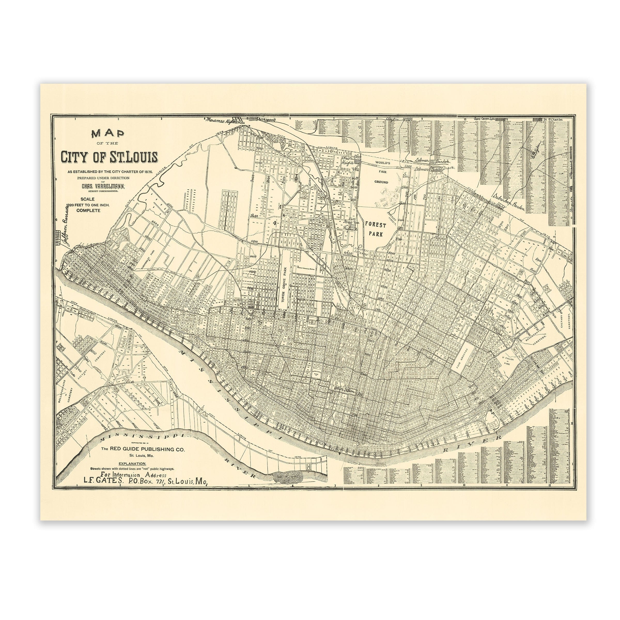
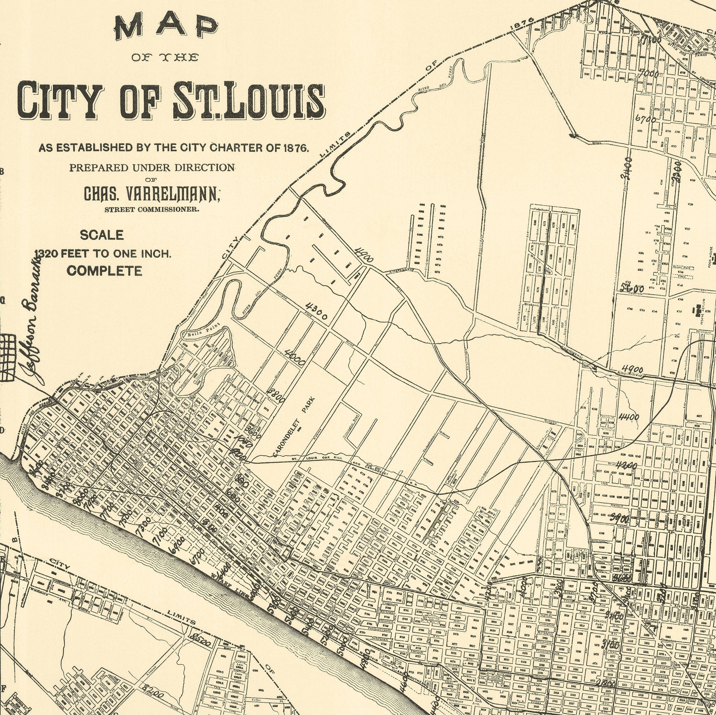
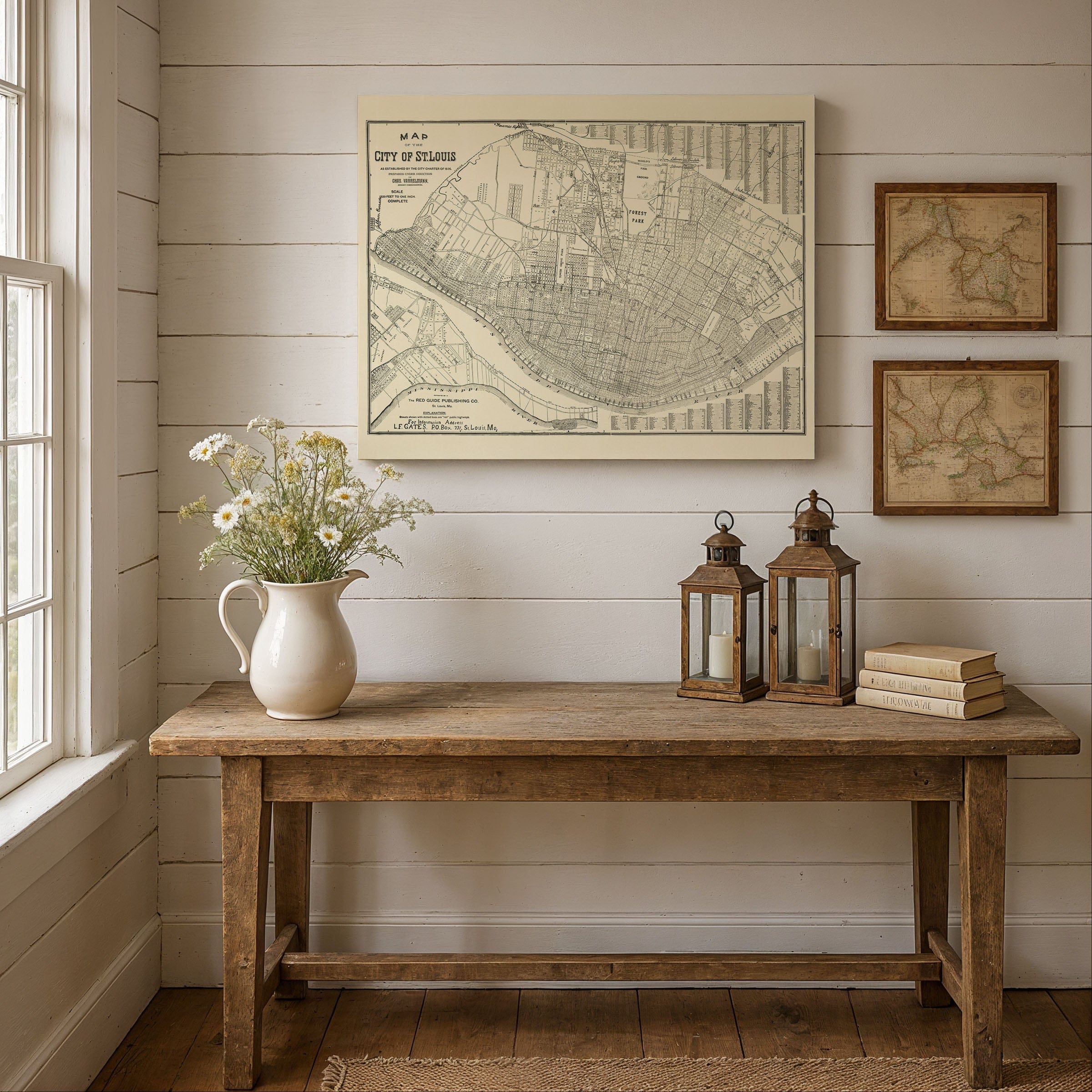
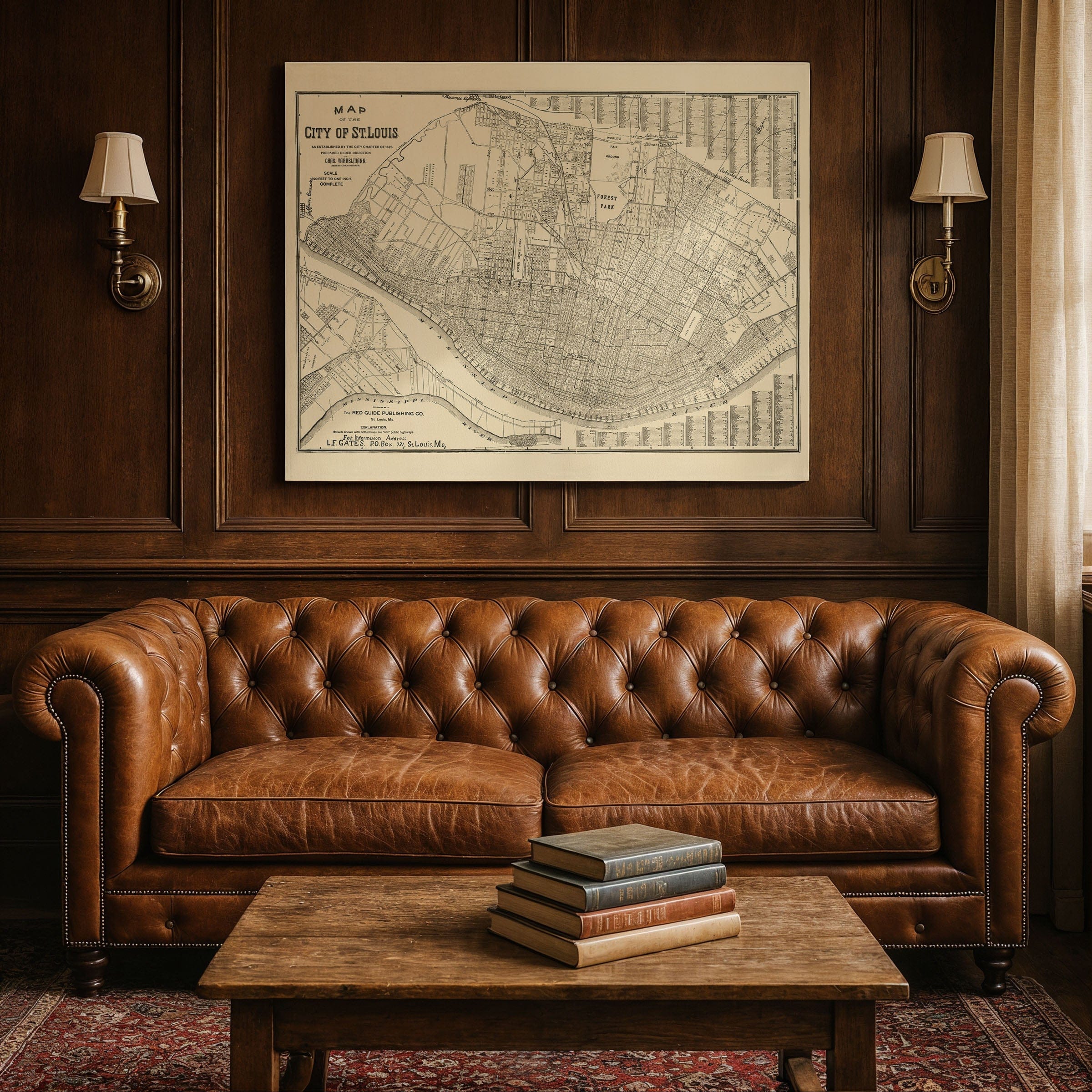
This official St. Louis Map from 1876 captures a defining moment when the city separated from St. Louis County and asserted a new civic identity following the City Charter adoption. Prepared by Red Guide Publishing Company, this map presents not merely a record of streets and wards, but a statement of independence, order, and ambition along the banks of the Mississippi River.
The St. Louis Map reveals a dense and carefully organized urban core pressed tightly against the waterfront. The Mississippi defines the city's eastern edge with wharves and landings forming the commercial lifeline. Rail lines thread through the urban fabric, connecting riverfront warehouses to inland markets and reinforcing St. Louis's role as the gateway between the Mississippi Valley and the American West.
Every element of this St. Louis Map documents a city at the height of its nineteenth-century influence. Downtown appears tightly packed with commerce and industry, while Forest Park stands as a forward-looking reservation of green space. Large tracts laid out in anticipation of growth hint at neighborhoods yet to come and populations yet to arrive.
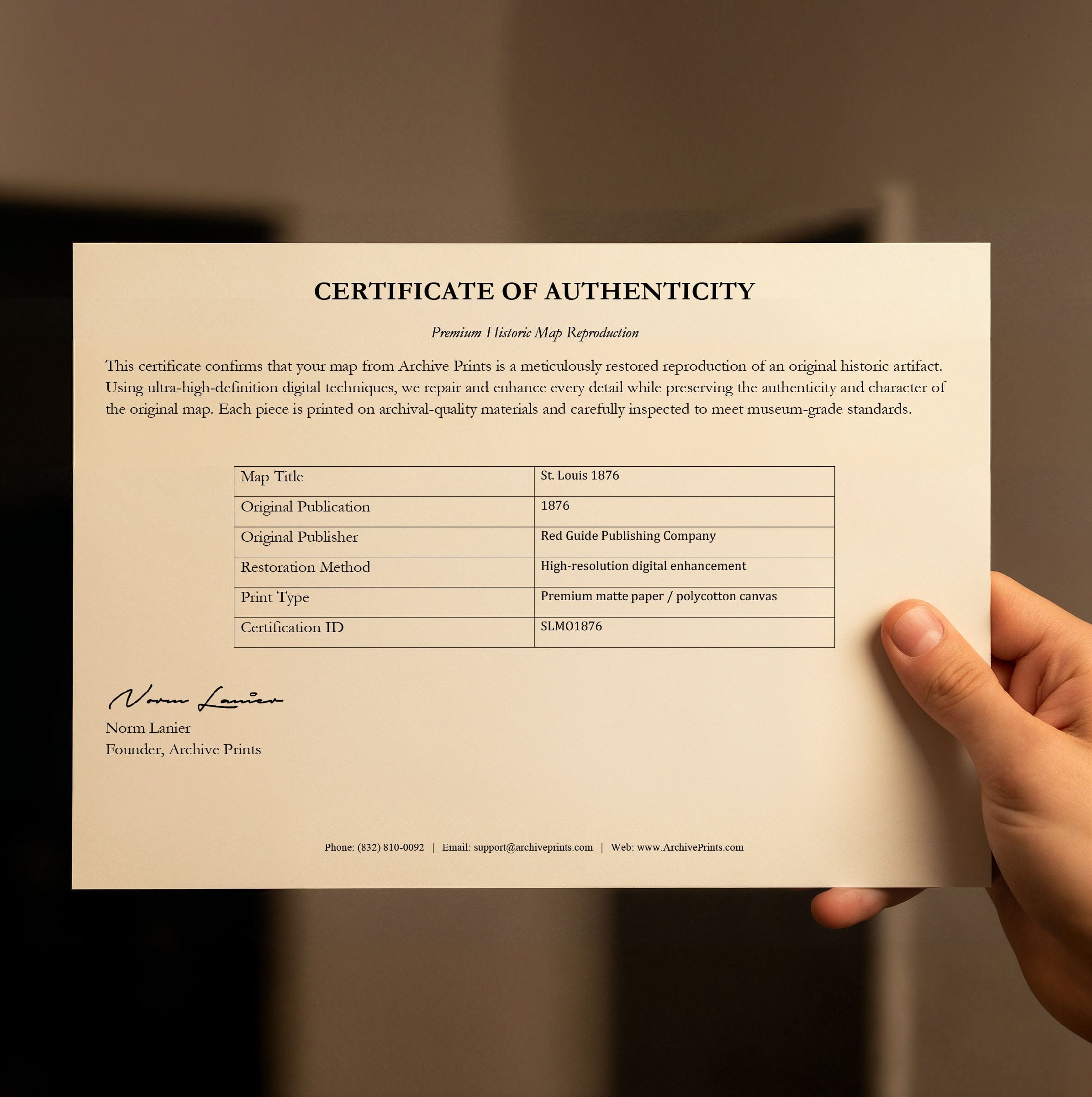
This vintage St. Louis Map preserves a pivotal moment poised between river commerce and rail power, industry and planning. Each reproduction is printed on premium archival materials with museum-quality inks, complete with a personalized Certificate of Authenticity documenting this piece of Gateway City cartographic history.
The Map Story
Materials
Choose options

Because every place has a story
Make History Personal
A vintage map is more than art.
It is a reminder of where life began.
Where memories were made.
Where hearts still live. Give the gift of place.
Beautifully preserved and made for the moments that matter.
Why Choose Us?
| Feature | Us | Competitor A | Competitor B |
|---|---|---|---|
| Hand Crafted | |||
| Museum Quality | |||
| 100 Year Guarantee | |||
| Restored by Hand | |||
| Certificate of Authenticity |

Art Prints
Archival quality colors. Best option if you'd like to frame it yourself

The Best Materials
We hand-stretched our canvas on solid American-grown pine stretcher bars. We use quality canvas and fade-resistant inks to create the lasting art. Canvases come with hardware already installed and ready to hang.
Need help?
Frequently Asked Questions
Order
All of our maps are meticulously restored reproductions of historic originals. Each piece is digitally repaired and color-corrected to bring out the finest details while preserving its authentic, vintage character.
Yes. All Archive Prints products are printed to order in the USA with archival materials.
We offer two premium formats:
- High-Quality Paper Posters – Printed on thick, archival-grade matte paper for rich, vibrant detail.
- Hand-Stretched Canvas Prints – Printed on premium polycotton canvas and mounted on 1.5" solid American pine stretcher bars for a gallery-quality finish.
We carefully digitally restore each map to enhance clarity and color while preserving its original look and historic charm. You’ll enjoy sharp details and a timeless vintage aesthetic that feels true to the original piece.
Yes, we do! We offer premium framing options to make your map ready to hang the moment it arrives. You can choose from Oak, Maple, Black, or Walnut frames directly on the product page. We also offer Stretched Canvas prints for a modern gallery look, as well as archival-quality Posters if you prefer to frame it yourself.
Yes! We offer free shipping on all products within the United States. Each map is carefully packaged to ensure it arrives in perfect condition.
If you’re not completely satisfied, you can return your order in new condition for a full refund. Return shipping costs are the responsibility of the customer.
Absolutely! Our maps make thoughtful, one-of-a-kind gifts for history lovers, map collectors, or anyone looking to add vintage character to their home or office. Choose between paper prints for framing or stretched canvas for a ready-to-hang presentation.
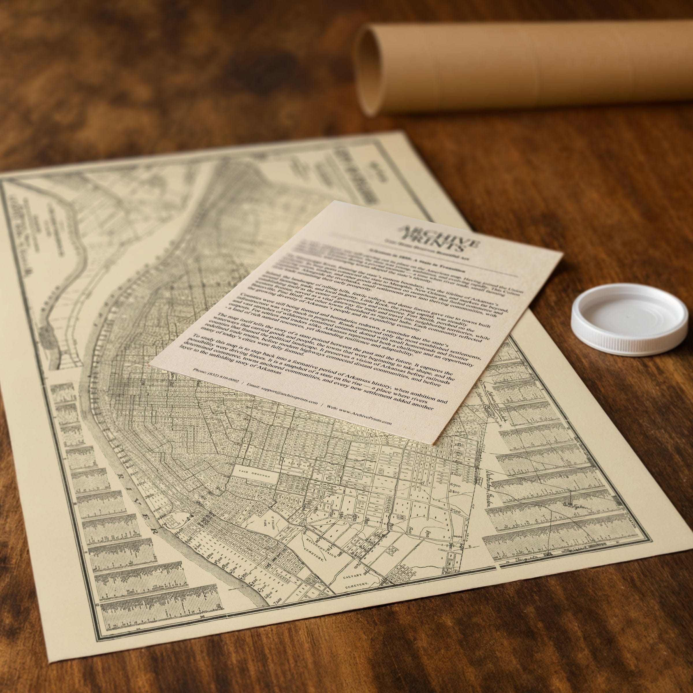
- Paper Posters → Shipped in durable, protective tubes to prevent creasing.
- Canvas Prints → Carefully wrapped, padded, and boxed to ensure safe delivery.
Our maps look stunning in a variety of settings, including:
- Living rooms and home offices
- Libraries and studies
- Corporate offices and conference rooms
- Restaurants, cafes, and boutique spaces