Vintage Alaska Map - 1867 Russian America Territory Map
Vintage Alaska Map
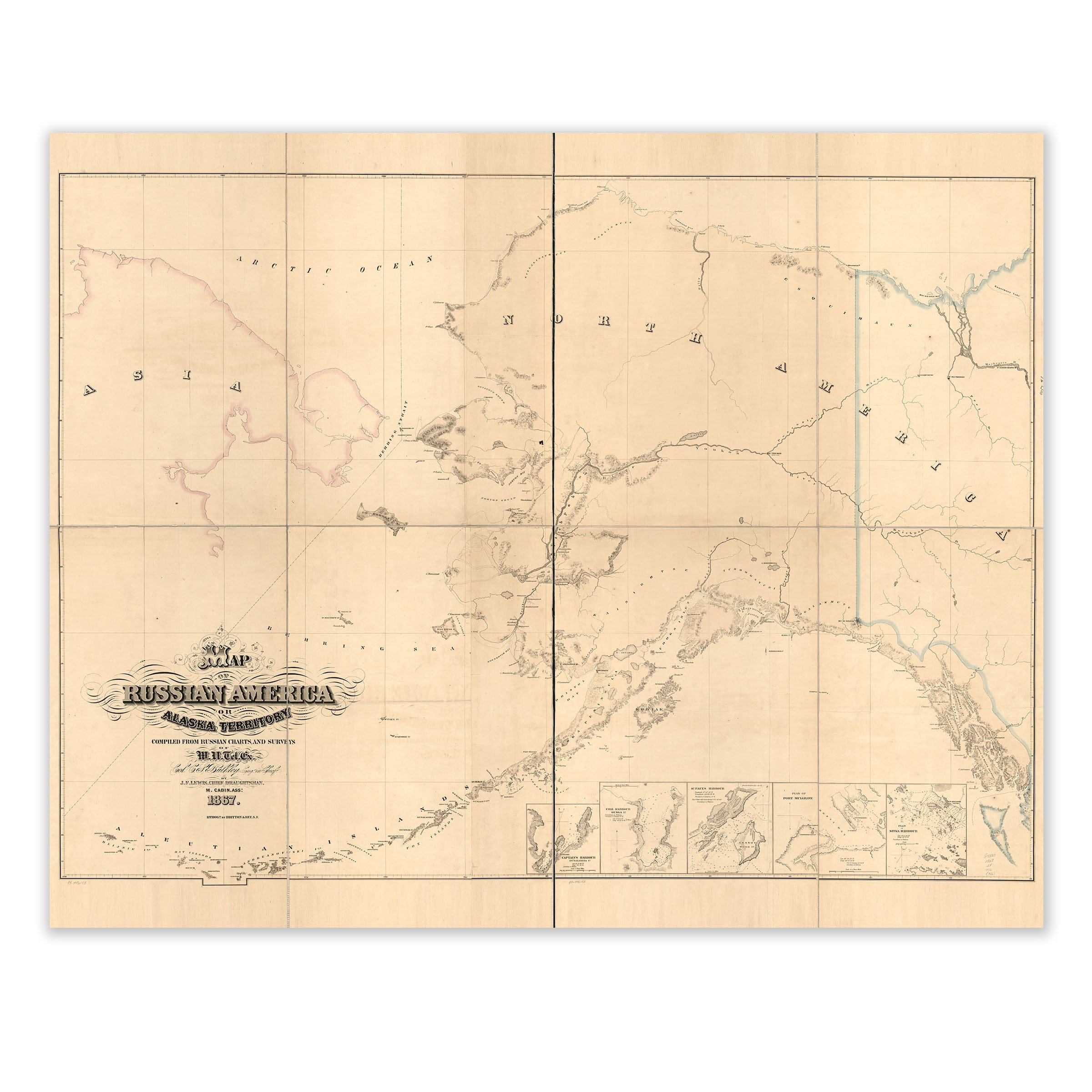
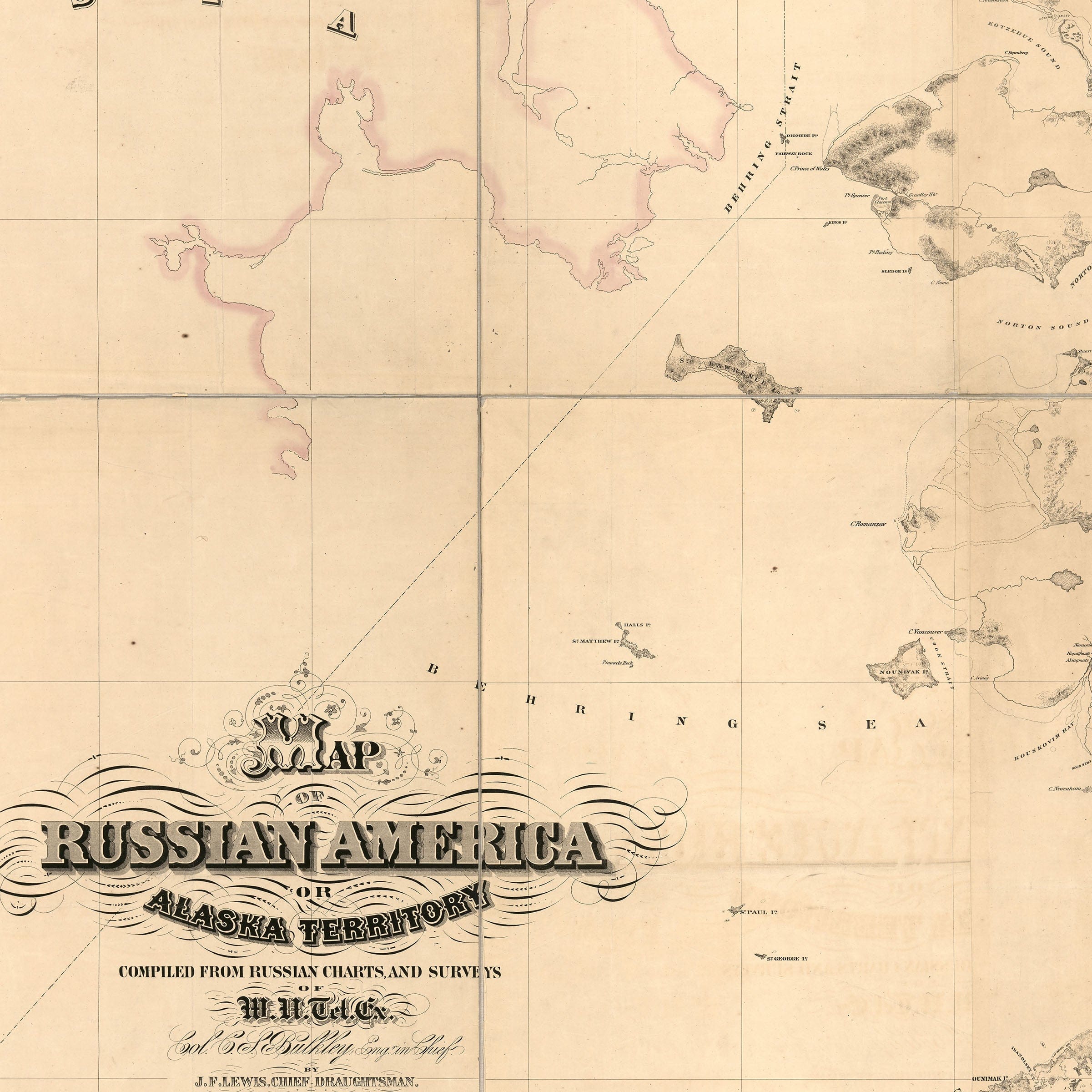
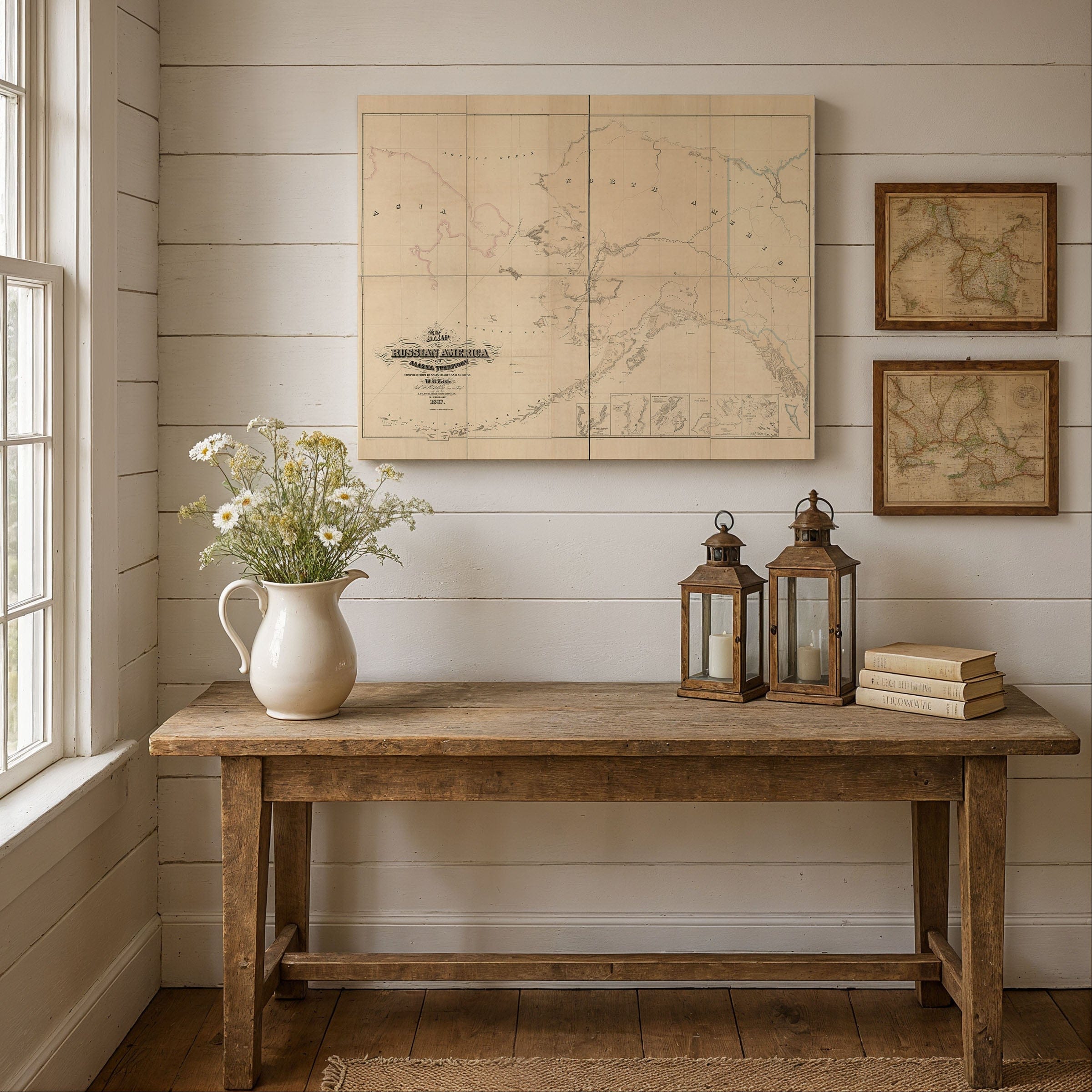
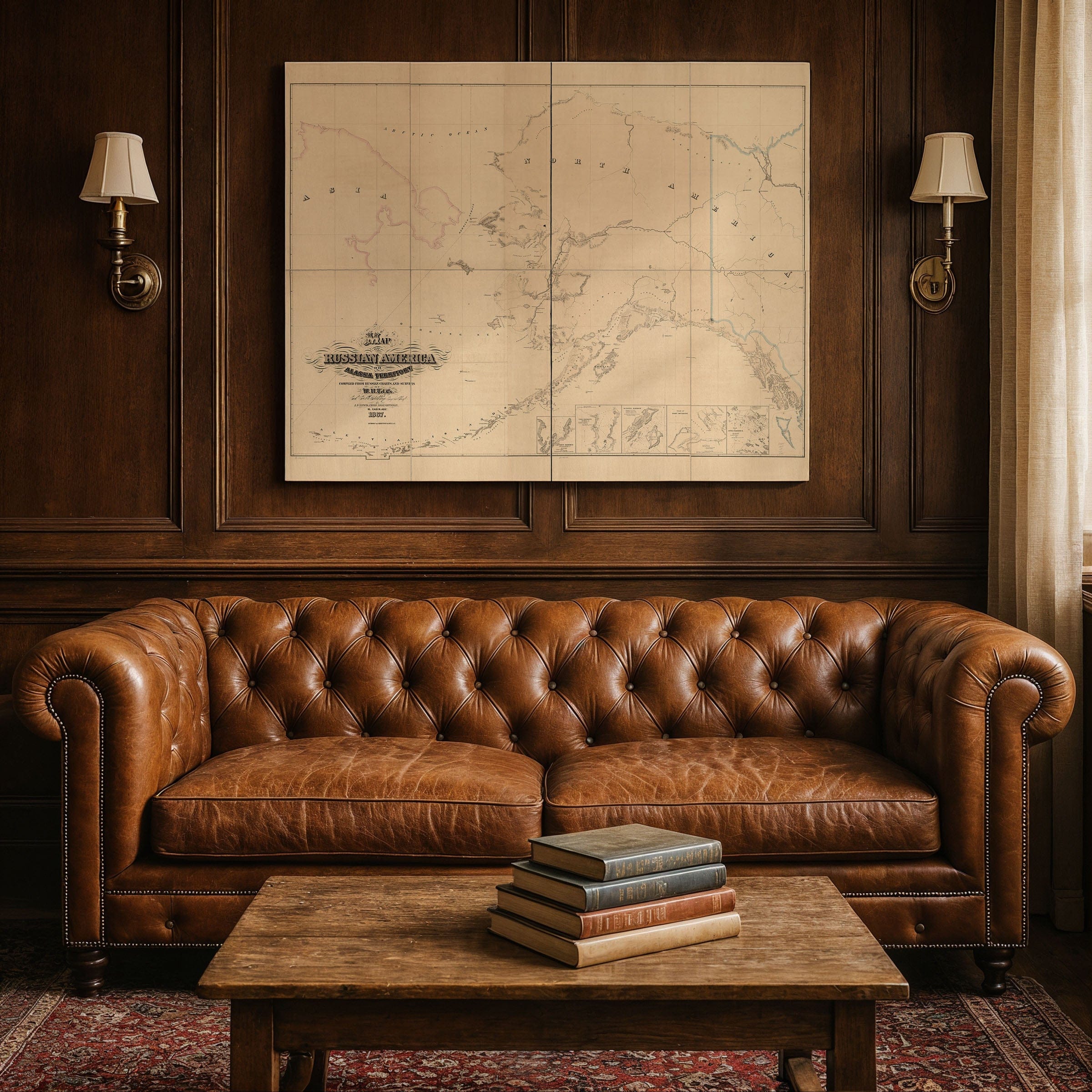
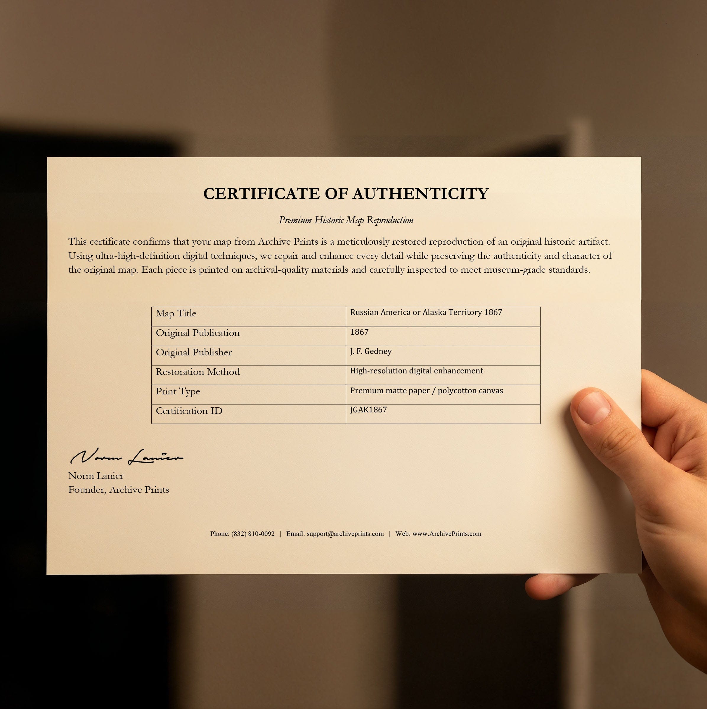
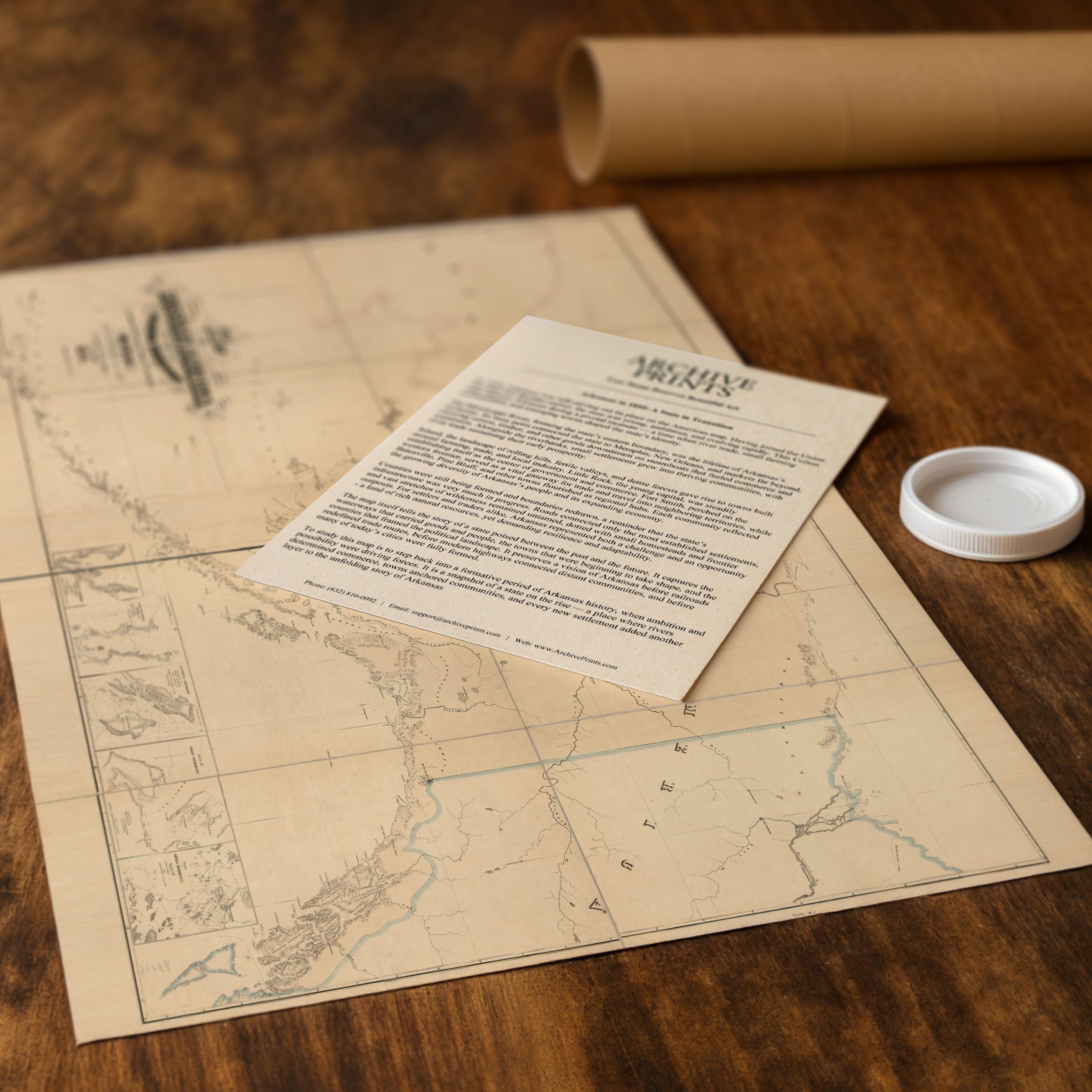
Step back to 1867 when this Vintage Alaska Map captured a territory at the crossroads of empires—remote, vast, and mysterious, it was a landscape on the brink of historic transformation. This isn't just a territorial survey—it's a portrait of Russian America at the exact moment the world's attention shifted toward the North Pacific. Published by J. F. Gedney and compiled from Russian surveys in the final year of Russia's colonial rule, this beautifully detailed map reveals Alaska only months before the United States would purchase it for $7.2 million, ushering in a new era filled with exploration, speculation, and the promise of undiscovered wealth. Spread across the northern frontier, this Vintage Alaska Map presents a sweeping vision of Russian America, stretching from the frozen Arctic coastline to the volcanic arc of the Aleutian Islands. Its precisely drawn shorelines, soundings, and coastal features reflect decades of careful Russian naval charting, evidence of an empire that relied heavily on maritime routes for trade, communication, and the lucrative fur industry. The Bering Sea and Gulf of Alaska—broad, cold, and meticulously rendered—served as arteries for ships carrying sea otter pelts, seal skins, and vital supplies between far-flung settlements and company stations. Yet inland, the map grows quiet. Vast spaces remain blank or sparsely annotated, revealing the limits of Russian penetration into the interior. Traces of ancient Indigenous trade paths and the occasional trader's route hint at a deeper human geography that Russian cartographers only partly understood. The bold sweep of the Yukon River stretches across the landscape, a natural highway that would later draw thousands during the great gold rushes at the turn of the century. Along the scattered coastal settlements—Sitka foremost among them—the imprint of Russian America appears in forts, missions, and trading posts clinging to the edge of a formidable wilderness. These were modest footholds, reminders of both ambition and fragility in a territory expensive to maintain and difficult to govern across such staggering distances. Each reproduction includes a custom historical letter detailing the story behind the map, making it perfect for collectors, historians, and Alaska enthusiasts. Printed on heavyweight archival paper or hand-stretched polycotton canvas, every coastline, settlement, and trading route is restored in museum-grade clarity for generations of enjoyment. Paper prints ship rolled in heavy-duty tubes, while canvas editions arrive gallery-wrapped on solid pine stretcher bars with pre-installed hardware—ready to display the moment it arrives. Bring home a piece of Alaska history and celebrate the territory that stood at the threshold of profound change.
The Map Story
Materials
Choose options

Because every place has a story
Make History Personal
A vintage map is more than art.
It is a reminder of where life began.
Where memories were made.
Where hearts still live. Give the gift of place.
Beautifully preserved and made for the moments that matter.
Why Choose Us?
| Feature | Us | Competitor A | Competitor B |
|---|---|---|---|
| Hand Crafted | |||
| Museum Quality | |||
| 100 Year Guarantee | |||
| Restored by Hand | |||
| Certificate of Authenticity |

Art Prints
Archival quality colors. Best option if you'd like to frame it yourself

The Best Materials
We hand-stretched our canvas on solid American-grown pine stretcher bars. We use quality canvas and fade-resistant inks to create the lasting art. Canvases come with hardware already installed and ready to hang.
Need help?
Frequently Asked Questions
Order
All of our maps are meticulously restored reproductions of historic originals. Each piece is digitally repaired and color-corrected to bring out the finest details while preserving its authentic, vintage character.
Yes. All Archive Prints products are printed to order in the USA with archival materials.
We offer two premium formats:
- High-Quality Paper Posters – Printed on thick, archival-grade matte paper for rich, vibrant detail.
- Hand-Stretched Canvas Prints – Printed on premium polycotton canvas and mounted on 1.5" solid American pine stretcher bars for a gallery-quality finish.
We carefully digitally restore each map to enhance clarity and color while preserving its original look and historic charm. You’ll enjoy sharp details and a timeless vintage aesthetic that feels true to the original piece.
Yes, we do! We offer premium framing options to make your map ready to hang the moment it arrives. You can choose from Oak, Maple, Black, or Walnut frames directly on the product page. We also offer Stretched Canvas prints for a modern gallery look, as well as archival-quality Posters if you prefer to frame it yourself.
Yes! We offer free shipping on all products within the United States. Each map is carefully packaged to ensure it arrives in perfect condition.
If you’re not completely satisfied, you can return your order in new condition for a full refund. Return shipping costs are the responsibility of the customer.
Absolutely! Our maps make thoughtful, one-of-a-kind gifts for history lovers, map collectors, or anyone looking to add vintage character to their home or office. Choose between paper prints for framing or stretched canvas for a ready-to-hang presentation.
- Paper Posters → Shipped in durable, protective tubes to prevent creasing.
- Canvas Prints → Carefully wrapped, padded, and boxed to ensure safe delivery.
Our maps look stunning in a variety of settings, including:
- Living rooms and home offices
- Libraries and studies
- Corporate offices and conference rooms
- Restaurants, cafes, and boutique spaces