
Vintage Ireland Map c. 1900 - Turn of Century Survey
Vintage Ireland Map 1900 - Turn of Century Survey
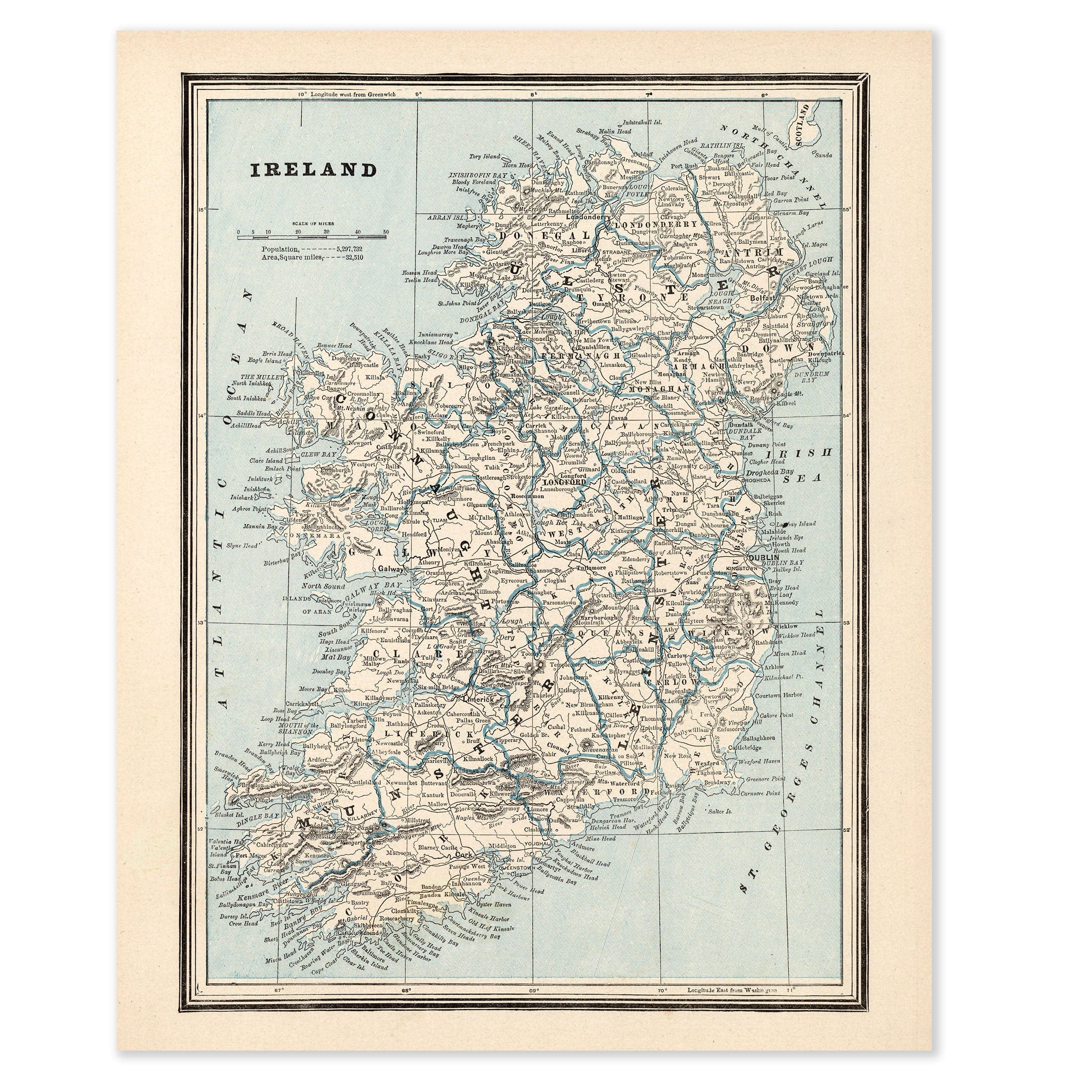
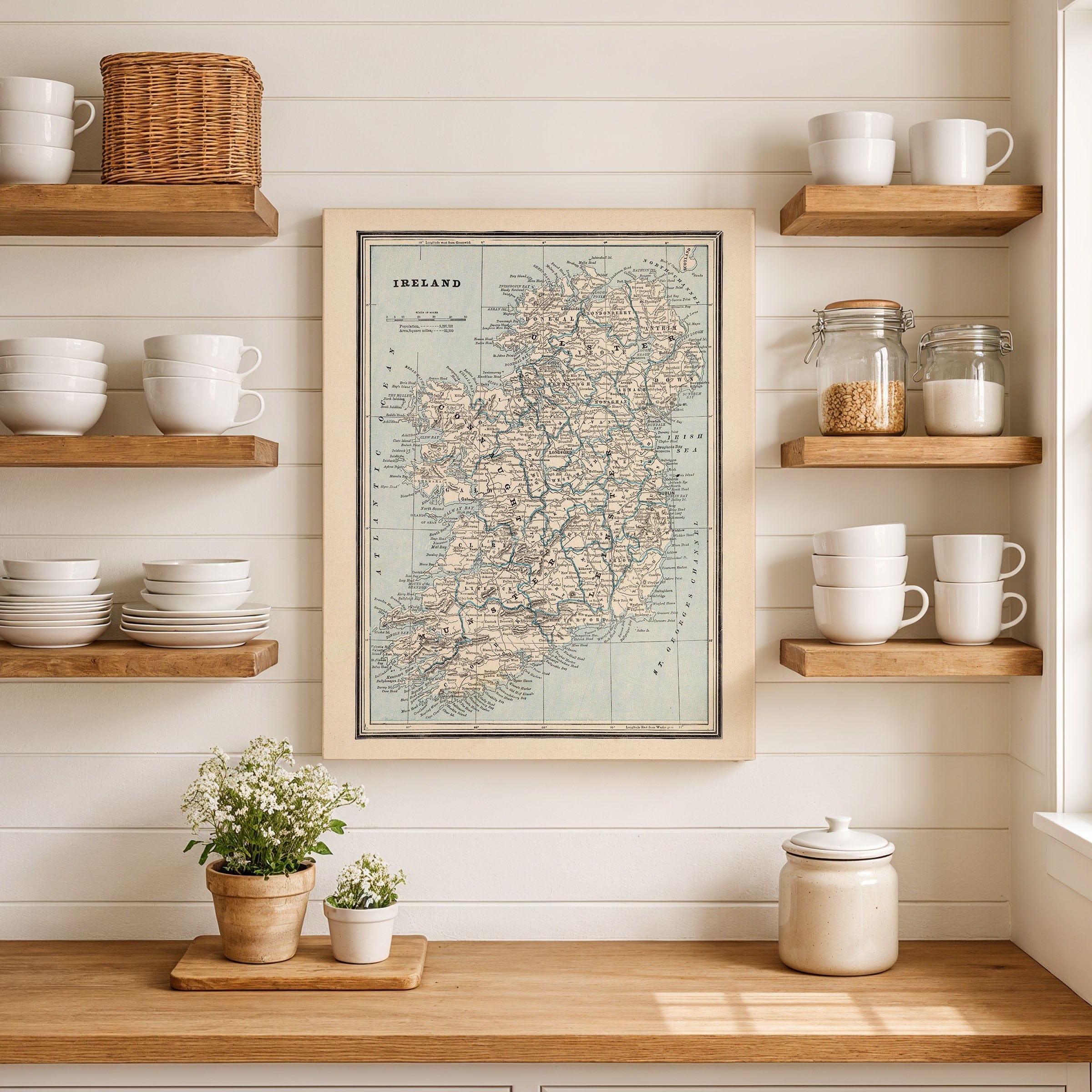
Explore the Emerald Isle at a pivotal moment with this detailed Vintage Ireland Map from circa 1900, presenting Ireland with scientific clarity at the turn of the twentieth century. This extraordinary Vintage Ireland Map captures the island when it remained within the United Kingdom yet was increasingly conscious of its own identity, with counties, rivers, railways, and towns carefully rendered in an era of precision and progress.
This comprehensive Vintage Ireland Map reveals Ireland's deeply rooted regional structure across Ulster, Leinster, Munster, and Connacht. Dublin anchors the east as the administrative and commercial center, while Belfast stands out in the northeast as a rapidly industrializing hub of shipbuilding and manufacturing. The Shannon River and other waterways cut through the landscape as vital arteries of movement and agriculture.
Rail connections on this Vintage Ireland Map bind even remote districts to coastal ports, illustrating modern transportation's growing reach. The rugged western coast of Connacht and Munster tells a different story—peninsulas, islands, and sparse networks reflecting communities shaped by fishing, farming, and emigration in the decades following the Great Famine.
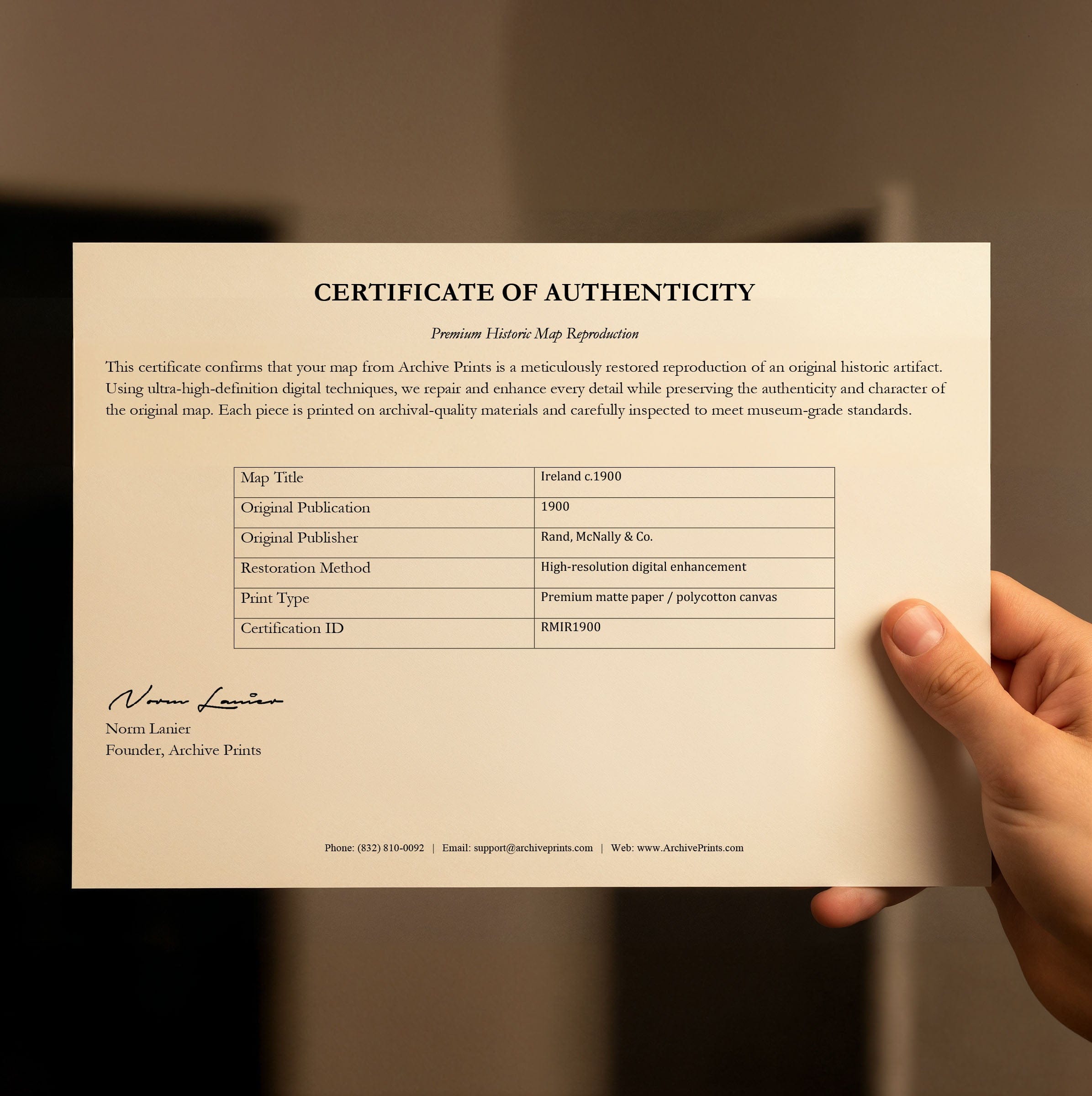
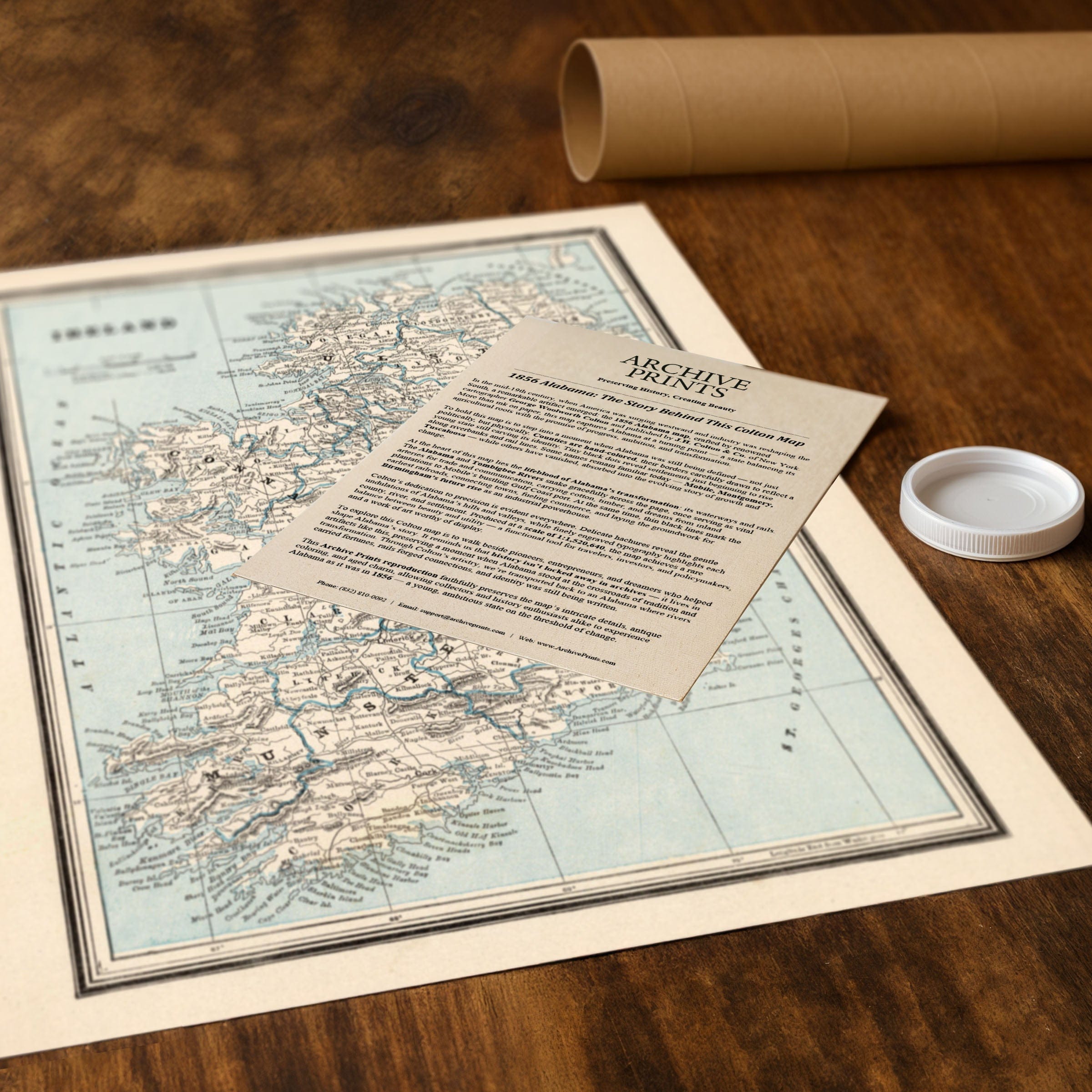
Each reproduction includes a custom historical letter detailing the map's significance, making it perfect for collectors, [location] history enthusiasts, and anyone with [region] connections. Printed on heavyweight archival paper or premium canvas, every [relevant detail] is preserved with museum-quality clarity through expert digital restoration.
For protection and presentation, paper prints arrive rolled in sturdy mailing tubes, while canvas prints come gallery-wrapped on solid pine stretcher bars with pre-installed hanging hardware. Framed prints are protected under crystal-clear acrylic and arrive ready to hang—perfect for immediate display.
Perfect for those with Irish heritage, Celtic history enthusiasts, genealogy researchers, and anyone fascinated by turn-of-century cartography, this museum-quality reproduction of the Vintage Ireland Map brings Ireland at the threshold of transformation to stunning life.
The Map Story
Materials
Choose options

Because every place has a story
Make History Personal
A vintage map is more than art.
It is a reminder of where life began.
Where memories were made.
Where hearts still live. Give the gift of place.
Beautifully preserved and made for the moments that matter.
Why Choose Us?
| Feature | Us | Competitor A | Competitor B |
|---|---|---|---|
| Hand Crafted | |||
| Museum Quality | |||
| 100 Year Guarantee | |||
| Restored by Hand | |||
| Certificate of Authenticity |

Art Prints
Archival quality colors. Best option if you'd like to frame it yourself

The Best Materials
We hand-stretched our canvas on solid American-grown pine stretcher bars. We use quality canvas and fade-resistant inks to create the lasting art. Canvases come with hardware already installed and ready to hang.
Need help?
Frequently Asked Questions
Order
All of our maps are meticulously restored reproductions of historic originals. Each piece is digitally repaired and color-corrected to bring out the finest details while preserving its authentic, vintage character.
Yes. All Archive Prints products are printed to order in the USA with archival materials.
We offer two premium formats:
- High-Quality Paper Posters – Printed on thick, archival-grade matte paper for rich, vibrant detail.
- Hand-Stretched Canvas Prints – Printed on premium polycotton canvas and mounted on 1.5" solid American pine stretcher bars for a gallery-quality finish.
We carefully digitally restore each map to enhance clarity and color while preserving its original look and historic charm. You’ll enjoy sharp details and a timeless vintage aesthetic that feels true to the original piece.
Yes, we do! We offer premium framing options to make your map ready to hang the moment it arrives. You can choose from Oak, Maple, Black, or Walnut frames directly on the product page. We also offer Stretched Canvas prints for a modern gallery look, as well as archival-quality Posters if you prefer to frame it yourself.
Yes! We offer free shipping on all products within the United States. Each map is carefully packaged to ensure it arrives in perfect condition.
If you’re not completely satisfied, you can return your order in new condition for a full refund. Return shipping costs are the responsibility of the customer.
Absolutely! Our maps make thoughtful, one-of-a-kind gifts for history lovers, map collectors, or anyone looking to add vintage character to their home or office. Choose between paper prints for framing or stretched canvas for a ready-to-hang presentation.
- Paper Posters → Shipped in durable, protective tubes to prevent creasing.
- Canvas Prints → Carefully wrapped, padded, and boxed to ensure safe delivery.
Our maps look stunning in a variety of settings, including:
- Living rooms and home offices
- Libraries and studies
- Corporate offices and conference rooms
- Restaurants, cafes, and boutique spaces