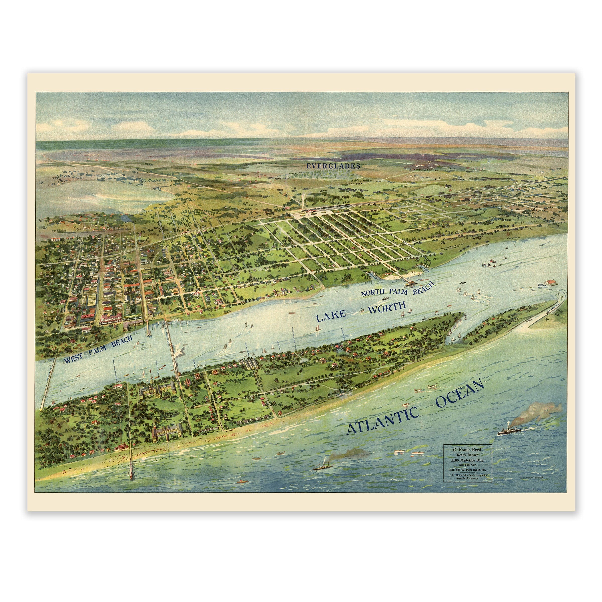
West Palm Beach Vintage Map 1915 - Antique Panoramic Bird's Eye View of Florida
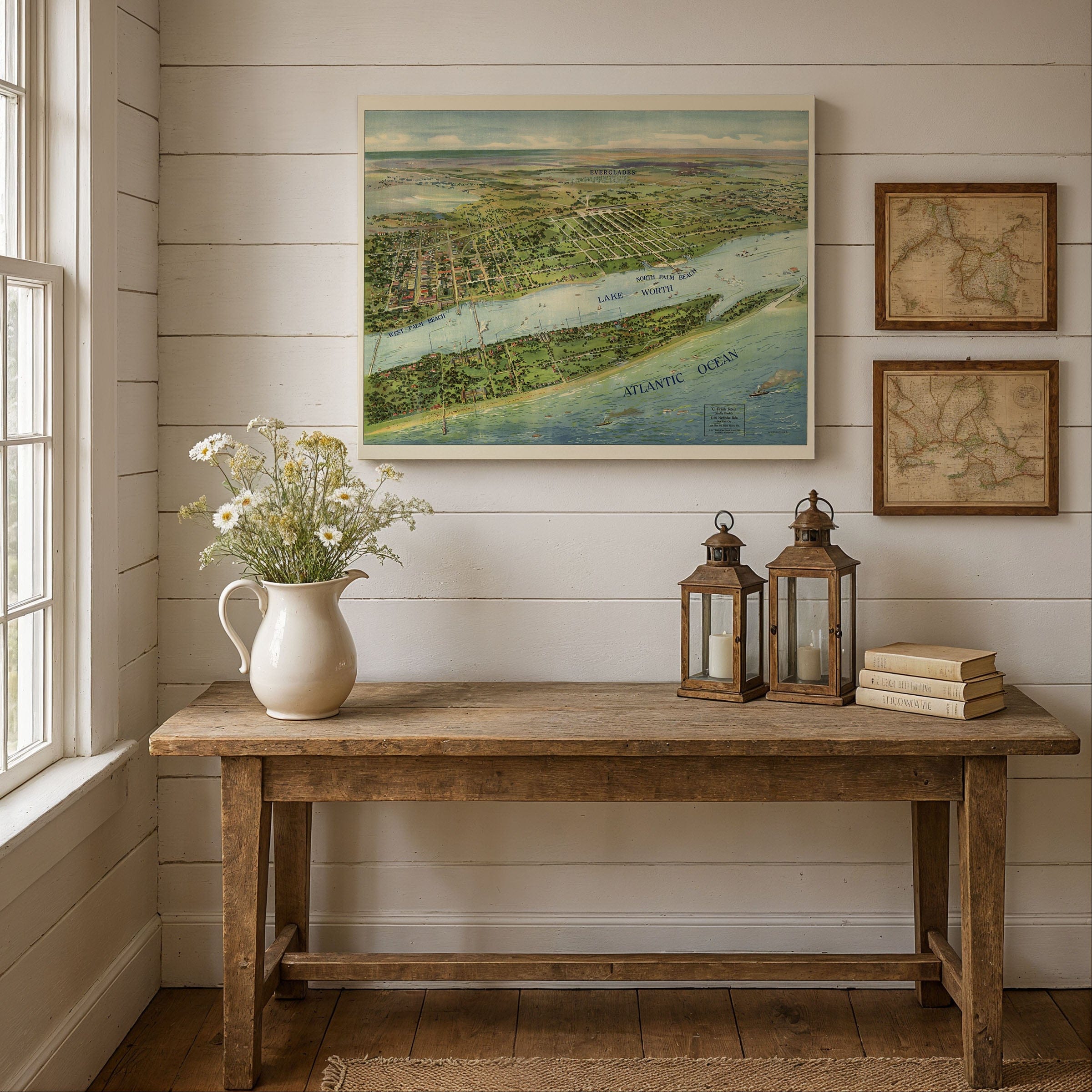
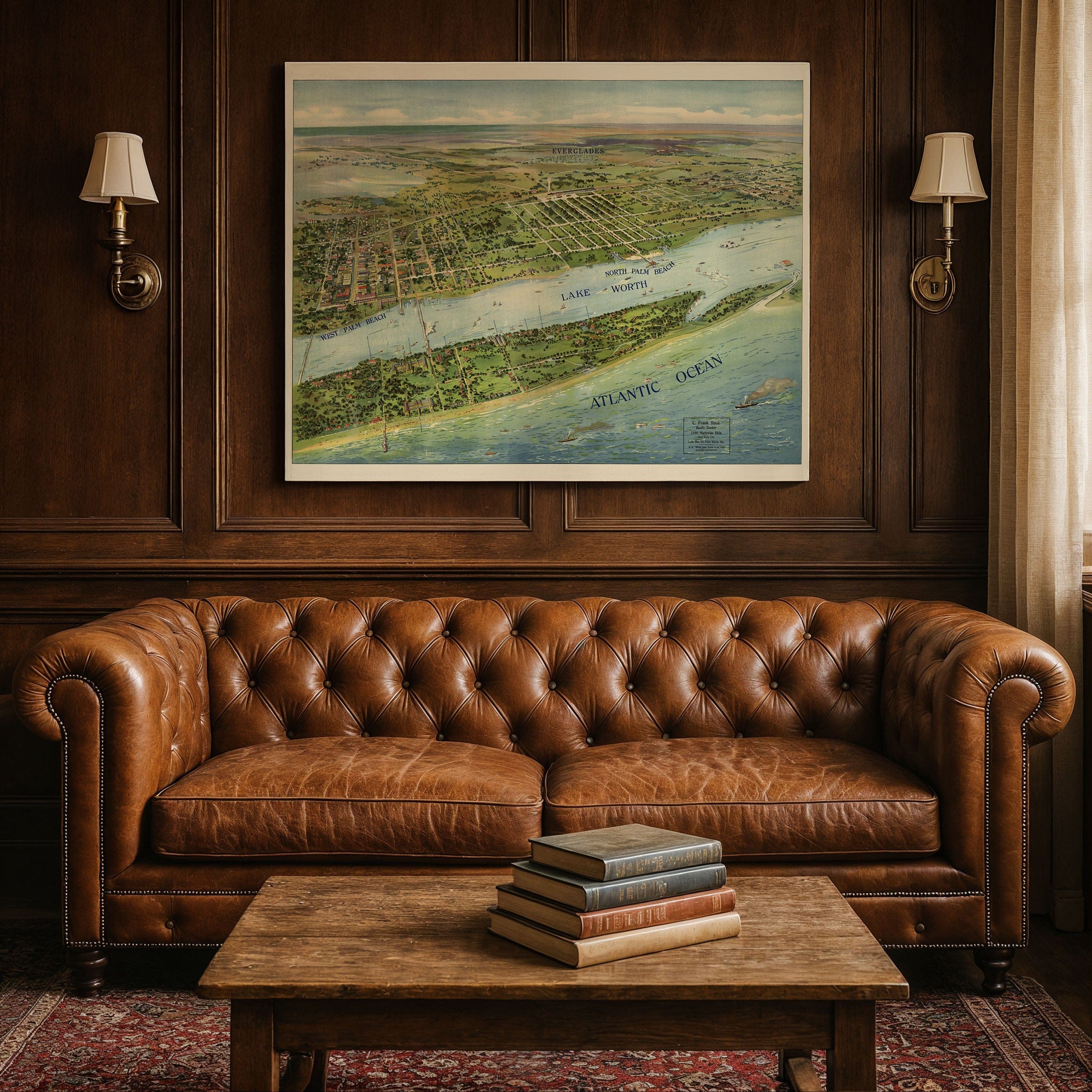
Discover early 20th-century Florida with this captivating 1915 panoramic view of West Palm Beach, North Palm Beach, and Lake Worth by W. K. Pleuthner. Created during Florida's early boom years, this sweeping bird's-eye perspective captures the coastline and inland towns when Palm Beach County was just beginning to draw attention for its promise of sunshine, opportunity, and vacation paradise.
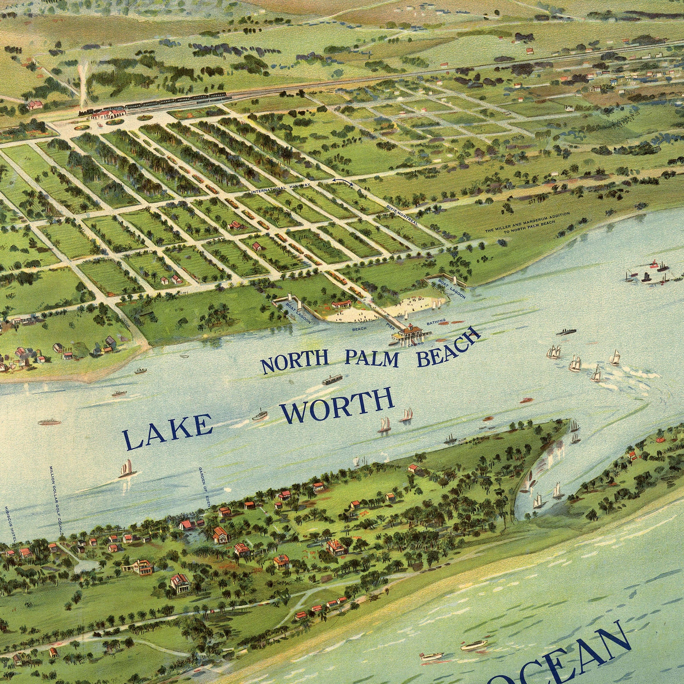
The Atlantic coastline dominates one edge, with beaches, piers, and waterways defining where land meets sea. Inland features—lakes, canals, and roads—fan out behind the waterfront towns, revealing West Palm Beach, North Palm Beach, and Lake Worth in a symphony of streets, blocks, and developing neighborhoods. Elegant homes dot the streets near the water, while inland areas remain sparse, indicating abundant room for growth and expansion. The detailed water infrastructure—lakes, canals, drainage systems—reflects the engineering challenges of building on Florida's marshland and the ambitious land reclamation projects that made coastal development possible.
As promotional cartography, Pleuthner's map sells both place and potential. Every detail entices prospective buyers, settlers, and tourists: the coastal appeal, proximity to water, spaciousness, and the promise of paradise by the sea. Yet behind that visual promise lay real challenges. In 1915, much of Florida's infrastructure remained primitive—unpaved roads, unreliable bridges, and limited utilities. This map participated in the promotional campaigns that would transform the region, capturing Palm Beach County at a pivotal moment before the boom years permanently changed the skyline.
Each reproduction includes a custom historical letter detailing the story behind the map, making it perfect for West Palm Beach residents, Florida history enthusiasts, real estate historians, and anyone who loves vintage panoramic maps. Printed on heavyweight archival paper or hand-stretched polycotton canvas, every street, waterway, and coastal detail is restored in museum-grade clarity for generations of enjoyment.
Paper prints ship rolled in heavy-duty tubes, while canvas editions arrive gallery-wrapped on solid pine stretcher bars with pre-installed hardware—ready to display the moment it arrives. Bring home this vision of early Florida and celebrate the origins of Palm Beach County.
The Map Story
Materials
Choose options

Because every place has a story
Make History Personal
A vintage map is more than art.
It is a reminder of where life began.
Where memories were made.
Where hearts still live. Give the gift of place.
Beautifully preserved and made for the moments that matter.
Why Choose Us?
| Feature | Us | Competitor A | Competitor B |
|---|---|---|---|
| Hand Crafted | |||
| Museum Quality | |||
| 100 Year Guarantee | |||
| Restored by Hand | |||
| Certificate of Authenticity |

Art Prints
Archival quality colors. Best option if you'd like to frame it yourself

The Best Materials
We hand-stretched our canvas on solid American-grown pine stretcher bars. We use quality canvas and fade-resistant inks to create the lasting art. Canvases come with hardware already installed and ready to hang.
Need help?
Frequently Asked Questions
Order
All of our maps are meticulously restored reproductions of historic originals. Each piece is digitally repaired and color-corrected to bring out the finest details while preserving its authentic, vintage character.
Yes. All Archive Prints products are printed to order in the USA with archival materials.
We offer two premium formats:
- High-Quality Paper Posters – Printed on thick, archival-grade matte paper for rich, vibrant detail.
- Hand-Stretched Canvas Prints – Printed on premium polycotton canvas and mounted on 1.5" solid American pine stretcher bars for a gallery-quality finish.
We carefully digitally restore each map to enhance clarity and color while preserving its original look and historic charm. You’ll enjoy sharp details and a timeless vintage aesthetic that feels true to the original piece.
Yes, we do! We offer premium framing options to make your map ready to hang the moment it arrives. You can choose from Oak, Maple, Black, or Walnut frames directly on the product page. We also offer Stretched Canvas prints for a modern gallery look, as well as archival-quality Posters if you prefer to frame it yourself.
Yes! We offer free shipping on all products within the United States. Each map is carefully packaged to ensure it arrives in perfect condition.
If you’re not completely satisfied, you can return your order in new condition for a full refund. Return shipping costs are the responsibility of the customer.
Absolutely! Our maps make thoughtful, one-of-a-kind gifts for history lovers, map collectors, or anyone looking to add vintage character to their home or office. Choose between paper prints for framing or stretched canvas for a ready-to-hang presentation.
- Paper Posters → Shipped in durable, protective tubes to prevent creasing.
- Canvas Prints → Carefully wrapped, padded, and boxed to ensure safe delivery.
Our maps look stunning in a variety of settings, including:
- Living rooms and home offices
- Libraries and studies
- Corporate offices and conference rooms
- Restaurants, cafes, and boutique spaces