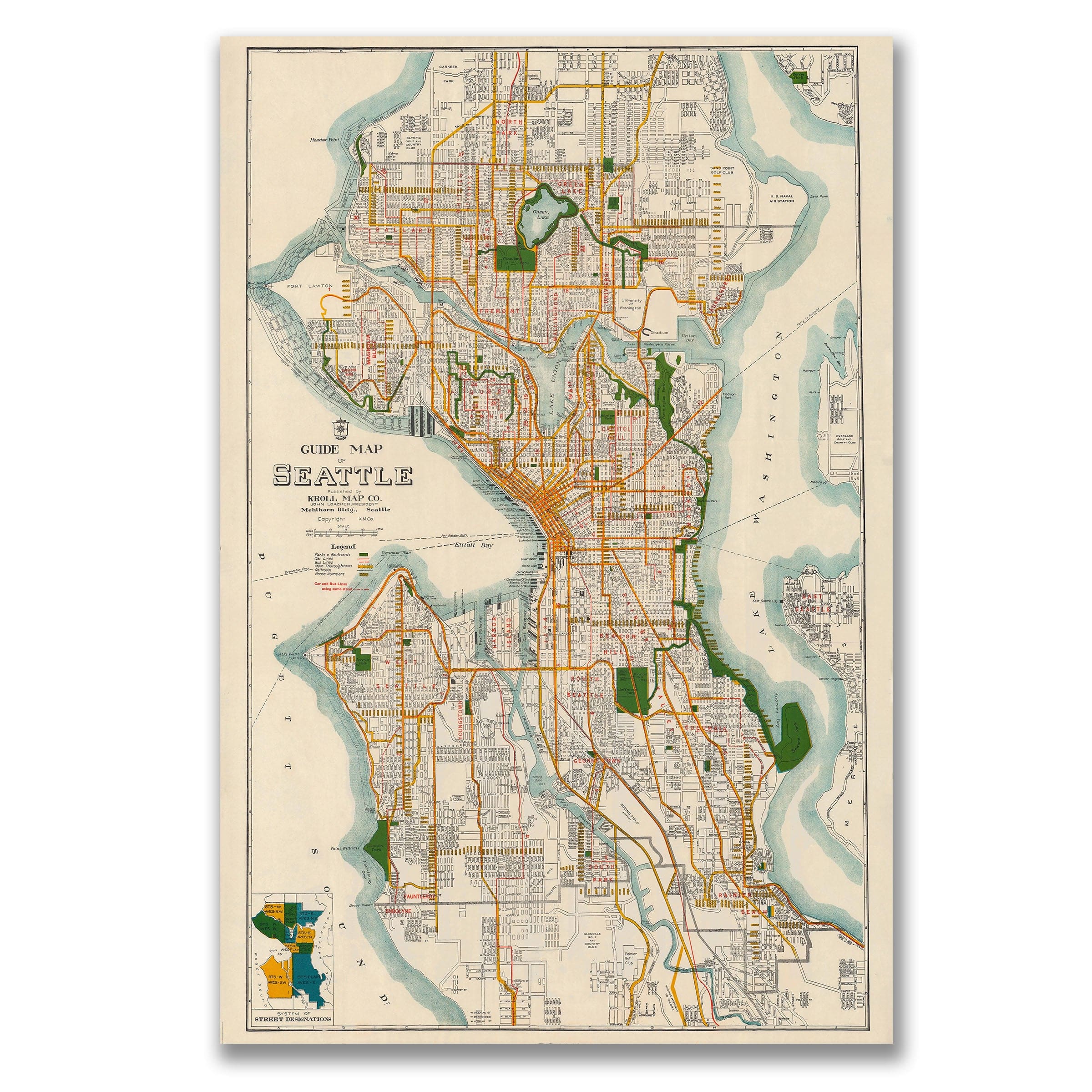
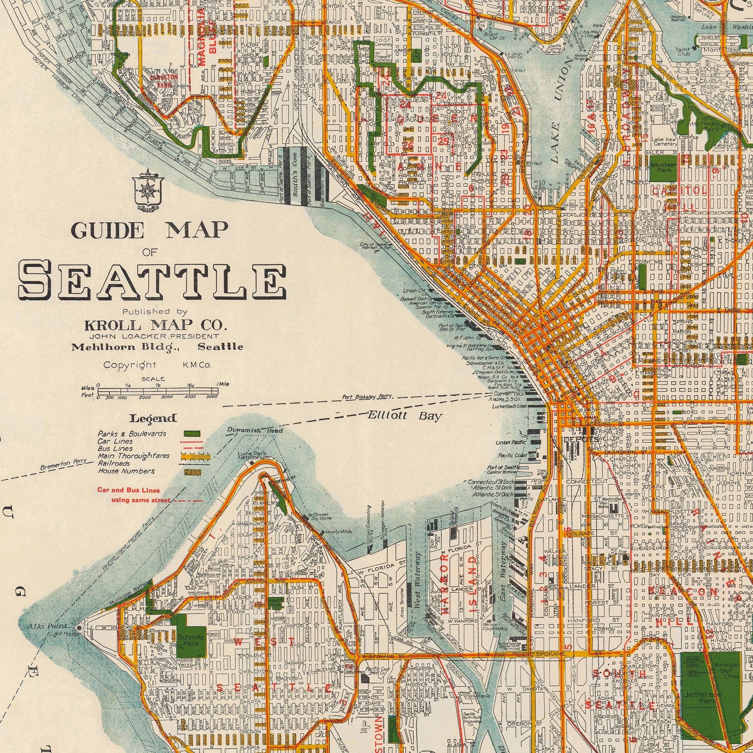
Vintage Guide Map of Seattle 1929 - Emerald City Survey
Sale priceFrom $34.00
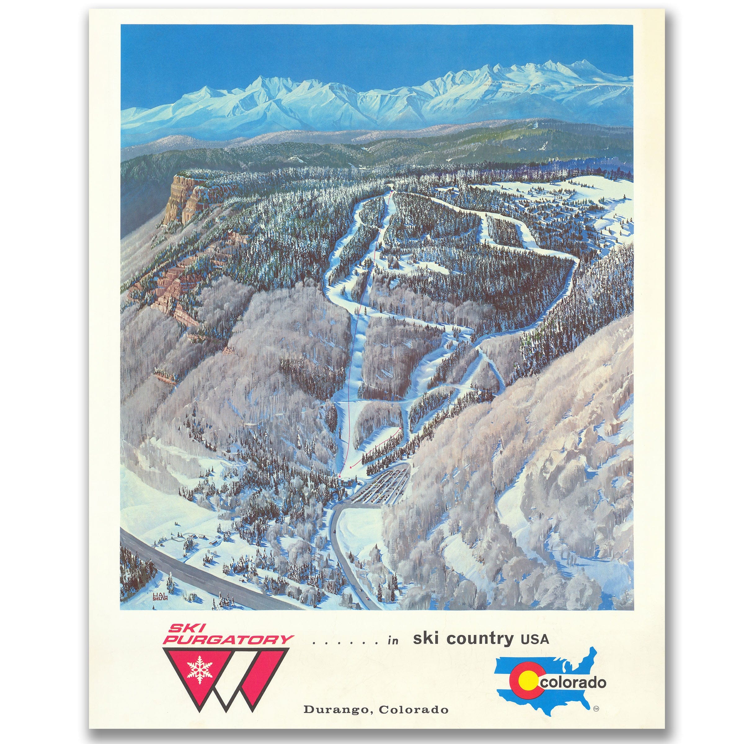

Purgatory Ski Resort Map, Durango, Colorado c. 1970s - Trail Map
Sale priceFrom $34.00
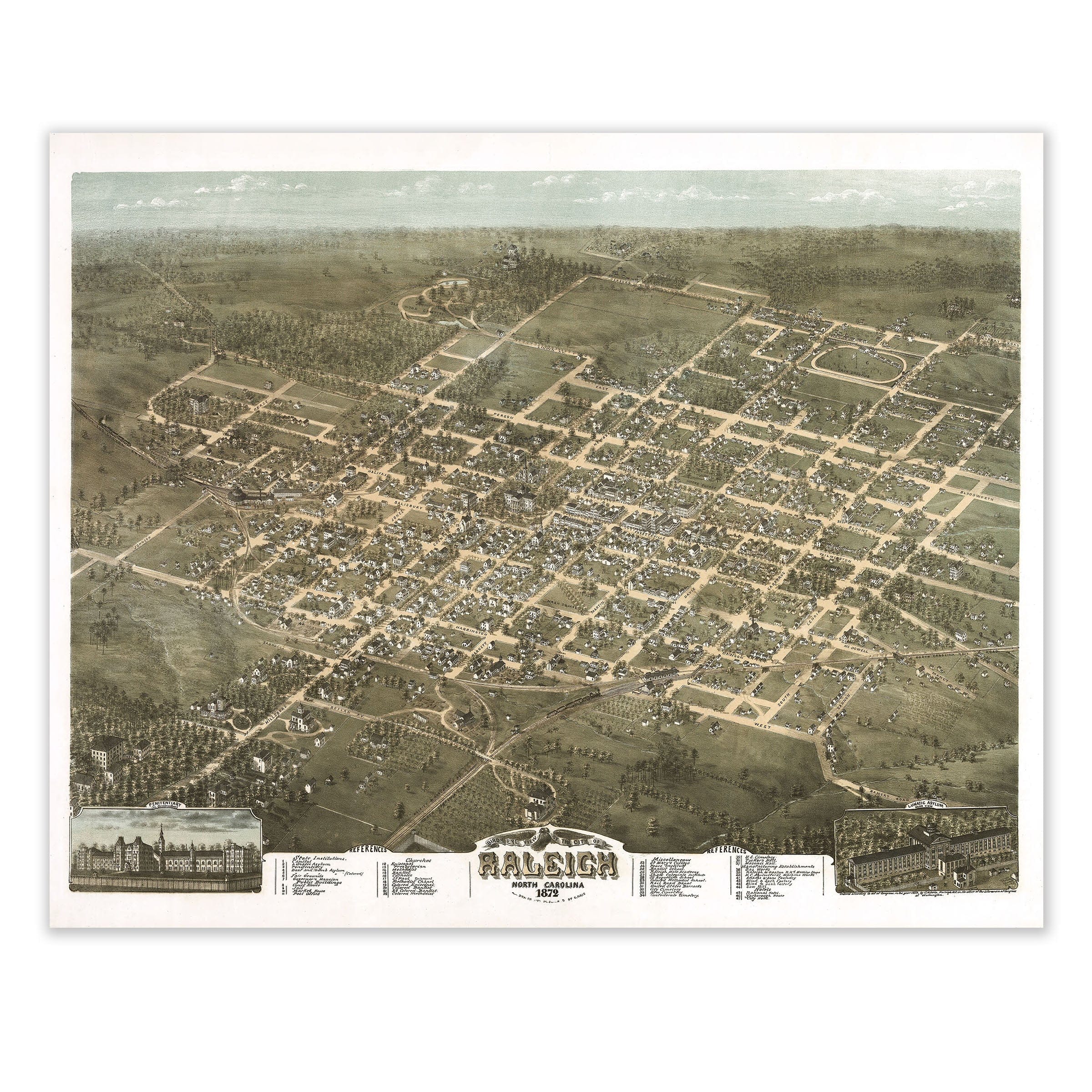
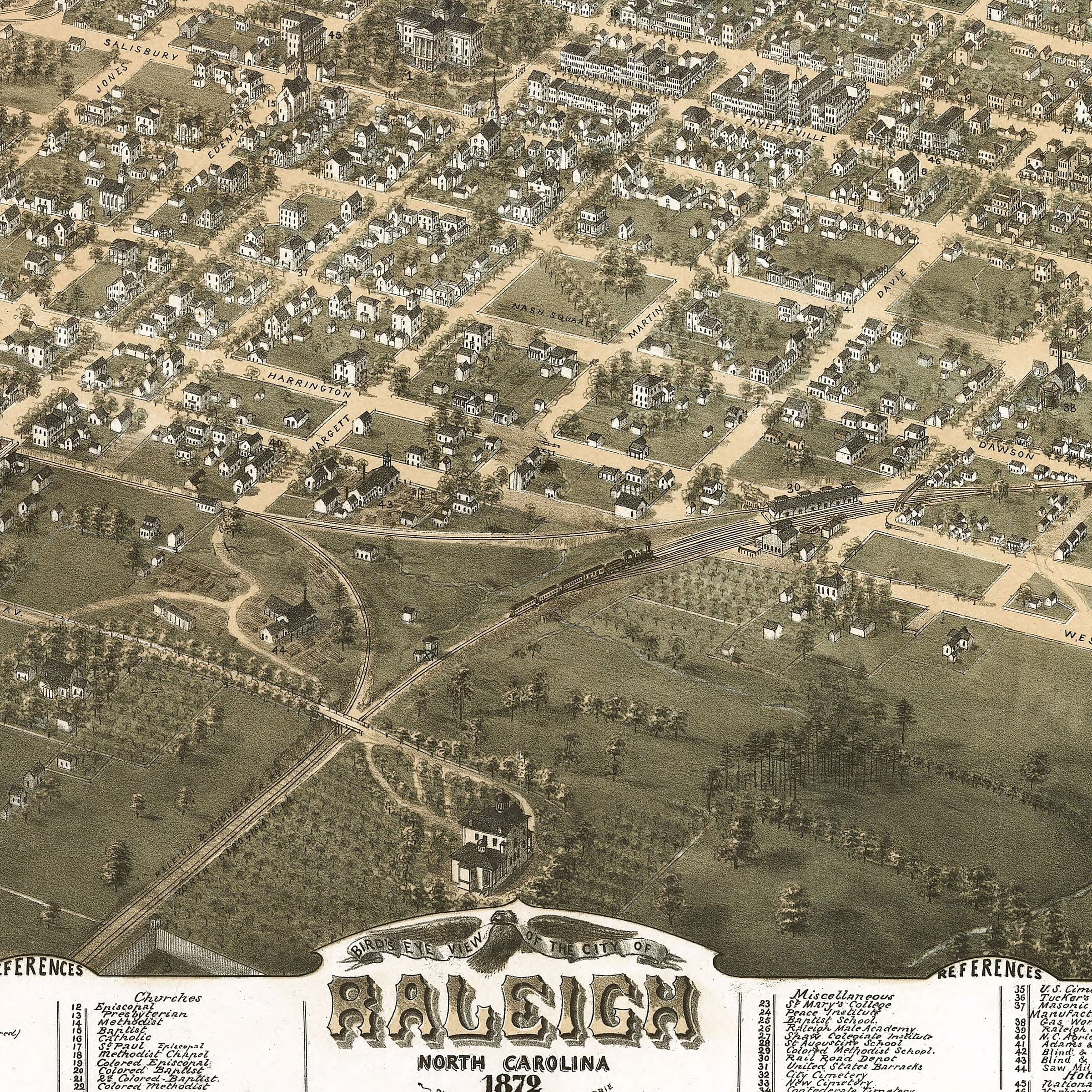
Raleigh, North Carolina Vintage Map 1872 - Bird's Eye View
Sale priceFrom $34.00
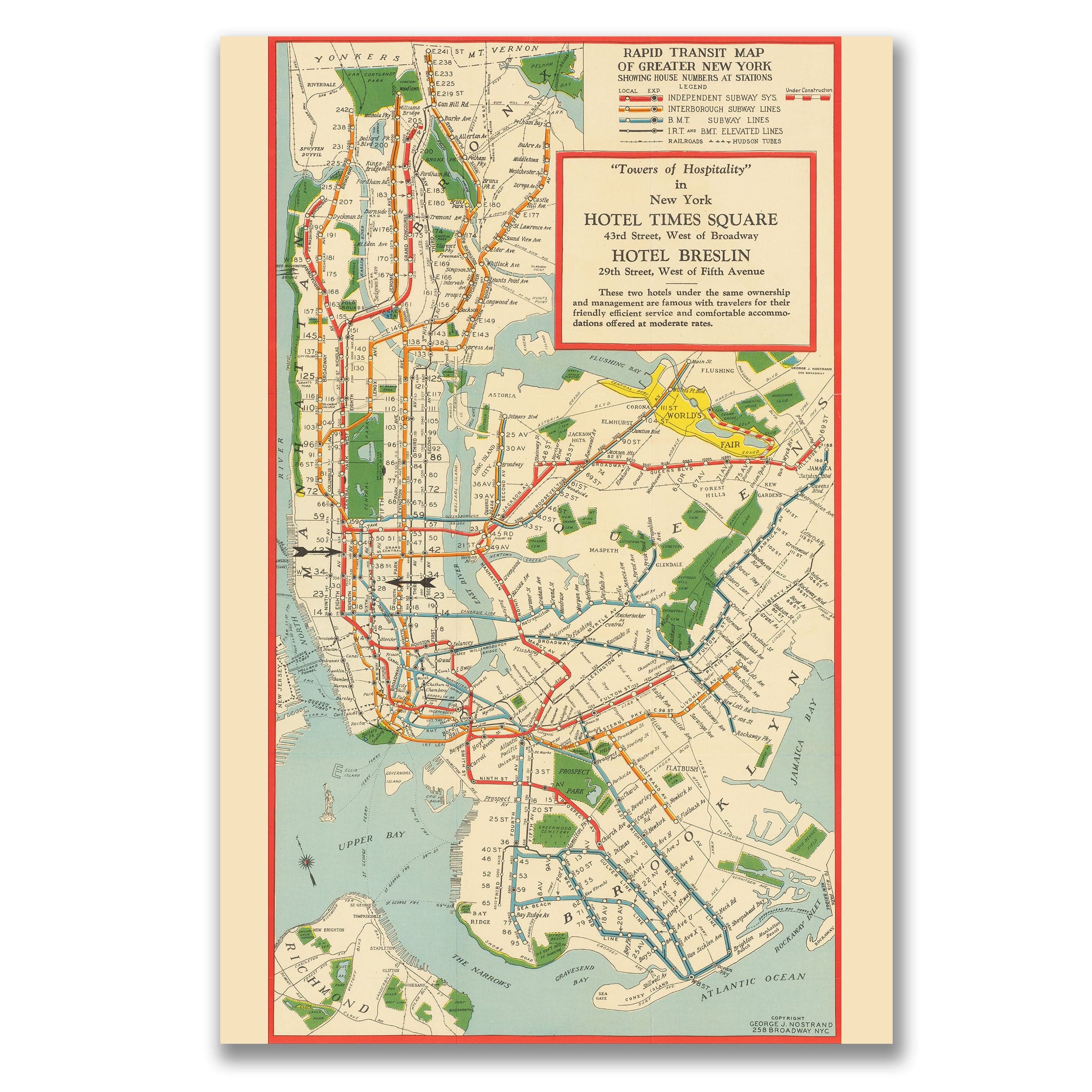
Rapid Transit Vintage Map of Greater New York 1939 - Subway Map
Sale priceFrom $34.00
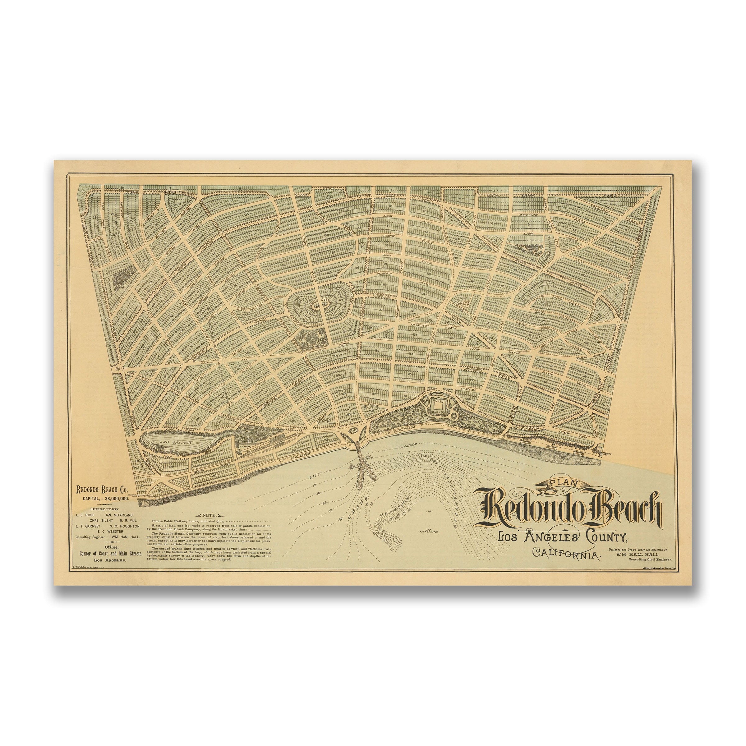
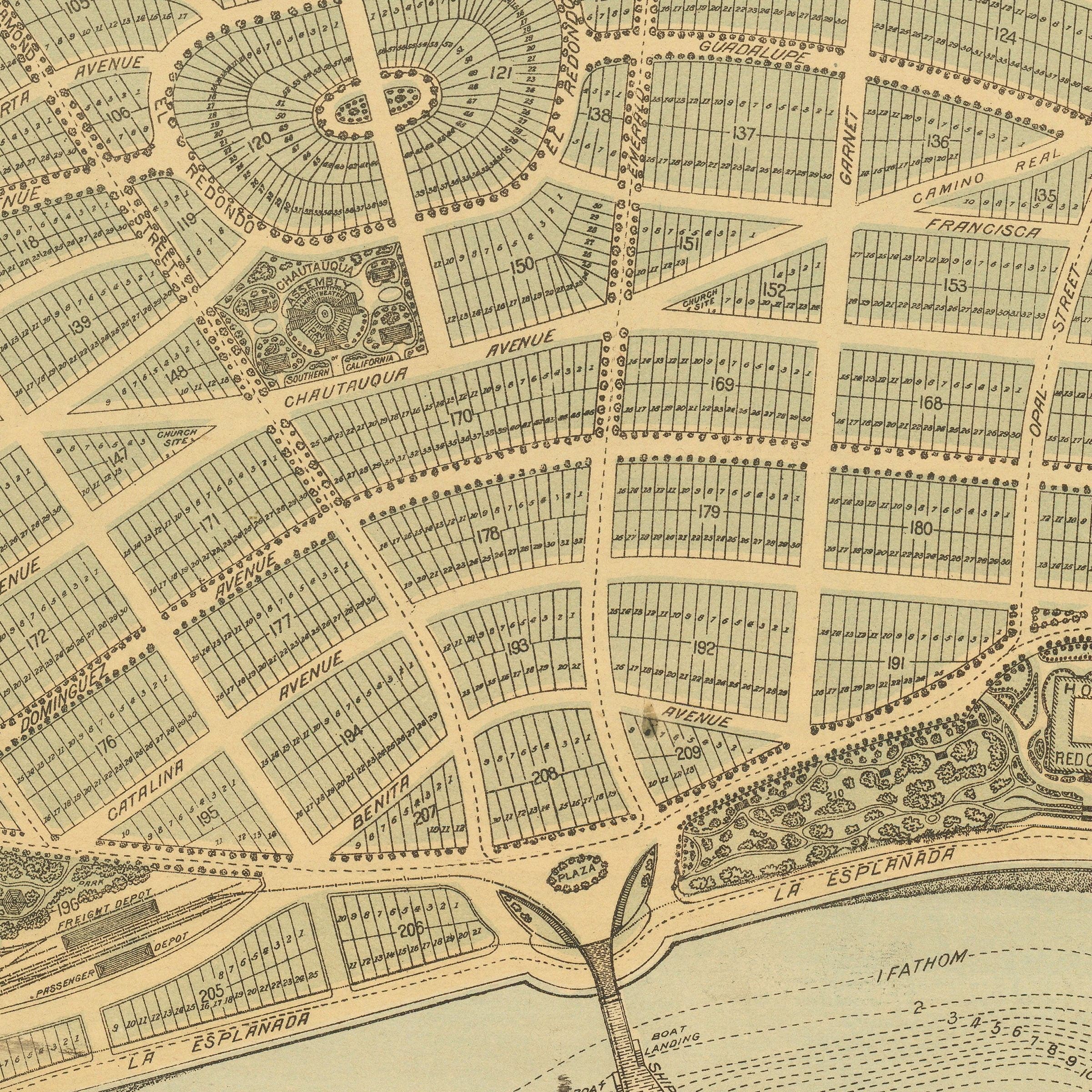
Redondo Beach, California Vintage Map 1887 - Bird's Eye View
Sale priceFrom $34.00
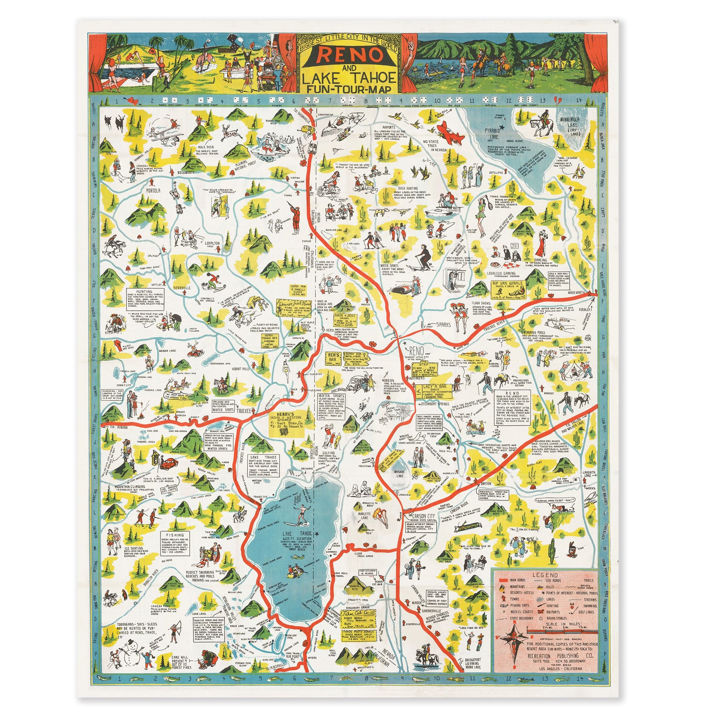
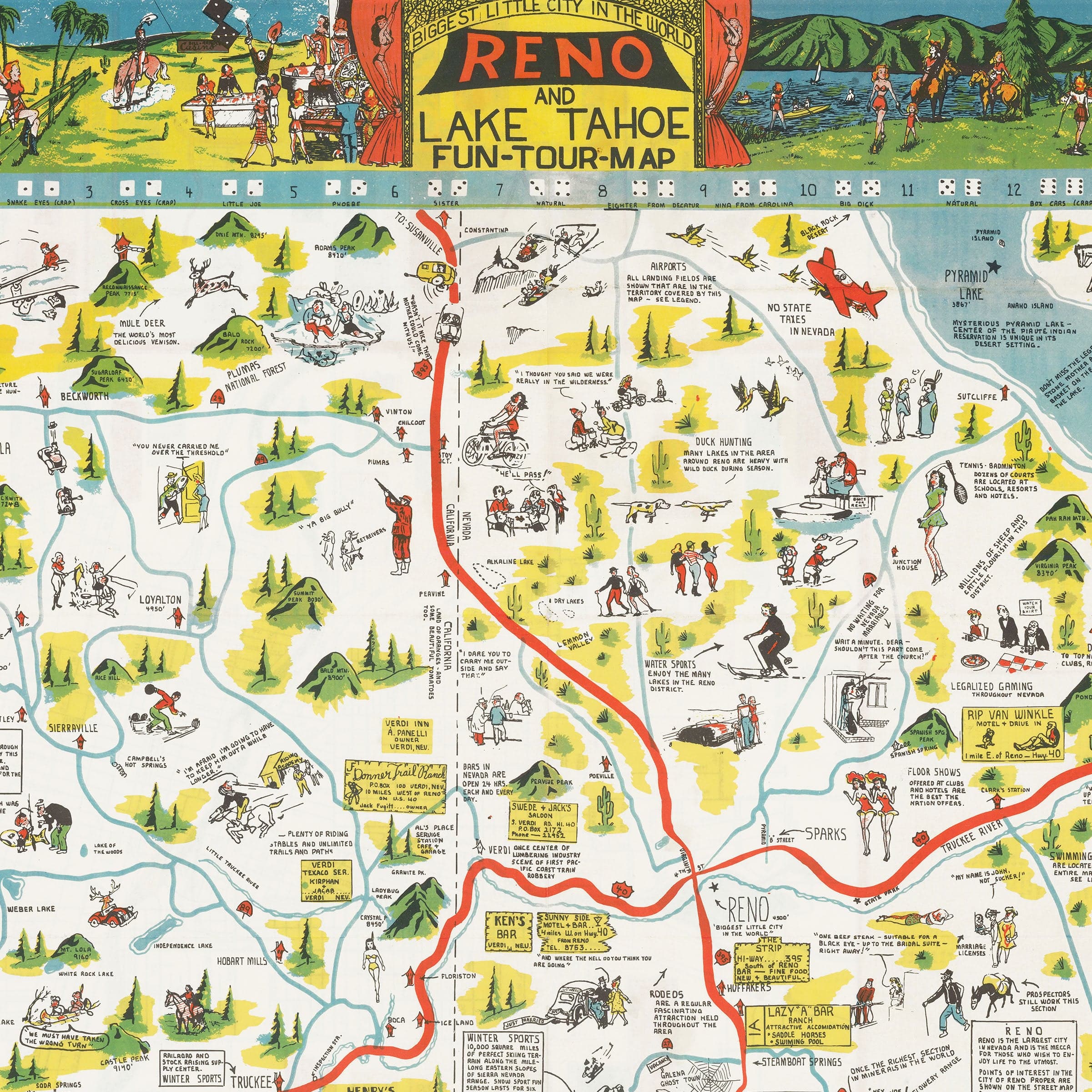
Reno & Lake Tahoe Vintage Map 1956 - Sierra Nevada Pictorial
Sale priceFrom $34.00
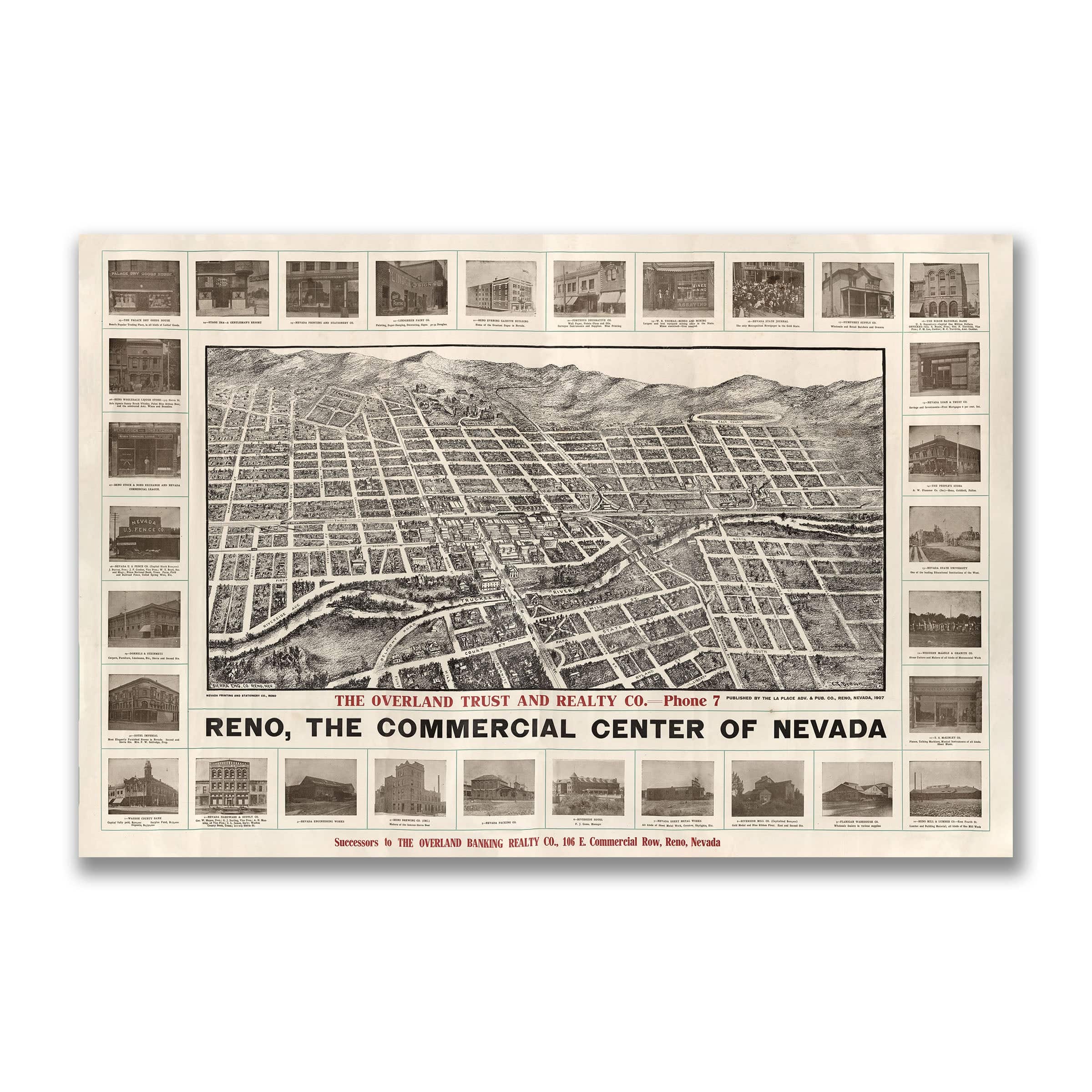
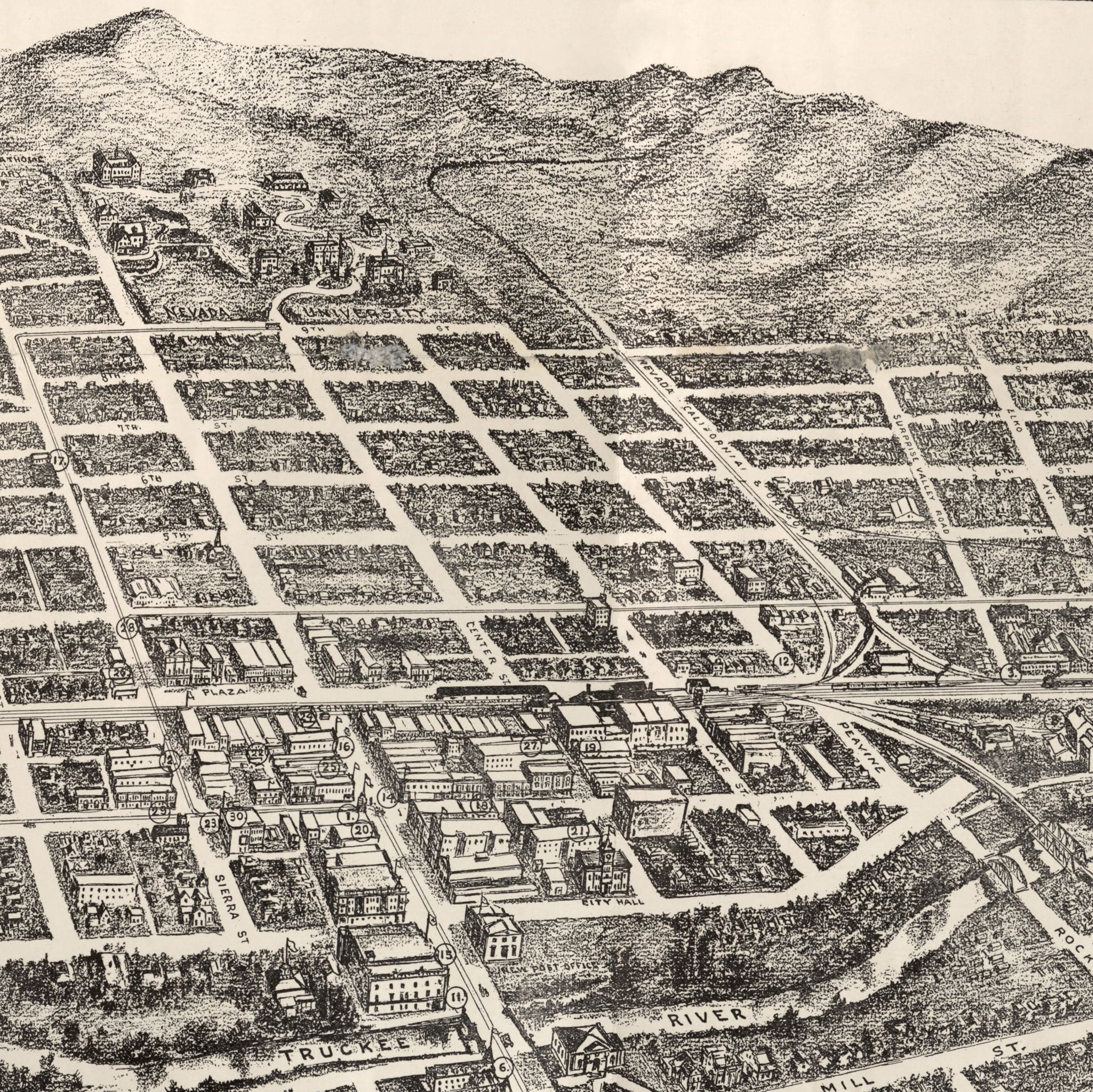
Reno, Nevada Vintage Map 1907 - Bird's Eye View
Sale priceFrom $34.00

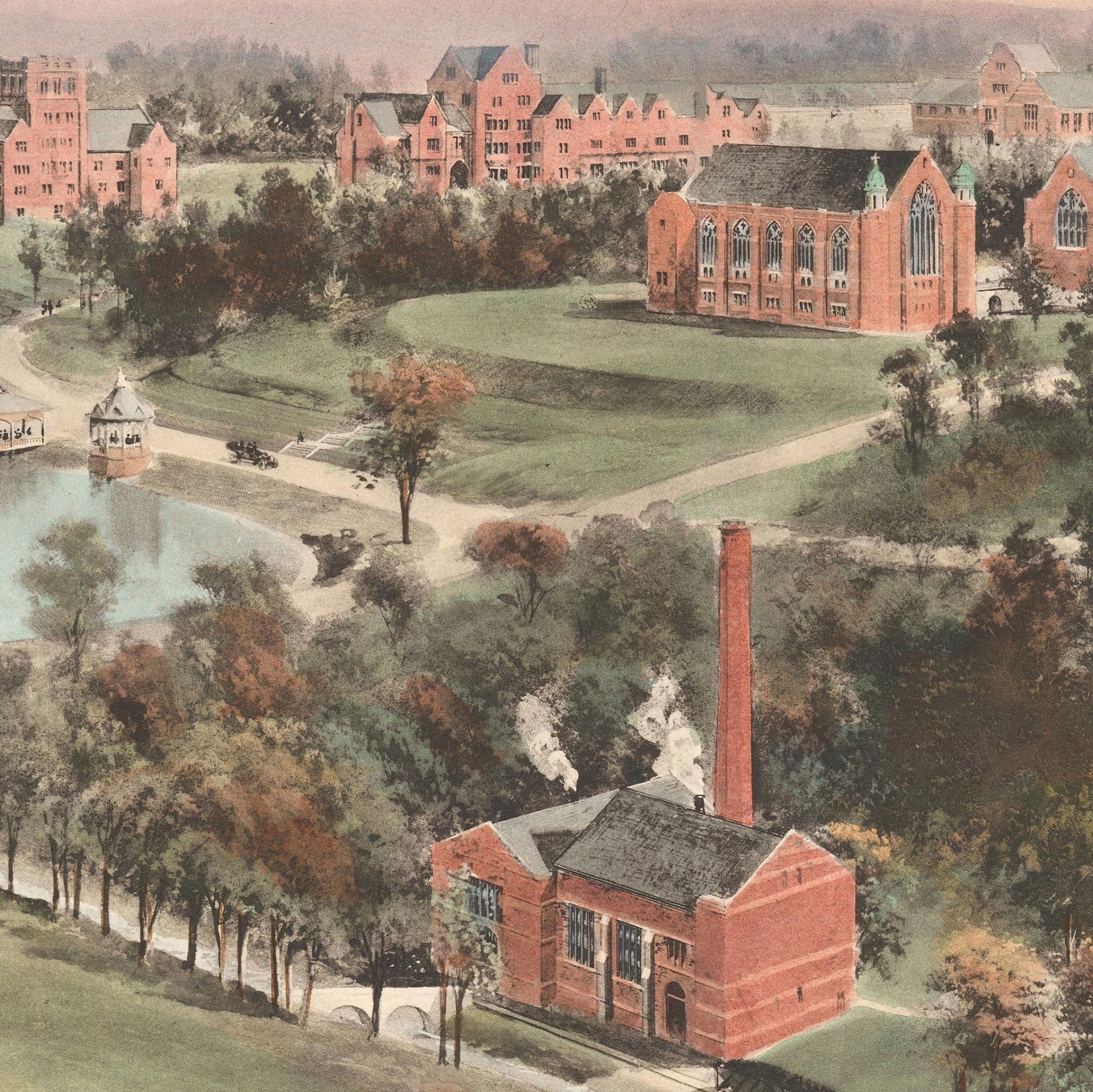
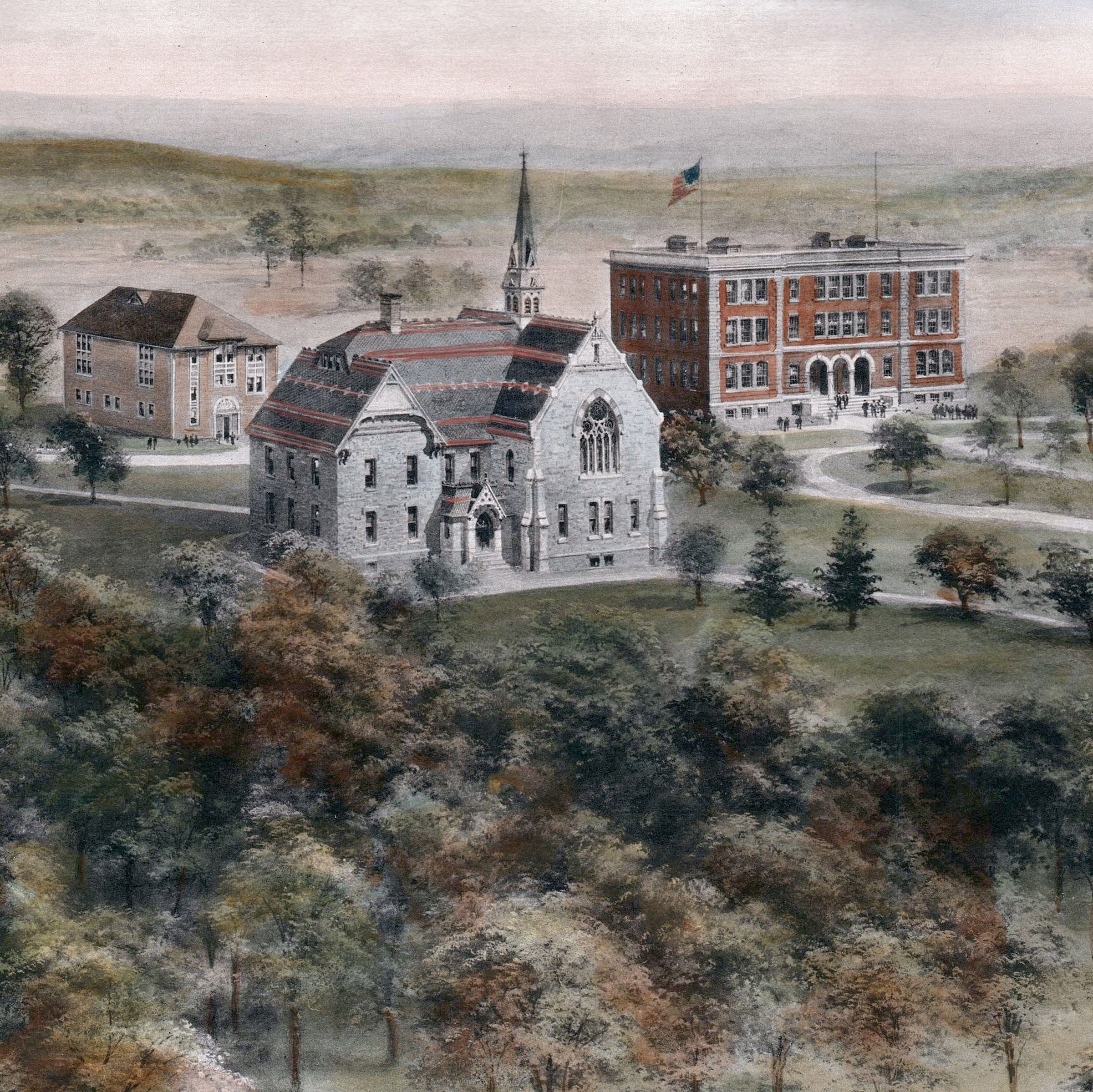
Richmond College, Richmond, Virginia Map 1915 - Campus Bird's Eye View
Sale priceFrom $34.00

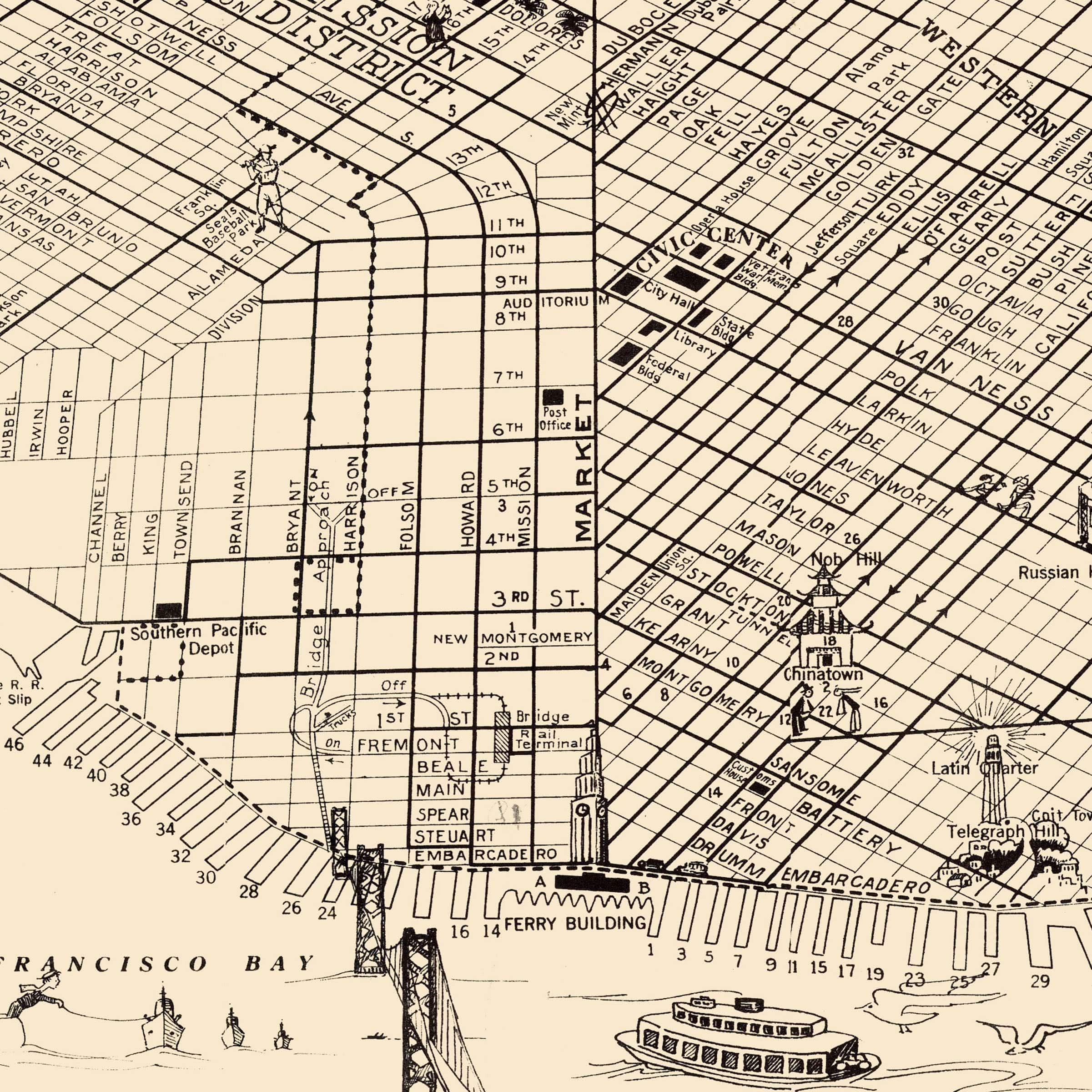
San Francisco, California Vintage Map 1938 - Golden Gate Era
Sale priceFrom $34.00

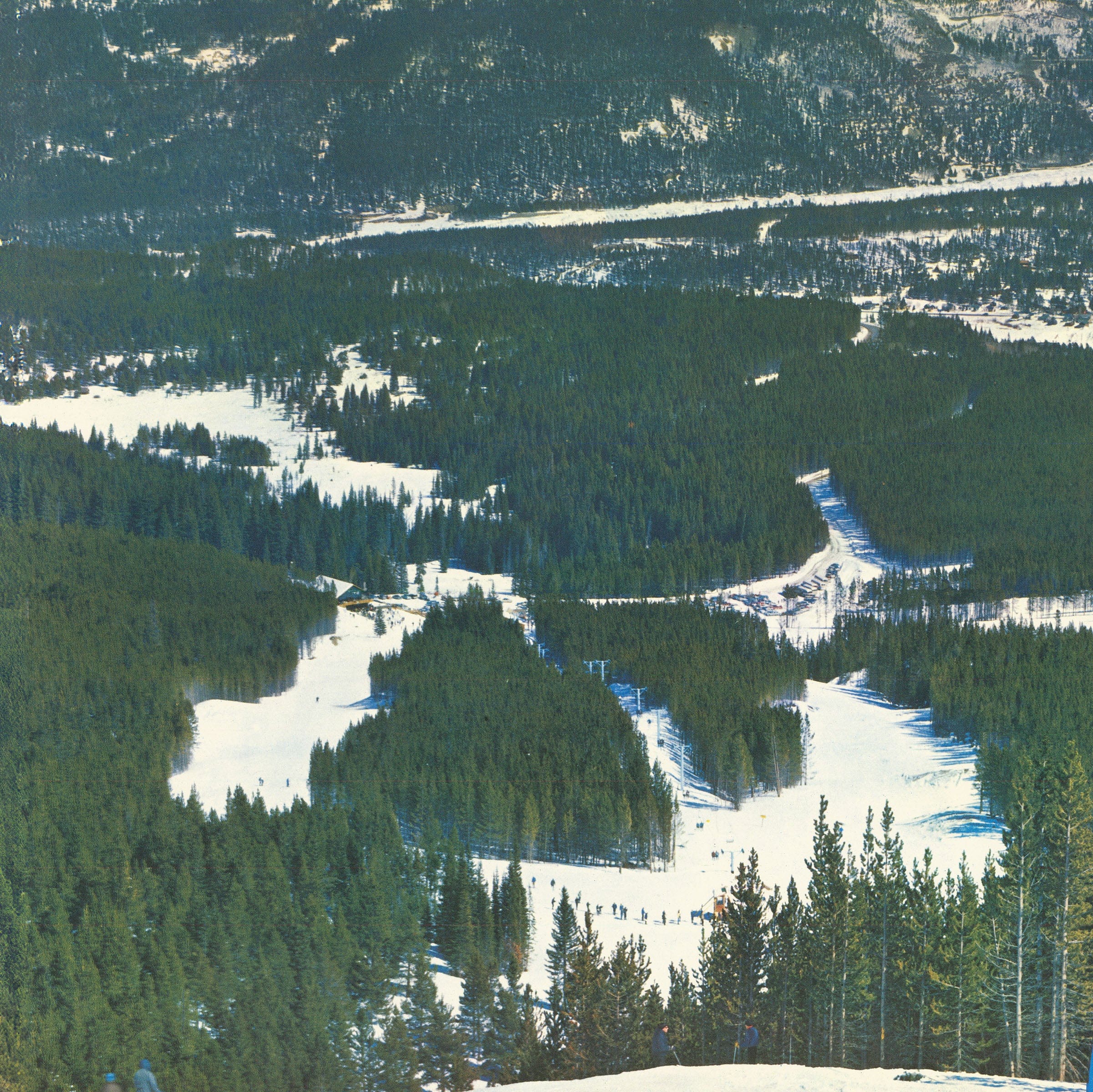
Ski Breckenridge, Colorado Vintage Map 1963 - Trail Map
Sale priceFrom $34.00
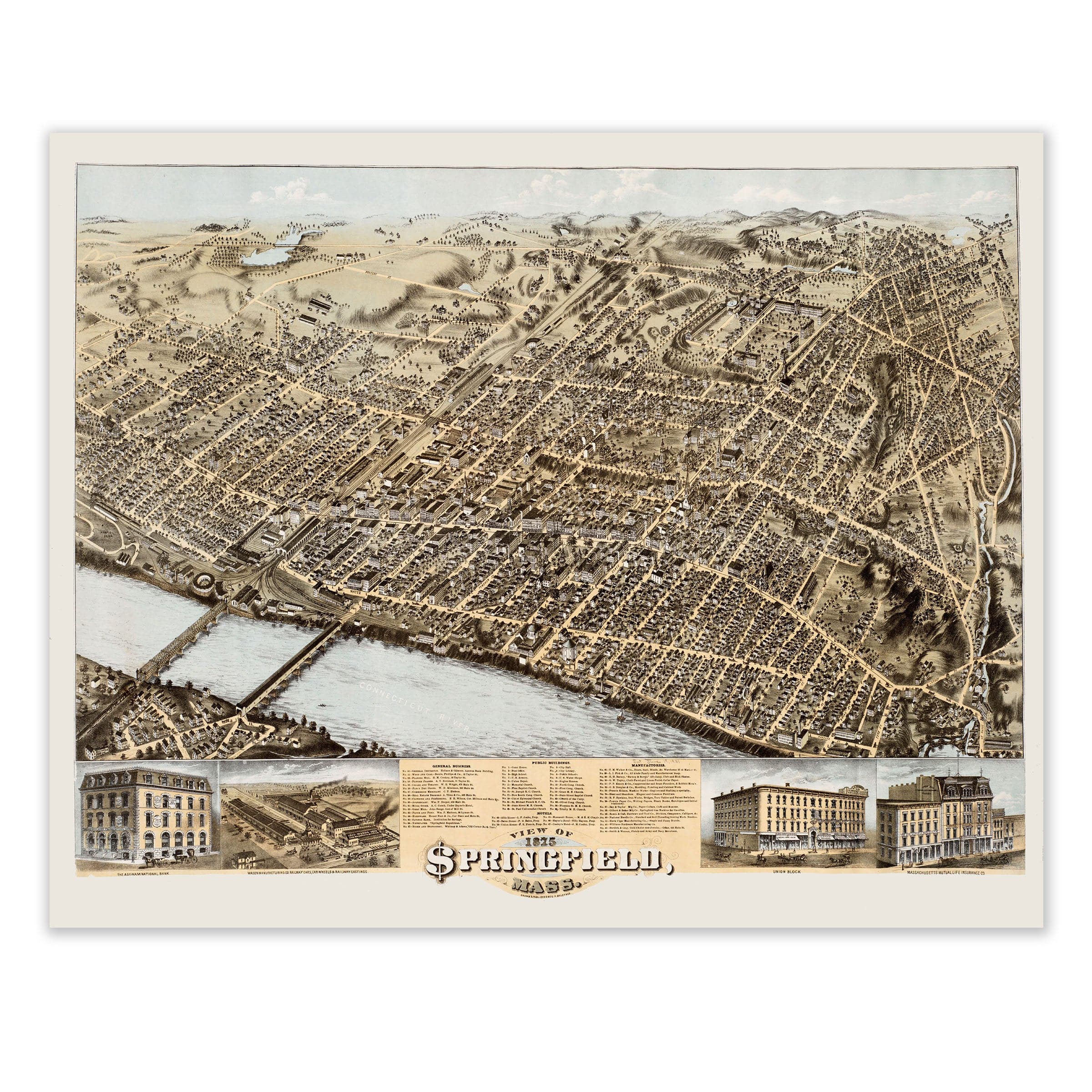
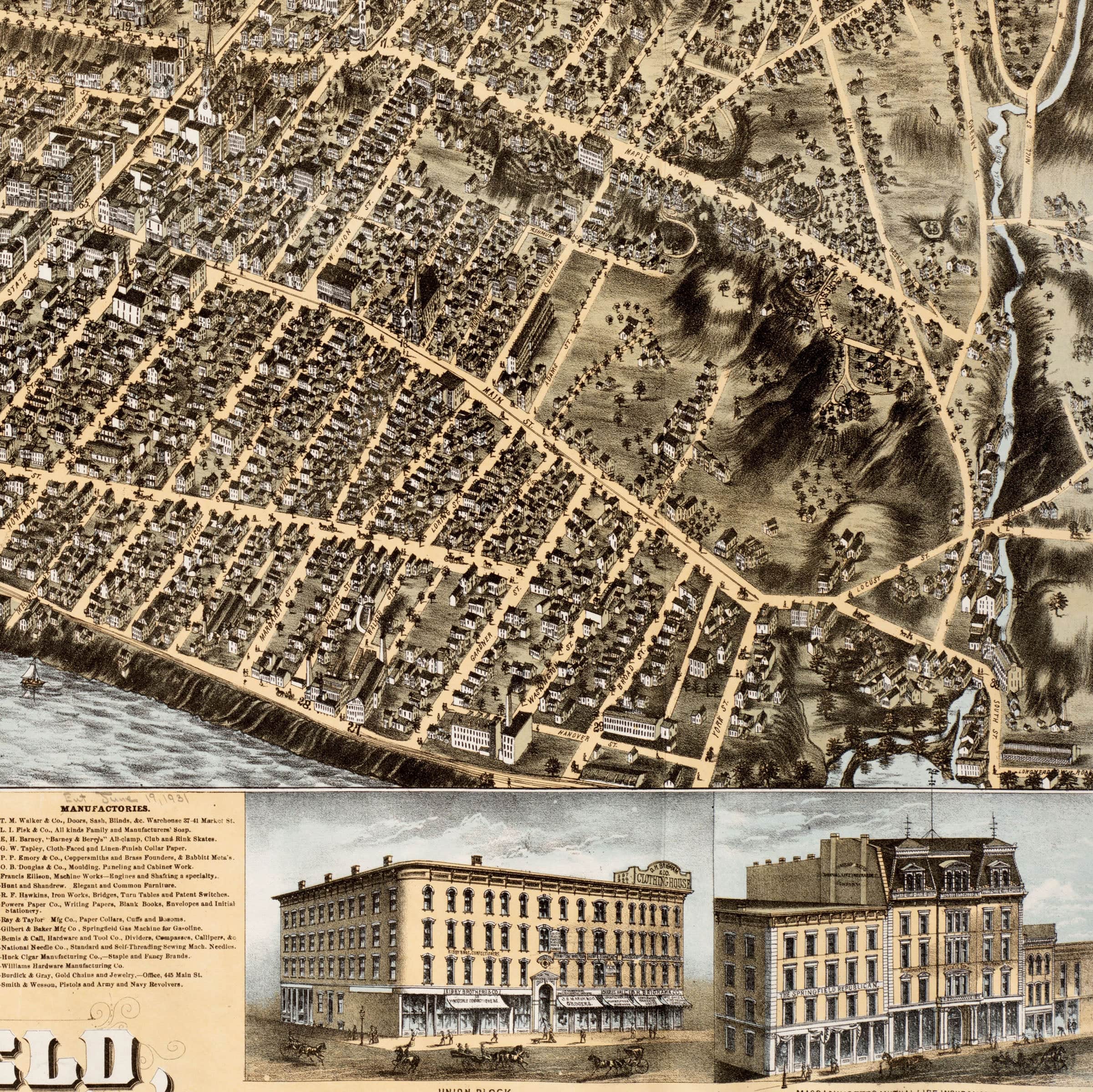
Springfield, Massachusetts Vintage Map 1875 - Bird's Eye View
Sale priceFrom $34.00

St. Lawrence University, New York Map 1909 - Campus Bird's Eye View
Sale priceFrom $34.00
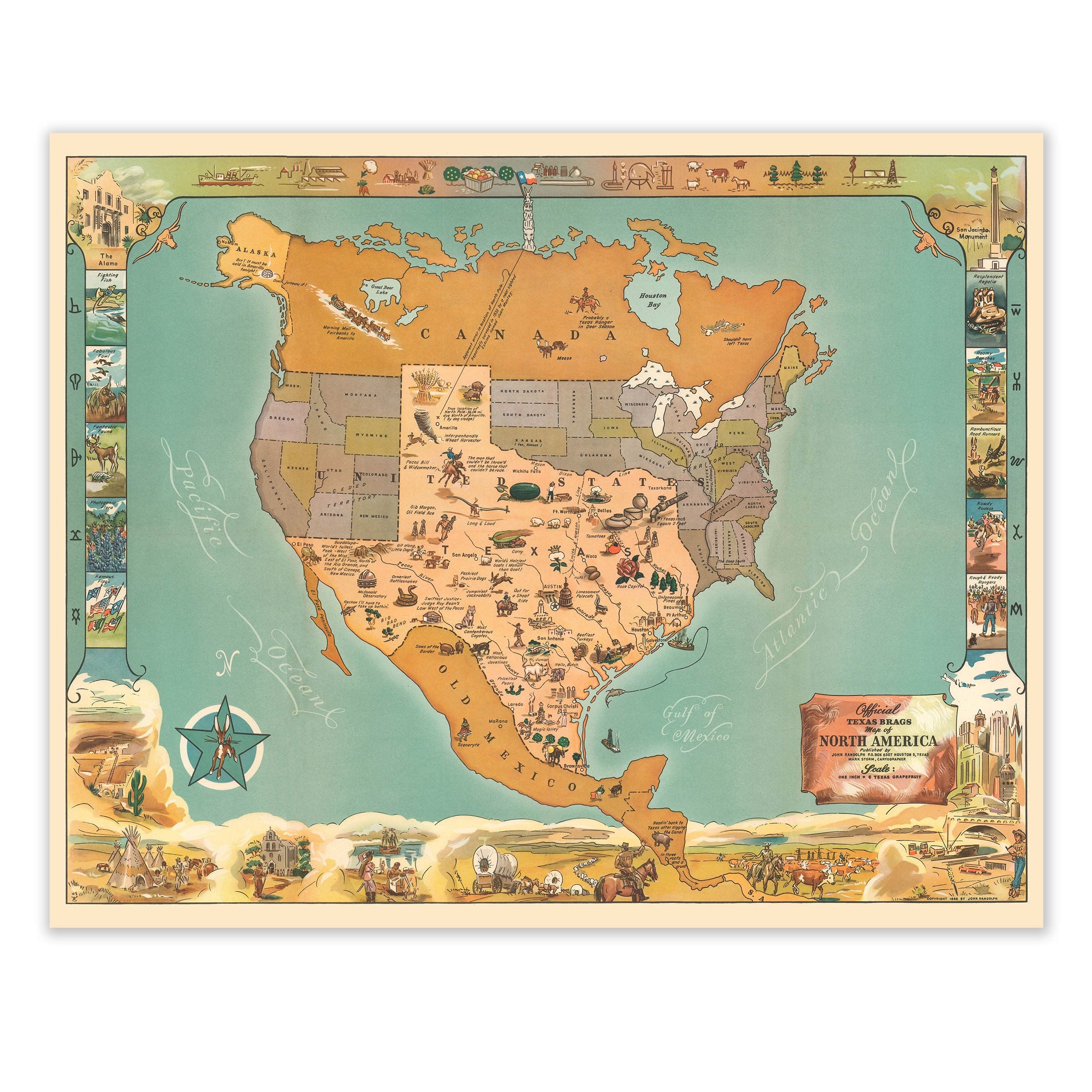
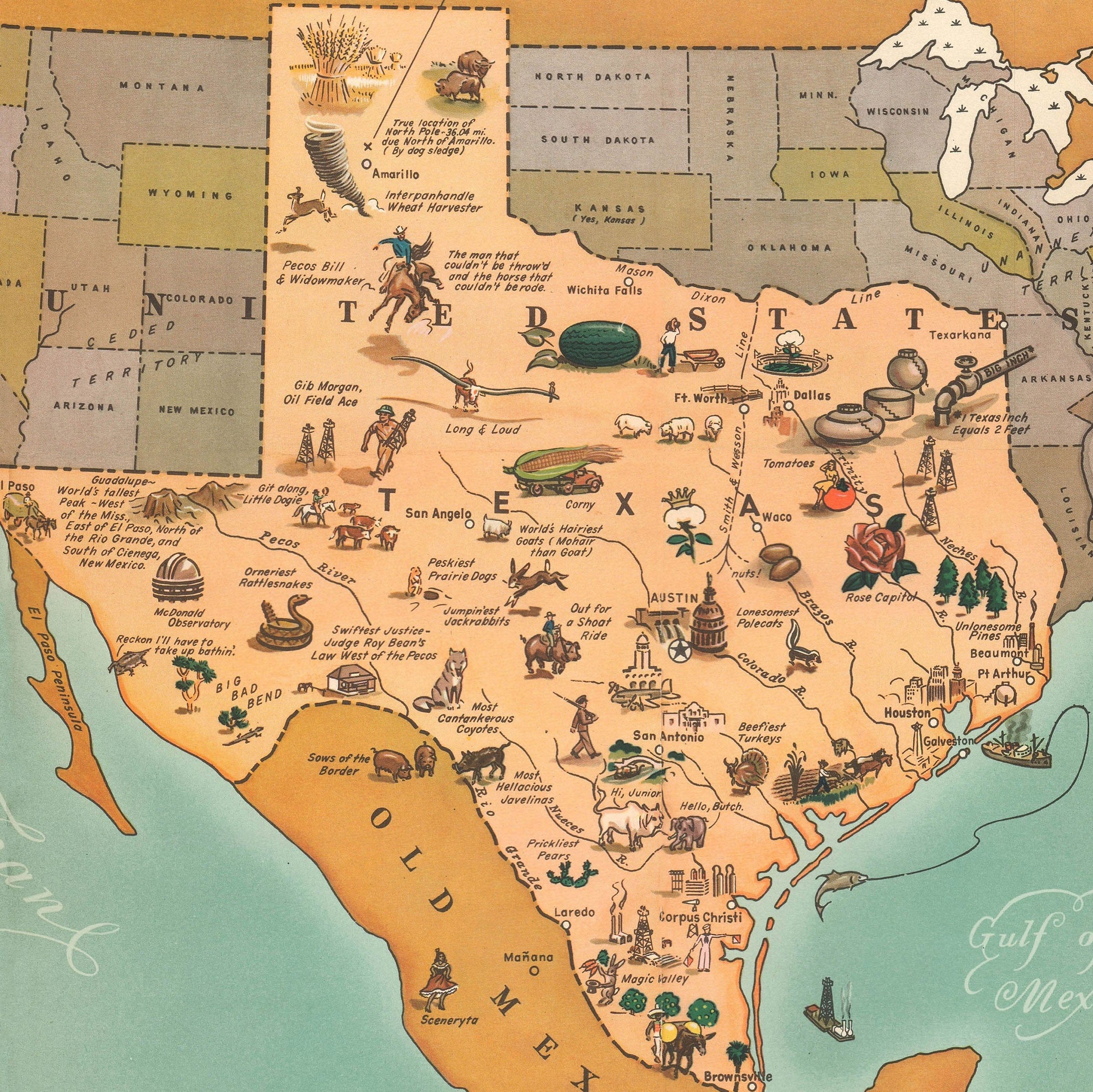
Texas Brags Pictorial Map of North America 1936 - Humorous Map
Sale priceFrom $34.00
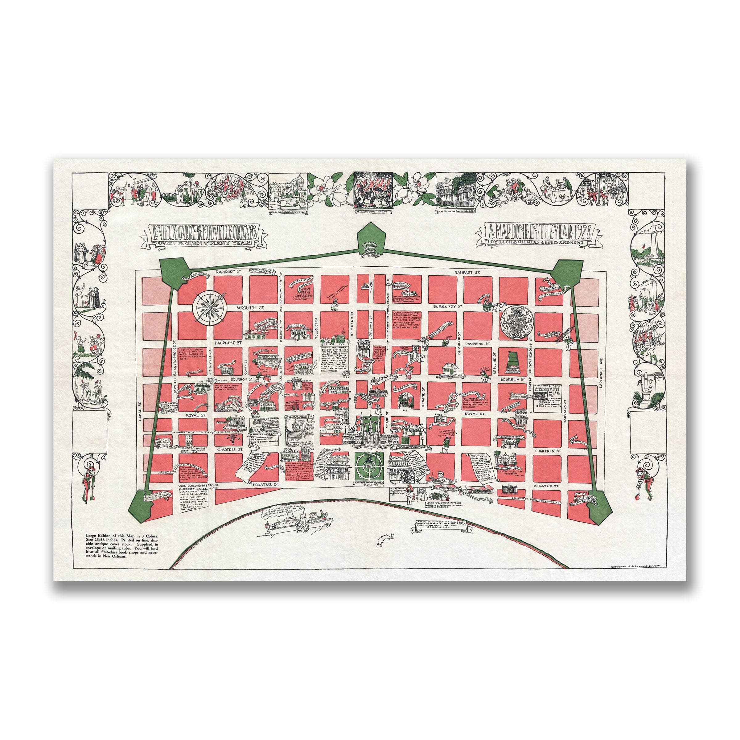
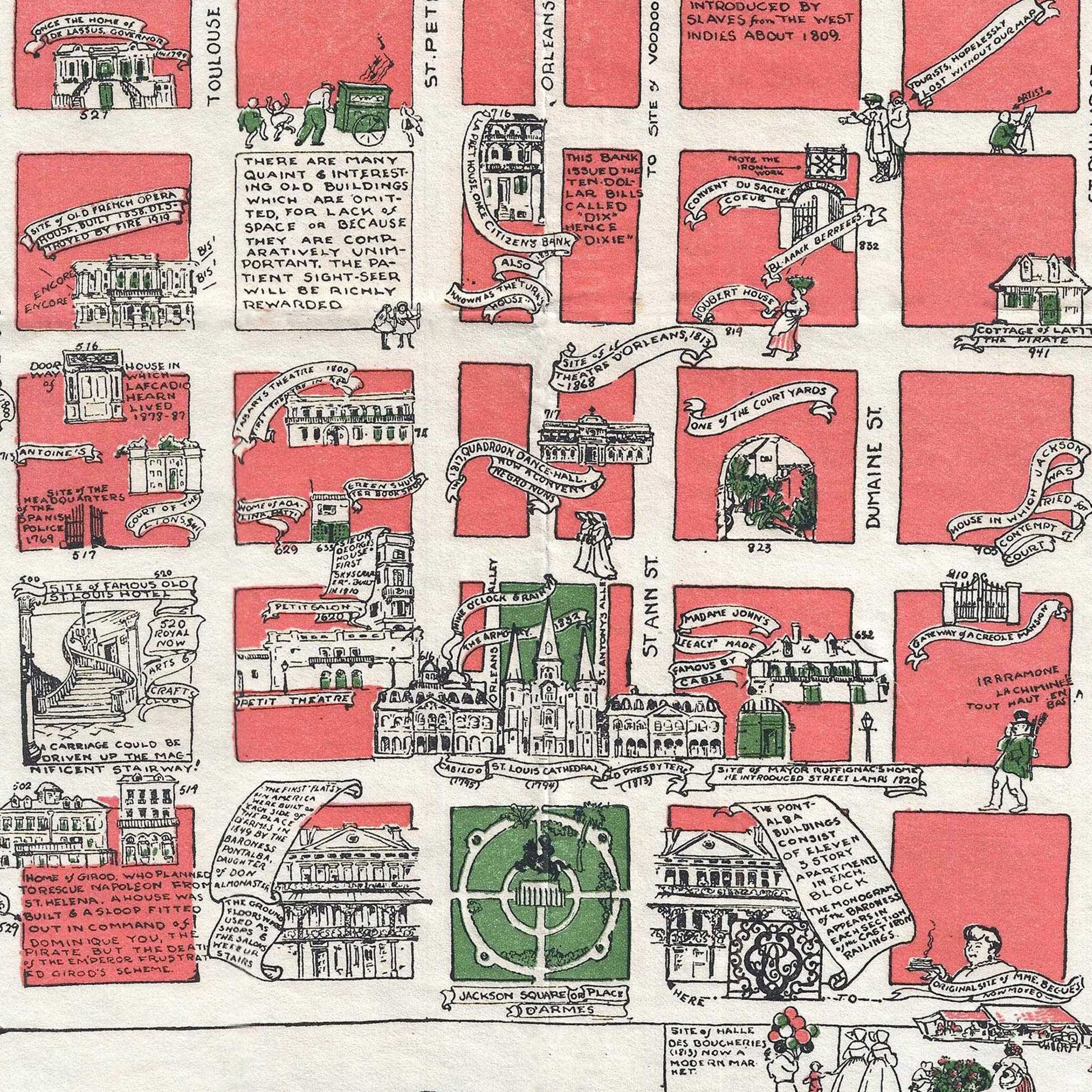
Vieux Carre, Nouvelle Orleans Vintage Map 1928 - French Quarter Pictorial
Sale priceFrom $34.00
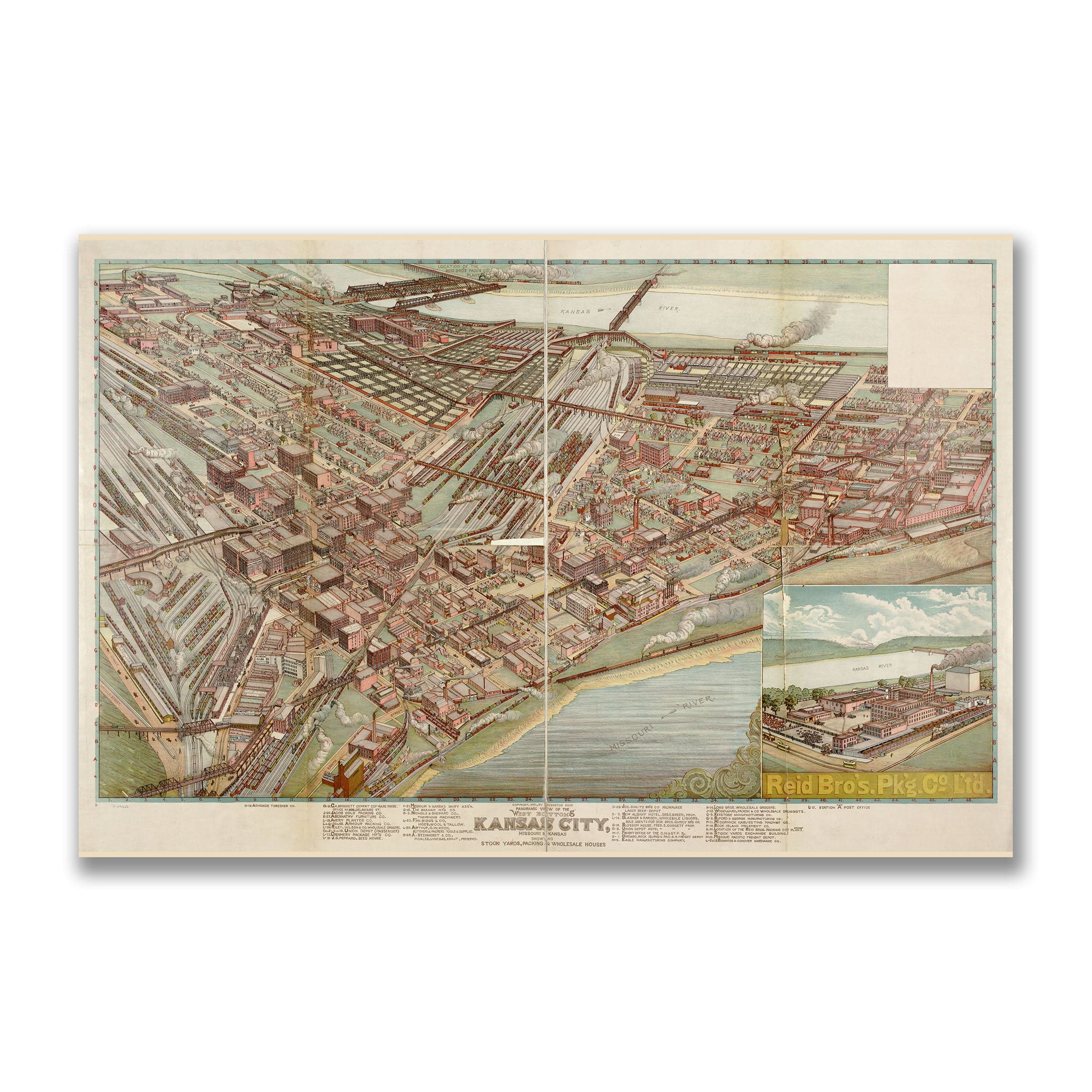
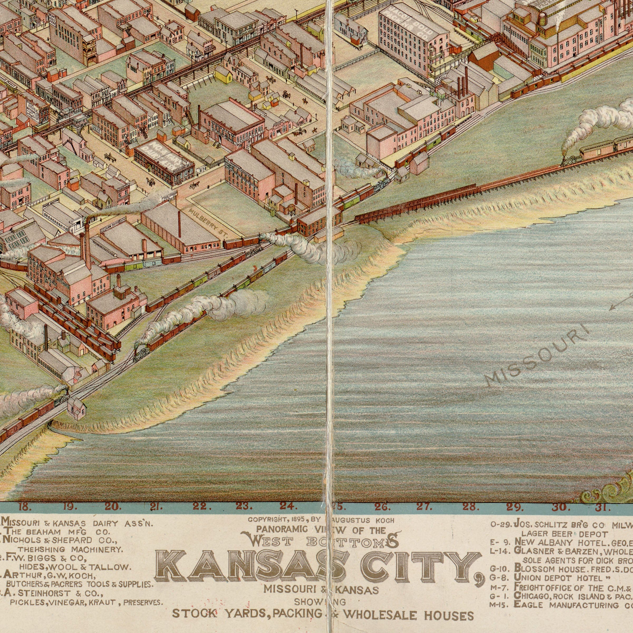
West Bottoms, Kansas City, Missouri Vintage Map 1895 - Bird's Eye View
Sale priceFrom $34.00
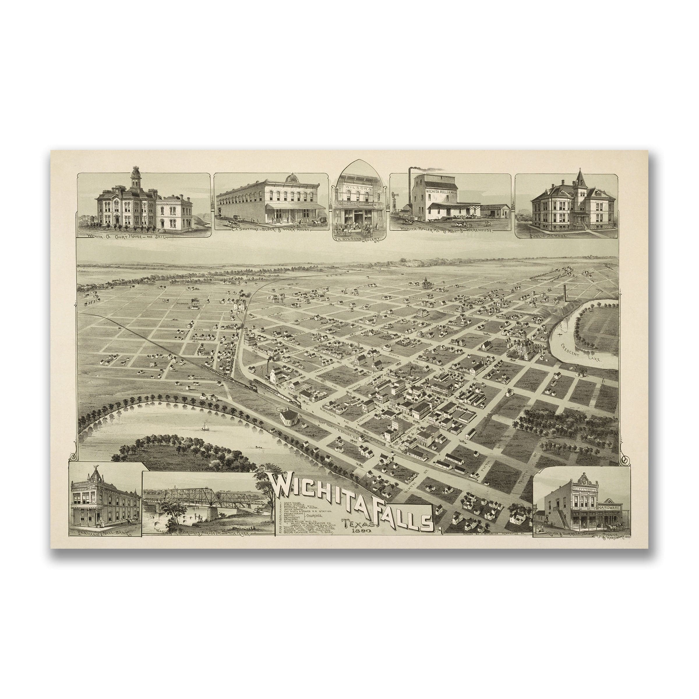
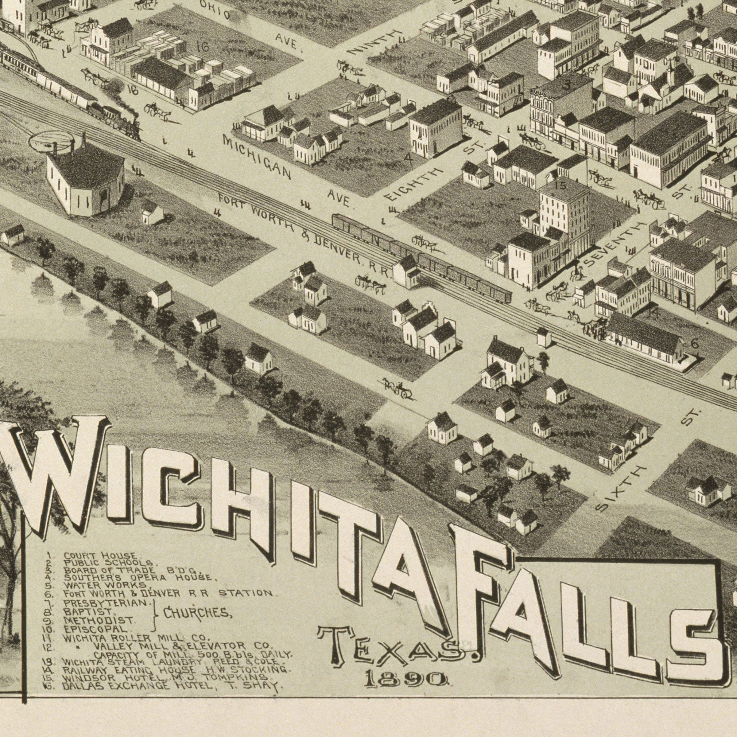
Wichita Falls, Texas Vintage Map 1890 - Bird's Eye View
Sale priceFrom $34.00
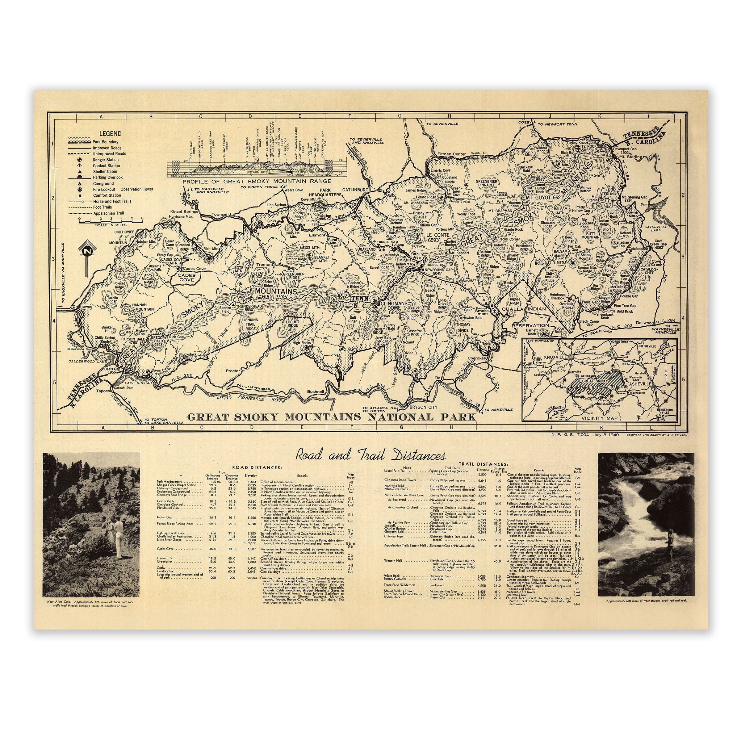
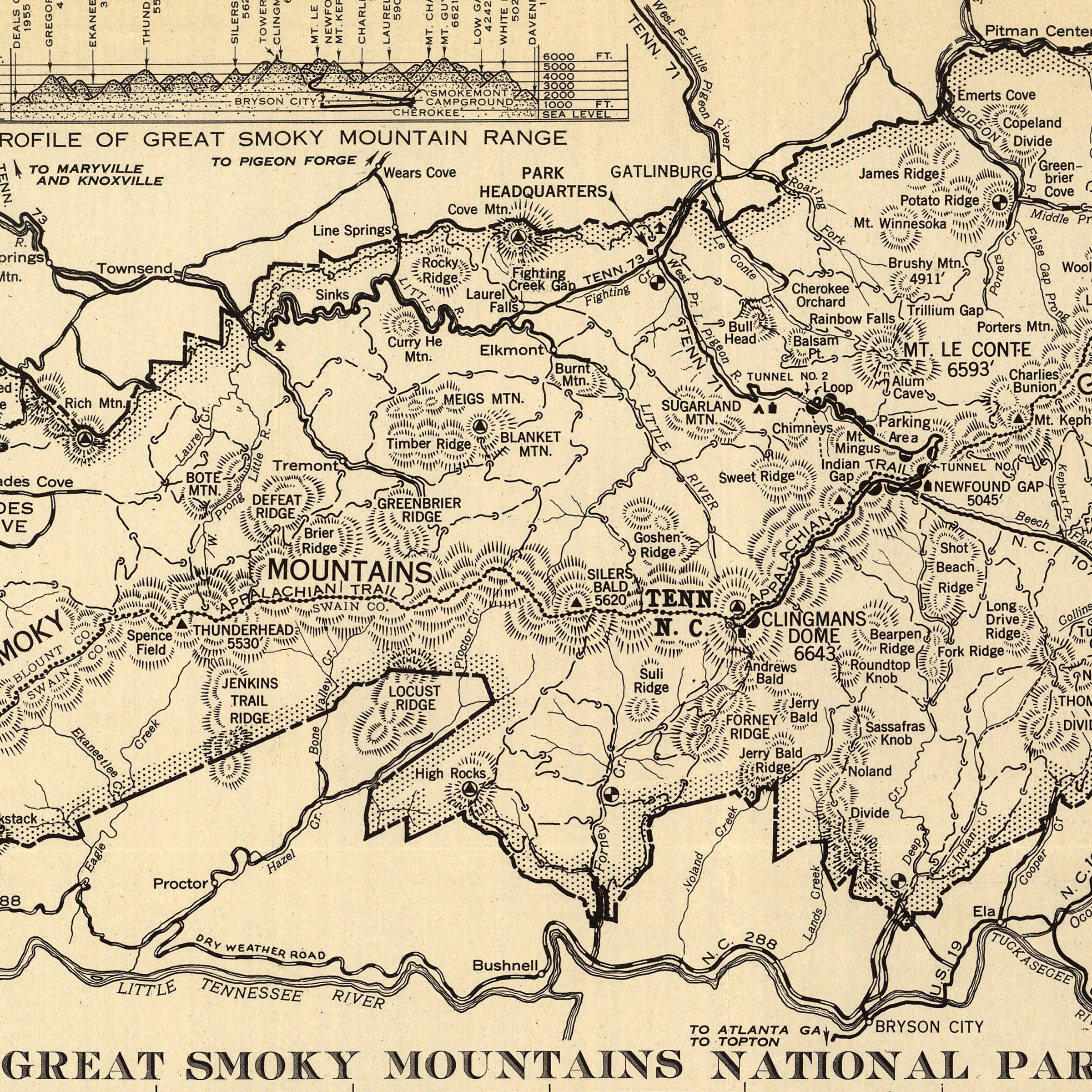
Great Smoky Mountains National Park Map 1940
Sale priceFrom $34.00
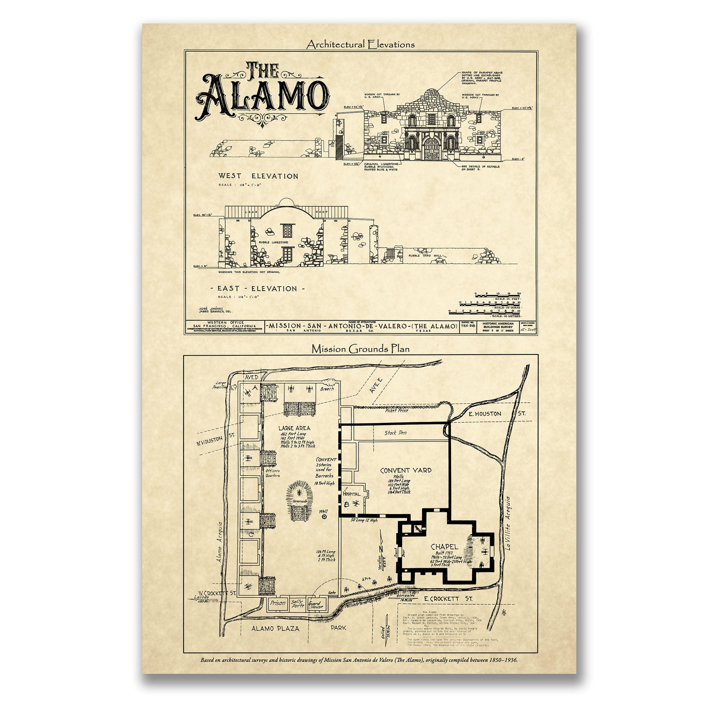
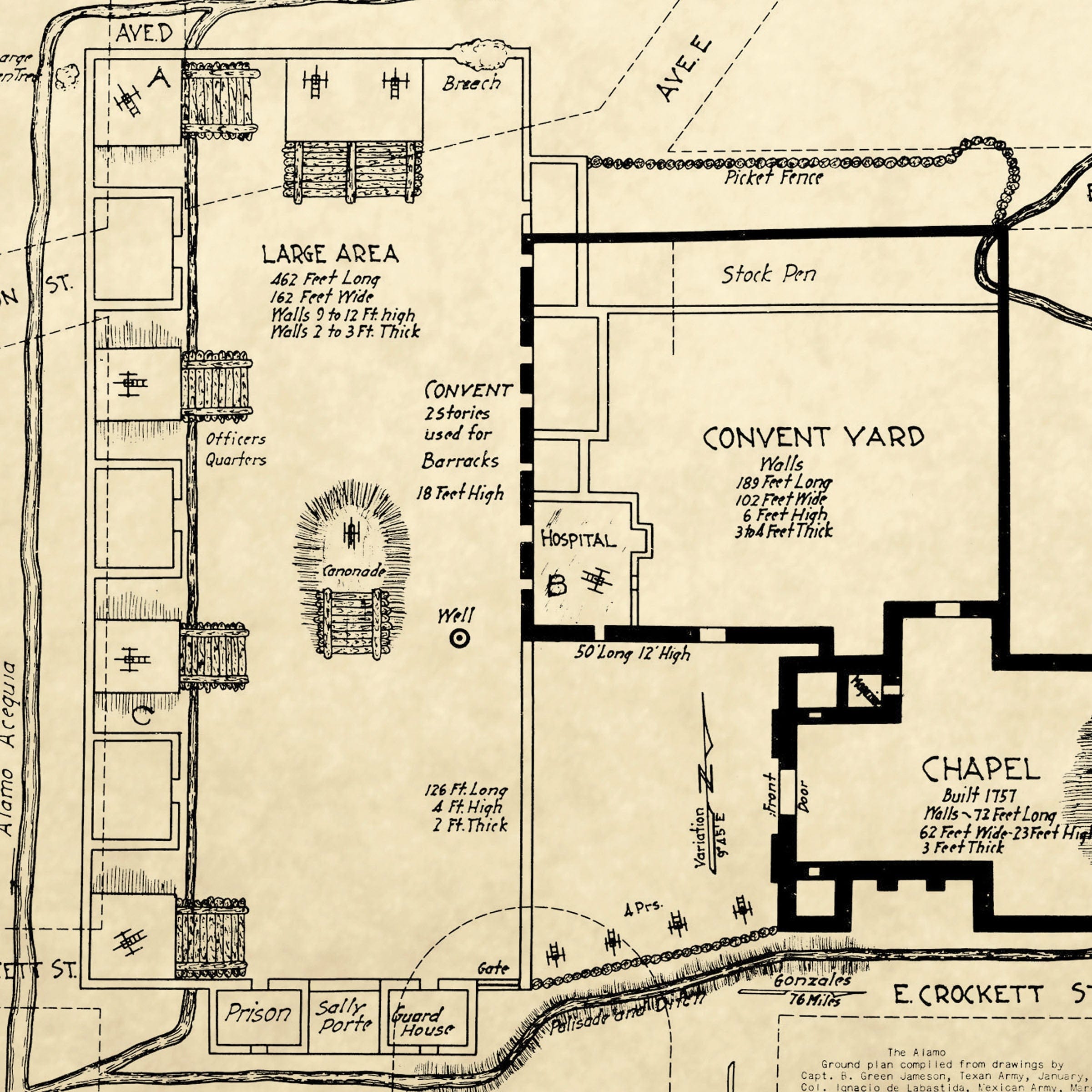
The Alamo Map 2025
Sale priceFrom $34.00
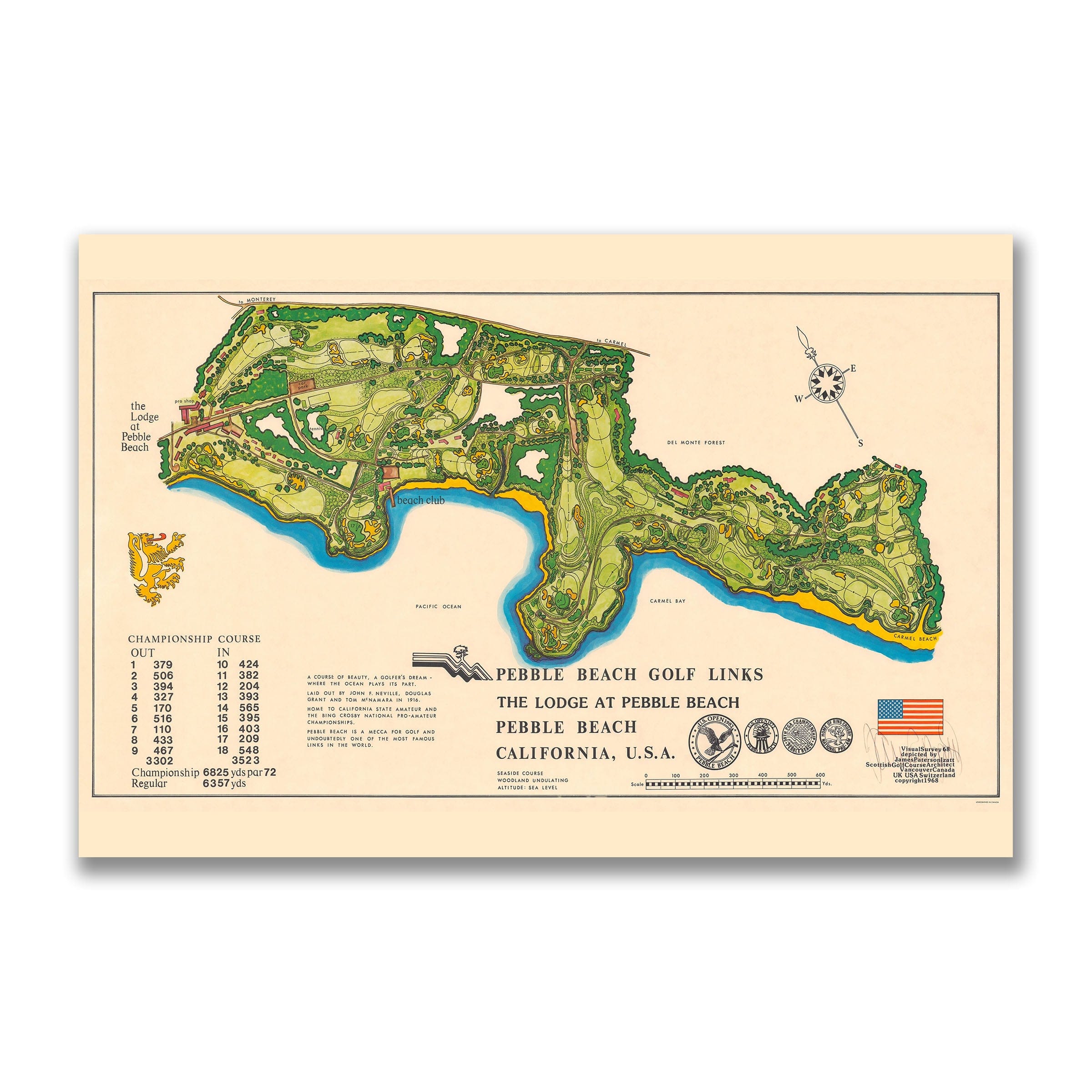
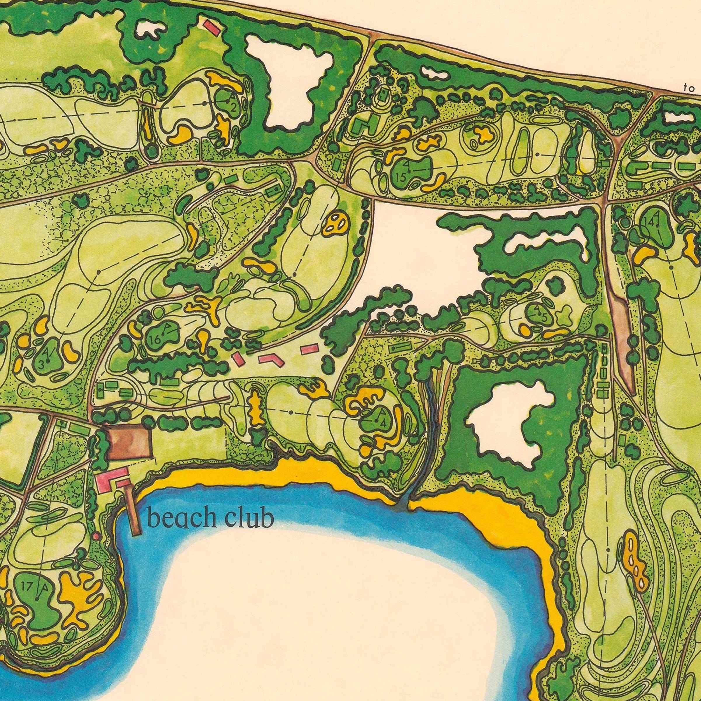
Pebble Beach Golf Links Map c.1968
Sale priceFrom $34.00
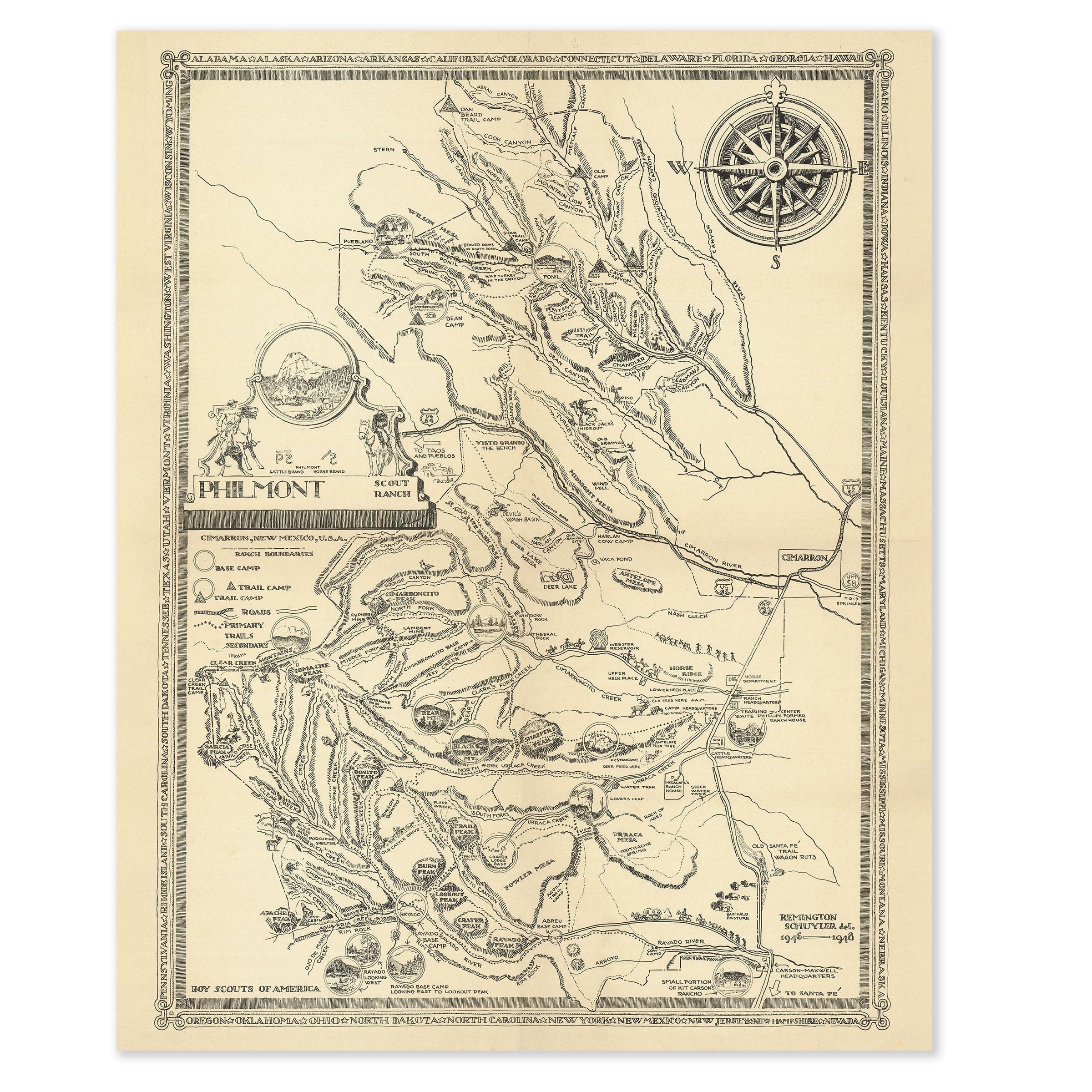
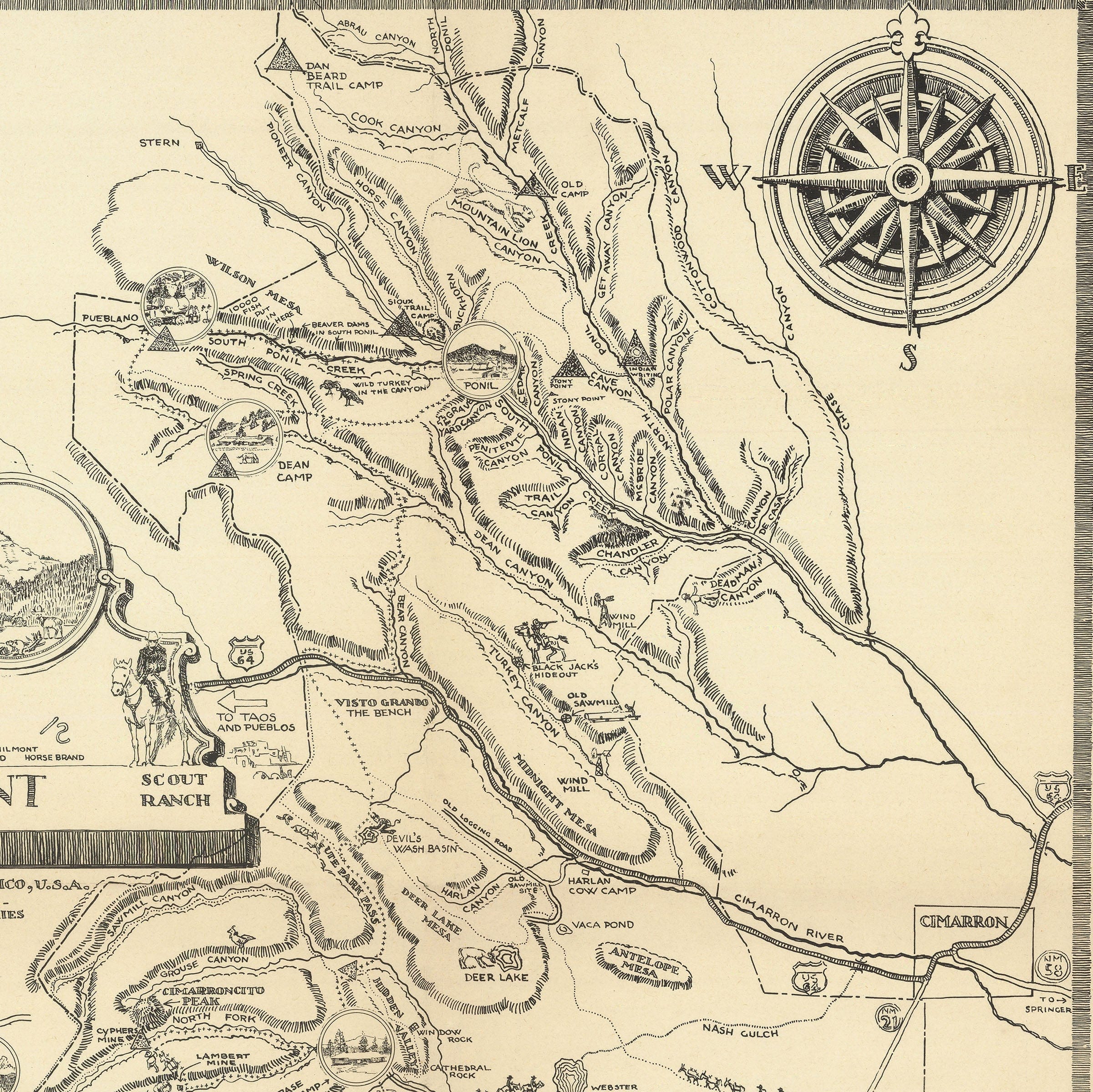
Philmont Scout Ranch Map 1948
Sale priceFrom $34.00