
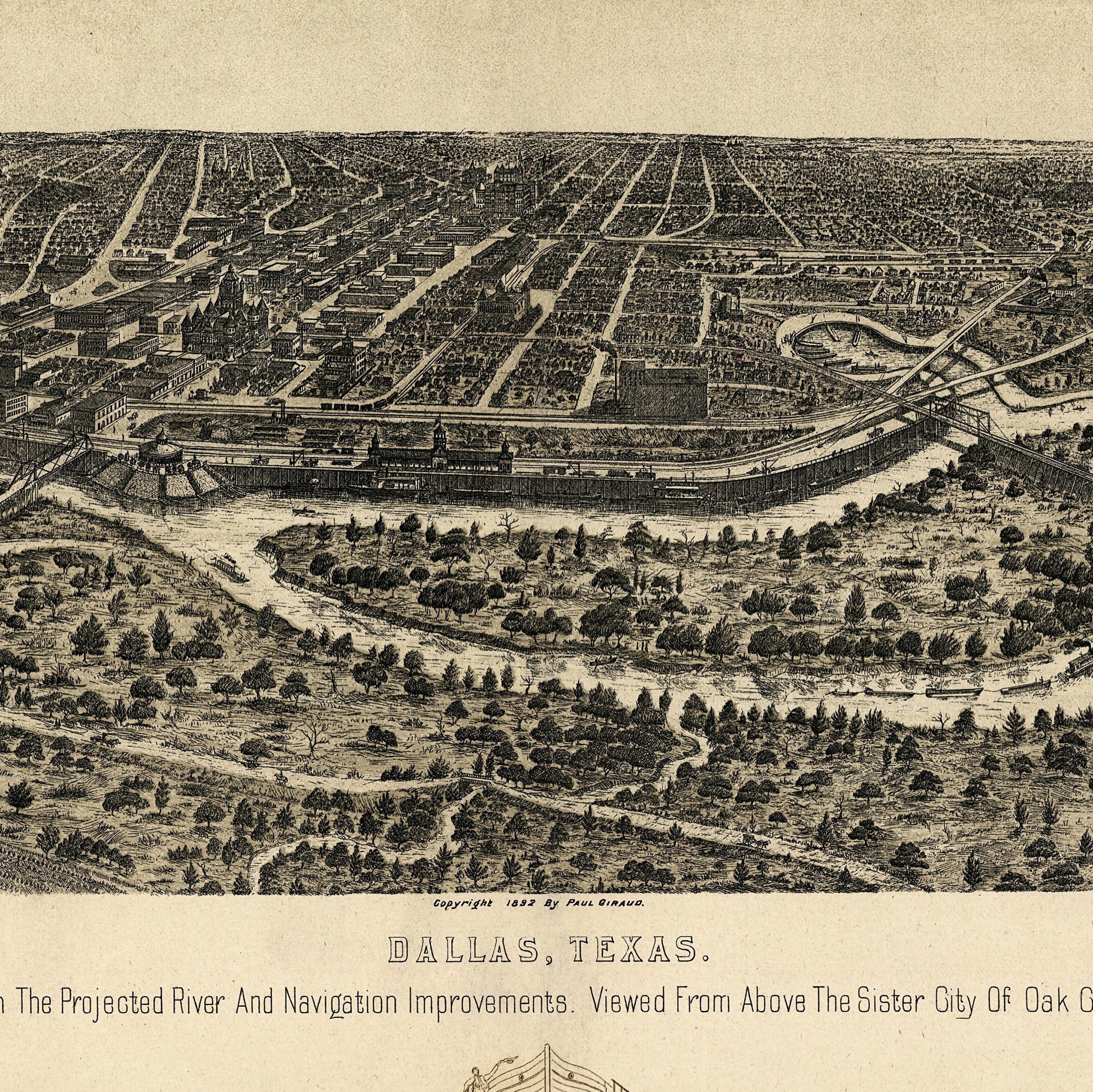
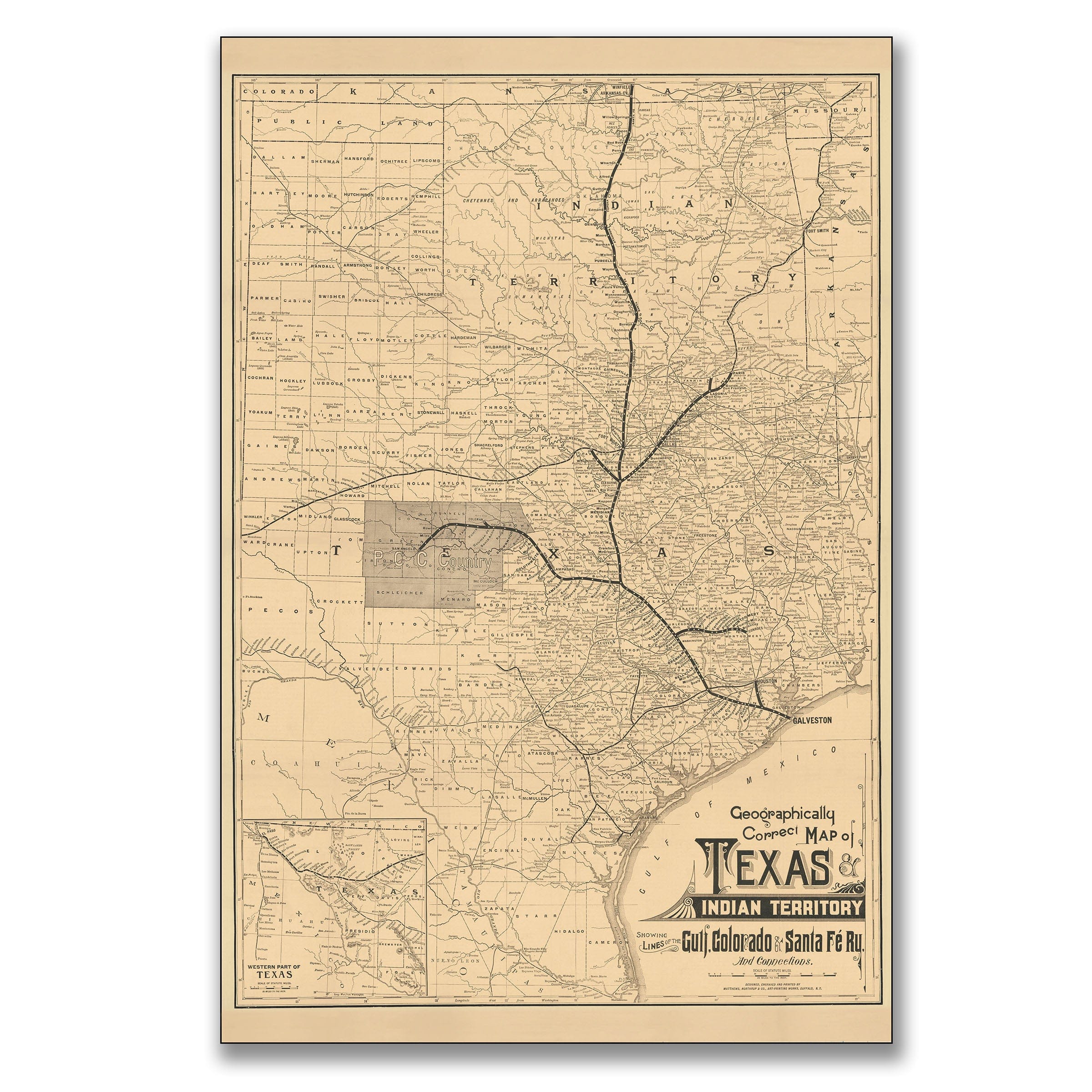
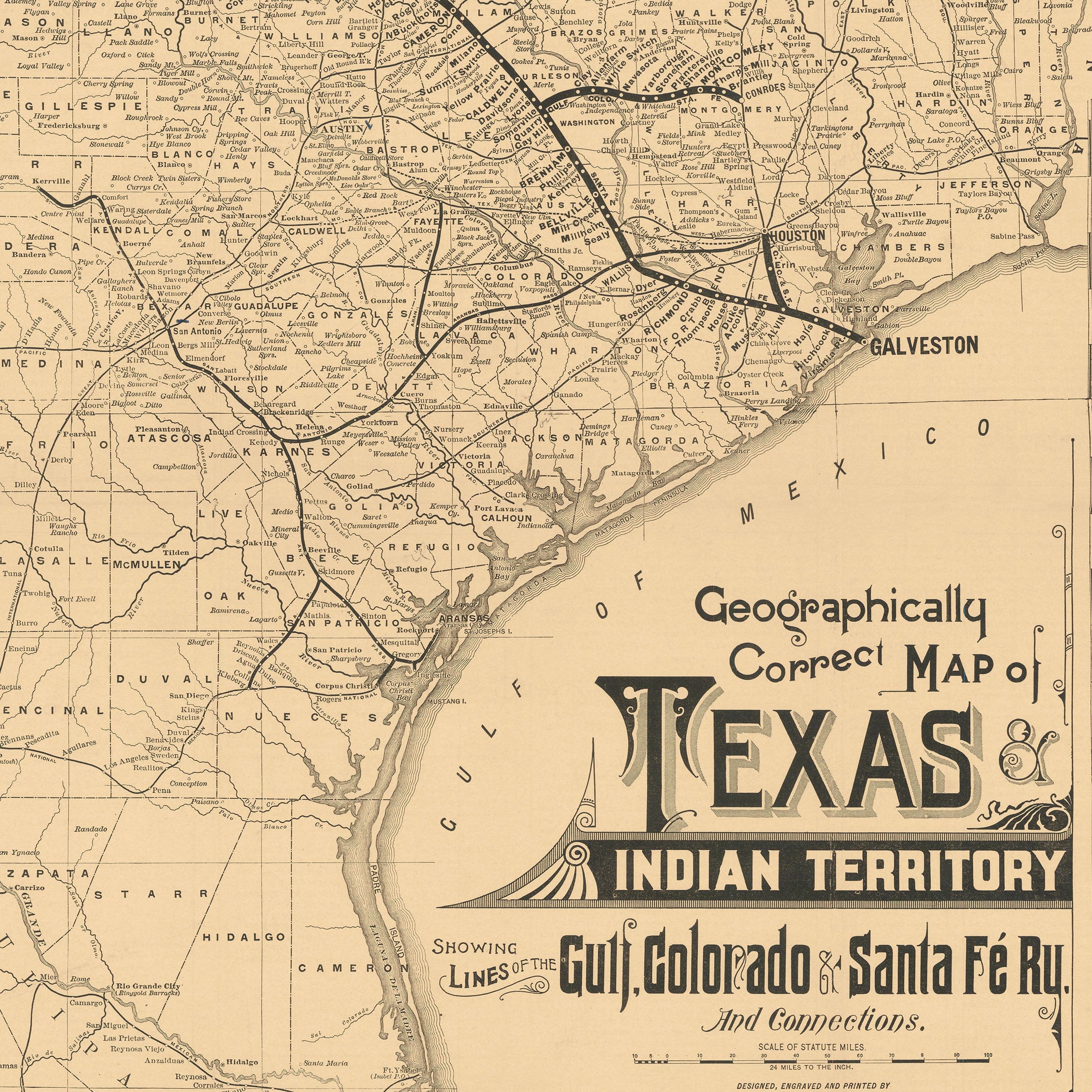
Dallas Texas 1892 Map - Vintage Bird's Eye View with Trinity River Navigation Plans
Sale priceFrom $39.99
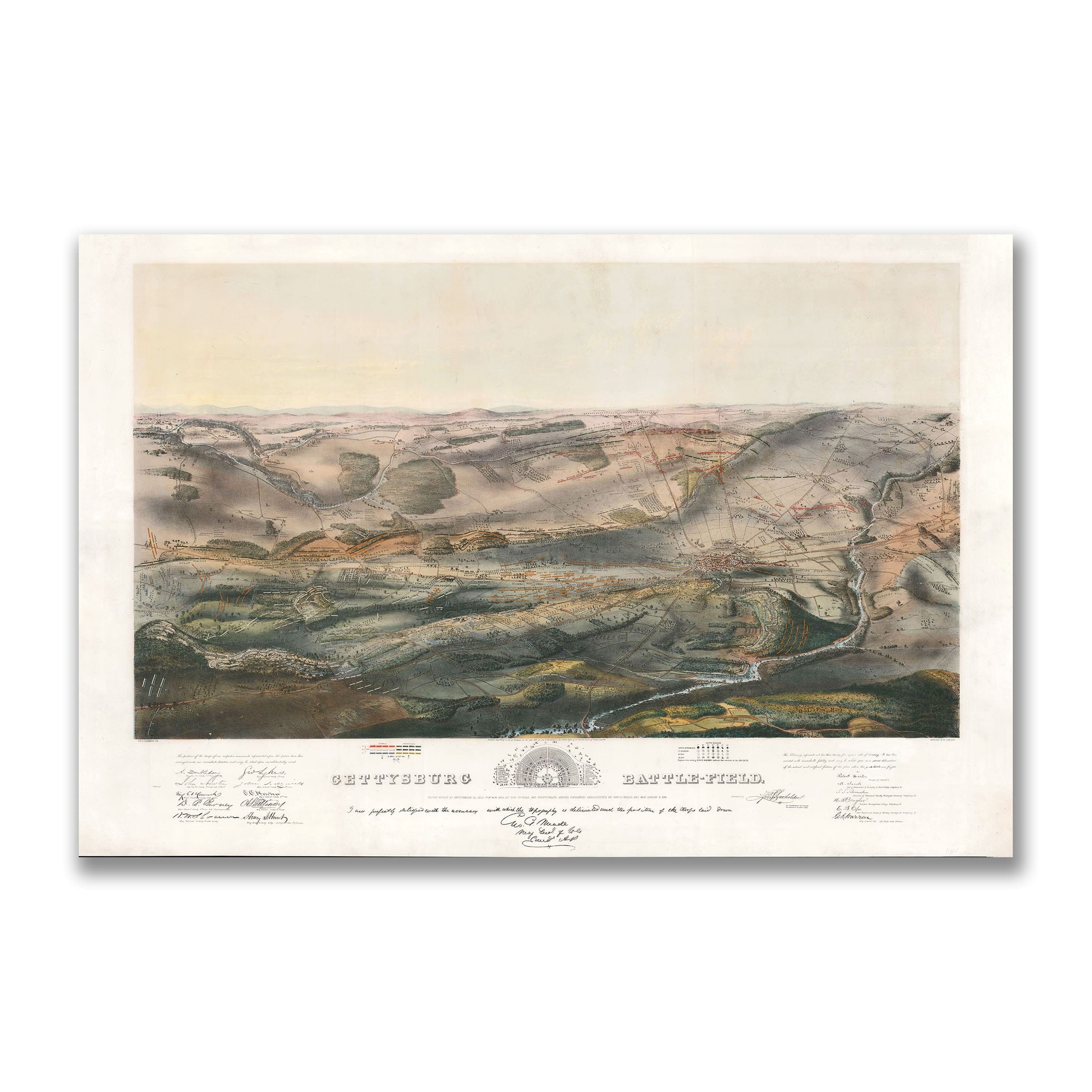
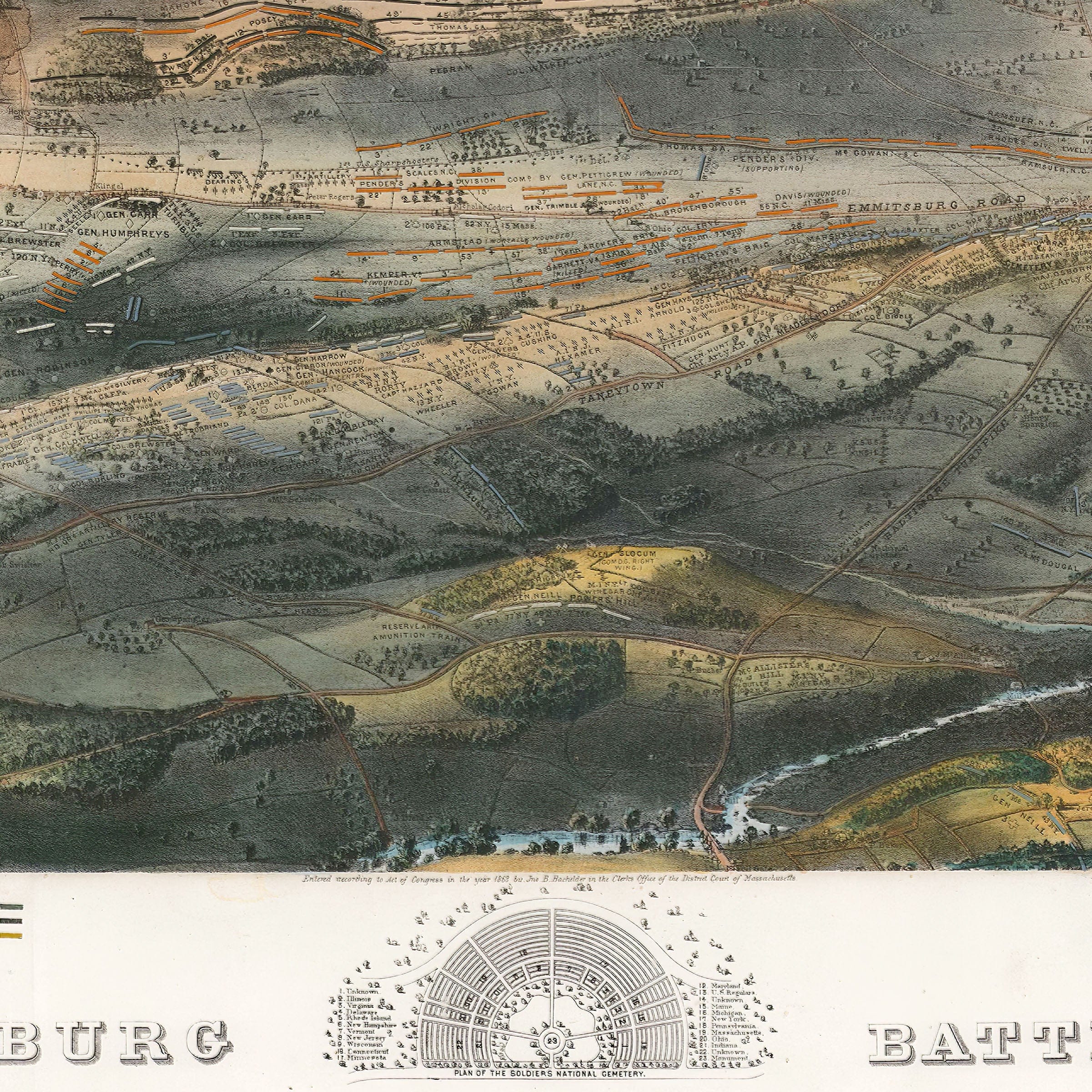
Gettysburg Battlefield Map 1863 - Historic Civil War Battle Map by John Bachelder
Sale priceFrom $39.99
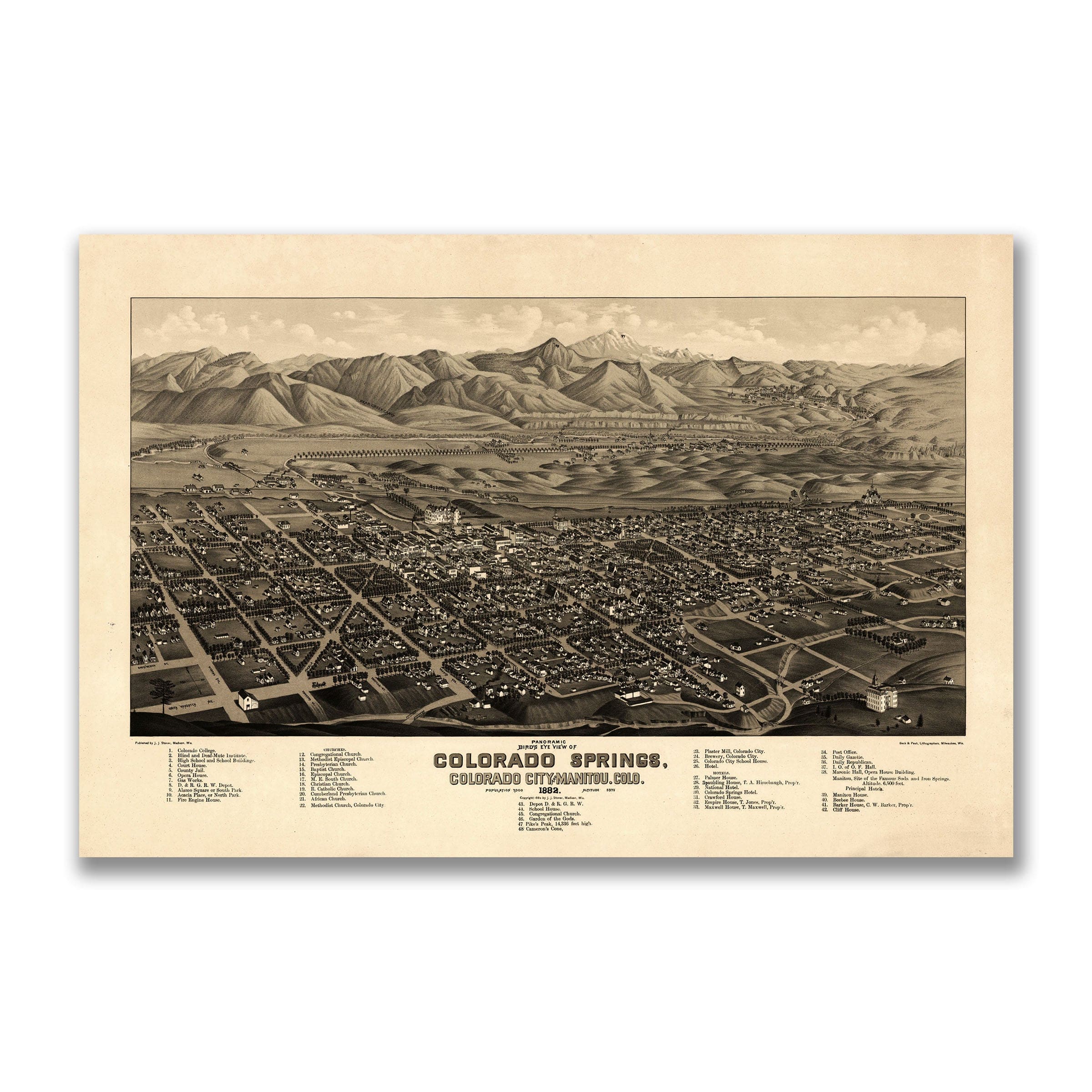
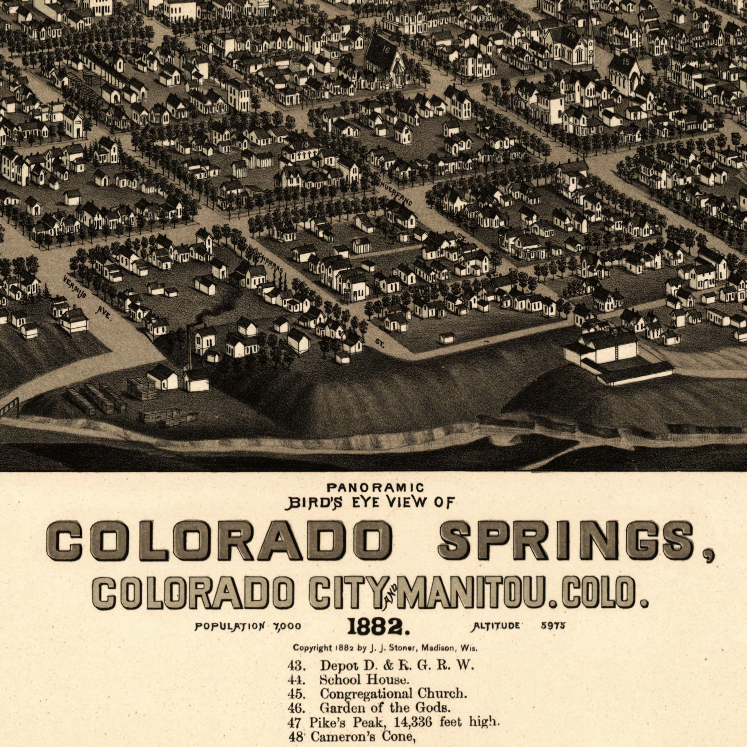
Colorado Springs Vintage Map 1882 - Bird's Eye View Pikes Peak Panoramic Map
Sale priceFrom $39.99

Plano Texas Vintage Map 1891 - Historic Bird's Eye View City Map
Sale priceFrom $39.99
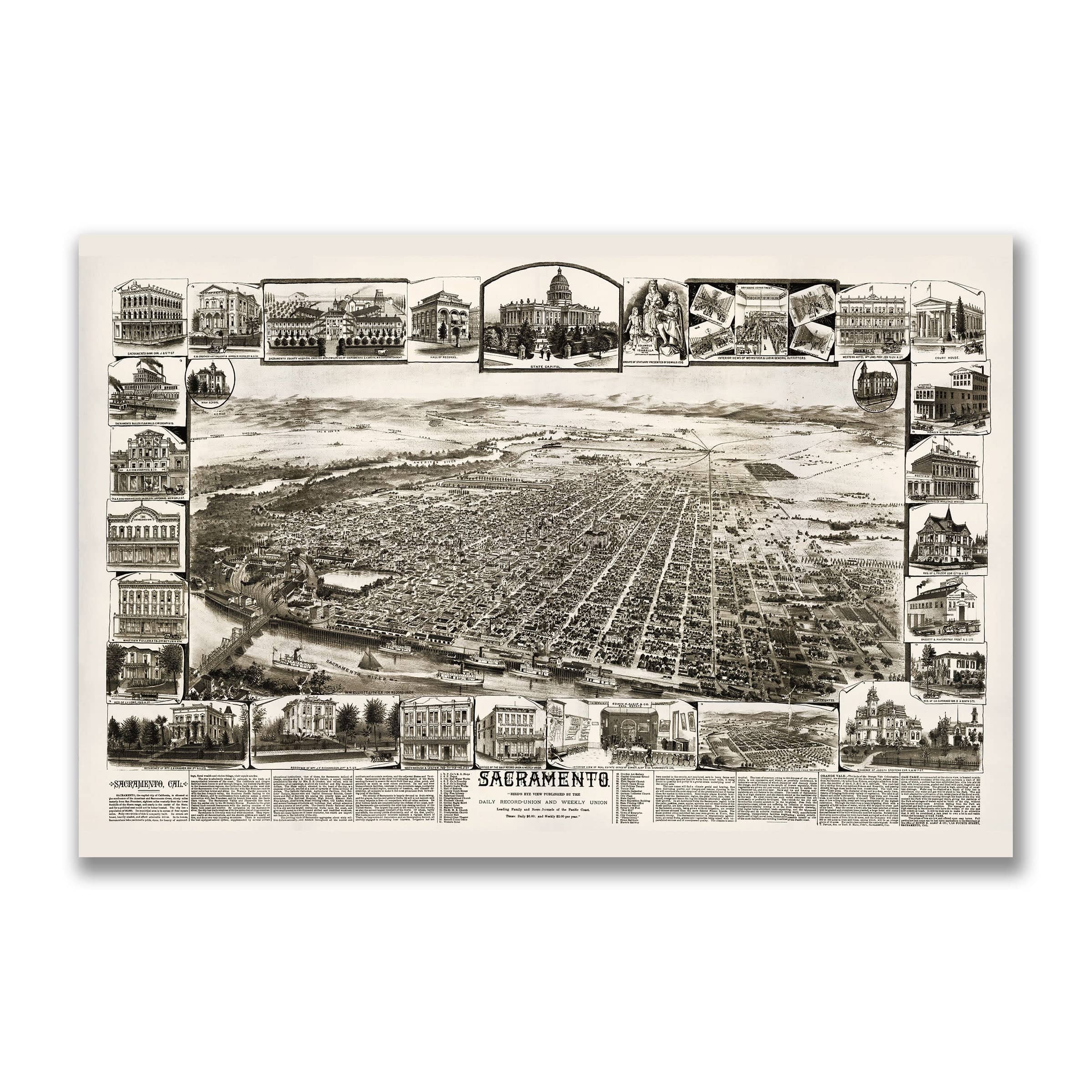
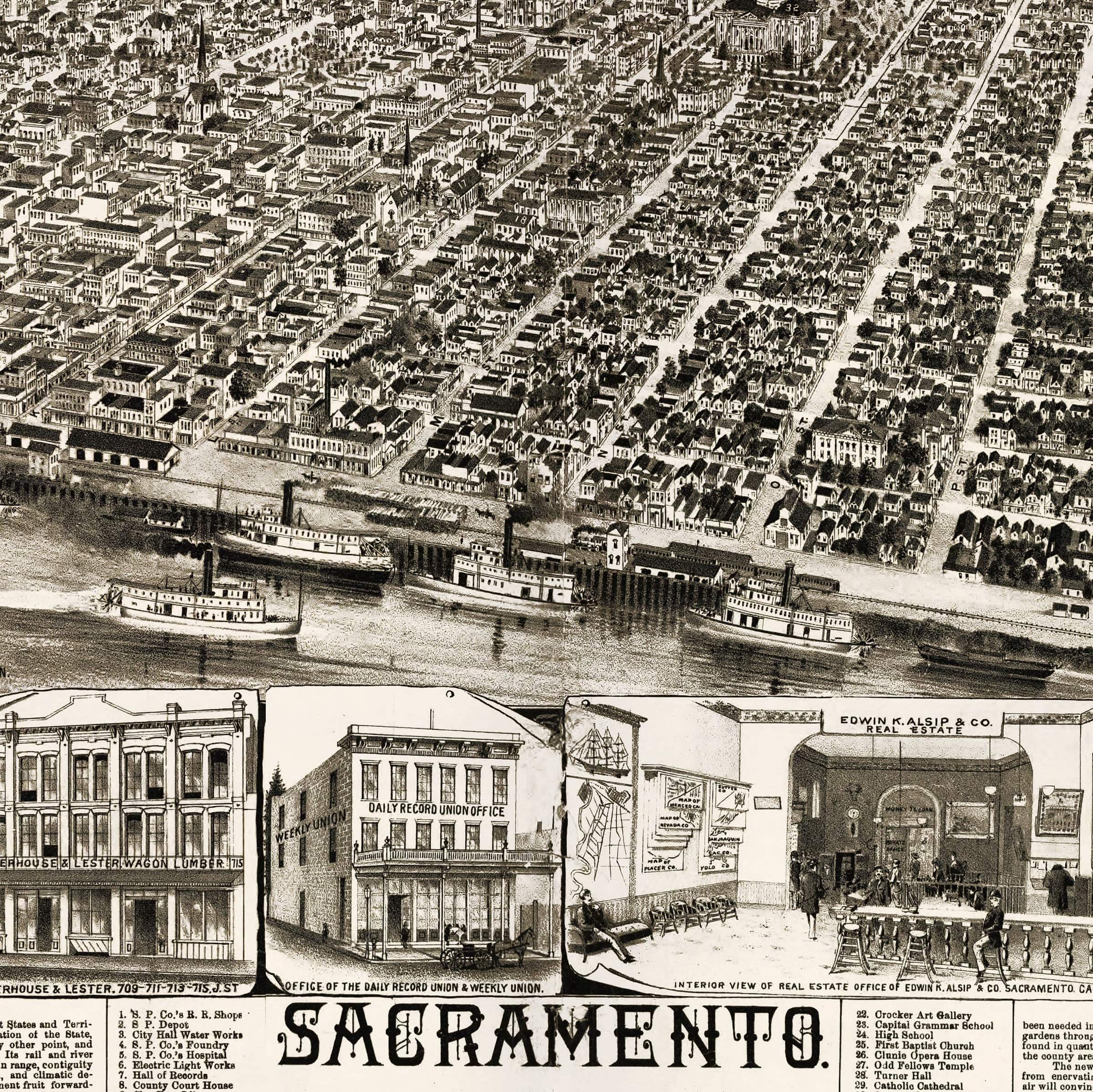
Sacramento 1890s Vintage Map - Bird's Eye View of California State Capitol
Sale priceFrom $39.99
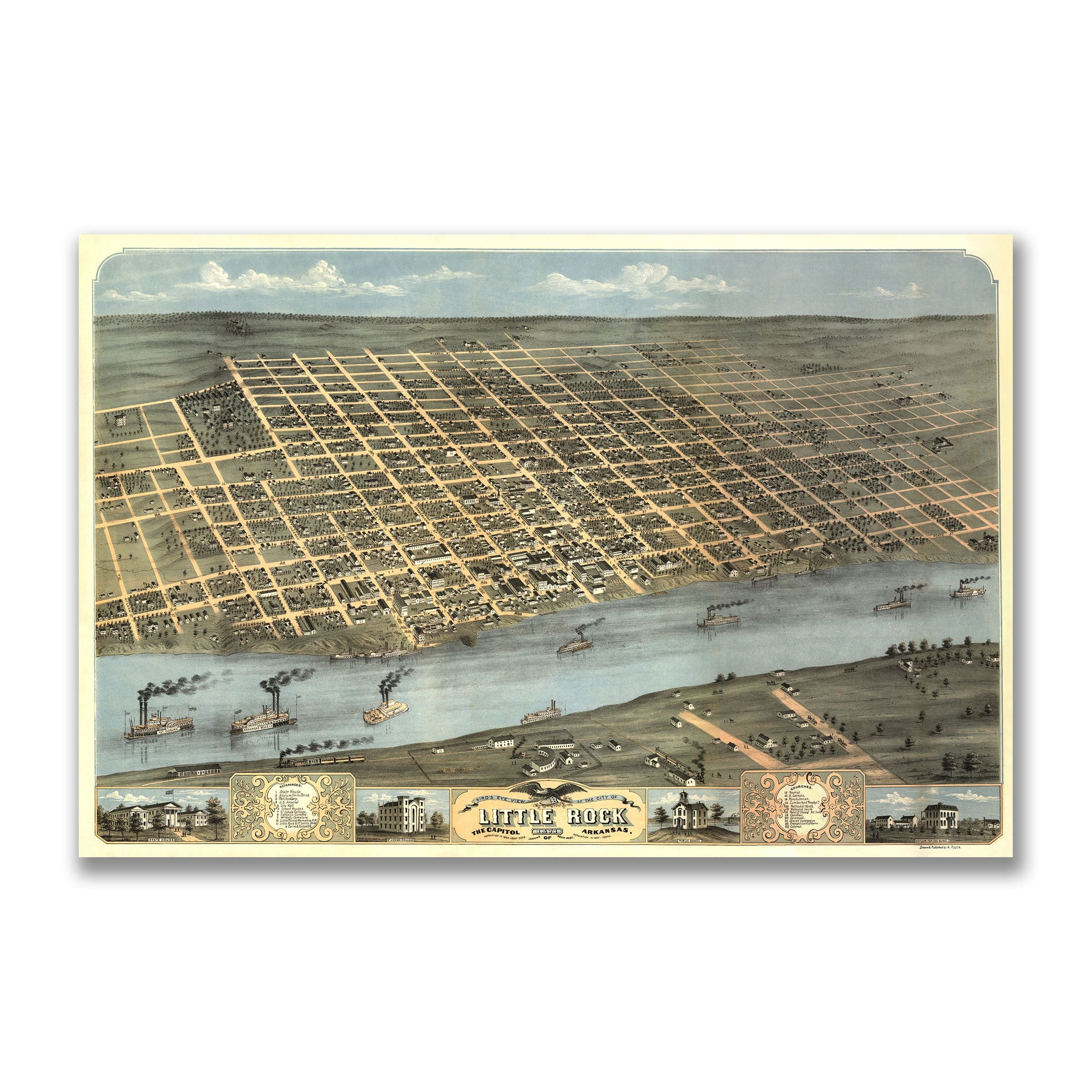
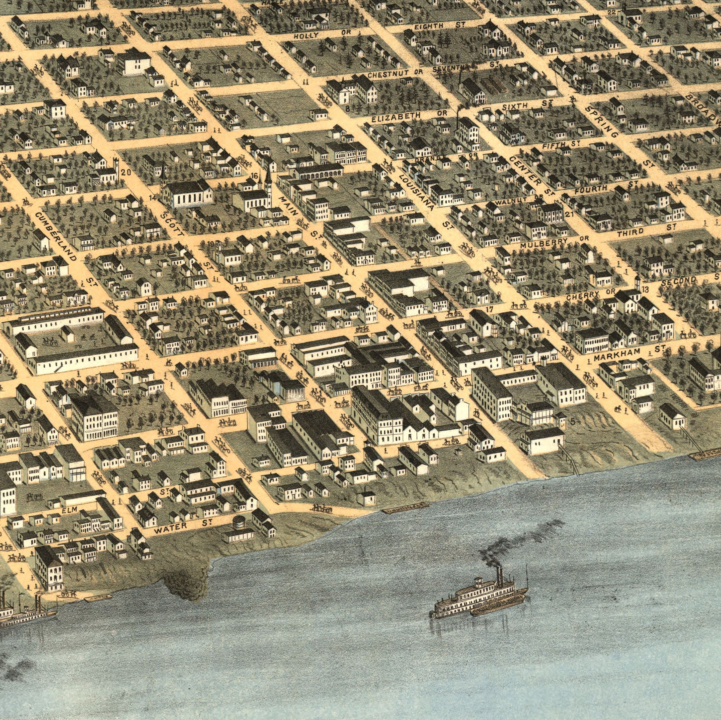
Little Rock Arkansas Historic Map - 1887 Perspective View of the City
Sale priceFrom $39.99
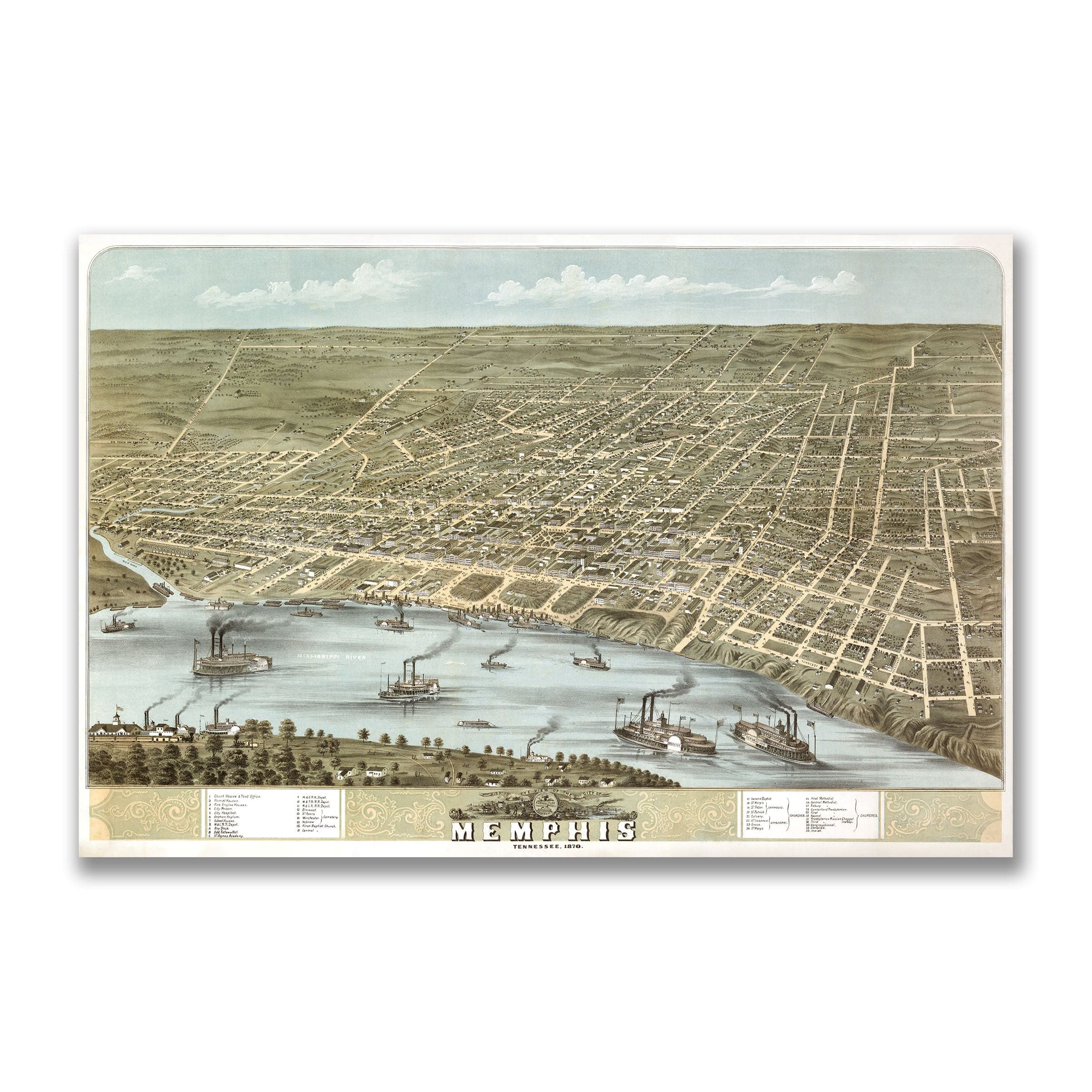
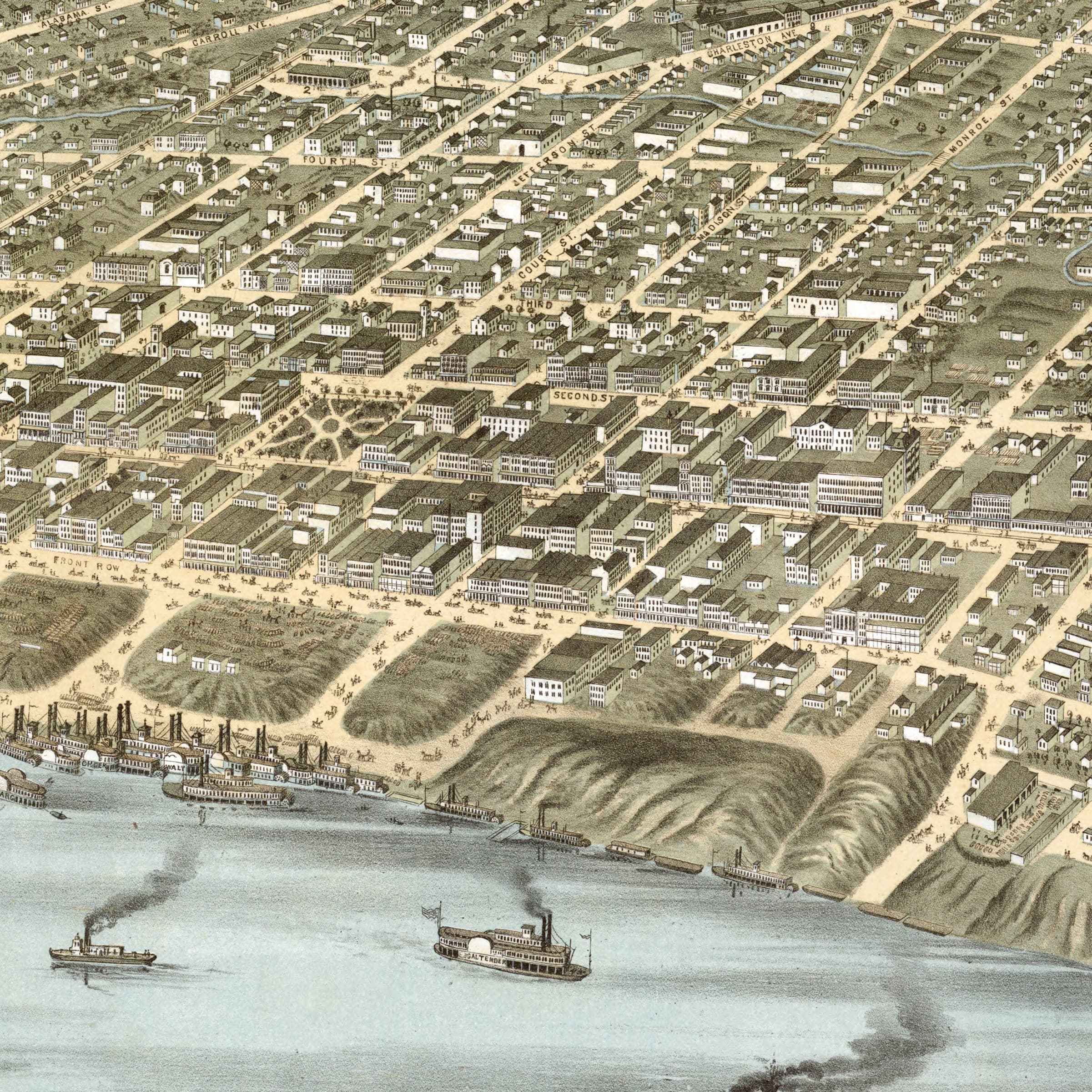
Memphis Tennessee Map - Bird's-Eye View of 1870 Historic River City
Sale priceFrom $39.99
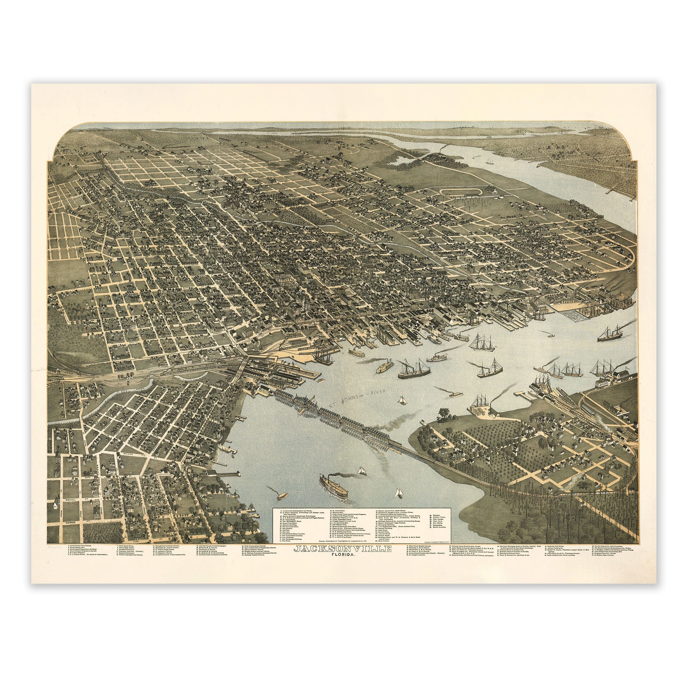
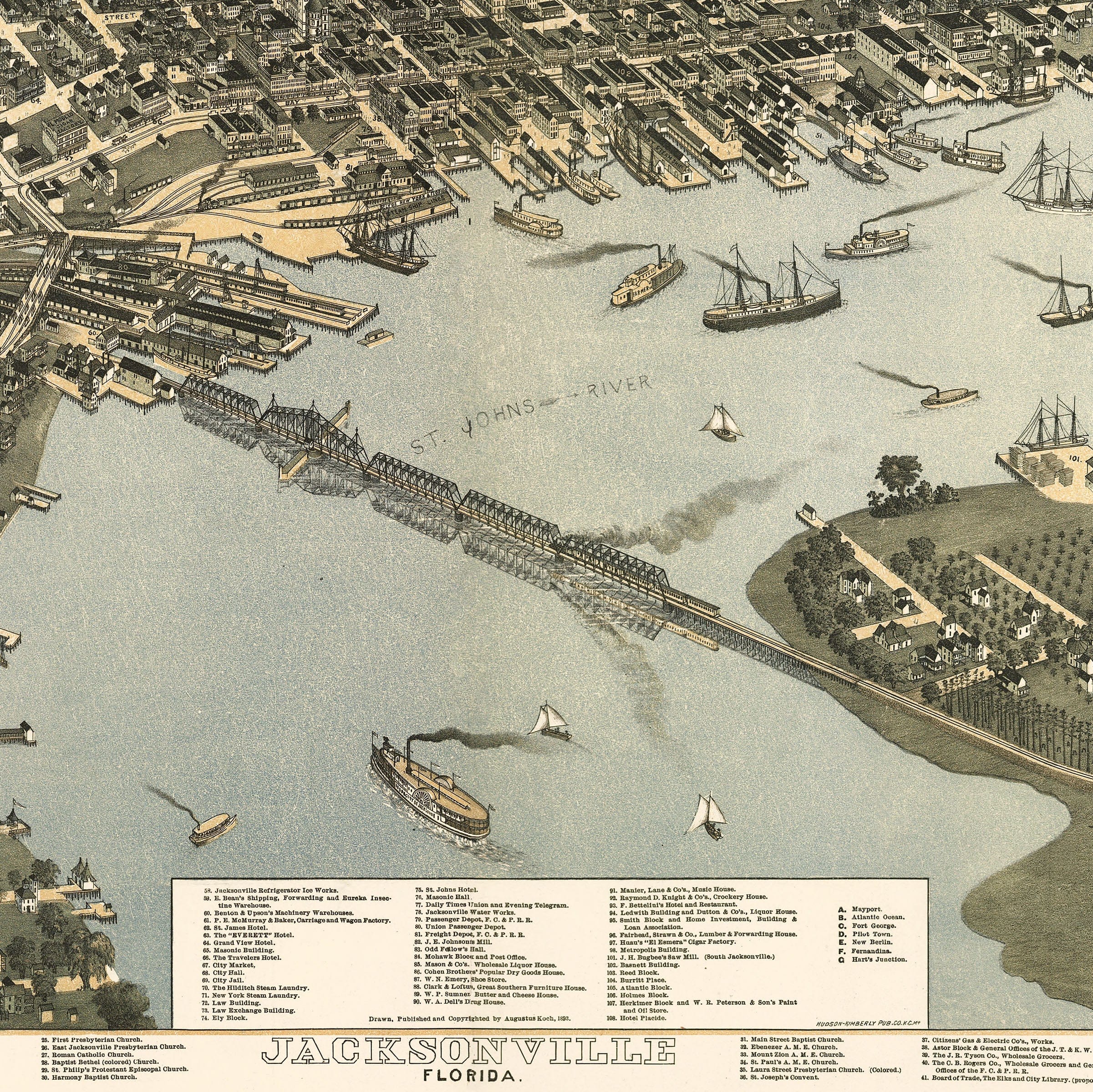
Jacksonville Florida Map - Bird's-Eye View 1893 Historic Gateway
Sale priceFrom $39.99
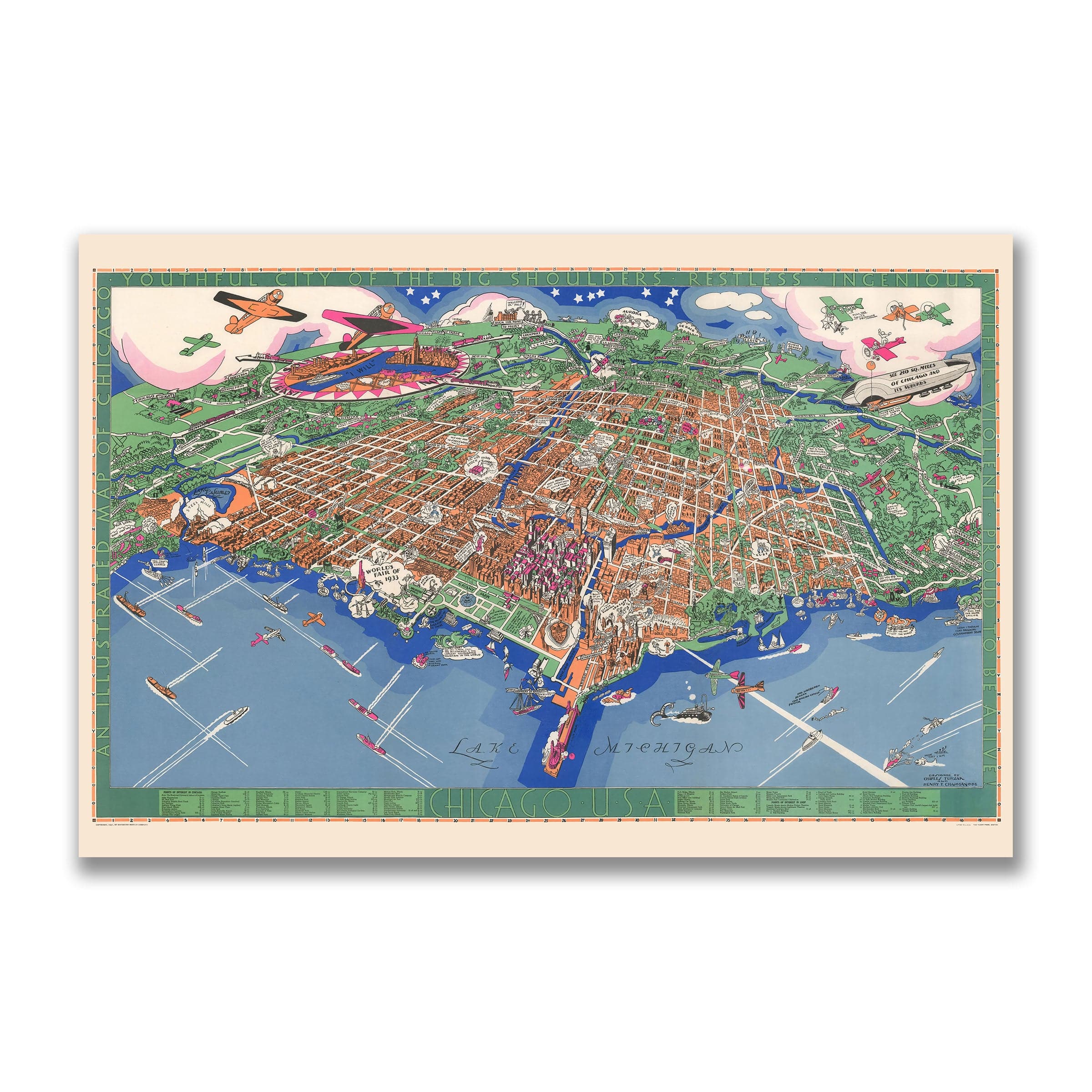

Chicago Illinois Map - Pictorial 1931 Historic City Map
Sale priceFrom $39.99
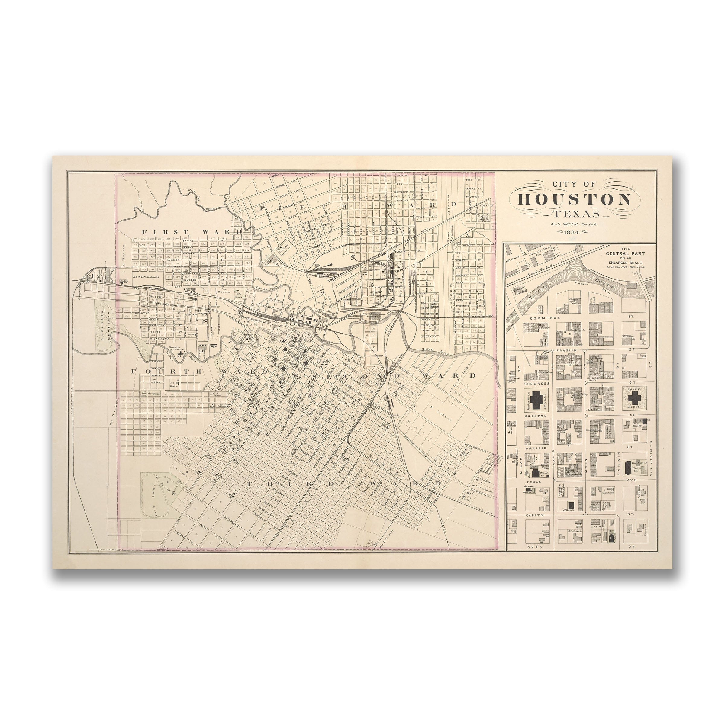
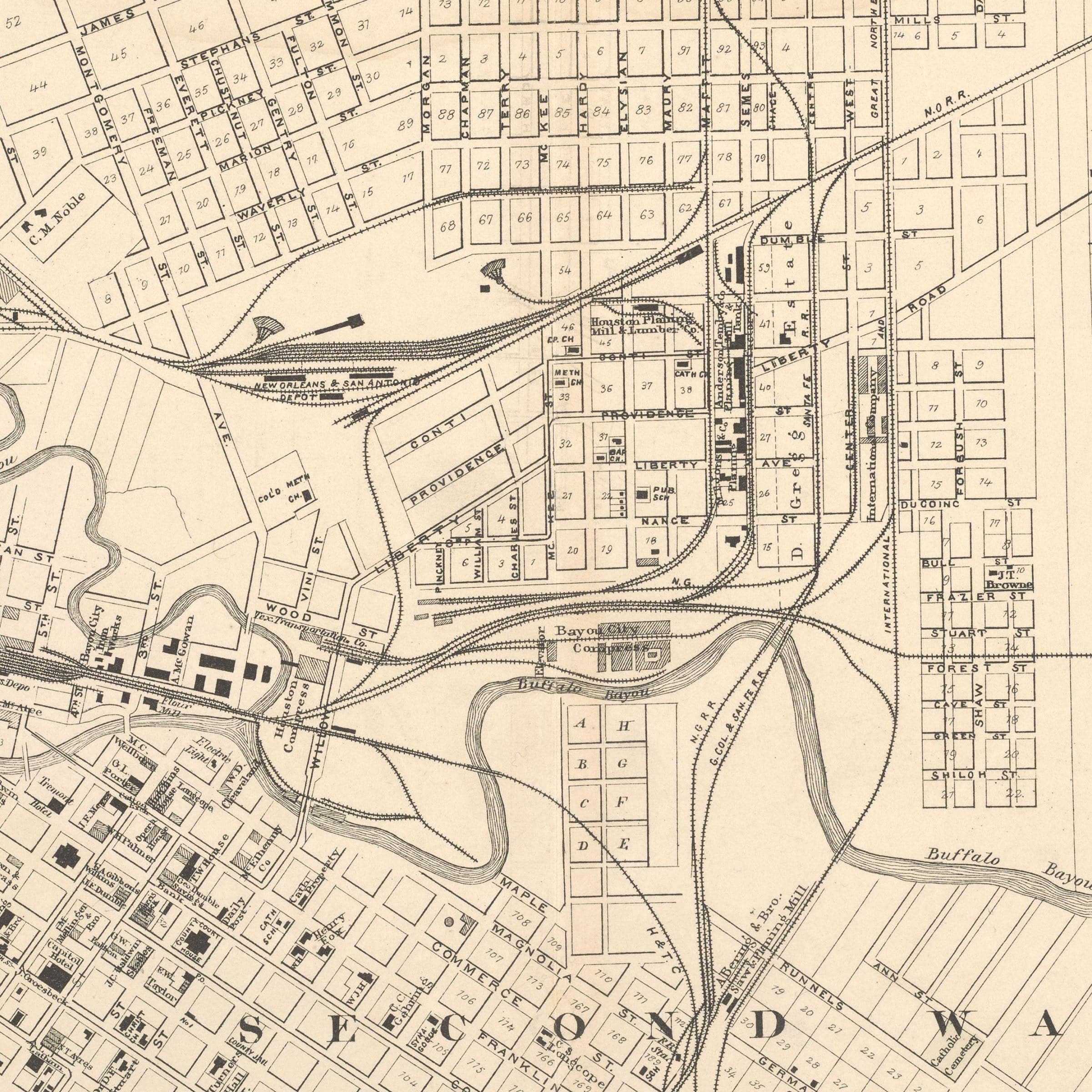
Houston Texas Map - 1884 Historic City Map Art
Sale priceFrom $39.99
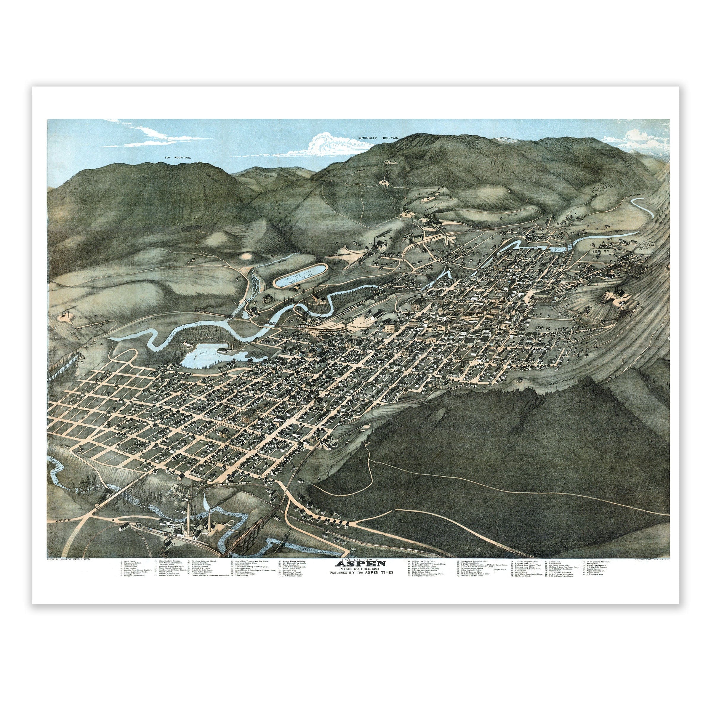

Aspen Colorado Map - 1893 Historic Bird's-Eye View of a Mining Town
Sale priceFrom $39.99
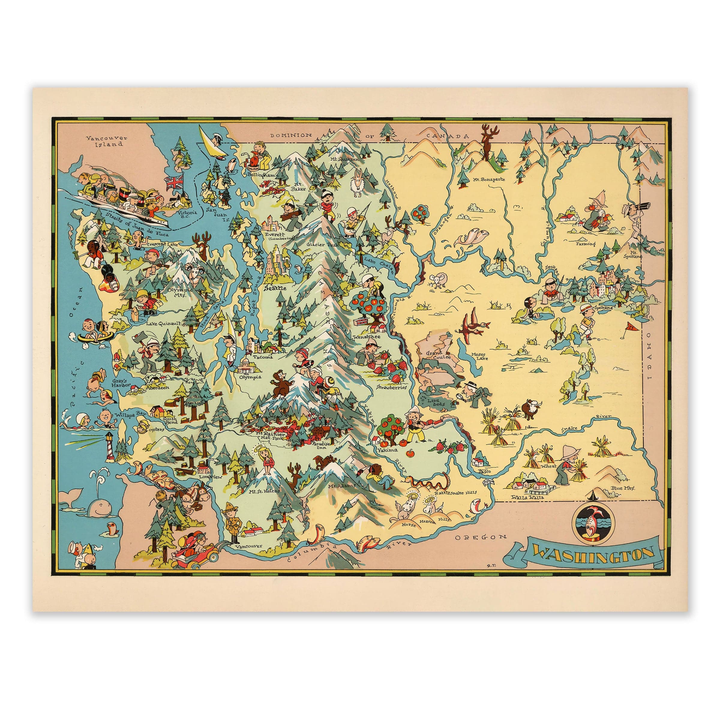
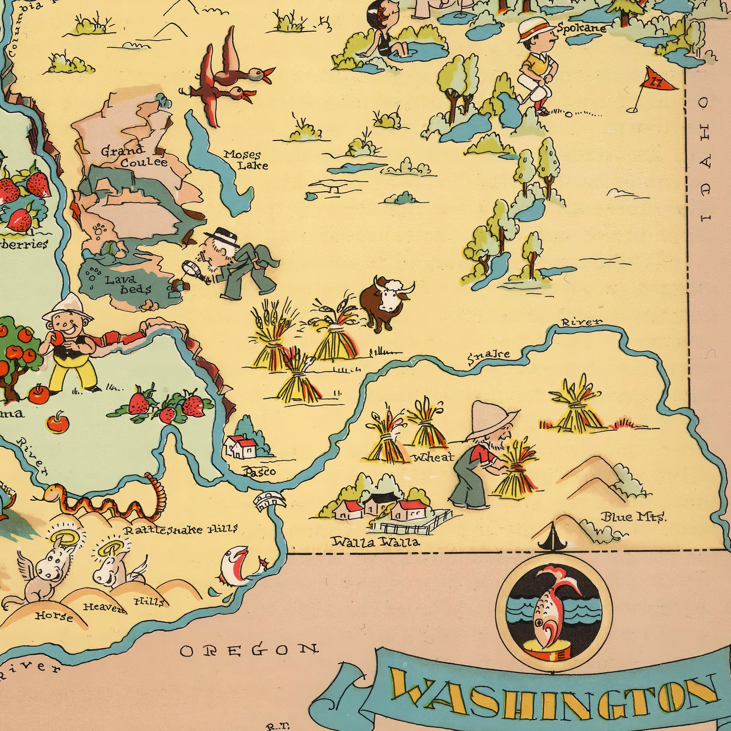
Washington State Map - 1935 Pictorial Journey Through the Evergreen State
Sale priceFrom $39.99
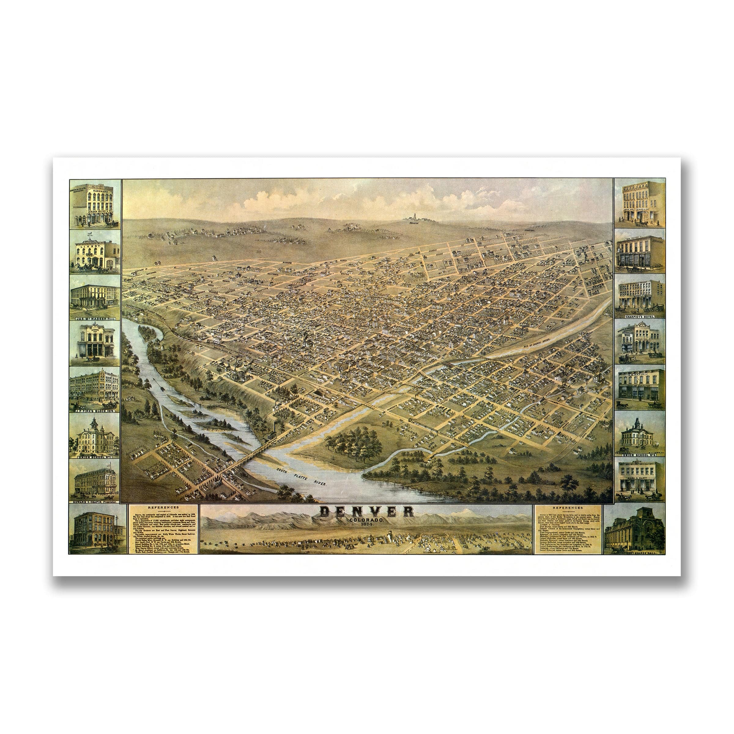
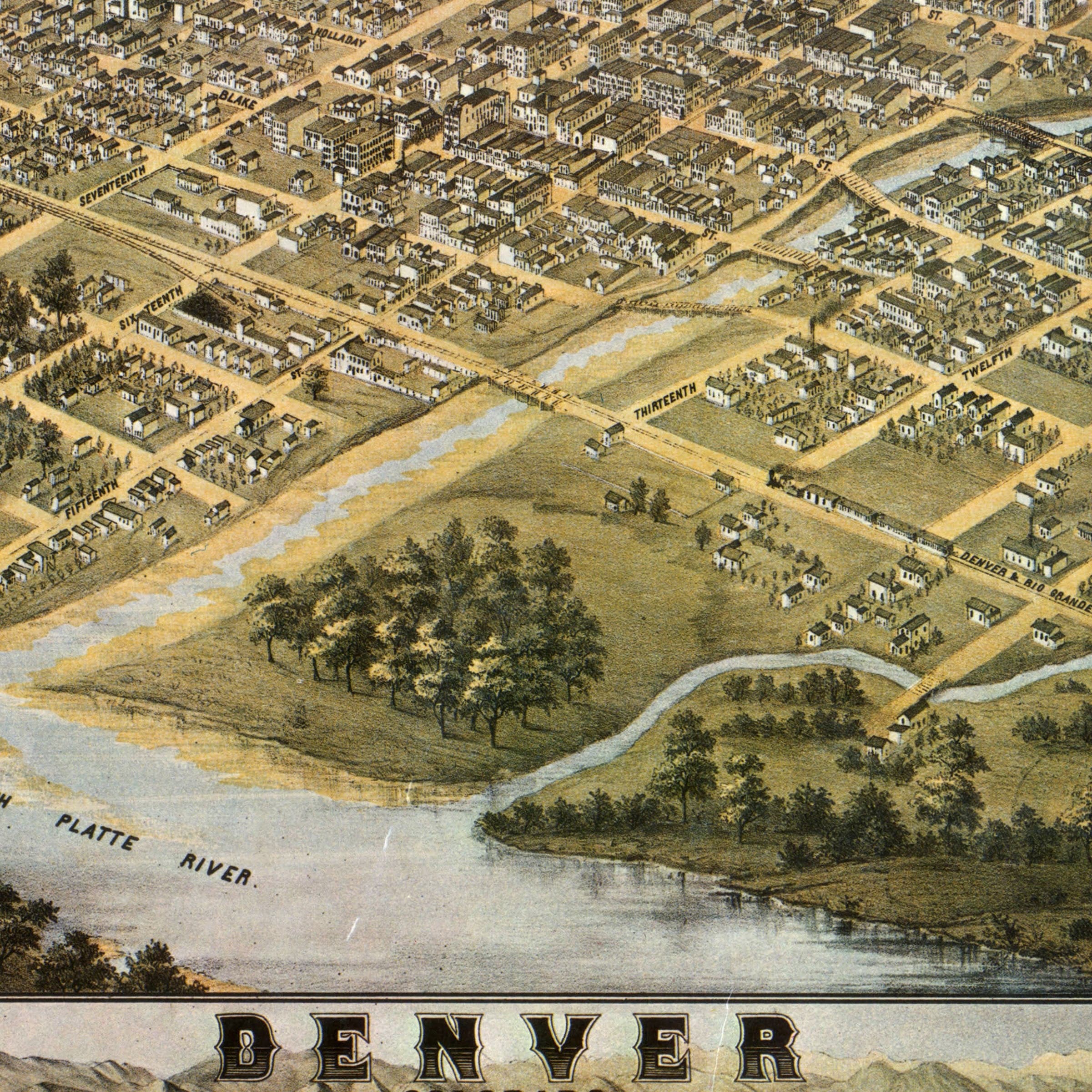
Denver Colorado Map - 1874 Bird's-Eye View Historic Mile High City Map
Sale priceFrom $39.99
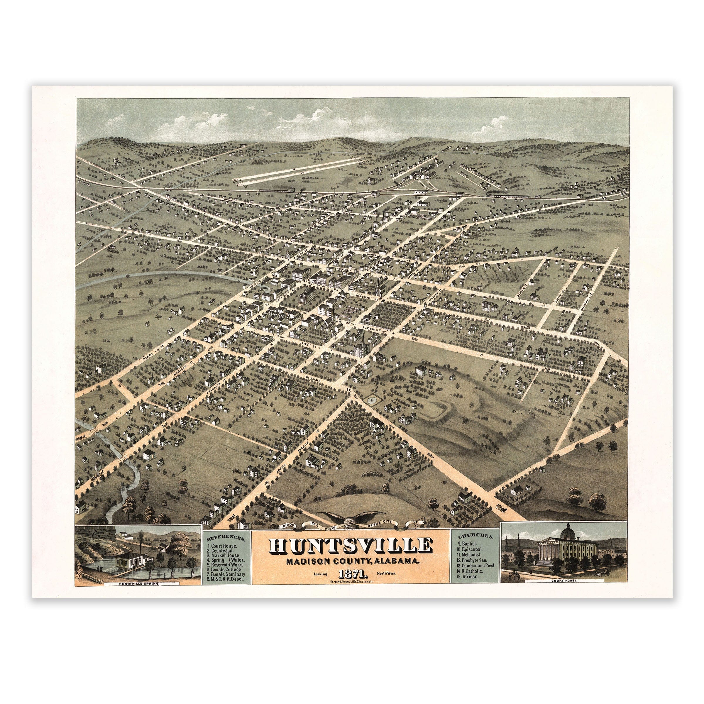
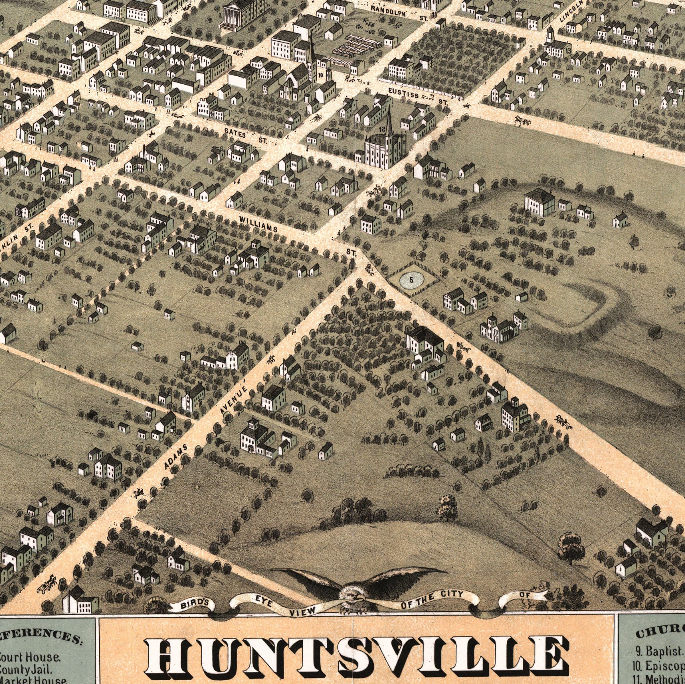
Huntsville Alabama Map - 1871 Bird's-Eye View Historic Madison County Map
Sale priceFrom $39.99
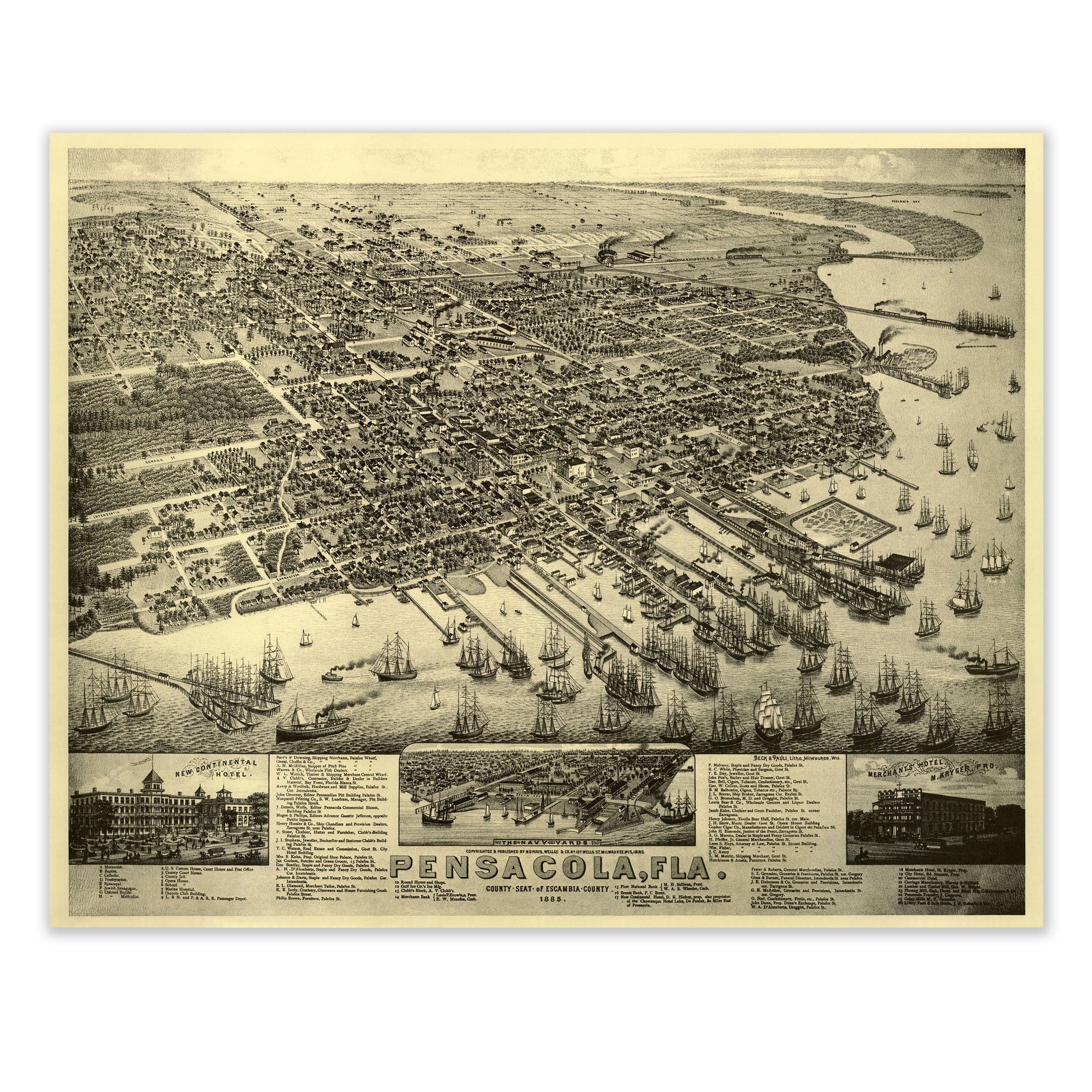

Pensacola, Florida Map - 1885 Bird's-Eye View Historic Gulf Coast Map
Sale priceFrom $39.99

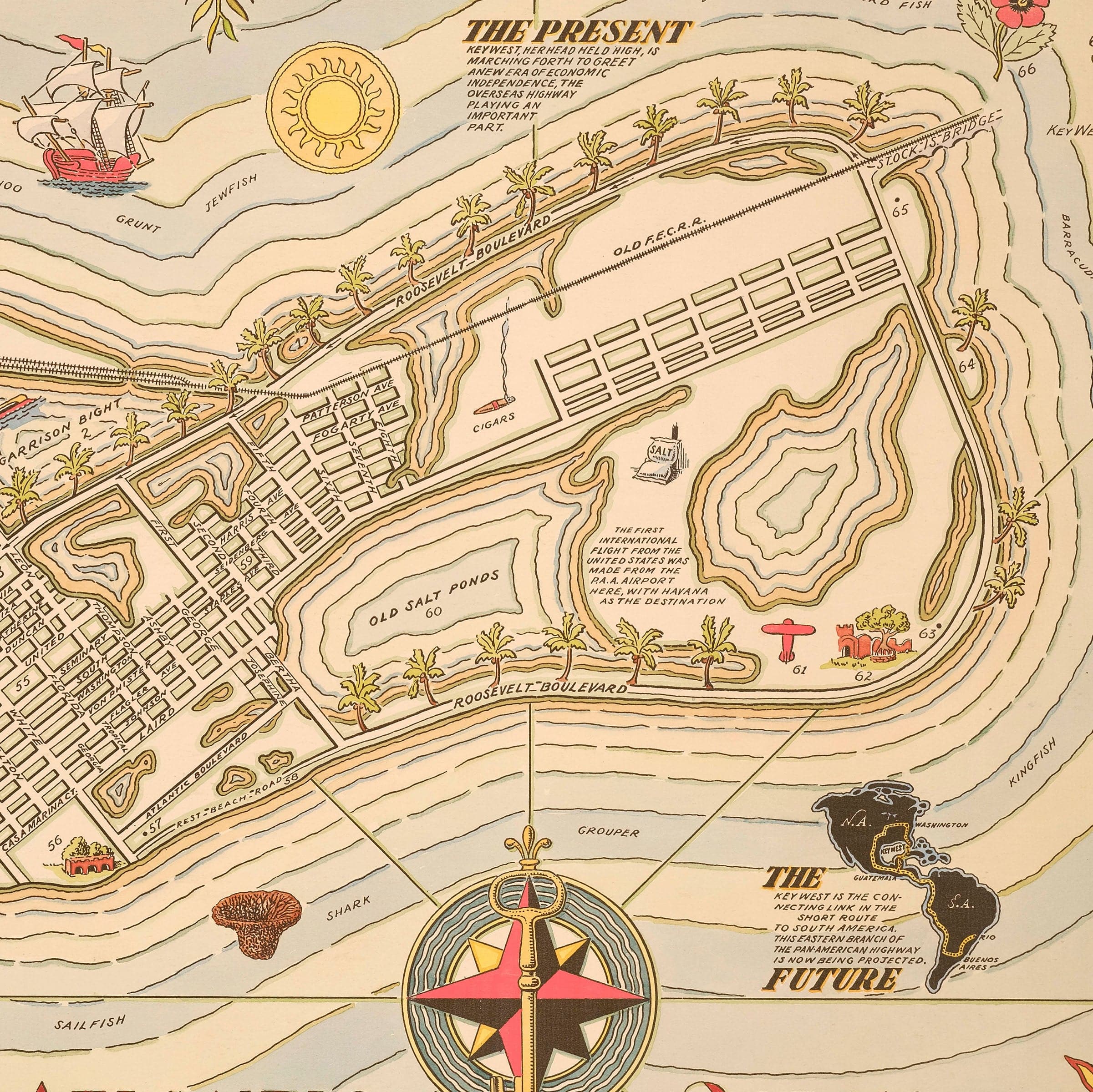
Key West Florida Map - 1935 Cayo Hueso Illustrated Historic Map
Sale priceFrom $39.99
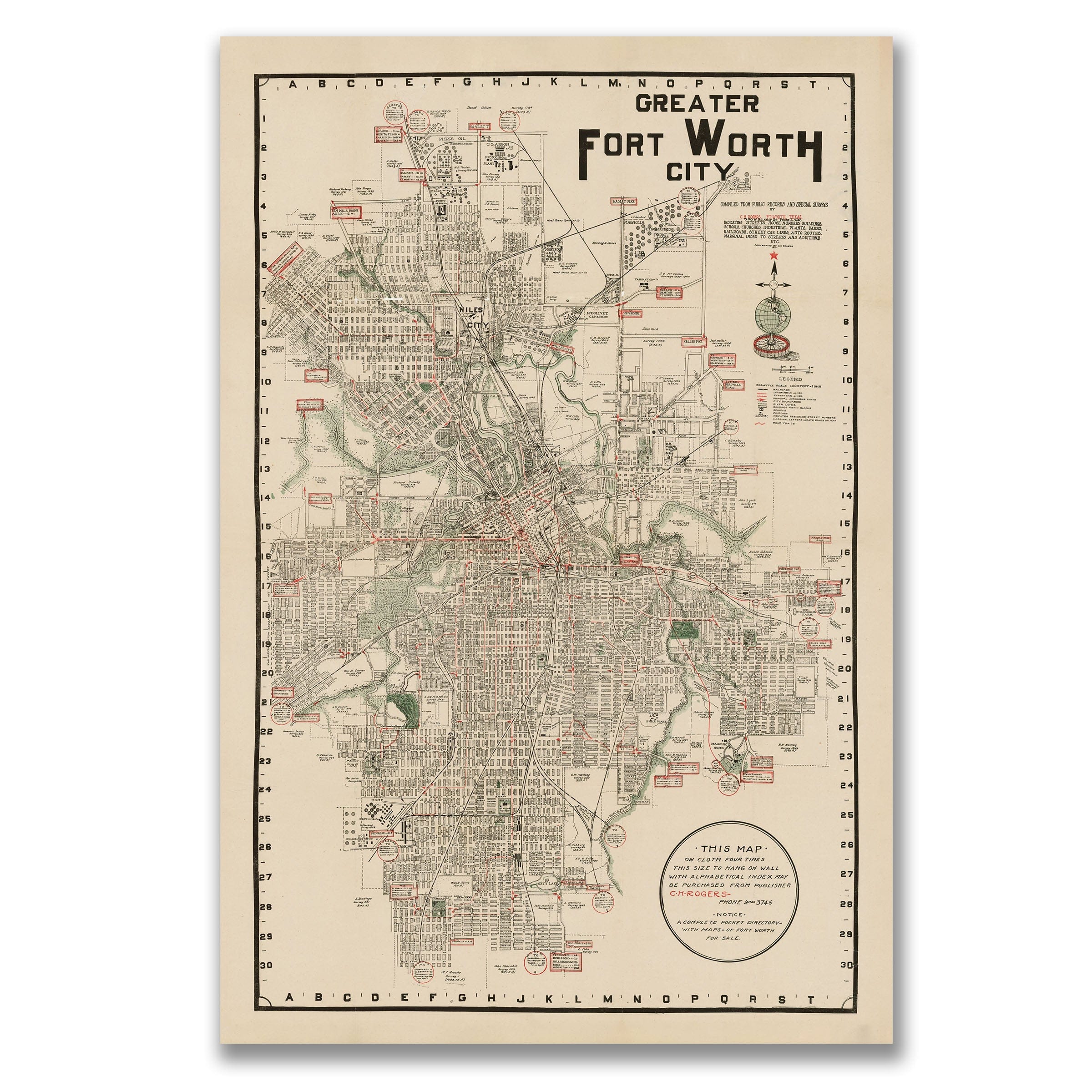
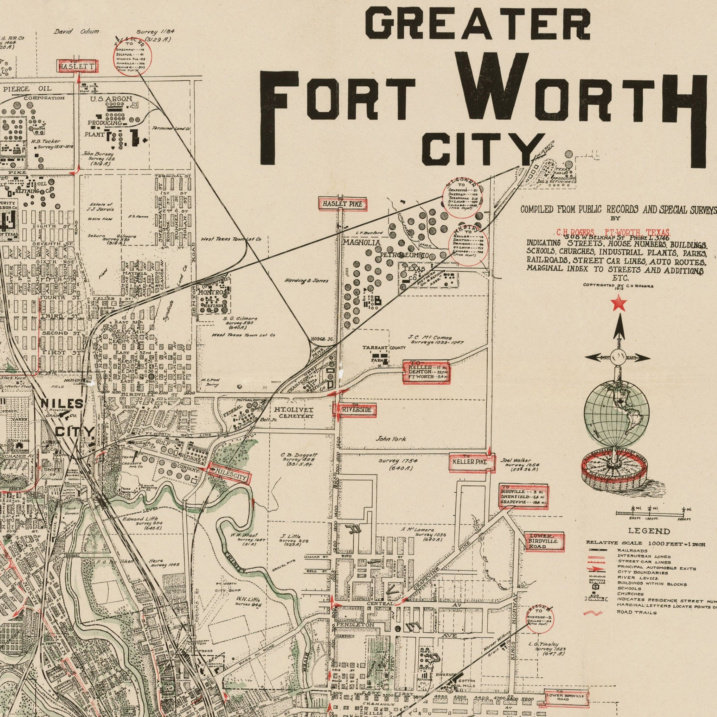
Fort Worth Texas Map - 1928 Greater Fort Worth City Historic Map
Sale priceFrom $39.99
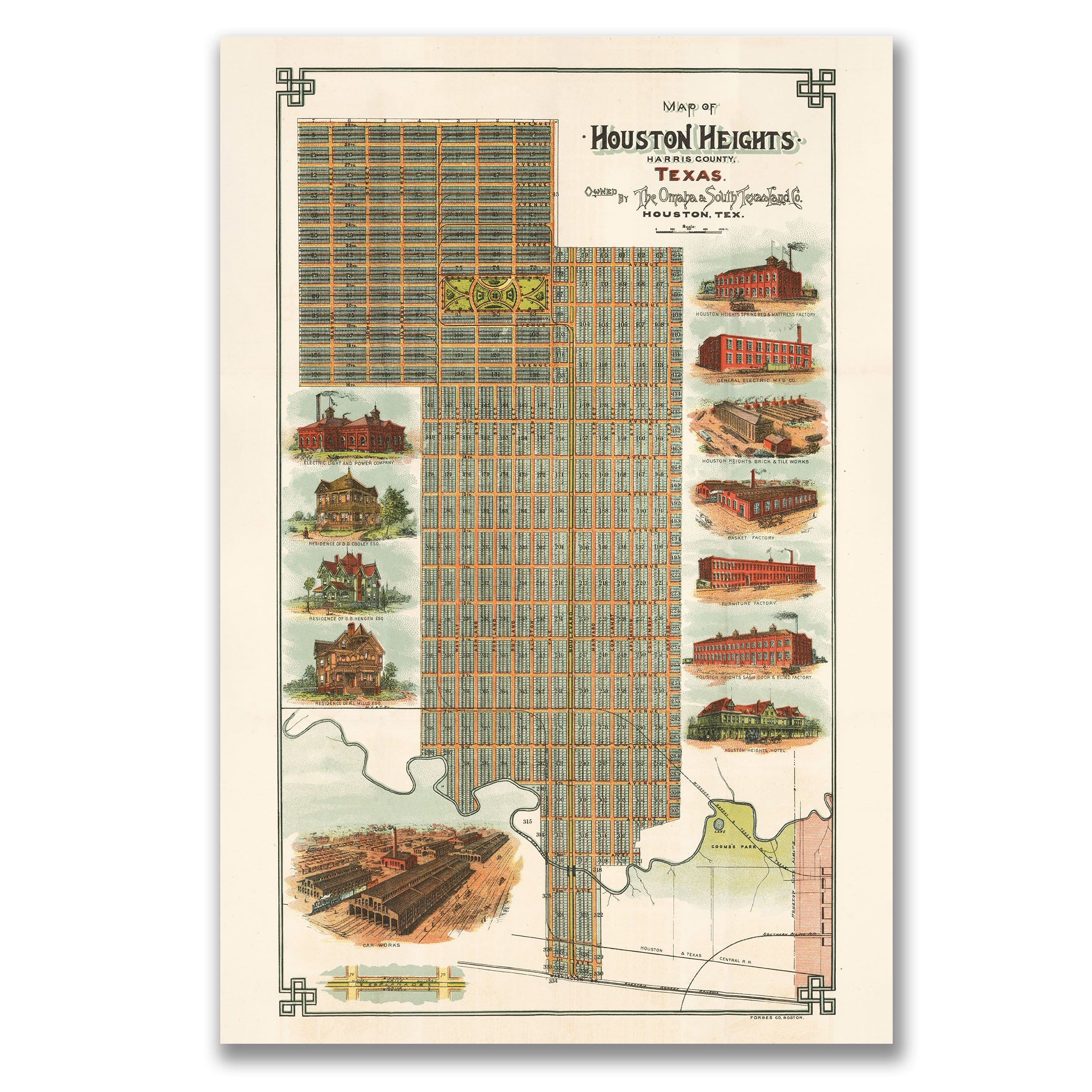
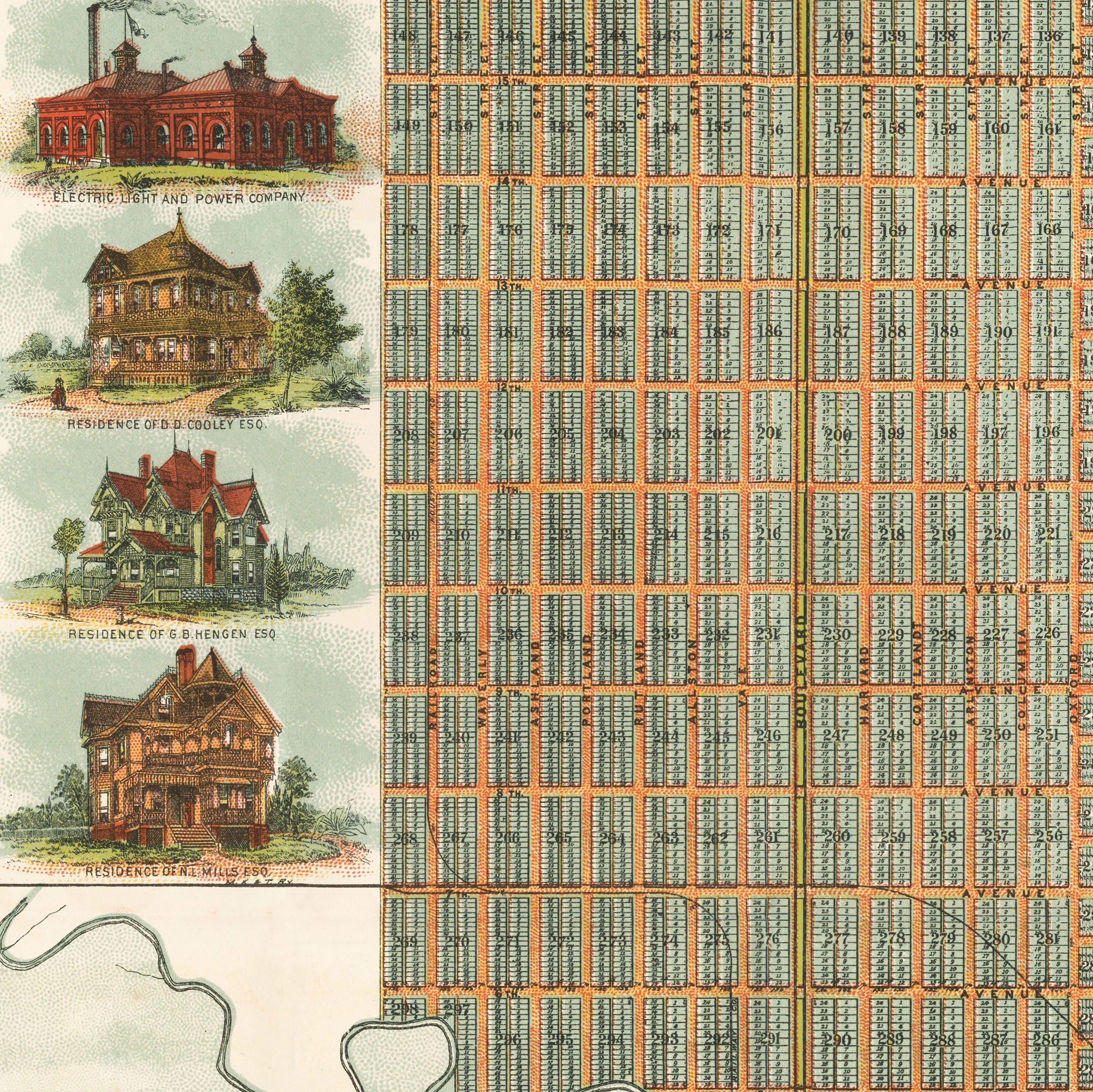
Houston Heights Map - 1896 Historic Map of Houston Heights, Texas
Sale priceFrom $39.99